Georges GiacomettiLivre Rare Book

2 100 résultats
1876boz_002510Geroges Giacometti, Lettre autographe signée Constantinople, 1876 Chérif Pacha Interessante lettre de 3 pages concernant la situation politique de la Turquie vu par un Français présent à Constantinople, il parle de Khalil Chérif Pacha et de son destin potentiel de premier ministre. Dimensions : 20.5 x 13 cm État : Voir photos pour plus de détails. Nombre de pages : 3
27456un feuillet ancien XVIIIe s.,2p.- 30x22 cm,- dessins PROFILS de la cote
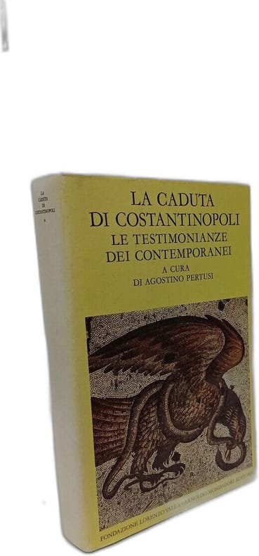
1976100143646Mondadori 1976 474 pages 13 6x3 4x19 8cm. 1976. Cartonné. 2 volume(s). 474 pages. Ouvrage historique traitant de la chute de Constantinople en 1453 écrit par l'historien Pertusi et publié par les éditions Mondadori. L'analyse se concentre probablement sur les événements causes et conséquences de cet événement majeur de l'histoire européenne et méditerranéenne
1835PHO-863Paris, éditions Firmin Didot, 1835 de la collection.« l'Univers, histoire et description de tous les peuples », relié demi cuir , dos à nerfs avec auteur et titre ,447 pages + 112 figures hors-texte et deux cartes hors-texte dépliantes .
HI353(XIIIe s. - Geneve, Fick, c. 1875?) in-4o, 87 p. non rogne, titre, en- tetes et lettrines graves par Le Maire, couverture muette
1900VO016Plon-Nourrit, Paris 1900. In-8o, XII-356 pp., 4 héliogravures hors-t. Envoye a Constantinople, il voyaga aussi a Chypre, Syrie et Jerusalem. Rel. 1/2 maroquin contemp., dos a nerfs.
Very Good French Scarce color lithographed tourist map of Syria and Lebanon, showing international boundaries, transportation, archaeological, historical, and military ruins, water features, distances between places and populated places. Relief is shown by hachures, bathymetric tints, and spot heights. Includes 28 attractive drawings in red of tourist sites in Syria and Lebanon: Damas, Palmyre, Afqa, Hama, Homs, Meyrouba, Saida, Beit ed-Dins, Djebail, Led Cedres, Krak des Chevaliers, Massiaf, Antioche, Deir Smane, El Goilla, Aleppo, etc. "Relief is shown by contours and spot heights. Includes 28 drawings of tourist sites in Syria and Lebanon, listing the city. "7 -49". On lower right margin.'". Free French Forces was the government-in-exile led by Charles de Gaulle during the Second World War, and its military forces, that continued to fight against the Axis powers as an Allied nation, following the Fall of France. Set up in London in June 1940, it organized and supported the Resistance in Occupied France, and established a foothold within several French colonies in Africa. Original color lithograph map of Syria and Lebanon. 57x72 cm., on sheet 63x84 cm. In French. Scale: 1:1.000.000. Edition of May 1942.
Very Good French Modern 1/3 red leather bdg. with five compartments on spine. Demy 8vo. (21 x 14 cm). In French. [xi], 480 p. La Turquie en 1864. Bertrand Camille Collas, born in Bordeaux in 1819 (died 1898), was a sailor for 15 years before devoting himself to politics. His first stay in Turkey dates from 1841-1842 and the second from 1860. Thanks to his good knowledge of the country and its important characters, he was able to follow the progress of political, diplomatic and commercial developments since the accession of Sultan Abdulaziz. This study takes stock this evolution whose aim was to transform the Ottoman Empire into a modern state taking the example of the European model.
New English Original cloth bdg. In publisher's special box. 4to. (28 x 21 cm). In Turkish. 2 volumes set: (1621 p.), color ills. Historical tombstones of Zeytinburnu. Full inventory of tombstones with translations of their calligraphic inscriptions. Zamani asan taslar: Zeytinburnu'nun tarihî mezar taslari. 2 books set in special box. Enlarged Second Edition.
103727<p>Facsimile reprint of the Leiden edition 1864. Two volumes. Edited by S. A. Naber. Hard cover 24 cm 458986 pp. ISBN: 978-960-400-377-8 set.</p><p>.</p><p>.</p><p>================================================</p><p><b>IMPORTANT: The shipping cost in not included in the price. You will have to approve it at confirmation of the order.</b></p> hardcover
New English Original cloth bdg. Folio. (41 x 31 cm). In Turkish. 328 p., color ills. and maps. Istanbul, Constantinople in the maps and drawings of Sultan Abdulhamid II's epoch. A very heavy volume. Extra shipping cost will be requested. Sultan II. Abdülhamid devri harita ve planlarinda Istanbul.
Former owner's bookplate on inner cover. DJ has been repaired in places with scotch tape. Browning to DJ spine. Scuffing and smudges in places. ; Examines the relations between Greeks and Latins, Eastern and Western Christendom, during the reign of the Byzantine Emperor Michael VIII Palaeologus (1258-1282). ; 434 pages
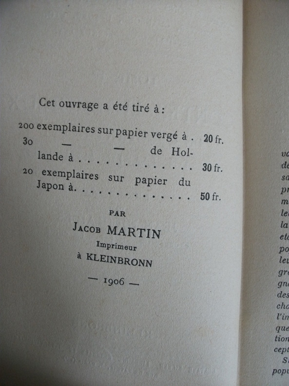
5558Recueillis par Jean NICOLAIDES professeur au lycée de Chios.In 12 reliure éditeur pleine toile marron titre doré au dos et sur le premier plat(avec un petit décor de fleur)faux-titre,titre,XXVIII,217 pages,non rogné,Kleinbronn librairie dépositaire Gustave Ficker Librairie internationale 1906 un des exemplaire sur papier vergé(tiré à seulement 200 exemplaire).Contributions au folklore érotique recueillis aux sources orales.Tome 1er.Rare
New New English Original bdg. Dust wrapper. Folio. (31 x 25 cm). In English and Croatian. 171 p., color and b/w ills. The Istanbul letters of Antun Vrancic: Croatian and English translation of selected latin letters.= Carigradska pisma Antuna Vrancica: Hrvatski i Engleski prijevod odabranih Latinskih pisama. Prep. by Oguz Aydemir. Antun Vrancic or Antonio Veranzio, was a Croatian prelate, writer, diplomat and Archbishop of Esztergom in the 16th century. Antun Vrancic was from Dalmatian town of Sibenik (modern Croatia), then part of the Republic of Venice. Vrancic is also known under his Latinized name Antonius Verantius, while Hungarian documents since the 19th century refer to him as Verancsics Antal. In 1549, Vrancic entered Ferdinand's service. In parallel to his diplomatic duties, he held important positions in Catholic Church (the chief dean of Szabolcs County, abbot of Pornó Abbey). In 1553 he was appointed as a bishop of Pécs and sent to Constantinople to conduct negotiations with sultan Suleyman I on Ferdinand's behalf. That mission was previously declined by many other diplomats as an earlier negotiator was imprisoned by the Ottomans. Vrancic spent four years in Asia minor and finally concluded a peace treaty. After his return he was appointed bishop of Eger (17 July 1560 - 25 September 1570). After the Battle of Szigetvár in 1566, as one of Maximilian's ambassadors, Antun was sent to Turkey to negotiate peace again; he arrived in Constantinople on 26 August 1567. After five months of negotiations with Sokollu Mehmed Pasha and Selim II, agreement was reached by 17 February, and the Treaty of Adrianople was signed on 21 February 1568, ending the war between the Holy Roman Empire and Ottoman Empire. In appreciation of his diplomatic work, the king named him archbishop of Esztergom (17 October 1569 - 15 June 1573). During his stay in Istanbul, together with Ogier Ghislain de Busbecq, Vrancic discovered Res Gestae Divi Augusti (Eng. The Deeds of the Divine Augustus), a Roman monument in Ankara. His travels throughout the Transylvania, Balkan and Asia minor resulted in his writing extensive travel accounts. By writing letters to the Habsburg Kingdom almost every day, the diplomat telling the daily life of Istanbul gave examples of his culture and art works. Letters written 450 years ago provide important information about the diplomatic tradition of the 16th century and the behavior of the two emperors.
Fine Fine English Original bdg. Dust wrapper. Folio. (33,5 x 23 cm). In English. 295 p., color ills. Ara Güler. Vanished colours. Texts by Ara Güler, Mehmet Baydur. In Ara Güler's words: ''My first book on Istanbul was in black and white, my second book, 'Vanished Colours', is in colour. Colour photographs lack the solidity of black-and-white, and in this book I have given priority not so much to artistic considerations as to an attempt to present the city of Istanbul in its own characteristic colours. My aim is not to produce art photography, but simply to reflect Istanbul as it really is. What does Istanbul mean to me? Istanbul is Jean Giraudoux' La Folle de Chaillot. Every since my childhood I have always identified Istanbul with the madwoman of Chaillot, a crazy woman of the type you can find in the Roman, Byzantine and Ottoman civilisations...''. Second Edition.
New New English Original bdg. Dust wrapper. Large 4to. / Small folio. (39 x 26 cm). In German. B/w and color photographs. 237, [2] p. "Auf die Frage, ob Fotografie Kunst sei, hat Ara Guler beharrlich immer mit "Nein" geanwortet. Dieses Nein begrundete er zuletzt mit dem Hinweis auf Oscar Wilde: "Es gibt keine Fotokunst," so sagt Ara Guler, "also gibt es auch keine Fotokunstler. Lass mich dir den Unterschied zwischen Kunst und Fotografie erklaren: Kunst entsteht aus einer Luge und lugt auch selbst.".
Fine Turkish Original bdg. HC. 4to. (29 x 20 cm). In Kabardian (Circassian) in Cyrillic, Russian, and Turkish. 480 p. Çerkes yemekleri.= Adige skhinig'uekher: Blyuda Adigskom (Cherkesskoi) kuzin. Recipes of Circassian cuisine.
Fine Turkish, Ottoman (1500-1928) In decorative cloth bdg. Roy. 8vo. (24 x 17 cm). In Ottoman script. 250 p., b/w plates, 1 folding map. Eski Istanbul âbidât ve mebânisi. Sehrin tesisinden Osmanli fethine kadar. Hicri 1328 = Milâdî 1912. Özege 5113. First Edition.
Very Good English Revised Third Edition of this rare map of Cyprus, made by Salmon, who was the director of Cypriot land registration and surveys. "Shows grid, district boundaries, heights in feet, railways, roads (2 categories), antiquities, ancient sites.". / "Shows district boundaries, towns and cities, roads (2 categories), railroads, ancient sites and antiquities, and dry streams. Relief is shown by contours, gradient tints, and spot heights. Earlier Edition: 1952.". (OCLC). "In December 1926, in a memorandum to the Colonial Office on vacant surveying positions in the colonies, Palestine and Cyprus were mentioned at the end of a group of Mediterranean colonies; that is there was a group of Mediterranean colonies, and also Cyprus and Palestine [.] Only in 1929 was an Imperial project involving Palestine and Transjordan, brought up at the committee (Colonial Survey Committee). This was the experimental aerial survey for determining the route of the Haifa - Damascus railway, which was presented as a model for mapping from aerial photographs [.] Among the important things reported to the Colonial Survey Committee was the reconnaissance conducted by Colonial Winterbotham, the Chief of the GSGS, in the survey departments of the colonies in 1929, a trip that had been encouraged in the first Conference of Empire Survey Officers in 1928 [.] ... how much Salmon [F. J.] expected from Winterbotham's visit to Ceylon a short time before he was to take over the directorship of the small survey department of Cyprus.". (Source: The Survey of Palestine Under the British Mandate, 1920-1948). Original color map. Folded in original wrappers. Fine. Elephant folio. (58 x 89 cm). In English. Survey of Cyprus administration map. Scale of 4 miles to one inch = 1/253440. Compiled and drawn under the direction of F. J. SALMON, (Director of Land Registration and Surveys, Cyprus, 1932). Revised Third Edition. Second in 1950.
Very Good English Paperback. Pbo. Roy. 8vo. (24 x 17 cm). Articles in French, English and German; title is bilingual in Bulgarian and French. 573, [2] p. Contribution a l'histoire du commerce de la Turquie et de la Bulgarie.= Prinos k'm istoriata na t'rgoviata na Turtsiia i Bulgariia. Avant-propos du Prof. IV. Stefanov and Elena Savova.
Very Good English Original bdg. HC. Oblong 4to. (21,5 x 28 cm). In English. [48] p., fully ills. First and only edition of this scarce and attractive souvenir album including 24 photogravures of general views, streets, architectural buildings, natives, and social life of Cairo, photographed, edited and published by German photograph studio of Cairo "Lehnert & Landrock". Lehnert & Landrock was a photographic studio run by Rudolf Franz Lehnert (1878-1948) and Ernst Heinrich Landrock (1878-1966) active in Tunisia and Egypt in the early 20th century, noted for producing Orientalist images. Rudolf Franz Lehnert and Ernst Heinrich Landrock produced images of North African people, landscapes, and architecture for a primarily European audience. These images were mainly distributed in monographs, though also as original prints, photogravures, and lithographic postcards. (Source: Wikipedia).
Very Good Turkish Modern cloth bdg. 4to. (30 x 24 cm). In Turkish. 27 p. text; 21 numerous map feuilles in Ottoman script and modern Turkish. 19. asirda Istanbul haritasi. Ekrem Hakki Ayverdi was raised at a time in which Istanbul was undergoing its late Ottoman-early Republican period. Apart from his persona as an engineer-architect, restorer, and architectural historian, he was a collector passionately dedicated to Ottoman art. Undertaking the construction of different public buildings in Istanbul, Bursa and Edirne, as well as the restoration of many architectural works, Ayverdi not only brought together the most select and refined works of Ottoman art, which had begun to lose its prestige amidst the changing values of high culture in the time he lived, but he also paid particular attention to their conservation and preservation. Ayverdi's two seminal corpuses that study Ottoman architecture from its early days until the end of the Mehmed II era, as well as its examples in Roumelia, continue to maintain their place as the most important reference books for those working in this field. This is a detailed research on a 19th century map of Istanbul city.
Very Good Turkish, Ottoman (1500-1928) Original color map on cloth. Folded. A good copy. Oblong atlas folio. (50 x 60 cm). In Ottoman script. [MAP of WEST ANATOLIA] Edremid Bay, The Dardanelles, Limni, Bozcaada (Tenedos), Balikesir, Ayvalik, Kal'a-yi Sultaniye. Shows Northeast Anatolia; southwest entrance of the Dardanelles, Çanakkale, Balikesir cities, Ayvalik, Tenedos Island, shores of North Aegean, Bay of Edremit. Mapmaker is not described. Scale: 1/200.000. Mubde-i tul: Greenwich and Dersaadet. This is one the serie of the Bonn projection maps which are the first map series in modern techniques in Turkey and the Ottoman Empire. This is one the serie of the Bonn projection maps which are the first map series in modern techniques in Turkey and the Ottoman Empire. In order to produce these maps covering Turkish territory, Reconnaissance Branch was incorporated into The Mapping Commission. The maps were produced in the datum based on the latitude and longitude of Ayasofya Mosque in equal area Bonn Projection. The field works for the 123 sheets covering the country were conducted by 76 staff. The production was completed in 18 years starting from east west. Field works continued without stopping except in years 1914 and 1920. This map series called also reconnaissance maps contributed a lot to producing 1:25.000 scale maps. Hegira: 1327 = Gregorian: 1910. Slightly stained and yellowing on paper. Loose extremities. A good copy. Very scarce. One copy in TBMM Library Map Collection: 201102274.
Light wear to corners of rear wrap else fine. ; This book presents translations of six speeches by Eustathios of Thessaloniki, accompanied by a detailed commentary which analyses the language used in these complex pieces of oratory and explains the allusions to the historical events of the time that they contain. Ten appendices provide further details on a range of topics. ; Australian Association for Byzantine Studies. Byzantina Australiensia 19.; 241 pages
Book is fine. ; This book presents translations of six speeches by Eustathios of Thessaloniki, accompanied by a detailed commentary which analyses the language used in these complex pieces of oratory and explains the allusions to the historical events of the time that they contain. Ten appendices provide further details on a range of topics. ; Australian Association for Byzantine Studies. Byzantina Australiensia 19.; 241 pages