2 079 résultats
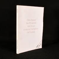
1981130817London: Trigram Press 1981. First edition. Softcover. Introduction by Asa Benveniste. Includes poems and illustrations by Glen Baxter Ian Breakwell Ivor Cutler Anthony Earnshaw and Jeff Nuttall. A tight near fine copy in wrappers that are very lightly soiled. Trigram Press unknown books
1981130817London: Trigram Press 1981. First edition. Softcover. Introduction by Asa Benveniste. Includes poems and illustrations by Glen Baxter Ian Breakwell Ivor Cutler Anthony Earnshaw and Jeff Nuttall. A tight near fine copy in wrappers that are very lightly soiled. Trigram Press unknown
1981783J13West Yorks: Trigram Press Ltd. 1981. First edition. Paperback. Near Fine. 8.5" by 6.5". Various. A nice copy of this anthology on art and writing compiled by Glen Baxter Ian Breakwell Ivor Cutler Anthony Earnshaw and Jeff Nuttall. Printed by private press and including many illustrations. This anthology compiled by Glen Baxter Ian Breakwell Ivor Cutler Anthony Earnshaw and Jeff Nuttall displays the artistic and written works the aforementioned individuals in order to make a commentary on society. Glen Baxter is a British artist who was trained at Leeds College of Art and was a teacher at the V&A. Ian Breakwell is a British fine artist who studied at the Derby College of Art and uses artistic expression to comment on various parts of society. Ivor Cutler is a Scottish poet artist singer and songwriter who performed regularly on BBC radio. Anthony Earnshaw was an English anarchist author and illustrator from Yorkshire. Jeff Nuttall was an English poet publisher actor painter sculptor and jazz trumpeter who was a key part of British 1960s counter-culture. This anthology was published locally by Trigram Press Limited. In publisher's original paper wraps. Externally very smart with minor shelf wear only. Internally firmly bound and pages very bright and clean. Near Fine Trigram Press Ltd. paperback
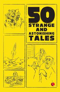
2023x-9357022449Rupa Publications India 2023. Paperback. New. 512 pages. 8.00x5.00x1.11 inches. Rupa Publications India paperback
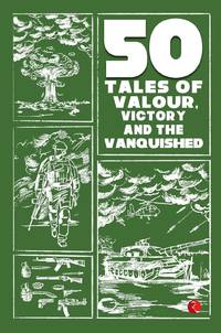
2023x-9357024549Rupa Pubns India Pvt Ltd 2023. Paperback. New. 536 pages. 8.00x5.00x7.80 inches. Rupa Pubns India Pvt Ltd paperback
0070149968.Gtextbook. Good. Access codes and supplements are not guaranteed with used items. May be an ex-library book. unknown
1020968842.Ghardcover. Good. Access codes and supplements are not guaranteed with used items. May be an ex-library book. hardcover
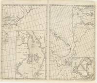
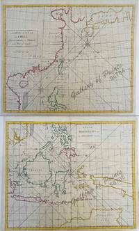
86034J. & J. Knapton W. & J. Innys London 1728. . Four engraved sea charts on one double-page map sheet.<br />Good condition. Dimensions: 50 x 61 cm.<br /> Published in the 'Atlas maritimus & commercialis: or a General View of the World so far as Relates to Trade & Navigation'.<br />The Atlas maritimus can be used as an index of English trading activity at this period since detailed insets and harbour plans emphasise those areas of greatest commercial significance.<br />Although the author of the text is anonymous Daniel Defoe is thought to have contributed to it and Halley the Astronomer-Royal added a prefatory note discussing the use of the charts; it is therefore sometimes catalogued under his name. It has also been attributed to Harris Senex and Wilson those name appears on one chart. Senex was certainly responsible for one of the atlas's innovations the globular chart of Western Europe whose projection according to the title-page was "authorized by letters patent".<br />The atlas was purely commercial and was not a real rival to the 'English Pilot': unlike the Pilot it compressed global coverage into one book as well as describing the the south and west coast of America omitted by the former.<br /> [J. & J. Knapton, W. & J. Innys, London, 1728]. unknown
1728279748James and John Knapton 1728. First. unbound. Sea Chart. Colored engraving. Sheet measures 21 1/4" x 25". Image measures 19 1/2" x 23 1/2".<br/> <br/> This stunning map of the western hemisphere depicts Guiana and Brazil in South America presented on Edward Wright's projection also called a globular projection. It features rhumb lines to facilitate navigation. The map focuses more on the coastlines rather than the interiors. <br> <br> This chart was made for the 1728 issued of "Atlas maritimus & commercialis or A general view of the world so far as relates to trade and navigation". The atlas which was meant to compete with Mount and Page's popular "English Pilot" was a collaboration between some of the leading cartographers of the time including Sir Edmund Halley John Senex Nathaniel Cutler Steven Parker and Daniel Defoe. The atlas unfortunately failed to achieve commercial success as great as its rival making this a hard-to-find map.<br> <br> The map is in good condition with minor wear along the original folds and overall toning. Some toning over joint. Original plate mark is visible.<br> <br> John Senex 1678-1740 was a kind of Renaissance man of the 18th-century map world working at times as a scholar surveyor engraver astrologer book seller and publisher of maps atlases and globes. In a short period he developed from an apprentice into one of the most important cartographers of the period and became a Fellow of the Royal Society of London as well as Official Geographer to Queen Anne of Great Britain. Although well regarded for his pocket-size maps Senex is probably best known for his globes which display a knowledge of astronomy equal to the skill of their craftsmanship. After his death in 1740 his wife Mary continued his business and continued to produce and sell cartographic works of high quality. Together their work represents a successful and valuable partnership in 18th-century mapmaking and publishing.<br> <br> Sir Edmond Halley 1656--1742 was an English astronomer geophysicist mathematician meteorologist and physicist known for computing the orbit of the eponymous Halley's Comet. He was the second Astronomer Royal in Britain after John Flamsteed. Globular Projection maps were invented by Halley Harris and Senex. This is a wonderful example of their collaborative work.<br/> <br/> James and John Knapton unknown
1728268137London: James and John Knapton 1728. unbound. Sea Chart. Uncolored engraving.19 x 22 1/2 inches.<br/> <br/> This beautiful early sea chart of the Coromandel coast in Southeast India covers the entire eastern coast of India as well as the western coast of Burma Myanmar and southern Thailand. Extends from modern day Kanyakumari north to include the Ganges River Delta the coast of Bangladesh and then south along western coast of Burma or Myanmar to Thailand. The northern parts of Sri Lanka or Ceylon are also included. The chart notes several villages and settlements along the coast. Islands coastal features rhumb lines and other geographical features are also noted.<br> <br> The Coromandel Coast was one of the most important regions for the British Dutch French Danish and Portuguese during this time as much of the Indian trade was controlled through its various harbors and ports.<br> <br> This chart was made by Senex for the 1728 issued of "Atlas maritimus & commercialis or A general view of the world so far as relates to trade and navigation". The atlas which was meant to compete with Mount and Page's popular "English Pilot" was a collaboration between some of the leading cartographers of the time including Sir Edmund Halley John Senex Nathaniel Cutler Steven Parker and Daniel Defoe. The atlas unfortunately failed to achieve commercial success as great as its rival making this a hard-to-find map.<br> <br> The map is in good condition with minor wear along the original centerfold and overall toning. Map is lined with archival paper.<br> <br> John Senex 1678-1740 was a kind of Renaissance man of the 18th-century map world working at times as a scholar surveyor engraver astrologer book seller and publisher of maps atlases and globes. In a short period he developed from an apprentice into one of the most important cartographers of the period and became a Fellow of the Royal Society of London as well as Official Geographer to Queen Anne of Great Britain. Although well regarded for his pocket-size maps Senex is probably best known for his globes which display a knowledge of astronomy equal to the skill of their craftsmanship. After his death in 1740 his wife Mary continued his business and continued to produce and sell cartographic works of high quality. Together their work represents a successful and valuable partnership in 18th-century mapmaking and publishing.<br> <br> Sir Edmond Halley 1656--1742 was an English astronomer geophysicist mathematician meteorologist and physicist known for computing the orbit of the eponymous Halley's Comet. He was the second Astronomer Royal in Britain after John Flamsteed. Globular Projection maps were invented by Halley Harris and Senex. This is a wonderful example of their collaborative work.<br/> <br/> James and John Knapton unknown
172856704/56705hand-coloured copper engravings. Condition: with centerfold as issued.<br />EXTREMELY RARE a very special and difficult to find maps from Atlas Maritimus & Commercialis: or a General View of the World for J. & J. Knapton W. & J. Innys London. The chart specially features the Philippines.<br />The Atlas Maritimus can be used as an index of English trading activity at this period since detailed insets and harbour plans emphasize those areas of greatest commercial significance.<br />Although the author of the text is anonymous Daniel Defoe is thought to have contributed to it and Halley the Astronomer-Royal added a prefatory note discussing the use of the charts; it is therefore sometimes catalogued under his name. It has also been attributed to Harris Senex and Wilson whose name appears on one chart. John Senex was certainly responsible for one of the atlas's innovations the globular chart of Western Europe whose projection according to the title-page was "authorized by letters patent". The atlas was purely commercial and was not a real rival to the 'English Pilot'. <br /><br /><br /><br /> J. & J. Knapton, W. & J. Innys, London
1728279748James and John Knapton 1728. First. unbound. Sea Chart. Colored engraving. Sheet measures 21 1/4" x 25". Image measures 19 1/2" x 23 1/2".<br/><br/> This stunning map of the western hemisphere depicts Guiana and Brazil in South America presented on Edward Wright's projection also called a globular projection. It features rhumb lines to facilitate navigation. The map focuses more on the coastlines rather than the interiors. <br><br> This chart was made for the 1728 issued of "Atlas maritimus & commercialis or A general view of the world so far as relates to trade and navigation". The atlas which was meant to compete with Mount and Page's popular "English Pilot" was a collaboration between some of the leading cartographers of the time including Sir Edmund Halley John Senex Nathaniel Cutler Steven Parker and Daniel Defoe. The atlas unfortunately failed to achieve commercial success as great as its rival making this a hard-to-find map.<br><br>The map is in good condition with minor wear along the original folds and overall toning. Some toning over joint. Original plate mark is visible.<br><br>John Senex 1678-1740 was a kind of Renaissance man of the 18th-century map world working at times as a scholar surveyor engraver astrologer book seller and publisher of maps atlases and globes. In a short period he developed from an apprentice into one of the most important cartographers of the period and became a Fellow of the Royal Society of London as well as Official Geographer to Queen Anne of Great Britain. Although well regarded for his pocket-size maps Senex is probably best known for his globes which display a knowledge of astronomy equal to the skill of their craftsmanship. After his death in 1740 his wife Mary continued his business and continued to produce and sell cartographic works of high quality. Together their work represents a successful and valuable partnership in 18th-century mapmaking and publishing.<br><br> Sir Edmond Halley 1656--1742 was an English astronomer geophysicist mathematician meteorologist and physicist known for computing the orbit of the eponymous Halley's Comet. He was the second Astronomer Royal in Britain after John Flamsteed. Globular Projection maps were invented by Halley Harris and Senex. This is a wonderful example of their collaborative work.<br/><br/> James and John Knapton unknown books
1728268137London: James and John Knapton 1728. unbound. Sea Chart. Uncolored engraving.19 x 22 1/2 inches.<br/><br/> This beautiful early sea chart of the Coromandel coast in Southeast India covers the entire eastern coast of India as well as the western coast of Burma Myanmar and southern Thailand. Extends from modern day Kanyakumari north to include the Ganges River Delta the coast of Bangladesh and then south along western coast of Burma or Myanmar to Thailand. The northern parts of Sri Lanka or Ceylon are also included. The chart notes several villages and settlements along the coast. Islands coastal features rhumb lines and other geographical features are also noted.<br><br>The Coromandel Coast was one of the most important regions for the British Dutch French Danish and Portuguese during this time as much of the Indian trade was controlled through its various harbors and ports.<br><br>This chart was made by Senex for the 1728 issued of "Atlas maritimus & commercialis or A general view of the world so far as relates to trade and navigation". The atlas which was meant to compete with Mount and Page's popular "English Pilot" was a collaboration between some of the leading cartographers of the time including Sir Edmund Halley John Senex Nathaniel Cutler Steven Parker and Daniel Defoe. The atlas unfortunately failed to achieve commercial success as great as its rival making this a hard-to-find map.<br><br>The map is in good condition with minor wear along the original centerfold and overall toning. Map is lined with archival paper.<br><br>John Senex 1678-1740 was a kind of Renaissance man of the 18th-century map world working at times as a scholar surveyor engraver astrologer book seller and publisher of maps atlases and globes. In a short period he developed from an apprentice into one of the most important cartographers of the period and became a Fellow of the Royal Society of London as well as Official Geographer to Queen Anne of Great Britain. Although well regarded for his pocket-size maps Senex is probably best known for his globes which display a knowledge of astronomy equal to the skill of their craftsmanship. After his death in 1740 his wife Mary continued his business and continued to produce and sell cartographic works of high quality. Together their work represents a successful and valuable partnership in 18th-century mapmaking and publishing.<br><br> Sir Edmond Halley 1656--1742 was an English astronomer geophysicist mathematician meteorologist and physicist known for computing the orbit of the eponymous Halley's Comet. He was the second Astronomer Royal in Britain after John Flamsteed. Globular Projection maps were invented by Halley Harris and Senex. This is a wonderful example of their collaborative work.<br/><br/> James and John Knapton unknown books
1728269980London: James and John Knapton 1728. unbound. Sea Chart. Uncolored engraving. Sheet measures 25.5" x 30".<br/><br/> This stunning map of the western hemisphere depicts North America and South America presented on Edward Wright's projection also called a globular projection. It extends from the Hudson Bay south to Terra del Fuego with the oceans featuring rhumb lines to facilitate navigation. The map focuses more on the coastlines rather than the interiors. New Zealand appears in its embryonic form with partial coastline shown. Perhaps the most notable feature is the mapping of California as an island and the unmapped northwest coast of North America.<br><br>Insular California was first mentioned in the early 16th century. Although contrary evidence from various explorers was available by the 17th century that California was in fact a peninsula cartographers remained divided on the subject and California continued to appear on maps as an island.<br><br> This chart was made for the 1728 issued of "Atlas maritimus & commercialis or A general view of the world so far as relates to trade and navigation". The atlas which was meant to compete with Mount and Page's popular "English Pilot" was a collaboration between some of the leading cartographers of the time including Sir Edmund Halley John Senex Nathaniel Cutler Steven Parker and Daniel Defoe. The atlas unfortunately failed to achieve commercial success as great as its rival making this a hard-to-find map.<br><br>The map is in good condition with minor wear along the original folds and overall toning. Some toning over joint. Original plate mark is visible.<br><br>John Senex 1678-1740 was a kind of Renaissance man of the 18th-century map world working at times as a scholar surveyor engraver astrologer book seller and publisher of maps atlases and globes. In a short period he developed from an apprentice into one of the most important cartographers of the period and became a Fellow of the Royal Society of London as well as Official Geographer to Queen Anne of Great Britain. Although well regarded for his pocket-size maps Senex is probably best known for his globes which display a knowledge of astronomy equal to the skill of their craftsmanship. After his death in 1740 his wife Mary continued his business and continued to produce and sell cartographic works of high quality. Together their work represents a successful and valuable partnership in 18th-century mapmaking and publishing.<br><br> Sir Edmond Halley 1656--1742 was an English astronomer geophysicist mathematician meteorologist and physicist known for computing the orbit of the eponymous Halley's Comet. He was the second Astronomer Royal in Britain after John Flamsteed. Globular Projection maps were invented by Halley Harris and Senex. This is a wonderful example of their collaborative work.<br/><br/> James and John Knapton unknown books
1015486150.Ghardcover. Good. Access codes and supplements are not guaranteed with used items. May be an ex-library book. hardcover
1437017959.Ghardcover. Good. Access codes and supplements are not guaranteed with used items. May be an ex-library book. hardcover
45238397like new. unknown
44963886like new. unknown
1436723779.Gpaperback. Good. Access codes and supplements are not guaranteed with used items. May be an ex-library book. paperback
1375792296.Gpaperback. Good. Access codes and supplements are not guaranteed with used items. May be an ex-library book. paperback
1164816829.Ghardcover. Good. Access codes and supplements are not guaranteed with used items. May be an ex-library book. hardcover
1164522663.Gpaperback. Good. Access codes and supplements are not guaranteed with used items. May be an ex-library book. paperback
101549126X.Gpaperback. Good. Access codes and supplements are not guaranteed with used items. May be an ex-library book. paperback
1169981208.Gpaperback. Good. Access codes and supplements are not guaranteed with used items. May be an ex-library book. paperback
2008DADAX1437017959Kessinger Publishing 2008-08-18. hardcover. New. 6.00x1.75x9.00. Buy with confidence. Excellent Customer Service & Return policy. Kessinger Publishing hardcover