229 résultats
183838922Weimar: Bernhard Friedrich Voigt 1838. 8vo. 239 1 pp. Numerous tables. Six large folding engraved plates some hand-coloured w/ instruments and cartographic details. Contemporary quarter-tree-calf over chppng ft of spine mnr splttng to hnges foxing to textblk mnr creasng to Plate VI still good reference copy. First edition of this exceedingly scarce work on surveying detailing the equipment and leveling instruments w/ details on cartography. Bernhard Friedrich Voigt, unknown
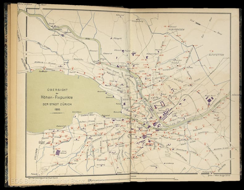
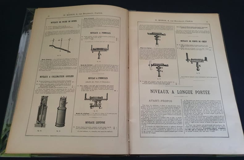
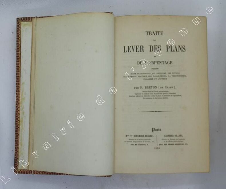
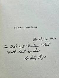
19772200California: Landmark Enterprises 1977. First edition. Hardcover. Very Good/good. Signed and inscribed by the author on the half-title page "March 22 1979 To Bill and Charlene Ebert with best wishes - Buddy Uzes." Front flap of the dustjacket confirms that the author was known as "Bud." Heavy green cloth binding with gilt spine titles in dustjacket. The book is in very good conditoin - clean straight and tight as if unread. A minor lift to the front cover is the only noted flaw. The dustjacket is only good with chips and short tears at the panel edges and some scuffing to the white rear panel. 315 pp. indexed some black and white photos and illustrations. <br/><br/> Landmark Enterprises hardcover
pp. 248, 62 [Logarithmsof Numbers], 15 [Sines and Tangents], 62 [Traverse Table], 100 [Natural Sines] + Frontis and 14 folding copper engraved plates. Loss of text to Title page and first page of preface. Age stained and foxed. Presented to the Philomathain Society by Jos. O'Connell of St. Charles College, Mo, July 8th, 1842. 12mo. (22 x 14 cm.) Original full leather binding. Quarter loss to tail of spine. Boards very fragile. Hardbound. "Gibson's Surveying was a dominant American text for a half century, and the standard against which others were compared. It appeared on the American scene when there was a need for what it offered, particularly in regard to calculating land areas from metes and bounds surveys. Despite several additions and changes by American editors, it never included descriptions or instructions on newer instruments such as the vernier compass, solar compass, or surveyors transit. Its heyday came and went, and it nobly served the needs of many pioneer American surveyors. Today it continues to serve professional surveyors by providing insight into alternative measuring methods used in early surveys." **PRICE JUST REDUCED! SCIENCE BOX 1
0944426689.Gpaperback. Good. Access codes and supplements are not guaranteed with used items. May be an ex-library book. paperback
053798Paris Chez Saillant & Nyon - Desaint 1770 in 8 (20x12) 1 volume reliure pleine basane fauve de l'époque, dos à nerfs orné, 2 feuillets préliminaires non chiffrés, 179 pages [2], avec 6 planches gravées dépliantes sur 7, à noter un léger manque sur la partie latérale externe de la première planche. Tel quel. Bon exemplaire ( Photographies sur demande / We can send pictures of this book on simple request )
18954834DBZürich, Museumsgesellschaft Zürich, 1895. 8°. 166 S., mit vielen ganzseitigen Abbildungen. Halbleinenband mit handschriftlichem Bibliotheks-Rückenschild.
80 pages. Black and white photographic plates. Contents: Ruwenzori - Flights and further exploration, by Dr. Noel Humphreys; Changes in Land Utilization in the South-West of the London Basin, 1840-1932; The Agrarian Contribution to Surveying in England; Woutneel's Map of the British Isles, 1603; Watkins' Kayak. Fold-out map of 'Ruwenzori - illustrating the expeditions of Dr. Noel Humphreys, 1932'. Average wear. Binding intact. Ink stamp to front cover and several pages. Library bar code on first page of advertisements. Covers beginning to loosen from textblock. A worthy copy. Book
Boite140 In4 ( 30 x 21 cm ) - cartonnage éditeur pleine percaline , titres dorés au 1er plat - 73 pages - trés nombreuses illustrations - sans date ( vers 1890) - Instrument de nivellement - niveaux - arpentage -triangulation , tachéométrie - topographie des mines - géodésie - astronomie - météorologie - marine - optique - instruments de mathématiques , etc...
18954834DBZürich, Museumsgesellschaft Zürich, 1895. 8°. 166 S., mit vielen ganzseitigen Abbildungen. Halbleinenband mit handschriftlichem Bibliotheks-Rückenschild. + Wichtig: Für unsere Kunden in der EU erfolgt der Versand alle 14 Tage verzollt ab Deutschland / Postbank-Konto in Deutschland vorhanden +, 4834DB|4834DB_2 [2 Warenabbildungen]
In 8 (cm 14,5 x 23), pp. 47 + (1b) con 1 tavola ripiegata in fine incisa all'acquaforte raff. la bilancia idrostatica. Fitte annotazioni manoscritte con grafia coeva nella parte superiore del contropiatto anteriore. Brossura muta coeva. "Questo libretto, come l'autore confessa, e' in gran parte fabbricato sulla teoria del sig. Fabbroni nel suo scritto intorno alle stime dei terreni. Comunque il mezzo piu' eccellente per misurare le superficie sia il goniometro munito di micrometro, il sig. Rensi per la pratica universale dei periti consiglia la Tavola pretoriana. Non approva pero' l'uso dell'ago magnetico per orientarla, ma invece vorrebbe s'adoperasse il cosi' detto punto sovrapposto... Misurata l'estensione orizzontale, conviene esaminare la profondita' del terreno adoperando percio' la trivella gallica, e consiglia il nostro autore di limitarsi in questa indagine al punto dal quale per la sua profondita' piu' non tornasse conto l'estraerla, a meno di una spesa esorbitante non ordinaria" (Biblioteca italiana ossia giornale di letteratura, scienze ed arti, p. 401 e ss.). Molto raro.
In 8, pp. XX + 448. Scarabocchio ad una carta Marm. M. pl. coeva con segni d'uso. Importante edizione che raccoglie centinaia di tavole di ragguaglio e trsformazione, utilizzabili in decine di attivita'. Sono presenti cosi' le tavole di pesi e misure tra le principali piazze italiane e quelle di Parigi e Vienna; Le monete; i pesi e le misure di centinaia di paesi italiani; le misure dei terreni; la stazatura delle botti ecc. Uno dei piu' completi prontuari di questo genere.
In Lucca, per Giuseppe Rocchi, 1782 e 1784, voll. 2 in 1 tomo, in-8, cartone coevo decorato a motivo floreale qualidrobato in rosso su fondo blù, pp. (4), 125, (3); IV, 18, (2). Due tavole con figure geometriche incise, piegate in fine alla 1a opera. Fregi xilografici. Alla prima opera mancano le pp. 127-130, contenenti: Appendice dell'Autore per dimostrare l'utilità della presente operetta(...) Fori di tarlo al margine bianco inferiore delle ultime 30 pagine, che vanno ampliando in fine. Silicani (Stazzema 1736-1824), anche notaio in Pietrasanta e poeta arcade (col nome di Persilio Lebaide), fu sopratutto ingegnere agrimensore (anche per conto del Governo Granducale nel 1769, con diploma della camera dei signori capitani di ponti ed uffiziali di fiumi di Firenze) e cartografo. Edizioni originali, rare: solo 2 esemplari in ICCU.
FIRST AND ONLY EDITION. A comprehensive demonstration of a new method of census and survey, using Grubbiana (Duchy of Milan) as an example. Complete with 3 folding maps and numerous charts and tables. Printed with large margins and extremely fine wove paper. Large 4to (29.5 cm). Bound in recent boards. Fine and bright. Scarce.
5606ouvrage à l’aide duquel on peut apprendre,le système métrique sans sa perfection, l’arpentage et la division des terres,avec instruments,ou sans autre instruments que le mètre;la trigonométrie rectiligne;la levée des plans par plusieurs méthodes différents.In 4 demi-cuir marron époque, titre et filets dorés. Faux-titre, titre,III,1 page d’errata ;228 pages,12 planches dépliantes,texte sur 2 colonnes,à la suite Le comparateur de l’Oise ou table générales de conversion de toutes les mesures anciennes du département de l’Oise,en nouvelles, et réciproquement, à l’usage de MM les avocats,huissiers, géomètres, arpenteurs, propriétaires,cultivateurs etc. par J.BA THOREL titre,1 page,226 pages,4 pages de table des matières,errata.Se vend à Formerie (Oise)chez l’auteur 1843-1845.Cuir légèrement cassant sinon bon exemplaire,peu courant
10960à l’usage des personnes studieuses. Ouvrage à l’aide duquel on peut apprendre, sans le secours d’aucun maître : le système métrique dans sa perfection, l’arpentage et la division des terres, avec instrumens ou sans autres instrument que le mètre ; la trigonométrie rectiligne ; la levée des plans par plusieurs méthodes différentes, notamment par une méthode moderne, au moyen de laquelle on peut obtenir la contenance effective de tout polygone quelconque, par le secours des triangles et des quadrilatères formés dans ces polygones. On trouvera aussi dans cet ouvrage une division moderne appuyée sur les principes dont il vient d’être parlé ; la manière de faire et de calculer les triangulations par plusieurs procédés de gnomonique, et les tables des carrés précédées du binôme, etc. etc. A la suite le comparateur de l’Oise ou tables générales de conversion de toutes les mesures anciennes du département de l’Oise en nouvelles, et réciproquement, à l’usage des avocats, avoués, notaires, juges de pais, greffiers, huissiers, cultivateurs, propriétaires etc. etc. In 8 demi cuir vert, titre, filets, roulette dorés. Faux-titre, titre, 228 pages, III. Table des matières 1 page errata. . Titre, 224 pages, 1 page de table. En fin de volume : 202 figures en 12 planches dépliantes, lithographiées (une tache d’encre à la dernière). Se vend à Formerie (Oise) chez l’auteur 1843. Bon exemplaire
1865108539Paris, Vve Bouchard-Huzard : Gauhtier-Villars 1865 In-8 22,5 x 13,5 cm. Reliure de l’époque plein chagrin rouge, dos à nerfs encadrés de fers dorés, plats encadrés d’un quadruple filet écoinçonné doré, contre-plats encadrés de roulette dorée, tranches dorées, XXXI-595 pp., 9 planches repliées in fine, table des matières. Reliure frottée, intérieur assez frais, pages de garde poussiéreuses.
1987G0937294837I4N00Asprs Pubns 1987. Paperback. Very Good. May have limited writing in cover pages. Pages are unmarked. ~ ThriftBooks: Read More Spend Less.Dust jacket quality is not guaranteed. Asprs Pubns paperback
8°, pp.XXIV-198 (2), mancano le 2 tavv. f.t. T. cart. color. coevo, dorso rinf. L'op. è divisa in 3 libri, corrispondenti ai 3 argomenti citati nel titolo. [Riccardi, I, 112: "buon trattatello di agrimensura, sebbene non si possa convenire coll'autore intorno all'eccellenza dello strumento da lui a tutti anteposto, chiamato cerchio icnografo, che consiste in un cerchio graduato fornito di ago calamitato a maniera di bussola topografica, con un'alidada a traguardi imperniata nel centro"].
in-8 (mm 170x110). Pagine VIII, 238. Brossura editoriale stampata. SI AGGIUNGE: Altri tre volumi della serie, tutti in brossura editoriale: Id. Trattato degli Arbori; Varrone, Della Agricoltura libri tre; Cosimo Trinci. Diciotto Trattati di Agricoltura.. .
pp. (12), 555. Illustrated with numerous folding tables, plans and diagrams. Very dampstained. Inked ownership of Sam Carpenter, Dec. 2nd 1803. Samuel Carpenter, was born in 1765, at Lancaster County, PA. He was a farmer for many years. In 1807 he moved to Lancaster for the purpose of having better opportunities for the education of his children. Here he engaged for some years in the business of inn-keeping. Lancaster at the time being the seat of the State government, and a great resort for strangers from all parts of the State, he developed wealth and influential connections. He was appointed an Alderman, and not long thereafter was elected Mayor of the City of Lancaster, a position to which he was frequently reelected. 205mm. Original full leather binding, very worn. Front board fragile. Sixth Edition. **PRICE JUST REDUCED! VERIA BX 1
4489Claude-Antoine Jombert, Paris, 1770. Un volume in-8 plein veau havane, dos à nerfs orné de caissons décorés, XII+354+6 pages, 21 planches in fine. Reliure méritant restauration, manques aux coiffes, charnières fragiles, pièce de titre manquante. Intérieur frais, exemplaire complet de ses planches.
63 pages. A detailed description of how mines were intricately surveyed in 1842 - 1892. "Be the mine limestone, ironstone, coal or clay, the same process is gone through." - from chapter one. Maroon cloth cover with gilt lettering. Page 56/57 binding loose but intact. Foxing to endpapers and title page. Minor foxing to sides of content on pages that fold out. Otherwise content unmarked. Minor wear to spine and corners. A worthy copy. Book
500 pages. Index. Black and white illustrations. Diagrams. Charts. "This singularly practical reference provides a wealth of up-to-the-minute information on all aspects of the production of surimi and surimi seafood. Surveying the transformation from functional fish proteins (surimi) to surimi seafood products with unique texture, flavor, and color, the volume covers fish stocks, on-shore and at-sea processing, quality control methods, and the chemistry of surimi functional ingredients - investigating special characteristics of myofibrillar fish proteins and their function in gelatin." - from back board. Prior owner's name atop front free endpaper is now covered with a blank white address label otherwise this copy appears unread. Clean, bright and unmarked with negligible wear. Tight and square. A superior copy. Book
1813117545Paris Goeury 1813 A Paris, Chez Goeury, 1813, 1 volume in-8 de 115x180 mm environ, VIII, 176 pages, complet des 9 planches dépliantes dont 1 en couleurs. Pleine reliure racinée, dos lisse portant titre doré sur pièce de cuir havane et fers dorés, impression sur papier bleuté. Des épidermures et taches sur le cuir, coins usés et cornés, gardes volantes manquantes, une déchirure et quelques taches sur la carte dépliante, sinon intérieur en bon état, état satisfaisant.