268 résultats
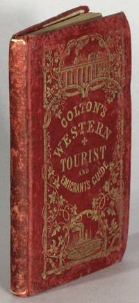
1854024704J.H. Colton and Company 1854. No Binding. Near Fine. Publisher: New York: 1854. 1850 Used. 12mo. 6-1/8"x 3 7/8". One page publisher's advertisement at front matter publisher's catalog at end with 23 numbered pages and 4 not so. Large folding engraved map after J. Calvin Smith with original hand-coloring in full some light brown staining and short separations at folds. Map colors are distinct and very bright/vibrant looking beautiful and in 'As New' condition. It was clearly never displayed in a lighted area. Original brown cloth stamped with titles and decorations minor wear at a few corners and edges. An early pencil & light flowing ink pen short name to front endpaper. First published in this edition in 1850 according to the copyright page. Dated 1854 on the title page. An attractive-looking and conditionally near fine example of this early US guide with a wonderful hand-colored map. Photos available. <br/> <br/> J.H. Colton and Company unknown
1847025664New York: J.H. Colton 1847. 12mo. The western tourist or emigrant's guide through the states of Ohio Michigan Indiana Illinois an being an accurate and concise description of each state territory and county : also describing all the principal stage routes canals railroads and the distances between the towns : accompanied with a correct map with hand coloring. The map is a remarkably fine example with a tiny tear in one fold. Bound in brown cloth lettered in gilt decorated in blind. spine plain some soiling to covers A very nice copy with contemporary owner's name. Howes H615. J.H. Colton unknown books
185419316New York: J.H. Colton & Co 1854. 16mo pp. 89 23 4; large folding hand-colored map of the region approx. 21" x 26"; one short split at one fold otherwise the map is generally in fine condition; original red cloth gilt stamped on upper cover extremities rubbed and the binding slightly stained front free flyleaf excised old pencil notes on rear flyleaf in German; pretty good copy. Howes S615. J.H. Colton & Co unknown
185238236New York: J.H. Colton 1852. 16mo pp. 89 18 ads; large folding hand-colored map of the region approx. 21" x 26"; map a little spotted and with several minor marginal tears and breaks otherwise the map is generally in fine condition; original green cloth gilt stamped on upper cover extremities rubbed; all else very good. An edition unnoticed by Howes but see Howes S615 for a number of others. <br/><br/> J.H. Colton hardcover books
185419316New York: J.H. Colton & Co 1854. 16mo pp. 89 23 4; large folding hand-colored map of the region approx. 21" x 26"; one short split at one fold otherwise the map is generally in fine condition; original red cloth gilt stamped on upper cover extremities rubbed and the binding slightly stained front free flyleaf excised old pencil notes on rear flyleaf in German; pretty good copy. Howes S615. <br/><br/> J.H. Colton & Co hardcover books
185462698New York: J.H. Colton 86 Cedar Street 1854. 16mo. 3.5 x 5.75 in. With hand-coloured 3 colour map which folds out into 26.5 x 21.5 in. map printed on thin onionskin paper engraved ornamental border tipped-in to original embossed red publisher’s portfolio pocket binding peach-coloured printed front pastedown minor toning creasing to fore-edges a few small short closed tear separations at folds one closed tear at gutter margin spine plit still VG- fresh copy w/ Gray Sprague & Co. Booksellers Albany NY label on front pastedown corner. Early edition of this wonderful pocket map from J.H. Colton depicting cities towns villages post hamlets canals stage and railroads. Including Minnesota Wisconsin Michigan Iowa Missouri Illinois Indiana & Ohio this map details not only the settled regions but also the largely unsettled Indian Territory in Minnesota Territory. A small engraved vignette depicts Maiden Rock on Lake Pepin and the Mississippi. Colton 1800-1893 produced his first maps in 1833 based on earlier maps by Burr and then through 1855 produced a large number of pocket railroad maps guidebooks and popular travel guides. J.H. Colton, 86 Cedar Street, unknown
1851008000New York: Charles Scribner 1851. RARE. Not found in Sabin. Last copy sold at auction 1916 Rare Book Hub. Two volumes frontispiece portraits one portrait in text Vol. I one fold-out map Fine. x paginated 18 - 563 v pag. 7- 621 pp. Bound in contemporary half calf over marbled boards backs ornately gilt with brown morocco labels gilt marbled end papers and page edges. A Fine and RARE set beautifully bound. First Edition. Half Calf. Fine/No Jacket As Issued. 8vo - over 7¾" - 9¾" tall. Charles Scribner Hardcover books
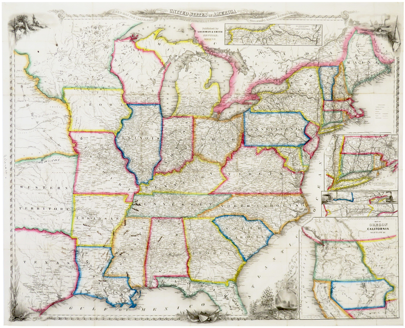
184871260New York:: Sherman & Smith 1848. publisher's gilt-lettered cloth. A beautiful clean unworn copy. 16mo. Embellished with 125 highly finished Engravings. Accompanied by a Large and Accurate Map by J. Calvin Smith. The folding"New Map Through the United States of America Showing the Railroads Canals & Stage Routes" measures approx. 21 x 26 inches and includes inset maps of Oregon & California New York etc. . Sherman & Smith, hardcover
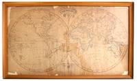
18379386England 1837. Good . 11¾" x 21" in frame measuring 13½" x 23¾". Manuscript map in pen and ink highlighted in pink yellow and blue. Good plus: not examined outside of frame a few tears chips and small losses. <br /> <br /> This is an exquisite world map in pen and ink. We think it's English in origin as there is a notation on the far left of the equator in the Western Hemisphere which reads "Longitude West from London." <br /> <br /> We imagine the artist used a map dated 1824 or earlier as Australia is drawn as "New Holland" whereas "Australia" was officially adopted by the British in 1824. Everything West of the Mississippi is denoted as "New Mexico" North and South America are outlined in yellow while Africa and New Holland are outlined in blue. unknown
1848106024<p>16mo original red cloth decoratively stamped in gilt and blind illustrated with 125 engravings 234 pp. and folding map 52 x 67 cm 20 1/2" x 26 1/4" plus decorative border. Old ink name on front pastedown with catalogue entry glued in some light foxing within map slightly darkened a few short splits at folds; otherwise very good. Smith was a prominent mapmaker in the mid 19th century. He competed with the likes of Colton and Mitchell and was associated with John Disturnell back in the 1840s.He published a number of city maps around that time. In 1843 Smith published a large map of the United States and three years later in 1846 he published the first edition of this map. Considered a really good map it basically covers the eastern and midwestern part of the U.S. California and Oregon are featured in an inset and part of Texas is also shown. Some railroad and canal routs in the northeast are also highlighted. Ristow: American Maps. </p> Sherman & Smith, books
1848106024<p>16mo original red cloth decoratively stamped in gilt and blind illustrated with 125 engravings 234 pp. and folding map 52 x 67 cm 20 1/2" x 26 1/4" plus decorative border. Old ink name on front pastedown with catalogue entry glued in some light foxing within map slightly darkened a few short splits at folds; otherwise very good. Smith was a prominent mapmaker in the mid 19th century. He competed with the likes of Colton and Mitchell and was associated with John Disturnell back in the 1840s.He published a number of city maps around that time. In 1843 Smith published a large map of the United States and three years later in 1846 he published the first edition of this map. Considered a really good map it basically covers the eastern and midwestern part of the U.S. California and Oregon are featured in an inset and part of Texas is also shown. Some railroad and canal routs in the northeast are also highlighted. Ristow: American Maps. </p> Sherman & Smith,
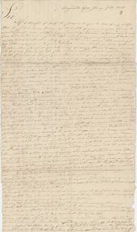
1818List2715Augusta Georgia 1818. Single letter three 9 x 16 inch pages letters with some tape repairs and stray holes at folds still quite legible. Very good. A letter written by Calvin Barnard to his friend Asa Holman of Bolton Massachusetts describing the former’s trip from Boston to Augusta South Carolina from November 25 to January 1. Barnard first traveled from Boston to Charleston South Carolina by boat from which he notes “almost a continual gagging and vomiting†from the passengers. In Charleston Barnard observes that the city is inelegant the unpaved streets “filled with mud†and views “the breastworks which were thrown up during the last warâ€. This would have been the War of 1812 of which Barnard was likely a veteran. South Carolina had engaged upwards of 5000 soldiers and had put up defenses along the coastline in anticipation of the war but it did not come to the mainland – although South Carolina was under naval blockade and the Sea Islands were targeted by the British.<br /> <br /> Barnard reaches Savannah Georgia on the 25th of December; similarly he finds it “although a place of considerable business†“about as dissatisfactory a place I ever was in.†Augusta which he reaches by foot “is much handsomer built and situated than Savannah but not less dissipated†– he remarks that “Being the first day of the year is in this part of the country another great day for getting drunk.†After spending some time in Augusta he finishes the letter with some pointed observations about its residents:<br /> <br /> “I have had a better opportunity of becoming acquainted with the manners customs and dispositions of the citizens of Augusta . I shall not do them injustice by dividing them into three classes in which the Negroes are excepted. The first class of which are the gentry as they would expect to be called made up of men from all parts who have become rich here mostly by avaricious and unjust means . And this class we cannot expect to see drink more than once a week. The second is mostly the natives of this state and South Carolina who are men of a little property of a little education and very little of an honorable principle of any kind and these are not often seen drunk in the forenoon. The third class appears to me to be made up of the off-scouring of every bad place on earth for I never saw their equal for drunkenness lying stealing fighting swearing from morning till morning again. It is not possible that the continent of America has in any other place their equal. If it had I think the whole world soon be sunk.â€<br /> <br /> He finds Augusta’s African-American residents the only trustworthy ones despite local opinions:<br /> <br /> “If any stealing is done here it is laid to the Negroes but I had my surtout a shirt and handkerchief stolen on Friday night last but have too good an opinion of the blacks to think they have them.â€<br /> <br /> Of interest as an outsider’s views on the early Antebellum South and on drinking – another pressing social issue of the day. unknown
1847106023<p>16mo original brown cloth decoratively stamped in gilt and blind illustrated with 125 engravings 233 pp. and folding map 52 x 67 cm 20 1/2" x 26 1/4" plus decorative border. Minor fading and wear to covers some pencil notes on endpapers about a 6" split at one fold a smaller split at another fold otherwise a really nice map; overall very good or better. Smith was a prominent mapmaker in the mid 19th century. He competed with the likes of Colton and Mitchell and was associated with John Disturnell back in the 1840s.He published a number of city maps around that time. In 1843 Smith published a large map of the United States and three years later in 1846 he published the first edition of this map. Considered a really good map it basically covers the eastern and midwestern part of the U.S. California and Oregon are featured in an inset and part of Texas is also shown. Some railroad and canal routs in the northeast are also highlighted. Ristow: American Maps. </p> Sherman & Smith, books
1847106023<p>16mo original brown cloth decoratively stamped in gilt and blind illustrated with 125 engravings 233 pp. and folding map 52 x 67 cm 20 1/2" x 26 1/4" plus decorative border. Minor fading and wear to covers some pencil notes on endpapers about a 6" split at one fold a smaller split at another fold otherwise a really nice map; overall very good or better. Smith was a prominent mapmaker in the mid 19th century. He competed with the likes of Colton and Mitchell and was associated with John Disturnell back in the 1840s.He published a number of city maps around that time. In 1843 Smith published a large map of the United States and three years later in 1846 he published the first edition of this map. Considered a really good map it basically covers the eastern and midwestern part of the U.S. California and Oregon are featured in an inset and part of Texas is also shown. Some railroad and canal routs in the northeast are also highlighted. Ristow: American Maps. </p> Sherman & Smith,
183324226London: Frederick Westley and A.H. Davis 1833. First edition 8vo 2 volumes pp. xxxii 316; vii 1 387; slightly later half calf over marbled boards red morocco labels on spines; rebacked with old spines laid down; good and sound. Colton 1789-1857 who gave up his ministry because of the failure of his voice went to England in 1831 as a correspondent for the New York Observer. Unlike his earlier religious works which are of little value "his descriptive narratives of travel are of much real value" see DAB. Field 345: "Mr. Colton seems to have been imbued with the laudable design of affording such information regarding the Indians he visited as would not only excite the interest of his readers in his narration of incident but would arouse the sympathy of the humane to their wretched condition. Almost the entire work is devoted to the relation of Indian affairs. More than half of the first volume is occupied with personal observations of Aboriginal life and statements made to him regarding it. The second volume is entirely filled with a collection of facts relating to their origin wars treaties treatment by the governments of Great Britain and the United States and the result of missions among them." Howes C619; Sabin 14783. <br/><br/> Frederick Westley and A.H. Davis hardcover books
183324226London: Frederick Westley and A.H. Davis 1833. First edition 8vo 2 volumes pp. xxxii 316; vii 1 387; slightly later half calf over marbled boards red morocco labels on spines; rebacked with old spines laid down; good and sound. Colton 1789-1857 who gave up his ministry because of the failure of his voice went to England in 1831 as a correspondent for the New York Observer. Unlike his earlier religious works which are of little value "his descriptive narratives of travel are of much real value" see DAB. Field 345: "Mr. Colton seems to have been imbued with the laudable design of affording such information regarding the Indians he visited as would not only excite the interest of his readers in his narration of incident but would arouse the sympathy of the humane to their wretched condition. Almost the entire work is devoted to the relation of Indian affairs. More than half of the first volume is occupied with personal observations of Aboriginal life and statements made to him regarding it. The second volume is entirely filled with a collection of facts relating to their origin wars treaties treatment by the governments of Great Britain and the United States and the result of missions among them." Howes C619; Sabin 14783. Frederick Westley and A.H. Davis unknown
1852LBW-6388New York, Sherman & Smith, 1852. 550 x 685 mm, sur papier fin.
1849r3543New York: Sherman & Smith. G : in Good condition. Cover lightly rubbed soiled and bumped. Slight darkening to page ends. Stamps of previous owner on fep and base of title page. Pencil annotation on ffep. Rear fold out map G with small tear at fore edge of centre fold. Contents tight. 1849. Reprint. Red/gilt hardback cloth cover. 150mm x 90mm 6" x 4". 234pp. 125 highly finished engravings and a large and accurate map hand coloured in outline. Containing a description of the states cities towns villages watering places colleges etc.etc.; with the railroad stage and steamboat routes the distance from place to place and the fares on the great travelling routes. . Sherman & Smith hardcover
184071211New York:: Tanner & Disturnell 1840. First edition. publisher's ribbed cloth with applied printed paper label. Slight use to the cloth portfolio; both maps and contents very nice. . 5-1/4 x 3-1/4 inches. Engraved frontispiece and two folding color maps "New Map of the City of New York with Brooklyn & Part of Williamsburg" and "Map of the State of New York." . Tanner & Disturnell, hardcover
184866814Tarrif as Essential to Secure Freedom COLTON Calvin. Public Economy for the United States. New York: A.S. Barnes & Co. 1848. First edition. With the inscription "Hon. J. Colamer with Respects of the Author" to the front free endpaper. J. Colamer was a Senator from Virginia. Large octavo. 7 8-536 pp. Publisher's brown cloth gilt spine lettering. Some light foxing throughout. A near fine copy. Born in Longmeadow Massachussets Colton was ordained in 1816 and worked as a pastor in western New York. He later became a professor of political economy at Trinity College Connecticut. He was a strong advocate for the protection of home industries and most of his writings reflect that. Public Economy for the United States is his most extensive work. Colton said he preferred 'public economy' over 'political economy' because the word 'political' had been abused. Political economy is "the application of knowledge derived from experience to a given position to given interests and to given institutions of an independant state or nation for the increase of public and private wealth. Freedom is a thing of 'commercial value' and the parts of the world most free require protection against those less so because the sole object of protection is to maintain and fortify freedom. Protection as opposed to Free Trade thus accords with the principles of the American Revolution" Dorfman II 778. Kress C.7332. HBS 66814. $1500 A.S. Barnes & Co. hardcover books
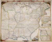
1849M7571New York: Sherman and Smith 1849. Tears along left margin repaired and professionally restored otherwise in very good condition laid down in acid free tissue paper for long term preservation. . Notes: A decorative map. In the corners of the map are four vignettes of iconic American imagery in the bottom right there are four inset maps the top showing the railroads of New York to Boston the second from New York to Philadelphia the third from Philadelphia to Washington the last being a map of the newly acquired territories of the West Coast. Also beneath the title is an inset map depicting the Erie canal and the railroad between Albany and Buffalo. Size : 564x688 mm 22.20x27.09 Inches Coloring: Original Outline Coloring Category: Maps United States; Sherman and Smith unknown
185335524NY: J.H. Colton 1853. 12mo. 89 pp. 24-page Colton catalogue of "maps charts books etc." Map: GUIDE THROUGH OHIO MICHIGAN INDIANA ILLINOIS MISSOURI WISCONSIN & IOWA SHOWING THE TOWNSHIP LINES OF THE UNITED STATES SURVEYS; LOCATION OF CITIES TOWNS VILLAGES POST HAMLETS CANALS RAIL AND STAGE ROADS by J. Calvin Smith; hand-colored broadside with ornamental border 22 x 26 1/2 inches folded to 12mo. Original elaborately gilt-stamped illustrated cloth a little rubbed; some foxing but the map fine. Reprint of a revised edition. Howes S-615. <br/><br/> J.H. Colton hardcover books
184850600New York:: Sherman and Smith 1848. publisher's decorated red cloth stamped in gold. Old owner's signature at head of title; D.C. bookseller's ticket; a few minor fold separations to map; very attractive. 16mo. Large folded map 26 x 21-1/2" with boundaries hand outlined in color. Howes S-614. Wheat #568. Sherman and Smith, hardcover
1847Embry 82690Sherman & Smith 1847. Second edition. Some mild toning to map occasional light foxing throughout rather elaborate ownership markings to front free endpaper expertly rebacked with original spine laid down overall a nicely restored copy with the map in excellent condition. One hundred twenty five text engravings and large folding map with colored outlines. Brown cloth decoratively stamped in gilt and blind. Map dated 1847. Howes S 614. Sherman & Smith, 1847. Second edition. hardcover books
1849216749New York: Sherman & Smith 122 Broadway 1849. Illustrated with 125 engravings in the text. Large folding map by Smith 22 x 25 3/4 inches at the back outlined in period color "A New Map for Travellers throught the United States" New York Sherman & Smith 1849". 2 ads 234 pp. 1 vols. 12mo. Original green gilt-stamped cloth with slight wear at extremities. One piece missing from right edge of map approximately 3 x 3 inches affecting one inset. Illustrated with 125 engravings in the text. Large folding map by Smith 22 x 25 3/4 inches at the back outlined in period color "A New Map for Travellers throught the United States" New York Sherman & Smith 1849". 2 ads 234 pp. 1 vols. 12mo. An important map of the U.S. first published in the 1846 edition which was updated for the editions of 1848 1849 this and 1850 then published separately in 1853 and 1853. With five insets to the general map: "Railroad & Canal Routes from Albany to Buffalo" "Map Showing the Rail Roads between the Cities of New York Boston & Albany" mostly missing in this copy "Railroad Route from New York to Philadelphia" "Railroad Route from Philadelphia to Washington" and "Map of Oregon Northern California Santa Fe &c." The latter inset first published in the 1846 edition although small is important for showing regions before the Mexican War and was copied by other map makers. Howes S 614; Sabin 82928; Wheat 56 ref Sherman & Smith, 122 Broadway unknown books