Jean CALVINBiblio.com

268 résultats
184213764Paris: C. Gosselin 1842. Fine. C. Gosselin Paris 1842 12 x 18 cm broché First edition. Spine slightly faded some occasional foxing. Rare. C. Gosselin unknown
189256413Dallas Texas 1892. Front cover is chewed on the bottom right-hand corner & a tiny bit on the lower left-hand corner. A faint mustiness pervades. Hardback. Good used Condition. Hardcover
188079427New York: : Moss Engraving Co. no date 1880s. Some light use to the metal plate; image very nice. 4-1/2 x 7-1/2 inches. John Calvin Moss is credited with developing the first practical photo-engraving process in 1863. He worked in a partnership as the Actinic Engraving Co 1871-1872; then as the Moss Photo-Engraving Company and finally enjoyed success as the Moss Engraving Company from 1880 until his death in 1892. Moss Engraving Co., unknown
186676445Boston:: E. P. Dutton & Co. 1866. folding into 12mo gilt-lettered boards as issued. Several sections of New York State have been outlined in thick felt-tip type pen; otherwise fine. . Image approx. 25 x 26 inches. Tinted map with inset views of Niagara Falls The Notch White Mountains Falls of the Montmorenci View from Mount Holyoke and ships at sea. . E. P. Dutton & Co., hardcover
18486386New York: Published by J. Disturnell 1848. Engraved on steel by Sherman & Smith. Full period color 19 x 23-1/2" folding into gilt stamped brown cloth covers. Two insets: The St. Lawrence River from the New York State Line to Quebec; and City of New York with Part of Brooklyn and Williamsburgh. This is a finely engraved and detailed general map of the State of New York. Canals are shown in blue and railroads in orange. Docketed on verso in blue pencil: "Jay Fiske Fort Plain N.Y." and "Map of New York State/ Fiske". Phillips p. 513; not in Rumsey. Published by J. Disturnell unknown
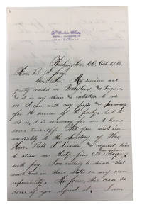
188489495Washington 1884. Very Good. Holograph letter written on both sides of a lined personal-sized sheet purple-stamped Washington Bee address at top. 23 cm. Dated: Washington 6 October 1884. Creases where folded for mailing or storage. Modest tear with no loss of text. Telling Jones that "My services are greatly needed in Maryland and Virginia" Chase asks that Jones intercede with Robert Lincoln the Secretary of War and Chase's employer his day job so that Chase can have 35 days paid leave to campaign for James Blaine in Maryland and Virginia. "I am willing to devote that much time in those states on my own responsibility . I am now distributing as many papers free as I can afford in the above states." Chase was born to a free black family in Washington D.C. and attended Howard University Law School. He edited the Washington Bee an influential African American newspaper for nearly forty years 1882-1921. Chase a dedicated 'Race Man' later used the power of his newspaper to promote the interests of Booker T. Washington. unknown
1833015458London United Kingdom: Frederick Westley and A.H. Davis 1833. Book. Very Good . Hardcover. 1st Edition. First UK Edition First Print. This is a true first edition first printing first impression Vol II only Octavo pp. vii. 1 - 387. Original brown blind stamped boards gilt author name and title to spine. Fade to spine and boards. internally clean pages some uncut. light toning to end pages Tightly shaken still tightly bound. Frederick Westley and A.H. Davis Hardcover
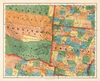
185524689Kassel: Theodor Fischer 1855-60. Other. In excellent condition. 375 by 467mm 14 by 18 inches. 375 by 467mm 14 by 18 inches. Lithograph original color in outline by Smith J. Calvin published 1855-60 by Theodor Fischer Kassel. Image size: 375 by 467mm 14 by 18 inches. From Smith's multi-sheet Special-Karte one of the most detailed and accurate mid-19th-century maps of the United States. John Calvin J. Calvin Smith c.18091890 was an American surveyor geographer and engraver active in New York City from the 1840s. Working with partners including George Sherman under the Sherman & Smith imprint 18401853 and later in association with J.H. Colton Smith produced some of the most accurate and widely used general-purpose maps of the United States of his era. His maps appeared in government publications military surveys and commercial atlases and his multi-sheet Special-Karte der Vereinigten Staaten published in a German-language edition brought American cartographic standards to European audiences. Despite his prolific output and importance to American cartographic history much of Smith's personal biography remains obscure.This very detailed map shows Arcansas Parts of Missouri Texas and the western Territory. In excellent condition. Theodor Fischer unknown
181550316Hartford: Sheldon and Godwin Printers 1815. Hardcover. fair. 160p 18mo. Translated from the Latin by the Rev Elijah Waterman. A fair copy in marbled calf boards. Wear to extremities. Top edge of title page clipped end papers tattered. Faint stains in margins. Bookplate pasted to ffep. <br/><br/> Sheldon and Godwin Printers hardcover
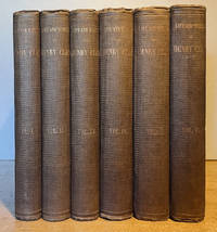
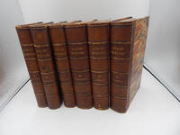
186432720New York: P. O'Shea 1864 Complete Six-Volume Set in publisher's original gilt-stamped brown textured cloth bindings tight pages bright & unfoxed Volumes 1-3 Biographical Volumes 4-6 Correspondence & Speeches no markings NOT ex-lib no names inscriptions or bookplates slight scuffed shelf wear to boards with slight darkening to spines titles clear & legible a clean tight nice set; 6 8vos; tissue-guarded frontispieces to each volume. Extra shipping charge REQUIRED for shipment of this heavy set additional charge WILL BE SUBSTANTIAL for overseas shipment. Hard Cover. Very Good. New York: P. O'Shea hardcover
18571506020120Pub. by A.S. Barnes & Co 1857-01-01. Hardcover. Good. 6 volume set. Full tooled leather binding. All edges red. Marbled end pages. 5 raised bands. Handsome bindings. Chip missing from top segment of vol. 5. Vol. 6 front hinge weakened. Engraved title pages. v. 1-3. Life and times -- Pub. by A.S. Barnes & Co hardcover
182310086712mo leather spine label xvi 320 pp. Binding a bit worn and hinges are tender some staining and foxing throughout; otherwise very good. Published about 50 years after the sect arrived in New York this work is an effort to set the record straight about the Shakers. In the preface the authors suggest the considerable interest in the Shakers along with the sometimes prejudiced view of these people which even included charges of drunkenness of Ann Lee and her associates was the reason for writing this book. According to them they didn't want to inspire controversy but merely to present the facts as they saw them which includes a history of this group. Sabin 79721. Packard & Van Benthuysen,
182310086712mo leather spine label xvi 320 pp. Binding a bit worn and hinges are tender some staining and foxing throughout; otherwise very good. Published about 50 years after the sect arrived in New York this work is an effort to set the record straight about the Shakers. In the preface the authors suggest the considerable interest in the Shakers along with the sometimes prejudiced view of these people which even included charges of drunkenness of Ann Lee and her associates was the reason for writing this book. According to them they didn't want to inspire controversy but merely to present the facts as they saw them which includes a history of this group. Sabin 79721. Packard & Van Benthuysen, books
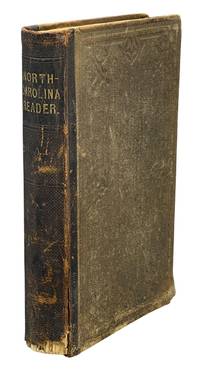
186012904New York: A.S. Barnes & Burr 1860. Octavo 8 x 5.5" original brown cloth with brown morocco spine gilt spine titles 2 6 3-251 pp. A school textbook for North Carolina students one of a series of three authored by Calvin H. Wiley a pioneering North Carolina educator. Wiley was the first superintendent of North Carolina Common Schools working to reorganize and expand the school such that literacy increased and North Carolina became an education leader among Southern states. The book was first published in 1851; this is the third revised edition.<br /> <br /> The reader contains descriptions of the various cities and regions of the state statistical information and a series of North Carolina themed essays and poems including "importance of female society in improvement of mind and formation of character" and "advantages of state pride". The text prints statistics regarding enslaved persons in the state and stresses that that state should be welcoming to farmers of all stripes including slaveowners. Another section covers a planned July 1775 slave rebellion emphasizing the violent intentions of the would-be participants and criticizing their British supporters: "they had been directed to fall on the night of the 8th on the white family in which they resided; and after destroying it to set fire to the buildings and proceed thus from plantation to plantation.This plan agrees with that suggested by the celebrated Samuel Johnson a distinguished English critic but a hateful bigot and uniform defender of tyranny." Seven in OCLC for this 1860 edition. A good copy with toning and foxing occasional damp staining to pages wear to covers with chip to lower spine leather. A.S. Barnes & Burr hardcover
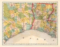
185524692Kassel: Theodor Fischer 1855-60. Other. 370 by 470mm 14 by 18 inches. 370 by 470mm 14 by 18 inches. Lithograph original color in outline by Smith J. Calvin published 1855-60 by Theodor Fischer Kassel. Image size: 370 by 470mm 14 by 18 inches. From Smith's multi-sheet Special-Karte one of the most detailed and accurate mid-19th-century maps of the United States. John Calvin J. Calvin Smith c.18091890 was an American surveyor geographer and engraver active in New York City from the 1840s. Working with partners including George Sherman under the Sherman & Smith imprint 18401853 and later in association with J.H. Colton Smith produced some of the most accurate and widely used general-purpose maps of the United States of his era. His maps appeared in government publications military surveys and commercial atlases and his multi-sheet Special-Karte der Vereinigten Staaten published in a German-language edition brought American cartographic standards to European audiences. Despite his prolific output and importance to American cartographic history much of Smith's personal biography remains obscure.This antique map of Louisiana Texas No: 13 was published in 1855-60 by Theodor Fischer Kassel 370 by 470mm 14 by 18 inches. It is printed as a lithograph original color in outline. The map documents the region with careful attention to rivers settlements roads and political boundaries reflecting the geographical knowledge available at the time of publication and offering an invaluable primary source for historians and collectors of North American antique cartography. 370 by 470mm 14 by 18 inches. Theodor Fischer unknown
185571411New York:: J. H. Colton 1855. publisher's gilt pictorial cloth. . One tiny tissue repair to the folding map; endsheets lightly foxed; some very light use to cloth. 16mo. With a large folding tinted map by J. Calvin Smith "Guide Through Ohio Michigan Indiana Illinois Missouri Wisconsin & Iowa." . J. H. Colton, hardcover
181525028Hartford CT: Sheldon & Goodwin Printers 1815. Full leather. Very Good . The 1815 presumed 1st American edition published in Hartford CT and translated from its original Latin into English by the Rev. Elijah Waterman. Clean and VG in its original full calf or certainly a contemporary-to-the-period full calf. A touch of light wear along the front inner hinge otherwise very sharp. Internally minor offsetting at a number of the pages but still bright and eminently legible. No writing either marring the text. 32mo 105 pgs. of text "The Catechism of the Church of Geneva" plus the 51 pg. Appendix "An Appendix in Letter Addressed to William S. Johnson L.L.D.". Sheldon & Goodwin, Printers unknown
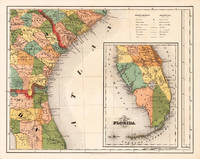
185524684Kassel: Theodor Fischer 1855-60. Other. In excellent condition. 370 by 470mm 14 by 18 inches. Lithograph original color in outline by Smith J. Calvin published 1855-60 by Theodor Fischer Kassel. Image size: 370 by 470mm 14 by 18 inches. From Smith's multi-sheet Special-Karte one of the most detailed and accurate mid-19th-century maps of the United States. John Calvin J. Calvin Smith c.18091890 was an American surveyor geographer and engraver active in New York City from the 1840s. Working with partners including George Sherman under the Sherman & Smith imprint 18401853 and later in association with J.H. Colton Smith produced some of the most accurate and widely used general-purpose maps of the United States of his era. His maps appeared in government publications military surveys and commercial atlases and his multi-sheet Special-Karte der Vereinigten Staaten published in a German-language edition brought American cartographic standards to European audiences. Despite his prolific output and importance to American cartographic history much of Smith's personal biography remains obscure.This antique map of Southern Part of Florida No: 15 was published in 1855-60 by Theodor Fischer Kassel 370 by 470mm 14 by 18 inches. It is printed as a lithograph original color in outline. The map documents the region with careful attention to rivers settlements roads and political boundaries reflecting the geographical knowledge available at the time of publication and offering an invaluable primary source for historians and collectors of North American antique cartography. In excellent condition. Theodor Fischer unknown
185570798New York:: J. H. Colton and Company 1855. publisher's red cloth embossed in gold and blind. . Some inoffensive brown spots to map; slight use to cloth; very nice. 16mo. Large folding tinted map "Guide Through Ohio Michigan Indiana Illinois Missouri Wisconsin & Iowa" by J. Calvin Smith. . J. H. Colton and Company, hardcover
184770800New York:: J. H. Colton 1847. publisher's gilt-lettered cloth. . Ex-historical society copy with donation bookplate and withdrawal stamp no other institutional markings; a few brown spots to the map which is otherwise fine. 16mo. With a large folding tinted map by J. Calvin Smith "Guide Through Ohio Michigan Indiana Illinois Missouri Wisconsin & Iowa." . J. H. Colton, hardcover
184234300New York: Published by J. Disturnell 1842. Handcolored map engraved by Sherman & Smith. 1 vols. 12mo folder 18 x 19 inches map. Original green cloth title lettered in gilt on upper cover with folded map. Some tears and holds along a few folds and along the edges creased light browning and offsetting else very good with the bookplate of Charles George Moller Jr. Handcolored map engraved by Sherman & Smith. 1 vols. 12mo folder 18 x 19 inches map. Detailed insets of New York with part of Brooklyn and Williamsburg the vicinity of New York and the St. Lawrence River. Published by J. Disturnell unknown books
1848WRCAM32759New York: Published by J. Disturnell 1848. Folding pocket map 19 x 23 1/2 inches engraved on steel by Sherman & Smith with full period color. Bound into original 16mo. brown cloth boards stamped in blind and gilt. Very good. This is a finely engraved and detailed general map of the State of New York with two insets: "The St. Lawrence River from the New York State line to Quebec" and "City of New York with Part of Brooklyn and Williamsburgh." Canals are shown in blue and railroads in orange. Not in Rumsey. PHILLIPS MAPS p.513. Published by J. Disturnell hardcover books
185059668New York:: Sherman & Smith 1850. . in publisher's gilt-lettered cloth portfolio as issued. A few neat tissue repairs on verso to tiny splits at fold intersections; a beautiful copy. 22 x 27 inches folded to 12mo. Folding map with original outline color; inset maps of Boston and New York environs; and engraved vignettes of Niagara Falls Notch of White Mountains Falls of Montmorenci and View of Mount Holyoke Mass. . Sherman & Smith, hardcover
185719728<p>Very Good hardcovers. Nonpareil marbled paper over boards half bound with brown hard-grain morocco leather; raised bands on spine with gilt stamped titles; all edges marbled; marbled end papers; tissue-guarded frontispieces. Bright clean square covers and spines; vols 1 and 6 have small rubbed areas on front cover marbled paper; all volumes have some rubbing along tail edges; all tightly bound; all leather joints are sound without splits or cracking; clean interiors; leaves remain supple. Vols 1-3 are biographical; vol 4 is correspondence; vols 5-6 are speeches. All volumes have tables of contents. Vols 2 3 and 4 have indexes vol 2 index is for vols 1 2. 8vos 3439 total pp paged: 504 504 504 639 656 632. See OCLC #883842521.</p> New York: A.S. Barnes and Co. hardcover
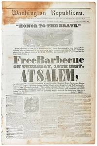
184745585Salem Indiana: Washington Republican / Calvin Frary 1847. Very Good -. Salem IN: Washington Republican 1847. Folio 55cm; removed; 4pp. Stain to upper corner; general wear staining and smudging; Good to Very Good. <br /> <br /> Uncommon Indiana newspaper here celebrating the return of veterans of the Mexican War including the Washington Rifles Posey Guards Hoosier Boys Lawrence Greys Lanesville Legion Spencer Grays and the Charlestown Guards. The public "without regard to age sex or condition" are invited to a "Free Barbecue" to celebrate their return. Includes regular ads and news with particular attention paid to the War. Advertisement for "Mrs. D. Curry's Tavern" to final page. OCLC shows five holdings of various issues and mentions the newspaper began in 1845 and shuttered in late 1847. . Washington Republican / Calvin Frary unknown