268 résultats
1850008430New York: Sherman & Smith 1850 Book. Very Good. Hardcover. 16mo - over 5¾ - 6¾" tall. 16mo. 6x3¾ inches Pp. 2 advts 233 234 blank. Steel-engraved frontis wood-engraved title vignette 123 wood-engraved illustrations interspersed throughout the text large folding hand-colored engraved map 21½ x 27 inches. Publisher's light green cloth gilt lettering and design on front cover and spine blind stamped on rear cover. Light wear to spine ends and corners bookplate on inner cover. Light foxing to engraved frontis plate a few tiny breaks at some fold junctions of map 3 inch split to center of one fold. A very good copy and with the exception noted the map in very nice condition. New York: Sherman & Smith 1850. First published in 1846 and reprinted with the same collation in 1847 '48 '49 and 1850. Rare in any of the early printings. The large folding map with contemporary hand-coloring in outline is titled "A New Map for Travelers through the United States of America showing the Rail Roads Canals & Stage Roads. With the Distances. Published by Sherman & Smith. New York 1850" entered 1846. The important map was first published in the 1846 edition and then updated for the editions of 1848 1849 and this edition 1850. This fine map includes engraved pictorial vignettes and 4 inset maps. The insets include "Rail Road Route from New York to Philadelphia" "Rail Roads between the cities of New York Boston and Albany" "Rail Road and Canal Routes from Albany to Buffalo" and "Oregon Northern California Santa Fe etc." The latter inset first published in the 1846 edition is important for showing regions before the Mexican War. The map extends as far west as central Texas. Howes I: S-614; Howes II: 622; Sabin: 82928; see Wheat Mapping the Transmississippi West volume 3: p. 267. . Sherman & Smith hardcover
1849216749New York: Sherman & Smith 122 Broadway 1849. Illustrated with 125 engravings in the text. Large folding map by Smith 22 x 25 3/4 inches at the back outlined in period color "A New Map for Travellers throught the United States" New York Sherman & Smith 1849". 2 ads 234 pp. 1 vols. 12mo. Original green gilt-stamped cloth with slight wear at extremities. One piece missing from right edge of map approximately 3 x 3 inches affecting one inset. Illustrated with 125 engravings in the text. Large folding map by Smith 22 x 25 3/4 inches at the back outlined in period color "A New Map for Travellers throught the United States" New York Sherman & Smith 1849". 2 ads 234 pp. 1 vols. 12mo. An important map of the U.S. first published in the 1846 edition which was updated for the editions of 1848 1849 this and 1850 then published separately in 1853 and 1853. With five insets to the general map: "Railroad & Canal Routes from Albany to Buffalo" "Map Showing the Rail Roads between the Cities of New York Boston & Albany" mostly missing in this copy "Railroad Route from New York to Philadelphia" "Railroad Route from Philadelphia to Washington" and "Map of Oregon Northern California Santa Fe &c." The latter inset first published in the 1846 edition although small is important for showing regions before the Mexican War and was copied by other map makers. Howes S 614; Sabin 82928; Wheat 56 ref Sherman & Smith, 122 Broadway unknown
1889816921889. STEVENS John Calvin and Albert Winslow COBB. Example of American Domestic Architecture. New York: William T. Comstock 1889. 1st ed. Oblong 4to. 30 24 31-40 2 pp frontis. plates illus. In orig. cloth. Binding is a bit soiled with some light fraying to the cloth at the corners and spine ends. Previous owner name on the first blank else clean with only light and scattered foxing. Very good or better. Hitchcock 1240. A scarce book by the Portland Maine based architects. Hitchcock erroneously calls for 50 plates. There are 59 numbered plates plus the frontispiece. unknown
1839397071New York: Published by J.H. Colton 1839. Hardcover. Near Fine. First edition. 12mo. 180pp. Large folding map. Gray-green cloth gilt. Scattered foxing throughout modest rubbing on the boards a solid very good copy with a small stain on the map otherwise in nice near fine condition. Howes S615. Published by J.H. Colton hardcover
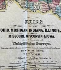
18475122<p><em>Discoverin the Midwest</em></p><p>COLTON J. H. and J. CALVIN SMITH. The Western Tourist or emigrant's guide: through the states of Ohio Michigan Indiana Illinois and Missouri and the territories of Wisconsin and Iowa ; being an accurate and concise description of each state territory and country. Also describing all the principal stage routes canals railroads and the distances between the towns. Accompanied with a correct map showing the township lines of the United States' Surveys the boundaries of countries position of villages etc. New York J. H. Colton 1847.</p><p>8vo pp. 119 6 publisher's advertisements with one large coloured folding map 520 x620 mm; the map is printed within a decorative border coloured by counties and includes a small vignette of the Mississippi; some light spotting due to paper stock; original publisher's blindstamped brown ribbed cloth with gilt lettering to upper board; a very fine copy.</p><p>A fine copy of this popular and often reprinted guide to the Midwest first published in 1839. 'A few years since this region then denominated the 'far west' was regarded as the outskirts of civilization it is now the greatest proportion of it the residence of an active enterprizing and intelligent population.' preface.</p><p>Detailed information is given on each state both geographical physical political and economic with intricate details of land and soil quality per county methods of sale of land and settlement and development possibilities. A perfect guide for the emigrant and settler. The large format map is incredibly detailed; it is coloured by counties and gives location of cities towns villages post hamlets rail and stage roads. It was produced by J.H. Colton a prominent family firm of mapmakers who were leaders in the American map trade in the nineteenth century.</p><p>Sabin 82932; Howes S-615</p> J.H. Colton
187052647Shanghai: NP 1870. First edition. Hardcover. g- to vg-. 1/500. Octavo. ix 64pp. Rebound in 3/4 green buckram over marbled paper boards. Missing the original blue printed wrappers as issued. This extremely rare work is an English translation of a collection of scandalous anti-missionary and anticlerical polemics and statements originally issued in Chinese and circulated throughout the previous centuries with the aim of rallying support against the growing Christian influence in the country. Although predominantly aimed at Catholics the texts here are anti-Christian in general. The work contains a number of odd and interesting Chinese perspectives on Christianity as well as opinions of the Pope and includes bizarre and detailed references to supposed sexual practices of the clergy and lay people p.10-11.<br /> <br /> The translator/publisher of the work is not named but has since been attributed to the influential American Presbyterian missionary and minister Calvin Wilson Mateer 1836-1908. As stated in the preface the idea of this publication in English was to expose westerners to the degree to which Christianity in China was treated with suspicion and hostility. The preface text is dated to August 18th 1870 in Tungchow now Penglai District Yantai Shandong Province China and is one of a number of telling aspects linking the work to Mateer who famously founded Tengchow College the predecessor to Shandong University and presided over the translation of the bible into Chinese Chinese Union Version.<br /> <br /> Texts translated in this publication are: "Extracts from the Amplified Instructions on the "Sacred Edict" originally issued by the Yongzheng Emperor in 1724 "Authorities Consulted" a list of outlawed Christian work to be banned with the inclusion of the original Chinese text "A Collection of Facts Respecting the False Religion of Tien-chu" "Miscellaneous Quotations" "Evidence from Public Records" "A Death Blow to False Doctrines" and "Petition from Human for the Expulsion of non-Human Species".<br /> <br /> Upon its publication this work caused such a scandal in China and within the international Christian community that according to late 19th century sources most of the original Chinese texts mentioned in this work as well as a majority of remaining copies of this work itself already limited in its publication were destroyed by mutual agreement of the Chinese authorities and the publisher. This fascinating work has largely been forgotten since the end of the 19th century. It is believed that no more than 100 copies of this text have survived from an original edition of only 500 copies.<br /> <br /> Text throughout in English with some occasional Chinese text.<br /> <br /> Ex-library binding with residue from a library sticker on the spine and covers. Spine with some rubbing abrasions and chips. Corners with some light rubbing and bumping. Covers with some light scratches and abrasions. Interior with some light sporadic water stains and age toning to pages. Library ink stamps and blind stamps on a few pages throughout including the interior covers and the title page. Interior back cover with library pocket pasted on. Page one with a repaired tear resulting in no loss of text. Gutters reinforced from the title page through the end of the preface section. Book block relatively tight overall. Wrappers in good- interior in very good- condition overall. Subtitle: "Published by the Gentry and People. Translated from the Chinese".<br /> <br /> Bibliographic source: Fraxi Pisanus Henry Spencer Ashbee 'Bibliography of Prohibited Books. Catena liborrum tacendorum; bio-biblio-icono-graphical and critical notes on curious uncommon and erotic books Vol.3'. 1885. p.434-440. NP hardcover
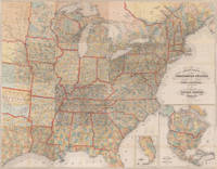
18508913New York 1850. Hardcover. Very Good. 21 ¾ x 26 inches. Lithograph with original hand color; some fold reinforcements with some mended losses at intersections very good condition. A delicately beautiful map of mid-19th century United States with extensive transportation-related content. Four of the work's five inset maps focus on rail lines and canals in specific parts of the country. The large inset of the western United States at bottom right completes the picture of the country that is not shown in the main map. Thus all of Texas is shown on the map and the California Territory is depicted as stretching as far east as the Texas border. The map generally is very well detailed and shows stage roads in addition to railroads and canals. It has a beautifully rendered floral border in which are fine scenic vistas including of Niagara Falls and a harbor scene with ship that is powered by both steam and sail. Published in A New Guide for Travelers.80 pp excellent in original binding included but separate. Modelski Railroad Maps no. 8. hardcover books
18508913New York 1850. Hardcover. Very Good. 21 ¾ x 26 inches. Lithograph with original hand color; some fold reinforcements with some mended losses at intersections very good condition. A delicately beautiful map of mid-19th century United States with extensive transportation-related content. Four of the work's five inset maps focus on rail lines and canals in specific parts of the country. The large inset of the western United States at bottom right completes the picture of the country that is not shown in the main map. Thus all of Texas is shown on the map and the California Territory is depicted as stretching as far east as the Texas border. The map generally is very well detailed and shows stage roads in addition to railroads and canals. It has a beautifully rendered floral border in which are fine scenic vistas including of Niagara Falls and a harbor scene with ship that is powered by both steam and sail. Published in A New Guide for Travelers.80 pp excellent in original binding included but separate. Modelski Railroad Maps no. 8. hardcover
18560002121NICHOLSON PENNSYLVANIA SUSQUEHANNA COUNTY. Good. 1856. On offer is a super original well filled manuscript notebook handwritten as noted by the paper label: "Journal CALVIN C. HALSEY July 1856." His journal of July 31 1856-March 1859. This is a very interesting personal journal of this fascinating man's observations and doings in ante bellum Pennsylvania at a critical and formative time in the man's life. Handwritten by Dr. Halsey who served in many significant positions in Susquehanna County before and after becoming a physician including a principal at the Susquehanna Academy a clerk in the bank before he received his degree in medicine in 1858. In 1853 located to Nicholson PA until 1859. He was later the Susquehanna examining surgeon for the county; jail physician and coroner for Susquehanna County. He was a known abolitionist Free Soiler and a Republican. On the invasion of PA by Lee he went to Harrisburg in 1862 and raised Company D 35th Regiment of PA Militia. Halsey was Captain. US service July 2 1863 and mustered out Aug 7 of 1863. The ante bellum journal intimately details everyday events beginning with a trip on passenger train to Williamstown and description of some fellow travelers some "drinking Germans" to the common mundanities of life" talked to Little Harding about purchase of lot for an office 16x24 they ask the moderate price of $80.00!" Ends July 1859 he is deciding to board/live at certain place and saying he wrote annual communication to his Mother since it was his 36th birthday. The marbleized paper over board covers are about 6 by 7 ½" in size. Canvas tape at spine and on endpapers front back-probably an old repair long ago repair as the corners are leather which is now almost gone. All edges expose board-the hinge and covers feel secure the tape evidently serves its purpose well. Overall G.; Manuscript; 12mo - over 6¾" - 7¾" tall; KEYWORDS: HISTORY OF CALVIN C.HALSEY PHYSICIAN CAPTAIN MILITIA CORONER SUSQUEHANNA COUNTY PENNSYLVANIA NICHOLSON ANTE BELLUM PRE CIVIL WAR AMERICANA HANDWRITTEN MANUSCRIPT AUTOGRAPHED AUTHORS DOCUMENT LETTER AUTOGRAPH KEEPSAKE WRITER HAND WRITTEN DOCUMENTS SIGNED LETTERS MANUSCRIPTS HISTORICAL HOLOGRAPH WRITERS AUTOGRAPHS PERSONAL MEMOIR MEMORIAL PERSONAL HISTORY ARCHIVE DIARY DIARIES JOURNAL LOG PRIMARY SOURCE FIRST HAND ACCOUNT SOCIAL HISTORY PERSONAL STORIES LIVING HISTORY ANTIQUITÉ CONTRAT VÉLIN DOCUMENT MANUSCRIT PAPIER ANTIKE BRIEF PERGAMENT DOKUMENT MANUSKRIPT PAPIER OGGETTO D'ANTIQUARIATO ATTO VELINA DOCUMENTO MANOSCRITTO CARTA ANTIGÜEDAD HECHO VITELA DOCUMENTO MANUSCRITO PAPEL . hardcover
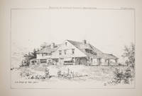
1889100598New York: William T. Comstock 1889. First edition. Oblong 4to. 59 plates after drawings by Stevens numerous illustrations in text. 40 pp. Publisher's blue-green cloth front cover and spine stamped in gilt; spine ends repaired hinges reinforced and now sturdy some repairs to endsheets covers scuffed and extremities worn moderate soiling and scuffing final paragraph of Preface effaced Scarce first edition of this important treatise on the Shingle Style of architecture. Stevens 1855-1940 who supplied the plans and drawings illustrated here was a major innovator of the Shingle Style. He was prolific completing some 1000 commissions mostly along the Maine coast including approximately 300 homes on the Portland peninsula. In 1888 he formed a partnership with Albert Winslow Cobb who had previously worked at the Boston office of William Ralph Emerson another major innovator of the Shingle Style. Cobb who provides the text argues for the Shingle Style as a necessary reform to produce a more democratic straightforward and uniquely American style of domestic architecture. "Examples of American Domestic Architecture was nothing short of an impassioned clarion call for a new form of architecture that was aesthetically beautiful and purposely engineered to reduce the widespread social inequalities of the period. While the strident and occasionally ponderous idealism on evidence in Examples is widely considered to be Cobbs doing the books lyrical prose and innovative Shingle Style illustrations won international recognition and acclaim for the two architects" Stephen Abbott "John Calvin Stevens: The Early Years" in Maine Home DesignREFERENCE: Hitchcock 1240; Vincent Scully The Shingle Style pp. 113-120; Sprague The Mirror of Maine 32 William T. Comstock hardcover
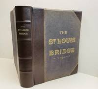
1881051524-TSt. Louis : G.I. Jones & Co. 1881. Book. Illus. by Author. Very Good. Hardcover. Signed by Authors. Limited Edition. Folio - over 12 - 15" tall. Limited Edition 1881 Hardcover Brown leather with gilt letters to the cover and spine with new leather spine and corners Rebound with imported end sheets 391 page book.Plus 46 plates and fold outs including schematics and photographs . Frontispiece photograph of the bridge in 1880. This is the first bridge to span the Mississippi River and still stands today . A engineering marvel by the engineer James Buchanan Eads 1820 - 1887 .This copy was presented by the author and engineering professor and dean of engining at Washing University in St. Louis Calvin Milton Woodward 1837 - 1914 . Laid in is a signed note by Mr. Woodward to : " Friend Moody - I send a copy of the "Book" for you to examine. Yrs. C.M. Woodward Jan. 24/82 along with a typed note tipped in This book is the property of Irwin T. Johnson . It was originally given to my grandfather Chas.D. Moody by the author. Please handle with care. s/Irwin D. Thompson . Charles D. Moody was a civil engineer and patent attorney of Webster Groves Missouri. Title page bears the inscription " For Irwin Twining Johnson From KatherT. Moody 1937. A Very Rare Book on Bridge Construction and with a note signed by the author . Condition : Very Good A complete and professionally rebound copy . . G.I. Jones & Co. Hardcover
184520600Kassel: Theodor Fischer 1845. Other. Throughout all maps in excellent condition. Protected in their original cover as published. Our illustration shows all 16 folded maps digital joint together to a large wall map 56 1/2 x 72 inches. 1440 by 1840mm 56 by 72 inches. 1440 by 1840mm 56 by 72 inches. Lithograph color by Smith J. Calvin published 1845 by Theodor Fischer Kassel. Image size: 1440 by 1840mm 56 by 72 inches. From Smith's multi-sheet Special-Karte one of the most detailed and accurate mid-19th-century maps of the United States. John Calvin J. Calvin Smith c.18091890 was an American surveyor geographer and engraver active in New York City from the 1840s. Working with partners including George Sherman under the Sherman & Smith imprint 18401853 and later in association with J.H. Colton Smith produced some of the most accurate and widely used general-purpose maps of the United States of his era. His maps appeared in government publications military surveys and commercial atlases and his multi-sheet Special-Karte der Vereinigten Staaten published in a German-language edition brought American cartographic standards to European audiences. Despite his prolific output and importance to American cartographic history much of Smith's personal biography remains obscure.This is the rare German edition printed in lithograph of Calvin Smiths large wall map of the United States of America. Complete with all 16 folded maps to join together to a large map of the United States including a general map of the US. A splendid detailed map showing nicely the adjacenting Indian territories in the West further the map is showing detailed a larger part of Texas the gulf of Mexico and Florida. The general key map of the entire United States is extending towards the Western territories with California and Oregon as well New Mexico and the Indian territories. Throughout all maps in excellent condition. Protected in their original cover as published. Our illustration shows all 16 folded maps digital joint together to a large wall map 56 1/2 x 72 inches. 1440 by 1840mm 56 by 72 inches. Theodor Fischer unknown
189119852Washington D. C.: Gpo. Fine. 1891-1895. First Edition. Hardcover. Slightest handling at a few spots. In their original three-quarter leather bindings. Brown leather and green cloth. Included are a number of "addition and correction" brochures. ; Folio 13" - 23" tall . Gpo hardcover
1891JMM8514<p>Washington: U.S. Gov't 1891. Published between 1891-1895; Published under the direction of the Hon. Daniel S. Lamont Secretary of War; The Board of Publication consisted of Maj. George R. Davis Leslie J. Perry & Joseph W. Kirkby; CLXXV Plates; 3/4 black leather & textured black cloth over boards gilt spine titles pale green heavier paper title page to each section & color to maps & uniform plate; Very good plates textblock in a good bindings freshly rebacked in the original manner. Size: 15"x18.5". Hardcover.</p> [U.S. Gov't] hardcover
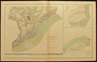
189128636Washington: Government Printing Office 1891-1895. 3 volumes. FIRST EDITION. With 175 numbered double-page lithographed color maps and plates on 178 sheets by Bien. Large folio original bright red cloth covered boards lettered in gilt on the upper covers the backs and corner pieces in red morocco the spines ruled in blind on tall bands with two black morocco lettering labels gilt ruled and boldly lettered endpapers renewed. 29 pp preface and contents plates 1-70; plates 71-135; plates 136-175. A beautiful set of this rare and impressive collection of maps of the Civil War. The maps are all well preserved fresh and bright some expected minor wear to the cloth otherwise the bindings are also fine. AN EXTREMELY IMPRESSIVE ATLAS PRODUCED BY THE UNITED STATES GOVERNMENT PRINTING OFFICE TO ILLUSTRATE THE OFFICIAL RECORDS OF THE AMERICAN CIVIL WAR. A beautiful and fascinating accompaniment to the official records of the Civil War. Each massive plate is either an impressively detailed and informative map or contains multiple images providing detailed plans of cities towns and fortresses views panoramas uniforms battlefields bridges engagements lookouts etc. etc.<br> The maps and plans were primarily reproduced from those that had been drawn during the war by engineers draftsmen and sometimes even generals themselves for actual military use. Only a few maps drawn later by cartographers were added for historical purposes. Tactical and strategic maps indicate troop disposition; defense lines redoubts and fortifications of key sites are clearly shown. Terrain maps often contain picket positions signal stations and lines of march. Some were taken from what had been only rough sketches some from cartographic masterpieces. All are informative and reveal the knowledge or lack of knowledge that both sides possessed about the terrain and the strength and the position of opposing troops. The index to the maps refers to campaigns and battles rivers creeks lakes bays islands bridges fords ferries landings roads railroads mountains towns churches forts and much more. <br> An indispensable source of information and imagery from the American Civil War. The atlas was not reprinted till 1958. Government Printing Office hardcover
1852WRCAM54266Cassel: Theodor Fischer 1852. Sixteen color lithographed mapsheets each 15 1/2 x 19 3/4 inches plus 2pp. explanatory text. Large oblong folio. Original printed paper- covered boards cloth backstrip. Minor rubbing and edge wear light staining. Internally clean. Very good plus. A rare and unusual atlas for the eastern half of the United States printed in German by noted American mapmaker J. Calvin Smith. Fifteen of the sixteen mapsheets comprise a sectional map intended to be pieced together to create a very large map of the eastern United States extending westward to parts of Texas the Indian Territory later Oklahoma and Nebraska. The sixteenth mapsheet is a general map of the United States including a good portion of lower Canada and the Caribbean extending southward to Venezuela. The sheet of explanatory text pictures the sectional map if assembled correctly from the fifteen sheets. <br> <br> This atlas was issued during a period of great German emigration to the United States and it was clearly intended for the use of emigrants and emigration offices - it would have been of great use to them. <br> <br> Most of the time Smith's maps are encountered as American productions. Considering the flood of German emigration to the United States in the mid-19th century it is logical that this map was printed to encourage the practice and therefore commissioned by German investors in the United States. This German edition of Smith's map is rarer than his American productions with Colton. KARROW I:1626. KARPINSKI 177 dating it 1850. RUMSEY 3471 ref. Theodor Fischer hardcover books
1849WRCAM54260New York: Sherman & Smith 1849. Folding map approximately 22 x 19 3/4 inches partially handcolored. 24mo. Original publisher's cloth stamped in blind and gold lettered. Very light wear to cloth. 20th-century bookplate on front pastedown. A near mint copy of this map in remarkable fine condition. In a half pebbled cloth and printed paper board clamshell box. A rare early version of Smith's MAP OF NORTH AMERICA with an inset of California with the gold regions highlighted. Another edition was published the same year by John Disturnell and it was reissued the following year to accompany the third edition of Disturnell's EMIGRANT'S GUIDE. The routes to California and Oregon from Independence Fort Smith and Port Lavaca are indicated in red and the gold regions of California are shaded yellow. OCLC records only two copies of this edition at Berkeley and UC Davis and Wheat notes one further at the California State Library. WHEAT GOLD REGION 124. WHEAT TRANSMISSISSIPPI 643. HOWES D351 ref. KURUTZ 196 ref. Sherman & Smith hardcover books
189126210Washington: Government Printing Office 1891-1895. In the original 36 parts. FIRST EDITION. With 175 numbered double-page lithographed color maps and plates on 178 sheets by Bien. Large elephant folio presented in the original 36 large folio fascicles with their original printed paper wrappers now housed together in a blue cloth portfolio case with string ties the spine of the case is lettered in gilt. A handsome and impressive set in fully original condition overall very excellent and especially well preserved. The original wrappers show some occasional minor wear along the edges and spines occasional small tears at folds or minor creasing or separation. Sets in the original fascicles with wrappers intact are very rare and very elusive in the open market. This is a very fine example of the most rare state of the first edition. SCARCE IN ORIGINAL FOLIO PARTS AND AN EXTREMELY IMPRESSIVE ATLAS PRODUCED BY THE UNITED STATES GOVERNMENT PRINTING OFFICE TO ILLUSTRATE THE OFFICIAL RECORDS OF THE AMERICAN CIVIL WAR. The first of the 36 fascicles contains the index and preface and also included is the 1902 additions and corrections insert each of the following 35 fascicles contain five of the large double page plates.<br> A beautiful and fascinating accompaniment to the official records of the Civil War. Each massive plate is either an impressively detailed and informative map or contains multiple images providing detailed plans of cities towns and fortresses views panoramas uniforms battlefields bridges engagements lookouts etc. etc.<br> The maps and plans were primarily reproduced from those that had been drawn during the war by engineers draftsmen and sometimes even generals themselves for actual military use. Only a few maps drawn later by cartographers were added for historical purposes. Tactical and strategic maps indicate troop disposition; defense lines redoubts and fortifications of key sites are clearly shown. Terrain maps often contain picket positions signal stations and lines of march. Some were taken from what had been only rough sketches some from cartographic masterpieces. All are informative and reveal the knowledge or lack of knowledge that both sides possessed about the terrain and the strength and the position of opposing troops. The index to the maps refers to campaigns and battles rivers creeks lakes bays islands bridges fords ferries landings roads railroads mountains towns churches forts and much more. <br> An indispensable source of information and imagery from the American Civil War. The atlas was not reprinted until 1958. Government Printing Office hardcover