Ortelius, AbrahamBiblio.com
213 résultats
1590M8858Antwerp 1590. Very Good margins are extended. Notes: A fine world map by Abraham Ortelius based on Ptolemy surrounded by the maps of the four continents Americas Europe Asia and Africa. Map is superbly decorated within ornamental 16th century design. Latin text on verso. Size : 310x439 mm 12.20x17.28 Inches Coloring: Original Hand Coloring Reference: Shirley World 176: Van den Broecke 186. Category: Maps World; unknown
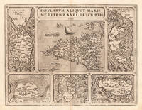
157324542Antwerp: Platin 1573. Other. A very good example printed on excellent German paper. In excellent condition. 365 by 478mm 14 by 18 inches. Original antique copper engraving from the 'Theatrum Orbis Terrarum' by Abraham Ortelius the world's first modern atlas published in Antwerp 1573. Depicting Mediterranean Islands this map is a fine example of 1570s European cartography. Image: 365 by 478mm 14 by 18 inches. An attractive and historically significant 16th-century map for the discerning collector. Abraham Ortelius 15271598 was a Flemish cartographer and geographer born in Antwerp. He is widely regarded as the creator of the first modern atlas the 'Theatrum Orbis Terrarum' Theatre of the World first published in 1570 by Gilles Coppens de Diest in Antwerp. Considered the world's first true atlas it established the modern format of uniform standardized maps bound together in a single volume. Appointed Geographer to King Philip II of Spain in 1575 Ortelius was one of the most influential figures in the history of cartography. His maps are held in the collections of the British Library the Library of Congress and major European institutions. The 'Theatrum' went through more than 30 editions and was translated into multiple languages making Ortelius's maps among the most sought-after in the world of antique cartography.Decorative double page map showing six islands in the Mediterranean Islands Sicily Sardinia Corfu Malta Djerba Elba. Sicily is prominently displayed in the center of the map above the title cartouche.A fine example from Theatrum Orbis Terrarum Antwerp sought after by collectors of antique maps of Italy antique maps of Mediterranean Islands and antique copper engravings for sale. In good condition consistent with age. Light age-toning to the sheet as expected for a 16th-century engraving. Centerfold as published. Broe. 141 Platin unknown
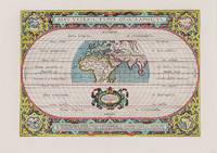
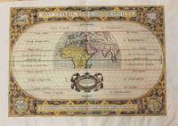
1590200018AG1590. Antwerp Ortelius 1590. Original hand-coloured engraving. Plate Size: 44 cm x 31 cm. Sheet Size: 53.7 cm x 38.5 cm. Original map. Very good actually stunning condition. Really clean and crisp. Generous margins. Reverse recto carries Latin text. Shirley 176; Broecke 186.1; Koeman III 0800H:31. Beautifully unusual and richly decorated map of the Ancient World based upon the work of Claudius Ptolemy from Ortelius' Parergon 'Supplement'. The depicted land masses of Europe Africa and western Asia are largely in their modern configurations although the place names on the map are based upon Ptolemy. The southern portion of Africa is missing and China is not included on the map. A small number of cities including Hispalis Seville Lutetia Paris Rome Byzantium Istanbul Hierusalem Jerusalem Alexandria and Memphis are identified. Relief shown pictorially. The mythical Luna Montes Mountains of the Moon - the fabled source of the Nile - can be seen in the southern half of Africa. Madagascar is also included. The climate zones are shown as 'Zona frigida et inhabitablis' 'Zona temperata et habitabilis' and 'Zona torrida et ob Solis nimium fervorem a veteribus inhabitabilis credita.' The tropics and Arctic and Antarctic circles are also shown. The 'Zona frigida' lying above the Arctic Circle and the region lying at the Equator are described as being inhospitable. The border of the globe carries longitudinal and latitudinal information. The outer areas of the map are decoratively patterned and there is one inset roundel map in each corner showing the different continents depicting in clockwise order Europe Asia Africa and the Americas. Ortelius' characteristic strapwork design ornaments the title cartouche above the globe as it does the cartouche seen beneath it. It bears the inscription: "En Spectator Pilae Totius Terrae Ichnographiam at Veteribus Usque ad Annum Salutis Nonagesimum Secundum Supra Milles Quadrigent. Cognitae Tantum Geographiam." Immediately underneath the illustrated landmass is a further cartouche similarly ornamented decorated with two lion heads and bearing an oval inset statement of responsibility in Latin script. The Parergon was conceived initially as a supplement to Ortelius' Theatrum Orbis Terrarum Theatre of the World. The work a vast and finely researched index of the Classical world was accompanied by a number of ancient world maps. Unlike the maps of the Theatrum the majority of which were reductions of earlier maps the maps of the Parergon were researched and drawn by Ortelius himself. The work was a great commercial success and the maps themselves set the standard for ancient world maps for the duration of the 17th Century. Abraham Ortelius was a Flemish cartographer and geographer conventionally recognized as the creator of the first modern atlas the Theatrum Orbis Terrarum Theatre of the World. He was one of the most notable figures of the Dutch school of cartography during its golden age approximately 1570s-1670s. unknown
1592273298Antwerp: Abraham Ortelius 1592. unbound. Map. Uncolored engraving. Sheet measures 16" x 21".<br/><br/> This beautiful 1588 map by Abraham Ortelius depicts Holland or the Netherlands in exceptional detail. The map covers the regions near the Wadden Sea roughly covering modern day provinces of North Holland South Holland and Utrecht. The map centered on Amsterdam is oriented with north to the left. Topographical and geographical features such as mountains and cities are beautifully rendered in profile.<br><br>The waters surrounding the region are shown with waves and include several illustrations of ships throughout. This is the first state of the map with later states showing a stippled sea rather than waves. Includes a large strapwork title cartouche scale of miles with a divider in the lower left. The Royal coat of arms is presented in the top left. The map also includes a 16-point compass rose.<br><br>Ortelius based this map on the work of Jacob van Daventer. Published in the 1588 edition of Ortelius' famous "Theatrum Orbis Terrarum" which is historically considered the first modern atlas. Based on the text on verso only 300 copies of this particular edition were ever printed van der Broecke 79.<br><br>The map is in good condition with minor wear along the original centerfold. Minor foxing at places. Original plate mark is visible. Latin text on verso.<br><br> Abraham Ortelius 1527--1598 a Flemish cartographer and geographer is widely regarded as one of the important and influential cartographers in history. He is known for his "Theatrum Orbis Terrarum" which was the first modern atlas. Hard to find in black and white.<br/><br/> Abraham Ortelius unknown books
1592273298Antwerp: Abraham Ortelius 1592. unbound. Map. Uncolored engraving. Sheet measures 16" x 21".<br/> <br/> This beautiful 1588 map by Abraham Ortelius depicts Holland or the Netherlands in exceptional detail. The map covers the regions near the Wadden Sea roughly covering modern day provinces of North Holland South Holland and Utrecht. The map centered on Amsterdam is oriented with north to the left. Topographical and geographical features such as mountains and cities are beautifully rendered in profile.<br> <br> The waters surrounding the region are shown with waves and include several illustrations of ships throughout. This is the first state of the map with later states showing a stippled sea rather than waves. Includes a large strapwork title cartouche scale of miles with a divider in the lower left. The Royal coat of arms is presented in the top left. The map also includes a 16-point compass rose.<br> <br> Ortelius based this map on the work of Jacob van Daventer. Published in the 1588 edition of Ortelius' famous "Theatrum Orbis Terrarum" which is historically considered the first modern atlas. Based on the text on verso only 300 copies of this particular edition were ever printed van der Broecke 79.<br> <br> The map is in good condition with minor wear along the original centerfold. Minor foxing at places. Original plate mark is visible. Latin text on verso.<br> <br> Abraham Ortelius 1527--1598 a Flemish cartographer and geographer is widely regarded as one of the important and influential cartographers in history. He is known for his "Theatrum Orbis Terrarum" which was the first modern atlas. Hard to find in black and white.<br/> <br/> Abraham Ortelius unknown
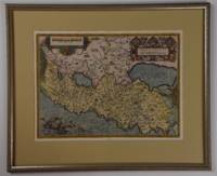
15801396356c1580. Condition of map is Good with moderate age toning creasing and a small brown stain along right edge. Matted in metal frame measuring 24.25 in. x 19.75 in. . CW Consignment. Shelved at Rockville PS 1101 #25. Believed to be from Abraham Ortelius's "Theatrum Orbis Terrarum - Parergon - Nomenclator Ptolemaicus" published in Antwerp by Christoph Plantin Press 1579 1584. 1396356. Special Collections - Upstairs. unknown
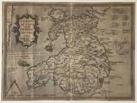
15958359Antwerp Plantin-Moretus 1595. Copper engraving 37 x 50 cms black and white small hole at centrefold Latin text to verso. Shirley notes that the map is a general improvement on the previous Mercator-Ortelius outline and draws attention to a detail which vividly suggests the personal involvement of the map-maker Welsh antiquary Humphrey Lluyd: the Caernarvon peninsula near Lluyds home town of Denbigh is badly distorted but it has been suggested very reasonably that this may have been due to Lluyds attempt to sketch this in by eye from the nearby mountains. Ortelius's Theatrum Orbis Terrarum is generally considered the first modern atlas of the world originally published in 1570. Ortelius gathered and selected the best available cartographic knowledge and presented it in a single volume duly credited and finely engraved in a consistent style with explanatory text. The Theatrum was very decorative and hugely popular amongst the wealthy and educated running into over forty editions in Latin and the major European languages. Shirley British Isles 185. Van den Broecke 19.3 Map unknown
1579029357Antwerp: Christopher Plantin 1579. Soft cover. Bom / Good / Bon. 344x514 mm. 1 fólio. Retirado de "Theatrum Orbis terrarum". Adaptação do mapa de Fernando Ãlvares Secco. No verso possui texto em Latim intitulado "Portugalia Regnum" e a indicação da paginação: Fólio 16. De acordo com Van den Broecke - "Ortelius Atlas Maps an illustred guide" este exemplar é da tiragem Plantiniana de 1579 250 exemplares pois a última linha do texto: ad Chinam & Lequios per omnes prouincias maritimas insulasq.adiacentesextenditur e o primeiro R do segundo tÃtulo alinha à esquerda do primeiro R do primeiro tÃtulo. Abraham Ortelius nasceu em Antuérpia após a conclusão dos estudos em grego latim e matemática estableceu-se com as suas irmãs como coloristas de mapas dedicando-se mais tarde ao comércio de livros e moedas antigas. A publicação do seu "Theatrum Orbis Terrarum" editado em Antuérpia em 1570 vai transformá-lo num dos mais importantes cartografos do Séc. XVI. Pela primeira vez uma obra reúne todos os elementos caracterÃsticos de um atlas é também o primeiro a ser composto por mapas bi-fólio de tamanho uniforme. A maior parte dos mapas foram gravados por Frans Hogenberg e inicialmente impressos por Aegidius Coppenium Diesth; a partir de 1579 passaram a ser impressos nas oficinas de Christophe Plantin. Ortelius no "Catalogus auctorum tabularum geographicarum" indica expressamente a autoria deste mapa como sendo de Fernando Ãlvares Seco. A gravura é inspirada quer na edição princeps quer na de Gerard de Jode do ano de 1565 nomeadamente a Cartela com a dedicatória feita por Aquiles Estaço a Guido Sforza. <br/> <br/> Christopher Plantin paperback
15703399<p>Very Good. 1570. 16th century map with original hand-colored outlines of the region of Poictou. Decorative cartouche. Some foxing most apparent to margins. Otherwise a handsome copy. Please see image. Plate size approximately 19 1/2 x 14 in. Overall size approx. 21 1/4 x 16 3/4 in 537 x 425 mm.; 1 pages; All shipments through USPS insured Priority Mail. .</p>
1587239611Antwerp: Abraham Ortelius 1587. unbound. Map. Uncolored engraving. Image measures 14" x 19.5".<br/><br/> These two maps on one sheet detail areas of western Mexico above and the Greater Antilles below. Ortelius created them from information compiled by other mapmakers such as Mercator Guttierez and Alsons de Sata Cruz. These sources allowed him to include a wealth of detailed information that is mostly if not entirely accurate. Above the map of western Mexico shows the area around Culiacan and the Spanish settlement of Villa S. Michaels which was notable in the period for its silver mines. It begins at the Yucatan and extends through the Cayman Magnus and the Caymanes. The map below illustrates the Greater Antilles including Cuba Hispaniola Jamaica St. Jois Insula St. Johns the Bahamas Virgin Islands and the Windward Islands all in impressive detail. The section of South Florida also shows suggestion of the Florida Keys which was uncommon for these period. A notable error is that the Tropic of Cancer is labelled as the Tropic of Capricorn. A highly decorative note with strapwork and foliage fills the acific Ocean to the left of Mexico and provides information about the upper map. The lower map also has a framed cartouche with birds perched atop it. Two ship illustrations float in the choppy seas around the islands. The map is a first state from the 1587 French edition of Ortelius's "Theatrum Orbis Terrarum." It is in good condition with no chips or tears. Stain at the center seam in the lower margin not affecting the image some overall stains. French text on verso. Abraham Ortelius 1527--1598 a Flemish cartographer and geographer is widely regarded as one of the important and influential cartographers in history. He is known for his "Theatrum Orbis Terrarum" which was the first modern atlas. This map is an uncommon uncolored example of this wonderful map by Ortelius.<br/><br/> Abraham Ortelius unknown books
1587239611Antwerp: Abraham Ortelius 1587. unbound. Map. Uncolored engraving. Image measures 14" x 19.5".<br/> <br/> These two maps on one sheet detail areas of western Mexico above and the Greater Antilles below. Ortelius created them from information compiled by other mapmakers such as Mercator Guttierez and Alsons de Sata Cruz. These sources allowed him to include a wealth of detailed information that is mostly if not entirely accurate. Above the map of western Mexico shows the area around Culiacan and the Spanish settlement of Villa S. Michaels which was notable in the period for its silver mines. It begins at the Yucatan and extends through the Cayman Magnus and the Caymanes. The map below illustrates the Greater Antilles including Cuba Hispaniola Jamaica St. Jois Insula St. Johns the Bahamas Virgin Islands and the Windward Islands all in impressive detail. The section of South Florida also shows suggestion of the Florida Keys which was uncommon for these period. A notable error is that the Tropic of Cancer is labelled as the Tropic of Capricorn. A highly decorative note with strapwork and foliage fills the acific Ocean to the left of Mexico and provides information about the upper map. The lower map also has a framed cartouche with birds perched atop it. Two ship illustrations float in the choppy seas around the islands. The map is a first state from the 1587 French edition of Ortelius's "Theatrum Orbis Terrarum." It is in good condition with no chips or tears. Stain at the center seam in the lower margin not affecting the image some overall stains. French text on verso. Abraham Ortelius 1527--1598 a Flemish cartographer and geographer is widely regarded as one of the important and influential cartographers in history. He is known for his "Theatrum Orbis Terrarum" which was the first modern atlas. This map is an uncommon uncolored example of this wonderful map by Ortelius.<br/> <br/> Abraham Ortelius unknown
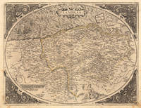
157221509Antwerpen: Platin 1572. Other. In excellent condition. 385 by 503mm 15 by 19 inches. Original antique copper engraving uncolored as published. This very decorative antique map shows Flanders from Greuelinge in the west to Brussels in the east and Schouwen in the north and Lens in the south. The corners of the oval map are engraved with the cardinal points. In the North Sea are 2 sailing ships that fire with cannons a decorative compass rose and a sea monster. The title is engraved in the center of a very nice cartoushe. Ortelius was born on 14 April 1527 in the city of Antwerp which was then in the Habsburg Netherlands modern-day Belgium. The Orthellius family were originally from Augsburg a Free imperial city of the Holy Roman Empire. In 1535 the family had fallen under suspicion of Protestantism. Following the death of Ortelius's father his uncle Jacobus van Meteren returned from religious exile in England to take care of Ortelius. Abraham remained close to his cousin Emanuel van Meteren who would later moved to London. In 1575 he was appointed geographer to the king of Spain Philip II on the recommendation of Arias Montanus who vouched for his orthodoxy. He travelled extensively in Europe and is specifically known to have traveled throughout the Seventeen Provinces; in southern western northern and eastern Germany e.g. 1560 15751576; France 15591560; England and Ireland 1576; and Italy 1578 and perhaps twice or thrice between 1550 and 1558. Beginning as a map-engraver in 1547 he entered the Antwerp Guild of Saint Luke as an illuminator of maps. He supplemented his income trading in books prints and maps and his journeys included yearly visits to the Frankfurt book and print fair where he met Gerardus Mercator in 1554. In 1560 however when travelling with Mercator to Trier Lorraine and Poitiers he seems to have been attracted largely by Mercator's influence towards the career of a scientific geographer. Wikipedia Platin unknown
158728094Antwerp: Ortelius 1587. Maps. Overall in very good condition. A very nice example of Ortelius' famous map of the Kingdom of Prester John with later hand color. It is from a Latin edition of Ortelius' Theatrum Orbis Terrarum the first modern atlas of the world. <br /> <br /> Cartographica Neerlandica Background for Ortelius Map No. 175. The map is difficult to date. The following details correspond to the aforementioned bibliography - it is consistent with 175.2 as the coastline has hatching extended from about 3 to about 6 mm signifying from 1587 & beyond. The ship in the lower left corner has a vessel attached to its mast. In the first state this vessel has vertical hatching. Now this is changed to horizontal hatching. In this copy the frame around the map has curved oval hatching around its oval ornaments. The sea was not re-engraved in later editions and as they are strongly engraved in this copy it would indicate an earlier edition. There is a watermark of two crossed arrows measuring 10 cm in length. The last line of text on the verso reads "uerit vide Jacobum Nauarchum in sua epistola Asiatica & Gerardum Mercatorem in sua universali tabula. 89". <br /> "Ortelius 1579 is penciled on the verso by an unknown person but that is unknown.<br /> <br /> The map centers on "Africva" in a strange configuration which goes from the coast of Benin and the "Mare Aethiopicum" to the Arabian Sea titled "Barbaricus Sinus". Arabia Felix covers the area of Saudi Arabia and adjoining countries with the Red Sea between the Arabian Penninsula and the coast of Africa. Mecca Medina and Jerusalem are noted with large buildings indicating their importance and colored red.<br /> <br /> Prester John was a mythical African King waging a war against the Muslim Infidels from his Kingdom in Central Africa. Add the Byzantine Patriarch Crusaders Islamic Saracens the Portuguese and a fake letter for this For centuries from the receipt of a fake letter from Prester John to the Byzantine Patriarch Europeans searched for Prester John initially in Asia and later in Africa. The Crusaders hoped that Prester John would join with Europeans in the protection of the Holy Lands from the Islamic Saracens and in the protection of all Europe from the Mongols. In the late 1400s and early 1500s the Portugese searched for Prester John in East Africa through they did eventually find a Christian kingdom in Abyssinia. A dedication to King David of the Bible is in the upper left of map. Above the dedication is the coat of arms of Prester John. Elephants and other figures adorn the map. <br /> <br /> Copper engraving with period hand color 17.5 x 15" with wide margins. Text in Latin on the verso. Two small wormholes in the top margin. Ortelius unknown
159813293451598. A map of the Holy Land by Abraham Ortelius dated 1598 first issued in 1584 as a part of Theatrum Orbit Terrarium. In Very Good condition with age toning and a central crease. Matted but not framed. w 26.5 in. x h 22 in. Shelved at Rockville PS 1101 #25. Based on material collected by the Dutch Astronomer Peter Laicksteen who travelled to the Holy Land in 1556. Christian Sgrooten here written "Schrot" royal geographer to King Phillip II of Spain produced a nine-sheet map of Palestine in 1570 from Laikstain's information. This map was condensed into the present form by Abraham Ortelius. Ortelius the creator of the first modern atlas collected and edited maps from all over Europe for his book. Many of the original mapmakers rose to fame solely through Ortelius's decision to include their maps in his atlas. Laicksteen took thorough and accurate notes and the original Laicksteen and Sgrooten map contained improvements over earlier maps. For instance the River Kishon is here shown as flowing from the mountains near the Sea of Galilee not as was previously thought from the Sea of Galilee itself. However the Levantine coastline Sgrooten and Ortelius depicted is hardly recognizable to modern eyes. The map is replete with fanciful bays and peninsulas though some of the most recognizable features of the coastline such as the outcrops of land at Haifa and Beirut are absent. Ortelius had originally used another map of the Holy Land by cartographer Tilleman Stella in the early editions of the Theatrum Orbis Terrarum. It covered a far more extensive territory including part of Egypt and Syria. Oddly the coastline in this first map was much more accurate than in the Sgrooten map. Laicksteen and Sgrooten's original map included a small inset with an extended geography. However their mapping of the Dead Sea and surrounding areas was so controversial that Ortelius chose to leave out this region completely. The strange anecdote written in the Dead Sea is Ortelius's own addition. It describes how the Dead Sea was once a fertile valley but was transformed by an act of God into a barren sea to punish the wickedness of Sodom and Gomorrah. In the bottom left hand corner is a hand colored illustration of the story of Jonah. Above the luscious cartouche Ortelius has added three miniatures featuring the Crucifixion the Nativity and the Resurrection of Christ. The French text on the verso a long-winded description with little relevance to the map was changed to a more "reader-friendly" version shortly after the publication of this edition. 525 copies were made of this edition of Ortelius's map. 1329345. Special Collections - Upstairs. unknown
1584001117Antwerp: Christopher Plantin 1584. Map. Fine. Framed. Size: 377 x 485 mm. Framed size: 580 x 465mm. Hand-coloured engraved map published in the Theatrum Orbis Terrarum. Wooden moulding frames glazed and mounted late 20th century. In fine condition only a small two spots in a upper part. A beautiful map of Poland and Lithuania part of the Baltic Sea title in cartouche at lower left in Latin scale at top left decorated sleigh with a horse. . Christopher Plantin Hardcover
1584001118Antwerp: Christopher Plantin 1584. Map. Fine. Framed. Size: 328 x 447 mm. Framed size: 580 x 465mm. Hand-coloured engraved map published in the Theatrum Orbis Terrarum. Wooden moulding frames glazed and mounted late 20th century. In fine condition. A beautiful map of Transilvania with parts of Valachia with 3 decorative cartouches. Christopher Plantin Hardcover
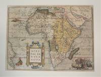
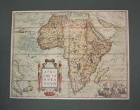
1570M10981Antwerp Belgium 1570. Very Good age toning. Notes: Map of Africa Continent by Abraham Ortelius published in Theatrum Orbis Terrarum <br>Latin Text on verso. Size : 367x495 mm 14.45x19.49 Inches Coloring: Original Hand Coloring Reference: Marcel P. R. van den Broecke #8.<br><br> Category: Maps Africa Continent; unknown
1570M10980Antwerp Belgium 1570. Very Good age toning. . Notes: Map of Africa Continent by Abraham Ortelius published in Theatrum Orbis Terrarum<br>Latin Text on verso. Size : 378x507 mm 14.88x19.96 Inches Coloring: Original Hand Coloring Reference: Marcel P. R. van den Broecke #8. Category: Maps Africa Continent; unknown
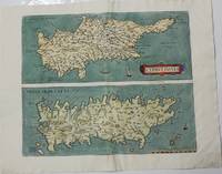
1573M9822Netherlands c.1573. Very Good. Notes: Latin text on verso. Size : 362x433 mm 14.25x17.05 Inches Coloring: Hand Colored Category: Maps Mediterranean Islands; unknown
15903400<p>Very Good. c1590. 16th century map with original hand-colored outlines of Luxembourg. Decorative cartouche. Some foxing most apparent to margins. Latin text to verso with colored historiated initial. Otherwise a handsome copy. Please see image. Plate size approximately 19 1/2 x 14 1/2 in. Overall size approx. 21 1/2 x 17 1/2 in 550 x 445 mm.; 1 pages; All shipments through USPS insured Priority Mail. .</p>
1595M6473Antwerp: Ortelius c. 1595. Very Good; margins shaved. Notes: "From 1595L onwards this successor of plate 171 a previous edition of the map which has 4 ships instead of the 3 on this plate and "SIGENENSI" instead of "SIGENENS" in the cartouche moves to the Parergon. Bertius bought a number of sheets with this map and included the map in his historical 1619 atlas 'Theatrum Geographiae Veteris'." van den Broecke Size : 340x457 mm 13.39x17.99 Inches Coloring: Hand Colored Reference: Marcel P.R. van den Broecke 172<br>Tooley 358 Category: Maps Asia Middle East Holy Land & Palestine; Maps Africa North Egypt; Ortelius unknown
15753397<p>Very Good. 1575. 16th century map with original hand-colored outlines of the Italian region of Piedmont. Decorative cartouche. Some foxing most apparent to margins. Otherwise a handsome copy. Latin text to verso with colored historiated initial. Please see image. Plate size approximately 19 1/2 x 14 1/2 in. Overall size approx. 21 3/4 x 16 3/4 in 530 x 427 mm.; 1 pages; All shipments through USPS insured Priority Mail. .</p>
15843401<p>Very Good. 1584. 16th century map with original hand-colored outlines of Tuscany. Decorative cartouche. Some foxing most apparent to margins. Latin text to verso. Otherwise a handsome copy. Please see image. Plate size approximately 19 1/4 x 12 1/2 in. Overall size approx. 21 1/4 x 16 1/2 in 540 x 425 mm.; 1 pages; All shipments through USPS insured Priority Mail. .</p>
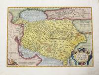
1595M457Antwerp 1595. Very good. Size : 352x504 mm 13.875x19.875 Inches Coloring: Hand Colored Reference: Marcel P. R. van den Broecke "Ortelius Atlas Maps An Illustrated Guide" map 167. Category: ; Maps Asia Middle East Iran Iraq unknown
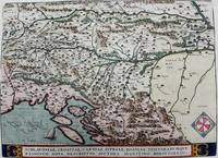
1595M7934Antwerp Belgium c.1595. Very Good;. Notes: French text on verso. Size : 336x463 mm 13.23x18.23 Inches Coloring: Hand Colored Reference: Marcel P.R. van den Broecke 145. Category: Maps Europe Balkans; unknown