Ortelius, Abraham:Biblio.com

213 résultats
15957611Antwerp 1595. Copper engraving 35.5 x 48.5 cms recent-hand-colour Latin text on verso. First published in a 1592 edition of the Theatrum replacing the earlier Austriae Ducatus plate; Wolfgang Lazius is credited as the source. Van den Broecke 106 Map unknown
15957610Antwerp 1595. Copper engraving 38.5 x 49.5 cms recent-hand-colour Latin text on verso. First published in a 1573 edition of the Theatrum Philip Appian is credited as the source; Van den Broecke notes minor ornamental changes horizontal cross hatching which indicate that our map was printed from the plate in its third state. Map unknown
1587Map906Antwerp: Abraham Ortelius 1587. French Edition . Hardback. Vg. Early map of SWITZERLAND. No 62 and FRENCH TEXT TO VERSO. 38x 51 cms 15.5 x 20 inches. Lower blank margin cropped but leaving margin below the plate mark. HAND-COLOURED Finely hand coloured in wash and outline. Decorated with a title cartouche. Scarce item. PLEASE EMAIL FOR PHOTOS. <br/> <br/> Abraham Ortelius hardcover
158552380Antwerp. c.1585. Very attractive map with ornamented cartouche and border.Three scales. The map was criticised by Hiob van Magdeburg at an early stage but survived through all editions of the Ortelius's landmark atlas. Published in the landmark work by Abraham Ortelius The Theatrum Orbis Terrarum. Copper engraving. The map itself is in good condition.V shaped water mark at top centre fold affecting margin and extending 25 mm. on to map tiny hole at top edge of centre fold. Expert repairs near invisible from the front on left hand margin and lower left hand corner faint watermarks on lower edge. Original colour. Size: 50 x 34 cm. van den Broecke 93. unknown
1570214216Antwerp: Ortelius Abraham 1570. unbound. very good. Map. Uncolored engraving. Image measures 14 3/8" x 19.75".<br/><br/> Beautiful map of southern Italy. Latin text on verso. Published in "Theatrum Orbis Terrarum". Minor scattered staining particularly in margins. Full original margins.<br/><br/> Ortelius, Abraham unknown books
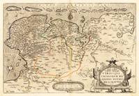
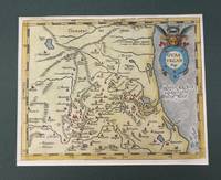
156821922Antwerpen: Platin 1568. Other. In excellent condition. 343 by 510mm 13 by 20 inches. Original antique copper engraving hand colored in outline when published. German text edition. Shows West and East Frisia with the islands. Decorative cartouche with card title lower right. Cartridge with mileage indicators in the lower center; in the Zuidersee Ijsselmeer compass rose; the map is illustrated with numerous sailing ships. Rare 1st condition with German back text. Ortelius was born on 14 April 1527 in the city of Antwerp which was then in the Habsburg Netherlands modern-day Belgium. The Orthellius family were originally from Augsburg a Free imperial city of the Holy Roman Empire. In 1535 the family had fallen under suspicion of Protestantism. Following the death of Ortelius's father his uncle Jacobus van Meteren returned from religious exile in England to take care of Ortelius. Abraham remained close to his cousin Emanuel van Meteren who would later moved to London. In 1575 he was appointed geographer to the king of Spain Philip II on the recommendation of Arias Montanus who vouched for his orthodoxy. He travelled extensively in Europe and is specifically known to have traveled throughout the Seventeen Provinces; in southern western northern and eastern Germany e.g. 1560 15751576; France 15591560; England and Ireland 1576; and Italy 1578 and perhaps twice or thrice between 1550 and 1558. Beginning as a map-engraver in 1547 he entered the Antwerp Guild of Saint Luke as an illuminator of maps. He supplemented his income trading in books prints and maps and his journeys included yearly visits to the Frankfurt book and print fair where he met Gerardus Mercator in 1554. In 1560 however when travelling with Mercator to Trier Lorraine and Poitiers he seems to have been attracted largely by Mercator's influence towards the career of a scientific geographer. Wikipedia Broe: 80 Platin unknown
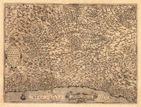
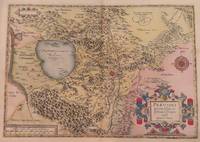
157513973Antwerp: Juan Baptist Vrients 1575. Other. In excellent condition. 368 by 495mm 14 by 19 inches. Original antique copper engraving uncolored from the 'Theatrum Orbis Terrarum' by Abraham Ortelius the world's first modern atlas published in Antwerp 1575. Depicting Piedmont this map is a fine example of 1570s European cartography. Image: 368 by 495mm 14 by 19 inches. An attractive and historically significant 16th-century map for the discerning collector. Abraham Ortelius 15271598 was a Flemish cartographer and geographer born in Antwerp. He is widely regarded as the creator of the first modern atlas the 'Theatrum Orbis Terrarum' Theatre of the World first published in 1570 by Gilles Coppens de Diest in Antwerp. Considered the world's first true atlas it established the modern format of uniform standardized maps bound together in a single volume. Appointed Geographer to King Philip II of Spain in 1575 Ortelius was one of the most influential figures in the history of cartography. His maps are held in the collections of the British Library the Library of Congress and major European institutions. The 'Theatrum' went through more than 30 editions and was translated into multiple languages making Ortelius's maps among the most sought-after in the world of antique cartography.The Piedmont region is based in the middle on these map of Giacomo Gastaldi. Milan is in the upper right and Monaco is at lower left corner. The map is a great illustration of the mountainous countryside and is filled with information including even the tiniest of villages. Decorated with two cartouches and a sailing ship in the Mediterranean.A fine example from Theatrum Orbis Terrarum Antwerp sought after by collectors of antique maps of Italy antique maps of Piedmont and antique copper engraving uncoloreds for sale. In good condition consistent with age. Light age-toning to the sheet as expected for a 16th-century engraving. Centerfold as published. Broe: 128 Juan Baptist Vrients unknown
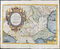
1590003611Belgico Antwerp: Abraham Ortelius 1590. No Binding. Very Good. Elephant Folio - over 15" - 23" tall. ORTELIUS Abraham. VG 1590 B&W Map of the Black Sea Coast. 50 35.5 the Map 54 44.5 cm map including margins. Latin Text to verso of 1 side p xxvii. No pin holes inscriptions etc very light edge browning. Includes part of Ukraine Russia Georgia Bulgaria Romania and Turkey. Belongs to a series of historical maps known as the Parergon Theatri from 1579 onwards. Tooley's Dictionary of Mapmaker Early World Press 2004 p358-359 Marcel P. R. van den Broecke Ortelius Atlas Maps HES Publishers 2011 p633. <br/> <br/> Abraham Ortelius unknown
15957641Antwerp Plantin-Moretus 1595. Copper engraving 36.5 x 51 cms black and white Latin text on verso. First published in the 1570 edition of the Theatrum Christiaan Sgrothen is cited as the principal source. Ortelius's Theatrum Orbis Terrarum is generally considered the first modern atlas of the world originally published in 1570. Ortelius gathered the best available cartographic knowledge and presented it in a consistent style in a single volume with text. The Theatrum was very decorative and hugely popular amongst the wealthy and educated running into over forty editions in Latin and the major European languages. Van den Broecke 56 Map unknown
15958231Antwerp Plantin-Moretus 1595. Copper engraving 33 x 46 cms modern hand-colour Latin text on verso. Ortelius map of the western Balkans drew on the cartography of Augustin Hirschvogel. Van den Broecke 145.3 Map unknown
15843014<p>Map. Paper size: 422 x 530 mm. Image size: 330 x 465 mm. 16th century map in original hand-coloring. Decorative polychrome cartouche and compass rose. Depicts bodies of water heights and towns/cities. Latin text to verso. Van den Broecke 2nd ed. 1584 L3.; 422 x 530 mm.; All shipments through USPS insured Priority Mail.</p> Abraham Ortelius
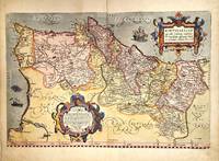
1579M11348Antwerp Belgium 1579. Very Good. Notes: Highly decorative and detailed map of Portugal with two elaborate cartouches. <br>Latin text on verso.<br>Abraham Ortelius April 1527 – June 1598 was a Flemish cartographer geographer and cosmographer from Antwerp in the Spanish Netherlands. He is recognized as the creator of the first modern atlas the Theatrum Orbis Terrarum Theatre of the World. Along with Gemma Frisius and Gerardus Mercator Ortelius is generally considered one of the founders of the Netherlandish school of cartography and geography. He was a notable figure of this school in its golden age approximately 1570s–1670s and an important geographer of Spain during the age of discovery. The publication of his atlas in 1570 is often considered as the official beginning of the Golden Age of Netherlandish cartography. Size : 342x520 mm 13.46x20.47 Inches Coloring: Original Hand Coloring Reference: Van den Broecke #26. Category: Maps Europe Portugal; unknown
159037978np 1590. Image area 19 1/2 x 13 1/2 inches in 28 x 23 inch mat. Single crease down center with one 1/2 inch spot worn through otherwise a nice handsome map. Image area 19 1/2 x 13 1/2 inches in 28 x 23 inch mat. Abraham Ortelius 1527-1598 was a Flemish geographer of German origin. His major work Theatrum Orbis Terrarum 1570 with later revisions and addenda was the first modern atlas. It was based on contemporary charts and maps and contained a collection of plates engraved by Franz Hagenberg in a uniform size and format. The Theatrum preceded the first Atlas of Ortelius' good friend Gerardus Mercator. In fact popular and sentimental legend has it that Mercator delayed publication of his own work so that his younger friend's would appear first. although this simply is not true Mercator wasn't ready the legendary cartographer did compliment Ortelius for the "care and elegance" he put into his "Theatrum. unknown books
159037978np 1590. Image area 19 1/2 x 13 1/2 inches in 28 x 23 inch mat. Single crease down center with one 1/2 inch spot worn through otherwise a nice handsome map. Image area 19 1/2 x 13 1/2 inches in 28 x 23 inch mat. Abraham Ortelius 1527-1598 was a Flemish geographer of German origin. His major work Theatrum Orbis Terrarum 1570 with later revisions and addenda was the first modern atlas. It was based on contemporary charts and maps and contained a collection of plates engraved by Franz Hagenberg in a uniform size and format. The Theatrum preceded the first Atlas of Ortelius' good friend Gerardus Mercator. In fact popular and sentimental legend has it that Mercator delayed publication of his own work so that his younger friend's would appear first. although this simply is not true Mercator wasn't ready the legendary cartographer did compliment Ortelius for the "care and elegance" he put into his "Theatrum. unknown
1584M1477Antwerp 1584. Excellent; upper margin extended. Notes: Note: This is one of the three maps of the large double-sheet Ortelius "La Florida Auctore Hieron. Chiaues. / Gvastecan Reg. / Pervviae Auriferae Regionis Typus. Didaco Mendezio Auctore." It has been seperated from the larger map. Note that the reference listed is for the double-sheet map.<br><br>"Published in editions of Theatrum Orbis Terrarum from 1854 onwards A. Ortelius here shows the three main areas of Spanish Colonial Interest in America in the 16th century: Florida Guasteca and the gold rich regions in Peru. The anonymous map of Guasteca continues the coastline of the gulf of Mexico to the south of the riode las Palmas." John Goss Size : 170x220 mm 6.75x8.625 Inches Coloring: Hand Colored Reference: Reference: Goss Map 13 Category: Maps Central America Mexico unknown
158415872Antwerp 1584. Maps. Original hand color map of Italy showing Tuscany. Based on Bellamarti's map of Tuscany supplemented by classical sources. Part of a series of historical maps compiled by Ortelius called the Parergon Theatri which appeared from 1579 on. With three ornate cartouches and a sailing ship. French text on verso of the right side. Image size:19 1/8 x 12 5/8". Paper size: 21 1/2 x 15 1/2". With some faint offsetting at the right hand border and in the area of the two cartouches otherwise very good. unknown
15849713<p>Original hand-colored engraving from Abraham Ortelius's <em>Theatrum Orbis Terrarum - Parergon - Nomenclator Ptolemaicus. </em>Features Latin text to verso see image and a large attractive cartouche. The map includes firing vessels a sea monster as well as birds & insects sitting on the cartouche. The image measures approximately 19.5 x 14.25 in 49.5 x 36 cm; page measures 21 x 17.25 in 53.5 x 44 cm.</p> Christoph Plantin Press
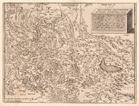
157321966Antwerp: Diesth 1573. Other. With full margins as published printed on excellent thick paper. Verso German text with a decorative woodcut device. A strong impression in excellent condition. 344 by 455mm 13 by 18 inches. 344 by 455mm 13 by 18 inches. Copper engraving uncolored as published. Published 1573 in the second German text edition of the Theatrum Orbis Terrarum. This map was published in the Theatrum Orbis Terrarum from 1570 onwards. The first German text edition appeared 1572 Koeman Ort. 5 and was followed by 'Ein Zusatz bei dass Theatrum.' the 'Additamentum' in German language in 1573 and then by this German text edition in 1573. The map is based on the cartographic sources by Aegidius Tschudi 1505-72. An early interesting map of Switzerland orientated with the north to the south. Based on the cartographic source after A. Tschudi. With many engraved place names cities and small villages are shown as miniature city views. A mileage scale with Swiss miles in the lower left corner. Top right a simple square title cartouche with descriptive text of the history of Switzerland in Latin. Koeman Ort. 11; Broecke 115. Diesth unknown
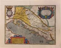
1595303401Antwerp: Abraham Ortelius 1595. Map. Engraving with original hand coloring. Image measures 14" x 18 1/8". Sheet measures 17" x 21 3/8"<br/> <br/> Beautifully colored map of the classical regions of Pannonia and Illyria Dalmatia lying on the northeastern coast of the Adriatic Sea. Depicts present-day Croatia Bosnia and Herzegovina and Montenegro. Shows classical place names topographical and geographical features. Latin text on verso. From "Theatrum Orbis Terrarum". Light scattered stains to margins and cartouche. Minor abrasion to upper right. <br> <br> Abraham Ortelius 1527--1598 a Flemish cartographer and geographer is widely regarded as one of the important and influential cartographers in history. He is known for his "Theatrum Orbis Terrarum" which was the first modern atlas. van den Broecke 203.<br/> <br/> Abraham Ortelius unknown
1579200024AG1579. Antwerp Ortelius 1579. Original hand-coloured engraving. Plate Size: 49.3 cm x 35.3 cm. Sheet Size: 53.1 cm x 42 cm. Original map. Very good condition with some signs of browning to the outer margins only. Slight creasing to the top right coner of map. Professionally repaired tear to lower centre fold barely noticeable given the quality of the workmanship. Latin text on reverse. Broecke 14ab.2; Koeman III 95299610:31; Wolff America S. 95; Lowery 65. A pair of stunning maps from the late 16th Century Theatrum Orbis Terrarum showing the northwest Pacific coast of Mexico and the Greater Antilles in the Caribbean. All these regions were first explored and settled by the Spanish in the 1490s and still under Madrid's control when Ortelius produced his renowned cartographic work. Among the settlements shown on the Mexican map are Culiacan and the Spanish settlement of Villa S. Michaelis with its cathedral clearly marked. Reliefs are depicted pictorially with mountains and rivers identified and a large forest/grove also shown. A large but narrow island lies just off the coast. Large decorative cartouche with Ortelius's characteristic ornamental straps lies of the coast with explanatory annotations in Latin text. Smaller title cartouche in the top right corner of map also. The map below illustrates the Greater Antilles including the Cayman Magnus and the Caymanes Cuba 'Aity sive Spaniola' Hispaniola Jamaica the Bahamas 'St. Jois Insula' St. Johns Virgin Islands and the Barbados Islands all in fine detail. Havana is clearly identified along with other major settlements throughout the islands. St. Lucia is just about included lying within the map border. The section of South Florida also shows suggestion of the Florida Keys which was uncommon for this era. To the west Yucatan can be seen breaching the map boundary. A decorative title cartouche beautifully adorned with two birds lies at the lower part of the map. Unlike the waters of the Mexican map above it the seas of this map appear choppy for the two ships depicted. Valuably laden Spanish galleons would have traversed these stretches of water bringing the riches of the New World across the Atlantic to Spain. Making use of a knowledge of Greek Mythology two particularly perilous areas are designated: amid the Bahamas a treacherous stretch of water is labelled 'Carybdis Magna' while off to the west of Hispaniola lies the dangerous 'Scyila Magna.' An interesting cartographic error is evident on both maps: the Tropic of Cancer is mislabeled as the southern 'Tropicus Capricorni'. Abraham Ortelius was a Flemish cartographer and geographer conventionally recognized as the creator of the first modern atlas the Theatrum Orbis Terrarum Theatre of the World. He was one of the most notable figures of the Dutch school of cartography during its golden age approximately 1570s-1670s. unknown
1592200015AG1592. Antwerp Ortelius c.1592. Original hand-coloured engraving. Plate Size: 49.6 cm x 37.6 cm. Sheet Size: 57.8 cm x 45.6 cm. Original map. Very good condition. Clean and crisp impression. Some slight creases along edges. Very minor barely visible tears to lower edges. Hernando Abb. S. 139; Imagens 11; Broecke 25.3; Koeman III 6000:31/b. - 3. Zustand from 4 with "Estrecho de Gibraltar". Border with longitudinal and latitudinal information. A beautifully detailed map of the Kingdom of Spain with the smaller provincial and historical kingdoms - Galitia Asturias Biscaia Navarra Aragonia Catalonia Castilia Nova and Vetus Valencia Murcia Granada and Andaluzia - also delineated as is Portugal. The Balearic Islands are also included. In the top right corner the French cities of Montpellier and Marseille can be seen. The Barbary Coast of North Africa lies to the lower section of the map. Relief shown pictorially with rivers mountains and significant towns and cities depicted. Lower right corner bears Ortelius characteristic strapwork design ornaments the title cartouche. Scale topped with a large pair of dividers in the lower left corner. Two naval ships pictured highlight the maritime importance of the peninsula. Giant mythical sea creatures guard the straits at Gibraltar and at the Balearic Islands. Abraham Ortelius was a Flemish cartographer and geographer conventionally recognized as the creator of the first modern atlas the 'Theatrum Orbis Terrarum' Theatre of the World. He was one of the most notable figures of the Dutch school of cartography during its golden age approximately 1570s-1670s. unknown
159552816Theatrum Orbis Terrarum. 1595. Ortelius based the map on the map and plan by Marcus Secsnagel 1551. Braun and Hogenberg also used Secsnagel work. The poem at the top left commemorates him. The map has been drawn as if stretched over a frame with the edges pinned down the lower edges have rolled free to reveal the town plan at lower right Copper engraving. Fine condition good margins top edge very slightly worn Later colouring. Size: 43 x 34 cm. 17 x 13½ inches van den Broecke 107 unknown
158453174Antwerp. c.1584. Based on Egnatio Dante's 1580 Perugia map engraved by Mario Cartaro. Decorated strapwork cartouche at lower right scale at lower left and compass point at centre right empty cartouche at top left. Published in Ortelius' epic atlas the Theatrum Orbis Terrarum. Copper engraving. A little darkened but clean with good margins. Expert repairs to cracks. caused by verdi gris. Closed tear at lower margin not affecting map.Very good condition. Original colour. Size: 33.4 x 47 cm. van den Broecke 136. unknown
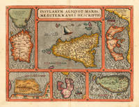
159816886Antwerp: Christopher Platin 1598. Other. A very good example in excellent condition. 360 by 475mm 14 by 18 inches. Original copper engraving published 1598 in a French edition of the Theatrum Orbis Terrarum. Finely hand-colored in wash and outline. Decorative doublepage map showing six islands in the Mediterranean Islands Sicily Sardinia Corfu Malta Djerba Elba. Sicily is prominently displayed in the center of the map above the title cartrouche. Ortelius was born on 14 April 1527 in the city of Antwerp which was then in the Habsburg Netherlands modern-day Belgium. The Orthellius family were originally from Augsburg a Free imperial city of the Holy Roman Empire. In 1535 the family had fallen under suspicion of Protestantism. Following the death of Ortelius's father his uncle Jacobus van Meteren returned from religious exile in England to take care of Ortelius. Abraham remained close to his cousin Emanuel van Meteren who would later moved to London. In 1575 he was appointed geographer to the king of Spain Philip II on the recommendation of Arias Montanus who vouched for his orthodoxy. He travelled extensively in Europe and is specifically known to have traveled throughout the Seventeen Provinces; in southern western northern and eastern Germany e.g. 1560 15751576; France 15591560; England and Ireland 1576; and Italy 1578 and perhaps twice or thrice between 1550 and 1558. Beginning as a map-engraver in 1547 he entered the Antwerp Guild of Saint Luke as an illuminator of maps. He supplemented his income trading in books prints and maps and his journeys included yearly visits to the Frankfurt book and print fair where he met Gerardus Mercator in 1554. In 1560 however when travelling with Mercator to Trier Lorraine and Poitiers he seems to have been attracted largely by Mercator's influence towards the career of a scientific geographer. Wikipedia Broe. 141 Christopher Platin unknown
15950044301595 [Anvers], Ortelius, 1594. Carte (557 X 405 mm, marges comprises) sous cadre en bois noirci moderne.