Ortelius, AbrahamBiblio.com
255 résultats
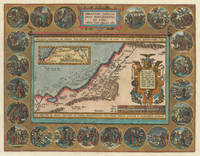
161230715Antwerp: Balthasar Moretus 1612. Other. A very strong impression. In excellent condition. 353 by 457mm 14 by 18 inches. Original copper engraving published 1612 in the famous historical atlas Parergon Latin text-edition by Abraham Ortelius. Finely later hand colored in wash and outline. The map shows the travels and life of Abraham. More else this highly decorative map is surrounded by 22 fine engraved medallions which are showing episodes of the life of the Patriach Abraham. The map was published 1592 for the first time in Abraham Ortelius edition of theTheatrum Orbis Terrarum. Ortelius who created this map used as cartographical source for this map information from Ptolemy and from the bible particulary for the illustrations of Abrahams life depicted in 22 medallions. Broe. 182 Balthasar Moretus unknown
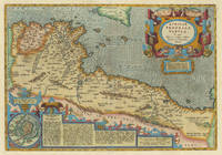
161230987Antwerp: Balthasar Moretus 1612. Other. In excellent condition. 338 by 488mm 13 by 19 inches. Original copper engraving published 1612 in the famous historical Atlas Parergon Latin text-edition by Abraham Ortelius. Finely later hand-colored in wash and outline. Very decorative map of North Africa Libya and Tunisia with Malta and southern Sicily.This map is ornated with a decorative title cartouche in the upper right corner and an inset with text cartouches in the lower left corner. Villages and towns are shown as miniature views. Ortelius was born on 14 April 1527 in the city of Antwerp which was then in the Habsburg Netherlands modern-day Belgium. The Orthellius family were originally from Augsburg a Free imperial city of the Holy Roman Empire. In 1535 the family had fallen under suspicion of Protestantism. Following the death of Ortelius's father his uncle Jacobus van Meteren returned from religious exile in England to take care of Ortelius. Abraham remained close to his cousin Emanuel van Meteren who would later moved to London. In 1575 he was appointed geographer to the king of Spain Philip II on the recommendation of Arias Montanus who vouched for his orthodoxy. He travelled extensively in Europe and is specifically known to have traveled throughout the Seventeen Provinces; in southern western northern and eastern Germany e.g. 1560 15751576; France 15591560; England and Ireland 1576; and Italy 1578 and perhaps twice or thrice between 1550 and 1558. Beginning as a map-engraver in 1547 he entered the Antwerp Guild of Saint Luke as an illuminator of maps. He supplemented his income trading in books prints and maps and his journeys included yearly visits to the Frankfurt book and print fair where he met Gerardus Mercator in 1554. In 1560 however when travelling with Mercator to Trier Lorraine and Poitiers he seems to have been attracted largely by Mercator's influence towards the career of a scientific geographer. Wikipedia Broe. 218 Koemann III map 8610H:31 ed. 31:051 1595 Latin Balthasar Moretus unknown
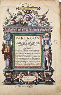
160312720Antwerp Jan Baptist Vrients 1603. Parergon sive veteris geographiae aliquot Tabulae . Engraved title 33 maps of the Ancient World 2 plates with costumes and 3 views ""Tempe"" ""Daphne"" and ""Escorial"". H. 43 x W. 30 cm. / H. 16.90 x W. 11.8 inch. A fine and complete copy of the Parergon by Abraham Ortelius 1527-1598 published in Antwerp in 1603. This celebrated companion to the Theatrum Orbis Terrarum represents one of the earliest and most influential works of historical cartography. The volume contains a full suite of maps illustrating the ancient world including the Roman Empire classical Greece and Biblical regions. All maps are original contemporary hand coloured exceptionally well-preserved and vibrant throughout. The engraved title page is richly decorated with allegorical figures and classical motifs. Latin text on verso. A highly decorative and scholarly work reflecting the humanist interest in antiquity and geography. Light age toning and occasional marginal wear are consistent with age. Overall a very attractive copy. Antwerp, Jan Baptist Vrients unknown
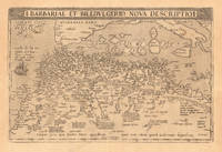
160819024Antwerpen: Platin 1608. Other. In excellent condition. 330 by 500mm 13 by 19 inches. Original copper engraving published 1608 in an Italian text edition of the " Theatrum Orbis Terrarum. A good and strong impression of this map. This antique map shows North Africa with the Mediterranean Sea and the Atlantic coast. The map is equipped with many place names rivers mountains towns a small part of Italy Sicily the islands Corsica Sardinia Menorca Mallorca etc. The map is ornated with a large title cartouche in the upper margin as well we find for decoration a sea monsters and a ship in the sea. Villages and towns are shown as miniature views. Ortelius was born on 14 April 1527 in the city of Antwerp which was then in the Habsburg Netherlands modern-day Belgium. The Orthellius family were originally from Augsburg a Free imperial city of the Holy Roman Empire. In 1535 the family had fallen under suspicion of Protestantism. Following the death of Ortelius's father his uncle Jacobus van Meteren returned from religious exile in England to take care of Ortelius. Abraham remained close to his cousin Emanuel van Meteren who would later moved to London. In 1575 he was appointed geographer to the king of Spain Philip II on the recommendation of Arias Montanus who vouched for his orthodoxy. He travelled extensively in Europe and is specifically known to have traveled throughout the Seventeen Provinces; in southern western northern and eastern Germany e.g. 1560 15751576; France 15591560; England and Ireland 1576; and Italy 1578 and perhaps twice or thrice between 1550 and 1558. Beginning as a map-engraver in 1547 he entered the Antwerp Guild of Saint Luke as an illuminator of maps. He supplemented his income trading in books prints and maps and his journeys included yearly visits to the Frankfurt book and print fair where he met Gerardus Mercator in 1554. In 1560 however when travelling with Mercator to Trier Lorraine and Poitiers he seems to have been attracted largely by Mercator's influence towards the career of a scientific geographer. Wikipedia Platin unknown
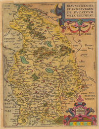
160235922Antwerpen 1602. Kräftig und gleichmäßig gedrucktes Exemplar. Tadellos. . 31 x 234 cm 12.25 x 925 inches. Hand-Colored Original Copperplate Engraving by Abraham Ortelius depicting Braunschweig Herzogtum. Published Antwerpen 1602. Sheet: 31 x 234 cm 12.25 x 925 inches. A fine and original hand-colored example of Ortelius's celebrated cartographic work documenting this region of Germany with the precision and decorative artistry characteristic of the 16000s. Abraham Ortelius 1527-1598 was a Flemish cartographer and geographer from Antwerp widely regarded as the creator of the first modern atlas. His landmark publication Theatrum Orbis Terrarum 1570 set the standard for atlas-making for the next century presenting uniform copper-engraved maps with scholarly commentary. By Ortelius's death the Theatrum had appeared in 25 editions in seven languages. In 1575 King Philip II of Spain appointed him Royal Geographer. His maps engraved with extraordinary precision are among the most sought-after in antique cartography held in collections including the Plantin-Moretus Museum in Antwerp the Library of Congress and the British Library.This plate presents a original copperplate engraving with original hand coloring depicting the city of Braunschweig Herzogtum published in Antwerpen 1602. The view is framed with a decorative Baroque cartouche containing the title inscription. Such topographic views from Ortelius's workshop are primary historical documents of German urban history in the 1600s now prized equally by historians map collectors and interior decorators. Sheet measures 31 x 234 cm 12.25 x 925 inches. In good condition overall with minor signs of age appropriate for a 17th-century engraving. Retains its original contemporary hand coloring. Ready to frame. Koem. Ort. 33 unknown
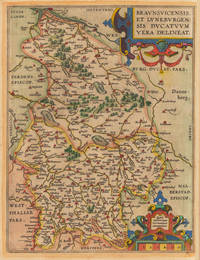
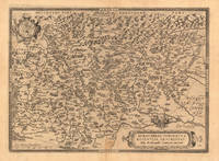
160235921Antwerpen: Vrients 1602. Still in acceptable condition. 31 x 235 cm 12.25 x 925 inches. Hand-Colored Original Copperplate Engraving by Abraham Ortelius depicting Braunsvicensis et Luneburgensis Ducatuum Vera Delineat. Published Antwerpen Vrients 1602. Sheet: 31 x 235 cm 12.25 x 925 inches. A fine and original hand-colored example of Ortelius's celebrated cartographic work documenting this region of Germany with the precision and decorative artistry characteristic of the 16000s. Abraham Ortelius 1527-1598 was a Flemish cartographer and geographer from Antwerp widely regarded as the creator of the first modern atlas. His landmark publication Theatrum Orbis Terrarum 1570 set the standard for atlas-making for the next century presenting uniform copper-engraved maps with scholarly commentary. By Ortelius's death the Theatrum had appeared in 25 editions in seven languages. In 1575 King Philip II of Spain appointed him Royal Geographer. His maps engraved with extraordinary precision are among the most sought-after in antique cartography held in collections including the Plantin-Moretus Museum in Antwerp the Library of Congress and the British Library.This original copperplate engraving with original hand coloring depicts the region of Braunsvicensis et Luneburgensis Ducatuum Vera Delineat. published in Antwerpen Vrients 1602. The map records the political and geographic boundaries of the region as understood in 1602 offering a fascinating window into the history of German territorial organization. Sheet measures 31 x 235 cm 12.25 x 925 inches. In good condition overall with minor signs of age appropriate for a 16th-century engraving. Ready to frame. Broe. 99 Vrients unknown
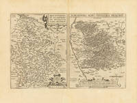
161232756Antwerpen: Vrients 1612. In excellent condition. 310 by 475mm 12¼ by 18¾ inches. Original antique copper engraving uncolored. Two maps on one doublepage sheet the Duchy of Brunswick-Lüneburg and the environs of Nuremberg. The Nuremberg area is shown on one map. In the north the map extends to Erlangen / Uttenreuth and in the south to Schwarzach. In the upper margin is the title Norimberg. Agri fidissima descrip. And below the map there is a large painted scrollwork cartouche and privilege. In the west the map extends from the Rednitz to Hersbruck in the east. Locations forests rivers lakes etc. were decoratively worked out. Koe. Ort. 42 Vrients unknown
160323753Antwerpen: J.B. Vrients 1603. Other. In excellent condition. 363 by 504mm 14 by 19 inches. Original antique copper engraving published 1603 at J.B. Vrients in an edition of Abraham Ortelius Theatrum. Finely hand colored in wash and outline. This antique historical map was published from 1595 to 1624 onwards in various edition of the Theatrum and the Parergon by Ortelius. Verso Latin text last line of text endsputant and with signature ix. The map is ornated with three cartouches in the upper middle the title cartouche in the upper right corner we find a cartouche with the privilegium. On the lower right side cartouche with text. Villages and towns are shown as miniature views moreover the map is ornated with ships. Ortelius was born on 14 April 1527 in the city of Antwerp which was then in the Habsburg Netherlands modern-day Belgium. The Orthellius family were originally from Augsburg a Free imperial city of the Holy Roman Empire. In 1535 the family had fallen under suspicion of Protestantism. Following the death of Ortelius's father his uncle Jacobus van Meteren returned from religious exile in England to take care of Ortelius. Abraham remained close to his cousin Emanuel van Meteren who would later moved to London. In 1575 he was appointed geographer to the king of Spain Philip II on the recommendation of Arias Montanus who vouched for his orthodoxy. He travelled extensively in Europe and is specifically known to have traveled throughout the Seventeen Provinces; in southern western northern and eastern Germany e.g. 1560 15751576; France 15591560; England and Ireland 1576; and Italy 1578 and perhaps twice or thrice between 1550 and 1558. Beginning as a map-engraver in 1547 he entered the Antwerp Guild of Saint Luke as an illuminator of maps. He supplemented his income trading in books prints and maps and his journeys included yearly visits to the Frankfurt book and print fair where he met Gerardus Mercator in 1554. In 1560 however when travelling with Mercator to Trier Lorraine and Poitiers he seems to have been attracted largely by Mercator's influence towards the career of a scientific geographer. Wikipedia Koe. Ort. 46; Broe. 192 Theatrum 16o3 Latin text edition signature ix; Shirley 1991 maps 186 pl. 71 259a 365. J.B. Vrients unknown
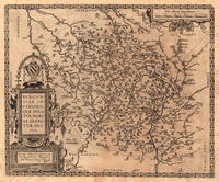
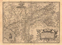
161218807Antwerp: Juan Baptist Vrients 1612. Other. In excellent condition. 375 by 458mm 14 by 18 inches. Original antique copper engraving published 1612 in the famous Italian text edition of the" Theatrum Orbis Terrarum published by Juan Baptist Vrients in Antwerp. An early and decorative map of the duchy of Burgundy in France by Abraham Ortelius published and printed from 1584 for the first time onwards. Ortelius was born on 14 April 1527 in the city of Antwerp which was then in the Habsburg Netherlands modern-day Belgium. The Orthellius family were originally from Augsburg a Free imperial city of the Holy Roman Empire. In 1535 the family had fallen under suspicion of Protestantism. Following the death of Ortelius's father his uncle Jacobus van Meteren returned from religious exile in England to take care of Ortelius. Abraham remained close to his cousin Emanuel van Meteren who would later moved to London. In 1575 he was appointed geographer to the king of Spain Philip II on the recommendation of Arias Montanus who vouched for his orthodoxy. He travelled extensively in Europe and is specifically known to have traveled throughout the Seventeen Provinces; in southern western northern and eastern Germany e.g. 1560 15751576; France 15591560; England and Ireland 1576; and Italy 1578 and perhaps twice or thrice between 1550 and 1558. Beginning as a map-engraver in 1547 he entered the Antwerp Guild of Saint Luke as an illuminator of maps. He supplemented his income trading in books prints and maps and his journeys included yearly visits to the Frankfurt book and print fair where he met Gerardus Mercator in 1554. In 1560 however when travelling with Mercator to Trier Lorraine and Poitiers he seems to have been attracted largely by Mercator's influence towards the career of a scientific geographer. Wikipedia Broe. 54 Juan Baptist Vrients unknown
161223589Antwerp: Juan Baptist Vrients 1612. Other. In excellent condition. 365 by 504mm 14 by 19 inches. Original antique copper engraving published 1612 in the famous Italian text edition of the" Theatrum Orbis Terrarum published by Juan Baptist Vrients in Antwerp. An early and decorative map of Burgundy in France by Abraham Ortelius which is based on the cartographical sources Ferdinand de Lannoy who made a map of Burgundy in 1563 for which he obtained a privilege but which was subsequently suppressed by the Spaniards for political reasons Broe. Ortelius was born on 14 April 1527 in the city of Antwerp which was then in the Habsburg Netherlands modern-day Belgium. The Orthellius family were originally from Augsburg a Free imperial city of the Holy Roman Empire. In 1535 the family had fallen under suspicion of Protestantism. Following the death of Ortelius's father his uncle Jacobus van Meteren returned from religious exile in England to take care of Ortelius. Abraham remained close to his cousin Emanuel van Meteren who would later moved to London. In 1575 he was appointed geographer to the king of Spain Philip II on the recommendation of Arias Montanus who vouched for his orthodoxy. He travelled extensively in Europe and is specifically known to have traveled throughout the Seventeen Provinces; in southern western northern and eastern Germany e.g. 1560 15751576; France 15591560; England and Ireland 1576; and Italy 1578 and perhaps twice or thrice between 1550 and 1558. Beginning as a map-engraver in 1547 he entered the Antwerp Guild of Saint Luke as an illuminator of maps. He supplemented his income trading in books prints and maps and his journeys included yearly visits to the Frankfurt book and print fair where he met Gerardus Mercator in 1554. In 1560 however when travelling with Mercator to Trier Lorraine and Poitiers he seems to have been attracted largely by Mercator's influence towards the career of a scientific geographer. Wikipedia Broe. 51 Juan Baptist Vrients unknown
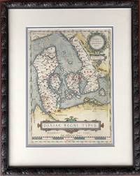
1610H15377Amsterdam 1610. Very Good. 13.5 x 9.75 inches double-matted and nicely framed; frame measures 20 x 16 inches. With original hand coloring very good with mild surface soil. Not examined outside of frame. This is the left-hand map of a sheet that had on the right a detailed map of Jutland. Part of Ortelius's Theatrum Orbis Terrarum considered the first great world atlas. unknown
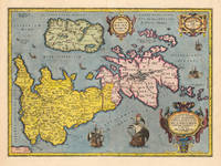
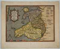
160915882Antwerp 1609. The first printed map of Wales with title translated as "Map of Wales by the author Humphrey Lhuyd the Welshman from Denbigh". Based on Mercator's 1564 wall map of the British Isles and Lhuyd's manuscript map of 1568. Ornate cartouche sailing ship and sea monsters. Latin text on verso. Van den Broecke and van den Broecke-Günzburger's Ortelius Map No. 21; 300 copies of this edition were printed. Image size: 19 1/2 x 14 1/2". Paper size: 23 x 18 3/4". Two stray printer's marks at lower margin otherwise very good. unknown
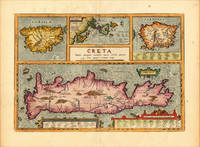
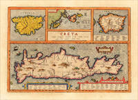
161220464Antwerp: Juan Baptist Vrients 1612. Other. In excellent condition. 342 by 491mm 13 by 19 inches. Original copper engraving published 1624 in the famous historical Atlas Parergon Latin text-edition by Abraham Ortelius. Finely later hand-colored in wash and outline. Four maps on one plate: Corsica the Ionian Islands Cephalonia Zacynthus Corcyra Sardinia and Crete. Villages and towns are shown as miniature views moreover the map at the bottom is ornated with ships sea monsters and animals. At the bottom we find two cartouches with listings of antique place names and explanations. Ortelius was born on 14 April 1527 in the city of Antwerp which was then in the Habsburg Netherlands modern-day Belgium. The Orthellius family were originally from Augsburg a Free imperial city of the Holy Roman Empire. In 1535 the family had fallen under suspicion of Protestantism. Following the death of Ortelius's father his uncle Jacobus van Meteren returned from religious exile in England to take care of Ortelius. Abraham remained close to his cousin Emanuel van Meteren who would later moved to London. In 1575 he was appointed geographer to the king of Spain Philip II on the recommendation of Arias Montanus who vouched for his orthodoxy. He travelled extensively in Europe and is specifically known to have traveled throughout the Seventeen Provinces; in southern western northern and eastern Germany e.g. 1560 15751576; France 15591560; England and Ireland 1576; and Italy 1578 and perhaps twice or thrice between 1550 and 1558. Beginning as a map-engraver in 1547 he entered the Antwerp Guild of Saint Luke as an illuminator of maps. He supplemented his income trading in books prints and maps and his journeys included yearly visits to the Frankfurt book and print fair where he met Gerardus Mercator in 1554. In 1560 however when travelling with Mercator to Trier Lorraine and Poitiers he seems to have been attracted largely by Mercator's influence towards the career of a scientific geographer. Wikipedia Broe. 217 Juan Baptist Vrients unknown
161213729Antwerp: Juan Baptist Vrients 1612. Other. In excellent condition. 342 by 491mm 13 by 19 inches. Original antique copper engraving decorative hand colored. Published 1612 in the historical Atlas "Parergon" by Abraham Ortelius bound with his famous Theatrum Orbis Terrarum. Finely hand-colored in wash and outline. Four maps on one plate: Corsica the Ionian Islands Cephalonia Zacynthus Corcyra Sardinia and Crete. Villages and towns are shown as miniature views moreover the map at the bottom is ornated with ships sea monsters and animals. At the bottom we find two cartouches with listings of antique place names and explanations. A very good example in excellent condition. Ortelius was born on 14 April 1527 in the city of Antwerp which was then in the Habsburg Netherlands modern-day Belgium. The Orthellius family were originally from Augsburg a Free imperial city of the Holy Roman Empire. In 1535 the family had fallen under suspicion of Protestantism. Following the death of Ortelius's father his uncle Jacobus van Meteren returned from religious exile in England to take care of Ortelius. Abraham remained close to his cousin Emanuel van Meteren who would later moved to London. In 1575 he was appointed geographer to the king of Spain Philip II on the recommendation of Arias Montanus who vouched for his orthodoxy. He travelled extensively in Europe and is specifically known to have traveled throughout the Seventeen Provinces; in southern western northern and eastern Germany e.g. 1560 15751576; France 15591560; England and Ireland 1576; and Italy 1578 and perhaps twice or thrice between 1550 and 1558. Beginning as a map-engraver in 1547 he entered the Antwerp Guild of Saint Luke as an illuminator of maps. He supplemented his income trading in books prints and maps and his journeys included yearly visits to the Frankfurt book and print fair where he met Gerardus Mercator in 1554. In 1560 however when travelling with Mercator to Trier Lorraine and Poitiers he seems to have been attracted largely by Mercator's influence towards the career of a scientific geographer. Wikipedia Broe. 217 Juan Baptist Vrients unknown
16248000Antwerp: Plantin-Moretus 1624. Copper engraving 36 x 46 cms modern hand colour Latin text on verso. Ancient Dacia and Moesia modern Romania and Bulgaria on the Black Sea. Our example was published by Balthasar Moretus at the Plantin Press in the final edition of the Parergon. Ortelius's Theatrum Orbis Terrarum is generally considered the first modern atlas of the world originally published in 1570. Ortelius gathered and selected the best available cartographic knowledge and presented it in a single volume duly credited and finely engraved in a consistent style with explanatory text. The Theatrum was very decorative and hugely popular amongst the wealthy and educated running into over forty editions in Latin and the major European languages. For Ortelius himself however his accompanying atlas of ancient geography the Parergon was a "personal work" Koeman. He seems to have regarded himself first and foremost as an antiquary and rather than copying other people's maps he drew the originals himself; they were subsequently engraved for him by the master engraver Jan Wierix. The results have to be evaluated as the most outstanding engravings depicting the wide-spread interest in classical geography in the 16th century Koeman. Koeman Atlantes Neerlandici Ort 46. Van den Broecke 212.2 Map Plantin-Moretus unknown
1603299083Antwerp: Abraham Ortelius 1603. unbound. Map. Engraving with hand coloring. Image measures 14" x 18 3/4". Staining toning and chips to margins but otherwise is good condition.<br/> <br/> Friuli is the northeast Italian region bordering Austria Slovenia and the Adriatic Sea. It's home to the sharp-peaked Dolomite Mountains and vineyards producing white wines. Ortelius' 1603 edition extends from Venice north to the Italian Alps and east to Trieste and Istria. Lovely depiction of Venice floating on several islands. Abraham Ortelius 1527--1598 a Flemish cartographer and geographer is widely regarded as one of the important and influential cartographers in history. He is known for his "Theatrum Orbis Terrarum" which was the first modern atlas. Van Den Broecke 119<br/> <br/> Abraham Ortelius unknown
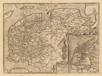
161233372Antwerp: Juan Baptist Vrients 1612. A minor printers crease on the right side of the double page slightly visible. Overall in excellent condition. 36.8 x 498 cm 14.5 x 195 inches. Hand-Colored Original Copperplate Engraving by Abraham Ortelius depicting Frisia Occidentalis. Sibrandus Leonis Leovardiensis Describ. Cum privilegio Imp. et Reg. Mtm. ad. decenninium. 1579. Published Antwerp Juan Baptist Vrients 1612. Sheet: 36.8 x 498 cm 14.5 x 195 inches. A fine and original hand-colored example of Ortelius's celebrated cartographic work documenting this region of Germany with the precision and decorative artistry characteristic of the 16100s. Abraham Ortelius 1527-1598 was a Flemish cartographer and geographer from Antwerp widely regarded as the creator of the first modern atlas. His landmark publication Theatrum Orbis Terrarum 1570 set the standard for atlas-making for the next century presenting uniform copper-engraved maps with scholarly commentary. By Ortelius's death the Theatrum had appeared in 25 editions in seven languages. In 1575 King Philip II of Spain appointed him Royal Geographer. His maps engraved with extraordinary precision are among the most sought-after in antique cartography held in collections including the Plantin-Moretus Museum in Antwerp the Library of Congress and the British Library.This original copperplate engraving with original hand coloring depicts the region of Frisia Occidentalis. Sibrandus Leonis Leovardiensis Describ. Cum privilegio Imp. et Reg. Mtm. ad. decenninium. 1579. published in Antwerp Juan Baptist Vrients 1612. An inset map is included providing additional geographic context. The map records the political and geographic boundaries of the region as understood in 1612 offering a fascinating window into the history of German territorial organization. Sheet measures 36.8 x 498 cm 14.5 x 195 inches. In good condition overall with minor signs of age appropriate for a 17th-century engraving. Ready to frame. Broe. 81 Juan Baptist Vrients unknown
16247933Antwerp: Plantin-Moretus 1624. Copper engraving 36.5 x 46.5 cms modern hand colour a couple of unobtrusive printers creases Latin text on verso. Ancient Gaul engraved on the basis of Caesars commentaries on the Gallic Wars his first hand account of the campaign. The text on the verso explores ancient source material relating the the druids. Our example was published by Balthasar Moretus at the Plantin Press in the final edition of the Parergon. Ortelius's Theatrum Orbis Terrarum is generally considered the first modern atlas of the world originally published in 1570. Ortelius gathered and selected the best available cartographic knowledge and presented it in a single volume duly credited and finely engraved in a consistent style with explanatory text. The Theatrum was very decorative and hugely popular amongst the wealthy and educated running into over forty editions in Latin and the major European languages. For Ortelius himself however his accompanying atlas of ancient geography the Parergon was a "personal work" Koeman. He seems to have regarded himself first and foremost as an antiquary and rather than copying other people's maps he drew the originals himself; they were subsequently engraved for him by the master engraver Jan Wierix. The results have to be evaluated as the most outstanding engravings depicting the wide-spread interest in classical geography in the 16th century Koeman. Koeman Atlantes Neerlandici Ort 46. Van den Broecke 194.3 Map Plantin-Moretus unknown
16248029Antwerp: Plantin-Moretus 1624. Copper engraving 39.5 x 49.5 cms modern hand colour Latin text on verso. Van den Broecke stresses the sigificance of this map of Gaul: in contrast to plate Ort 194 Gallia vetus based on Caesars commentaries this map is based on ancient geographical rather than on ancient military sources and is much more detailed. It contains the largest amount of text to be found on any map by Ortelius . testifying the importance he attached to it. It contains all elements of Ortelius as a true Renaissance scholar. Our example was published by Balthasar Moretus at the Plantin Press in the final edition of the Parergon. Ortelius's Theatrum Orbis Terrarum is generally considered the first modern atlas of the world originally published in 1570. Ortelius gathered and selected the best available cartographic knowledge and presented it in a single volume duly credited and finely engraved in a consistent style with explanatory text. The Theatrum was very decorative and hugely popular amongst the wealthy and educated running into over forty editions in Latin and the major European languages. For Ortelius himself however his accompanying atlas of ancient geography the Parergon was a "personal work" Koeman. He seems to have regarded himself first and foremost as an antiquary and rather than copying other people's maps he drew the originals himself; they were subsequently engraved for him by the master engraver Jan Wierix. The results have to be evaluated as the most outstanding engravings depicting the wide-spread interest in classical geography in the 16th century Koeman. Koeman Atlantes Neerlandici Ort 46; Van den Broecke 196.2. Map Plantin-Moretus unknown
161213895Antwerp: Vrients 1612. Other. In excellent condition. 372 by 503mm 14 by 19 inches. Original antique copper engraving published 1612 in a Italian text edition of the " Theatrum Orbis Terrarum. Uncolored example in a strong impression. The map is ornated with a title cartouche in the lower right corner naming the autor "Christian Schrot" on whom Abraham Ortelius based his cartographic source for this map in his atlas. Top left corner with a small mileage scale. For the decoration of the map we find a sailing ship in the "Zuyder Zee". Ortelius was born on 14 April 1527 in the city of Antwerp which was then in the Habsburg Netherlands modern-day Belgium. The Orthellius family were originally from Augsburg a Free imperial city of the Holy Roman Empire. In 1535 the family had fallen under suspicion of Protestantism. Following the death of Ortelius's father his uncle Jacobus van Meteren returned from religious exile in England to take care of Ortelius. Abraham remained close to his cousin Emanuel van Meteren who would later moved to London. In 1575 he was appointed geographer to the king of Spain Philip II on the recommendation of Arias Montanus who vouched for his orthodoxy. He travelled extensively in Europe and is specifically known to have traveled throughout the Seventeen Provinces; in southern western northern and eastern Germany e.g. 1560 15751576; France 15591560; England and Ireland 1576; and Italy 1578 and perhaps twice or thrice between 1550 and 1558. Beginning as a map-engraver in 1547 he entered the Antwerp Guild of Saint Luke as an illuminator of maps. He supplemented his income trading in books prints and maps and his journeys included yearly visits to the Frankfurt book and print fair where he met Gerardus Mercator in 1554. In 1560 however when travelling with Mercator to Trier Lorraine and Poitiers he seems to have been attracted largely by Mercator's influence towards the career of a scientific geographer. Wikipedia Broe. 61. State 3/4. Vrients unknown
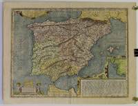
1603W2303Antwerp Belgium: Jan Baptiste Vrients 1603. 14 3/4 inches by 19 3/8 inches on a 16 5/8" by 21 3/4" sheet of laid paper. Latin text on the verso. van den Broecke 193. Abraham Ortelius was a Flemish scholar who moved to Antwerp to become a bookseller and cartographer. This map of ancient Spain is from his PARERGON published as an appendix to the THEATRUM ORBIS TERRARUM the world's first true atlas as well as the most authoritative and commercially successful atlas of the late 16th and early 17th centuries. Although it is dated 1586 in one cartouche this map actually is a second state printed between 1601 and 1612 as indicated by the stipple engraving in the ocean & seas and by the line through the word "Cinniana" in line 8 of the descriptive text within the cartouche in the lower right corner. The map is in very good condition: generally clean and bright with barely a hint of toning and minor soiling limited to the blank margins. Madrid bookseller's stamp and brief handwritten comment and signature in the margin on the verso. Original. Single Sheet. Very Good. Folio - over 12" - 15" tall. Map. Jan Baptiste Vrients
16248030Antwerp: Plantin-Moretus 1624. Copper engraving 37.5 x 49.5 cms modern hand colour small burn hole in table of peoples and places Latin text on verso. Our example was published by Balthasar Moretus at the Plantin Press in the final edition of the Parergon. Ortelius's Theatrum Orbis Terrarum is generally considered the first modern atlas of the world originally published in 1570. Ortelius gathered and selected the best available cartographic knowledge and presented it in a single volume duly credited and finely engraved in a consistent style with explanatory text. The Theatrum was very decorative and hugely popular amongst the wealthy and educated running into over forty editions in Latin and the major European languages. For Ortelius himself however his accompanying atlas of ancient geography the Parergon was a "personal work" Koeman. He seems to have regarded himself first and foremost as an antiquary and rather than copying other people's maps he drew the originals himself; they were subsequently engraved for him by the master engraver Jan Wierix. The results have to be evaluated as the most outstanding engravings depicting the wide-spread interest in classical geography in the 16th century Koeman. Koeman Atlantes Neerlandici Ort 46; Van den Broecke 193.3. Map Plantin-Moretus unknown
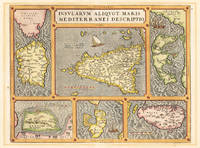
160316331Antwerp 1603. Other. A very good example in vivid handcolor. Minor lightstaining outside the image. 365 by 478mm 14 by 18 inches. Original antique copper engraving from the 'Theatrum Orbis Terrarum' by Abraham Ortelius the world's first modern atlas published in Antwerp 1603. Depicting Mediterranean Islands this map is a fine example of 1600s European cartography. Image: 365 by 478mm 14 by 18 inches. An attractive and historically significant 17th-century map for the discerning collector. Abraham Ortelius 15271598 was a Flemish cartographer and geographer born in Antwerp. He is widely regarded as the creator of the first modern atlas the 'Theatrum Orbis Terrarum' Theatre of the World first published in 1570 by Gilles Coppens de Diest in Antwerp. Considered the world's first true atlas it established the modern format of uniform standardized maps bound together in a single volume. Appointed Geographer to King Philip II of Spain in 1575 Ortelius was one of the most influential figures in the history of cartography. His maps are held in the collections of the British Library the Library of Congress and major European institutions. The 'Theatrum' went through more than 30 editions and was translated into multiple languages making Ortelius's maps among the most sought-after in the world of antique cartography.Decorative doublepage map showing six islands in the Mediterranean Islands Sicily Sardinia Corfu Malta Djerba Elba. Sicily is prominently displayed in the center of the map above the title cartrouche.A fine example from Theatrum Orbis Terrarum Antwerp sought after by collectors of antique maps of Italy antique maps of Mediterranean Islands and antique copper engravings for sale. In excellent condition. Broe. 141 unknown
1603299306Antwerp: Abraham Ortelius 1603. unbound. Map. Engraving with beautiful original hand color. Image measures 14" x 18 3/4". Light staining and toning but otherwise is good condition.<br/> <br/> A representation of some islands in the Mediterranean Sea. Abraham Ortelius 1527-1598 a Flemish cartographer and geographer is widely regarded as one of the important and influential cartographers in history. He is known for his "Theatrum Orbis Terrarum" which was the first modern atlas. Van den Broecke #141<br/> <br/> Abraham Ortelius unknown
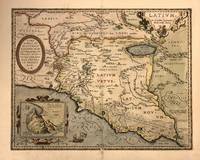
1603322945Antwerp: Abraham Ortelius 1603. framed. Map. Engraving with beautiful hand coloring. Image measures 14" x 18".<br/> <br/> Beautiful 1603 map by Abraham Ortelius depicting Ancient Latium including Rome from his "Parergon". It covers Latium from the Tyrrhenian Sea to Umbria with parts of Tuscany and Campania. Cities are identified as individual buildings with particular focus on Rome its walls and notable buildings like the Coliseum. Notes mountains rivers marshlands and forests beautifully illustrated in profile. <br> <br> The map also includes historical and mythological elements such as a reference to Pliny in the Fucine Lake adding depth to the map's depiction of the region. Three cartouches adorn the map. The first is an ornate title cartouche in the upper right quadrant. Another is a dedication to Marcus Velser Augustanus. The third contains an inset of Mount Circeo the supposed dwelling place of the mythical goddess Circe who enchanted Odysseus and turned his companions into swine. <br> <br> This is the second state of the map identified by the addition of a network of roads around Rome and the designation of the swamp extended in the lower right along with the letters "VOLCI". The map is in good condition with some toning and minor abrasion loss near centerfold and verso repair near bottom margin. Van den Broecke #209. <br> <br> Abraham Ortelius 1527-1598 was a prominent Flemish cartographer geographer and cosmographer renowned for creating the first modern atlas "Theatrum Orbis Terrarum" which first appeared in 1570 and expanded over time to include 134 maps by 1592. Born in Antwerp he began his career as a map colorist and became a significant figure in cartography after being influenced by Gerard Mercator. His work was pivotal in the development of modern cartography integrating maps from various sources and reflecting his advanced geographical theories including early thoughts on continental drift. Appointed Royal Cartographer to King Philip II of Spain in 1575 Ortelius had access to extensive Spanish geographical knowledge. Despite the religious and political turmoil of his time he maintained a position of relative neutrality focusing on his scholarly and cartographic pursuits. His influential works also included "Synonymia Geographica" "Nomenclator Ptolemaicus" and "Parergon."<br/> <br/> Abraham Ortelius unknown