Abraham OrteliusBiblio.com
213 résultats
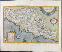
15849714<p>Original hand-colored engraving from Abraham Ortelius's <em>Theatrum Orbis Terrarum - Parergon - Nomenclator Ptolemaicus</em>. Features Latin text to verso see image. The image measures approximately 19 x 12.75 in 48 x 32.5 cm; page measures 21 x 17.25 in 53 x 44 cm.</p> Christoph Plantin Press
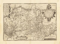
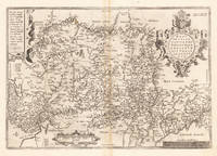
15843401<p>Very Good. 1584. 16th century map with original hand-colored outlines of Tuscany. Decorative cartouche. Some foxing most apparent to margins. Latin text to verso. Otherwise a handsome copy. Please see image. Plate size approximately 19 1/4 x 12 1/2 in. Overall size approx. 21 1/4 x 16 1/2 in 540 x 425 mm.; 1 pages; All shipments through USPS insured Priority Mail. .</p>
158415872Antwerp 1584. Maps. Original hand color map of Italy showing Tuscany. Based on Bellamarti's map of Tuscany supplemented by classical sources. Part of a series of historical maps compiled by Ortelius called the Parergon Theatri which appeared from 1579 on. With three ornate cartouches and a sailing ship. French text on verso of the right side. Image size:19 1/8 x 12 5/8". Paper size: 21 1/2 x 15 1/2". With some faint offsetting at the right hand border and in the area of the two cartouches otherwise very good. unknown
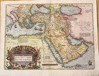
1574M10044Antwerp Belgium 1574. Very Good. Notes: Detailed and decorative map of the Ottoman Empire.<br>It depicts the Middle East by one of the founding fathers of cartography during the late 16th century. This important map features a decorative cartouche. The map depicts cities towns geographical features and has short paragraphs giving the reader information on certain areas. <br>Latin text on verso.<br>Abraham Ortelius April 1527 – June 1598 was a Flemish cartographer geographer and cosmographer from Antwerp in the Spanish Netherlands. He is recognized as the creator of the first modern atlas the Theatrum Orbis Terrarum Theatre of the World. Along with Gemma Frisius and Gerardus Mercator Ortelius is generally considered one of the founders of the Netherlandish school of cartography and geography. He was a notable figure of this school in its golden age approximately 1570s–1670s and an important geographer of Spain during the age of discovery. The publication of his atlas in 1570 is often considered as the official beginning of the Golden Age of Netherlandish cartography. Size : 375x500 mm 14.76x19.69 Inches Coloring: Hand Colored Reference: Marcel P.R. van den Broecke pg.168 Category: Maps Asia Near East Turkey; Maps Asia Middle East Arabia; unknown
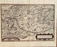
1584687Antwerp: Abraham Ortelius 1584. 19 3/4 x 13 1/2 inches. Very good but for a harpsichord shaped wormhole at the upper centerfold which is relatively of little consequence. This is a handsomely executed map of the Danube River Basin starting on the left at Vienna and passing through Austria Serbia and Romania. Belgrade is prominently displayed near the cartouche. In the lower left is a mileage scale. This is a very nice example of late 16th century mapmakers art. Abraham Ortelius unknown
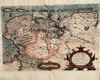
1584674Antwerp: Abraham Ortelius 1584. 20 1/3 2 x 13 1/2 inches. Very good condition. This is Ortelius classic map of the Netherlands up close. It has Groeningen in the upper center. It also has sailing ships and a plethora of small towns. The cartouche is an elaborate production Not only does the map show the Netherlands but also Belgium. It also has a set of island adorning the top of the coast. This is a nice copy of a rarer map that is in good condition with color not applied at the time of publication. Abraham Ortelius unknown
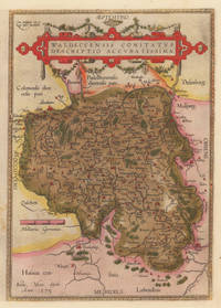
158410309Antwerpen: Platin 1584. In sehr gutem Erhaltungszustand. 31.3 x 223 cm 12.25 x 875 inches. Hand-Colored Original Copperplate Engraving by Abraham Ortelius depicting Waldeccensis Comitatus Descriptio Accuratissima. Published Antwerpen Platin 1584. Sheet: 31.3 x 223 cm 12.25 x 875 inches. A fine and original hand-colored example of Ortelius's celebrated cartographic work documenting this region of Germany with the precision and decorative artistry characteristic of the 15800s. Abraham Ortelius 1527-1598 was a Flemish cartographer and geographer from Antwerp widely regarded as the creator of the first modern atlas. His landmark publication Theatrum Orbis Terrarum 1570 set the standard for atlas-making for the next century presenting uniform copper-engraved maps with scholarly commentary. By Ortelius's death the Theatrum had appeared in 25 editions in seven languages. In 1575 King Philip II of Spain appointed him Royal Geographer. His maps engraved with extraordinary precision are among the most sought-after in antique cartography held in collections including the Plantin-Moretus Museum in Antwerp the Library of Congress and the British Library.This original copperplate engraving with original hand coloring depicts the region of Waldeccensis Comitatus Descriptio Accuratissima published in Antwerpen Platin 1584. The map records the political and geographic boundaries of the region as understood in 1584 offering a fascinating window into the history of German territorial organization. Sheet measures 31.3 x 223 cm 12.25 x 875 inches. Professionally restored; the image area is fully intact and displays well. Retains its original contemporary hand coloring. Ready to frame. Broe. 98 b; Koeman Ort. 21; Platin unknown
158433639Antwerpen 1584. In sehr gutem Zustand. 34.5 x 497 cm 13.5 x 195 inches. Hand-Colored Original Copperplate Engraving by Abraham Ortelius depicting Westphaliae Totius Finitimarumque Regionum Accurata Descriptio. Published Antwerpen 1584. Sheet: 34.5 x 497 cm 13.5 x 195 inches. A fine and original hand-colored example of Ortelius's celebrated cartographic work documenting this region of Germany with the precision and decorative artistry characteristic of the 15800s. Abraham Ortelius 1527-1598 was a Flemish cartographer and geographer from Antwerp widely regarded as the creator of the first modern atlas. His landmark publication Theatrum Orbis Terrarum 1570 set the standard for atlas-making for the next century presenting uniform copper-engraved maps with scholarly commentary. By Ortelius's death the Theatrum had appeared in 25 editions in seven languages. In 1575 King Philip II of Spain appointed him Royal Geographer. His maps engraved with extraordinary precision are among the most sought-after in antique cartography held in collections including the Plantin-Moretus Museum in Antwerp the Library of Congress and the British Library.This original copperplate engraving with original hand coloring depicts the region of Westphaliae Totius Finitimarumque Regionum Accurata Descriptio. published in Antwerpen 1584. The map features a decorative Baroque cartouche containing the title inscription. A distance scale is incorporated within the cartouche or alongside it. The map records the political and geographic boundaries of the region as understood in 1584 offering a fascinating window into the history of German territorial organization. Sheet measures 34.5 x 497 cm 13.5 x 195 inches. In good condition overall with minor signs of age appropriate for a 16th-century engraving. Ready to frame. Koe. Ort 23 / #46 85. Broe. 91. unknown
159533635Antwerpen 1595. In sehr gutem Zustand. Leichte Bräunung im Mittelfalz. 34.5 x 497 cm 13.5 x 195 inches. Hand-Colored Original Copperplate Engraving by Abraham Ortelius depicting Westphaliae Totius Finitimarumque Regionum Accurata Descriptio. Published Antwerpen 1595. Sheet: 34.5 x 497 cm 13.5 x 195 inches. A fine and original hand-colored example of Ortelius's celebrated cartographic work documenting this region of Germany with the precision and decorative artistry characteristic of the 15900s. Abraham Ortelius 1527-1598 was a Flemish cartographer and geographer from Antwerp widely regarded as the creator of the first modern atlas. His landmark publication Theatrum Orbis Terrarum 1570 set the standard for atlas-making for the next century presenting uniform copper-engraved maps with scholarly commentary. By Ortelius's death the Theatrum had appeared in 25 editions in seven languages. In 1575 King Philip II of Spain appointed him Royal Geographer. His maps engraved with extraordinary precision are among the most sought-after in antique cartography held in collections including the Plantin-Moretus Museum in Antwerp the Library of Congress and the British Library.This original copperplate engraving with original hand coloring depicts the region of Westphaliae Totius Finitimarumque Regionum Accurata Descriptio. published in Antwerpen 1595. The map features a decorative Baroque cartouche containing the title inscription. A distance scale is incorporated within the cartouche or alongside it. The map records the political and geographic boundaries of the region as understood in 1595 offering a fascinating window into the history of German territorial organization. Sheet measures 34.5 x 497 cm 13.5 x 195 inches. In good condition overall with minor signs of age appropriate for a 16th-century engraving. Ready to frame. Koe. Ort 23 / #46 85. Broe. 91. unknown
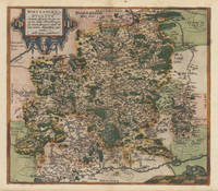
158737336Antwerp: Christopher Platin 1587. A very good example in excellent condition. 387 by 440mm 15 by 17 inches. Hand-Colored Original Copperplate Engraving by Abraham Ortelius depicting Wirtenberg Ducatus Accurata descriptio; tu qua omnia eius Opida Monasteria pagi nemora; fluminia et riuuli alicuius nominis diligentißimé exprimuntur. Auctore Georgio Gadnero. Published Antwerp Christopher Platin 1587. Sheet: 387 by 440mm 15 by 17 inches. A fine and original hand-colored example of Ortelius's celebrated cartographic work documenting this region of Germany with the precision and decorative artistry characteristic of the 15800s. Abraham Ortelius 1527-1598 was a Flemish cartographer and geographer from Antwerp widely regarded as the creator of the first modern atlas. His landmark publication Theatrum Orbis Terrarum 1570 set the standard for atlas-making for the next century presenting uniform copper-engraved maps with scholarly commentary. By Ortelius's death the Theatrum had appeared in 25 editions in seven languages. In 1575 King Philip II of Spain appointed him Royal Geographer. His maps engraved with extraordinary precision are among the most sought-after in antique cartography held in collections including the Plantin-Moretus Museum in Antwerp the Library of Congress and the British Library.This plate presents a original copperplate engraving with original hand coloring depicting the city of Wirtenberg Ducatus Accurata descriptio; tu qua omnia eius Opida Monasteria pagi nemora; fluminia et riuuli alicuius nominis diligentißimé exprimuntur. Auctore Georgio Gadnero. published in Antwerp Christopher Platin 1587. The view is framed with a decorative Baroque cartouche containing the title inscription. Such topographic views from Ortelius's workshop are primary historical documents of German urban history in the 1500s now prized equally by historians map collectors and interior decorators. Sheet measures 387 by 440mm 15 by 17 inches. In good condition overall with minor signs of age appropriate for a 16th-century engraving. Ready to frame. Broe. 113 Christopher Platin unknown
157928112Antwerpen: Platin 1579. Other. In excellent condition. 321 by 243mm 12 by 9 inches. Hand-Colored Original Copperplate Engraving by Abraham Ortelius depicting Württemberg Herzogtum. Published Antwerpen Platin 1579. Sheet: 321 by 243mm 12 by 9 inches. A fine and original hand-colored example of Ortelius's celebrated cartographic work documenting this region of Germany with the precision and decorative artistry characteristic of the 15700s. Abraham Ortelius 1527-1598 was a Flemish cartographer and geographer from Antwerp widely regarded as the creator of the first modern atlas. His landmark publication Theatrum Orbis Terrarum 1570 set the standard for atlas-making for the next century presenting uniform copper-engraved maps with scholarly commentary. By Ortelius's death the Theatrum had appeared in 25 editions in seven languages. In 1575 King Philip II of Spain appointed him Royal Geographer. His maps engraved with extraordinary precision are among the most sought-after in antique cartography held in collections including the Plantin-Moretus Museum in Antwerp the Library of Congress and the British Library.This original copperplate engraving with original hand coloring depicts the region of Württemberg Herzogtum published in Antwerpen Platin 1579. The map features a decorative Baroque cartouche containing the title inscription. The map records the political and geographic boundaries of the region as understood in 1579 offering a fascinating window into the history of German territorial organization. Sheet measures 321 by 243mm 12 by 9 inches. In good condition overall with minor signs of age appropriate for a 16th-century engraving. Ready to frame. Platin unknown
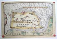
1590M3047Antwerp 1590. Excellent; narrow margins. Notes: This is the modern day island of Hawmat As Suq located about 300 kilometers southwest of Tunis on the South Western edge of the Gulf of Gabes. Size : 105x159 mm 4.125x6.25 Inches Coloring: Original Hand Coloring Category: Maps Africa North; Maps Mediterranean Sea unknown
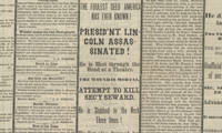
15042913315/04/1865. <blockquote><p>The Assassination:<strong><br /></strong></p></blockquote><p>Abraham Lincoln continues to stand as America’s most beloved President. Of our nation’s historical icons Lincoln is the quintessential embodiment of American possibility in his mythic-like rise from rail-splitter to Chief Executive and Emancipator of the oppressed. The admiration felt by Americans for Lincoln’s humble integrity his performance in office his noble statesmanship and his keen sense of justice is enduring. Lincoln is not given the highest marks just for character but for the transformation of the nation that he left behind which was both profound and long-lasting.</p><p>Polls of historians generally show their belief that Lincoln faced the hardest job of any president. He had to define the issues inspire the people be steadfast in the face of losses win the Civil War free the slaves and lay the groundwork to reunite the nation. All that in the face of determined opposition. He accomplished all this in four years but was assassinated on April 14 1865 and his death left him unable to finish the job a job that quite likely he was the only one with a chance to get completed in a way that would truly bring the nation together.</p><p>The end of the Civil War left the nation with two overwhelming questions: what to do with and do for the millions of freed slaves; and how to reintegrate the South into the Union. On the first point Lincoln was focused on African American access to land economic prosperity and legal rights and had just approved Gen. William T. Sherman’s order distributing parcels of former slave plantations to the slaves themselves. Lincoln wanted black Union veterans to have the right to vote which was a step to ultimately embracing full suffrage for African American males. In what proved to be his final speech three evenings before his death Lincoln had become the first president ever to support black voting. Lincoln’s successor Andrew Johnson was a Southerner uninterested in fair treatment of the liberated slaves. He opposed plans designed to guarantee the civil rights of black Americans and cancelled Sherman’s order granting land to slaves. Johnson accepted the draconian post-Civil War Black Codes which limited the rights and liberties of African-Americans something Lincoln would never have done.</p><p>On the second point the readmission of the Southern states Johnson felt that once Southern states returned their loyalty to the national government they could manage their own affairs. This meant they could pass any Jim Crow laws they liked. He opposed the Republican plan for Reconstruction of the South including provisions designed to guarantee the civil rights of black Americans. The Republican Congress had no rapport with Johnson and the initial four years era of Reconstruction which was a disaster to the nation was essentially a bitter battle between a North and South that remained locked in contention presided over by a weak President Johnson and a Congress at loggerheads with him. Lincoln had enormous power and influence some of which extended into the South. He saw the end of the war as an opportunity to not simply celebrate victory but an opportunity to move the country forward. Johnson had no such feeling. Lincoln would have been much better placed to direct moderate and ease the contentions of Reconstruction.</p><p>John Wilkes Booth was a member of a famous acting family and he enjoyed a phenomenally successful stage career during the Civil War: By 1864 he earned $20000 a year at a time when the average Northern family earned around $300 annually. A Marylander by birth Booth was an open Confederate sympathizer during the war. A supporter of slavery Booth believed that Lincoln was determined to overthrow the Constitution and to destroy his beloved South. After Lincoln’s reelection in November 1864 Booth devised a plan to kidnap the president and spirit him to Richmond where he could be ransomed for some of the Confederate prisoners languishing in northern jails. That winter Booth and his conspirators plotted a pair of elaborate plans to kidnap the president; the first involved capturing Lincoln in his box at Ford’s Theater and lowering the president to the stage with ropes. Booth ultimately gave up acting to focus on these schemes. Neither of the kidnapping plans bore fruit. On the evening of April 11 the President stood on the White House balcony and delivered a speech to a small group gathered on the lawn. Two days earlier Robert E. Lee had surrendered the Army of Northern Virginia at Appomattox Court House and after four long years of struggle it had become clear that the Union cause would shortly emerge from the war victorious. Lincoln’s speech that evening outlined some of his ideas about reconstructing the nation and bringing the defeated Confederate states back into the Union. Lincoln also indicated a wish to extend the franchise to some African-Americans—at the very least those who had fought in the Union ranks during the war - and expressed a desire that the southern states would extend the vote to literate blacks as well. Booth stood in the audience for the speech and this notion seems to have amplified his rage at Lincoln. “That means nigger citizenship†he told Lewis Powell one of his band of conspirators. “Now by God I’ll put him through. That is the last speech he will ever make.â€</p><p>Three days later Booth made good on his promise. Upon learning that Lincoln and his wife intended to see the play “Our American Cousin†at Ford’s Theater Booth used his actor’s connections there to gain access to the President’s box. He shot Lincoln at about 10 pm on April 14 1865 and Lincoln died about after 7 am on the 15th.</p><p>Dr. Charles Leale was in the audience. Leale leapt over theater seats got to the president’s box and announced that he was a doctor. As he entered the President was sitting in a chair with his eyes closed and head slumped. He already looked dead Leale recalled. He felt Lincoln’s right arm for a pulse but couldn’t find one. He and some others eased Lincoln to the floor and Leale began searching for the wound. “I quickly passed the separated fingers of both hands through his blood-matted hair…and I discovered his mortal wound†Leale recalled. “The president had been shot in the back part of the head behind the left ear.†Leale stuck the little finger of his left hand into the hole in Lincoln’s skull. “I then knew it was fatal and told the bystanders†he wrote later. Leale knew he had to get Lincoln out of the theater to treat him. But he believed a carriage ride back to the White House would kill him. He and several other men lifted the president and with Leale holding Lincoln’s head they began to maneuver him outside. Across the street from the theater was the house of William Peterson and Lincoln was taken there. Lincoln was carried to a small back room stripped of his clothes and covered with blankets. His 6-foot-4-inch frame had to be placed diagonally to fit on the bed. Leale ordered the window opened and the wait began. A parade of anguished government officials and family members came and went. The President sank steadily his breathing labored and his pulse nearly undetectable. At 7:22 am on April 15 President Lincoln breathed his last. Leale smoothed the contracted muscles of Lincoln’s features placed two coins over his eyes and pulled a sheet up over his face. Famously Secretary of War Stanton saluted the fallen President and uttered “Now he belongs to the ages.†Stanton further eulogized Lincoln with the apt observation “There lies the most perfect ruler of men the world has ever seen.â€</p><p><strong>Original report</strong> on the assassination printed the very day he died</p><p>The public was hungry for information and the newspapers equally hungry to report the momentous news. One of these was the Binghamton Daily Republican and this is its issue of April 15 1865 with black mourning columns.</p><p>The front page as was routine at the time was taken up by ads. The news then began on page two. There at top left is the headline <em>“The Assassination of President Lincoln! A Nation in Mourning!!!â€</em> It begins <em>“We feel too unfitted by this awful event to allude to the calamity in terms becoming its solemnity and importance! LINCOLN IS DEAD! Struck down by the hands of a brutal assassin in the midst of the triumphs which were commemorating his salvation of the country. A great man indeed has fallen! The foremost man of his time is no more…We dare not contemplate what may follow this sad and inscrutable providence.â€</em> This was followed by a proclamation of the governor of New York. On page three were dispatches from 12:30 AM to noon to 3:00. An early dispatch reports that<em> “the President was shot… and is not expected to liveâ€</em> and told of the events of the assassination then available in detail. It mentioned <em>“The screams of Mrs. Lincoln first disclosed the fact to the audience that the President had been shot.â€</em> Later it reported of Lincoln <em>“At midnight the Cabinet…a few personal friends with Surg. Gen. Barnes and his immediate assistants were beside his bedside…The parting of his family with the dying president is too sad for description.â€</em></p><p>At noon the newspaper had more news and reported <em>“Later concerning the President. He died this morning at 7:20. Two villains engaged in the horrible crime. The murder planned before March 4th.â€</em> At the bottom of the column is a report on the progress of the army of General William T. Sherman saying that in response to Grant’s hope Sherman would pursue the remaining Confederates Sherman said <em>“I think we’ll do it.â€</em> At 3:00 the paper printed the latest from Washington. It contained <em>“Full particulars of the Death of Abraham Lincolnâ€</em> plus <em>“Inauguration of President Johnsonâ€</em> and Johnson’s statement on taking office.</p><p>Original newspapers reporting Lincoln’s assassination have become very scarce this being our first in over a decade. This one is comprehensive and with its black borders and large headlines is evocative of the moment and would be perfect for display.</p><p><img class=""alignnone wp-image-25018 size-post-window"" src=""https://cdn.raabcollection.com/wp-content/uploads/20231204144051/Folder-site-11-1600x1327.jpg"" alt="""" width=""1600"" height=""1327"" /></p> hardcover