ORTELIUS, AbrahamBiblio.com

213 résultats
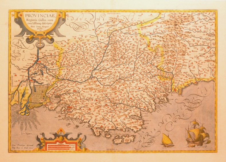
158453174Antwerp. c.1584. Based on Egnatio Dante's 1580 Perugia map engraved by Mario Cartaro. Decorated strapwork cartouche at lower right scale at lower left and compass point at centre right empty cartouche at top left. Published in Ortelius' epic atlas the Theatrum Orbis Terrarum. Copper engraving. A little darkened but clean with good margins. Expert repairs to cracks. caused by verdi gris. Closed tear at lower margin not affecting map.Very good condition. Original colour. Size: 33.4 x 47 cm. van den Broecke 136. unknown
15703399<p>Very Good. 1570. 16th century map with original hand-colored outlines of the region of Poictou. Decorative cartouche. Some foxing most apparent to margins. Otherwise a handsome copy. Please see image. Plate size approximately 19 1/2 x 14 in. Overall size approx. 21 1/4 x 16 3/4 in 537 x 425 mm.; 1 pages; All shipments through USPS insured Priority Mail. .</p>
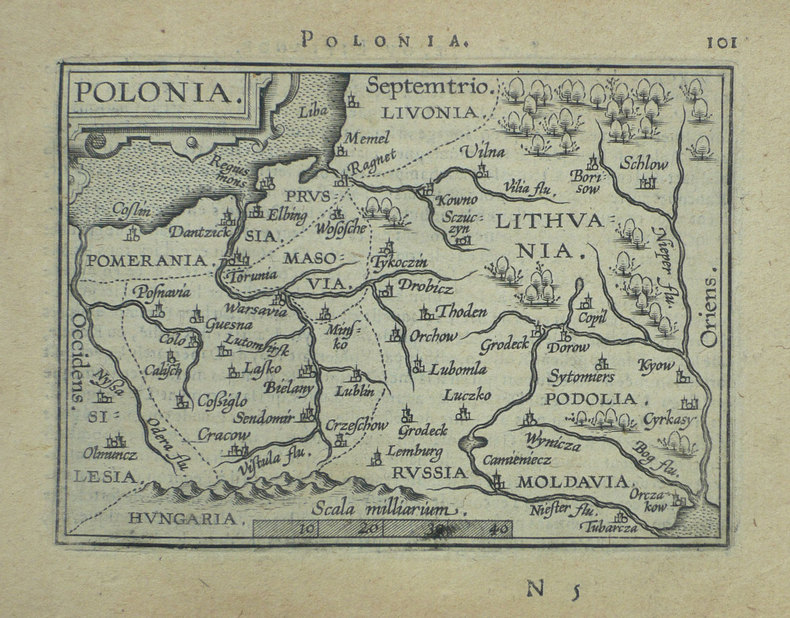
1598LBW-1390Anvers 1598 82 x 108 mm.
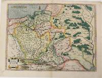
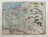
1574M6759Antwerp Belgium: Abraham Ortelius 1527-1598 1574. Very Good;. Notes: Latin text on verso. L58.<br><br>"Waclaw Grodecki his true name was Grodziecki which was latinized as Grodecius corrupt Godreccius was born about 1535. He was the son of a Silesian gentleman to whom belonged the village Grodziec in Cieszyn Silesia hence the family name. He entered Cracow University in 1550 and in 1555 was still there studying mathematics and philosophy. In 1556 he left for Leipzig as tutor to the son of a great noble and there too he entered the university. In 1557 he drew his well-known map of Poland. He travelled to Italy and after his return in 1561 took orders. In 1564 he received the degree of Master of Arts at the Cracow University. He later became canon of the chapter in Wroclaw this post having been ceded on his behalf by his elder brother Jan when he became bishop of Olomouc in 1572. Waclaw Grodecki followed his brother to Moravia in 1566 and settled for good in Brno where later he became dean of the collegiate chapter. Being to the end of his life a devoted Catholic and a protector of the Jesuits he was a major figure of the counter-reformation movement in Moravia. He was a man of humble character and good-natured. He died in Brno in 1591." Buczek<br> <br> Size : 373x498 mm 14.69x19.61 Inches Coloring: Original Hand Coloring Reference: Marcel P. R. van den Broecke #154. Category: Maps Europe Poland Lithuania; Abraham Ortelius (1527-1598) unknown
1598M3122Antwerp c.1598. Very Good. Notes: Scarce map of Poland and Lithuania during the late 16th century. <br>The map shows major cities and towns as well as geographical features. Includes a charming image of a horse-drawn sleigh in the bottom right corner. <br>Dutch text on verso. Size : 369x482 mm 14.53x18.98 Inches Coloring: Hand Colored Category: Maps Europe Poland Lithuania; unknown
1584001117Antwerp: Christopher Plantin 1584. Map. Fine. Framed. Size: 377 x 485 mm. Framed size: 580 x 465mm. Hand-coloured engraved map published in the Theatrum Orbis Terrarum. Wooden moulding frames glazed and mounted late 20th century. In fine condition only a small two spots in a upper part. A beautiful map of Poland and Lithuania part of the Baltic Sea title in cartouche at lower left in Latin scale at top left decorated sleigh with a horse. . Christopher Plantin Hardcover
15739404Antwerp 1573. Three engraved maps on one sheet 38.5 x 50 cm black and white very faintly red-ruled slight marginal soiling Latin text on verso; old tabs on verso where previously mounted. An early example of this particular map which was first printed in Dutch German and Latin editions of Ortelius Theatrum in the same year 1573. Pomerania running along the Baltic coast between Rostock and Gdansk is now divided between Germany and Poland; Livonia covers much of modern Latvia and Estonia; the Duchies of Oswiecim and Zator were two of the Duchies of Silesia in modern Poland. Ortelius's Theatrum Orbis Terrarum is generally considered the first modern atlas of the world originally published in 1570. Ortelius gathered the best available cartographic knowledge and presented it in a consistent style in a single volume with text. The Theatrum was very decorative and hugely popular amongst the wealthy and educated running into over forty editions in Latin and the major European languages. Marcel Van den Broecke Ortelius Atlas Maps no. 158. Map unknown
1590003611Belgico Antwerp: Abraham Ortelius 1590. No Binding. Very Good. Elephant Folio - over 15" - 23" tall. ORTELIUS Abraham. VG 1590 B&W Map of the Black Sea Coast. 50 35.5 the Map 54 44.5 cm map including margins. Latin Text to verso of 1 side p xxvii. No pin holes inscriptions etc very light edge browning. Includes part of Ukraine Russia Georgia Bulgaria Romania and Turkey. Belongs to a series of historical maps known as the Parergon Theatri from 1579 onwards. Tooley's Dictionary of Mapmaker Early World Press 2004 p358-359 Marcel P. R. van den Broecke Ortelius Atlas Maps HES Publishers 2011 p633. <br/> <br/> Abraham Ortelius unknown
1598LBW-1384Anvers 1598 81 x 106 mm.
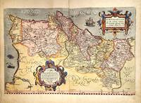
1579M11348Antwerp Belgium 1579. Very Good. Notes: Highly decorative and detailed map of Portugal with two elaborate cartouches. <br>Latin text on verso.<br>Abraham Ortelius April 1527 – June 1598 was a Flemish cartographer geographer and cosmographer from Antwerp in the Spanish Netherlands. He is recognized as the creator of the first modern atlas the Theatrum Orbis Terrarum Theatre of the World. Along with Gemma Frisius and Gerardus Mercator Ortelius is generally considered one of the founders of the Netherlandish school of cartography and geography. He was a notable figure of this school in its golden age approximately 1570s–1670s and an important geographer of Spain during the age of discovery. The publication of his atlas in 1570 is often considered as the official beginning of the Golden Age of Netherlandish cartography. Size : 342x520 mm 13.46x20.47 Inches Coloring: Original Hand Coloring Reference: Van den Broecke #26. Category: Maps Europe Portugal; unknown
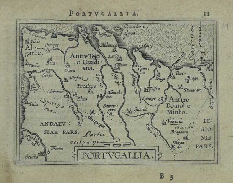
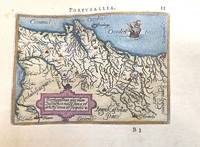
1588M11346Antwerp Belgium c.1588. Very Good. Notes: A miniature map of Portugal.<br>French text on verso. <br>Abraham Ortelius April 1527 – June 1598 was a Flemish cartographer geographer and cosmographer from Antwerp in the Spanish Netherlands. He is recognized as the creator of the first modern atlas the Theatrum Orbis Terrarum Theatre of the World. Along with Gemma Frisius and Gerardus Mercator Ortelius is generally considered one of the founders of the Netherlandish school of cartography and geography. He was a notable figure of this school in its golden age approximately 1570s–1670s and an important geographer of Spain during the age of discovery. The publication of his atlas in 1570 is often considered as the official beginning of the Golden Age of Netherlandish cartography. Size : 78x110 mm 3.07x4.33 Inches Coloring: Hand Colored Category: Maps Europe Portugal; unknown
158728094Antwerp: Ortelius 1587. Maps. Overall in very good condition. A very nice example of Ortelius' famous map of the Kingdom of Prester John with later hand color. It is from a Latin edition of Ortelius' Theatrum Orbis Terrarum the first modern atlas of the world. <br /> <br /> Cartographica Neerlandica Background for Ortelius Map No. 175. The map is difficult to date. The following details correspond to the aforementioned bibliography - it is consistent with 175.2 as the coastline has hatching extended from about 3 to about 6 mm signifying from 1587 & beyond. The ship in the lower left corner has a vessel attached to its mast. In the first state this vessel has vertical hatching. Now this is changed to horizontal hatching. In this copy the frame around the map has curved oval hatching around its oval ornaments. The sea was not re-engraved in later editions and as they are strongly engraved in this copy it would indicate an earlier edition. There is a watermark of two crossed arrows measuring 10 cm in length. The last line of text on the verso reads "uerit vide Jacobum Nauarchum in sua epistola Asiatica & Gerardum Mercatorem in sua universali tabula. 89". <br /> "Ortelius 1579 is penciled on the verso by an unknown person but that is unknown.<br /> <br /> The map centers on "Africva" in a strange configuration which goes from the coast of Benin and the "Mare Aethiopicum" to the Arabian Sea titled "Barbaricus Sinus". Arabia Felix covers the area of Saudi Arabia and adjoining countries with the Red Sea between the Arabian Penninsula and the coast of Africa. Mecca Medina and Jerusalem are noted with large buildings indicating their importance and colored red.<br /> <br /> Prester John was a mythical African King waging a war against the Muslim Infidels from his Kingdom in Central Africa. Add the Byzantine Patriarch Crusaders Islamic Saracens the Portuguese and a fake letter for this For centuries from the receipt of a fake letter from Prester John to the Byzantine Patriarch Europeans searched for Prester John initially in Asia and later in Africa. The Crusaders hoped that Prester John would join with Europeans in the protection of the Holy Lands from the Islamic Saracens and in the protection of all Europe from the Mongols. In the late 1400s and early 1500s the Portugese searched for Prester John in East Africa through they did eventually find a Christian kingdom in Abyssinia. A dedication to King David of the Bible is in the upper left of map. Above the dedication is the coat of arms of Prester John. Elephants and other figures adorn the map. <br /> <br /> Copper engraving with period hand color 17.5 x 15" with wide margins. Text in Latin on the verso. Two small wormholes in the top margin. Ortelius unknown
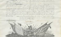
15073254115/07/1864. <blockquote><p>A real rarity the first Lincoln appointment to the Signal Corps for an officer active in Sherman’s Georgia Campaign we have seen</p></blockquote><p>On March 29 1860 the United States House of Representatives approved the Army appropriations bill for fiscal year 1861 which included the following amendment: ""For the manufacture or purchase of apparatus and equipment for field signals $2000; and that there be added to the staff of the Army one signal officer with the rank pay and allowance of a major of cavalry who shall have charge under the direction of the Secretary of War of all signal duty and all books papers and apparatus connected therewith."" The United States Senate eventually approved the appropriations bill over the objections of Jefferson Davis now Senator from Mississippi and President James Buchanan signed it into law on June 21 1860 the date now celebrated as the birthday of the modern U.S. Army Signal Corps.</p><p>Now armies on the go could report back to their civilian leadership in real time and those leaders could make decisions without waiting for a messenger on horse. This changed the face of warfare. President Lincoln himself spent significant time in the telegraph office sending and receiving war correspondence. He often walked alone from the White House to the office and chatted with the operators. As Bates later wrote “During the Civil War the President spent more of his waking hours in the War Department telegraph office than in any other place except the White House. While in the Telegraph Office he was comparatively free from official cares and therefore more apt to disclose his natural traits and disposition than elsewhere under other conditions.â€</p><p>John Quincy Adams first enlisted in 1862 with the 38th Ohio Volunteers. On October 15 of that year he was a quartermaster sergeant with the 10th Ohio Cavalry. After a stint as acting lieutenant on July 15 1864 he was appointed by the President Second Lieutenant to date from March 3 1863. Adams was actively involved in the Georgia campaign conducted by Gen. William T. Sherman. He was with left wing of the 16th Army Corps on the march to Chattanooga Tenn. In the Atlanta Campaign he participated in the battles of Resaca Dallas Kenesaw Mountain. and Jonesboro. He manned signal corps stations at Kenesaw Mt. and Allatoona.</p><p>Adams was in the engagements at Port McAllister and Rice Mill station in the campaign from Savannah through the Carolinas including battles at Columbia Bentonville and Raleigh; and at the surrender of Confederate Gen. Joseph E. Johnston to Sherman on April 26 1865. Adams was breveted 1st lieutenant for gallant and meritorious service in the Signal Corps at the battle of Allatoona; he was breveted captain for gallant and meritorious services in the Signal Corps at the capture of Fort McAllister and Savannah and throughout the war. Adams was mustered out August 22 1865. After the war he was in the 1st U. S. Cavalry and was in the Indian wars and finished his career as captain and aide to Gen. O.O. Howard in October 1884. He is listed on the roster of the U.S. Signal Corps in the Civil War.</p><p>Adams is also a protagonist in one of the most famous telegraph exchanges of the war during the battle near Allatoona. During this battle legend goes that Sherman signaled to General Corse and his men to ""hold the fort"" a phrase that inspired the later popular religious hymn entitled Hold the Fort by Chicago evangelist Philip P. Bliss which featured the chorus 'Hold the fort for I am coming’ which then became a common expression. We still use ""hold down the fort"" today. Adams was the signal officer who received that message or rather a variant as Sherman did not use that exact phrase though captured the sentiment.</p><p>This is President Lincoln’s appointment of Adams as Second Lieutenant. <strong>Document signed</strong> Washington July 15 1864 naming Adams <em>""Second Lieutenant in the Signal Corps""</em> dating from the third of March 1863.</p><p>This document is a real rarity as we have never before seen a Lincoln appointment to the Signal Corps for an officer active in Sherman’s March to the Sea. Moreover Lincoln Signal Corps appointments are themselves uncommon this being our first.</p><p>It was acquired from the Adams descendants and has never been offered for sale before.</p><p><img class=""alignnone wp-image-25018 size-post-window"" src=""https://cdn.raabcollection.com/wp-content/uploads/20231204144051/Folder-site-11-1600x1327.jpg"" alt="""" width=""1600"" height=""1327"" /></p> unknown
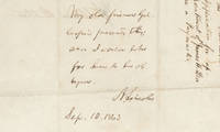
15093547615/09/1863. <blockquote><p>The letter itself was from Lamb a pallbearer after Lincoln's assassination</p></blockquote><p>Joseph Gillespie was a Whig member of the Illinois Assembly in 1840-41 and then served in the State Senate from 1847 to 1859. He joined the Republicans in 1856. Gillespie chaired the Illinois Republican State Convention in 1860 where presidential electors were selected who would vote for Abraham Lincoln and served as circuit court judge in Southern Illinois from 1861 to 1873.</p><p>From when they met in 1840 Gillespie was a key political ally lawyer and trusted and intimate friend to Abraham Lincoln. They consulted on legal cases and in political matters where they kept each other informed of political developments. Gillespie visited President-elect Lincoln at Springfield before he left for Washington. When Lincoln was president Gillespie occasionally went to Washington to see him and kept him informed about the political situation in the western states. Their correspondence shows a close personal bond.</p><p>James L. Lamb was a meatpacker industrialist and friend of Lincoln from Illinois known for his business dealings with the future President and his role as one of the pallbearers at Lincoln's funeral. In a letter addressed to President Lincoln Lamb wrote him from Springfield Ill. September 10 1863 to secure a position for a relative. “My friend and relative Mr. James H. Lea is an applicant for the position of paymaster in the army. His appointment I am sure would meet the approbation of all true friends of the Government who are acquainted with him. I have long known him as a reliable competent businessman and one whose integrity could be fully relied upon. His moral character is without blemish and the most satisfactory assurances can be given of his integrity and fitness for the position.†The docket states “Springfield Sep. 10/63 James L. Lamb to the President. Application for appointment of James H. Lea as a Paymaster.â€</p><p>This letter was not mailed by Lamb to Lincoln. Instead Lamb gave the letter to Gillespie to enlist his support and use his influence with Lincoln. Gillespie presented Lamb’s letter to Lincoln with his request that it be honored.</p><p><strong>Autograph endorsement signed</strong> Washington September 15 1863. <em>“My old friend Gillespie presents this; and I would like for him to be obliged.†</em>This is unpublished and not in Basler’s Collected Works of Abraham Lincoln. The wording of Lincoln’s endorsement saying that Gillespie presented this to Lincoln and the implication that Gillespie will need to be presenting this to the Secretary of War raises the possibility that Gillespie handed this to Lincoln in person and then took the endorsement to Stanton.</p><p>On October 10 Gillespie wrote Lincoln that the appointment had not yet been made and relating a communication with Stanton saying<em> “I would beg to call your attention to the subject of the appointment of my friend James H. Lea of Alton to the office of paymaster in the regular army. Secy. Stanton told me that he would retire one now on the list to make place for Mr Lea in a short time. I have heard nothing from him since. I would take it as a great favor if this thing could be done soon. I am aware how much you must be pressed with business of an engrossing character at this juncture but hope you may find leisure to jog the secretary’s memory.â€</em></p><p>According to papers in the Library of Congress James H. Lea was appointed an additional paymaster of volunteers to rank from February 23 1864. He signed his oath of office in April.</p><p>This is a fascinating endorsement showing how Lincoln sought to assist his old friends to the extent he appropriately could.</p><p><img class=""alignnone wp-image-25018 size-post-window"" src=""https://cdn.raabcollection.com/wp-content/uploads/20231204144051/Folder-site-11-1600x1327.jpg"" alt="""" width=""1600"" height=""1327"" /></p> unknown
15950044301595 [Anvers], Ortelius, 1594. Carte (557 X 405 mm, marges comprises) sous cadre en bois noirci moderne.
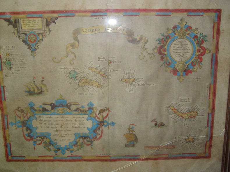
1584224251584 Orig. copper-engraving. Published by A. Ortelius after to L. Teixeira's map of the Açores. Dated 1584. Coloured. With title in decorative border, 3 ornamental cartouches, 2 ships, sea-monster and "Scala Leucarum". 32,5:46,5 cm (12 3/4 x 18 1/4 inch.) 2,5 x 46,5 cm Van der Krogt, Koeman's Atlantes Neerlandici, Vol. III B, 6350:31; Van den Broecke, Ortelius Atlas Maps, Nr. 24. - Stammt aus einer von fünf lateinischen Ausgaben, die in den Jahren 1595 - 1612 erschienen. Alle tragen das Datum 1584 in der großen Kartusche.A splendid sea chart of the Azores with three scrollwork cartouches; the ocean is decorated with sailing vessels. A fresh example of this scarce sea chart, based on Teixeira's single sheet map of Terceira from 1582, and a later manuscript atlas of the Azores islands. The Azores played a significant role in international sea trade as a victualling stop and shelter for ships sailing into the South Atlantic. In very good condition. The map was first issued in an edition of 100 examples in the Additamentum to the 1583 edition of Ortelius' Theatrum Orbis Terrarum, which is widely referred to as the first modern atlas and a landmark in the history of Western map making. Beginning in 1570, Abraham Ortelius and his successors published (and continuously added to) this monumental work for a period of over 40 years (not including the very rare edition of 1641), with text on the verso in Latin, Italian, German, Dutch, French, Spanish and English.References: Van Den Broecke 24. Meurs p 253-254.
1592200015AG1592. Antwerp Ortelius c.1592. Original hand-coloured engraving. Plate Size: 49.6 cm x 37.6 cm. Sheet Size: 57.8 cm x 45.6 cm. Original map. Very good condition. Clean and crisp impression. Some slight creases along edges. Very minor barely visible tears to lower edges. Hernando Abb. S. 139; Imagens 11; Broecke 25.3; Koeman III 6000:31/b. - 3. Zustand from 4 with "Estrecho de Gibraltar". Border with longitudinal and latitudinal information. A beautifully detailed map of the Kingdom of Spain with the smaller provincial and historical kingdoms - Galitia Asturias Biscaia Navarra Aragonia Catalonia Castilia Nova and Vetus Valencia Murcia Granada and Andaluzia - also delineated as is Portugal. The Balearic Islands are also included. In the top right corner the French cities of Montpellier and Marseille can be seen. The Barbary Coast of North Africa lies to the lower section of the map. Relief shown pictorially with rivers mountains and significant towns and cities depicted. Lower right corner bears Ortelius characteristic strapwork design ornaments the title cartouche. Scale topped with a large pair of dividers in the lower left corner. Two naval ships pictured highlight the maritime importance of the peninsula. Giant mythical sea creatures guard the straits at Gibraltar and at the Balearic Islands. Abraham Ortelius was a Flemish cartographer and geographer conventionally recognized as the creator of the first modern atlas the 'Theatrum Orbis Terrarum' Theatre of the World. He was one of the most notable figures of the Dutch school of cartography during its golden age approximately 1570s-1670s. unknown
1570214216Antwerp: Ortelius Abraham 1570. unbound. very good. Map. Uncolored engraving. Image measures 14 3/8" x 19.75".<br/><br/> Beautiful map of southern Italy. Latin text on verso. Published in "Theatrum Orbis Terrarum". Minor scattered staining particularly in margins. Full original margins.<br/><br/> Ortelius, Abraham unknown books
157432793Antwerp: Platin 1574. Other. In excellent condition.which was then in theHabsburg Netherlandsmodern-day Belgium. 340 by 260mm 13½ by 10¼ inches. Original antique copper engraving hand colored in outline and wash when published. Latin text edition. "Tirolis Comitatus" a fine engraved map depicting of the county of Tirol after Wolfgang Lazius published in a 1574 Latin text edition of the "Theatrum Orbis Terrarum" by Abraham Ortelius. Abraham Ortelius published this map between 1573 until 1612 in various editions of his atlas "Theatrum Orbis Terrarum". From this 1574 Latin text edition only 175 copies were published! A fine a decorative 16th century map of Tirol. With many engraved details as some place names rivers mountains lakes small villages and cities. Place names are still engraved as miniature views. At the bottom the "privilegium" and a dedication to Wolfgang Lazius. Ortelius was born on 14 April 1527 in the city of Antwerp which was then in the Habsburg Netherlands modern-day Belgium. The Orthellius family were originally from Augsburg a Free imperial city of the Holy Roman Empire. In 1535 the family had fallen under suspicion of Protestantism. Following the death of Ortelius's father his uncle Jacobus van Meteren returned from religious exile in England to take care of Ortelius. Abraham remained close to his cousin Emanuel van Meteren who would later moved to London. In 1575 he was appointed geographer to the king of Spain Philip II on the recommendation of Arias Montanus who vouched for his orthodoxy. He travelled extensively in Europe and is specifically known to have traveled throughout the Seventeen Provinces; in southern western northern and eastern Germany e.g. 1560 15751576; France 15591560; England and Ireland 1576; and Italy 1578 and perhaps twice or thrice between 1550 and 1558. Beginning as a map-engraver in 1547 he entered the Antwerp Guild of Saint Luke as an illuminator of maps. He supplemented his income trading in books prints and maps and his journeys included yearly visits to the Frankfurt book and print fair where he met Gerardus Mercator in 1554. In 1560 however when travelling with Mercator to Trier Lorraine and Poitiers he seems to have been attracted largely by Mercator's influence towards the career of a scientific geographer. Wikipedia Bibliography: Broe. 116a K/M:62a K:1/89 Platin unknown
15849713<p>Original hand-colored engraving from Abraham Ortelius's <em>Theatrum Orbis Terrarum - Parergon - Nomenclator Ptolemaicus. </em>Features Latin text to verso see image and a large attractive cartouche. The map includes firing vessels a sea monster as well as birds & insects sitting on the cartouche. The image measures approximately 19.5 x 14.25 in 49.5 x 36 cm; page measures 21 x 17.25 in 53.5 x 44 cm.</p> Christoph Plantin Press
1598LBW-1431[Anvers, 1598]. 80 x 106 mm.
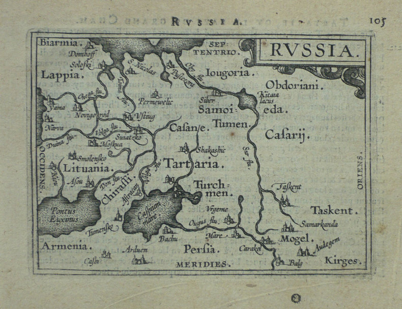
1574M10843Antwerp Belgium c.1574. Very Good. Notes: Latin text on verso. L.61<br>Decorative map of Russia by Abraham Ortelius. Size : 352x448 mm 13.86x17.64 Inches Coloring: Original Hand Coloring Reference: Marcel P. R. van den Broecke #162. Category: Maps Russia; unknown
15842101091584. Auf Bütten mit Wasserzeichen "Zwei gekreuzte Pfeile". 35 x 19,7 cm (Plattengröße) 43,5 x 26 cm (Papier).
15842100981584. Auf Bütten mit Wasserzeichen "Wappen". 35 x 19,7 cm (Plattengröße) 43,5 x 26 cm (Papier).
159552816Theatrum Orbis Terrarum. 1595. Ortelius based the map on the map and plan by Marcus Secsnagel 1551. Braun and Hogenberg also used Secsnagel work. The poem at the top left commemorates him. The map has been drawn as if stretched over a frame with the edges pinned down the lower edges have rolled free to reveal the town plan at lower right Copper engraving. Fine condition good margins top edge very slightly worn Later colouring. Size: 43 x 34 cm. 17 x 13½ inches van den Broecke 107 unknown