CHATELAIN (Henry Abraham).Livre Rare Book
399 résultats
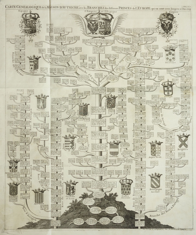
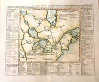
1720LBW-2021Amsterdam, circa 1720. 369 x 428 mm.
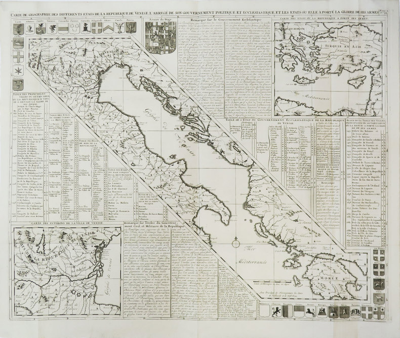
1720LBW-2046Amsterdam, circa 1720. 615 x 508 mm.
1708LBW-3452[Amsterdam, 1708]. 497 x 612 mm.
17898547Jaeger, Johann Wilhelm Abraham 59,7 x 50 Francfort Sur Le Mein 1789 Carte topographique en noir de la fin du XVIIIe siècle, entoilée et dépliante, composée de 8 sections (14,5 x 25,5). Echelle de deux lieux d'Allemagne. Originaire de Bavière, Jaeger a été un des grands cartographes et marchands de carte allemands au XVIIIe siècle. On lui doit le Grand atlas d'Allemagne en LXXXI feuilles, dédié a sa majesté Joseph II, empereur des Romains. Exemplaire en très bon état. PHOTOS NUMERIQUES DISPONIBLES PAR EMAIL SUR SIMPLE DEMANDE-DIGITAL PHOTOGRAPS MAY BE AVAILABLE ON REQUEST
17898547Jaeger, Johann Wilhelm Abraham 59,7 x 50 Francfort Sur Le Mein 1789 Carte topographique en noir de la fin du XVIIIe siècle, entoilée et dépliante, composée de 8 sections (14,5 x 25,5). Echelle de deux lieux d'Allemagne. Originaire de Bavière, Jaeger a été un des grands cartographes et marchands de carte allemands au XVIIIe siècle. On lui doit le Grand atlas d'Allemagne en LXXXI feuilles, dédié a sa majesté Joseph II, empereur des Romains. Exemplaire en très bon état. PHOTOS NUMERIQUES DISPONIBLES PAR EMAIL SUR SIMPLE DEMANDE-DIGITAL PHOTOGRAPS MAY BE AVAILABLE ON REQUEST
1789234401789 Numerierung oben rechts: "Feuille XLIX."Ursprungswerk: "Grand atlas d'Allemagne en LXXXI feuilles" von J. W. A. Jaeger (Frankfurt a.M., 1789)Feuille XLVIIII nouvellement corrigée, Neu verbessertes XLVIIII. Blatt,coloriée,en 15 segments sur toile..
1789234491789 A Francfort sur le Mein : se vend chez l'auteur, [1789] Collection:Germania universa XII, Falz 68; Grand atlas d'Allemagne en LXXXI feuilles, feuille 68,45 x 63 cm.fait par I. W. Iaeger ; gravé par I. G. Facius,coloriée,en 15 segments sur toile..
1789234501789 A Francfort sur le Mein : se vend chez l'auteur, [1789],Germania universa XII, Falz 66; Grand atlas d'Allemagne en LXXXI feuilles, feuille 66,1 Karte : Kupferdruck ; 45 x 63 cm,coloriée,en 15 segments sur toile...
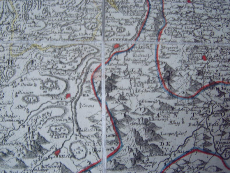
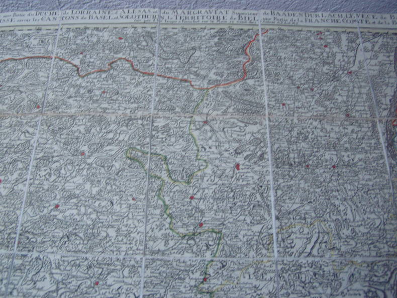
1789234511789 A Francfort sur le Mein : se vend chez l'auteur, [1789] Germania universa XII, Falz 57; Grand atlas d'Allemagne en LXXXI feuilles, feuille 57 Carte topographique d'Allemagne contenat le Margraviat de l'Alsace, une Partie du Duché de Lorraine, et le Principauté d'AlsaceAlsace / Elsaß / Lothringen / Lorraine / Karte / Carte.45 x 63 cm,coloriée,en 15 segments sur toile..
1789234541789 A Francfort sur le Mein : se vend chez l'auteur, [1789] Germania universa XII, Falz 60; Grand atlas d'Allemagne en LXXXI feuilles, feuille 60,coloriée,1 Karte : Kupferdruck ; 45 x 62 cm,en 15 segments sur toile.Bon état
1789234551789 A Francfort sur le Mein : se vend chez l'auteur, [1789] Collection:Germania universa XII, Falz 69; Grand atlas d'Allemagne en LXXXI feuilles, feuille 69 ,"Feuille LXIX."47x65 cm, en 15 segments sur toile,coloriée.Bon état
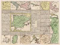
171357660hand-coloured copper engraving. Fascinating map from the 'Atlas historique….' Second State plate no. 34; originally one then extended to 7 volumes over the span of several years - The colonial power SPAIN is shown in the centre surrounded by small depictions of all its territorial possessions throughout the world including the Philippines supported by a geographical and historical text for each map. Philipines is mis-spelled with one 'p'. Reference: UNRECORDED - not in Quirino; Koeman Cha1 published in Amsterdam.
170578313Amsterdam 1705-39. Folio. Arkets størrelse : 265 cm X 45 cm. Med gammel kolorering. Folio. Size of sheet : 265 cm X 45 cm. Old colouring. . <br/><br/><em>Henri Abraham Châtelain 1684-1743. Fra hans verk “Atlas historique†som utkom i syv bind. Et av de største nederlandske oversiktsverker fra denne tiden. Fra bind 4 av dette verket. From his work “Atlas historique†published in seven volumes. One of the largest encyclopediac works published in the Netherlands in the 18th century. This print is from volume 4. </em> unknown
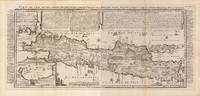
172032296Amsterdam: Henri Abraham Chatelain 1720. Other. In two sheets. In excellent condition. Lightstained outside of the image of the map see illustration. 380 by 880mm 15 by 34¾ inches. A beautiful example of Henri Chatelain's important 1720 map of Java. The map was produced for Chatelains 7 volume world atlas out of Amsterdam. Covers the island in full as well as adjacent parts of Sumatra and Bali. The volcanic island of Krakatau here identified as Cracatao which nearly 150 years later would erupt with devastating consequences appears in the Strait of Sunda between Java and Sumatra. In the lower left side is an inset details the city and port of Batavia. Henri Abraham Chatelain 1684 - 1743 was a Huguenot pastor of Parisian origins. He lived consecutively in Paris St. Martins London c. 1710 The Hague c. 1721 and Amsterdam c. 1728. He is best known as a Dutch cartographer and more specifically for his cartographic contribution in the seminal seven volume Atlas Historique published in Amsterdam between 1705 and 1720. Innovative for its time the Atlas Historique combined fine engraving and artwork with scholarly studies of geography history ethnology heraldry and cosmography. Some scholarship suggests that the Atlas Historique was not exclusively compiled by Henri Chatelain as is commonly believed but rather was a family enterprise involving Henri his father Zacharie and his brother also Zacharie. Koeman Cornelis Atlantes Neerlandici. Bibliography of Terrestrial Maritime and Celestial Atlases and Pilot Books Published in the Netherlands up to 1880 ch 6 9. Suarez T. Early Mapping of Southeast Asia page 232. Henri Abraham Chatelain unknown
171561975copper engraving wide margin with vertical folds as issued verso: blank. Fascinating sheet from the 'Atlas historique….' plate no. 39. Sheet shows a map of North and South America amidst a text overview of the governance structure of the Spanish overseas territories and vignettes of meetings of their governing bodies. published in Amsterdam.
17182585<p>Very Good. 1718. First Edition. Pr. Large engraving featuring royal lineage of Scandinavia as well as two finely illustrated maps: "Nouvelle Carte du Royaume de Suede" & "Carte du Royaume de Gothie". Period hand-coloring. 17 in x 40.5 in. ; 17''x 40.5''; All shipments through USPS insured Priority Mail. .</p>
179912534Paris: Du Pont 1799. Three engraved maps 465 by 420 mm 550 by 340 mm and 530 by 350 mm respectively with fine contemporary hand-colour in full old folds. These maps from the library of the Rochambeau family were published in the first edition of Rochefoucauld-Liancourt's travels in the United States 'Voyage Dans les États-Unis D'Amérique Fait en 1795 1796 et 1797 " Paris 1799 annotated in an early 19th-century hand after Abraham Bradley Junior's 1796 map 'A Map of the United States. Exhibiting Post Roads & Distances'. They are reduced copies of the 1796 first edition of Bradley's map and are therefore the first French edition of these maps. The Comte de Rochambeau 1725-1807 was a battle-hardened French general chosen by King Louis XVI in 1780 to command the expeditionary corps in the United States under the orders of General George Washington. Their combined success at the Siege of Yorktown on the 19th of October 1781 ended the Revolutionary War and secured American independence. 1."Carte générale des États-Unis de l'Amérique Septentrionale divisée en ses 17 provinces" annotated in an early 19th-century hand numbering each of 16 states giving the location of Native American tribes providing a key showing the major post roads from Main to South Carolina all after Abraham Bradley's map of 1796 acknowledged by the inscriber who has replaced the imprint with "par Abraham Bradley Jun.r" This map of the East Coast extends from Quebec south to include part of East and West Florida; the western boundary of Georgia extends to the Mississippi River; a strip of land extending westward between Georgia and Tennessee is designated "United States Territory" having been ceded back to the United States in 1787 from South Carolina; another strip between Georgia and West Florida is "Land claimed by the united states" referring to the ongoing dispute between the United States and Spain; all the land to the west which would become the Louisiana Purchase is "Spanish Territory Louisiana." English captions and French title. Manuscript ink annotations in French indicating the names of the 17 states and the position of the Indian tribes. Ink manuscript inscription to verso "IK 403" shelfmark of Rochambeau family library and as "Etats-Unis en 17 provinces." 2. The "Carte des États-Unis Provinces méridionales" shows Kentucky Virginia Tennessee North and South Carolina Georgia a strip of land between Tennessee and Georgia as "United States Territory" and to the south of Georgia "Land claimed by the united states". 3. The "Carte des États-Unis provinces Septentrionales" shows the states from Main sic to Maryland and Delaware. François Alexandre Frédéric duc de La Rochefoucauld-Liancourt 1747-1827 was a French writer and courtier. A social and scientific reformer he was elected to the Estates-General and pushed for changes to the absolute monarchy of France. Rochefoucauld-Liancourt was the first to warn Louis XVI of the fall of the Bastille; when the king called it a revolt Rochefoucauld Liancourt replied "No sire it is a revolution". Despite being sympathetic to the original aims of the Revolution and serving as the first president of the Constituent Assembly he opposed republicanism and secretly tried to arrange for the escape of the king. Following the storming of the royal palace in August 1792 and the beginning of the September Massacres later that same year precipitated his flight from France and he went into self-imposed exile in America. From London in September 1794 Angelica Schuyler Church wrote to her brother-in-law Alexander Hamilton with a glowing introduction. Liancourt made his was to Philadelphia in November and travelled extensively from "le Haute-Canada" above Lake Ontario to Charleston South Carolina taking notes on everything from the economy to slavery to agriculture. After returning to France in 1799 when Napoleon took power he published his analysis as an eight-volume work in which these maps were published. Related Letters and Historic Background Angelica Church to Alexander Hamilton September 19 1794: "My dear Brother I have very particular and very good motives to ask your kindness for the Duke de Liancourt. he loved Liberty with good sence and moderation; and he meant so well towards his country as to introduce into France a better system of Agriculture and to soften the situation of the Lower class of people there: Virtue has not found its reward for in the many scenes of distress that has afflicted his unfortunate country he like many more good men has been obliged to leave his possessions and seek an Asylum in this country. He goes to America and goes there without a friend unless my dear Brother who is always so good will extend to Monsieur de Liancourt his ease. besides many good Qualities this gentleman is the friend of the Marquis de La Fayette. Angelica Church." On April 10 1795 Liancourt wrote to Hamilton in a letter docketed by the recipient and then later by his widow Elizabeth Schuyler Hamilton. Rough translation from French: "You have allowed me to count on your interest Monsieur and this without complaint a hope for which I am flattered. I am herewith asking you to prove it which I hope will be one for you interest since it seems to me not being a stranger to you. I am at the point of leaving for a voyage that will take me as far as Canada. I will enter the United States through the province of Maine from there for another voyage in the east There are introduction letters to principle places that I am due to visit that I would be more pleased to get from you rather than anyone else. If you agree as I think you will to give them to me would you please send them to General Knox in the province of Maine where I will be until the end of July. I flatter myself that you will excuse my importunity!." Although France and the United States had been allies since 1778 political developments in both countries damaged the relationship. The French Revolution was viewed by Federalists like Alexander Hamilton as a dangerous precedent; and the ensuing wars between Britain and France placed the neutral United States in a precarious position. Relations deteriorated further on the signing of Jay's Treaty 1794 with Great Britain. France ordered the seizure of American ships carrying British goods and in 1796 the French refused to admit American diplomats. This impasse led to the XYZ Affair which provoked Congress in turn to suspend commercial relations with France and to authorize American warships to seize armed French vessels. This undeclared naval war lasted for three years with the United States capturing about eighty-five French vessels Du Pont, unknown
1719014625Paris 1719. Map measures 46x40.cm. Map in very good clean condition. . Very Good. unknown
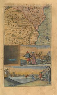
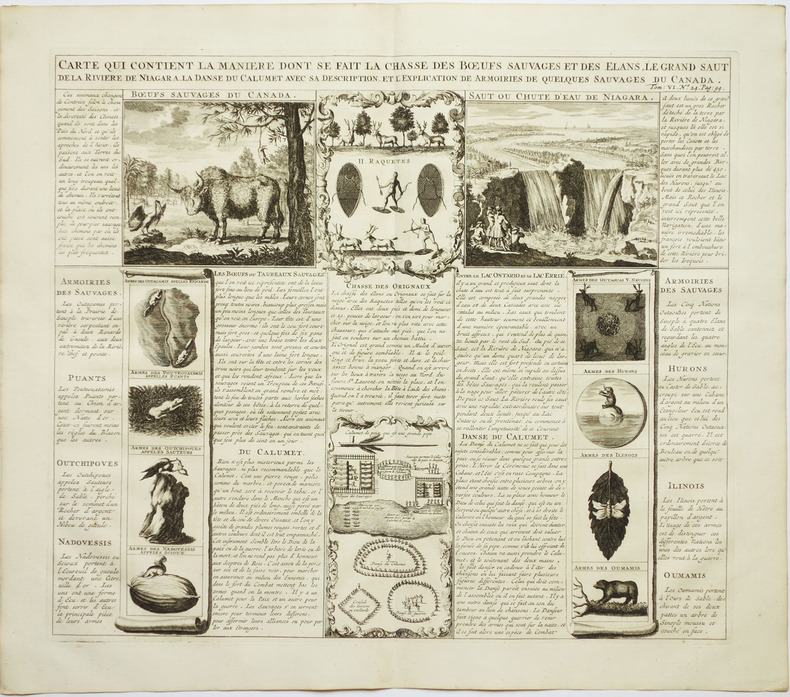
1719M1126Paris c.1719. Very Good;. Notes: From Chatelain's Atlas Historique.<br>This map is based on the 1703 map by Lahontan. The map covers the area of South Hudson Bay and concentrates on the Great Lakes. The St. Laurent is shown running into the Great Lakes from present day Lake Winnipeg. Georgian Bay is named "Baye de Toronto". English French Iroquois treaty is shown and many early settlements forts trading posts missions friendly and hostile Indian Villages are clearly marked. This is a highly significant and informative fur trade map. Surrounding the map are a number of descriptive panels contained lists of the birds fish plants and insects of Canada. Also the Indian tribes of the different regions together with a list of various trade goods including whiskey which were popular among the Indians. Size : 368x458 mm 14.49x18.03 Inches Coloring: Hand Colored Reference: Koeman II: Cha 7; Sellers and Van Ee 2; Kershaw II: 307. Category: Maps Canada; Maps North America Great Lakes; unknown
171925722Amsterdam 1719. Engraving with 8 maps on one sheet. An attractive combination of text and illustration and an important record of the French perception of British holdings in the Americas. This charming plate is typical of the work that makes Chatelain's atlas one of the great works of its era.<br/> <br/>The engraved sheet here combines informative text mostly about Jamaica with small-scale but accurate maps of eight different locations: Barbadoes; New England New York; Bermuda; Jamaica; the Caribbean; the Carolinas with Virginia and Maryland; Maryland Pennsylvania and New England; south east Canada with a part of New England. This charming grouping is characteristic of the marvelous engraving work which distinguishes the Atlas Historique with maps by Chatelain and text by Nicholas Gueudeville.<br/> <br/>JCB 'Archive of Early American Images' record number 12376-2; cf. van Waning "Chatelain's Atlas Historique" in Journal of the International Map Collectors' Society Spring 2010. unknown books
171962639/62640<p>original outline-colour copper engravings enhanced hand-colour. EXTREMELY RARE stunning World map in 2 sheets from the extensive multi-volume 'Atlas Historique' vol. 6 no. 30 p. 117; published by Chatelain Amsterdam. One of the most informative decorative and impressive maps centered on the Pacific available. Printed on four large sheets the overall map is of wall-chart proportions and a veritable pictorial encyclopaedia of the World including the Philippines; many famous voyagers' tracks/routes are indicated. A great example of early 18th Century craftsmanship! Condition: 1st sheet - folds as issued small tear on lower centrefold; 2nd sheet - folds as issued; due to imperfect printing the neatlines are not perfectly parallel neither horizontally nor vertically. Otherwise Excellent condition. References: Not in Quirino; Phillips 579; Goss Kartenkunst Taf. 7.5; Ders. North America map 52; Portinaro/Knirsch p. 216/7 all 3 with crude but col. image.; Tooley California No. 80; Tooley Early Maps of Australia No. 66; Wagner NW Coast America Nr. 511; Lowery No. 291 only Northern part; Lietz Insulae India Orientalis p. 132<br /><br /><br /><br /></p> Chatelain, Amsterdam.
17091Vienna: Christoph Lercher 1709. First edition. Fair. Johann Christoph Weigel. The date of publication is revealed from the chronosticon given on the title page completed here with bracketed letters. Johann Ulrich Megerle July 2 1644 December 1 1709 is also known as Gautentius Hilarion Hilarius von Freudberg Theophilus Mariophilus. First edition emblem book 20.5 cm x 16cm quarto; engraved allegorical frontispiece; title-page in black and red letter; vi; 404; iv 101 leaves of full-page engravings. Johann Christoph Weigel / Kupfferstechern in Nürnberg caption legends engraved or hand-written under each image. Errors of pagination: p. 188 is missing the page number; p. 192 reads as 912; p. 307 reads as 407; p. 318 reads as 218; p. 320 reads as 230; p. 374 reads as 274; p. 376 reads as 176; p. 378 reads as 278; p. 403 reads as 401.This copy is bound in contemporary quarter vellum on light-gray marbled paper boards with a hand-lettered spine. The title-page has been repaired and reinforced with heavier paper as are some of the introductory pages and plates. Plate No. 48 is printed on very heavy paper with a handwritten legend. The other plates have engraved legends. The edges of the first nine pages have been expertly reinforced. Apart from a crack in the uppermost front hinge this binding is in fair condition. Inside the back cover is a triangular stamp reading in part ZUR AUSFUR FREIGEGEBEN. Pencil annotations inside the front cover are a title index of the emblem plates and the calculus of the chronosticon.Extremely rare complete. Old repairs noted this is a good bright tight copy. Not in Praz or Landwehr. See Gerhard Dünnhaupt F5.1.; Bertsch 52a 1; Goedeke III 240 26. See also William Sallochs Catalog 365 Sept. 1980: 100 fools with their occupations preoccupations and vanities described and illustrated by Weigel. An old booksellers catalog entry pasted down on the verso of the initial blank states: In 150 Exemplaren gedruckt als Festgabe für die Gesellschaft der Bibliophilen. The last plate is blank intentionally to provoke the reader. Christoph Lercher hardcover books
1757478841757/58. Disp. morborum 3/ 82. - Hrsg. v. Albrecht v. Haller. - Lausanne Marc Michael Bousquet & Socior 1757/58 4° 2 pp.225-234 Rückenbroschur. Abraham Vater 1684-1751 Sohn von Christian Vater 1651-1732 "geb. 9. Dec. 1684 zu Wittenberg studirte von 1702 ab daselbst erwarb 1706 die philos. 1710 auch die med. Doctorwürde nach längerem Studium in Leipzig. Er unternahm hierauf durch Deutschland England und Holland eine wissenschaftliche Reise von welcher er 1712 nach Wittenberg zurückkehrte woselbst er als Docent sich habilitirte. Er wurde 1719 zum a. o. Prof. der Anat. und Botanik ernannt 1733 aber zum ord. Prof. der Anat. in welcher Stellung er sich namentlich auch durch Errichtung eines reichen anat. Museums grosse Verdienste erworben hat. Unter seinen Leistungen auf dem Gebiete der Anatomie verdienen besonders hervorgehoben zu werden die Abhandlungen über den Mechanismus der Schliessung des Foramen ovale 1714 über ein Divertikel an der Mündung des Ductus choledochus im Duodenum 1720 über einen Speichelgang in der Zunge 1720 23 über einen Ringmuskel im Fundus uteri 1723. Erwähnt sei ausserdem dass Vater anat. Demonstrationen für Frauen gehalten und die Ablieferung der Leichen von Selbstmördern an die Anat. ausgewirkt hat. Im Jahre 1737 erhielt Vater die Professur der Patholologie überliess jedoch die Vorträge über dieselbe Dr. STENZEL während er selbst als Lehrer der Anatomie seine Thätigkeit in gleichem Maasse fortsetzte. In die erste Professur der Therapie rückte Vater 1746 auf und verwaltete dieselbe mit grösster Auszeichnung bis zu seinem 1751 erfolgten Tode. Vater's ausserordentlich ausgedehnte literarische Thätigkeit war vorwiegend der Anatomie zugewendet; ausserdem aber hat er zahlreiche meist als Inaug.-Disscrtt. veröffentlichte Abhandlungen aus dem Gebiete der Botanik der Chemie der Pharmakol. der allgem. und spec. Pathol und Ther. sowie auch der Chir. Gynäkol. und Staatsarzneik. verfasst. Einen sehr grossen Theil derselben hat HALLER wieder abdrucken lassen Disp. ad morb. hist. I-IV VI VII ; Disp. chir. Ill-V ; Disp. anat. I-III V VI. Unter den Uebrigen verdienen folgende erwähnt zu werden: "Das Blatter-Beltzen oder die Art und Weine die Blattern durch künstliche Einpfropfung zu erwecken" Wittenberg 1721; vergl. auch: "Ausführliche Nachricht von der Beschaffenheit und Success des Blatter-Beltzens in Neu-England; aus dem Engl nach Benj. Colman" 1723 - "De calculis in locis inusitatis natis et per vias insolitas exclusis" 1741 - "De instrumento ad determinandas lucis refractiones" 1751 - "Diss. qua valor et sufficientia signorum infantem recens natum aut mortuum aut vivum editum arguentium examinatur" 1735; vergl. J. CHR. T. SCHLEGEL Coll. nd. med. for. V pag. 1." Winter Hirsch-H. V pp.711-712 siehe - Boerner I p. 116 398 912; II p. 426 750; III p. 381 welcher auch ein Verzeichniss der von Vater veröffentlichten Schriften giebt. -Baldinger p. 197.- Titius De Vaterorum meritis ; Programma II Wittenbergae 1795. - Biogr. méd. VII p. 399. - Dict. hist. IV. p. 309. - ADB XXXIX p.502. - Vierordt Med. - gesch- Hilfsb. p. 293. unknown
177031502AB1770. Dublin Thomas Ewing 1770 - 1790. Octavo 135 cm wide x 215 cm high. Pagination: Volume I contains Numbers I II III IV: Frontispiece-Portrait XIV 6 unnumbered pages of "Contents" 636 pages 2 pages with the contents-page misbound 2 and 24 pages on "The Brehon Laws of Ireland" to the rear of the Volume. Volume I includes three illustrations including the Large Folding-Map of Meath/ Volume II contains Numbers V VI VII VIII IX: 562 pages and 10 illustrations including the Large Folding-Plan of the City of Kilkenny / Volume III contains Numbers X XI XII: LXX 682 pages with one illustration being the Large Fold-Out-Map of "Antient Ireland" by William Beauford and VI Tables on two large sheets in the rear of the Volume containing Orthography/Names of Numbers in different Languages Names of Numbers of some of the Indians of America etc. etc. compared to the antient Irish / Volume IV contains Number XIII of Collectanea de Rebus Hibernicis and "A Vindication of the Ancient History of Ireland" by Charles Vallancey": LX 161 pages being the end of Number XIII plus Pagination for "The Vindication of the Ancient History of Ireland": Frontispiece-Map of Europe and Asia XLVIII 551 pages followed by 16 unnumbered pages of an Index for "The Ancient History of Ireland" followed by X 10 Plates mainly fold-out plates with numerous illustrations for the "Ancient History of Ireland" aslo included is a text-illustration "Inscription in the Cave of New Grange page 212. / Volume V of Collectanea de Rebus Hibernicis: 368 pages plus Hardcover / Original 19th century full-leather with gilt lettering and ornament to spine. Very good condition with only minor signs of wear. Spine of Volume Three is coming apart. From the library of Cork Antiquarian Abraham Abell with an inscription and original manuscript letter by his friend and "Brother Antiquarian" John Bennett 9 Academy St. 18th September 1841. Volume One contains Number I of the Collectanea de Rebus Hibernicis: "A Chorographical Description of the County of West - Meath - Written A.D.1682 by Sir Henry Piers of Tristernaght Baronet" This Section on West-Meath has its own 5-page Index Table of Contents for the description of West Meath listing Advantages of Draining Bogs Athlone Ballimore Battle of Rochonnell Brehon Law called "Bearded Owen's Law" Causes why the Irish were not sooner reduced by the English / Connagh worm Deel River / Degenerate English their forstering and marriages / Kilkenny-West / Landlords oppressors / Marriages of the Irish / Swimming of Cattle on the first Sunday in Harvest / Springs running east and west a proof that this country is seated on the highest ground of Ireland / Wakes described / etc. _________________________________________________________________________________________________________ Volume One contains Number II of the Collectanea de Rebus Hibernicis: I.A Letter from Sir John Davis to the Earl of Salisbury II. Original and first Institution of Corbes Erenachs and Termon-Lands. By Archbishop Ussher. III. An Account of two ancient Instruments lately discovered illustrated by a drawing. _________________________________________________________________________________________________________ Volume One contains Number III of the Collectanea de Rebus Hibernicis: "A Critico-Historical Dissertation concerning the Ancient Irish Laws or National Customs called Gavel-Kind and Thanistry or Senior Government" Part I - The Natuire and primitive Intent if these Laws Part II - A short Sketch from the Leabhar na Geeart or Book of Rights" of the Subsidies which were furnished by the Provincial Kings of Ireland etc. The whole intended as an Essay towards furnishing some Lights for future Enquiries into the Origin of the antient Irish Natioin _________________________________________________________________________________________________________ Volume One contains Number III of the Collectanea de Rebus Hibernicis: "A Critico-Historical Dissertation concerning the Laws of the ancient Irish - Part II" - containing: "The Tanistic Law of Senior Succession illustrated in an Historical and Genealogiocal Account of the Kings of Munster" - being "An Essay on the General History of Munster from the beginning of the third century to the year 1541 when Morrogh O Brien surrendered his Title of King of Munster to Henry VIII. and was created Earl of Thomond and Baron of Inchiquin" / _________________________________________________________________________________________________________ Illustrations included in Volume I: Three 3 Illustrations in total: 1. Frontispiece - Portrait of Charles Vallancey 2. The large fold-out "Map of the County of West Meath - Divided into Baronies and Parishes with the Principal Roads" 3. The small fold-out-Illustration: "Antiquities turned up by the plough in a field near Tipperary" hardcover
171848739Amsterdam et Trajecti ad Rhenum (Utrecht), Sumptibus Societatis, 1718. Folio. Bound in 2 contemp. full calf. Gilt and bluindtooled borders on covers, inside gilt borders.Corners bumped. Rebacked, gilt lettering to spines. Titlepages printed in red/black. (18),1008(4),716,134,70,XXXVI pp. Stamp to first textleaves in both volumes. Internally clean, printed on good paper in double-columns.