39 475 résultats
Oblong folio (363 x 274 mm). Contemporary block-bound silk album of 167 photographs. Various sizes; largest 297 x 218 mm. A photograph album comprising 167 images of the life of a German merchant family in China around the turn of the century. Includes several views of the interior of the Schröders' art-deco residence in Shanghai and of their Chinese domestic workers dressed in late Qing costumes with house puppies and pet monkey, with several portraits of Schröder's wife, showing her feeding the chicken in the courtyard or seated on a horse carriage in the streets of Shanghai, many photographs were taken during the Schröder family's extensive travels in and around Shanghai, for example along the Huangpu River to the mountain retreat in Moganshan and to Hangzhou, showing not only scenic views but also the life of locals they met en route. - Extremeties somewhat rubbed with slight flaws to silk, but still well preserved. Provenance: From the collection of Johannes Gottfried William Schröder (1870-1942). Born in India, the brother of the German poet Rudolf Alexander Schröder grew up in Bremen, trained as a merchant and visited India, China, Japan, and America. He established his own business in Shanghai in 1906. His intimate knowledge of East Asia led him to embrace the philosophy of anthroposophy.
Small folio (320 x 205 mm). With: (2) The same. Log of H.M.S. Siren. 16 guns[,] commanded from May 1st to May 8th 1858 by Captain J.H. Selwyn, from May 9th 1858 to [27th July 1858] by Com[ande]r G.M. Balfour, kept by T. A. Sneyd Kynnersley naval cadet & midshipman, acting mate & acting lieut[enan]t commencing May 1st 1858, ending April 11th 1860. (3) The same. Journal of T. A. Sneyd Kynnersley acting mate H.M.S. Siren, 16 [guns], commencing July 28 1858, ending [11 April 1860]. (215) pp. (including 5 blanks); (117 blank pp.). Three English manuscript ships' logs written in a single album during the voyages, in black ink on laid paper with a blue cast, with 3 hand-lettered title-pages, the 3rd with the title in a drawn and coloured loop of rope and all three with drop-shadowed sans-serif capitals, the first two with the drop-shadow in colour, 2 sea charts showing the routes and 8 colour views (in watercolour, coloured pencil and sepia and black ink, mostly ships on the South American coast, but also camps) are drawn on 9 separate leaves (7 mounted in the album and 2 loosely inserted, probably all by Sneyd-Kynnersley and 4 signed by him, with one sea chart on the back of a loosely inserted view), and 6 sea charts showing the routes and about 15 views drawn directly on the album leaves, mostly in black ink, but including a colour plan of one of the ships.Contemporary black half sheepskin, sewn on 3 green vellum tapes, with a hollow back, shell-marbled sides (small blue shell spots with red veins), the smooth spine gold-tooled with 5 horizontal rolls and the title (apparently made for Sneyd-Kynnersley when he acquired it): "Log / H.M.S. Cumberland / 1857" (with a blank space left for the year of completion). A manuscript log book and journal of voyages to, from and along the coast of South America in the British navy ships Cumberland and Siren, all kept in a single album by the midshipman Thomas Alfred Sneyd Kynnersley (1839-74) in the years 1857 to 1860. The first voyage sailed from Cornwall to Rio de Janeiro, while others sailed along the South American coast, including the Falkland Islands (Islas Malvinas), Montevideo, Rio de Janeiro, Buenos Aires, Bahia, Pernambuco, Port and Cape Frio and Bahia de São Marcos. The album includes views from nearly all of these sites, probably all by Sneyd Kynnersly and some signed by him, plus a full-page survey (with coastal profiles) of Atol das Rocas, a volcanic and coral atoll off the coast of Brazil, providing a detailed record of its state 160 years ago. The drawings are excellent, especially when one considers that Sneyd Kynnersley set off on these voyages as a 17-year-old junior officer. - Sneyd Kynnersley was born in Uttoxeter in Staffordshire. He was promoted to lieutenant in 1860 but had to take leave soon after due to illness and settled in New Zealand, where he remained to his death. - All the album leaves, including the paste-downs and three leaves inserted in the regular quires, are made of laid paper with a bluish cast, watermarked: E Towgood / 1856 = Brittania in a crowned triple oval. Sneyd Kynnersley no doubt acquired the album for the purpose of keeping his logs before he set off in 1857. The logs occupy the first 209 pages, with some additional notes on the following 3 rectos. The rest is blank and about 15 leaves at the end have been torn out, no doubt partly to use for other matters, though 3 may have been used to make the 3 inserted leaves. - The bluish paper has some white spots throughout and 1 leaf is tattered at the fore-edge, but the text and drawings are in very good condition. The bookblock has separated from the binding at the inside front hinge and shows minor damage at the head and foot of the spine and along the board edges, and a few small, minor scuffs on the boards, but has survived its voyages in surprisingly good condition. A detailed and well-illustrated set of ships' logs, mostly concerning South America. For the author: A. Hutchison, "Kynnersley, Thomas Alfred Sneyd", in" Dictionary of New Zealand Biography (online); for Admiral Wallis: T. A. Heathcote, The British admirals of the fleet 1734-1995 (2002), pp. 248f.
458S.l. (Lisbonne) : s. d. (entre 1713 et 1728). SUITE ET FIN INÉDITE DE LA PREMIÈRE HISTOIRE FRANÇAISE DU PORTUGAL
A total of 108 topographic maps, colour-printed, ca. 52.5 x 57.5 cm - 56 x 68.5 cm. Constant ratio linear horizontal scale. In Russian (Cyrillic). The Soviet Union's 1:500,000 General Staff map quadrangles showing China: from the Russian series of maps produced during the Cold War, based on high-quality satellite imagery, but usually also ground reconnaissance. While central and southern China are well covered, ranging from Myanmar over Hongkong to Hefei, and far Western quadrangles include parts of Kashmir, a few quadrangles of the East coast and the far North are lacking. Assembled continuously, the quadrangles would form an enormous map spanning roughly 10 x 15 metres!. - Products of a massive, clandestine cartographic project begun under Stalin and ultimately encompassing the entire globe, the Soviet General Staff maps are today noted for their extreme precision. Indeed, even in post-Soviet times they provide the most reliable mapping for many remoter parts of the world: "Soviet-era military maps were so good that when the United States first invaded Afghanistan in late 2001, American pilots relied on old Russian maps of Afghanistan. For almost a month after the United States began a bombing campaign to help oust the Taliban government, American pilots were guided by Russian maps dating back to the Soviet occupation of Afghanistan in the 1980s" (Davies/Kent, p. xi). - Although the details of the cartographic programme evolved over the decades, its overall system and plan remained remarkably constant. "The basic quadrangle is the 1:1,000,000 sheet spanning 4° latitude by 6° longitude. The quadrangles are identified by lettered bands north from the equator and by numbered zones east from longitude 180° [...] Each 1:1,000,000 sheet is subdivided into four 1:500,000 sheets (from northwest to southeast), labeled [by] the first four letters of the Russian alphabet" (ibid., p. 19-21). "Printing such large-format plans in so many colors with near-perfect print registration itself testifies to the skill of the printers in the military map printing factories across the former Soviet Union. The quality of printing reflects the level of training and the reliability of humidity-control equipment and the electricity supply at the time" (ibid., p. 6f.). - Five of the maps carry the Russian air defense grid ("setka PVO") printed in pink. Although the general terrain evaluation maps and operational maps produced at the smaller scales of 1:1,000,000 and 1:500,000 were not usually marked as classified (larger-scale maps were routinely labelled "Secret" or "For Offical Use"), all General Staff maps de facto constituted closely guarded military material, none of which became available in the West before the end of the Cold War in the early 1990s. - Light traces of folds and occasional wrinkles, but altogether in excellent condition. Cf. J. Davies / A. J. Kent, The Red Atlas (Chicago/London, 2017).
A total of 152 topographic maps, colour-printed, ca. 45 x 45 cm - 47 x 55 cm. Constant ratio linear horizontal scale. In Russian (Cyrillic). The Soviet Union's 1:200,000 General Staff map quadrangles showing Japan: from the Russian series of maps produced during the Cold War, based on high-quality satellite imagery, but usually also ground reconnaissance. All three main islands are very well covered, showing many large cities including Sappora, Tokyo, Hiroshima and Fukuoka, as well as Busan in North Korea and several small islands. Assembled continuously, the quadrangles would form an enormous map spanning roughly 17 x 16 metres!. - Products of a massive, clandestine cartographic project begun under Stalin and ultimately encompassing the entire globe, the Soviet General Staff maps are today noted for their extreme precision. Indeed, even in post-Soviet times they provide the most reliable mapping for many remoter parts of the world: "Soviet-era military maps were so good that when the United States first invaded Afghanistan in late 2001, American pilots relied on old Russian maps of Afghanistan. For almost a month after the United States began a bombing campaign to help oust the Taliban government, American pilots were guided by Russian maps dating back to the Soviet occupation of Afghanistan in the 1980s" (Davies/Kent, p. xi). - Although the details of the cartographic programme evolved over the decades, its overall system and plan remained remarkably constant. "The basic quadrangle is the 1:1,000,000 sheet spanning 4° latitude by 6° longitude [...] Each 1:1,000,000 sheet is [...] subdivided into 36 1:200,000 sheets in a six-by-six grid [... They] normally contain on the reverse side a detailed written description of the districts (towns, communications, topography, geology, hydrology, vegetation, and climate) together with a geological sketch map" (ibid., p. 19-21). "Printing such large-format plans in so many colors with near-perfect print registration itself testifies to the skill of the printers in the military map printing factories across the former Soviet Union. The quality of printing reflects the level of training and the reliability of humidity-control equipment and the electricity supply at the time" (ibid., p. 6f.). - Traces of folds, occasional odd edges, but altogether very well preserved. Cf. J. Davies / A. J. Kent, The Red Atlas (Chicago/London, 2017).
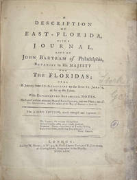
1771008201London in the Strand. and London: at No. 51 St. Paul's Church Yard; and T. JEFFERIES at Charing-Cross: T. BECKET and PA De HONDT. and NICOLL W. 1771. 1st Edition 1st Printing. Hardcover. Very Good. 4to - over 9¾ - 12" tall. JEFFERYS Thomas. The First Published Account of Cook's First Voyage to the Pacific complete with Dedication Leaf. A cornerstone of any Cook collection. Two works in one bound in modern to style half calf over marbled boards some blind edge tooling spine with raised bands gilt tooling gilt titles to red calf labels. Internally Journal of a Voyage 1771 First Edition First Issue with the Dedication and printers instructions plus the two 'Otahitee Vocabulary' leaves bound in at end. BOUND AFTER: Description of East-Florida 1769 Third Edition much enlarged 2 parts in one 3 folding engraved maps title with small library ink-stamp & repair to fore margin small ink correction to C3v professional repairs to maps some loss to the first occasional small stain some soiling and light browning scattered spotting. 281214 mm. Folding map frontis 2 title & dedication 1 ii-viii; Stork - Description of East Florida 1 2-40 1 folding map; Bartrams Journal 1 xii 35 pp 1 errata & binders list1 folding map; Magra's Voyage 1 title 2 dedication 1 2-130 pp 3 Vocabulary of the Language of the Otahitee. The 3 folding maps engraved by T. Jefferys are: 1.East Florida. 2.St. Augustine the Capital of East Florida. 3.The Bay of Espiritu Santo in East Florida. Signatures: East-Florida - 2ff b-b4 B-G1. G-G2 2ff H-M4. Voyage round the World - 2ff B-S1 2ff Vocab. Public appetite for a detailed narrative encouraged a publishing race of which this work published less than three months after the expedition's return to England and almost two years prior to Hawkesworth's authorised version was the winner. This first issue containing the dedication leaf was swiftly withdrawn following the publicly advertised consternation of the dedicatees the Admiralty Joseph Banks and Daniel Solander. Published anonymously the work is generally attributed to James Magra an American mid-shipman aboard. Hill II:1066without dedication leaf; Hocken p9; Holmes 3; O'Rielly-Reitman 362; Sabin 4246 & 16242; DuRietz-catalogue of the Kroepelien Collection p215; Frost Life of James Mario Matra: Voyager with Cook 1995; Beddie 693/4; STC T29207. The work is a short but interesting narrative of Cook's first voyage which relates his visits to Tahiti New Zealand Australia New Guinea Batavia and Rio de Janeiro. The author is noteworthy because he is one of the few to criticize Cook in any meaningful way. Despite problems with the accuracy of the text this work will always hold the place of being the first account of that voyage and the first account in print of the Australian coast. in translation it also gave the French their first account of that voyage. <br/> <br/> T. BECKET and PA De HONDT. and NICOLL W. hardcover
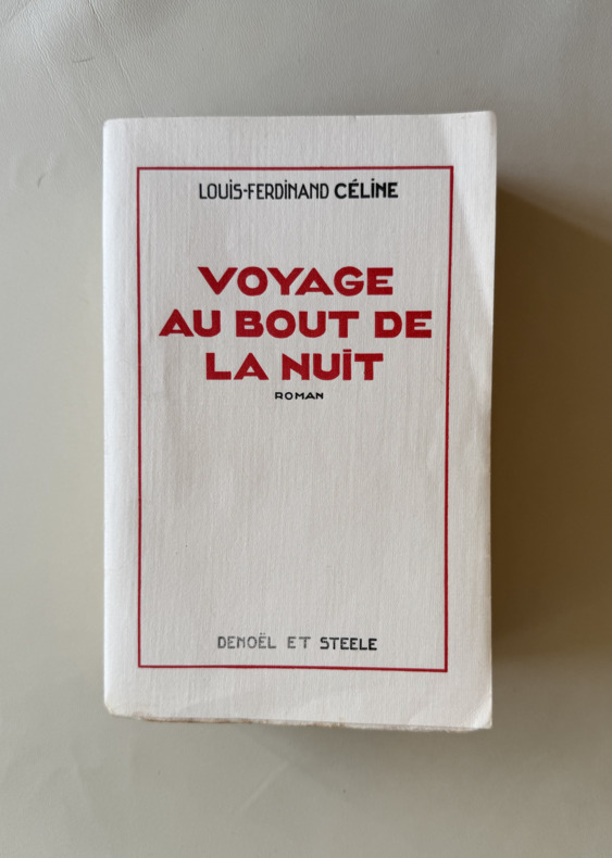
EXE-826Paris, Denoël et Steele, 1932. In-8° broché, couverture imprimée. EDITION ORIGINALE. Tirage à 110 exemplaires numérotés, celui-ci le numéro 51 des 100 sur Alfa (après 10 vergé d'arches). Voyage au bout de la nuit, le roman le plus connu et le plus controversé de Louis-Ferdinand Céline, fit sensation lors de sa publication, salué aussi bien par les critiques de droite que de gauche. Dans ce roman, Céline fit un usage frappant de la langue populaire et de l’argot. Œuvre pessimiste s’inscrivant dans la tradition picaresque, il y exprime à la fois l’aliénation du narrateur et « anti-héros » Bardamu, ainsi que son indignation face aux barrières sociales et économiques qui l’emprisonnent. Le roman explore avec une noirceur croissante les divisions entre les « nantis » et les « démunis », qu’il s’agisse des officiers et des soldats pendant la Première Guerre mondiale, des colons et des indigènes en Afrique, ou encore des riches et des pauvres dans le Nouveau Monde. Ce livre manqua de peu le Prix Goncourt mais obtint le prix Renaudot.
Oblong folio (306 x 252 mm). Contemporary half leather album of 230 photographs (average size 9 x 12 cm). A remarkable collection of photographs showing China during the 1910s, the vast majority captioned in English. They include Shanghai, the Yangtze River, life outside Shanghai, Hong Kong, the River Canton, the canal between Shameen and Canton City, Canton, the five-storey pagodas and graveyards outside the Canton walls, Cheefo, Wei-hai-Wei, old Taku Forts and junks on the Pei-ho River, Changli station, Pei-tai-ho, Chien-Meng gate in Beijing, Chien-Men, the wall of Beijing, shelter for man guarding crops, kiaolang and soya crop near Beijing, the Beijing bell tower, the Race Club, yew trees, Temple of Heaven, the Pagoda at Yu-Chuan-Shan near Beijing, the Terracotta Pagoda and hills east of Beijing, the hills west of Yu Chuan-Pu, camel-back bridge in the gardens of Ya Choan-Shan, temples and lake in the summer palace, the Lama Temple courtyard in Beijing, the Pond Summer Palace, the Marble Bridge Summer Palace, looking up beginning of Pass Kalgar, foot of pass: carts and bullocks, the great wall on hills, camels waiting to be loaded at foot of pass, the riverbed forming a road; ascending the Nantow Pass, Messrs. Brisker, Hawkshaw and Horsely with the Lama Temple in the background, a view from the train near Kalgar, Men-Tou-Kou, a coal mine near Beijing, the Shan-Hai-Kwan hills, junks, fishing boats, a bluff seen from the harbour, Chinwantao, the old walled town on way to Hot Springs, the Great Wall of China at Shan-Hai-Twam, a steamer going down the river, a pontoon bridge to a Russian concession, Peizus waiting on tee to take passengers down the river, gardens, the Tientsin Club and station, the Tientsin Golf course, a fire at Liddell Bros., British soldiers leaving Tientsin for Tsingtau, international manoeuvres at Tientsin (spring 1914) showing Russian, British, French, Japanese, German troops, an icebreaker at Tientsin, the river near Canton, inside the Forbidden City of Beijing, Tai-Ho-Tien Forbidden City, a grotto temple near Shan-hai-Kwan, 13 photographs of Japan, a dam in the course of construction (Li-Shu-Shcen), the Regent Emperor (12th July 1917), Manchu troops in Beijing, the funeral of Yuan Shih-Kai in 1916, northern troops outside Tung Hua, Chang Siens soldiers, a flooded Chinese city, as well as eight photographs of Russia. - Album bumped at extremeties and lacks spine, a few leaves loose but interior very well preserved altogether.
Large oblong folio. 3 vols. in 1. 354 engravings on 321 plates (some folding). 13 pp. index. Marbled brown calf with double borders of six different rolls (gilt-stamped tendrils, blossoms, and fleurs-de-lis) and double fillets, gilt-stamped label to richly gilt spine, leading edges and inner dentelle gilt, marbled endpapers and matching fore-edge marbling. First edition of this splendid collection of Swedish views. In a master binding by the Swedish bookbinder Gustaf Hedberg (1859-1920). - The first copies of this work, printed at the cost of the Swedish king, were given away by the royal family; it was not for sale until 1772. The present copy is one of the few ones with the plates bound flat in oblong folio (instead of folded in large oblong 4to), for which the plates frequently had to be mounted within paper borders or remargined to ensure a uniform large oblong folio format. - Hinges imperceptibly restored. Interior slightly fingerstained and with professionally restored tears; altogether a well-preserved copy of the rare plano edition; plates in early, bold impressions. Brunet V, 578. Graesse Vi, 519. Ebert 21882. Hiler 211. Ornamentstichslg. Bln. 2256. Lipperheide Haa 3. Thieme/B. VIII, 276. Collijn 1600-talet 197. Warmholtz 207. Avery AH485. AKL XXIII, 421.
4to. 3 volumes in 8 parts. With 80 lithographed plates, including several folding plates and 2 chromolithographed plates, and some smaller illustrations in text. Contemporary blue and grey paper wrappers, kept in two modern half morocco boxes. Complete set of all the articles published by the Royal Asiatic Society of Great Britain and Ireland in the years 1824-1834 under the name "Transactions". In 1835 the journal would continue under the name Journal of the Royal Asiatic Society. The society was founded in 1823 and received its Royal Charter in 1824 for "the investigation of subjects connected with and for the encouragement of science, literature and the arts in relation to Asia" (website Royal Asiatic Society). The set consists of three volumes, published in two or three parts, each containing several articles on a wide variety of subjects: archaeology, religion, philosophy, languages, scripts, coins, inscriptions, and occasionally natural history and medicine. The areas covered are China, India, Southeast Asia and Indonesia. The lithographed plates illustrate temples, statues of gods, inscriptions, scripts, coins, maps, etc. Some half-titles slightly browned, but overall in very good condition, wholly untrimmed and mostly unopened. Paper wrappers slightly frayed along the extremities. Löwendahl: China illustrata nova. Supplement, Serials p (individual fascicules 1709, 1716, 1720, 1721, 1723, 1726, and 1734).
20 large uniform albumen prints (210 x 270 mm), all but one in landscape format. Each print mounted on paper boards (245 x 325 mm) with a manuscript series number and a German caption. Stored in a modern black cloth clamshell box with a red morocco label ("Singapore"). A uniform set of large photographic albumen prints of Singapore, including exterior views of traditional, European, and mixed-style buildings, landscapes, the botanical gardens, etc., many with European and/or Malay people in the scene and some with horse-drawn carriages, or boats. The two views from Fort Canning have been attributed to August Sachtler (ca. 1839-73): one looking southwest toward Telok Blanagah village and its hill, with a Malay man in the foreground; the other looking southeast toward the roadstead, with many ships in the background and a canon in the foreground, at least the former published in the National Museum of Singapore's catalogue "The Image of Our Landscape" (2009). Sachtler gained experience as a photographer in the Prussian expedition to Japan and China (1860-62), came to Singapore in 1863 and worked there as a commercial photographer until his death in April 1873. He may be the author of some of the other photographs as well. They show the Jamae Mosque (ca. 1835) and Sri Mariamman Hindu temple (ca. 1827; the tower and wall to the left differ only slightly from those in a dated view of 1866: the tower was completely changed in the early 20th century); six views of the botanical gardens established by Whampoa (1816-80); a jungle plantation in operation (with 4 boats); jungle houses built on wooden stilts with roofs and some walls of reed; the Hôtel de l'Europe (either that on St Andrew's Road, demolished in 1906, or its predecessor on Beach Road); the mission chapel; the gothic revival St Andrew's Cathedral (ca. 1861); Raffles Square (named Commercial Square by Stamford Raffles in 1823 but changed to Raffles Place in 1858, the name in the photograph apparently retaining the older name); the town hall (ca. 1862: the offices moved elsewhere in 1893). The view of Raffles Place clearly shows the signboards of the shops: G. Schiller; Geokteat & Co; John Little (department store established 1845), and Singapore Dispensary (these last two are also visible in an album presented to Prince Alfred, Duke of Edinburgh in 1869). - Two of the photographs have lettered captions and numbers as part of the photographic prints themselves, in white sans-serif capitals in the lower right corner: "Bot. Garden S. 200" and "Raffles Square S. 212". Most have a number in the lower left corner, written after the print was made, ranging from 3 to 200 (matching the number in the print, but the print with number 212 has no written number). Each has a number written on the mount, along one long edge (the head except in the one photograph in portrait format) ranging from 109 to 139, not corresponding to the other numbers. - As usual for albumen prints, the sky in the background shows little or no cloud detail, and two or three have lost a bit of detail in the background, but all further preserve very detailed images and are in very good condition, with only occasional minor spots. A remarkable set of large, detailed and well-preserved historical images of Singapore ca. 1870. For Sachtler, see the report of a lecture by Sebastian Dobson on oag.jp.
Large 4to (395 x 300 mm). Engraved title with hand-coloured engraved vignette, 36 hand-coloured aquatint plates by R. G. Reeve, T. Fielding, G. Hunt, C. Bentley and others after Grindlay, William Westall, Clarkson Stanfield and others. Contemporary half green morocco over marbled boards, bound by J. Wright, spine gilt with raised bands, marbled endpapers, edges gilt, rebacked with original spine laid down. One of the "most attractive colour plate books on India" (Tooley), noted for the brilliant quality of the hand colouring. Robert Grindlay, the son of a London merchant, sailed for India at the age of seventeen in 1803. He served with the 7th Bombay Native Infantry from 1804 until 1820 and travelled widely throughout India with his regiment. His talent for recording the life and landscape of India is evident from the images in the present work, and on his return to Britain he was persuaded to work on its publication. Abbey Travel II, 442. Brunet II, 1742. Colas 1333. Lipperheide 1487. Tooley 239.
4to. Wholly engraved series, consisting of a title-page, dedication, 24 illustrations and 24 text pages, all printed on one side of a leaf. (With) II: Helman, Isidore-Stanislas. Abrégé historique des principaux traits de la vie de Confucius célebre philosophe chinois [...] gravées [...] d'après des dessins originaux de la Chine envoyés à Paris par M. Amiot missionaire à Pékin [...]. Paris, Helman and Nicholas Ponce, [1788]. Wholly engraved series, consisting of a title-page, 24 illustrations and 28 text pages, all except 8 of the text pages, printed on one side of a leaf. 2 works in 1 volume. Later gold-tooled, mottled calf, gold-tooled spine, sides, binding edges and dentelles, gilt edges. Deluxe issue, printed on wove paper, of two handsomely engraved print series, with each print accompanied by an engraved text leaf. - The first series is a radically revised version of Dijian tushuo, designed to appeal to educated Parisians. The Dijian tushuo, known in English as The emperor's mirror, was a very popular Chinese work with stories and illustrations of the praiseworthy and blameworthy actions of Chinese emperors, originally composed for the instruction of the young Wanli emperor. A manuscript version of this work was sent to the French minister of finance Henri Bertin, after which Helman modelled his edition. Besides reframing the Chinese historical anecdotes for a French audience, Helman also completely reconceptualised the illustrations. Although Helman intended to publish four instalments, only the present first instalment appeared. "Published in Paris just a year before the French revolution, perhaps the volume was meant as a veiled criticism not only of Louis XVI's policies but also of his wife, Marie-Antoinette" (Reed & Demattè). - The second series is also based on a collection of drawings from the library of Bertin, who had received these from the French Jesuit missionary Joseph-Marie Amiot. Amiot wrote a lengthy biography of Confucius, which was published as "Vie de Koung-Tsée, appellé vulgairement Confucius", together with the engravings by Helman, in 1786, simultaneously with the first impression of the present print series. The accompanying text to the plates are short "morales de Confucius" from the "Collection des moralistes anciens" (1782). - As stated on the title-page, part 1 could be purchased unbound, at 12 livres; in paper wrappers, at 13 livres and 10 francs; unbound on wove paper for 18 livres; on large paper to accompany the Batailles de la Chine and hand-coloured on "papier de Hollande". Both series are here printed on wove paper, and part 2 (usually dated 1786) is, as such, clearly issued together with the other in 1788. - Isidore-Stanislas Helman (1743-ca. 1810), a student of Le Bas, was a successful engraver in service of the Duke of Chratres. In 1785 he had reproduced a then already extremely rare print series illustrating Chinese battles, that was commissioned by the Emperor of China in France. Helman would later engrave the major events of the French Revolution. - A couple of occasional spots and some very minor foxing in the upper margins, otherwise a very good copy. The binding has some minor wear along the extremities of the spine, but is also very good. Cohen/De Ricci 479. Cordier, La Chine en France au XVIIIe siècle, pp. 59f. Cordier, Sinica, 587f. Journal de Paris, 9 oct. 1786, p. 1167. J. K. Murray, "Narrative and visual narrative across disciplines and cultures", in: A. Green, Rethinking Visual Narratives from Asia (2013), pp. 21-22. Löwendahl 647 & 654. Lust 729 & 1133. Reed & Demattè 21f. & pp. 43-45.
4to. (2), 44, (1) pp. With woodcut vignette on title-page, and 6 engraved folding plans (16 x 12 to 23.5 x 25 cm). 19th century half sheepskin, marbled endpapers. First edition of a description of Beijing, illustrated with six accurate plans. The French cartographer and astronomer Joseph-Nicolas de L'isle (1688-1768) had been corresponding about Chinese astronomy and geography with Jesuit missionaries for more than 30 years, collecting a vast amount of valuable information. The Jesuit father Patouillet asked him to compose a map of Beijing, based on these memoirs, to illustrate a description of the city he was preparing. Unfortunately, Patouillet was unable to complete his description, and De L'isle, assisted by the French astronomer and geographer Alexandre Guy Pingré (1711-96), continued and finished it. Astronomical observations helped them to determine the position of Beijing. The work starts with a description of the foundation of the city, the palace, other buildings and the suburbs, followed by some observations on the Li, also called the Chinese mile: the traditional Chinese unit of distance. - Some leaves slightly browned, some spots throughout and one plate with a small tear in the margin just touching the image. Binding slightly rubbed along the corners. A good copy, only slightly trimmed. Cordier (Sinica) 210f. Morrison II, 67. Löwendahl 537 (lacking 1 plan). Lust 187.
Folio (322 x 202 mm). 2 pts. in one vol. Engr. additional t. p. and 53 double-page plates, maps, and plans (a few folding). (Bound with) II: Boissard, J. J. Topographia urbis Romae. Ibid., 1681. With 100 engr. plates (instead of 101; lacking final plate; including 2 double-page) and plate list at end. Contemp. calf with attractively gilt spine. I: First edition, complete with introduction and supplement. "It is not without justification that this book is counted among the finest produced by Merian's publishing house, and as one of the best works on Italy" (cf. Wüthrich). With the splendid, large-format views of Rome and Venice, as well as views of Bologna, Ferrara, Florence, Genua, Lucca, Mantua, Milan, Messina, Naples (including the Phlegrean Fields and the Solfatara), Padua, Palermo, Siena, Turin, La Valetta, and Verona. The appendix on Greece shows Koroni, Dubrovnik, Euboea, and Lefkada. - Bound with (II): first edition of Boissard's condensed topography of Rome, almost never encountered complete, here lacking a single inscription plate (the final no. 101; included in facsimile). A guidebook in four itineraries, offering the principal chapter of the first part of Boissard's monumental six-volume "Romanae urbis topographia" (first published separately in German in 1603). The illustrations are printed from the original copper plates, including two folding bird's eye views, Castel Sant'Angelo, the Pyramid of Cestius, the Vatican Obelisk, the Tiber Island, Circus Maximus, and especially statues, reliefs, sarcophagi, and several inscriptions. - Both works in fine condition, with occasional abrasions or adhesions (very slight surface loss), a few very minor tears or repairs. Lacking free endleaves; binding insignificantly rubbed; slight split to upper joint. Tightly bound; stamp of the library of the counts of Schlieffen-Schwandt, Mecklenburg, on title page of (I). I: VD 17, 12:647868G. Wüthrich IV, 81-82. Bircher, B 7479-7481. - II: VD 17, 12:642970M. Wüthrich IV, 77. Schuchard 101.A = W. 79.
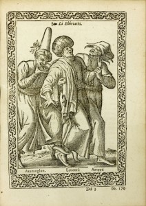
LCS-6950Première édition en italien des Navigations de Nicolay, illustrée de 60 superbes gravures de costumes. Bel exemplaire relié en vélin à recouvrement de l’époque. Des bibliothèques Philip Yorke, Earl of Hardwicke et Sefik E. Atabey. Anvers, Guillaume Silvius, 1576. Petit in-4 de (8) ff., 325 pp. (nombreuses erreurs de pagination), (15) ff., 60 planches de costumes à pleine page. Relié en plein vélin rigide à recouvrement de l’époque, dos lisse avec le titre manuscrit. Reliure de l’époque. 200 x 143 mm.
YTB-109Paris, 1780-1783. 26 volumes in-12, veau granité, filet à froid autour des plats, dos à nerfs orné, pièces de titre et de tomaison en maroquin, tranches jaspées. Reliure de l’époque. 168 x 97 mm. “Volumes VI to IX inclusive, relate to America. J. R. Bartlett’s Catalogue of J. C. Brown’s Library gives a copious list of the contents of each volume. This edition is generally preferred to the original, because it has the advantage of being systematically arranged. “Fontenelle said ‘that he had never read a work which answered better to its title’. Of the accuracy of those ‘Lettres’ and the works of Du Halde and Gaubit, the author has often heard the late Sir G. Staunton speak in the highest terms.” Charles Butler – (Sabin. 40698) « Of the great value of these “Lettres”, as illustrating the early history and settlement, not only of Canada, but of Central New York, Ohio, Michigan, Illinois, and Wisconsin, it is unnecessary to speak. These “Lettres” were collected by the Fathers Le Gobien, Du Halde, Ingoult, De Neuville, and Patouillet. For the missions among the American Indians, Charlevoix refers to volumes X, XI, XII, XIII, XVII, XX and XXIII ; see his notice in “Liste des Auteurs”. See also Shea’s “Charlevoix”, Sabin’s “American Bibliopolist”, and a very full history of the “Lettres Edifiantes” in Backer’s “Bibliothek de la Comp. de Jésus, octavo edition, vol. II., appendice, and in the folio edition, 1857-60, vol. III, cols. 1737-53, Backer gives in detail the contents of the edition of 1838 ; and in cols. 1753-1860, he gives the contents of the German version and extension of the “Lettres”” (Sabin 40697 à propos de l’édition 1702-1776). Cette seconde édition de 1780-1783 « est généralement préférée à l’ancienne, parce qu’elle a sur cette première l’avantage d’avoir été mise en ordre : 60 à 72 fr., et beaucoup moins quand les cartes et fig. n’y sont pas » (Brunet III-1028). Elle est ici complète des 54 estampes. Quatre volumes traitent exclusivement de l’Amérique (VI à IX) : Ils sont illustrés d’une carte dépliante de la Mer de Californie, d’une carte dépliante des côtes du Pérou et du Chili, d’une carte dépliante de la Terre de feu et du détroit de Magellan, d’une grande carte dépliante de l’Amazone, d’une grande carte dépliante du Paraguay, d’une autre du Cap Français, de la Mission des Moxes dans le Pérou etc… Six volumes décrivent l’Inde et onze volumes sont consacrés à la Chine. REMARQUABLE EXEMPLAIRE COMPLET CONSERVE DANS SES ELEGANTES RELIURES DE L’EPOQUE, DESTINE A LA FAMILLE D’HAUTEVILLE.
227 original photographs (mostly ca. 18 x 24 and 23 x 28 cm) mounted on 181 cardboard sheets (37 x 29.5 cm). In two cases. - II: "Indien" (cover title). Album with 33 original photographs (mostly 24 x 30 cm), mounted on cardboard sheets. Around 1900-10. Contemporary cloth. Fine and comprehensive collection of large-size original photographs of India with views of cities, landscapes, mountains, the famous Darjeeling Himalayan Railway and temples, as well as portraits of people. - Includes: Agra (26), Benares (16), Bombay (5; 2 of which are large panoramic photochrome views), Delhi (15), Darjeeling (7), Fathepur Sikri (7), Himalaya (11), Calcutta (18), Lucknow (13), Madras (5), Madura (5), Tanjore (4), and other places. - Many prints indicate the photographers (mostly Clifton & Co., as well as Johnston & Hoffmann and G. Lekegiar, Cairo). Some prints somewhat stained. - Includes (II) an album of views showing Ahmedabad, Darjeeling (with the Darjeeling Railway), Delhi, Elephana, Jeypore, and other places. Some prints with indication of the photographer (Clifton & Co.); somewhat stained in places. A fine ensemble documenting India around the turn of the century.
Folio (285 x 447 mm). (2), II, 144, (6) pp. With 20 hand-coloured aquatint plates, each showing several coastal views, and 24 hand-coloured detailed plans on 12 plates, engraved by John Luffman. Contemporary half calf over marbled boards with giltstamped red spine label. Later endpapers. First English translation of Le Sieur Bougard's famous and oft-printed navigation manual, the "Petit flambeau de la mer", which contains "the minute description of the coasts of the countries and islands indicated by the title" (Phillips). Crucially, this edition boasts a new and original series of illustrations, "beautifully drawn and colored views of the principal headlands, harbors, lighthouses, ports, etc. mentioned in the text" (Phillips), drawn by the English painter John Thomas Serres (1759-1825), who was created Maritime Painter to King George III in 1793. In 1800 Serres became Marine Draughtsman to the Admiralty, and the sketches he made on his ensuing coastal voyages around Britain, France and Spain, and into the Mediterranean, were self-published in the present form, with the consent of the Admiralty (which purchased two copies). "The vast majority of the [...] 170 subscribers were naval officers. This may well be considered to be Serres's most important contribution to the arts of naval victory, both because it was a valuable aid to navigation and because it displays such consummate workmanship" (Tracy). The harbour charts are the work of John Luffman, who was active between 1776 and 1820 as an engraver, publisher, and goldsmith, and the "Naval Chronicle" published quite a few of Luffman's charts. - Slight wear to extremities. Occasional light spotting, neatly rebacked to style. Phillips 2852. Goldsmiths'-Kress library of economic literature; v. 5, reel 22, no. 4. Tooley, Mapmakers I, 172. N. Tracy, Britannia's Palette: The Arts of Naval Victory (Montreal 2007), p. 232. Cf. Polak 1044; NHSM 69.
3 text volumes (8vo) & atlas volume (folio). The atlas with 92 engraved illustrations on 61 leaves by De Guines after Deserve and 6 engraved maps (4 folding) by d'Houdan. Contemporary gold-tooled tree calf with marbled endpapers (text vols.), modern gold-tooled half sheepskin, marbled sides (atlas). The atlas untrimmed, leaving deckles intact. First edition of an esteemed and well-illustrated account of China and the Philippines by the French sinologist and lexicographer Chrétien-Louis-Joseph de Guignes. De Guignes lived in China for 17 years, partly as Resident of France in China and consul at Canton. He was attached as interpreter to the Dutch embassy to Beijing (1794-1795), led by Titsingh and Van Braam. His engaging travelogue recounts his experiences in China, with illustrations after sketches that he made on the spot. De Guignes's narrative provides an interesting and personal perspective on the embassy to Beijing. - De Guignes was the son of the distinguished sinologist Joseph de Guignes, and a correspondent for the Académie des Sciences and the Académie des Inscriptions et Belles-Lettres. He authored an important dictionary, the "Dictionnaire Chinois-Français et Latin" (1813). A German translation of the "Voyages" appeared in Leipzig in 1809-1810. - Slightly browned, plates in the atlas spotted and slightly dirty, the bindings slightly worn, otherwise in good condition. Cordier (Sinica) 2351f. Gay 3307. Löwendahl 738. Lust 336. Morison II, 104. Reed & Demattè 11.
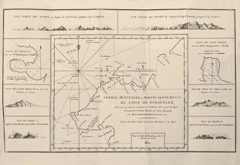
LCS-18462Provenant de la Bibliothèque du Duc d’Aiguillon. A Paris, chez Knapen & Fils, Lib.-Imp. de la Cour des Aides, 1782. In-8 de viii pp., 244 pp., 1 carte dépliante hors-texte in-fine (Terres Australes ou Partie Septentrionale de l’Isle de Kerguelen), (2) ff. Plein veau glacé moucheté, filet à froid d’encadrement sur les plats, dos lisse orné de fleurons dorés, pièce de titre de maroquin vert, tranches rouges. Reliure de l’époque. 199 x 126 mm.
Folio. (14), 237, (10) pp. With frontispiece, vignette on title, portrait of the author, 2 engraved maps (folded), 23 plates (one folded), and 59 engraved illustrations in the text. Contemporary calf. First edition of a richly illustrated account on China, based on descriptions by European explorers, many of them Jesuits as Kircher himself, in China, India, and other Asian countries. The engravings were based on explorers' sketches and original images imported from Asia. - Binding rubbed and bumped, small defects to spine and covers. Paper slightly browned and stained. Graesse IV, 21. Ebert 11397.
3 volumes. VI, 73, [3 blank]; [3], [1 blank]; [3], [1 blank] pp. With 12 plans and 2 maps (mostly folding), and a total of 274 plates with heliotypes. Publisher's original printed blue paper wrappers. First edition in French of a work on the imperial palaces of Beijing by the Finnish-born Swedish art historian and professor Osvald Sirén (1879-1966). Besides the Italian Renaissance, Sirén was very interested in Chinese art and culture, and wrote various books on the subject, mostly in English. The photographs were all taken by Sirén himself, and he wrote an accompanying 40-page introduction on the so-called "Forbidden City", with two small chapters on the seaside and summer palaces. The heliotypes show mostly palaces, some from several angles, but also monuments, pavilions, statues, interiors and gardens, with short descriptions in both French and English. They give a unique view of the city in the early 20th century, since some of the buildings have vanished or are now settled in completely different surroundings. An English edition appeared simultaneous by the same publisher. - With a bookplate in each volume of W. A. S. Swets (1902-92). Minor foxing throughout, original paper wrappers heavily discoloured. Overall a good copy, wholly untrimmed and with the bolts unopened. R. Thiriez, Barbarian Lens: Western Photographers of the Qianlong Emperor's European Palaces, p. 182.
London, printed by George Bigg: sold by P. Elmsly, and Mr. Chapman, 1791-1793 & London, Ballentine and Law, 1808. Folio (313 x 233 mm). 2 volumes uniformly bound in recent half calf with five raised bands and gilt lettering and ornamentation to spines.Vol. 1: With repair to upper inner corner of general title-page. Title-page to “A Plan for a Publication of a Repertory” with vague illegible blind-stamp. 1 plate (Map of the Ava River) mounted in lower inner part. Plates with light brownspotting, otherwise internally fine and clean.(2) pp., pp. (1)-4, (i)-iv [Introduction to the first number, 9th April 1791], (1)-4 [Introduction, January 1791], (2)pp. [Dedication], pp. (i)-iv [Introduction to the second number], (i)-iv [Introduction to the third number], (i)-iv [Introduction to first number, 31st December 1792], (4)pp., pp. 2-576, 577-578, 577-578, (16) [Register] pp. + 16 plates as called for. Vol. 2: Title-page with vague blind stamp. First leaf of introduction to first number with repairs to inner and lower margin, slightly affecting text. ‘Map of part of the Nothern Cicars’ with two large tears almost splitting the map. Plates with browning. Text fine and clean throughout.(4) pp., pp. (i)-iv [Introduction to first number], (i)-iv [Introduction to second number], (1)-4 [Introduction to the third number], (1)-4 [Introduction to the fourth number], (4) pp., pp.(1)-600, (16) [register] pp. + 17 plates as called for.
8vo. (16), 180, (6) pp. Title printed in red and black. With 6 folding engraved plates. - (Bound after) II: Megiser, Hieronymus. Paradisus deliciarum; das ist, eigentliche und wahrhafftige Beschreibung der wunderbaren, mechtigen und in aller Welt hochberümbten Stadt Venedig [...]. Leipzig, (Michael Lantzenberger for) Henning Grosse, 1610. (24), 495, (13) pp. Title printed in red and black. With engraved Dietrichstein arms on the verso of title and 25 (instead of 26) engraved plates (mostly folded, one double-page-sized). - (Includes:) Chronologia Veneta. (94) pp., 1 blank f., (62) pp., final blank f. Contemporary blindstamped leather with handwritten labels to spine; remains of clasps. Edges goffered and coloured blue. I: Rare account of the embassy undertaken by Stephan Kakasch (Khakas) and Georg Tectander von der Jabel from Prague to the Persian court in the year 1602, in response to an embassy sent to the Habsburgs' court two years previously by Shah Abbas. The travellers passed through Bohemia, Silesia, and Moscow (to which a large part of the narrative is dedicated) before reaching Persia. Kakasch, the ambassador, died near Astrakhan, but the journey was successfully completed by his aide Tectander, and in January 1605 the report was officially presented to Emperor Rudolph. The present edition is a rare re-issue of the one published by Grosse in the previous year. The plates include views of Moscow and Breslau, the audience with the Grand Duke of Moscow, as well as Persian and Tatar costumes. Complete with all illustrations as called for by VD17 and the table of plates at the end (though some copies are known to have included as many as 8 plates). - II: First edition under this title; very rare: an extensively revised and expanded version of the author's "Venediger Herrlichkeit" from 1602. The famous historiographer and linguist Hieronymus Megiser (1554-1618/19) spent almost a year at Padua, from there making frequent journeys throughout Italy as far as Sicily and Malta. His book covers not only the history of Venice and its most important buildings and landmarks, but also provides information on the city's political and financial administration. The views include Venice, Padua, Verona, Bergamo, Udine, Palma, Sibenik, and Corfu; other plates depict Venetian curiosities such as a gondola and a Dogal procession. The appendix (with its own title-page and colophon) gives a chronology of the Most Serene Republic. - Some browning throughout due to paper. Appealing binding well preserved, though wanting clasps. Acquisition note, dated 1711, on lower pastedown, as well as a later note, according to which the volume was purchased for 40 Marks from Breslauer in Berlin in 1914. Ownership "Vi. Kringer / [18]59" on front flyleaf. Last in the library of the Viennese collector Werner Habel (1939-2015) with his handwritten and stamped ownership, dated 1975. I: VD 17, 23:253397U. Wilson 117. Apponyi 711. Bircher A 7099. BL-German books T 155. Adelung, Reisende in Russland II, 137. Schwab 568. Cf. Weber II, 236 (French 1877 ed. only). Not in Atabey or Blackmer. - II: VD 17, 3:300735K; 3:300737Z. Stagl 71. ADB XXI, 184. Cf. Tresoldi 14. Not in Pescarzoli.