HOMANN Johann BaptistMareMagnum

39 447 résultats
- s.d. (circa 1720), 62x53,5cm, une feuille rempliée. - Carte originale, entièrement rehaussée en couleurs, montrant la régon du Bosphore. Grande vue panoramique de Constantinople vue de Scutari en bas de la carte. Une légende nomme et localise 30 bâtiments importants, tels que le Sérail, Sainte-Sophie et plusieurs mosquées. Une vue de l'Hellespont, de la mer de Marmora et de Constantinople au loin, se trouve en haut à droite de la carte. Bel exemplaire de cette carte conçue par Johann Baptist Homann (1664-1724) - l'un des cartographes les plus renommés et fondateur de l'une des plus importantes maisons d'éditions allemandes. [ENGLISH DESCRIPTION ON DEMAND]
- Nuremberg s.d. (circa 1716), 61,4x53cm, une feuille rempliée. - Nova Anglia Septentrionali Americae implantata Anglorumque coloniis florentissima Geographica exhibita Nuremberg | [ca 1716] | 61.4 x 53 cm | one map Beautiful copy of one of the rare maps of the American North-East in the early eighteenth century, showing the region as it was considered before the British government commissioned more in-depth cartographic studies on the subject. his map is the work of Johann Baptist Homann (1664-1724), one of the most well-known cartographers, founder of one of the most important German publishing houses. Conceived while the region was still being discovered, it shows a certain number of inaccuracies: Cape Cod is represented as an island and the port of Boston appears larger than its true size. The size of some lakes is exaggerated, whereas Lake Champlain is farther east that its actual location. Seneca Lake (New York State) is shown to be an immense sea that flows into the Hudson Valley and Lake George is then called «Lake Iroquois.» The representation of New France in the North is also inaccurate insofar as Montreal (Mont Royal) takes the shape of a huge island immediately adjacent to Lake Ontario. We also note the presence of the legendary Norumbega colony. It is also one of the very first representations of New York City: Manhattan is identified as an island captioned «N. Loch,» which helps to identify this map as a second state. Very beautiful copy. [FRENCH VERSION FOLLOWS] Edition originale et second tirage de cette carte à toutes marges, gravée sur cuivre et rehaussée en couleurs à l'époque. La carte est apparue pour la première fois dans l'Atlas Novus vers 1716 et a été rééditée pendant plusieurs décennies. Beau cartouche en bas à droite témoignant des échanges commerciaux entre Amérindiens et Européens : perles, armes, outils, alcool, textiles et fourrures, l'un des piliers économiques de la Nouvelle-Angleterre à l'époque. Cette carte très détaillée couvre la zone géographique allant de Philadelphie au Sud jusqu'à la vallée du Saint-Laurent au Nord et indique les colonies amérindiennes et européennes. Elle couvre les Etats du Maine, du New Hampshire, du Vermont, du Massachusetts, du Connecticut, du Rhode Island, de New York et de Pennsylvanie et du New Jersey. Bel exemplaire de l'une des rares cartes du Nord-Est américain du début du XVIIIème siècle, représentant la région telle qu'elle était envisagée avant que le gouvernement britannique ne commande des études cartographiques plus approfondies sur le sujet. Cette carte est l'uvre de Johann Baptist Homann (1664-1724), l'un des cartographes les plus renommés, fondateur de l'une des plus importantes maisons d'éditions allemandes. Conçue alors que la région était toujours en cours d'explorations, elle montre un certain nombre d'inexactitudes : Cape Cod y est représentée comme une île et le port de Boston apparaît plus grand que son apparence réelle. La taille de certains lacs est exagérée, tandis que le lac Champlain plus à l'Est que son emplacement réel. Le lac Seneca (état de New York) se révèle être une immense mer qui se déverse dans la vallée de l'Hudson et le lac George porte alors le nom de « lac iroquois ». La représentation de la Nouvelle-France au Nord est elle aussi inexacte dans la mesure où Montréal (Mont Royal) prend la forme d'une île immense immédiatement adjacente au lac Ontario. On notera également la présence de la colonie légendaire de Norumbega. Il s'agit en outre de l'une des toutes premières représentations de la ville de New York : Manhattan est identifiée comme une île légendée « N. Loch », ce qui aide à identifier cette carte comme deuxième état. Très bel exemplaire.
- presso Giuseppe Roselli., in Napoli 1697, in-12 (8,5x15,2cm), de (24) 399pp. (33)., relié. - Nouvelle édition augmentée et révisée après l'originale de 1685. Editée par Antonio Bulifon. Illustré de une carte dépliante de Naples, un frontispice, et 49 figures hors texte, dont le format est légèrement plus petit que l'ouvrage et sur une papier différent, plus fin. Outre les églises, les monuments, fontaines et trésors, on y voit une planche du Vésuve et une du port. Toutes les planches portent une légende se terminant par le nom Antonio Bulifon. Cet excellent guide de Naples a été édité jusqu'au XIXe. Reliure en plein vélin souple d'époque. Dos lisse avec titre à la plume. Une mince déchirure à la carte. Ce guide des étrangers (Forestieri) recense et décrit tous les monuments et les bâtisses remarquables de Naples ainsi que les oeuvres qu'ils renferment. En index, un catalogue des églises de Naples. On a appelé Naples la ville aux mille églises, il y eut par ailleurs de très nombreuses constructions au XVIIe... Pompeo Sarnelli (1649-1724) fut évêque et écrivain, on lui doit un autre guide de la région de Naples et des contes napolitains, issus de la tradition orale. [ENGLISH DESCRIPTION ON DEMAND]
- Chez Brunet, à Paris 1777, in-8 (12,5x20,2cm), xii (2f.) 352pp., relié. - SCHERER Jean-Louis Recherches historiques et geographiques sur le Nouveau-Monde Chez Brunet, Paris 1777, in-8 (12,5 x 20,2 cm), xii (2 f.) 352 pp., contemporary sheep The rare first edition with eight illustrations (Chinese coins and medals, Buddha) and a large folding map of Siberia and the river Lena. Contemporary marbled sheep, spine in compartments, roulette to head and foot, brown morocco title-piece. Triple fillet frame. Small lack at head. Wormhole to foot of upper joint, two corners rubbed. Headpieces, joints, and corners scraped. A very good, fresh copy. An important essay on the origins of the peoples of the American continent (North and South). The author uses several approaches to produce a powerful comparative study of languages (most notably those of the islands of South-East Asia, Mexico and Peru), dress and traditions. Scherer's conclusion, notably relying on Classical literature and various accounts of voyages, is that the people of the Americas had several different migratory origins, including Chinese, African and Asian tribes. North America, and especially Alaska, received several waves of migration from the Bering Strait, via Kamchatka, and from Asia. [FRENCH VERSION FOLLOWS] Édition originale, rare, illustrée de huit figures (monnaies et médailles chinoises, bouddha) et d'une grande carte dépliante de la Sibérie de la rivière Lena. Reliure en pleine basane d'époque marbrée. Dos à nerfs orné, roulette en queue et tête. Pièce de titre en maroquin havane. Triple filet d'encadrement. Un petit manque en tête. Un trou de ver au mors supérieur en queue. Deux coins émoussés. Frottements en coiffes, mors et coins. Bon exemplaire, frais. Important essai sur l'origine des populations du continent américain (nord et sud). L'auteur adopte plusieurs méthodes pour parvenir à son but : une étude comparative poussée des langues (notamment des îles du Sud-Est asiatique, du Mexique, du Pérou...), des coutumes et des traditions. Scherer en vient à conclure, notamment en se servant de la littérature antique et de divers voyages, que les populations de l'Amérique ont plusieurs origines migratoires : chinois, africaine et de tribus asiatiques. L'Amérique du Nord, et notamment l'Alaska aurait subi plusieurs flux migratoires par le détroit de Béring, via le Kamtchatka, en provenance de l'Asie.
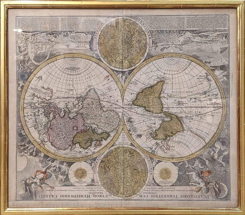
1720973DGNürnberg, J.B. Homann, ca. 1720. Altkolorierter Kupferstich. Bildformat: 56 x 65 cm. Blattformat: 51 x 60 cm.
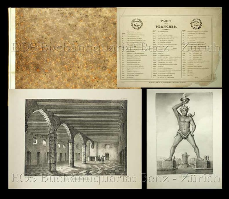
18302491DB(Bruxelles, A. Colinez, 1830). Quer-folio. 73 von 75 (dv. 7 farbige) Tafeln + 1 zusätzliche (nicht zum Werk gehörende) Tafel. Neuer Halbpergamentband im Stile der Zeit.
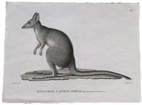
18244505062Paris: Langlois 1824. Fine. Black and white engraving 320 x 238mm. <p><p>Very rare early proof for an engraving of a potoroo in the zoological Atlas of the Freycinet voyage account: the engraving as finally published would include a further taxonomical detail in the form of added detail of the animal's skull titled "Son crâne" and the caption would be entirely changed renaming the animal completely from Kangurus lepturus as shown here to Hypsiprymnus white. These are names given to different specimens of Gaimard's Rat-Kangaroo collected by the Freycinet voyage zoologists Jean Rene Constant Quoy and Joseph Paul Gaimard. We are not aware of the reasoning that led to this change of name but such a substantial change from proof to finished engraving is noteworthy.</p> <p>In the text of the Zoologie section Quoy and Gaimard equate the "petit kanguroo ou le kanguroo-rat des habitans du Port-Jackson" with those shown in the First Fleet accounts of Phillip plate 47 and White plate 60 and tell a sad story of the live specimen that they collected: "Notre individu a vécu quelques jours à bord de l'Uranie: il devint victime de la férocité d'un chien que nous avions pris aux îles des Papous et qui l'étrangla au moment où il s'avançait vers lui en cherchant à le caresser." The dog ate our potoroo.</p> <p>They also describe coming across potoroos in the Blue Mountains: "Ces petits animaux sont d'un naturel très-doux et moins timides que les kanguroos. Dans un voyage que nous fîmes dans l'intérieur des Montagnes-bleues de la Nouvelle-Hollande nous eûmes occasion d'en voir un venir enlever familièrement au milieu de la case en terre qui nous servoit d'abri des restes d'alimens et s'enfuir par un trou à la manière des rats. Nous croyons que c'est une variété de l'espèce que nous venons de décrire".</p> <p>The index to the publication lists the animal as "Potoroo White du Port Jackson"."A French voyage in 1816 under the command of Louis Freycinet brought back to Paris a wealth of new specimens information and sketches of kangaroos. The published account of the natural history of the voyage which included striking plates of the 'Kanguroo Laineux' and the 'Potoroo White' was overseen by Georges Cuvier the leading French naturalist of the day" Des Cowley and Brian Hubber "Distinct Creation: Early European Images of Australian Animals" in The La Trobe Journal 66 Spring 2000; online resource. Perhaps we can assume that Cuvier enforced the name change.</p> </p> . [Langlois] unknown
1807g6538Edinburgh: Peter Hill; P. Bower. VG : in very good condition. Rebound with new eps. Title page slightly darkened. Some light age toning. 1807. First Edition. Modern quarter leather marbled board cover. 180mm x 110mm 7" x 4". viii 244pp. Three views and town plan. Includes a section entitled 'Company of Golfers'. . Peter Hill; P. Bower hardcover
176663132Chez Marc Michel Rey | à Amsterdam 1766 | 10.50 x 17 cm | 2 volumes reliés
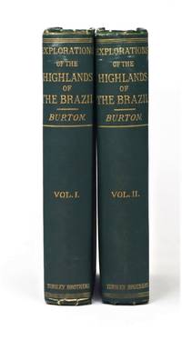
186920752London: Tinsley Brothers 1869. First Edition. Hardcover. Very good. Two volumes. 8vo pp xii 443; viii 478 2 ads each with engraved frontispiece and title page vignette folding map in Volume II. Publisher's green cloth ruled in blind with gilt figure on each front board. Account of Burton's journey from Rio to the rich mining area of Minas Gerais via Tres Barras River Velhas Penedond Paulo Afonso Falls. He canoed down the entire 3000 kilometer length of the previously uncharted Sao Francisco River to the Atlantic. Borba de Moraes I p. 110; Penzer pp. 78-79. Corners bumped some scuffing to upper spines foxing to first and last few leaves of each volume. With the bookplates of British Civil Engineer Leveson Francis Vernon-Harcourt we believe prominent early Los Angeles physician Walter Lindley and his son Francis Haynes Lindley. Tinsley Brothers hardcover books
179722475London: Henry Hughs 1797. First Edition. Hardcover. Very good. Three volumes in two with the supplement bound in at the end of Volume II. 4to 9.25 x 11.75 inches with wide margins. Volume I: pp 10 cc 6 185 1. Volume II: pp 2 187-586 14; Supplement vii 163. Collated and complete with frontispiece two vignette title pages two folding maps and 23 full page plates one folding. In a contemporary binding of red sheepskin with gilt decoration on spines and gilt borders on front and rear boards gilt inner dentelles marbled endpapers. Boards scuffed and rubbed chip missing from head of spine a few pages with old repairs to margins scattered foxing especially to the folding maps. Elliott Coues in his 1892 Key to North American Birds wrote: "A great landmark -- one of the most conspicuous of the last century -- was set up with the appearance in 1785 of the second volume of Pennant's 'Arctic Zoology.' The whole work in three quarto volumes with many plates 1784-87 was 'designed as a sketch of the Zoology of North America.' . Pennant treated upwards of 500 nominal species of North American birds. .We are so accustomed to see 'Linn.' Linnaeus and 'Gm.' Gmelin after the names of our longest-known birds that we almost unconsciously acquire the notion that Linnaeus and Gmelin were great discoverers or describers of birds in those days. But the men who made North American ornithology what it was during the last century were Catesby Edwards Forster Pennant Latham and Bartram." Volume 2 includes description and illustration of several extict species including the Passenger Pigeon Eskimo Curlew and Great Auk all of which were still extant at the time these volumes were published. In addition to the pioneering work on birds the work is notable for its descriptions of Steller's sea cow obtained directly from explorers who observed the animals before their extinction as well as for apparently the first published illustration of a North American musk-ox. Welsh naturalist Pennant originally conceived of these volumes as “North American Zoology†but changed the title and focus after the loss of the British colonies. Sabin 59757; Lada-Mocarski 38; Arctic Bibliography 13291. Henry Hughs hardcover
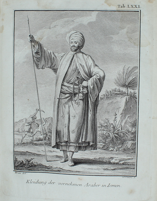
177456602Kopenhagen, Nicolaus Möller, 1774. 4to. Near contemp. hcalf. Gilt spine. Gilt lettering. Mild cracking along front joint, but holding (inner joints strenghtened). Engraved titlevignette. XVI,504,(1) pp.,1 large folded map, outlinecoloured ""Tabula Iteneraria... Terrae Yemen... 1763."" and 72 engraved maps, plans, plates, several folding. (Plate LXXI is inserted between pp.304 and 305). 5 leaves in the middle with a faint dampstain in right margin. A few marginal brownspots. Internally clean, printed on good paper.
182856329London, John Murray, 1828. 4to. Contemp. full calf. Richly gilt spine. Titlelabel with gilt lettering. Gilt borders on covers. Cover-edges gilt. Joints weakening, but holding. XXIV,572,xLIII,(5) pp., 9 maps (the large folded mounted on linen) and 13 (2 handcoloured) engraved plates (the larged folded mounted on linen). Some of the plates with browning. Text clean and fine, a wide-margined copy. With Errata-slip.
165645342Kiøbenhafn, Peder Hake - Jørgen Holst, 1656. 4to. Samtidigt helldrbd. med ægte bind på ryggen. Lidt tab af skind i nederste rygfelt udbedret. nederste hjørne på forpermen stødt. Rygtitlen i gl. håndskrift. Kobberstukket titelblad og bogtrykt titelblad. (20),359,652 pp. samt upaginerede registre (48 pp.) incl. de 4 titelblade (ialt 1116 pp.). Side 323/24 i stort format og foldet (oversigt over Norges inddeling, med en revne, uden tab). Det kobberstukne titelblad lidt tæt beskåret forneden og med et par smårifter i ydre margin. Det bogtrykte titelblad med et indhak i nederste højre hjørne, uden teksttab. Trykt med varierende papirkvalitet, nogle læg lidt brunede og med brunpletter, dog mest marginalt.
177714232Barby, Chr. F. Laux, 1777. Bound in one cont. hcalf. (16),1068 pp. + Register and 3 large folded engraved maps, 4 engraved folded views (one of these a little stained). Very slightly brownspotted.
176656363Lemgo, Meyerischen Buchhandlung, 1766. 4to. Contemp. hcalf. Raised bands. Some cracks in leather along joints. Wear to spine ends. Spine rubbed.Titlelabel with gilt lettering. Stamp on title-page. XVI,344 pp., 2 folded engraved maps and 5 engraved plates. Plate I and II having each two illustrations are divided, and the illustrations are inserted at the places where they are treated in the text. Internally clean and fine.
183354086London, Richard Bentley, 1833. 2 contemp. hcalf. Richly gilt spines. Gilt lettering. Very light wear to top of spines with a small repair. 2 engraved frontispieces. XV,(1),434"VIII,420 pp., Errat-slip bound in. 3 engraved plates and 4 large folded engraved maps. Plates with some marginal brownspots, otherwise clean and fine.
170660965Leide, Pierre van de Aa, 1706. 8vo. Uniformly bound in three contemporary full calf bindings with five raised bands and richly gilt spines. Edges of boards gilt. Small paper-label pasted on to top of spines. Wear to extremities, boards with scratches with some loss of leather. Internally with a few small worm-tracts but generally a good copy.Vol. 1: (16), 275 pp. + Engraved half-title, engraved half-title and 43 plates (out of 45)Vol. 2: 277-554 pp. + Engraved half-title, engraved title-page and 49 plates (out of 55).Vol. 3: 555-718, (62), 9, (1) pp. + Engraved half-title, engraved title-page and 46 plates (out of 50).
Kopenhagen, Nicolaus Möller, 1774. 4to. Near contemp. hcalf. Gilt spine. Gilt lettering. Mild cracking along front joint, but holding (inner joints strenghtened). Engraved titlevignette. XVI,504,(1) pp.,1 large folded map, outlinecoloured ""Tabula Iteneraria... Terrae Yemen... 1763."" and 72 engraved maps, plans, plates, several folding. (Plate LXXI is inserted between pp.304 and 305). 5 leaves in the middle with a faint dampstain in right margin. A few marginal brownspots. Internally clean, printed on good paper.
London, John Murray, 1828. 4to. Contemp. full calf. Richly gilt spine. Titlelabel with gilt lettering. Gilt borders on covers. Cover-edges gilt. Joints weakening, but holding. XXIV,572,xLIII,(5) pp., 9 maps (the large folded mounted on linen) and 13 (2 handcoloured) engraved plates (the larged folded mounted on linen). Some of the plates with browning. Text clean and fine, a wide-margined copy. With Errata-slip.
Kiøbenhafn, Peder Hake - Jørgen Holst, 1656. 4to. Samtidigt helldrbd. med ægte bind på ryggen. Lidt tab af skind i nederste rygfelt udbedret. nederste hjørne på forpermen stødt. Rygtitlen i gl. håndskrift. Kobberstukket titelblad og bogtrykt titelblad. (20),359,652 pp. samt upaginerede registre (48 pp.) incl. de 4 titelblade (ialt 1116 pp.). Side 323/24 i stort format og foldet (oversigt over Norges inddeling, med en revne, uden tab). Det kobberstukne titelblad lidt tæt beskåret forneden og med et par smårifter i ydre margin. Det bogtrykte titelblad med et indhak i nederste højre hjørne, uden teksttab. Trykt med varierende papirkvalitet, nogle læg lidt brunede og med brunpletter, dog mest marginalt.
Barby, Chr. F. Laux, 1777. Bound in one cont. hcalf. (16),1068 pp. + Register and 3 large folded engraved maps, 4 engraved folded views (one of these a little stained). Very slightly brownspotted.
Lemgo, Meyerischen Buchhandlung, 1766. 4to. Contemp. hcalf. Raised bands. Some cracks in leather along joints. Wear to spine ends. Spine rubbed.Titlelabel with gilt lettering. Stamp on title-page. XVI,344 pp., 2 folded engraved maps and 5 engraved plates. Plate I and II having each two illustrations are divided, and the illustrations are inserted at the places where they are treated in the text. Internally clean and fine.
London, Richard Bentley, 1833. 2 contemp. hcalf. Richly gilt spines. Gilt lettering. Very light wear to top of spines with a small repair. 2 engraved frontispieces. XV,(1),434 "VIII,420 pp., Errat-slip bound in. 3 engraved plates and 4 large folded engraved maps. Plates with some marginal brownspots, otherwise clean and fine.
184561035Darton and Clark London 1845. First Edition. Hardcover. Good Condition. Size: 8vo 7 3/4 - 9 3/4". Unpaginated. Rebacked with original spine laid onto new cloth. Original boards retained. New end papers fitted. Spine cocked. Marking front/rear pages but body of book mostly clean and unfoxed. Previous owner's book-plate laid in and ink signature. Corners bumped. Covers marked and creased. The publication date given above is an estimate only there being no date given in the book. All maps present. Double-frontispiece. Bright colouring to plates throughout. Quantity Available: 1. Shipped Weight: Under 1 kilogram. Category: Geography & Maps; England; Travel & Places. Pictures of this item not already displayed here available upon request. Inventory No: 61035. . Darton and Clark hardcover