GREG, ROBERT HYDE:Biblio.com
39 448 résultats
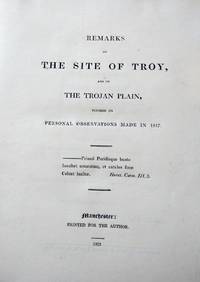
21992Manchester: Printed for the Author 1823. The Round Towers of Ireland Printed for the Author Manchester 1824. The first work with double-page folding map & one leaf partly detached 4to 92-pages; the half-title retained. The second work with lithographic frontispiece and two lithographic plates; 42-pages.The two works bound together 4to 9 1/4 x 7 3/4 inches contemporary binder's cloth binding rubbed. The Author's own copies with his engraved armorial bookplate on front pastedown. Both works are very rare.The Manchester liberal politician and manufacturer Robert Hyde Greg 1795-1875 was sent on a grand tour of Europe before joining his familys prosperous textile business. His dissertation on Troy is dedicated to Prince Louis William of Hesse Hombourg whom the author accompanied on his travels in Greece and Asia Minor. Manchester: Printed for the Author 1823. hardcover
1959016941Beijing 1959 Book with dust jacket visible plastic in good conditions. The dustjacket has same traces of use tears / missing small pieces. Illustrated book of the 10th anniversary of the People's Republic of China. 544 pages. Page large photograghs illustrations in black and white and colour. The pictures show the life in China people art seasons industry history towns & villages nature army. Text in Chinese. Zhongguo hua ce bianji weiyuanhui Beijing 1959. Reading ribbon on the front cover there is in relfief "the National Emblem of the People's Republic of China". Table of contents. Included is a stapled booklet 8 pages in German text this is the German translation of the table of contents. "CHINA ein Bildband. Bildunterschriften. Zusammengestelt von der Kommission zur Herausgabe des Bildbandes CHINA. Peking 1959". Size: 39 x 32.5 x 5.5 centimeter. Weight: 6.6 kilogram. Price is including registered - insured - shipping. 1ste / 1st. cloth / linnen hardcover. good / goed/good / goed. A3 formaat gebonden. hardcover
3890Lettres écrites en 1777 à M. le C. de N. pour servir de supplément au voyage en Sicile et à Malthe de M. BrydonneTome I : Lettre I à XI -Tome II : Lettre XII à XX -Bien complet des 3 cartes dépl. et 27 planches HT
On 36 leaves (each ca. 20.5 x 14.5 cm, total ca. 134 x 82.5 cm), mounted on cloth and folded. Interesting and beautifully lithographed map of previously almost entirely uncharted parts of America still inhabited by the Utah, Sioux and Pawnee Indians, considered one of the most important maps of the western United States issued in the first half of the 19th century. Wheat noted that "John Fremont's map of 1845 represented as important a step forward from the earlier western maps of the period as did those of Pike, Long, and Lewis and Clark in their day". - At the top is an inset of a "Profile of the route from the Mouth of the Kansas to the Pacific by Capt. J. C. Fremont in 1843" (horizontal scale: 1:3,000,000). - The map includes parts of the States of Oregon and California in the West, via parts of Nevada, Idaho, Utah, Wyoming and Colorado, to parts of Nebraska and Kansas in the East; from the west coast the mouth of the Columbia River, Fort Vancouver (Portland) in the Northwest, via San Francisco to St. Barbara, Ventura and the outskirts of today's Los Angeles in the Southwest, through the Rocky Mountains, the areas of the Utah, Sioux and Pawnee Indians, in a kind of triangle to the Missouri River and Fort Leaverwood near today's Kansas city and Westpoint in the East (an area of approximately 1,300 x 2,600 km). - The map is from Fremont's "Report of the Exploring Expedition to the Rocky Mountains", which includes the first accurate depiction of the Great Salt Lake. "Though the Oregon Trail and the Spanish Trail had been regularly used for a few years there were no dependable maps. For other parts of Fremont's route, much of the recording of his map was new, including the whole extent of the Sierra Nevada Range, the California rivers from the American River south, and the three Colorado rivers" (Streeter). It is therefore hard to overestimate the influence of this map, which left only minor areas unmapped or unexplored with the exception of the Great Basin. Wheat states that it "radically and permanently altered western cartography". - John Charles Fremont (1813-90) was a young and ambitious lieutenant in the Corps of Topographical Engineers. Together with the Frenchman Joseph N. Nicollet he completed the first truly scientific survey of the interior during 1838-39. He was the son-in-law of the powerful Senator Thomas Hart Benson from Missouri and under his influence he undertook three further expeditions to the west. Arriving in the United States in 1834, Fremont hired Charles Preuss as a cartographer and draughtsman. Preuss would go on to draw both of Fremont's other highly important maps of the west. - Some soiling and spotting, otherwise in good condition. Howes F370. Philips, List, p. 642. Sabin 25845 (cf. 25838-43). Storm, C. 1436. Wagner & Camp 115:1. Wheat I, (TM) 497 & II, 194-200.
2 vols. 8vo. LIV [of LVI, lacking half-title], 444 pp. (2), 344, (148) pp. With engr. frontispiece portrait of Mariner by Bragg after Mouchet, and a folding engraved map of the Tonga Islands. 19th century half calf. Second enlarged edition. The young William Mariner sailed in the privateer Porte au Prince to the New World with the objective of attacking Spanish ships and searching for whales. The crew seized several Spanish vessels and picked up a number of Hawaiian crew in 1806. A visit to the Tonga Islands proved fatal: almost the entire the crew was massacred by the natives. The author, however, survived and lived in the 'Friendly Islands' from circa 1806 until 1810, observing and recording the Tonga culture with a keen eye for detail. His account contains an elaborate dictionary and grammar of the Tonga language as well as several songs. Volume two, moreover, includes some interesting notes on James Cook, who had named the Tonga Islands the Friendly Islands in remembrance of the friendly reception accorded to him and his crew. Mariner states that the Tonga chiefs had in fact planned to kill Cook, but due to a disagreement on "the exact mode and time of making the assault" (p. 60) this plan was never executed. "Mariner's meticulous observations on Tonga make this a key historical text on the history and culture of this island group" (Forbes). - With inscription on endpapers and title pages; vol. 1 lacking half-title; spines chafed. Very good set with the armorial bookplate of the Tennant family on front pastedown. Forbes 487. Hill 1076. Kroepelien 819. Cf. Howgego, 1800-1850, M14.
EXE00c4213 volumes brochés in-8. Couvertures imprimées illustrées rempliées, 1 illustration en frontispice, une illustration au titre, bandeau au 1er chapitre. Titres en édition originale. 1.De Shanghai à Canton / par Thomas Raucat; front. de François de Marliave.- Paris, Emile-Paul, 1927. 2.Au Maroc / par Abel Bonnard; front. de Jean Berque.- Paris, Emile-Paul, 1927. 3. Rhénanie / par Pierre Mac Orlan; front. de Jean Oberlé. Paris, Emile-Paul, 1928. 4. Portrait de Madagascar / par Pierre Camo; front. de Jacovleff. Paris, Emile-Paul, 1928. 5. Bruxelles / par Jean Fayard; front. de Haardt. Paris, Emile-Paul, 1928. 6.Uruguay / par Jules Supervielle; front. de Daragnès.Paris, Emile-Paul, 1928. 7. Huit jours à Séville / par Francis Carco; front. de Maurice Barraud. Paris, Emile-Paul, 1929. 8. Blason de la Pologne / par André Thérive; front. de Kisling. Paris, Emile-Paul, 1929. 9. Hispano-moresque / par Henry de Montherlant; front. de Georges Capon. Paris, Emile-Paul, 1929. 10. Polynésie / par Jean Dorsenne; front. d'Urbain Faure. Paris, Emile-Paul, 1929. 11. Esquisses havanaises / par Jean-Louis Vaudoyer; front. de Mariano Andreu. Paris, Emile-Paul, 1930. 12.- Caucase / par André Beucler; front. de Pierre Guastalla. Paris, Emile-Paul, 1931. 13. Berlin / par Jean Giraudoux; front. de Chas-Laborde. Paris, Emile-Paul, 1932.
large 8vo [26.5 x 18 cm]; xiv, 172 pp, complete with 24 tinted plates including frontis, folding panorama & 4 partly colored, plates with tissue guards, folding map (short tear at stub), 42 other tinted illus. original green pictorial gilt cloth, with picture of mountain goat in gilt, gilt spine title lettering, spine rubbed and repaired, endpapers stained, light ripple, owner name on endpaper but otherwise unmarked, interior is very good in good cover. A pictu Cordier 2820. Yakushi G88. Royal Geographical Society Catalogue p. 188. Neat G35. The author was a member of Forsyth second mission to Kashgar in 1873-4, one of the first expeditions to combine exploration with scientific investigation. All members contributed much useful information on the areas covered A detailed narrative of travels from Leh, to Kashgar, the Karakorum Pass, etc. The plates and illustrations, which used photo-lithography, were from author's sketches and paintings, and are of scenes, views, buildings and one of the horns of the Large Ovis Poli.
8vo [21.5 x 14 cm]; includes 9 original papers by Spruce, folding partly colored map, plate of Utricularia Peltata, Spruce, from Linn. Society Journal Botany Vol. IV, 1845. contemporary half calf, with gilt title lettering 'Opuscula; R. S.' on leather spine label, marbled boards rubbed, contents of papers listed hand-written on endpaper, initials RS in ink on margin of first paper, marginal notes & corrections, very good. A The papers by Richard Spruce included here are: The Musci and Hepaticae of Teesdale, Trans. Bot. Society of Edinburgh, 1844 (pp 65-89); On Several Mosses new to the British Flora, London Journal of Botany, 1845 (pp1-27); On Five New Plants from Eastern Peru, Linnaean Society, 1859 (pp191-204); On the Mode of Branching of Some Amazon Trees, Linn. Soc., 1861, (pp 3-51); Notes of a Visit to the Cinchona Forests on the Western slope of the Quiteian Andes, Linn Journal, 1859, (176-192); On the Mountains of Llanganati in the Eastern Cordillera of the Quitonian Andes, offprint (?, or possibly earlier printing, has a few hand corrections) from Royal Geographical Society of London, 1861 (1-21, with folding engraved map, partly colored showing his routes); On the River Purus, a Tributary of the Amazon, no publisher stated, June 13, 1864 (1-13); Notes on the Valleys of Piura and Chira in Northern Peru and on the Cultivation of Cotton Therein, London, Her Majesty's Stationery Office, 1864 (pp 1-81). In addition there is only part of his paper, Report on the Expedition to Procure Seeds and Plants of the Cinchona Succirubra, or Red Bark Tree, London 1861, pages 85-112 only, the rest being removed but pages 104-111 being a note by Spruce on Cinchona Succirubra, Pavon and allied species, dated 1861 and pages 111-112 being a note by Clements R. Markham , respected author who wrote two books on obtaining Cinchona seeds and plants for planting in India to develop a cure for malaria. There is also a paper by Daniel Oliver, 'Descriptions of New Species of Utricularia from South America, 1859 (pp 169-176). Mark Honigsbaum in his book Valverde's Gold, 2004, on the exploration in eastern Ecuador for Incan gold, refers extensively to Spruce's work, especially that on Llanganati Mountains and he reproduced Spruce's map described above in his book but in much reduced size. The manuscript notes in parts of this work may be in Spruce's hand but this is not verified. Spruce was one of the great plant hunters of the Amazon region, collecting over seven thousand botanical specimens, many of which were previously unknown. Spruce was in the Amazon region at the same time as Bates and Wallace, and all three lived on the earnings from specimens sent back to England. In 1860, Spruce collected some 600 cinchona plants and thousands of seeds in Ecuador for raising in India for the production of quinine as a cure for malaria. The Royal Geographical Society elected him an honorary fellow in 1866 for his fine work. The Linnaean Society also made him an associate. Spruce was a great influence on the work of Darwin, Wallace, Richard Schultes and others. The author's 'Notes of a Botanist on the Amazon & Andes; being records of travel on the Amazon and its Tributaries, the Trombeta, Rio Negro, Uapes, etc. . to the Orinoco, the eastern side of the Andes of Peru and Ecuador and the shores of the Pacific during 1849-1864' was published in 1908 after his death, by Alfred Russell Wallace, and remains a classic work of travels in South America and especially Amazonia.
8vo [22 x 14 cm]; xvi, 402 pp, engraved frontis (interior of harem), engraved folding map of Persia, showing route of General Gardan's Embassy from Constantinople to Teheran in 1807. recent leather backed marbled boards with gilt decorations on spine and gilt title lettering on green leather label, one cm tear in frontis margin, light stain in inner corner of margin, title slightly foxed else a near fine copy in nice binding. A pictur Wilson p. 222. Weber I, 82. Blackmer 1628 (note). Not in Ghani. Tancoigne accompanied General Gardane's embassy to Tehran in 1807 and negotiated various concessions for French merchants. The last goo quality copy noted at auction sold for over US$2,300 at Sotheby's in 1999..
1816102597Paris, chez Ledoux et Tenré, Libraires, impr. Imprimerie de Crapelet 1816 24 volumes. In-8 21 x 13 cm. Reliures de l’époque demi-basane havane, dos lisses ornés de petits fers à froid encadrés de roulettes et filets dorées, environ 450 pp. par volume, table des matières à la fin de chaque volume. Premier volume fendillé en tête.
177520804Genève, Libraires associés 1775 3 volumes in-4 reliure tardive demi-parchemin marbré, titre manus. au dos, IV- VIII- 719- VIII- 662- VIII- 658 pp. Portrait de l'auteur dessiné par Cochin, 7 figures gravées hors-texte, 3 vignettes d'en-tête et 4 cartes dépliantes golfe du Mexique, Amérique méridionale, nord de l'Amérique septentrionale, Océan Indien et mer du Sud avec les Philippines et la Nouvelle Hollande. Infimes rousseurs et petite hum. marginale à qq. ff. Reliure lég. ternie mais très bon exemplaire.
1885103721Paris, L. Boulanger 1885 3 volumes. In-4 à l’italienne 24,5 x 31,5 cm. Reliures de l’époque demi-percaline rouge, dos lisses ornés de filets à froid. Ensemble complet des 75 fascicules publiés, offrant 600 reproductions de photos coloriées et en noir & blanc à pleine page, imprimées sur papier couché. Chaque fascicule comprend 8 photos hors texte et deux pages de commentaires. Coupes légèrement frottées, éraflure sur un plat, intérieur très frais.
18104396In Bassano, Nella stamperia Remondiniana, 1810. 1810 1 vol. in-8° (220 x 140 mm) de : XVI (titre et préface) ; 66 pp. Cartonnage rose d'époque muet, exemplaire non rogné. (Défauts d'usage, rousseurs et taches).
172942645A Paris , chez la Théodore Le Gras, 1729. In-12 de (4)-349-(3) pp., veau brun, dos orné à nerfs, tranches rouges (reliure de l'époque).
169113748DBParis, Chez Claude Barbin, 1691. Klein-8°. 16,5 x 9,5 cm. [8] Blatt, 336, 343 und 419 Seiten. Original-Ganzlederbände der Zeit, mit goldgeprägten Rückentiteln und floralem Buchschmuck. [4 Warenabbildungen] Marie-Catherine, Baronne d?Aulnoy (Madame d?Aulnoy), geboren 1650 oder 1651 als Le Jumel de Barneville in Barneville-la-
1839STLL0130Lpz., Baumgärnter 1834 und 1839. 4°, VIII, 338 S. u. II, 320 S.; XVI, 320 S.; 256 S., IV; 99 S., I; insges. 1055 Kupferstichabb. auf 277 Taf., 1 gestoch. Generalkarte, 16 Kupferstich-Porträts auf 4 Taf, Taf. 71 (Generalkarte von Oceanien) fehlt; 4 HLnbde. d. Zt., berieben, bestoß., Rüleinen ausgebleicht, 2 Rü. vom Buchblock abgeplatzt, 1 Buchrü. tlw. rissig, 1 Vorderdeckel lose, 1 Einbddecke lose, einige Vorsätze u. Taf. lose, bzw. gelockert, vereinzelt schwach stockfl. Engelmann 99; Sabin 21214. - Malerische Reise 2 Bände in 1 Band. Im Band Nord-Amerika beigebunden: Eine Reise durch Asien - Eine Reise durch Afrika.
198985Paris, Imprimerie Nationale, 1876 in-4, [4]-83 pp., demi-chagrin aubergine à coins, dos à nerfs, double filet doré sur les plats, tête dorée (reliure de l'époque). Dos un peu insolé, des épidermures.
7826"P., Nicolas Le Clerc, 1715-1723. Trois volumes in 12 veau marbré, dos orné à nerfs, tranches rouges, (petits défauts aux coiffes); (1) 135 pp.-173 pp.-(1), une planche dépliante (Santorin); (2) 288 pp.-125-(1), avec deux planches dépliantes; (3) 482 pp.-(1), avec une carte dépliante."
In-12, plein cartonnage ivoire à la Bradel, dos lisse orné de filet au noir en place des nerfs (reliure Laurenchet), 236, (4) p. de tables. Edition originale de cet ouvrage longtemps attribué à Diderot dans la deuxième moitié du XVIIIe siècle, jusqu'à être intégré aux éditions de ses oeuvres complètes. "Un des livres les plus importants du XVIIIe siècle. Reconnu comme tel par les historiens des doctrines politiques (...), il a été proclamé par le marquis d'Argenson comme "le livre des livres", Babeuf s'en réclama au cours de son procès, Fourier s'en inspira de façon évidente, Tocqueville, dans 'l'Ancien Régime', y retrouva 'plusieurs des théories politiques qui ont le plus effrayé la France…'" (Chinard, 'Code de la Nature', p. 7). "'Le code de la nature' est aussi le premier programme socialiste de l'histoire de France: l'ouvrage se termine sur un plan de législation idéale destiné à assurer le bonheur du genre humain, sur la base de l'abolition de la propriété privée et de l'avènement d'une société fraternelle" (Stéphanie Roza, 2011). (Chinard, p. 81. Einaudi, 4031. Hartig & Soboul, 'Utopies', p. 55. Higgs, 1594. Kress, 5457. Maffey, 'L'utopia della ragione', p. 230, n°8). Petit trou marginal. Bon exemplaire.
Copper engraving. 250:330 mm. Matted.
14370- 8 premiers volumes :Relation des voyages entrepris par ordre de sa Majesté britannique, et successivement exécutés par le Commodore Byron, le Capitaine Carteret, le Capitaine Wallis & le Capitaine Cook dans les Vaisseaux le Dauphin, le Swallow et l'Endeavour. Publié chez Nyon et Mérigot à Paris en 1789 ; 219 pp, 243 pp, 316 pp, 320 pp, 259 pp, 223 pp, 231 pp, 252 pp.- Volumes 9 à 14 : Voyage dans l'hémisphère Austral, et autour du monde, fait sur les vaisseaux de roi l'Aventure &t la Résolution en 1772, 1773, 1774, & 1775 ; écrit par Jacques Cook, commandant de la Résolution ; dans lequel on a inséré la relation du capitaine Furneaux, et celle de MM. Forster.Publié à Paris chez Mérigot en 1792 ; XL-375 pp, 397 pp, 380 pp, 376 pp, 320 pp, 311 pp. -. Volumes 15 à 18 :Troisième voyage de Cook, ou voyage à l'océan pacifique, ordonné par le roi d'Angleterre, pour faire des Découvertes dans l'Hémisphère Nord, pour déterminer la position et l'étendue de la Côte Ouest de l'Amérique Septentrionale, sa distance de l'Asie, et résoudre la question du passage au nord ; exécuté sous la Direction des Capitaines Cook, Clerke et Gore, sur les Vaisseaux La Résolution et la Découverte, en 1776, 1777, 1778, 1779 et 1780.Publié chez Raymond à Paris en 1819 ; 368 pp, 390 pp, 456 pp, 380 pp. Collection complète des 3 voyages de Cook en reliures uniformes à tomaison continue, au format in-8° (207 x 125 mm), œ basane verte maroquinée (vers 1820), dos lisses à décors dorés romantiques, tranches marbrées.Papier des plats épidermés, dos légèrement insolés, quelques rousseurs éparses, pas de page de faux-titre dans les tomes 4 et 6 du 2e voyage, bel exemplaire par ailleurs.
200506418A Paris, Chez BUISSON, libraire, hôtel de Mesgrigny, rue des Poitevins, n° 13., 1787-1787 ; in-8, 389-366-366 pp., demi-veau (un manque sur le dos du 3eme tome étiquette de titre). Avec cartes, figures et planches en taille douce. traduit par M. LE TOURNEUR.
1017in 12 broché couverture imprimée rempliée.Titre,33 pages,1 feuillets de notes Paris 1853 belle et rare édition sur beau papier.Proche de l’état de neuf «Tiré à petit nombre pour quelques curieux",comme l'indique un astérisque,intercalé entre les notes 10 et 11 à la page [35]:"Mot oublié dans la première édition".Dans l'édition originale,imprimée pour la "librairie nouvelle" au format in-16 et qui comptait 30 pages et 2 pages non chiffrées,à la page 27 figurait le verbe "serait".Cette narration des voyages de l'écrivain et explorateur Jacques Arago est rédigée sans employer la lettre "a" sur un rythme fougueux,dans un style hautement métaphorique. Vicaire,"Manuel de l'amateur de livres du 19e",Voyage autour du monde sans la lettre A",Paris,Les autodidactes, 1994
180210950Édition originale très rare. 1 grande carte dépliante, 1 planche de monnaies et 7 palnches hors texte. 1/2 basane havane (coiffes restaurées), coins verts, tranches jaunes. Reliure de l'époque. Bon Paris et Strasbourg Levrault 1802 2 volumes in-8°
1699143931699 Amsterdam, Paul Marret, 1699-1709, 2 tomes en 2 vol. in 12 de 340 pp. ; 358 pp., rel. d'ép. XVIIIe, demi-veau brun granité, dos à nerfs ornés de fers dorés, pièce de titres de maroquin rouge, très bon ex. bien complet des 2 front., 2 pl. hors-texte et 9 planches dépliantes hors-texte dont 3 cartes.