39 458 résultats
908+ p. frontispiece & engraved title. 17 x 11.5 cm. Hardcover Very good condition in vellum
175860878Uppsala, Kongl. acad. tryckeriet, 1758. 8vo. In contemporary half calf with five raised bands. Ex-libris (Nils Personne) pasted on to verso of front board. Wear to extremities, boards with scratches and leather on spine cracked. Internally with light marginal miscolouring but generally nice and clean. (12), 144, (5) pp.
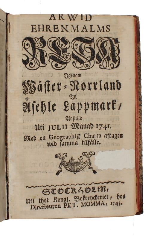
174660879Stockholm, Lars Salvius, (1746) (+) Stockholm (Peter Momma) 1743. 8vo. In contemporary full calf with richly gilt spine. Wear to extremities, boards with scratches and some loss of marbled paper. Previous owner's name to front free end-paper. Second work (Resa genom Wäster-Norrland) closely trimmed in upper margin with minor loss of text. (20), 271, (13) 144 pp. (wanting the map).
8vo [21 x 13.5 cm]; [iv], iv, [ii], 402, [ii, ads] pp, engraved frontis of two headed snake. later full calf, gilt ruled on covers and spine, gilt title lettering on red morocco spine label, old and partly erased inkstamp on title margin, else a near fine copy, clean, in fine and attractive binding. A picture of this book is available upon reques The author was friends with Benjamin Franklin and Joseph Priestly and was a fellow of the Royal Society. An American, he was accused of spying for both Britain and United States in the American Revolution. According to Casey Wood, 220: "One of the earliest and most informative accounts of the flora and fauna of the Guianas." Sabin 3106: "A very useful and entertaining work." Field 17: 'The especial subject of the author's inquiries regarding the Indians is the nature and use of the Wourali Poison, with which their weapons are charged'. Cox II, 281. Not only a description of the natural history of the area, but includes a description of the native peoples and geography, rivers and villages. Some copies have the contents pages bound at the end which was arbitrary. Sabin's copy had the contents pages at the beginning as does this copy, which is the preferred position for contents pages.
8vo [23 x 15 cm]; xvi, 326 pp, 18 plates, maps and plans including 3 folding maps colored in outline, 2 plans, 2 partly colored profiles, plates from author's drawings, tables, index. original cloth, gilt spine title lettering, spine faded, repair to head affecting two letters of title, light stain to cover, interior is quite good, unmarked, short tear to stub of map, overall very good. A picture of this book is available upon request Ghani 221. Royal Geographical Society 278. Wilson 127. A narrative of the author's travels from London to the Caucasus to Vladikavkas, Tiflis via the Georgian military road, Caucasia, Trans-Caucasus railway, Baku, Naphtha Springs, through Transcaspia to Asunada, the Oxus to Bokhara, Persia to Resht, Teheran, Isaphan, Bushire and finally to Bombay, with much on each place visited, astute observations on religion, customs, politics, trade, transportation, etc, and intelligence observations on the Russian rail building across Caucasus.
12mo [19.5 x 12.5 cm]; ix, 320 pp, 4 colored lithographed plates including frontis, folding partly hand colored map, with the appendix. contemporary full calf, gilt title lettering on leather spine label, gilt ruled, marbled boards and edges, endpaper inscription, endpaper bookplate of polar researcher Andrew Taylor, front joint partly cracked but firm, edge rubbed, clean & fine. A pictur Sabin 57760. Abbey Travel 640. Arctic Bibliography 12899: "the voyage by Baffin Bay, Lancaster Sound, Barrow Strait, the wintering at Griffith Island, and return. Includes informative notes on West Greenland Eskimos, negotiating the ice of northern Baffin Bay, ice conditions in the Canadian Arctic waters, hunting adventures, clothing, food and equipment , carrier pigeons, the sledge journeys, arctic nature and winter recreations". "As a surveying expedition, it was eminently successful. . . due to the steam- tenders, which, during the summers of 1850 and 1851, held out new prospects for arctic navigation. The way in which the Pioneer or Intrepid cut through rotten ice, or steamed through the loose pack in a calm, was an object-lesson to the whalers, and led directly to the employment of powerful screw-steamers in the whaling fleet" [DNB]. One of the important Franklin search expedition and dedicated to Lady Franklin, the fine and attractive colored view plates, the appendix nor the map, were not included in the US edition.
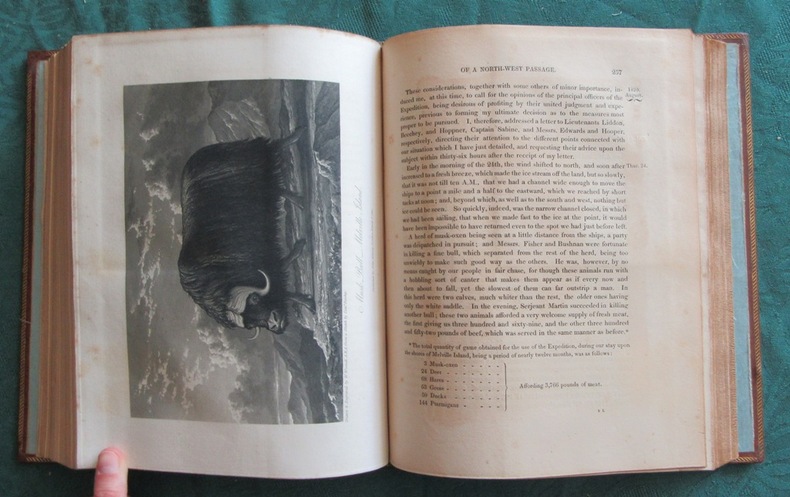
4to [29 x 23.5 cm]; [viii], [i, errata], xxix, 310, clxxix pp, 20 plates, maps and charts (complete) including folding, frontis, landfalls, other illus, tables. later half calf & marbled boards, raised bands, gilt title lettering on red leather spine labels, decorated in compartments, very light foxing to few leaves, old small repair to stub of map, a fine, clean & unmarked copy in handsome binding, wide margins. TPL 1206. Sabin 58860. Lande 1751. National Maritime Museum 822. Arctic Bibliography 13145. Hill 225: 'Parry reached Lancaster Sound in July, sailed through and explored and named Barrow Strait, Prince Regent Inlet and Wellington Channel. . . He reached 110 degrees west, earning a reward offered by parliament to the first ship's company that should attain that meridian. He also discovered Melville Island and other of the Parry Islands. After being frozen in for ten months, the ships were released on August 20, 1820. . . on his arrival in England he was commissioned commander and elected to Royal Society. . . he charted hundreds of miles of coastline in the Canadian Arctic and collected valuable data on Arctic natural history. Many of the fine plates are from sketches by Frederick William Beechey.
small folio [32 x 19 cm]; [iv 240 pp, extra engraved title page as frontis, double-page map of eastern Mediterranean to Caspian Sea, Arabia, Black Sea, foldout panorama of part of Constantinople, total of 50 engravings including costumes, plans, views. contemporary full calf, worn, gilt title lettering on red leather spine label, spine ends chipped, joints cracked but holding, front fixed endpaper chipped, interior is crisp, clean & near fine, only slight foxing in some outer margins, in good cover. A p Cox I, 206. Blackmer Cat 297: 'Sandys travelled to the Levant in 1610, spending a year in Turkey, Palestine and Egypt. His observations first appeared in 1615 and his text was soon regarded as a special authority on the Levant. Sandys was also interested in colonial promotion and was one of the undertakers of the third charter of the Virginia company in 1611'. Wing S680. Also described in the text are Cyprus, Crete, Malta, Sicily, the Aeolian Islands, Rome, Venice, Naples, Syracuse, Massena. There is good description of the Jews in the Holy Land, the peoples of Egypt, Turkey, their customs, religion, ceremonies, etc. New S. T. C. 21726: These celebrated travels were 'written in a pleasant style, are distinguished by erudition, sagacity and a love of truth'.
8vo [23 x 15 cm]; xv, [i], 436 pp, 14 plates (complete) of which 5 are colored lithographs with added hand coloring including a double-page and frontis and plans, 2 other illus, hand colored folding map (short tear at stub), tables. contemporary half morocco with gilt decorations & title lettering on spine, marbled endpapers, light wear at spine edge, light stains in margins of some plates, very good sound copy in handsome binding. A picture of this book is available upon request by The author traveled from San Francisco to Mazatlan, Durango, Mexico City, Puebla, Mitla, Tehuantepec, Guatemala, Santa Catarina, Salvador, and well over 100 smaller towns, providing excellent descriptions of the locations, the people, conditions, countryside, etc. The ancient ruins at Mitla are described and illustrated. The plates are superb examples of early chromolithography. Abbey Travel 665. Palau 329979. Humphreys 1745. Welch 114. Spain & Spanish America II, 623.
192059816Los Angeles CA: MacDonald Collection ca. 1920-1955. Archive of 89 coated labels sized from 2.25 x 3.5 in. up to 6.25 x 8.5 in. with many in the middle ranges including distinctive 5.25 in. rounds most colour lithographs some with metallic inks nearly all retaining the original adhesive from never having been applied to luggage in assorted shapes many round others rectangular square diamond shaped etc. most on thin coated paper stock all NF condition from the library of Archibald Angus MacDonald 1892-1977 stepson of famed southern California oil man William F. Byrne as well as oil company and drilling equipment company owner and manager of MacDonald & Burns Oil Producers. A delightful and remarkably colourful small archive of fine lithographed and colour printed luggage labels preserved from over three decades of ocean liner travel by the well-to-do California oil family. Their frequent voyages carried them to Hawaii Asia South Asia Africa Europe and the Americas preserving luggage labels souvenir brochures and more along the way. At the time they were an essential advertising campaign largely driven by the popular Grand Hotels and were often illustrated by such renowned commercial and graphic artists as Dan Sweeney and Mario Borgoni. Included amongst these are iconic labels for the historic Park Hotel depicting jockeys racing on the Shanghai Club race track in front of the iconic Art Deco building completed in 1934; The Cathay & The Metropole in Shanghai operated by Cathay Hotels Ltd.; the historic Peninsula Hotel in Kowloon Hong Kong opened in 1928 and founded by the brothers Ellis & Elly Kadoorie still considered one of the finest hotels east of the Suez; or beautiful scenic labels created for the Eastern & Oriental Hotel the “E&O†still considered one of the finest hotels in Southeast Asia and the Oriental Hotel in Kobe Japan. Also present are labels for the Raffles Hotel in Singapore originally opened in 1887 Mrs. Ch’ien’s Guest House located originally not far from the Legation Quarter in Peking Maidens Hotel Delhi the splendid Clark’s Hotel Benares Varanasi still considered the finest heritage hotel in the city and the Imperial Hotel of New Delhi opened in 1936 designed by F.B. Blomfield. The MacDonald’s visited the Philippines several times often staying the Manila Hotel Hawaii where the Royal Hawaiian and the Kiluaea Volcano House were their places of choice and frequently stated at The Biltmore in Los Angeles after returning from trips the Plaza in Buenos Aires the Waldorf in New York and many of the major European Hotels. Also present are labels for the Galle Face Hotel in Colombo Sri Lanka founded in 1865 featuring the historic south wing designed by Edward Skinner and one of the oldest hotels East of Suez. South Africa was a stopover during their 1952 Great Africa-India Cruise on the RMS Caronia and labels include Polley’s Hotel Pretoria the Imperial Hotel in Pietermaritzburg and the North Western Hotel Livingstone N. Rhodesia. MacDonald Collection, unknown
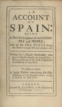
170028857London: Printed for Joseph Wilde at the Elephant at Charing Cross 1700 1700. First edition one of two variants. In this one the dedication is signed "E. L. ESTC R223814 records nine copies Durham Oxford Bodleian National Trust Folger UCLA Illinois Kansas Tennessee Beinecke; Wing A226C. Edges neatly repaired; a little browning and slight smudges in the text; very good copy. 8vo contemporary panelled sheep neatly rebacked with the original spine laid on brown leather spine label gilt decorations and lettering. Informed and lively observations on Spain at the end of the 17th century the political intrigues of the monarchy Spanish culture - including bull fighting and theater - and one allegorical tale entitled "The Story" about the "Monarchy of Philippia" all written in a series of letters to a Mr. Brunet from "His Devoted Friend R.--" who apparently visited Spain and northern Africa between 1694 and 1696. The "Epistle Dedicatory" signed "E. L." in this variant is signed "E. Lewis" in the other equally scarce variant. See ESTC R13796. London: Printed for Joseph Wilde, at the Elephant at Charing Cross, 1700 unknown
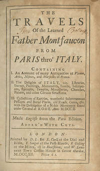
171227989London: Printed by D. L. for E. Curll E. Sanger R. Gosling and W. Lewis 1712 1712. First edition translated into English issue not certain. Pine-Coffin 698; Straus The Unspeakable Curll page 217; ESTC T110070; and see ESTC N21633. Text lightly foxed and browned; binding rubbed; very good copy. 8vo contemporary panelled calf rebacked black leather label gilt lettering. Five engraved plates four folding 15 engravings in the text and vignettes. An important work by Bernard de Montfaucon 1655-1741 a French Benedictine monk who was a pioneer in the disciplines of paleography and archaeology. In 1698 Montfaucon traveled to Italy to study antiquities and manuscripts the results of which were published in Paris in 1702 as Diarium Italicum. It was translated into English in 1711 and published by Edmund Curll. There is an issue with a second title-page that reads "Diarium Italicum: or a Journey Through Italy London 1711." It appears as stated in ESTC to be the same setting of type as this edition which has a cancel title-page. London: Printed by D. L. for E. Curll, E. Sanger, R. Gosling, and W. Lewis, 1712 unknown
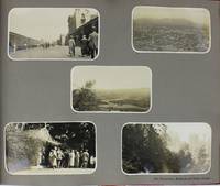
19254849Various locations in the American Southwest West Coast and Pacific Northwest 1925. Very good. 30 leaves illustrated with 270 photographs of various sizes including two multi-panel panoramic photographs each leaf with a single printed caption identifying the subjects or location. Contemporary red leather gilt titles on front cover. Oblong folio. Some scuffing and abrading to covers a few short edge tears. Internally clean. A handsome annotated photograph album produced to commemorate a railroad trip by a well-to-do party of travelers from Kansas City through New Mexico Arizona Colorado California and up the West Coast to British Columbia and Alberta in 1925. The first photograph in the album is a panorama of a large group of well-dressed men and women at the Mission Hills Country Club in Kansas City captioned in the negative indicating the traveling party emanated from Kansas City as part of the "N.E.L.A. Red Special Delegation to San Francisco Convention" who were "Guests of K.C.P and L Co" presumably the Kansas City Power & Light Company. The second and much larger panoramic photograph is comprised of fifteen 5-x-8-inch photographs picturing the travelers posed outside the numerous Pullman cars that comprise the Red Special. The preponderance of the photographs are organized by location generally five or six photographs per page with a single printed caption per page mostly indicating the location. The body of photographs begins with facing pages of images featuring the travelers and some scenery in Colorado Springs and Garden of the Gods in Colorado. A sampling of subsequent groups of photographs feature the travelers at Pike's Peak Albuquerque the Grand Canyon San Bernardino Redlands Los Angeles Santa Barbara Del Monte Yosemite Valley Glacier Point Mariposa Grove San Francisco Shasta the Columbia River Victoria Vancouver Canadian Rockies Lake Louise Lake Agnes Moraine Lake Johnson's Canyon Banff and other locations. The album closes with four pages of photos picturing "Fellow Travelers Here and There" and a group photo of "The Train Crew." The latter photograph is the only one featuring African Americans who were likely working as Pullman porters on the Red Special. A wide-ranging series of photographs featuring much of the American and Canadian West before the Great Depression. unknown
171227989London: Printed by D. L. for E. Curll E. Sanger R. Gosling and W. Lewis 1712 1712. First edition translated into English issue not certain. Pine-Coffin 698; Straus The Unspeakable Curll page 217; ESTC T110070; and see ESTC N21633. Text somewhat foxed and browned; binding rubbed; very good copy. 8vo contemporary panelled calf rebacked black leather label gilt lettering. Five engraved plates four folding 15 engravings in the text and vignettes. ¶ An important work by Bernard de Montfaucon 1655-1741 a French Benedictine monk who was a pioneer in the disciplines of paleography and archaeology. In 1698 Montfaucon traveled to Italy to study antiquities and manuscripts the results of which were published in Paris in 1702 as Diarium Italicum. It was translated into English in 1711 and published by Edmund Curll. There is an issue with a second title-page that reads "Diarium Italicum: or a Journey Through Italy London 1711." It appears as stated in ESTC to be the same setting of type as this edition which has a cancel title-page. <br/><br/> London: Printed by D. L. for E. Curll, E. Sanger, R. Gosling, and W. Lewis, 1712 unknown books
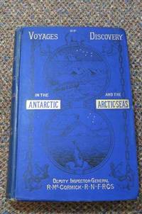
1884291<p>Sampson Low Marston Searle and Rivington London 1884. First Edition. Cloth. Good/No Dust Jacket. 1st Edition; Volume 2 ONLY xii 412 pages all illustrations and maps as called for. Appendix Index. Original covers yellow end papers. Shelf ware covers bumped beginning to fray spine sunned and softening as expected. Some foxing mainly to prelims and end papers and page edges. Contents clean. Volume 2 contains The Voyage in Search of Sir John Franklin and Her Majesty's "Erebus" and "Terror" under the command of the author. To which are added some concluding remarks an autobiography and appendix. Full Title: Voyages of Discovery in the Arctic and Antarctic Seas and Round the World: Being Personal Narratives of Attempts to Reach the North and South Poles; and of an Open-boat Expedition up the Wellington Channel in Search of Sir John Franklin and Her Majesty's "Erebus" and "Terror" in Her Majesty's Boat "Forlorn Hope" under the command of the author. To which are added an autobiography appendix portraits maps and numerous illustrations. This is the first UK edition. Quantity Available: 1. Shipped Weight: Under 2 kilogram. Category: Arctic & Antarctic; 19th century; Exploration. Pictures of this item not already displayed here available upon request. Inventory No: 291. . This book is extra heavy and may involve extra shipping charges to some countries.</p> Sampson Low, Marston, Searle, and Rivington hardcover
1891020304London & Liverpool: George Philip & Son 1891. First edition. With the first map but lacking the other two maps with a chromolithograph colour frontispiece twelve plain lithograph plates and eight mounted photographs nineteen text illustratons large thick octavo pp xx 404 a little foxing and age-toning throughout an inscription on the half-title with two small library stamps on the title page Kenya Carnegie Circulating Libraries and McMillan Memorial Library an accession stamp on the verso of the title page stoutly bound in grey cloth. Meyer was a German geographer and traveller. In 1887 during his first attempt to climb Kilimanjaro Meyer reached the base of Kibo but was forced to turn back. He did not have the equipment necessary to handle the deep snow and ice on Kibo. In 1888 alongside the Austrian cartographer Oscar Baumann he explored the Usambara region with designs of continuing on to Mount Kilimanjaro. However the two explorers could not proceed on due to events related with the so-called Abushiri Revolt. Baumann and Meyer within a matter of days were captured and held as prisoners. Only after a large ransom was paid to rebel leader Abushiri ibn Salim al-Harthi were the two men released. In 1889 Meyer returned to Kilimanjaro with the celebrated Austrian mountaineer Ludwig Purtscheller and Yohane Lauwo a Chagga guide for a third attempt. Their climbing team included two local headmen nine porters a cook and a guide. After Meyer and Purtscheller pushed to near the crater rim on 3 October before retreating to the base of Kibo they reached the summit on the southern rim of the crater on Purtscheller's 40th birthday 6 October 1889. Meyer named this summit - now known as Uhuru Point- "Kaiser Wilhelm Spitze". After descending to the saddle between Kibo and Mawenzi they attempted to climb Mawenzi next but only reached a subsidiary peak Klute Peak before retreating due to illness. In Meyer's honor the highest summit of Mawenzi nevertheless is known as Hans Meyer Peak. The summit of Kibo would not be climbed again until 20 years later and the first ascent of Hans Meyer Peak was only in 1912. First Edition. Cloth. Good. George Philip & Son Hardcover
186326553Edinburgh and London, Blackwood and Sons, 1863. Orig. full cloth, gilt lettering on spine, frontcover gilt. Tears to cloth at hinges, but covers not loose. Spine and covers somewhat rubbed. Covers worn at edges. XXXI,658 pp. and Publishers Catalogue at end. Numerous textillustrations in woodcut, 26 plates (incl. the steelengraved frontispiece), 2 maps (1 large folded and coloured in outline), foldings of map strenghtened on verso). Internally in general fine and clean, only a few weak brownspots.
Edinburgh and London, Blackwood and Sons, 1863. Orig. full cloth, gilt lettering on spine, frontcover gilt. Tears to cloth at hinges, but covers not loose. Spine and covers somewhat rubbed. Covers worn at edges. XXXI,658 pp. and Publishers Catalogue at end. Numerous textillustrations in woodcut, 26 plates (incl. the steelengraved frontispiece), 2 maps (1 large folded and coloured in outline), foldings of map strenghtened on verso). Internally in general fine and clean, only a few weak brownspots.
No dust jacket. Hardcover in blue card slipcase. Facsimile. Large, heavy book. Number 47 of a commemorative edition of 200 copies printed on the occasion of the American Bicentennial. Book is hand-numbered on first page of text. Item comprises numerous maps, most of which are fold-out. Minor wear on slipcase. Bound in goatskin on spine and leading corners. Hand-marbled boards. Gilt lettering within a circular leather onlay on front board. A few light scores on onlay. Slight wear on spine ends. Slight wear on lower leading corner of front board. Minor bumping on endpapers. Pages are hand-numbered. Contents are clean and clear throughout. AF Used
182119531Performed in the years 1819-20 in his Majesty's ship Hecla and Griper under the orders of William Edward Parry R.N., F.R.S. and commander of the expedition. With an Appendix, containing the scientific and other Observations.Published by authority of the Lords Commissioners of the Admiralty.London, Published to the Admiralty, and Board of Longitude 1821. Ex-libris héraldique Anison Che Fiorisce.Édition originale. 4 carte dépliante, 16 planches dont 1 carte et 9 Appendix.Reliure pleine basane marron de l'époque. Dos à nerfs filetés et fleurons dorés, décor à froid et fers dorés en pied. Tranches dorées. Double filet doré encadrant les plats avec fleurons angulaires. Roulette sur les coupes et les contreplats. Gardes de soie bleue moirée. Quelques rousseurs. Bien relié. Très bon état. Format in-4°(28x22).
- De l'imprimerie de Jean Foulquier, A Bordeaux 1810 (S.d), In-18 (9,5x16,9cm), 288pp., relié. - Edition originale, rare, illustrée d'un plan dépliant de la ville et d'un grand tableau dépliant placés en début d'ouvrage, avec les rues, places, etc. Reliure en plein cuir de Russie rouge d'époque. Dos lisse orné de fers différents d'époque, roulettes en queue et tête. Pièces de titre de maroquin brun, la seconde en queue avec le nom de Foulquier. Tranches dorées. Guirlande d'encadrement sur les plats. Roulette sur les coupes et intérieure. Le plan et le tableau ont une déchirure provoquée par les dépliement successifs. Dernier feuillet 287 avec un manque de papier en marge et perte de quelques chiffres de la table. Feuillet 41? manque de papier en marge basse. Bonne fraîcheur du papier. Traces de frottement, 2 petites taches brunes sur le second plat. Très bel exemplaire de ce rare almanach impérial sur la ville de Bordeaux. [ENGLISH DESCRIPTION ON DEMAND]
- Chez Le Jay et Maradan, A Paris 1788, in 8 (12,5x19,5cm), (4) 282pp. et (4) 274pp. (3), 2 volumes reliés. - Edition originale française in-8, parue dans le même temps que l'édition in-4. Elle est illustrée de 16 planches, dont 12 dépliantes (vues, portraits, objets) et d'une grande carte dépliante, le tout sur papier fort. Cette édition est parue la même année que l'originale anglaise, et la traduction a été revue par le Comte de Mirabeau. Reliures en pleine basane marbrée et glacée d'époque. Dos lisses ornés de 4 fleurons caissonnés. Pièces de titre en maroquin rouge, tomaisons en maroquin noir. Triple filet d'encadrement sur les plats. 2 micro coupures en tête du tome 2. Etroite fente au mors supérieur en tête du tome 1, mors inférieur fendu en tête et queue sur 4 cm. Coins émoussés, certains rognés avec manques de cuir. Ensemble frotté. Bon aspect général. L'archipel des îles Palaos est situé à l'est des Philippines, au nord de l'Indonésie, en Micronésie ; Le capitaine Georges Wilson et son équipage, au service de la Compagnie des Indes, firent naufrage sur une île proche des Palaos en 1783. L'ouvrage conte comment ils furent reçus par les indigènes et leur roi, et comment ils vécurent, jusqu'à ce que le roi leur fit construire un navire pour se rendre à Macao, tout en confiant son fils au soin du capitaine Wilson, afin que celui-ci reçut un éducation occidentale. Georges Keate, à l'aide des carnets du capitaine, a établi la narration de voyage du navire l'Antelope qui partit de Macao. L'introduction est une recherche dans la littérature de l'existence de ces îles. Le livre relate, bien évidemment, les moeurs et coutumes des habitants. A la fin du tome II, un vocabulaire de la langue Pelew. On notera avec intérêt un épisode qui montre le roi en guerre contre les habitants d'autres îles, et qui emprunta 5 hommes au capitaine pour l'accompagner à la guerre, les relations pacifiques entre les anglais et le roi tirent sûrement leur origine de ce curieux fait diplomatique. L'ouvrage connut un grand succès, certainement parce que le témoignage qu'il rendait correspondait à ce mythe du bon sauvage qui sévissait en Europe ; Paul et Virginie de Bernardin de Saint-Pierre est paru à la même date. Ex libris : Bibliothèque de C. Jameson. Au dessous chiffre en noir illisible. [ENGLISH DESCRIPTION ON DEMAND]
- Ménard et Desenne, fils, Paris 1825, In-18 (10x17cm), 30 volumes reliés. - Nouvelle édition illustrée d'un frontispice par Deveria et de 60 figures sous serpentes d'Adam gravées par divers graveurs, Fessard... Impression en caractères didot sur vergé. Reliures en demi basane fauve d'époque. Dos lisse orné de 4 fers au casque et à l'épée, 3 roulettes différentes à la place des nerfs. Pièces de titre en maroquin rouge, et de tomaison en maroquin vert. Un petit accroc avec manque en queue du tome 2. Un manque en tête du tome 11. Coiffe de tête du tome 18 arrachée. Manques en tête des tomes 29 et 30. Accroc en queue du tome 16. Des zones plus sombres sur certains volumes. Des frottements. Dans l'ensemble, bon exemplaire. Préface à L'Abrégé par Depping : "Vers l'an 1745, quelques gens de lettres d'Angleterre, formèrent le projet d'une collection complète de toutes les relations de voyages publiées dans toutes les langues de l'Europe. L'abbé Prévost, écrivain avantageusement connu par le succès de ses romans, s'engagea à traduire l'ouvrage en français. Il tint parole, l'ouvrage se répandit dans toute l'Europe. Mais les auteurs anglais abandonnant leur projet, l'abbé poursuivit sa route, malgré ses critiques des vices de leur méthode, et termina l'ouvrage, sans fournir aux lecteurs un fil qui pût les conduire dans les sentiers tortueux et innombrables, dans les landes arides de ce vaste labyrinthe où il s'était enfoncé avec eux. Voici maintenant ce qu'on à cru pouvoir faire pour le présenter au public sous une forme plus agréable : on l'a réduit ; tout ce qui s'appelle Journal de navigation a été retranché ; Quand un voyageur, qui s'est vu dans des situations extraordinaires, raconte lui-même, on s'est bien gardé de prendre sa place : on l'a laissé parler sans rien changer rien ajouter à son récit ; on n'a fait que très peu de changements dans les descriptions de lieux et de murs, dans les détails physiques. Mais on y a joint autant qu'on l'a pu cette philosophie qui lui manque absolument, cette morale pure et universelle, qui n'est dictée et sentie que par le cur, qui ne cherche dans toutes les connaissances que l'homme peut acquérir que de nouveaux rapports faits pour l'attacher à ses semblables." Tome 1 à 4 : Afrique, par régions et pays. Tomes 5 à 12 : Asie, par régions et pays. Tomes 12 à 20 : Amériques, par régions et pays, avec le Groenland et le Port Boréal. Tomes 21 à 30 : Voyages autour du monde. [ENGLISH DESCRIPTION ON DEMAND]
- Chez Buisson, A Paris An 3e (1794), In 8 (13,5x21cm), xxiv, 391pp. et (4) 386pp. et (4) 371pp. (1), 3 volumes reliés. - Edition originale de la traduction française par Billecocq, après l'édition anglaise de 1790, sans l'atlas in 4 contenant 28 planches qu'on pouvait acquérir à part. Reliure en demi chagrin bordeaux fin XXe. Dos à nerfs janséniste. 2 pièces de titre et une pièce de tomaison de basane bordeaux. Papier à la cuve marbré sur les plats. Quelques cahiers et feuillets restaurés finement en marge. Titre et faux-titre du second tome doublés. Feuillets 1 et 3, papier gratté sur une zone et restauré avec perte de quelques lettres. Quelques feuillets jaunis ou avec brunissures. Les restaurations sont bien réalisées et relativement invisibles. Reliure realisée sur brochure, papier non rogné. Bel exemplaire. Un des voyages fondamentaux sur la côte nord-ouest de l'Amérique du nord (Colombie britannique) et plus particulièrement de l'Alaska. Les voyages de la chine à l'Amérique constituant la plus grande partie du récit. John Meares fut tout d'abord capitaine dans la Royal-Navy, puis commandant dans la marine marchande ; il fit commerce de fourrures entre la Russie et l'Amérique, installa des comptoirs... Il fit l'objet d'une polémique quant aux découvertes dont il s'arrogeait la primeur, et qu'il aurait puisé chez Vancouver. Les relations de voyage de Meares sont riches et bien écrites, dans un style clair et descriptif, passionnantes à plus d'un titre, notamment sur les Indiens, les Russes ou les habitants des îles. L'expédition de Meares avait le double objectif de découvrir un passage au nord-ouest et de donner plus d'étendue au commerce. Dans le second voyage, plus détaillé que le premier, Meares aborde aux îles Sandwich et aux Philippines. Il donne d'amples détails sur les habitants du détroit de Nootka, notamment sur le commerce des fourrures et de la pêche à la baleine. [ENGLISH DESCRIPTION ON DEMAND]
- De l'imprimerie de Poignée, à Paris 1800 - An VIII, 3 tomes en 3 Vol. in 8 (12,5x20,5cm), xxxviij, 299pp. (2), relié. - Edition originale française, rare, traduite par Bouscheseiche. Sans l'atlas contenant 11 cartes que l'on trouve souvent séparément. Reliure en demi veau vert marbré postérieur ca 1850 ; beau pastiche confondant d'une reliure d'époque. Dos lisse orné de grecques et de quatre fleurons. Pièces de titre et de tomaison en maroquin marron. Tranches marbrées. Un manque en queue du tome 2, se poursuivant sur le plat. Bel exemplaire, très élégant, et bien frais dans l'ensemble. L'Insdostan s'étendait de l'Himalaya au Nord, jusqu'à la presqu'île de Malabar et de Coromandel au Sud, c'est-à-dire la majeure partie de l'Inde à cette époque. L'étude de James Rennel est presque exclusivement géographique, et seul un chapitre sur la chute du grand Mogol sacrifie à l'aspect historique exception pour l'introduction au tome premier sur l'origine de L'Indostan et les conquêtes européennes. L'ouvrage fut très bien accueilli en Angleterre, Rennel fournissait assurément des renseignements précis et utiles à quiconque se rendait dans ces contrées. Afin de compléter la géographie physique et humaine de l'Indostan, l'édition française a ajouté plusieurs chapitres, une introduction de textes traduits par Castera sur l'histoire de l'Inde, la bibliographie des voyageurs, et qui forment une grande partie du troisième volume ; on relèvera avec intérêt le Voyage au Thibet de Samuel Turner. [ENGLISH DESCRIPTION ON DEMAND]