RICHARD Abbé JérômeMareMagnum

39 458 résultats
- Chez François Des Ventes & Saillant, A Dijon & à Paris 1766, in-12 (10x17cm), (20) clxiv, 320pp. (3) et (4) viij, 585pp. (1) et (4) lxxij, 343pp. (1) et (4) 513pp. (1) et (4) xxxv (1) 502pp. (2) et (4) 482pp. (6), 6 volumes reliés. - Edition originale, illustrée de deux cartes de l'Italie dépliantes. Dos à nerfs orné de 4 fleurons caissonnés. Pièce de titre et de tomaison en maroquin rouge. Triple filet d'encadrement sur les plats. Roulette sur les coupes. Coiffes de tête du tome I et IV en partie arrachées ; et des tomes V et VI élimées. Coiffes de queue des tomes I et IV élimées. Mors supérieur du tome I en partie fendu, du tome III en queue et du tome VI sur les trois derniers caissons en queue. Feuillets inversés in fine de la table du tome IV. Malgré tout, ensemble satisfaisant, de bon aspect général. L'auteur ne se contente pas de donner une relation de son voyage personnel en Italie, mais il tend à réaliser une description complète et la plus exacte possible de l'Italie contemporaine, afin que son ouvrage soit un guide moderne et utile, en comparaison aux multiples voyages en Italie qui on été écrits ; et L'abbé Richard s'est en effet beaucoup documenté pour réaliser cette étude aussi bien politique, économique que culturelle. On y trouve des éléments tout à fait nouveaux, en dehors de l'histoire de l'Italie et des descriptions classiques des monuments et oeuvres d'art, comme la qualité de l'air, l'alimentation, les routes, les imprimeries, les courtisanes, les collections... Deux volumes entiers sont consacrés à Rome. L'ouvrage procède par villes et régions géographiques. Des tables de matières permettent aisément de retrouver des éléments particuliers de l'oeuvre. Une somme, si l'on considère que chaque volume contient plus ou moins 400 pages. Le volume 3 contient une chronologie des écoles de peintures et des peintres en Italie. [ENGLISH DESCRIPTION ON DEMAND]
- Dentu, Paris 1809, In-8 (12,5x20,2cm), (4) iv (4) 401pp. (3) et (4) 398pp. (2) et (4) 379pp. (1), 3 volumes reliés. - Edition originale, très rare, sans l'atlas parue à part. Traduit de l'anglais sur la seconde édition par Pictet-Mallet. Reliures en pleine basane flammée d'époque. Dos lisses ornés de 2 fers différents, de roulettes et d'un large caisson à la grotesque. Pièces de titre en maroquin rouge, et de tomaison en maroquin noir. Têtes des tomes 2 et 3 en partie élimées ; un léger manque en queue du tome 3. Mors inférieur du tome 1 en grande partie étroitement fendu ; Mors supérieur du tome 2 fendu en tête et queue. Frottements. Bon exemplaire. Récit de voyage pittoresque qui commence par Figuere et les Pyrénées, Barcelone et ses environs, Madrid, Saragosse, Aranjuez et Tolede, les Asturies, Salamanque, Seville, Cadix, Malaga, Grenade, Carthagene, Alicante, Valence. Les volumes sont occupés par de nombreuses considérations sur l'agriculture, la politique, l'industrie, le commerce et les moeurs des espagnols... Ce voyage fut édité à l'heure où les regards des français étaient tournés vers l'Espagne en raison des guerres napoléoniennes, la capitulation de Madrid datant de décembre 1808. Tableaux des monnaies et des revenus de l'Espagne. [ENGLISH DESCRIPTION ON DEMAND]
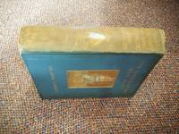
1911794<p>Hodder & Stoughton London 1911. First Edition. Cloth. Good/No Dust Jacket. 1st English Edition; Association Copy - Rudmose-Brown. English Version translated by Philip Walsh. viii 315 pages folding photographic frontispiece plus 47 photographs 3 sketches and 1 map. Original blue-grey cloth binding embossed with gilt illustration of a ship and titling on front cover white a penguin and gilt titling to spine. "Ex Libri Rudmose Brown" stamp of verso front cover and signed R N Rudmose Brown may 28th 1912 on Front end paper. Spine faded endpapers browned Bubbling and bowing to covers. Contents clean. Exploration & mapping of 3000km of the Antarctic Peninsula Graham Land by a French expedition. Charcot continued exploring and recording data in the polar water until his death in 1936 in a storm-induced shipwreck on the coast of Iceland. Provenance: Library stamp of R.N.Rudmose-Brown with his signature dated May 28 1912 on front end paper. Rudmose Brown was a botanist and polar explorer who was on The Scottish National Antarctic Expedition 1902 - 1904. This is the first English edition. Quantity Available: 1. Shipped Weight: Under 2 kilogram. Category: Arctic & Antarctic; 1900-1920; Exploration. Pictures of this item not already displayed here available upon request. Inventory No: 794. .</p> Hodder & Stoughton hardcover
23074Karl W. Hiersemann Leipzig 1924. First edition. Three plans and nine illustrations in the text and further illustrated by 243 full-page sepia toned photographic plates largely from photgraps taken by the author 1914-1917 during the ill-fated German secret mission to Kabul in World War I when they attempted to engage Afghanistan in a Holy War against British India. 4to 12 1/4 x 9 3/4 inches pages: xvi:69:1;243 plates. Publisher's decorative coloured cloth orange endpapers. The boards are very good however the upper half of the backstrip has faded and there is rubbing to the corners and headbands and some fraying to the base of the upper joint. The joints are firm and the volume is very good and clean internally. Karl W. Hiersemann, Leipzig, 1924. hardcover
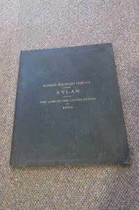
19034018Washington D.C Washington 1903. First Edition. Hardcover Original Cloth. Very Good Condition/No Dust Jacket. Signed by persons connected with book. SIGNED PRESENTATION COPY: Full Title: ALASKAN BOUNDARY TRIBUNAL Atlas Accompanying the Case of the United States Before the Tribunal Convened at London Under the Provisions of the Treaty between the United States of America and Great Britain Concluded January 24 1903. 1st Edition 1st printing. Very large folio 46cm. Original covers titled in gilt on front plain end papers; 6pagesList of maps and biographical notes of Cartographers; 25 maps some in color. Minor shelf wear. Presentation copy to Henry S Wellcome with the compliments of John W Forster. U.S. Secretary of State Government. Reproductions of maps used in 1903 border disputes with Britain showing the American claim to the land; effectively a cartographic history of Alaska. When the U.S. purchased Alaska from Russia in 1821 it inherited a dispute over the territory's border with British Columbia. The Klondike Gold Rush of 1897-98 exacerbated tensions until the 1903 Hay-Herbert Treaty under which the nations entered arbitration to resolve the dispute. The arbitration's conclusion favored the United States sparking Canadian frustration that Britain had not better defended its interests. This atlas presents official facsimiles of the maps presented by the U.S. in the arbitration process. 21 are facsimiles of historical maps from Russian French German British Canadian and American atlases dating between 1798 and 1863; many are depicted with facsimiles of title pages from the source atlases. The remaining four maps were produced in 1903 by the U.S. Coast and Geodetic Survey including one depicting the locations of Native American villages along the border. Quantity Available: 1. Shipped Weight: Under 5 kilogram. Category: Arctic & Antarctic; Politics & Government. Signed by persons connected with book. Pictures of this item not already displayed here available upon request. Inventory No: 4018. . This book is extra heavy and may involve extra shipping charges to some countries. Washington D.C hardcover
178429268London: G. Nicol & T. Cadell 1784. Etched and engraved by C. Grignion after a drawing by Webber. Image size: 10 1/4 x 7 inches. Sheet size: 22 x 15 1/2 inches. In this attractive portrait a young muscular man dances what was then a sacred dance called Hula. In his right hand he holds a feather covered gourd. Virtually nude he wears only a bark cloth "malo" or loin cloth a coral necklace and dogtooth leggings. His body is tattooed in rhythmic patterns that flow down his arms and legs.<br/> <br/>"Cook's third voyage was organized to seek the Northwest Passage and to return the islander Omai to Tahiti. Officers of the crew included William Bligh James Burney James Colnett and George Vancouver. John Webber was appointed artist to the expedition. After calling at Kerguelen Island Tasmania New Zealand and the Cook Tonga and Society Islands the expedition sailed north and discovered Christmas Island and the Hawaiian Islands which Cook named the Sandwich Islands. Cook charted the American west coast from Northern California through the Bering Strait as far north as latitude 70 degrees 44 minutes before he was stopped by pack ice. He returned to Hawaii for the winter and was killed in an unhappy skirmish with the natives. Charles Clarke took command and after he died six months later the ships returned to England under John Gore. Despite hostilities with the United States and France the scientific nature of this expedition caused the various governments to exempt these vessels from capture. The voyage resulted in what Cook judged his most valuable discovery - the Hawaiian Islands" Hill. John Webber R.A. born in London of Swiss parents was the official artist on Cook's historic and final Pacific voyage. The drawings were the source for the engravings that illustrated Cook's "A Voyage to the Pacific" which was published in 1784. G. Nicol & T. Cadell unknown books
200414521London: Simon & Schuster. As New in As New dust jacket. 2004. First Edition; First Printing. Hardcover. A most beautiful unread Complete Set of the first UK edition/first printing in As New condition signed by authors Tony DiTerlizzi and Holly Black directly on the title page; Includes all 5 volumes: The Field Guide; The Seeing Stone; Lucinda's Secret; The Ironwood Tree; and The Wrath of Mulgarath. Follow the adventures of the three Grace siblings - 13 year-old Mallory and 9 year-old twins Jared and Simon - from their discovery of Arthur Spiderwick's Field Guide to the Fantastical World Around You to their encounter with Mulgarath and his goblin army ; The Spiderwick Chronicles; Vol. 1/5/2026; B&W Illustrations; 12mo; Signed by Author & Illustrator . Simon & Schuster hardcover
180540751Weimar, Landes=Industrie=Comptoirs, 1805. Contemp. hcalf. Spine gilt, title- and tomelabel with gilt lettering. A very smal nick to lower compartment. A small tear to top of spine. ""Anhang"" unbound but stitched. X,676 pp. and 2 folded engraved maps. Anhang: (4),IV,196 pp.
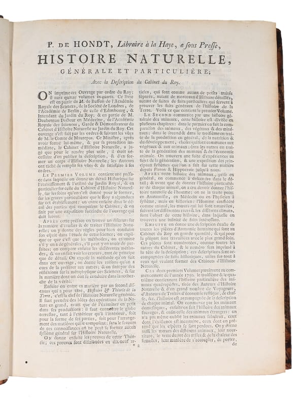
174961227La Haye, P. de Hondt, 1749. 4to. In contemporary half calf with five raised bands. Small paper-label pasted on to top of spine. Light wear to extremities. Ex-libris pasted on to pasted down front end-paper. Internally fine and clean, a nice copy. XVI, 402, (4) pp. + 22 folded maps and plates and a large folded world-map (complete).
179355315Upsala, J. Edmans Enka, 1793 &1794. 8vo. In contemporary paper covered boards with red leather title-label with gilt lettering to spine. Spine cracked, otherwise a fine and clean copy. XII, 147, (1), (7), 86, (1) pp.
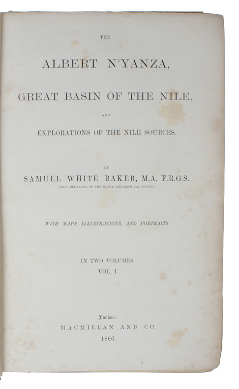
186659639London, Macmillan and Co. 1866. 8vo. 2 volumes, both in the original green pictoral cloth. Light wear to upper and lower part of spines. Front free end-paper in vol. 1 with repair and the large folded general map of the country (erroneously called for in vol. 2) reinforced in margin and with two small tears. A fine and clean set, housed in custom made red clam shell box. XXX, 395 IX, 384 pp. + double-portrait frontispiece in volume 1, lithograph frontispiece in volume 2, 2 maps (1 large folding), 13 full-page plates, 20 illustrations in text.
184353623London, Henry Colburn, 1843. Bound in 2 contemp. hcalf. Gilt spines. Title-and tomelabels with gilt lettering. Top of spines a bit worn. Light wear along edges. 2 engraved frontispieces. XXXVIII,387"IV,474 pp., 3 large folded maps and 17 engraved plates. Woodengravings in the text. Two maps bound in volume 1, 1 map bound in volume 2. The 7 plates in volume 1 with a dampstain. The plates with light spotting. text clean.
179053974Paris, Lejay fils, 1790-91. Bound in 10 uniform contemp. full mottled calf. Gilt spines, title-and tomelabels with gilt lettering. Stamp on title-pages. A few spine-ends with wear. Some corners bumped. 9 engraved frontispieces. Ca. 4100 pp.
185047583Hannover, Carl Rümpler, 1850. 4to. Contemp. hcloth. Spine gilt. Lithographed frontispiece (Samothraki). VIII,123,(1) pp. and 20 lithographed plates (incl. maps). A small stamp to titlepage. Clean and fine.
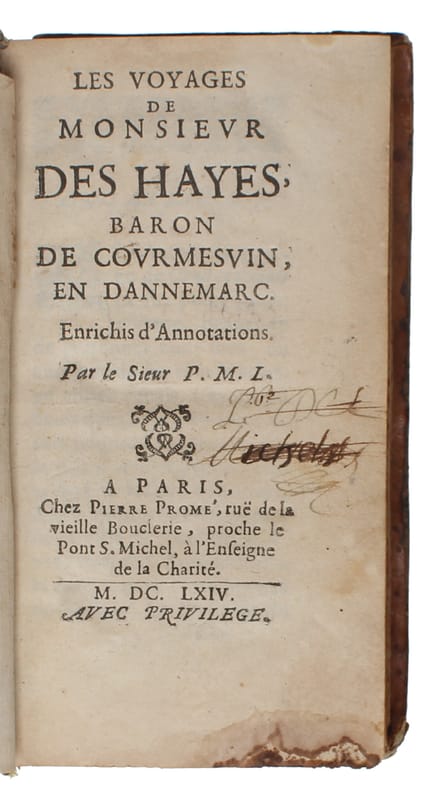
166460201Paris, Chez Pierre Promé, 1664. 12mo. In contemporary full calf with five raised bands and richly gilt spine. Extremities with wear and top 5 mm. of spine missing. Corners bumped and part of lower corner of front board worn of. Front free end-paper detached. Previous owner's name on title-page crossed out. First few leaves missing small parts of paper in lower margin, far from affecting text. Stain to lower edge. (8), 284 (wrongly printed as 184), (3) pp.
185554165Paris, Bénard et Compagnie, 1855. Royal8vo. Contemp. hcalf. Spine gilt and with gilt lettering. Edges rubbed. Top of spine repaired. (4),409 pp., 3 large folded lithographed maps, 5 lithographed plates (incl. frontispiece).
185616502Large 8vo. Bound in 2 cont. hcalf. Backs somewhat worn. Engraved title and printed. 488 pp. and 144 fine steel-engraved plates. Text ocassionally brownspotted. Plates ocassionally brownspotted, mainly marginal except for the last 10 plates in vol. 1 which have dampstaining reaching a small portion of images. One plate loose and frayed in margin.
169861339Amsterdam, George Gallet, 1698 (+) Amsterdam, Lorme, 1699. 8vo. In a nice contemporary Cambridge-style mirror binding with five raised bands and richly gilt spine. Small paper-label pasted on to top of spine. Lower part of front board with small hole in leather, showing the wooden boards underneath. With a few occassional brownspots. Line of imprint trimmed off in the second work and small tear to the map ('Relation du voyage de Mr Evert Isbrand'), otherwise a nice and clean copy. (6), 164, (4) pp. + frontispiece and 8 engraved plates" (4), 249, (1) pp. + folded map. Wanting the frontispiece.
185147590Halle, Schwetschke und Sohn, 1851. Bound in one later (around 1900) hcloth. Gilt spine with gilt lettering. A small stamp on foot of titlepage. XIX,256VIII,256 and 1 large folded lithographed map, outline coloured. Some foxing to part of the map. A few scattered brownspots, but fine and clean.
178762986Paris, Buisson, 1787. 8vo. Uniformly bound in three nice full mottled calf bindings with five raised bands and richly gilt. Boards with triple gilt ruled fillets and edges of boards with single line ruled fillets. All edges coloured in red. Ex-libris (Fortis ut Samson) pasted on to verso of front boards. Spines and edges of boards with light wear, otherwise a very nice and clean set. XXXII, 389 pp. + 1 double-page frontispiece, 1 folded map and 2 folded plates (4), 366, (1) pp. + 7 folded plates. (4), 366, (6) pp. + 6 folded plates.
185054081Philadelphia, (Printed by C. Sherman),1850. Royal8vo. Orig. full cloth, but volume one rebacked, preserving orig. spine. Spine ends neathly repaired on vols 2-5. In all ab. 2350 pp., 13 maps, mostly folding, 64 engraved plates, including 2 portraits as frontispiece, numerous large vignettes and textillustrations. Internally clean and fine.
Weimar, Landes=Industrie=Comptoirs, 1805. Contemp. hcalf. Spine gilt, title- and tomelabel with gilt lettering. A very smal nick to lower compartment. A small tear to top of spine. ""Anhang"" unbound but stitched. X,676 pp. and 2 folded engraved maps. Anhang: (4),IV,196 pp.
Upsala, J. Edmans Enka, 1793 &1794. 8vo. In contemporary paper covered boards with red leather title-label with gilt lettering to spine. Spine cracked, otherwise a fine and clean copy. XII, 147, (1), (7), 86, (1) pp.
London, Macmillan and Co. 1866. 8vo. 2 volumes, both in the original green pictoral cloth. Light wear to upper and lower part of spines. Front free end-paper in vol. 1 with repair and the large folded general map of the country (erroneously called for in vol. 2) reinforced in margin and with two small tears. A fine and clean set, housed in custom made red clam shell box. XXX, 395 IX, 384 pp. + double-portrait frontispiece in volume 1, lithograph frontispiece in volume 2, 2 maps (1 large folding), 13 full-page plates, 20 illustrations in text.
London and Paris, George Virtue and Ferrier, 1836. 4to. Bound in 2 very fine contemp. embossed full black morocco, signed Westley/London in bottom of the blindstamped rococco motive on covers. Spines richly gilt and with a gilt border on covers. All edges gilt. A small nick to one corner, otherwise in very fine condition. 2 engraved titles and 2 printed. VI,(2),192 (4),136 pp. and 106 (57+49) fine steel-engraved plates drawn by Bartlett with different engravers. 1 large folded map. All plates with protective tissue guards. A few plates with light offsetting, otherwise fine and clean throughout. Text in French.