30 547 résultats
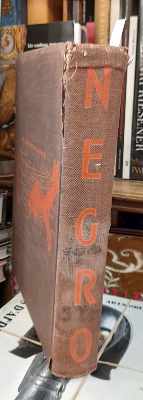
192979718Nrf | Paris 1929 | 25.50 x 33.50 cm | relié
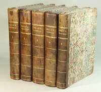
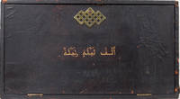
18974415London: H S Nichols 1897. Edition de Luxe reprint - Coffin Set. Hardcover. Fine/Original box fair. Letchford A. Penzer p 20. This is the "coffin set" or boxed 1897 edition printed by Nichols. Of all the reprints the second best after the true first is the Nichols edition of 1897. The most elaborate of these is Style C described in the prospectus as follows: In three quarter levant Selected Syrian large grained Angora goat skins. Sumac tanned of the characteristoics Damascus red. Full gold black and five double bands Grolier corners gold tops tooled sides silk head bands triple cord stitching hollow backs rein forced joints gold veined end papers. The twelve volumes enclosed in a leather casket 23" x 12.5" x 8.5 " to place on an ordinary bookshelf or stand on a table. The casket in olive green morocco lined soft cloth with a spring lock and key of oriental design this set does Not have the key. It contains the 71 Letchford plates printed on special paper. Volumes over 400 pages each. The set was issued at L1515s each. There were 500 such sets. All 12 of the books in this set are Fine appearing as if never read or opened. The case however has seen better days. The leather is dried and cracking and chipped and the inside shows its age. Repeat the key is missing. A very scarce and stunning set. H S Nichols hardcover
1918127251918 1 Mine de plomb signée en bas à droite, titrée et datée en bas à gauche, 1918, 38 X 30,5 cm., encadrée.
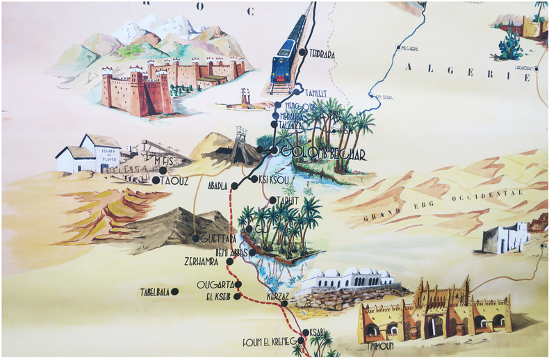
1957LBW-8887S. l., 1957. Carte exécutée à la gouache et à l’aquarelle, signée et datée dans la partie inférieure, et mesurant 3 m 35 sur 1 m 50 ; enroulée, bords renforcés, traces de fixation.
241j1550Toronto: The Cumberland Press. Good. 1988. Privately Published Limited Edition. Paperback. Signed and numbered 74/100 by Neil Peart inside back cover. "And now it was all over. I didn't want to replay it all or relive it again but man- will someone hurry up and figure out a way to slow the good times down But no- even African Time can't make a day last one minute longer." -p 201. Describes his African travel experiences during September of 1987. Neil Peart 1952-2020 was the renowned drummer and main lyricist of the internationally acclaimed Canadian rock band Rush which he joined in 1974. He dedicated this book to his then wife Jacqueline and daughter Selena both of whom left the world prematurely and tragically in the 1990s causing Peart to take a prolonged timeout from his musical career. Rush tribute website Cygnus-X1 suggests this to be one of several books/travelogues authored and privately published by Peart during the 1980's a full decade before he released his first novel. Apparently these books were all produced in very limited quantities and only gifted to friends and family thus rarely found. 205 5 pp. Bibliography. Occasional black and white illustrations by David Bygott. 11" x 8.5". Tight and unmarked with average wear. A sound and precious memento of the the iconic drummer known to his fans as "The Professor". ; Illustrations; 4to; Signed by Author . The Cumberland Press paperback
1662bf4740Chez L'auteur Relié 1662 "MAGNIFIQUE ENSEMBLE DES QUATRE CONTINENTS CARTOGRAPHIÉS PAR LE PREMIER CARTOGRAPHE FRANÇAIS, DANS UN ÉTAT DE FRAICHEUR INCOMPARABLE. Quatre volumes petit in-4 (18,5 x 25 cm), reliés en plein veau brun de l'époque. Les reliures sont toutes identiques, dos à 5 nerfs, titrés, roulettes dorées sur les coupes. Nicolas Sanson d'Abbeville est considéré comme le fondateur de la cartographie en France. En 1627, rencontrant Richelieu (il venait d'Abbeville et s'était installé à Paris), il fut présenté par lui à Louis XIII, qui le nomma Géographe Ordinaire du Roi. Il cartographia quatre continents (ici présents : l'Europe, l'Asie, l'Afrique et l'Amérique), et fut même le premier à cartographier certaines parties du globe (ainsi, par exemple, la région des grands lacs canadiens, avec sa carte ""Le Canada ou Nouvelle France"" (carte datant de 1656)). Il fut le premier Français à concevoir le plan d'un atlas mondial. Les cartes et le texte de chaque volume sont entièrement montés sur onglets. Chaque carte reçoit un commentaire explicatif, avec informations sur l'économie, les habitants et les moeurs du pays décrit, tiré des auteurs anciens (Pline, Strabbon...), de récits de voyageurs ou de rapports des missions des jésuites. De plus, chacune des cartes présente les tracés de contours des pays ou régions aquarellés. Les volumes s'organisent comme suit : L'Europe (sans date) : Titre et dédicace gravés sur double page, 12 cartes doubles et 30 feuillets imprimés au recto. L'Asie (1662) : 108 pages (avec erreurs connues de chiffrage et inversion de feuillets) et 17 cartes doubles. L'Afrique (1662) : 96 pages et 17 planches doubles, proposant 18 cartes (car l'une des planches porte deux cartes) (ce volume est le seul à présenter une petite mouillure sur les quelques premières pages). L'Amérique (1662) : non paginé (80 pages) et 15 cartes doubles. Nos exemplaires sont en TRÈS BEL ÉTAT. Les pages sont très fraiches, sans aucune réelle trace, tache, piqûre ni mouillure. Les cartes, particulièrement, sont dans un vraiment très bel état de fraîcheur, avec des couleurs extrêmement éclatantes. Les reliures présentent des traces peu visibles de réparations anciennes. Les volumes ont étés reliés avec contre-gardes, mais sans pages de garde. Ce rare ensemble est véritablement en TRÈS BEL ÉTAT. Livraison a domicile (La Poste) ou en Mondial Relay sur simple demande."
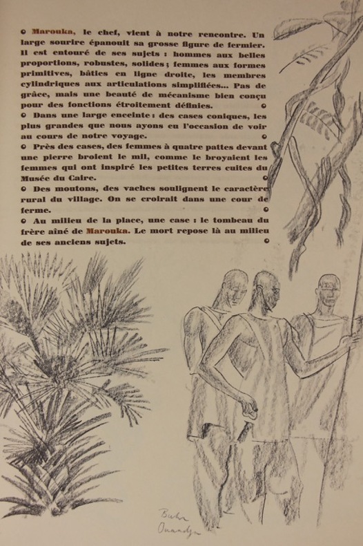
1927104162Paris, Jules Meynial, sous la direction de Lucien Vogel 1927 Chemise in-folio à lacets de cuir, revêtue d'une peau en plein filali de Marrakech avec auteur et titre estampés au premier plat tous les exemplaires sont reliés par Félix. Rabats intérieurs cartonnés contenant 50 compositions en couleurs de Iacovleff dont 1 à double page et un volume de texte 15 ff. à dos en peau retournée et plats de soie noire, avec une bande décorée verticalement sur le premier plat, d'un motif repris de la planche 39. Le texte est illustré à toutes pages de reproductions d'esquisses au crayon prises sur le vif et parfois légendées. Petits accrocs et salissures à la reliure, légères salissures aux rabats. Planches et texte en parfait état.
187390450s. n. | s. l. 1873 | 21 x 31.5 cm | Relié
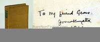
First Edition signed and inscribed by Jomo Kenyatta, dated 1944, atop front free endpaper. xxvi, 339 pp. Index. Glossary. Eight pages of black and white photographic plates. One-page map of Gikuyu Country. "One of the first really competent and instructive contributions to African ethnography by a scholar of pure African heritage. Through his upbringing Mr. Kenyatta combines to an unusual extent the knowledge of Western ways and Western modes of thought with a training and outlook essentially African. As a first-hand account of a representative African culture, as an invaluable document in the principles underlying culture-contact and change; last, not least, as a personal statement of the new outlook of a progressive African, this book will rank as a pioneering achievement of outstanding merit." - from Introduction. Author was the founding father of Kenya and led the nation from its independence in 1963 until his passing in 1978. Somewhat above-average soiling and wear to tan fabric-covered boards. One-inch split in fabric between foot of backstrip and front board. Brilliant gilt lettering in green panels upon backstrip. Contents unmarked with occasional moderate soiling and minimal foxing. Binding tender in places but intact. Two openings, each less than one centimetre, to central portion of front hinge. A special copy of this important work. Book
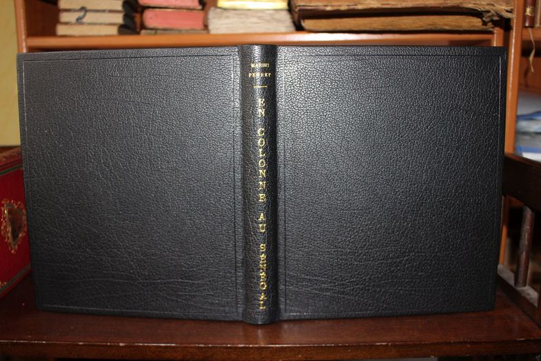
008047[Manuscrit - Afrique] Marius Perret (1851-1900), En Colonne au Sénégal. [ca.1891], in-8, 78-3p. Exceptionnel journal de Marius Perret lors de l'expédition du colonel Dodds (colonne du Fouta). Ce manuscrit semble entièrement inédit bien qu'il fût clairement destiné à être publié, probablement dans Le Tour du Monde, journal auquel il collaborait. Certaines parties ont été supprimées, notamment celle sur les espions. Peut-être y a-t-il eu un véto militaire ou politique à cette publication ? Il s'agit d'une version remise au propre puis corrigée à de nombreuses reprises (plusieurs encres différentes). On remarquera qu'il y a deux versions pour la fin du manuscrit - les 3 pages supplémentaires. La première version a été réécrite quelques mois après la première, probablement pour tenir compte de la mort d'Abdoul Boubakar, tué par des maures quelques mois après l'expédition. Cela permet de dater le manuscrit de 1891. Notons que Perret n'était pas militaire. Il est en fait le premier peintre français à aller au Sénégal et il suivit l'expédition comme médecin. En effet, le médecin militaire était indisposé et Perret l'a donc remplacé (il était médecin de formation). Reliure moderne, plein buffle noir, dos lisse, corps de l'ouvrage composé de pochettes en plastique de conservation dans lesquelles sont glissés les feuillets.
1938241H0034London: Secker and Warburg. Fair in Poor dust jacket. 1938. First Edition. Hardcover. Signed and inscribed by Jomo Kenyatta atop front free endpaper. "One of the first really competent and instructive contributions to African ethnography by a scholar of pure African heritage. Through his upbringing Mr. Kenyatta combines to an unusual extent the knowledge of Western ways and Western modes of thought with a training and outlook essentially African. As a first-hand account of a representative African culture as an invaluable document in the principles underlying culture-contact and change; last not least as a personal statement of the new outlook of a progressive African this book will rank as a pioneering achievement of outstanding merit." - Introduction. Author was the founding father of Kenya and led the nation from its independence in 1963 until his passing in 1978. pp. xxvi 339. Index. Glossary. Eight pages of black and white photographic plates. One-page map of Gikuyu Country. Somewhat above-average soiling and wear to original tan cloth. One-inch opening between foot of backstrip and front board. Brilliant gilt lettering in green panels upon backstrip. Contents unmarked with occasional moderate soiling and minimal foxing. Binding tender in places but intact. Two openings each less than one centimetre to central portion of front hinge. Very heavy wear to dust jacket now in archival protection.; 8vo - over 7¾" - 9¾" tall; Facing Mount Mt. Kenya - The Tribal Life of the Gikuyu Kenya Africa Mau Mau Kikuyu Gekoyo Gikuyu; Signed by Authors . Secker and Warburg hardcover
1595100047AG1595. Paris / London / Antwerp and other places of print c.1595 - 1851. Some stunning examples of hand-coloured copper-engravings plus one manuscript map Tuckey / Congo - Zaire. All of these maps in very good / excellent condition. This collection presents itself for becoming an amazing a meaningful starting-point for an Africana-Collection decoration for a Safari-Lodge interior-design for an Africana-themed library etc. etc. The price includes worldwide free shipping per DHL Express-Courier 2-3 day-delivery. Ask for complete list and images and please also inquire about our amazing book-collection of Africana which would be a great match for this collection of vintage maps. unknown
In-4 gr. (mm. 360x219), 3 volumi, p. pelle bazana coeva, filetti dorati ai piatti, dorso a cordoni (abrasioni) con ricca decoraz. e tit. oro su tassello, tagli rossi, pp. (12),472,23; (8),496,39; (6),480,(2); con 3 belle antiporte figur. inc. in rame, 4 carte geografiche (più volte ripieg.) e 58 magnifiche tavv. f.t. (numerosiss. più volte ripieg.). Vi figurano: “plans, costumes, medailles, inscriptions, idoles, lampes & autres restes des anciennes villes, ou des productions de l’art, de la nature, etc”.<br> I primi 2 volumi sono in "prima edizione francese" - Il 3° vol. (che completa l’opera) è in "edizione originale" e porta il titolo: “Voyages en anglois et en françois en diverses provinces et places de la Prusse ducale et royale, de la Russie, de la Pologne &c.”, contenant un Traité de divers Ordres de Chevalerie.., avec des remarques géographiques, topographiques, historiques & politiques sur ces provinces & autres pays.. comme le Macklembourg, la Pomeranie, la Covelande, la Livonie, l’Estonie..”. Testo su due colonne, in francese e inglese.<br> L’opera descrive i viaggi compiuti da La Mottraye nel corso di oltre 26 anni, attraverso quasi tutta l’Europa sino alla Tartaria, al Levante e all’Africa. Le tavole, molte delle quali incise da William Hogarth, sono tutte di grande interesse. La Mottraye (1674-1743) fu particolarmente attento nel descrivere città, monumenti ed antichità, ma la sua opera contiene anche una vasta messe di notizie che riguardano le istituzioni, le usanze ed i costumi. Boucher de La Richarderie loda l’accuratezza delle sue descrizioni, mentre altri lo accusano di digressioni teologiche. Sicuramente fu agevolato nelle sue ricerche in Scandinavia e nell’Est dell’Europa dall’amicizia con Carlo XII di Svezia, che poi seguì in esilio in Moldavia. Avendo visitato moltissimi paesi, la sua opera fornisce interessanti ritratti contemporanei di città importanti come Costantinopoli, Venezia, Uppsala, Londra, etc. <br> Cfr. Boucher de La Richarderie,I,216 - Gay,73 - Chadenat,6333 - Brunet,III,801.<br> Biographie Universelle,XXX, pp. 294/296: “La relation de ses courses si longues paru à la Haye en 1727, en 2 volumi Dès 1724 ils avaient paru en anglais. L’A. fut très mécontent de cette version.. les libraires d’Amsterdam avaient publié le second volume sans son aveu, pendant son absence, et avant qu’il l’eut achevé. Aussi de retour de sa dernière excursion au Nord, il en traduisit lui-meme la relation en anglais, et fit imprimer cette version, avec le texte en français en regard; l’ouvrage est intitulé "Voyage en diverses provinces..", 1732.. Les figures qui ornent ces voyages, sont généralement exactes et bien gravées: elles sont le premier ouvrage de Hogart, depuis si célèbre”.<br> Fresco esemplare, ben conservato.
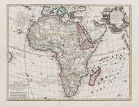
Nel cartiglio in basso a sinistra è inciso il titolo: AFRICA EX MAGNAE ORBIS TERRAE DESCRIPTIONE. Nel cartiglio posto nell’angolo inferiore destro si trova la dedica: AL CL.MO S.OR FRANCESCO MORESINI Havendo fatto ridur sotto la presente forma le quatro parte del mondo con molta diligentia, ho voluto anco aggiunger loro questo altro ornamento, ch’è di dedicarle al nome honoratissimo di V.M. Cl.ma la quale come intendendiss.a d’ogni arte nobile acquistera alle mie fatiche qualche splendore .V. M. dunque accettandole benignamente nella sua protettione gradirà insieme nel picciolo dono la mia buona volontà di servirla, et honorarla et con talfine le basio le mani. Di V. M. C.ma affect.mo ser. Donato Rascicottj. Sotto al cartiglio troviamo la firma dell’incisore: Iovan Batista Mazza fece. Orientazione fornita da una rosa di trentadue venti, nella quale sono indicati i punti cardinali, i quattro venti principali e quattro mezzi venti, il nord è in alto. Nella tavola sono presenti alcune didascalie che forniscono notizie storico-geografiche. Opera priva di scala grafica. Orientazione di grado in grado, da 37° 30’ sud a 37° 30’ nord di latitudine e da 315° ovest a 128° est di longitudine. Graduazione all’equatore da 350° ovest a 90° est. Carta dell’Africa incisa da Giovani Battista Mazza per l’editore Donato Rascicotti. Appartiene ad un gruppo di quattro carte dei continenti tutte firmate dall’incisore per lo stesso editore. La carta è una copia della mappa pubblicata da Abraham Ortelius nel Theatrum Orbis Terrarum (1570), a sua volta basata sul modello di Giacomo Gastaldi. Dedicata al patrizio veneziano Francesco Morosini, l’opera è nota in pochi esemplari, tutti identici. Tuttavia, un secondo stato della lastra viene congetturato dagli studiosi, in base al fatto che è noto un secondo stato della carta dell’America, appartenente alla stessa serie, nel quale non compare la firma dell’incisore. Sebbene questa AFRICA comunemente venga datata, come le altre carte dei continenti del Rascicotti-Mazza, intorno al 1590, la dedica al Morosini permetterebbe di circoscrivere la realizzazione della lastra intorno al 1585, sicuramente prima della nomina da parte di Sisto V a vescovo di Brescia (23 settembre 1585), dove si insediò solo dal 10 giugno 1590. Nella dedica, infatti, è appellato semplicemente Clarissimo Signor. Giovanni Battista Mazza fu incisore e stampatore attivo a Venezia negli ultimi anni del ‘500. Dal segno elegante e preciso, incide diverse carte, messe poi in commercio da Donato Rasciotti, ed anche un grande planisfero di Giuseppe Rosaccio, del 1597, nel quale si firma Giovan Battista Mazza venetiano Maestro delle stampe della Zecha de Venetia. Donato Rascicotti fu editore, commerciante e tipografo. Di origine bresciana ma attivo a Venezia, e forse anche a Bologna e Roma. A volte viene indicato come Rasciotti e Rosigotti. Secondo alcuni sarebbe da identificarsi con Donato Resegato “stampatore di disegni”, arrestato a Roma nel 1577 con l’accusa di aver rubato disegni dalla bottega del Lafreri. A Venezia la sua bottega era al Ponte dei Barettieri. Esemplare nel primo stato di due descritto in Bifolco-Ronca. Acquaforte e bulino, impressa su carta vergata coeva, con margini, in perfetto stato di conservazione. Rarissima. Bibliografia Bifolco-Ronca, Cartografia e topografia italiana del XVI secolo, p. 449, tav. 99, I/II; Almagià (1948): p. 118; cfr. Burden (1996): n. 73; Betz (2007): n. 25; Tooley (1983): n. 72a. In the cartouche in the lower left corner is engraved the title: AFRICA EX MAGNAE ORBIS TERRAE DESCRIPTIONE. In the cartouche placed in the lower right-hand corner is the dedication: AL CL.MO S.OR FRANCESCO MORESINI Havendo fatto ridur sotto la presente forma le quatro parte del mondo con molta diligentia, ho voluto anco aggiunger loro questo altro ornamento, ch’è di dedicarle al nome honoratissimo di V.M. Cl.ma la quale come intendendiss.a d’ogni arte nobile acquistera alle mie fatiche qualche splendore .V. M. dunque accettandole benignamente nella sua protettione gradirà insieme nel picciolo dono la mia buona volontà di servirla, et honorarla et con talfine le basio le mani. Di V. M. C.ma affect.mo ser. Donato Rascicottj. Under the scroll we find the signature of the engraver: Iovan Batista Mazza fece. Orientation provided by a rose of thirty-two winds, in which are indicated the cardinal points, the four main winds and four half winds, the north is at the top. Orientation from degree to degree, from 37° 30' south to 37° 30' north latitude and from 315° west to 128° east longitude. Graduation at the equator from 350° west to 90° east. Map of Africa engraved by Giovani Battista Mazza for the publisher Donato Rascicotti. It belongs to a group of four maps of the continents all signed by the engraver for the same publisher. The map is a copy of the work published by Abraham Ortelius in Theatrum Orbis Terrarum (1570), which in turn was based on the model by Giacomo Gastaldi. Dedicated to the Venetian patrician Francesco Morosini, the work is known in a few copies, all identical. However, a second state of the plate is conjectured by scholars, based on the fact that a second state of the map of America is known, belonging to the same series, in which the engraver's signature does not appear. Although this AFRICA is commonly dated, like the other maps of the continents by Rascicotti-Mazza, around 1590, the dedication to Morosini would allow us to circumscribe the realization of the plate around 1585, certainly before the appointment by Sixtus V as bishop of Brescia (September 23, 1585), where he took office only from June 10, 1590. In the dedication, in fact, he is simply called Clarissimo Signor. Giovanni Battista Mazza was an engraver and printer active in Venice in the last years of the 1500s. With his elegant and precise mark, he engraved several maps, later marketed by Donato Rasciotti, and also a large planisphere by Giuseppe Rosaccio, dated 1597, in which he signed Giovan Battista Mazza venetiano Maestro delle stampe della Zecha de Venetia. Donato Rascicotti was a publisher, merchant and printer. Of Brescian origin but active in Venice, and perhaps also in Bologna and Rome. Sometimes is indicated as Rasciotti and Rosigotti. According to some, he should be identified with Donato Resegato "printer of drawings", arrested in Rome in 1577 on the charge of having stolen drawings from the workshop of Lafreri. In Venice his workshop was at Ponte dei Barettieri. Example in the first state of two described in Bifolco-Ronca. Etching and engraving, impressed on contemporary laid paper, with margins, in perfect condition. Very rare. Literature Bifolco-Ronca, Cartografia e topografia italiana del XVI secolo, p. 449, tav. 99, I/II; Almagià (1948): p. 118; cfr. Burden (1996): n. 73; Betz (2007): n. 25; Tooley (1983): n. 72a.
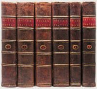
179033833Edinburgh: J. Ruthven for G.GJ. and J. Robinson et al and Printed by George Ramsay and Company for Archibald Constable and Company 1790; 1808. 6 volumes. The First Edition Edinburgh imprint sometimes called “the best edition†Cox with the First Edition of Murray's fine and important work on Bruce. Engraved title vignettes in all volumes. Vol. I with illustrated header on the dedication to the King and with 53 very finely engraved plates and maps and charts including 3 very large folding maps. The Murray volume with an additional 22 engraved plates including a portrait frontispiece of Bruce and two large folding maps at the end of the volume. A total of 75 plates and 5 large folding maps. 4to 300 x 240 mm. with the half-titles in vols. !-!V very handsomely bound in very handsome contemporary half polished calf over marbled paper covered boards. The spines with raised bands are gilt ruled and decorated with gilt lettering on red morocco labels original endleaves end-leaves and with a fine antique engraved armorial plate. Early ownership inscription to title-page and a fine early armorial bookplate. The Bruce lxxxv 535; viii 718; viii 759; viii 695; xiv 230 3 large folding maps index errata pp. The Murray xiii 5044 ads. pp 22 engraved plates and maps. A fine and desirable set in scarce contemporary bindings the paper fresh and clean and the text-blocks as solid as could be the bindings are very handsome withminor evidence of use or age at the extremities a bit of tenderness to the hinges of a few volumes but these are still sturdy and strong and the folding maps are in excellent condition. HIGHLY IMPORTANT EARLY EXPLORATION INTO AFRICA AND A RARE EDITION IN FULL CONTEMPORARY CALF WITH ORIGINAL SPINE PANELS AND WITHOUT REPAIRS. A cornerstone to any collection of Africana this is one of the earliest and greatest illustrated works on the seminal discoveries to be made on the continent over A hundred year period. This set with the added murray volume rarely encountered in matching binding as here.<br> With time on his hands and at the urging of a friend Bruce composed this account of his travels on the African continent including comments on the history and religion of Egypt an account of Indian trade a history of Abyssinia and other such material. Although Bruce would not be confused with "a great scholar or a judicious critic. few books of equal compass are equally entertaining; and few such monuments exist of the energy and enterprise of a single traveller" DNB. "The result of his travels was a very great enrichment of the knowledge of geography and ethnography" Cox II p. 389.<br> Bruce was one of the earliest westerners to search for the source of the Nile. In November of 1770 he reached the source of the Blue Nile and though he acknowledged that the White Nile was the larger stream he claimed that the Blue Nile was the Nile of the ancients and that he was thus the discoverer of its source.<br> The account of his travels was written twelve years after his journey and without reference to his journals which gave critics grounds for disbelief but the substantial accuracy of the book has since been amply demonstrated.<br> James Bruce traveled to Egypt in 1768 accompanied by the Italian artist Luigi Balugani. They spent five years in Upper Egypt Abyssinia and in the exploration of the Nile. With the exception of the French surgeon Poncet no European had visited Abyssinia in over 150 years so Bruce's account was of unique importance in providing valuable information on the region to Europeans. The plates based on his own and Balugani's drawings include maps botanical and zoological specimens antiquities artifacts and plans of monuments.<br> A cornerstone to any collection of Africana this is one of the earliest and greatest illustrated works on the seminal discoveries to be made on the continent over a hundred year period. J. Ruthven for G.GJ. and J. Robinson et al and Printed by George Ramsay and Company, for Archibald Constable and Company hardcover
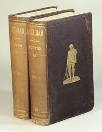
187252516London: Tinsley Brothers 1872. First edition first issue binding 2 volumes 8vo pp. xii 2 503 1; vi 2 519 1; folding map highlighted in blue 11 wood-engraved plates including 2 frontispieces 4 full-p. sketch maps; original chocolate brown cloth gilt vignette on upper covers both volumes neatly rebacked with original spines laid down; previous owners' bookplates pertinent newspaper clippings tipped into both volumes at endpaper and half-title; a good sound copy. Zanzibar is Burton's account of the country and its natural history and Burton's and Speke's various journeys 1857-59 in the lake regions of east Africa including the discoveries of Lakes Victoria and Tanganyika. The final chapter is Burton's memorial of Speke with whom he had many points of divergence regarding the geographical discoveries at Victoria and the Nile basin. Spink Catalogue no. 49; Penzer pp. 88-89; Casada 72: "It is in my opinion among the most important of his African-related studies." <br/><br/> Tinsley Brothers hardcover books
168pp. 31x32cm., Rilegatura in cartone, Monografia, 108 Foto B/n, 13 Foto a colori, con Sovraccoperta, inglese
19349184London, 1934, grand in-4 pleine toile (viii-854 pages). Editions originale. Elle rassemble 255 contributions signées par 150 auteurs. Illustrée de reproductions dans et hors-texte en noir et blanc.
179052509Edinburgh: J. Ruthvan for G. G. J. and J. Robinson London 1790. First edition published later in London the same year; 5 volumes 4to engraved vignette title page in each volume 58 engraved charts battle plans and plates 3 engraved folding maps 7 typographic pages of Ethiopic characters between pp. 400 and 401 of the first volume and the list of plates at the back of vol. V which is usually lacking; contemporary marbled boards neatly rebacked in calf gilt-lettered spine; a few marginal tears neatly repaired light occasional foxing but in all a very good sound and absolutely complete copy with the requisite half-titles in each volume. Bruce arrived in Alexandria in June 1768 committed to discovering the source of the Nile which he thought began somewhere in Abyssinia. He traveled across the northern desert in the guise of a Turkish sailor and finally reached Abyssinia in early 1770. In November of that year he found the previously unknown source of the Blue Nile which he claimed mistakenly to be the Nile of the ancients and therefore more important than the larger White Nile. Bruce's difficult return in 1771 was highlighted by another first: he became the first to trace the Blue Nile to its confluence with the White Nile. The last major obstacle was a dangerous trip back into the desert to recover his journals and baggage which had been left behind after his camels died. Though his Travels was criticized by some contemporaries "the substantial accuracy of every statement concerning his Abyssinian travels has since been amply demonstrated" Ency. Britannica. Bruce's account is also notable for its famous plate of the figure of a harpist in the tomb of Rameses III "the first picture of a scene in the royal tombs to be published" Romer Valley of the Kings 36. Blackmer 221; Cox I 398-99; Howgego III B171; Ibrahim-Hilmy p. 91. <br/><br/> J. Ruthvan for G. G. J. and J. Robinson, London hardcover books
187252516London: Tinsley Brothers 1872. First edition first issue binding 2 volumes 8vo pp. xii 2 503 1; vi 2 519 1; folding map highlighted in blue 11 wood-engraved plates including 2 frontispieces 4 full-p. sketch maps; original chocolate brown cloth gilt vignette on upper covers both volumes neatly rebacked with original spines laid down; previous owners' bookplates pertinent newspaper clippings tipped into both volumes at endpaper and half-title; a good sound copy. Zanzibar is Burton's account of the country and its natural history and Burton's and Speke's various journeys 1857-59 in the lake regions of east Africa including the discoveries of Lakes Victoria and Tanganyika. The final chapter is Burton's memorial of Speke with whom he had many points of divergence regarding the geographical discoveries at Victoria and the Nile basin. Spink Catalogue no. 49; Penzer pp. 88-89; Casada 72: "It is in my opinion among the most important of his African-related studies. Tinsley Brothers unknown
18523836London: Jon Van Voorst 1852. First Edition - only 500 copies printed. Hardcover. Near Fine. First ed. 107 pp 4 lithographed plates. Only 500 copies printed. Penzer p 41. After 10 years 257 copies remained for sale so the publisher recommended scrapping them and preparing a second edition. Thus the book is now RARE. Bound in dark purple cloth with gilt blind border enclosing corner & center designs on both covers. Gilt spine lettering. Burton's falconry experiences while in Sind in Northern India. A work that still today is of great interest to falconers and Burton collectors. Lovely very near fine to fine in all respects. Jon Van Voorst hardcover
18771175-22London, John Murray 1877. 2 vols. 8°. VIII, 1 Bl., 305 S., 32 S.; IV, 1 Bl., 317 S. Mit zus. 8 Holzstich-Taf., dav. 2 getönt als Frontisp. u. 1 mehrf. gefalt. Karte. Blaue OLn.-Einbände mit goldgeprägtem Rückentitel u. Deckelillustration. Restaur. Ecken etwas bestoßen. Innen wenige Bll. mit kl. Fleck, Karte alt im Falz verstärkt, Spiegel jew. mit aufkaschiertem Etikett der "Irish Society London". [5 Warenabbildungen]
Si tratta della seconda mappa dell'Africa realizzata dalla famiglia De Jode, nella fattispecie realizzata da Cornelis De Jode nel 1593. Suo padre, Gerard, nel 1578 aveva pubblicato l'atlante Speculum Orbis Terrarum, di cui intendeva probabilmente realizzare un'edizione riveduta e ampliata. A causa della sua morte, nel 1591, fu il figlio Cornelis a portarne a compimento il progetto nel 1593 con lo Speculum Orbis Terrae. Realizza così, dieci nuove mappe, tra cui questa carta dell'Africa. Cartograficamente la mappa deriva in parte dalla carta del mondo di Mercator del 1569, ed in parte da quella di Ortelius, pubblicata nel 1570. Come tutte le carte della famiglia De Jode, anche questa mappa è molto rara. Infatti, dopo la prematura morte di Cornelis, nel 1600, tutte le lastre passarono a Jan Baptiste Vrients. La vedova di Vrients vendette poi le lastre a Moretus, ma non furono più utilizzate per successive tirature. Incisione in rame, in perfetto stato di conservazione. This is the De Jode family's second map of Africa, issued in 1593 by Cornelis de jode. His father, Gerard, in 1578 published the atlas Speculum Orbis Terrarum, and evidently he intended to issue a revisited and expanded edition. Due to his death, Cornelis realized the new edition and in 1593 published the atlas Speculum Orbis Terrae, adding ten new copperplates includind this map of Africa. The large title at the top is flanked by some intricate design work and the oceans are decorated with sailing ships and sea monsters. Cartographically, the map refers to Mercator for the river systems and Ortelius for other points. De Jode had originally intended his atlas to compete with Ortelius' Theatrum Orbis Terrarum. The competition between De Jode and Ortelius had been intense, but the better-connected Ortelius was able to influence events - possibly even ensuring a denial of the necessary Royal Privilege for De Jode until 1577. De Jode's Speculum Orbis Terrarum was issued the next year. The Speculum had to compete against Ortelius' Theatrum Orbis Terrarum, in its eighth year of publication and already in its sixteenth edition, and was unable to make any serious impression on the market-hold enjoyed by Ortelius. De Jode's maps are thus appreciably rarer than those by Ortelius and are often better engravings. A good impression of this finely engraved, rare and sought after map in overall good condition. R. L. Betz "The Mapping of Africa…" (2007), map 27; O. I. Norwich, "Norwich's Maps of Africa", map 19
1776STLA0099Amsterdam, J. S. Baalde u. Utrecht, J. van Schoonhoven 1776-80. 4°. VIII S. (Titelei), 3 Bll. (Inh.), 484(2) S. u. 7 [v. 8] Bll. (Titelei m. fehlendem Schmutztit.), 448 [v. 455(1)] S. Mit 2 wh. Titelvign. (N. v. d. Meer Jun. fec.), 123 [v. 124] Ansichten u. Karten auf z. Tl. mehrf. gef. Taf. (tls. unsign.) u. 1 mehrf. gef. Karte m. v. Hd. 2-farbig markierter Reiseroute (Th. Koning fec.) in Kupferstich. Neue Halblederbände mit rauhem Schnitt und mont. Rüschi. sowie unter Verwendung von altem Marmorpapier als Deckelbezug; Bd. 1 auch unter Verwendung der alten Vorsätze. Deckelbezüge altersbedingt mit stärkeren Gebrauchsspuren, Schnitt stark angestaubt; Tit. fingerfl. u. m. Sign. v. alter Hd., Tl. 2 m. stärker angeschmutzt. Tit., durchgehenden Wasserfl. sowie 2 Ss. u. 1 Taf. m. Riß; im Text durchgeh. sauber. Vgl. dazu Henze III, 602 ff; Embacher 217 u. Brunet IV, 74. Seltene erste Ausgabe der holländischen Übersetzung von C. Niebuhr's 'Reisebeschreibung nach Arabien u. andern umliegenden Ländern' (1774-78). Der deutsche Mathematiker u. Kartograph Carsten Niebuhr (1733-1815) trat 1760 als Ingenieurleutnant in dänische Dienste und nahm 1 Jahr später an der königlich-dänischen Arabien-Expedition teil, die ihn durch Unter-Ägypten zum Roten Meer, längs der arabischen Küste nach Yemen, weiter nach Bombay, von dort zurück über Maskat in Oman u. durch den Persischen Golf u. Mesopotamien nach Syrien u. Palästina, schließlich durch Klein-Asien nach Konstantinopel führte; von wo aus er (als einziger Überlebender der Expedition) dann 1767 die Heimreise nach Kopenhagen antrat. Niebuhr war der erste, der die Methode der Monddistanzen auf dem Festland zur Bestimmung der geographischen Länge anwandte u. konnte so die erste Kartenskizze des Roten Meeres sowie die erste genaue Karte des Jemen anfertigen. Zudem hatte er umfangreiches Inschriftenmaterial aufgenommen, womit er einen großen Beitrag zur späteren Erforschung der alten Schriften leistete. Als erste literarische Hauptfrucht der langen Reise veröffentlichte er 1772 die 'Beschreibung Arabiens'. 1774 erschien dann schließlich der erste Band der vorliegenden Reisebeschreibung, die lt. Henze "das an gesicherten Daten reichhaltigste und nützlichste Werk asiatischer Forschungsliteratur des 18. Jahrhunderts" darstellt. Ein dritter Schlußband sollte bei der deutschen Originalausgabe erst 1837, 12 Jahre nach N.'s Tod herausgegeben werden. Die fein gestochenen Tafeln zeigen neben zahlreichen Inschriften auch schöne Ansichten u. Panoramen sowie etliche Genre-Szenen u. Typen. - Letzte Lage (Ss.449-455) von Bd. 2 fehlt.
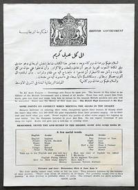
1940170773London: British High Command in the East c.1940-43. Greetings and Peace be upon you A rare chit for RAF pilots to carry during the North Africa Campaign 1940-3 in case of being lost or captured. Written for the benefit of British personnel in the field the focus is simple and concise. The first paragraph in English and Arabic presents a simple greeting asking for hospitality. The following gives points of conduct such as "remove footwear before entering their tents" and "do not expect breakfast if you sleep the night. Arabs will give you a mid-day or evening meal". A word list includes translations of "friend" "food" "tired" and "enemy". The document was colloquially known as a "goolie chit" a "throwback from an earlier war when Royal Flying Corps pilots in India and Mesopotamia needed security in the form of a document that promised a reward to anyone who would bring a British aviator back to British lines. It was so called because local tribesmen in the area were said to turn over aviators to the women who castrated them for use as servants" Feast. We have encountered two other issues: one slightly simplified British issue and an American issue carried by all pilots and crewmen of the Twelfth Air Force with a message from President Roosevelt instead of the British High Command in the East. Quarto single-sheet 244 x 173 mm text in Arabic and English on recto only edge-mounted on thick black card within white card mount all on laminate board presented in dark oak frame with conservation acrylic glazing 353 x 280 mm. Vignette of the Great Seal of the Realm at head. Backed on coarse linen minor foxing sometime folded. A very good example of a fragile publication. "Notes for Communicating with Arabs" IBCC Digital Archive document 25543; Sean Feast Coming Down 1988. unknown