30 547 résultats
50306For the lot of approximately 250 items $6000. a Correspondence with various government officials hunting guides and others involved with preparing and carrying out the trip including14 letters to Furlong typed and autograph one accompanied by four photographs of members of the expedition with trophies; five retained copies of letters from Furlong to the correspondents four telegrams seven typed and manuscript recapitulations of various aspects of the trip e.g. titles for the "Dance of the Nandi" film and a three page typed press release on the expedition dated Nairobi 27 March 1930 accompanied by a photograph of Furlong and two bearers with a leopard he has killed.<br/>b Two hunting licenses issued by the Uganda Protectorate to Furlong 22 April 1930 one "For a First Elephant" the other a "Visitor's Full Game License."<br/>c Three maps period road map of Kenya and Uganda published by Bullows and Roy for the Royal East Africa Automobile Assn.; Map Showing Cairo-Mombasa Route published by the Sudan Survey Dept Khartoum 1929; and a period National Geographic Society map of Africa.<br/>d An account book narrow 12mo 19 pp. 22 March - 8 June 1930 and approximately 125 receipts most partly printed for a wide range of services and material necessary for the trip.<br/>e 21 photographs in addition to those mentioned above many picturing Furlong in the field with his rifle and trophies some with Furlong's notations on verso and 34 unused photo postcards featuring tribesmen animals and scenery of East Africa.<br/>f 42 promotional pamphlets ca. 1925-1934 for the various parts of Africa along Furlong's route 36 of which are unrecorded on OCLC. The pamphlets were issued by African railway companies and governmental agencies outfitters e.g. Thomas Cook and "Safari Africa Limited" London ship lines and other travel agencies and taxidermy concerns.<br/>g A wooden carved string instrument from the Para Mountains in present day Tanzania with Furlong's ownership label "Col. Wellington Furlong / c/o Safariland Ltd. / Musical Instrument / Para Mountains" still attached; the instrument is shaped like a hollowed-out bread tray 27 x 7 1/2 inches three holes in the shape of crosses in the bottom six strings stretched across the opening.<br/>Furlong 1874-1967; American explorer army officer author artist and photographer embarked on this big game expedition in 1930 partly as an effort to recover relics of Sir Henry M Stanley in East and Central Africa. Gateway to the Sahara New York 1909 is among several books he published. A member of the Explorers Club he was the first American to explore the interior of Tierra del Fuego 1907-1908. Most of his personal papers are held by the Stefansson Collection at Dartmouth. <br/><br/> unknown books
18513855London: Wm H Allen 1851. First Edition. Hardcover. VG. with notices of the topography and history of the province. 422 pp Penzer p 40. Burton worked with the Bombay Army survey and eventually traveled to the annexed Sindh province in 1851. Bound in terra cotta cloth with blind triple border enclosing blind oval design on both covers. Gold lettering. The book has been scarce almost since it was published. Sindh is today's Pakistan. VG copy in orig. cloth. Large folding map not called for pasted neatly opposite title page. Bookplates of Mission House library inside front cover and Political Department nicely written on title page. Little soiling upper left hand part of spine. Rare in original cloth. Wm H Allen hardcover
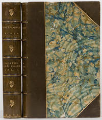
18723863London: Tinsley Brothers 1872. First Edition. Hardcover. VG. Visits to the Libanus the Tulul el Safa the Anti-Libanus the Northern Libanus and the Ala. First ed. Penzer pp 85-88. Two volumes: 360 pp folding map plates text ill. 400 pp plates & text ill. In most of the copies the binder inserted the plates incorrectly so the list of illustrations is faulty and the plates are bound in different order in different copies. Burton COnsul at Damascus 1865-1871 traveled to Syria to explore it and Lebanon. Nicely bound in half leather over marbled boards marbled endpapers raised spine bands gilt rules on bands. A good looking set showing little wear. Scarce. VG. Tinsley Brothers hardcover
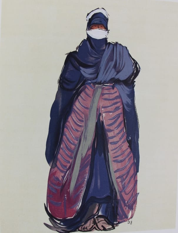
1934129656Cercle lyonnais du Livre 1934 Fort volume in-4 310 x 235 mm en ff, 304 pp., 6 ff. Pl. couv. rempliée, chemise, étui. Illustré par Paul-Elie DUBOIS de 89 compositions peintures, dessins et croquis, 7 à pleine page gravés sur bois en couleurs par Pierre BOUCHET. Les lettres ornées et tirées en noir et or sont adaptées d’ornements et motifs de décoration touareg. In fine liste des membres du Cercle Lyonnais. Tirage limité à 162 exemplaires tous sur vélin d’Arche. Tiré à 162 exemplaires, un des 120 nomùinatifs pour les membres du cercle Exemplaire imp. pour M. Jacque Sagnier. Paul-Elie DUBOIS a fait partie de la mission officielle envoyée au Hoggar en 1928. C’était la première fois qu’un peintre parcourait cette région mystérieuse. Il en a rapporté quantité de peintures, dessins, croquis et documents décoratifs. “Par son illustration comme par son exécution, l’oeuvre se place parmi les plus remarquables de la production contemporaine. Certains exemplaires en souscription sont payés jusqu’à cinquante mille francs... L’artiste curieux des réalités du pays touareg, de la psychologie de ses habitants, les traduits avec intelligence. C’est émerveillé qu’au grès des heures et des circonstances, il représente les princesses de la famille de l’Amenokal, de “belles et rieuses Targuia”, avoue-t-il.... Paul Elie Dubois, après avoir vécu ce pays, l’offre au monde civilisé par l’intermédiaire de l’art, “la plus belle et la plus efficace propagande coloniale, observe la presse” Elisabeth Cazenave, Paul-Elie Dubois peintre du Hoggar
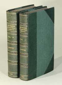
186052513London: Longman Green Longman and Roberts 1860. First edition likely the second issue; 2 volumes 8vo pp. xvi 2 412; vi 2 468; engraved folding map hand colored in blue and green 12 chromoxylographs 22 woodcuts in the text; 20th century three-quarter green morocco gilt-paneled spine in 6 compartments gilt lettered direct in 3 t.e.g.; the plates all with a small and discreet stamp in the margin not touching the image and the map with an old paper repair at the folds on the verso; otherwise a fine copy. There were two issues each in a different cloth binding. As the book has been rebound we can't be sure which issue this is except that the map is in volume II in this set which is where it should be in the second issue. Casada 42; Penzer p. 65-67. <br/><br/> Longman, Green, Longman, and Roberts hardcover books
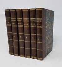
180120702London: John Stockdale 1801. Hardcover. Near fine. First octavo edition and second edition overall. Six volumes uniformly bound in recent quarter leather and marbled boards complete with two large folding maps/charts and 17 folding plates; 2 pages of ads at the end of Volume VI. Occasional light foxing a couple small splits/tears to maps else fine. Signature of Alfred Fowler on the front free endpaper of Volume I and the rear pastedown of Volume II. Vancouver sailed by way of the Cape of Good Hope to Australia then to New Zealand Hawaii and the northwest coast of America -- discovering previously unknown geographical features in each locale. In three seasons' work Vancouver surveyed the coast of California with remarkable accuracy visited a number of the Spanish settlements in Alta California investigated the Strait of Juan de Fuca circumnavigated Vancouver island and disproved the existence of any passage between the Pacific and Hudson Bay. In all Vancouver's party sailed about 55000 miles in what Hill 1753 calls "one of the most important voyages ever made in the interests of geographic knowledge." Howgego I V13; Howes V-23; Sabin 98443. John Stockdale hardcover books
Rarissima carta geografica dell'Africa.La mappa è tratta dalla Geografia di M. Livio Sanuto : distinta in XII libri : ne quali, oltra l'esplicatione di molti luoghi di Tolomeo, e della Bussola, e dell'Aguglia, si dichiarano le Prouincie, Popoli, Regni... dell'Africa. Con XII tauole di esse Africa in dissegno di rame / aggiuntiui de piu tre Indici da M. Giouan Carlo Saraceni... ; [aiutato a ciò da Giulio suo fratello, che di propia mano tagliò tutti li Rami.Si tratta del primo atlante dedicato esclusivamente all'Africa, con le tavole disegnate da Livio Sanuto e finemente tradotte in rame dal fratello Giulio. L'opera venne pubblicata postuma a Venezia nel 1588, da Damiano Zenaro ed a cura di Carlo Saraceni. Le mappe sono state disegnate da Sanuto e finemente incise dal fratello Giulio. L'atlante è suddiviso in dodici libri, il primo contenente note sull'osservazione scientifica, la declinazione dell'ago magnetico e le correzioni all'opera, il secondo spiega le divisioni della descrizione prospettica del mondo di Sanuto, e gli altri dieci sull'Africa che fu l'unica sezione da lui completata prima della sua morte. Livio Sanuto (1520-1576 circa), era un cosmografo veneziano, matematico e costruttore di globi terrestri. Livio e suo fratello Giulio, progettarono un massiccio e completo atlante per includere mappe e descrizioni di tutto il mondo, che egli riteneva più accurate di qualsiasi altra pubblicazione precedente. Purtroppo morì nel 1576 dopo aver completato solo 12 mappe dell'Africa. A completamento di questa e delle altre carte africane, Sanuto si affidò alla carta di Gastaldi del 1564 e alle carte marine portoghesi per la mappatura delle coste e per le informazioni sull'interno, utilizzate da Duarte Barbosa e João de Barros. Dopo la sua pubblicazione nel 1588, quest'opera fu copiata da altri importanti cartografi per quasi un secolo. Incisione in rame, restauri perfettamente eseguiti alla piega centrale e a dei fori di tarlo presenti nella parte bianca superiore ed inferiore, per il resto in ottimo stato di conservazione. A very rare map of Africa.The map is taken form 'Geografia di M. Livio Sanuto : distinta in XII libri : ne quali, oltra l'esplicatione di molti luoghi di Tolomeo, e della Bussola, e dell'Aguglia, si dichiarano le Prouincie, Popoli, Regni... dell'Africa. Con XII tauole di esse Africa in dissegno di rame / aggiuntiui de piu tre Indici da M. Giouan Carlo Saraceni... ; [aiutato a ciò da Giulio suo fratello, che di propia mano tagliò tutti li Rami'.First printed atlas of Africa, published postumously by Sanuto's friend Saraceni who added the tables of contents and the preface on the life of the author.The maps were drawn by Sanuto and finely engraved by his brother Jules. The atlas is divided into twelve books, the first containing notes on scientific observation, the declination of the magnetic needle and corrections to the work, the second explains the divisions of Sanuto's prospective description of the world, and the other ten on Africa which was the only section he completed before his death.Livio Sanuto (c.1520-1576), was a Venetian cosmographer, mathematician and maker of terrestrial globes. Sanuto was one of the so-called Lafreri school of engravers, whose output signalled the transition between the maps of Ptolemy and the maps of Mercator and Ortelius. Livio and his brother Giulio, planned a massive and comprehensive atlas to include maps and descriptions of the whole world, which he believed would be more accurate than any previously published. Unfortunately, he died in 1576 having only completed 12 maps of Africa. The 12 maps were eventually published in 1588 by Livio's brother Giulio, under the title "Geografia Di M. Livio Sanuto..." . In the compliation of this and the other African maps, Sanuto relied on Gastaldi's 1564 map and Portuguese sea charts for the mapping of the coasts and for information about the interior, used accounts by Duarte Barbosa and João de Barros. After its publication in 1588, this work was copied by other leading map makers for nearly a century afterwards.Seas are decorated with contemporary sailing vessels and monsters.Etching with engraving, some expert repairs at the central folds and at worm holes along the upper and lower edge, otherwise in good condition. Betz n. 22; Norwich n. 15.
Due volumi in 8° grande (mm 215x138); pagg. XV, 529 con 15 illustrazioni a piena pagina e 1 grande carta rip. alla fine; pagg. XI, 472 con 23 ill. (fra cui il ritratto di Stanley), 2 carte geografiche nel testo, 1 grande carta rip. alla fine, oltre a decine di ill. nel testo nei due volumi per complessive 150 illustrazioni silografiche e carte geografiche. Splendida legatura rossa in marocchino con bordure e filetti dorati, firma facsimile di Stanley impressa in oro al piatto ant., tagli lucidi dorati. Prima edizione. Bellissimo esemplare di presentazione a Sir Percy Anderson, sottoscrittore del viaggio di Stanley, da parte del Emin Pasha Relief Committee, come attestato dal foglio manoscritto allegato all’inizio, datato 29 agosto 1890, firmato dal segretario del Comitato. Qualche minima fioritura della carta ma esemplare splendido conservato in custodia coeva in marocchino e tela. 2 vols. In 8° (mm 215x138), portrait frontis. to vol. II, three folding coloured maps (two linen-backed and contained in rear pockets), numerous wood-engraved illustrations, a.e.g., a few minor spots, contemporary full red morocco, upper covers with Stanley’s signature in gilt, spines with raised bands and gilt decoration. 1st ed., A specially bound presention copy for Sir Percy Anderson, a Subscriber to the Fund by the Emin Pasha Relief Committee, with a presentation manuscript inscription In 1886 Stanley led the Emin Pasha Relief Expedition to "rescue" Emin Pasha, the governor of Equatoria in the southern Sudan. Stanley met Emin in 1888, charted the Ruwenzori area and Lake Edward, and saved Emin and his followers in 1890. He then spent in Cairo two months writing the famous account of the expedition, before sailing back to England in April 1890.<BR><BR>
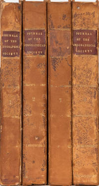
18324725London: John Murray 1832. First Through Fourth editions. Hardcover. Good. The FIRST four volumes of this prestigious publication. Volume the first 1832 London John Murray 264 pp 3 large folding maps worn half contemporary leather over marbled boards front cover detached. Kimbolton Castle shelf label. Volume the second 1832 London John Murray 342 pp 8 folding maps. worn contemporary leather over marbled boards. Kimbolton Castle shelf label. Volume the third 1833. London John Murray 1834. 328 pp 6 folding maps plates. Kilbolton Castle shelf label. Worn contemporary leather over marbled boards. Volume the fourth 1834. 1834 London John Murray. 422 pp. 6 folding maps ill. Worn contemporary leather over marbled boards. Kimbolton Castle shelf labels. The first four journals. In spite of worn outside appearance they are internally quite nice. These first four volumes are rarely listed. Photos include those of table of contents of each volume. An amazing compendium of world exploration almost 200 years ago with a fine royal association. John Murray hardcover
131201Undetermined. very good. Oblong loosely tied album 28 X 40 cm. A total of 87 albumen photos mounted on linean backed stiff grey card boards mostly on both sides. Images for the most part are in excellent conditon with no offsetting and unfaded. very good The album comprises two components with the first 15 images being of Madeira. These images are all 17.5 X 23 CM in size. They are all captioned and signed in the image by the photographer Santos Madeira. The suject matter includes: towns people city views ethnographic agriculture and railways. An interesting selection all in excellent condition and from an unusual place. The second collection of images are all of South Africa. This lot includes a total of 72 images mostly ranging in size from 17.5 X 23 CM to 15 X 20.5 cm. The subject area's include: Cape Town Kimberley Diamond mine operations. Underground mining Native workers at the mine. An image of the de Beers share certificate Johannesburg and area 5 images of the interior of the Sterkfontein Caves and some agricultural scenes. A wonderful album full of interesting large format images in excellent condition. unknown
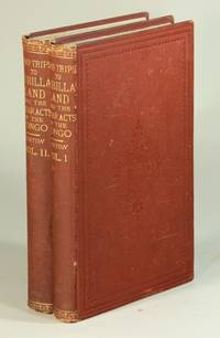
187652519London: Sampson Low Marston Low and Searle 1876. First edition 2 volumes 8vo pp. xiv 2 261 1; vi 2 255 i.e. 355 1; largely unopened; 4 wood-engraved plates and 2 folding maps plus other wood-engraved illustrations in the text; a very good copy in a secondary unrecorded binding of original blindstamped terracotta cloth stamped in gilt on spines. Sir Richard Burton 1821-90 is well known for his colorful career recorded in numerous books and articles as a diplomat explorer and ethnographer. In 1861 he was appointed consul to Fernando Po now Bioko in Equatorial Guinea remaining there for four years until he was transferred to Brazil. These volumes collate the expeditions and ethnographic observations made during his time there. In his preface Burton writes that the 'plain truth' about the African has not been told in Britain declaring that English occupation of West Africa has proved 'a remarkable failure'. First published in 1876 the second volume recounts a journey made from Fernando Po to Loango Bay and up the Congo River. Of particular interest is the penultimate chapter 'The slaver and the missionary in the Congo River' in which Burton expresses his ambivalence towards a European presence in Africa. Volume 2 also includes appendices containing geographical observations. Penzer p. 94; Spink 56; Casada 66: "This work covers the Fan people and the region of the lower Congo." <br/><br/> Sampson Low, Marston, Low, and Searle hardcover books
186052513London: Longman Green Longman and Roberts 1860. First edition likely the second issue; 2 volumes 8vo pp. xvi 2 412; vi 2 468; engraved folding map hand colored in blue and green 12 chromoxylographs 22 woodcuts in the text; 20th century three-quarter green morocco gilt-paneled spine in 6 compartments gilt lettered direct in 3 t.e.g.; the plates all with a small and discreet stamp in the margin not touching the image and the map with an old paper repair at the folds on the verso; otherwise a fine copy. There were two issues each in a different cloth binding. As the book has been rebound we can't be sure which issue this is except that the map is in volume II in this set which is where it should be in the second issue. Casada 42; Penzer p. 65-67. Longman, Green, Longman, and Roberts unknown
187652519London: Sampson Low Marston Low and Searle 1876. First edition 2 volumes 8vo pp. xiv 2 261 1; vi 2 255 i.e. 355 1; largely unopened; 4 wood-engraved plates and 2 folding maps plus other wood-engraved illustrations in the text; a very good copy in a secondary unrecorded binding of original blindstamped terracotta cloth stamped in gilt on spines. Sir Richard Burton 1821-90 is well known for his colorful career recorded in numerous books and articles as a diplomat explorer and ethnographer. In 1861 he was appointed consul to Fernando Po now Bioko in Equatorial Guinea remaining there for four years until he was transferred to Brazil. These volumes collate the expeditions and ethnographic observations made during his time there. In his preface Burton writes that the "plain truth" about the African has not been told in Britain declaring that English occupation of West Africa has proved "a remarkable failure." First published in 1876 the second volume recounts a journey made from Fernando Po to Loango Bay and up the Congo River. Of particular interest is the penultimate chapter "The slaver and the missionary in the Congo River" in which Burton expresses his ambivalence towards a European presence in Africa. Volume 2 also includes appendices containing geographical observations. Penzer p. 94; Spink 56; Casada 66: "This work covers the Fan people and the region of the lower Congo. Sampson Low, Marston, Low, and Searle unknown
19103013551910. Containing 70 silver print photographs of various dimensions many captioned in white ink. 1 vols. Large 4to 33.5 x 28 cm. Contemporary beige buckram 'Pictured Records' blocked in black on upper cover 'British Central Africa' added by hand in white; cover worn and a little stained upper joint partly split. Containing 70 silver print photographs of various dimensions many captioned in white ink. 1 vols. Large 4to 33.5 x 28 cm. A handsome album documenting missionary work in a little-known area. <br/><br/>The party almost certainly attached to the Church of Scotland Mission evidently enjoyed their time in Africa as they proceeded from Tanganyika into Central Africa. Among the photographs are shots of a native witch doctor women preparing food native sports including pillow fighting as well as topographical images. The also found time to hunt and thirteen pages are dedicated to big game. There are images of eland lion leopard elephants koodoo bushbuck hippopotamus zebra reedbuck porcupine sable wild boar buffalo hartebeeste and wildebeeste. <br/><br/>Lastly there is a photo of the Zomba Church belonging to the Church of Scotland Mission and one of the Blantyre Church which was completed in 1891. Inspired by the example of David Livingstone the Church of Scotland decided to establish a mission in Malawi in the mid-1870s. It was on the basis of their influence that Malawi became a British Protectorate. unknown books
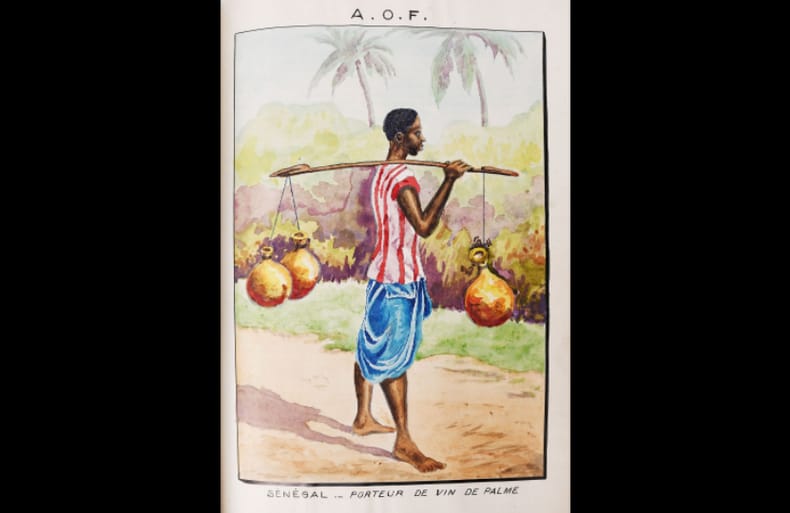
193823642Sans lieu, sans nom, 1938. Fort in-4 (21 x 30 cm) maroquin marron, premier plat orné des lettres dorées A. O. F. dans un contour dessinant l'Afrique de l'Ouest avec petit décor d'instruments de musique, dos à nerfs avec filets dorés, plats et doublures de maroquin marron, chemise de maroquin marron à bandes doublée de suédine de couleur noisette, étui bordé. 662 pages.
187520110Leipzig, Brockhaus; (und) London, Sampson Low, 1875. X S., 21 Bll. (Beschreibender Text). 21 lithographierte Tafeln. 4°. Spätere HLwd. mit aufgheklebtem Titelschild (etw. bestoßen und fleckig). [5 Warenabbildungen]
- Alger s.d. (circa 1870), Album : 13x17cm / photographies : 6,3x10,4cm, 28 portraits sur cartes de visite consignés dans un album. - Photographic album containing 28 portraits of Algerians finely enhanced with watercolour Algiers [ca 1870] | Album: 13 x 17 cm / photographs: 6.3 x 10.4 cm | 28 carte de visite portraits in an album Photographic album comprising 28 photograph portraits, in contemporary albumen print, pasted on card in carte-de-visite format. These photographs, well contrasted and finely enhanced with watercolour at the time, are of great intensity: the models stare at the photographer's lens with pride and nobility. Binding in full black grained leather, metal clasp, all edges gilt. Rubbing. Superb photographic testimony by one of the first European photographers established in Algeria. A Swiss expatriate in Algeria, Jean Geiser (1848-1923) was immersed in photography from childhood. In 1852, his mother joined forces with Antoine Alary, one of the pioneers of Algerian photography; together they founded a studio which lasted until 1867, when Jean Geiser took charge. Initially specialising in portraits of the city's European bourgeois, the photographer quickly understood the city's interest for folk images. These rare and magnificent "typical" portraits, depicting all the layers of the indigenous populations - from street children to caïd - are today sought after for their ethnographic value, testimony of an Algeria at the dawn of colonisation. [FRENCH VERSION FOLLOWS] Album photographique constitué de 28 portraits photographiques, en tirage albuminé d'époque, contrecollés sur des cartons au format carte de visite. Ces photographies, bien contrastées et finement rehaussées à l'aquarelle, sont d'une grande intensité : les modèles y fixent avec fierté et noblesse l'objectif du photographe. Reliure en plein cuir noir grainé, fermoir de métal, toutes tranches dorées. Frottements. Superbe témoignage photographique par l'un des premiers photographes européens établis en Algérie. Suisse expatrié en Algérie, Jean Geiser (1848-1923) a baigné dans la photographie depuis son enfance. En 1852, sa mère s'associe à Antoine Alary, l'un des pionniers de la photographie algérienne ; ensemble ils fondent un studio qui perdurera jusqu'en 1867 date à laquelle Jean Geiser prendra sa direction. D'abord spécialisé dans les portraits de bourgeois européens de la ville, le photographe comprend bien vite l'intérêt de la métropole pour les images folkloriques. Ces rares et magnifiques portraits « types », dépeignant toutes les couches de la population indigène - de l'enfant des rues au caïd - sont aujourd'hui recherchés pour leur valeur ethnographique, témoignage d'une Algérie à l'aube de la colonisation.
- Alger s.d. (circa 1870), Album : 13x17cm / photographies : 6,3x10,4cm, 28 portraits sur cartes de visite consignés dans un album. - Photographic album containing 28 portraits of Algerians finely enhanced with watercolour Algiers [ca 1870] | Album: 13 x 17 cm / photographs: 6.3 x 10.4 cm | 28 carte de visite portraits in an album Photographic album comprising 28 photograph portraits, in contemporary albumen print, pasted on card in carte-de-visite format. These photographs, well contrasted and finely enhanced with watercolour at the time, are of great intensity: the models stare at the photographer's lens with pride and nobility. Binding in full black grained leather, metal clasp, all edges gilt. Rubbing. Superb photographic testimony by one of the first European photographers established in Algeria. A Swiss expatriate in Algeria, Jean Geiser (1848-1923) was immersed in photography from childhood. In 1852, his mother joined forces with Antoine Alary, one of the pioneers of Algerian photography; together they founded a studio which lasted until 1867, when Jean Geiser took charge. Initially specialising in portraits of the city's European bourgeois, the photographer quickly understood the city's interest for folk images. These rare and magnificent "typical" portraits, depicting all the layers of the indigenous populations - from street children to caïd - are today sought after for their ethnographic value, testimony of an Algeria at the dawn of colonisation. [FRENCH VERSION FOLLOWS] Album photographique constitué de 28 portraits photographiques, en tirage albuminé d'époque, contrecollés sur des cartons au format carte de visite. Ces photographies, bien contrastées et finement rehaussées à l'aquarelle, sont d'une grande intensité : les modèles y fixent avec fierté et noblesse l'objectif du photographe. Reliure en plein cuir noir grainé, fermoir de métal, toutes tranches dorées. Frottements. Superbe témoignage par l'un des premiers photographes européens établis en Algérie. Suisse expatrié en Algérie, Jean Geiser (1848-1923) a baigné dans la photographie depuis son enfance. En 1852, sa mère s'associe à Antoine Alary, l'un des pionniers de la photographie algérienne ; ensemble ils fondent un studio qui perdurera jusqu'en 1867 date à laquelle Jean Geiser prendra sa direction. D'abord spécialisé dans les portraits de bourgeois européens de la ville, le photographe comprend bien vite l'intérêt de la métropole pour les images folkloriques. Ces rares et magnifiques portraits « types », dépeignant toutes les couches de la population indigène - de l'enfant des rues au caïd - sont aujourd'hui recherchés pour leur valeur ethnographique, témoignage d'une Algérie à l'aube de la colonisation.
1934132256Cercle lyonnais du Livre 1934 Fort volume in-4, plein maroquin cerise, dos à faux nerf, filet en coupe, filets en contreplats, gardes de soie, couvertures et dos cons., tête dorés, étui toilé rel. H. Jacquet, 4 ff.- 304 pp.- 2 ff. Liste des membres- 1 ff.- 13 pp. de planches remplacées- 4 ff. table et justification. Illustré par Paul-Elie DUBOIS de 89 compositions peintures, dessins et croquis, 7 à pleine page gravés sur bois en couleurs par Pierre BOUCHET. Les lettres ornées et tirées en noir et or sont adaptées d’ornements et motifs de décoration touareg. Tiré à 162 exemplaires, tous sur vélin d’Arche, un des 120 nomùinatifs pour les membres du cercle Exemplaire imp. pour Georges Descours. Notre exemplaire comporte l'impression de trois dessins qui furent remplacés aux pages 185, 188 et 248, ainsi que de deux dessins en noir avant la lettre13:59:56Paul-Elie DUBOIS a fait partie de la mission officielle envoyée au Hoggar en 1928. C’était la première fois qu’un peintre parcourait cette région mystérieuse. Il en a rapporté quantité de peintures, dessins, croquis et documents décoratifs. “Par son illustration comme par son exécution, l’oeuvre se place parmi les plus remarquables de la production contemporaine. Certains exemplaires en souscription sont payés jusqu’à cinquante mille francs... L’artiste curieux des réalités du pays touareg, de la psychologie de ses habitants, les traduits avec intelligence. C’est émerveillé qu’au grès des heures et des circonstances, il représente les princesses de la famille de l’Amenokal, de “belles et rieuses Targuia”, avoue-t-il.... Paul Elie Dubois, après avoir vécu ce pays, l’offre au monde civilisé par l’intermédiaire de l’art, “la plus belle et la plus efficace propagande coloniale, observe la presse” Elisabeth Cazenave, Paul-Elie Dubois peintre du Hoggar
Bari,Da Vinci,1958.In 8°gr.pp.396n. tt.tela edit. numerose tavv. ill.f.t
19134001Oxford University Press 1913. First Edition in English. Hardcover. VG. decouverts par Aurel Stein dans les Sables due Turkestan Oriental.TEXT IN FRENCH translated by and published for E. Chavannes. Large format. 232 pp 37 plates one folding. Oxford University Press hardcover
186129188Cape Town: Saul Solomon 1861. Quarto. xii 180 pp. plus photographically illustrated titlepage and sixteen mounted albumen photographs. Modern three-quarter calf and marbled boards spine gilt with leather label. Light scattered foxing occasional faint offsetting from images. Photographs generally clean. Very good.<br/> <br/>With some of the earliest photographic images from South Africa with a striking portrait of a Basuto Chief.<br/> <br/>An early photographically illustrated book and the first such book printed on the African continent. The volume was made to commemorate the visit of Alfred Duke of Saxe-Coburg and Gotha one of Queen Victoria's sons. The book was designed to showcase the colony which had hitherto been viewed in a less than positive light by the general British public. Prince Alfred was well-received by the colonists in South Africa and the volume contains many positive facts about the colony's usefulness to the British Empire. The book includes seventeen images by photographer Joseph Kirkman who was active in South Africa from 1859 to 1870. Some of the images in this volume are photographs of drawings or other artwork but others do capture live scenes along the Prince's route including a grand portrait of the African chief Moshesh and his advisors. The chief is pictured seated in the center of the image dressed in a top hat and suit holding a cane. The man seated next to him glowers at the camera and is draped in an animal pelt and holds a spear. Four men all in Western dress stand arrayed behind them. The images taken from life during the Prince's progress are as follows: Untitled image on the titlepage showing several men next to a rail car full of large rocks. In 1860 Kirkman and Frederick York were employed by the Government and the Harbour Board to photograph the tilting of the first truck of stone off the Breakwater by Prince Alfred. This is presumably an image from that scene. Graham's Town from the West The Reception of the Prince by a Burgher Escort near Queenstown The Prince's Interview with the Tambookies Moshesh and His Counsellors The Prince and His First Wildebeeste The Prince's Travelling Equipage A rare and interesting work and notable for being the first photographically illustrated book produced in Africa.<br/> <br/>Not in The Truthful Lens. Saul Solomon unknown books
1861WRCAM49581ACape Town: Saul Solomon 1861. xii180pp. plus photographically illustrated titlepage and sixteen mounted albumen photographs. Quarto. Original publisher's gilt cloth rebacked with most of original spine laid down. Corners lightly worn. Contemporary ownership inscription on front fly leaf. Light foxing and toning heavier in some places. Most images clean though one or two with some light foxing at the edges. Very good. An early photographically illustrated book and the first such book printed on the African continent. The volume was made to commemorate the visit of Alfred Duke of Saxe- Coburg and Gotha one of Queen Victoria's sons. The book was designed to showcase the colony which had hitherto been viewed in a less than positive light by the general British public. Prince Alfred was well- received by the colonists in South Africa and the volume contains many positive facts about the colony's usefulness to the British Empire. <br> <br> The book includes seventeen images by photographer Joseph Kirkman who was active in South Africa from 1859 to 1870. Some of the images in this volume are photographs of drawings or other artwork but others do capture live scenes along the Prince's route including a grand portrait of the African chief Moshesh and his advisors. The chief is pictured seated in the center of the image dressed in a top hat and suit holding a cane. The man seated next to him glowers at the camera and is draped in an animal pelt and holds a spear. Four men all in Western dress stand arrayed behind them. The images taken from life during the Prince's progress are as follows: <br> <br> 1 Untitled image on the titlepage showing several men next to a rail car full of large rocks. In 1860 Kirkman and Frederick York were employed by the government and the Harbour Board to photograph the tilting of the first truck of stone off the Breakwater by Prince Alfred. This is presumably an image from that scene. <br> <br> 2 "Graham's Town from the West" <br> <br> 3 "The Reception of the Prince by a Burgher Escort near Queenstown" <br> <br> 4 "The Prince's Interview with the Tambookies" <br> <br> 5 "Moshesh and His Counsellors" <br> <br> 6 "The Prince and His First Wildebeeste" <br> <br> 7 "The Prince's Travelling Equipage" <br> <br> Not in THE TRUTHFUL LENS. A rare and interesting work and notable for being the first photographically illustrated book produced in Africa. Saul Solomon hardcover books
1861WRCAM49581Cape Town: Saul Solomon 1861. xii180pp. plus photographically illustrated titlepage and sixteen mounted albumen photographs. Quarto. Modern three-quarter calf and marbled boards spine gilt leather label. Light scattered foxing occasional faint offsetting from images. Photographs generally clean. Very good. An early photographically illustrated book and the first such book printed on the African continent. The volume was produced to commemorate the visit of Alfred Duke of Saxe-Coburg and Gotha one of Queen Victoria's sons. It was designed to showcase the colony which had hitherto been viewed in a less than positive light by the general British public. Prince Alfred was well received by the colonists in South Africa and the volume contains many positive facts about the colony's usefulness to the British Empire. <br> <br> The book includes seventeen images by photographer Joseph Kirkman who was active in South Africa from 1859 to 1870. Some of the images in this volume are photographs of drawings or other artwork but others capture live scenes along the Prince's route including a grand portrait of African chief Moshesh and his advisors. The chief is pictured seated in the center dressed in a top hat and suit holding a cane. The man seated next to him glowers at the camera and is draped in an animal pelt and holds a spear. Four men all in Western dress stand arrayed behind them. The images taken from life during the Prince's progress are as follows: <br> <br> Untitled image on the titlepage showing several men next to a rail car full of large rocks. In 1860 Kirkman and Frederick York were employed by the government and the Harbour Board to photograph the tilting of the first truck of stone off the Breakwater by Prince Alfred. This is presumably an image from that scene. <br> <br> "Graham's Town from the West" <br> <br> "The Reception of the Prince by a Burgher Escort near Queenstown" <br> <br> "The Prince's Interview with the Tambookies" <br> <br> "Moshesh and His Counsellors" <br> <br> "The Prince and His First Wildebeeste" <br> <br> "The Prince's Travelling Equipage" <br> <br> Not in THE TRUTHFUL LENS. A rare and interesting work and notable for being the first photographically illustrated book produced in Africa. Saul Solomon hardcover books
Rarissima carta geografica dell'Africa meridionale.La mappa è tratta dalla 'Geografia di M. Livio Sanuto : distinta in XII libri : ne quali, oltra l'esplicatione di molti luoghi di Tolomeo, e della Bussola, e dell'Aguglia, si dichiarano le Prouincie, Popoli, Regni... dell'Africa. Con XII tauole di esse Africa in dissegno di rame / aggiuntiui de piu tre Indici da M. Giouan Carlo Saraceni... ; [aiutato a ciò da Giulio suo fratello, che di propia mano tagliò tutti li Rami'.Si tratta del primo atlante dedicato esclusivamnete all'Africa, con le tavole disegnate da Livio Sanuto e finemente tradotte in rame dal fratello Giulio. L'opera venne pubblicata postuma a Venezia nel 1588, da Damiano Zenaro ed a cura di Carlo Saraceni.Incisione in rame, restauri perfettamente eseguiti alla piega centrale ed a dei fori di tarlo presenti nella parte superiore ed inferiore, per il resto in ottimo stato di conservazione.Rara ed affascinante mappa dell'Africa. A very rare map of Southern Africa.The map is taken from 'Geografia di M. Livio Sanuto : distinta in XII libri : ne quali, oltra l'esplicatione di molti luoghi di Tolomeo, e della Bussola, e dell'Aguglia, si dichiarano le Prouincie, Popoli, Regni... dell'Africa. Con XII tauole di esse Africa in dissegno di rame / aggiuntiui de piu tre Indici da M. Giouan Carlo Saraceni... ; [aiutato a ciò da Giulio suo fratello, che di propia mano tagliò tutti li Rami'.First printed atlas of Africa, published postumously by Sanuto's friend Saraceni who added the tables of contents and the preface on the life of the author.The maps were drawn by Sanuto and finely engraved by his brother Jules. The atlas is divided into twelve books, the first containing notes on scientific observation, the declination of the magnetic needle and corrections to the work, the second explains the divisions of Sanuto's prospective description of the world, and the other ten on Africa which was the only section he completed before his death.Livio Sanuto (c.1520-1576), was a Venetian cosmographer, mathematician and maker of terrestrial globes. Sanuto was one of the so-called Lafreri school of engravers, whose output signalled the transition between the maps of Ptolemy and the maps of Mercator and Ortelius. Livio and his brother Giulio, planned a massive and comprehensive atlas to include maps and descriptions of the whole world, which he believed would be more accurate than any previously published. Unfortunately, he died in 1576 having only completed 12 maps of Africa. The 12 maps were eventually published in 1588 by Livio's brother Giulio, under the title "Geografia Di M. Livio Sanuto..." . In the compliation of this and the other African maps, Sanuto relied on Gastaldi's 1564 map and Portuguese sea charts for the mapping of the coasts and for information about the interior, used accounts by Duarte Barbosa and João de Barros. After its publication in 1588, this work was copied by other leading map makers for nearly a century afterwards.Seas are decorated with contemporary sailing vessels and monsters.Etching with engraving, some expert repairs at the central folds and at worm holes along the upper and lower edge, otherwise in good condition. NORWICH: 152; see BETZ 22.