30 549 résultats
19127600ABDresden, Brandner, 1912. XXIV + 288, XII + 266 + 2 S. Priv. Lwd., mit eingebundener OBrosch. 2 Bde. Mit einer Farbkopie der Karte. - Tadellos
94507aafEdinburgh and London, William Blackwood and Sons, 1864, lg. in-8vo, engraved frontispiece + X + 1 ll. (2 p.: half-title : Journal...Somali Land) + 372 p., + 1 double-page + 1 folding map, a very clean copy, engraved ex-libris: James Early Smith + one small legacy stamp on first fly: C.A.W. Guggisberg, contemporary h.-leather, spine richly gilt. Fine copy.
18474742London: John Murray 1847. First Edition. Soft cover. VG. Volume the Seventeenth Parts 1 & II: Part 1: XLVIII pp 1-84 1 folding map in rear. Text uncut. Entire volume devoted to Dr Beke on the Nile and its Tributaries. Vol II: LIX pp 85-159 3 folding maps in rear. Incl. Capt Sturt's Exploration of Central Austral Colchester & Collinson on the Tang-tse Ingram's expedition up the Gambia. Text uncut. Both in orig. printed wraps. Obviously intended for purchaser to bind to their own taste. John Murray unknown
18484743London: John Murray 1848. First Edition. Soft cover. VG. Volume the Eighteenth Parts 1 & 2. Part I: LXXII pp 1-76 large folding map of Western Australia and ill pf part of a terrestrial globe. Incl. Barrow on best means of reaching the north pole Gregory on Western Australia expedition Ayrton on sources of the White Nile. Text uncut. Part II: LXXXVIII pp 77-150. Text uncut. Folding maps on Eastern Africa esp of the SOmauli sic Coast and a diagram illustrating the fall of rivers.VG. Both vol in orig printed wraps. Intended to be bound by orig. purchaser. John Murray unknown
18524747London: John Murray 1852. First Edition. Soft cover. VG. Volume the Twenty-Second. CXXVI pp 1-288 pub ads in rear. Journey S E of Perth in Western Australia Arctic exploration Explorations in Africa re the Limpopo River by Galton and exploration i Central Africa by Livingston and Oswell. Walfisch Bay Lake NGami British North America etc. Twelve folding maps. Text uncut. VG in prig printed cloth. Obviously intended for purchase to bind to their taste. John Murray unknown
18574748London: John Murray 1857. First Edition. Soft cover. VG. Volume the Twenty-Seventh. CXCVIII pp 1-398 pub ads in rear. Folding maps and folding plates. Yule on geography of Burma Monteith on Shiraz Grant on Vancouver Island Anderson on Arctic Journal Livingstone on the Interior of Africa. Text uncut. VG in orig printed wraps. Intended for purchaser to bind to their taste. John Murray unknown
19042154Washington DC: Smithsonian Institution 1904. First. Orig Printed Wraps. VG. pp 747-774 with plates 1-7 from the Smithsonian Report for 1903. Map showing a portion of Chinese Turkestan taken from Stein's original. Very scarce Stein offprint/ephemera. VG in original printed Smithsonian wrappers. Smithsonian Institution unknown
Madrid, Pantaleón Aznar, s.a. (hacia 1750), 18,5 x 12,5 cm., pasta española de época, 4 h. + mapa plegado + 347 págs. + 1 estado plegado con el orden de batalla del ejército español durante la conquista de Orán en 1732 + planos plegados de las ciudades de Orán y Argel + 1 h. (Buen ejemplar).
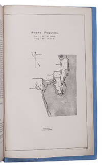
1884KC3E5IO24NK1London 1884. Folio. Eyre and Spottiswoode Modern blue paper wrappers. With a folding map in ad 1 and a full-page map in ad 3. 3 works in 1 volume. X 60; 13 1; X 75 1 blank pp. Ad 1: Official publication presented to the British Houses of Parliament containing correspondence concerning the German settlement at Angra Pequena or Lüderitz Namibia. The correspondence starts with four letters written in 1880 the first letter including a translation of a German article expressing the German interest in the region. The following letters and telegrams were written in 1883 and 1884 starting with letters from July 1883 asking whether the rumours that a German trading company has bought Angra Pequena harbour are true. The land had indeed been bought by Adolf Lüderitz 1834-1886 who founded a trading post at Angra Pequena and renamed it Lüderitz. The majority of the following letters discuss the British attitude towards Germany and the new settlement including evidence of British claim and authority in the area and orders to send gunboats to the bay. The folding map shows a large part of Namibia's coast line.Ad 2: Official publication presented to the British Houses of Parliament containing a letter by the Earl of Derby Colonial Secretary concerning Lüderitz with four appendices including letters and statements from 1867 and 1868. It becomes clear that Britain doesn't have a solid claim on the territory.Ad 3: Official publication presented to the British Houses of Parliament containing further correspondence concerning Lüderitz from July to November 1884. Some letters deal with the official statement of the German government to treat Lüderitz as a German protectorate: German South West Africa; others with the exact boundaries of the territories belonging to Germany Portugal and Britain.With a small tear along the fold of the map a few small spots some margins slightly frayed. Overall in very good condition. unknown
Acquaforte e bulino, priva di firma. Bellissima prova, impressa su carta vergata coeva, consueta piega centrale, piccole ossidazioni, per il resto in ottimo stato di conservazione.La mappa, appartiene agli atlanti editi dalla cosiddetta Scuola Cartografica di Colonia. Per circa mezzo secolo, Colonia fu il centro più importante nella produzione cartografica cinquecentesca, dovuta principalmente a rifugiati fiamminghi ed olandesi che fuggivano dalle persecuzioni religiose. Tra i principali esponenti della Scuola, citiamo Matthaeus Quad, Johannes Metellus, Giovanni Botero e Frans Hogenberg, che ne fu il fondatore. Gli atlanti spesso venivano pubblicati in forma anonima o con l’utilizzo di alcuni pseudonimi proprio a causa dei problemi politici e religiosi che caratterizzavano il periodo storico. Jan Matal o Metellus, francese di nascita è attivo a Louvaine ed a Colonia, dove si rifugia proprio per sfuggire alle persecuzioni dei regnanti cattolici e dove muore nel 1597. Fu tra i maggiori cartografi del tempo e, insieme al Quad e al Hogenberg stesso, il principale esponente della scuola coloniese. Giovanni Botero (1544 – Torino 1617) è stato un presbitero, scrittore e filosofo italiano, autore delle Relazioni universali, un trattato di geografia politica pubblicato per la prima volta a Roma nel 1591 senza illustrazioni cartografiche. L’opera divenne subito molto importante ed oggetto di studio in tutta Europa, dando inizio praticamente allo studio della demografia. Lambert Andreas (attivo tra il 1590 ed il 1598) fu principalmente editore, tuttavia, alcune delle mappe nelle sue pubblicazioni sono a lui stesso attribuite, sebbene in maniera dubitativa. Dal punto di vista cartografico le mappe sono una derivazione delle carte pubblicate ad Anversa da Abraham Ortelius, per la prima volta nel 1570. L’intaglio delle mappe viene attribuito a Frans Hogenberg. La carta che presentiamo è tratta dall’edizione tedesca delle opere di Giovanni Botero, denominata Theatrum oder Shawspiegel, edita nel 1596 da Lambert Andreas, che nello stesso anno pubblica anche l’edizione con testo latino. La grandissima rarità dell'opere della scuola di Colonia, insieme alla scarsità di informazioni su queste mappe “segrete”, contribuisce al fascino di questa importante carte, caposaldo di ogni collezione cartografica. Bibliografia: Meurer, Atlantes Colonienses Die Kolner Schule der Atlas Kartographie 1570-1610, pp. 74/78, BOT 2; Ginsberg, Printed Maps of Scandinavia and the Arctic, pp.150/153, 35 & 36; Suarez, Early Mapping of Southeast Asia, pp. 186/7, 104; Burden, The Mapping of North America, p. 115, 90; Shirley, Early Printed Maps of the British Isles, p. 83, 189; Borri, L’Italia nelle antiche Carte, p. 95, 106; Walter, Japan a Cartographic Vision, 20; Tibbets, Arabia in Early Maps, p. 57, 50. Etching with engraving, without signature. Beautiful impression, printed on contemporary laid paper, showing the usual center fold, small spots, otherwise in excellent condition.The map belongs to the so-called atlases published by the Cartographic School of Cologne. For nearly half a century, Cologne was the most important mapmakers center in the XVI century, mainly due to Dutch and Flemish refugees fleeing religious persecution. Among the principal members of the School, include Quad Matthaeus, Johannes Metellus, Giovanni Botero and Frans Hogenberg, who was its founder. The atlases were often published anonymously or using pseudonyms precisely because of some political and religious problems that characterized the era. Jan Matal or Metellus, French-born Louvaine and is active in Cologne, where he took refuge just to escape persecution from the Catholic monarchs and where he died in 1597. He was one of the major cartographers of the time and, together with the Quad and Hogenberg itself as the leader of the Cologne school. Giovanni Botero (1544 - Turin 1617) was a priest, Italian philosopher and writer, author of universal relations, published a treatise on political geography for the first time in Rome in 1591 without cartographic illustrations. The work quickly became very important and studied throughout Europe, beginning almost to the study of demography. Andreas Lambert (active between 1590 and 1598) was primarily a publisher, however, some of the maps in its publications are attributed to himself, albeit in doubt. From the point of view cartographic maps are a derivation of the papers published by Abraham Ortelius in Antwerp, for the first time in 1570. The carving of the maps is attributed to Frans Hogenberg.The present work is taken by the German edition of the works of Giovanni Botero, Theatrum oder Shawspiegel, published in 1596 by Andreas Lambert, that same year also publishes the edition with Latin text. The great rarity of the works of the school of Cologne, together with the paucity of information on these maps "secret", contributes to the charm of this important works, the cornerstone of any collection mapping.
X, 508 Seiten. Mit zahlreichen Original-Holzschnitten und Aufnahmen des Verfassers und 2 Karten. 25 x 17 cm. Halblederband der Zeit mit Rückentitel. *Originalausgabe. - Josef Chavanne (1846-1902) war ein österreichischer Geograph, Meteorologe und Weltreisender. Er unternahm 1867-69 eine ausgedehnte Reise nach Mittel- und Nordamerika (Mexiko, Westindien, Texas), danach besuchte er verschiedene marokkanische Hafenstädte und drang von Oran aus in die algerische Sahara vor. 1884 bis 1885 bereiste er für 14 Monate den Kongo und sammelte wertvolle Erkenntnisse, diese machten das Buch zu einem wichtigen Quellenwerk zur Geschichte des Kongo. - Erste Ausgabe in einem sauberen Exemplar in zeitgenössischem Halbledereinband. Bücher de
1683901661AGAmsterdam:, Guliemi, 1683. 5 Kupferstiche, jeweils ca 14 x 20 cm, Blattgröße 21,5 x 25 cm.
A stunning, rebellious, and sacrilegious book, consisting of 18 original color lithographs (many with additions in gold leaf), with lithographed text (the author / artist's handwriting, on lithographic plates) and a lithographed justification. Edition limited to 40 numbered copies, all printed on fine Rives wove paper and signed by the artist / author. 4to. Bound in original full brass bolted binding, also executed by Hattingh. FINE AND BRIGHT, LIKE NEW.
1663125805Nürnberg, Johann Andreas Endter & Wolfgang d. J. Erben 1663. * Mit gestochenem Frontispiz und 41 (statt 42) Kupferstich-Tafeln, darunter 5 doppelblattgroße. 7 Blatt, 998 Seiten, 20 Blatt. 17 x 10,5 cm. Moderner Pergamentband im Stil der Zeit mit handschriftlichem Rückentitel. [5 Warenabbildungen]
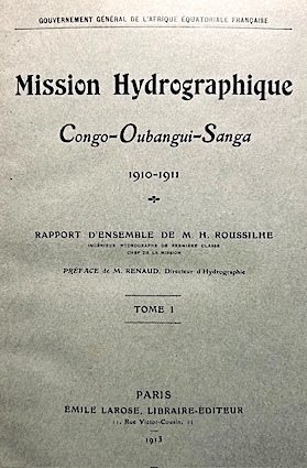
191314470Larose Paris 1913 2 vol. 2 vol. grand in-8 de 2 ff.n.ch. XII 464 pp. et 2 ff.n.ch. 319 pp. V 1 f.n.ch., demi-basane à coins de l'époque, dos à 5 nerfs, tête dorée, couvertures imprimées conservées.
181816395London, Murray, 1818. Mit gefalt. Kupferstichkarte, 13 (1 kolor.) Kupfertafeln sowie einigen Textholzschnitten. 3 Bll., LXXXII, 498 SS. Ganzleder der Zeit, 8°
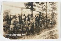
1896185041896. German colonial forces operating in German South West Africa present day Namibia execution photograph documenting colonial military punishment of African prisoners during the early period of German imperial rule circa 1896. The image records a scene of public hanging in which numerous African men appear suspended from a gallows while German soldiers stand nearby. The photograph emerges from the violent regime of colonial control established after Germany declared the territory a protectorate in 1884. Armed resistance against German occupation began during the 1890s including uprisings among communities identified in colonial records as Herero and Nama. German authorities responded with punitive campaigns intended to suppress rebellion and enforce imperial authority. The photograph preserves visual evidence of colonial execution practices and racialized violence used by imperial administrations to control subject populations.<br /> <br /> Albumen photograph approximately 6 x 4 inches black and white circa 1896. Caption beneath the image reads "German So. W Africa Hanging Party. 312 Negroes Hanged." The photograph depicts a gallows structure with numerous bodies visible while soldiers stand in the foreground observing the execution site. Several African men appear present among the assembled personnel alongside European soldiers illustrating the complex composition of colonial forces that often included locally recruited auxiliaries. The composition presents a stark view of the aftermath of execution and the organized display of punishment within the colonial military environment of German South West Africa.<br /> <br /> German colonial warfare in the region escalated during the following decade culminating in the Herero and Nama wars beginning in 1904 during which German forces carried out systematic campaigns of killing forced displacement and imprisonment against indigenous populations. Historians widely recognize these events as one of the earliest genocidal campaigns of the twentieth century. Photographs documenting punitive executions from the earlier phase of German rule provide visual context for the structures of coercion and racial hierarchy that defined colonial governance in the territory. Minor paper loss at the lower left corner and a closed tear measuring approximately three quarters of an inch repaired on the verso; image largely unaffected and overall condition very good. unknown
- Théophile Barrois et Benjamin Duprat, Paris 1831, In-8 (13x21cm), 189pp. 32pp., relié. - Mention de seconde édition, corrigée et augmentée. La première est parue sans nom d'auteur et n'a bénéficié que d'un tirage confidentiel, c'est pourquoi on ne la trouve que très rarement. L'illustration comprend un portrait au frontispice de Hussein Pacha, une carte repliée, et 10 tableaux sur l'état de l'armée. 7 planches pour L'univers pittoresque. Reliure en pleine basane verte d'époque. Dos lisse orné de 2 fers et d'un grand fer central romantique en miroir, filets et roulettes. Pièce de titre en maroquin bordeaux. Traces de frottements en coiffes et coins. Bel exemplaire. Le commandant Fernel (1793-1854) était attaché à l'état-major de l'armée d'Afrique, il nous conte dans cet ouvrage à tendance légitimiste l'histoire de la prise d'Alger. Le dernier chapitre est consacré aux particularités de la région, dattier, canne à sucre, grenades, chameaux... Cette campagne, on le sait, aura des répercussions considérables sur la presence française en Afrique du nord. In fine, l'exemplaire a été truffé de la partie de L'Univers pittoresque sur Algers, écrite par Rozet, capitaine du génie, qui contient 7 planches sur acier. [ENGLISH DESCRIPTION ON DEMAND]
- Maison Quantin, Paris 1890, In-4 (24,5x31,5cm), 245pp., relié. - Edition originale de cet ouvrage magnifiquement illustré d'un titre-frontispice en couleurs, d'une quatrième de couverture en couleurs et de 150 aquarelles par Charles Lallemand gravés par Michelet. Tirage sur grand papier, vélin fort. Les aquarelles ont été faites in situ par l'auteur. Cartonnage d'éditeur bleu ciel biseauté. Dos lisse orné d'un croissant et une étoile, de roulettes et d'un tunisien en couleur en tenue pittoresque. Tranches dorées. Sur le plat supérieur le titre et le drpeau tunisien. Plaque signée Lenègre & cie. Salissures sur le premier plat. Dos devenue légèrement turquoise. Coiffes un peu affaissées. Traces de frottement. Parfaite fraîcheur du papier. Bel exemplaire de cette superbe publication, dont le texte constitue un témoignage sur la Tunisie de la fin du XIXe et une réelle admiration pour son peuple, son histoire et sa contrée. [ENGLISH DESCRIPTION ON DEMAND]
- Paulin, Paris 1832, 13x20,5cm, 3 volumes reliés. - Edition originale de la traduction française. Reliures à la bradel en plein cartonnage vert sapin, dos lisse partiellement décolorés et ornés de filets dorés, traces de frottements sur les mors, gardes et contreplats de papier vert d'eau, coins émoussés, tranches jaunes, reliures de l'époque. Ouvrage illustré de figures dans le texte et bien complet de ses 2 cartes ainsi que de ses 5 gravures hors-texte. Indications de rangement de bibliothèque, à l'encre rouge, en têtes des contreplats, quelques petites rousseurs. [ENGLISH DESCRIPTION ON DEMAND]
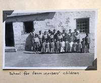
1941175891941. Langwill J. P. and Mrs. J. P. Photo album and travel scrapbook 1941 to 1952 a multi format record of civilian travel through southern Africa during and immediately after World War II preserving firsthand observations of colonial infrastructure landscape and local communities. Compiled by an American couple residing in Cape Town and Paarl the album documents movement across South Africa the Bechuanaland Protectorate and Southern Rhodesia at a time when wartime restrictions shaped mobility and access. The inclusion of typed journals alongside photographs and printed ephemera provides a narrative account of travel conditions tourist sites and cross regional routes linking British colonial territories in southern Africa.<br /> <br /> Photo album and scrapbook containing 55 small format black and white photographs 13 larger photographs 15 real photo postcards 79 magazine clippings including photographic reproductions and maps 2 pamphlets 1 folding map 2 newspaper clippings and 8 pages of original typed journal entries housed in a 10 x 13 inch cloth album with a world map affixed to the front cover. Photographs are corner mounted and ephemera tipped or taped to the leaves. The material documents residence in Cape Town beginning in 1941 a July 1944 यातà¥à¤°à¤¾ to Victoria Falls and Southern Rhodesia a 1946 visit to Oudtshoorn and a return to Victoria Falls in 1952. The typed journal titled "Trip to Victoria Falls and Southern Rhodesia July 2 to 25 1944" opens with the statement "Month after month we had postponed our long planned trip because of war restrictions on travel. At last however we decided to go in spite of everything" and proceeds to describe travel through Mafeking the Bechuanaland Protectorate and onward to Victoria Falls including observations of baobab trees the Victoria Falls Hotel and the descent to view the falls and lunar rainbow. Additional entries describe visits to Salisbury and Bulawayo and to gold mining regions near Johannesburg. Photographs include landscapes tourist sites and local scenes including images of Black South African children outside a school documenting colonial educational conditions.<br /> <br /> The album provides a civilian perspective on wartime and postwar travel within the British colonial network of southern Africa where infrastructure such as rail lines and hotels facilitated movement even under wartime constraints. The juxtaposition of personal narrative commercial imagery and photographic documentation illustrates how travelers encountered and recorded colonial spaces natural landmarks and local populations. The presence of American travelers marking events such as the Fourth of July abroad further situates the album within transnational wartime experience. Light wear to covers; clippings show moderate toning; ephemera with light soiling; photographs remain clean and well preserved. Overall good to very good condition. unknown
18414735London: John Murray 1841. First Edition. Soft cover. VG. Volume the Eleventh. Parts I and II. Part 1. LXXX pp 1-120. 1 folding plate 2 large folding maps publisher's ads and catalogue of Grattan and Gilbert Maps bound in rear. Text uncut. Part II. IX pp. 121-269. Index of books relating to the East title page table of contents 3 folding and 1 single page map in rear. Text uncut. Both in original printed wraps. Obviously meant for purchaser to bind to their taste. VG condition. John Murray unknown
1806216804Uhlmannsche Buchhandlung Amberg 1806. Hardcover kartoniert. Zustand: Exemplar einer Privatbibliothek mit Kennungen Rücken Ecken Kanten berieben/bestoßen. Innen gut. Uhlmannsche Buchhandlung, Amberg, hardcover
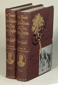
189152605London & New York: Frederick Warne 1891. 2 volumes 8vo pp. xxi 1 376; xv 1 347 1; 4 folding color maps 3 printed in color inside back cover pockets 60 photographic or wood-engraved plates some tinted a few in color; original pictorial maroon crocodile-patterned cloth stamped in gilt silver and black; contemporary prize label Camden Road Collegiate School Cambridge on front pastedown of volume I; small breaks in the cloth at the top of both spines rear hinge on volume II starting; all else very good bright and sound. <br/><br/> Frederick Warne hardcover books
189152605London & New York: Frederick Warne 1891. 2 volumes 8vo pp. xxi 1 376; xv 1 347 1; 4 folding color maps 3 printed in color inside back cover pockets 60 photographic or wood-engraved plates some tinted a few in color; original pictorial maroon crocodile-patterned cloth stamped in gilt silver and black; contemporary prize label Camden Road Collegiate School Cambridge on front pastedown of volume I; small breaks in the cloth at the top of both spines rear hinge on volume II starting; all else very good bright and sound. Frederick Warne unknown