Bovill, E W (Editor)Biblio.com
30 549 résultats
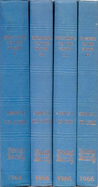
196433Cambridge England: Hakluyt Society 1964. Hakluyt-Second Series. Original Cloth. Fine. 1:Hornemann's travels from Cairo to Murzuk 1824/6 letters of Laing 1824/6 406 pp. ill. text maps & folding map. 2. Bornu Mission part 1 1822-25. 306 pp. ill. text and folding maps. 3. Bornu Mission part 2 1822/25. 285 pp. illl. text & folding maps. 4. Bornu Mission part 3. 1822/5. 798 pp. Ill. text folding and pull out rear pocket maps. Hakluyt Society unknown
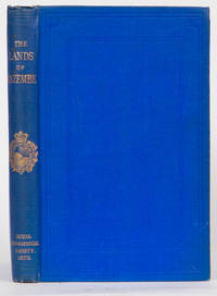
18733832London: Royal Geographical Society 1873. First Edition. Hardcover. VG to near Fine. Lacerda's Journey to Cazembe in 1798. Translated and annotated by Capt. R.F. Burton. Penzer pp 8990. 271 pp 1 folding map in front. Together with the description of another trip by Amaro Jose across Africa from Angola to Tete on the Zambeze and a resume of Monteiro Angola and the River Congo. Burton's portion of the book ends on p 164. Bound in blue cloth double blind borders both covers gold lettering. First edition. VG to near fine copy. Royal Geographical Society hardcover
190820467London: Archibald Constable 1908. First Edition. Hardcover. Very good-. xvi 403 pp with color frontispiece many illustrations from photographs some folding five folding maps appendices index. Original red cloth boards rubbed at the edges and corners minor damage to cloth at upper spine. Mild spine slant but binding sound text unmarked and clean with almost no foxing. A detailed and beautifully illustrated account of the expedition Filippi led from April to September of 1906 to explore the snow range of Ruwenzori upon the borders of Congo and Uganda in the center of Equatorial Africa. Neate F27 describes this as the "classical reference work on this tropical range" noting that the party succeeded in climbing all of the principal peaks. Archibald Constable hardcover books
18341746Edinburgh: Oliver & Boyd 1834. Second. Hardcover. VG. from the earliest ages to the present time with a detailed view of its recources government population natural history and the character of its inhabitants particularly of the wanderings tribes including a description of Afghanistan and Beloochistan. 472 pp ill folding map engraved half title other plates & maps. Internally near fine partially uncut. Bound in early cloth with what looks like an early gilt label also cloth. Oliver & Boyd hardcover
19461973London: Intelligence Division 1946. June 1946. Hardcover. VG. 659 pp profuse ill plates many folding and large pull out folding map in rear pocket. Part of the geographical handbook series. The purpose of these handbooks was to supply a vast amount of information on various parts of the world. .and the final result shows that the compilers certainly met their goals. Excellent lengthy bibliography in rear. This volume was in fact produced and printed for official purposes during the war of 1939/45. A beautiful copy save for a plate that notes it belonged to the Borough of Swindon Museum and Art Gallery. Reserve stock. There are very faint stamps on top/bottom and front edges and one on verso of title page but no other markings. And it would appear that the book sat in the Museum never read. Intelligence Division hardcover
159040297N.p. 1590. Image area 19-1/2" x 12-7/8" in 28" x 23" mat. 1 vols. Imperfectly colored along crease down center small and unobtrusive dampstain in one corner. Still a nice piece. Image area 19-1/2" x 12-7/8" in 28" x 23" mat. 1 vols. Abraham Ortelius 1527-98 was a Flemish geographer of German origin. His major work Theatrum Orbis Terrarum 1570 with later revisions and addendums was the first modern atlas. It was based on contemporary charts and maps and contained a collection of plates engraved by Frans Hagenberg in a uniform size and format. The Theatrum preceded the first atlas of Ortelius' good friend Gerardus Mercator. In fact popular sentimental legend has it that Mercator delayed publication of his own work so that his younger friend's would appear first. Although this simply isn't true Mercator wasn't ready the legendary cartographer did complement Ortelius for the "care and elegance" he had put into the Theatrum. unknown books
1927016276New York: Columbia University Press 1927. These are very good hardcover copies in the publisher's original dark red cloth bindings decorated in gilt. These are the first three volumes of 15 that were published between 1927 and 1949. Very clean inside and out. Volume 1: To 1798 published January 1927 xiii 496 pages. Volume 2: 1798- 1821 published January 1927 viii 643 pages. Volume 3: 1821- 1834 published October 1928 xii 747 pages. All volumes illustrated sparsely in black & white. All volumes bear a small circular private New York art library stamp on the inside front covers otherwise clean throughout. 11" high X 7" wide. Large heavy books foreign shipping will be extra. This set will be securely wrapped and packed in a sturdy box and shipped with tracking. . First Edition. Hard Cover. Very Good. Columbia University Press Hardcover
1883051806New York: G.P. Putnam's Sons 1883. First edition Second printing. Hardcover. Very Good. Second issue with steel engravings. The earliest in depth history of the third major transcontinental railroad constructed though it was the first proposed. Howes S561. Graff 3817. 437 pages. All plates and maps present including folded map in rear pocket. Bound in green buckram with lettering and rule on spine in gilt. Marbled endpapers. Foldout profile chart professionally repaired with rice paper. Attractive bookplate of George B. Leighton on the front paste-down endpaper. Light toning to page edges. A very good handsome copy. <br/> <br/> G.P. Putnam's Sons hardcover
1458BGo. O., o. Vlg., o. J. Kupferstich. 21 x 61 cm., Abbildung
187416591Prag, Heinr. Mercy, 1874. 400 SS., 30 Tafeln, 34 Holzstiche im Text, 1 farb. lithogr. gef. Panorama (Golf von Hammamat) rotes Orig.-Leinen mit vergold. Deckelillustr. und vergold. Rückentitel, 4°
196911844Bulawayo, Books of Rhodesia, 1969. Gr.-Fol. (57 cm x 37,5 cm), Original Leinwand mit goldgeprägtem Deckeltitel (mit Folieumschlag)( min. berieben)
18429565-0306Paris, Libraire Orientale de Dondey-Dupre?, 1842. Oktav, Ganzleinenband (um 1900), XXVI, 1 Bl., 334 S., 1 Bl., mit aufmontiertem rotem goldgeprägtem Lederrücken, der Einband etwas berieben, die Ecken leichter gestaucht, innen durchgehend leichter stockfleckig, mit wenigen Anstreichungen in Blei (radierbar), seitlich unbeschnitten, insg. wohlerhaltenes Exemplar. - Wichtige und seltene Beschreibung der portugiesischen Besitzungen an der Westküste Afrikas. Es erschien begleitend ein Atlasband in Imperial-Folio. - Der in Lissabon geborene Manuel Francisco de Barros e Sousa, Vicomte de Santarém (1791-1856) war Historiker, Diplomat und Staatsmann. Er begleitete die königliche Familie nach der französischen Invasion 1807 nach Brasilien, ließ sich in Rio de Janeiro nieder und widmete sich in den dortigen diplomatischen Archiven historischen Forschungen.
Roma, Arti Grafiche, 1929. In 8vo grande cm. 24,5 x 17,5 pp. XVI-436. Legatura editoriale in tutta tela blu con tassello e titolo al piatto anteriore e titolo in oro al dorso, con una carta geografica ripiegata con indicazione degli itinerari esplorativi seguiti e da 49 tavole a piena pagina raffiguranti le varieta? botaniche raccolte.
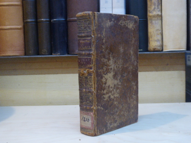
932748Pierre Machuel Rouen 1731 ETAT DES ROYAUMES DE BARBARIE, TRIPOLY, TUNIS ET ALGER. Contenant L'Histoire naturelle & politique de ces Pais, la maniere dont les Turcs y traitent les Esclaves, comme on les rachete, & diverses avantures curieuses. Avec la Tradition de l'Eglise, pour le rachat ou le soulagement des Captifs. 2 ouvrages reliés en 1 volume in-12 ( 165 X 95 mm ) de 3ffnch.-263 et 2ffnch-270 pages, plein veau fauve marbré, dos à nerfs orné de caissons dorés, pièces de titre de maroquin vieux-rouge ( Reliure de l'époque ). Nouvelle édition des trois lettres de ces moines trinitaires, écrites a Tripoli, Tunis et Marseille en 1700, donnant des descriptions sur l'état chrétien et politique des royaumes de Barbarie. Le premier ouvrage, attribué dans un premier temps à Jean-Baptiste DE LA FAYE, avait été publié de façon anonyme en 1703. Cest sur cette édition de 1731 que les noms des auteurs apparaissent pour la première fois sur le titre. Le second ouvrage de Philémon DE LA MOTTE a été inséré à la publication en guise de supplément sous ladresse de Pierre Machuel. Reliure frottée, premier mors fendu, un ancien cachet découpé sur la première page de titre.
18920591-22Wien,Hölder 1892. gr.8°. XVIII,877 S. mit 179 Originalillustr. in Holzstich u. 2 gr. Ktn. in Farbendr. Illustr. Oln. mit Farb-, Gold- u. Schwarzpräg., gering bestoßen, etw. berieben, stellenw. gering stock- od. fingerfleckig, Ktn. in farb. Kopie lose beiliegend (die Originalktn. nur fragmentarisch vorhanden), insges. aber noch gut erh. [3 Warenabbildungen]
1370331Paris: Ed. Jeune Afrique, 1977-1978 Collection complète de 12 volumes gr. in-8, reliure d'édit., dos orné et plat sup. ornés. 328, 318, 328, 320, 336, 332, 325, 351, 343, 351, 301, 344 pages, abondamment illustré, index, bibliographie. Cette collection comprend 121 biographies de personnages historiques africains de l'Antiquité au XXè siècle, écrites par des spécialistes.
1286-Co.J. Radierung mit leichtem Plattenton, auf cremefarbenem Japan, mit Bleistift signiert ?Wilh. Kuhnert? und nummeriert ?16-30?, mit Atelierstempel (kleiner Elefant). Darstellungsgröße 11,7:12,5 cm, Blattgröße 28:37,8 cm, mit Schöpfrand rundum. Vorzüglicher Abdruck, Papier nur im unteren breiten Rand leicht gebräunt.
LEGATURA IN BROSSURA EDITORIALE CON TITOLO IN ROSSO, ESEMPLARE N. 39 DEI 50 STAMPATI. MOLTE ILLUSTRAZIONI E CARTE, ALCUNE RIPIEGATE PIU' VOLTE. MOLTO RARO numero pagine: 574 formato: 26.2X19.5 stato conservazione: BUONO, PICCOLE PIEGHE E TAGLI ALL'ULTIMA PAGINA E RETROCOPERTINA. SEGNO DI PRESSIONE ALLE ULTIME 5 PAGINE edizione: SEGRETA DI 50 ESEMPLARI
Querformat. (ca. 14,9 x 9,9 cm). 8 Photographien. Original-Photographien mit weissem Bildrand, Rückseiten sämtlich mit Beschriftung (Schreibmaschinenschrift). Photographien gut erhalten, leichte Gebrauchsspuren. Altersentsprechend guter Zustand. Alle Aufnahmen haben das selbe Format und gleiche fotografische Bildqualität, zudem sind sie identisch mit blauen Lettern (Schreibmaschinenschrift) und in detaillierter Form beschriftet. Es handelt sich hier um eine Tabakplantage, das geht aus den Beschriftungen und Bildinhalten klar hervor. Eine der Aufnahmen nennt den Ort Penja, nahe bei Mbanga. Dieser Ort ist nach zeitgenössischen Schriften mit den Plantagengebieten der einstigen Tabakbau- und Pflanzungsgesellschaft Kamerun AG assoziiert. Mit gewisser Wahrscheinlichkeit handelt es sich hierbei um die einstigen Tabakanbaugebiete dieser Firma. (Für genaueren Einblick zur Selbstüberprüfung siehe unsere zur Verfügung gestellten Bilddateien). Eine weitere Aufnahme zeigt den Besuch von Wilhelm Solf und seines Stabs auf der Plantage. Da Solf in seinem Amt als Kolonialstaatssekretär die westafrikanischen Kolonien erst mit seiner zweiten Afrika-Reise besuchte, scheinen die vorliegenden Photographien aus dem Jahr 1913 zu stammen. Die Aufnahmen tragen folgende konkrete Beschriftung: Ansicht des Etablissements / Penja Scheunen. Leute beim Löcher machen / Gesamtansicht vom Bamumdorf / Ansicht eines grossen Tabakfeldes / Arbeiter im Tabakfeld / Sortierhaus. Fermentierhaus / Besuch Solf mit Begleitung vor den Saatbeeten / Schürings im Tabakfeld. Die historischen Aufnahmen stammen aus der deutschen Kolonialzeit selbst, erst mit Kriegsverlauf ab August 1914 wurden die Gebiete enteignet und anderen Kolonialmächten übergeben. Im Falle der Tabakbau- und Pflanzungsgesellschaft Kamerun AG gingen die Gebiete nach dem Weltkrieg wohl gänzlich verloren, während andere Firmen die einstigen Plantagen wieder zurück kaufen konnten. Die sehr interessanten Ansichten zeigen zahlreiche Funktionsgebäude der Tabakherstellung. Bei einer Ansicht handelt es sich um ein aus drei Teilen zusammengesetztes (kleines) Panorama, um ein Tabakfeld in Gänze zu zeigen. Einige Aufnahmen zeigen die afrikanischen Arbeitskräfte im Feld stehend. Auf einem Bild ist mitten zwischen ihnen auch der in weiss gekleidete deutsche Aufseher zu sehen. Der ebenfalls dokumentierte Besuch von Wilhelm Solf legt zudem nahe, daß es sich um eine in ihrer Größe bedeutende Plantage gehandelt haben muss wenn sie den Besuch eines kaiserlichen Staatssekretärs hervorruft. Schließlich ist auch die Aufnahme des Bamum-Dorfs [der Volksgruppe der Bamum] etwas Besonderes, vermutlich lag deren Dorf nahe der eingerichteten Plantage. Auch von "Schürings" im Feld künden die Beschriftungen, möglicherweise handelte es sich hier um einen ehemaligen Aufseher oder eine auf der Plantage ansässige und in Funktion stehende Familie. Historische Bilder mit konkreten Bezügen zur Kolonial- und Wirtschaftsgeschichte im heutigen Kamerun!
Querformat. (ca. 14,9 x 9,9 cm). 8 Photographien. Original-Photographien mit weissem Bildrand, Rückseiten sämtlich mit Beschriftung (Schreibmaschinenschrift). Photographien gut erhalten, leichte Gebrauchsspuren. Altersentsprechend guter Zustand. Alle Aufnahmen haben das selbe Format und gleiche fotografische Bildqualität, zudem sind sie identisch mit blauen Lettern (Schreibmaschinenschrift) und in detaillierter Form beschriftet. Es handelt sich hier um eine Tabakplantage, das geht aus den Beschriftungen und Bildinhalten klar hervor. Eine der Aufnahmen nennt den Ort Mbanga. Dieser Ort ist nach zeitgenössischen Schriften mit den Anbaugebieten der Tabakbau- und Pflanzungsgesellschaft Kamerun AG assoziiert. Mit gewisser Wahrscheinlichkeit handelt es sich hierbei um die einstigen Plantagegebiete dieser Firma. (Für genaueren Einblick zur Selbstüberprüfung siehe unsere zur Verfügung gestellten Bilddateien). Eine weitere Aufnahme zeigt den Besuch von Wilhelm Solf und seines Stabs auf der Plantage. Da Solf in seinem Amt als Kolonialstaatssekretär die westafrikanischen Kolonien erst mit seiner zweiten Afrika-Reise besuchte, scheinen die vorliegenden Photographien aus dem Jahr 1913 zu stammen. Die Aufnahmen tragen folgende konkrete Beschriftung: Ansicht des Etablissements / Gesamtansicht vom Bamumdorf / Ansicht eines grossen Tabakfeldes / Arbeiter im Tabakfeld / Sortierhaus. Fermentierhaus / Besuch Solf mit Begleitung vor den Saatbeeten / Schürings im Tabakfeld / Pflanzung Mbanga. Die historischen Aufnahmen stammen aus der deutschen Kolonialzeit selbst, erst mit Kriegsverlauf ab August 1914 wurden die Gebiete enteignet und anderen Mächten übergeben. Im Falle der Tabakbau- und Pflanzungsgesellschaft Kamerun AG gingen die Gebiete nach dem Weltkrieg wohl gänzlich verloren, während andere Firmen die einstigen Plantagen wieder zurück kaufen konnten. Die sehr interessanten Ansichten zeigen Tabakfelder und zahlreiche Funktionsgebäude für die Tabakherstellung. Bei einer Ansicht handelt es sich um ein aus drei Teilen zusammengesetztes (kleines) Panorama, um ein Tabakfeld in Gänze zu zeigen. Einige Aufnahmen zeigen die afrikanischen Arbeitskräfte im Feld stehend. Der dokumentierte Besuch von Wilhelm Solf legt zudem nahe, daß es sich um eine in ihrer Größe bedeutende Plantage gehandelt haben muss wenn sie den Besuch eines kaiserlichen Staatssekretärs hervorruft. Schließlich ist auch die Aufnahme des Bamum-Dorfs [der Volksgruppe der Bamum] etwas Besonderes, vermutlich lag deren Dorf nahe der eingerichteten Plantage. Auch von Schürings im Feld künden die Beschriftungen, möglicherweise handelte es sich hier um einen ehemaligen Aufseher oder eine auf der Plantage ansässige und in Funktion stehende Familie. Die Aufnahme "Pflanzung Mbanga" zeigt zudem verlegte Schienen und kleine Funktionsgebäude am Streckenrand, womöglich Infrastruktur einer zugehörigen Kleinbahn. Historische Bilder mit konkreten Bezügen zur Kolonial- und Wirtschaftsgeschichte im heutigen Kamerun!
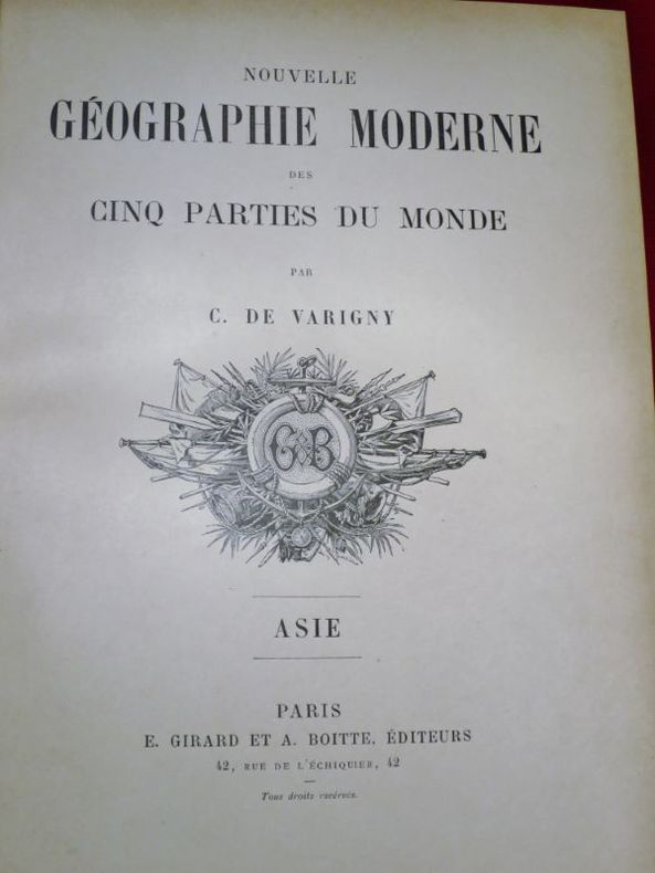
104488Paris, E. Girard et A. Boitte, sans date (vers 1890-1892), 5 volumes + 1 atlas en couleurs, in-folio de 310x220 mm environ, Tome I. Asie, 324 pages - Tome II. Europe Méridionale & Occidentale, 324 pages - Tome III. Europe septentrionale & Centrale, 324 pages - Tome IV. Amérique, 324 pages - Tome V. Afrique-Océanie, 350 pages + 1 volume d' Atlas, demi-chagrin vert sapin, dos 5 nerfs portant titres et tomaisons dorés, ornés d'un fleuron doré aux entre-nerfs, gardes de couleurs, tranches finement mouchetées. Frottements sur le cartonnage avec quelques coins dénudés, légères épidermures sur le cuir, petite mouillure sur la tranche supérieure du tome 4, sinon bon état. Avec des illustrations HT et des illustrations dans le texte.²
2011017094Paris: Assouline 2011. This is a near fine hardcover copy with a like illustrated hardshell slipcase. Completely clean inside and out. No fading gilt letters still bright on red cloth spine. Lightly bumped front board lower corner does not affect the text block. Illustrated in black & white and color with photographs from the legendary costume balls of the twentieth century. 14" high X 11" wide 307 pages. Large heavy book foreign shipping will be extra. This book will be securely wrapped and packed in a sturdy box and shipped with tracking. Hard Cover. Near Fine. Assouline Hardcover
1897006812New York: Edward Arnold 1897. 471 4ads. with half-title. photogravure frontis. portrait 6 maps 5 folding some partly coloured & numerous illus. many full-page. original gilt-stamped cloth. tear along 1 map fold . First Edition. The expedition explored the unknown territory between Somaliland and Lake Rudolf. "At the time it was the universal opinion.that it would be impossible to enter the Galla countries let alone reach Lake Rudolf with less than two or three hundred well-drilled followers." from Introduction. Minimal markings - only inside front and back covers and spine - otherwise clean. First Edition. Hard Cover. Very Good/No Jacket Issued. 8vo - over 7¾" - 9¾" tall. Ex-Library. Edward Arnold Hardcover
Carta tratta dalla Geographia universalis, vetus et nova, complectens. Claudii Ptolemaei Alexandrini Ennarationis libros VIII, pubblicata per la prima volta nel 1540 a Basilea da Heinrich Petri, figliastro di Münster e suo fidatissimo stampatore. Il volume è illustrato da 27 carte costruite seguendo le indicazioni di Tolomeo, a cui si affiancano 21 carte “moderne”, delineate in base alle recenti scoperte geografiche. La Geographia di Münster ebbe un notevole successo, e Petri la ristampò l'anno seguente (1541) e quello successivo ancora. Aumentate di sei le carte moderne, tra le quali la Carta Marina di Olao Magnus descrittiva della Scandinavia, l'editore la ristampò ancora nel 1545, nel 1551 e infine nel 1552, sempre con 54 carte geografiche, ma con la sostituzione della Pomerania al posto del Lago di Costanza. Alla scomparsa di Münster l’opera non venne più ristampata; alcune delle carte furono invece utilizzate da Heinrich Petri per le edizioni postume della Cosmographiae Universalis. Le matrici lignee, debitamente emendate, furono poi utilizzate per il Rerum Geographicarum dello Strabo, edizione stampata a Basileae: Ex Officina Henricpetriana, 1571 Mense Augusto. Silografia, finemente colorata a mano, in ottimo stato di conservazione. Map taken from the Geographia universalis, vetus et nova, complectens. Claudii Ptolemaei Alexandrini Ennarationis libros VIII, published for the first time in 1540 in Basel by Heinrich Petri, stepson of Münster and his trusted printer. The book is illustrated by 27 maps built following the indications of Ptolemy, which are flanked by 21 "modern" maps, outlined on the basis of recent geographical discoveries. The Geographia of Münster was a great success, and Petri reprinted it the following year (1541) and then in 1542.. Having increased the number of modern maps by six, including the Carta Marina of Olao Magnus describing Scandinavia, the publisher reprinted it again in 1545, in 1551 and finally in 1552, still with 54 maps, but with the substitution of Pomerania in place of Lake Constance. At the death of Münster the work was not reprinted; some of the maps were instead used by Heinrich Petri for the posthumous editions of the Cosmographiae Universalis. The woodblock of the maps, duly amended, were used for the Rerum Geographicarum of Strabo, edition printed in Basileae: Ex Officina Henricpetriana, 1571 Mense Augusto. Woodcut, in excellent condition.
La carta trae le informazioni cartografiche dalla grande mappa del continente di Giacomo Gastaldi, mentre le informazioni storiche sono traatte dafonti di Virgilio, Plinio, Appiano ed Elicarnaso. Opera tratta dal Parergon, il primo atlante storico mai pubblicato. Fu inizialmente concepito da Ortelius come appendice del suo Theatrum Orbis Terrarum ma visto il notevole successo di queste carte storiche divenne in seguito un lavoro indipendente e rimase la fonte principale di tutti i lavori simili per tutto il XVII secolo. Come sottolinea Koeman “il Parergon deve essere considerato come lavoro personale di Ortelius. Per quest'opera, infatti, diversamente dal Theatrum, non copiò le mappe di altri cartografi, ma ne disegnò lui stesso di nuove ed originali…prese luoghi, regioni e territori delle civiltà classiche illustrandone e spiegandone la storia, una materia molto vicina al suo cuore. Le mappe e le lastre del Parergon devono essere valutate come le più importanti incisioni che rappresentano il diffuso interesse per la geografia classica nel XVI secolo”. Il Theatrum Orbis Terrarum e che è considerato il primo vero “atlante” moderno. L’opera fu pubblicata in 7 lingue e 36 edizioni, per il quale – nel 1570 - Ortelius ottenne il privilegio, ovvero una sorta di diritto d'autore che impediva ad altri cartografi di pubblicare i propri lavori. Il Theatrum rappresentava il lavoro più avanzato del lavoro della descrizione cartografica. L’Ortelius vi raccolse il sapere geografico e cartografico del suo tempo, proponendo in 147 spettacolari tavole incise l’immagine più fedele del mondo allora conosciuto e, in alcune straordinarie “carte storiche”, regioni e itinerari tratti dalla letteratura, dalla mitologia, dalla tradizione. Incisione in rame, fine coloritura, in ottimo stato di conservazione. Interesting map of North Africa with Italy at the top center of the map and centered on Malta. An inset map of Carthage. Descriptive text to right of inset with information on the Carthaginian Wars with Rome.Striking large cartouche. This map was originally issued in 1590 in Ortelius' Parergon, a series of maps reconstructed in part from historical sources. This map was made by Ortelius based on information from Gastaldi's Africa map and on ancient sources such as Pliny (van den Broecke, p. 272). The Parergon, is the first historical atlas ever published. It was initially conceived by Ortelius as an appendix to his Theatrum Orbis Terrarum, but given the considerable success of these historical maps it later became an independent work and remained the main source of all similar works throughout the seventeenth century. Koeman wrote: "This atlas of ancient geography must be regarded as a personal work of Ortelius. For this work he did not, as in the Theatrum, copy other people's maps but drew the originals himself... He took many places and regions from the lands of classical civilization to illustrate and clarify their history, a subject very close to his heart... The maps and plates of the Parergon have to be evaluated as the most outstanding engravings depicting the wide-spread interest in classical geography in the 16th century." The Theatrum Orbis Terrarum, which is considered the first true modern "Atlas". The work was published in 7 languages and 36 editions, for which - in 1570 - Ortelius obtained the privilege, a kind of copyright that prevented other cartographers from publishing his works. The Theatrum represented the most advanced work of cartographic description. Ortelius collected in it the geographical and cartographic knowledge of his time, proposing in 147 spectacular engraved plates the most faithful image of the world then known and, in some extraordinary "historical maps", regions and routes taken from literature, mythology, tradition. Copperplate, with fine later hand colour, very good condition. M. Van den Broecke "Ortelius Atlas Maps" (2011), n. 218.