KALMER LUDWIG HUYN-JOSEPH.MareMagnum
ARCUNO Irma -MareMagnum
Abissinia ieri ed oggi.
Napoli, 1935, 8vo brossura muta, pp. 185 + 1 cart. col. rip. f.t.

Libreria Piani · Monte San Pietro, IT12,00 €
30 545 résultats
In 8° (215x155); 320 pp. Cartonato editoriale figuratp policromo. Con 72 foto orig. f.t. e sei carte, di cui una ripieg. Non comune. L'autore visse cinque anni in Abissinia. Ne scaturisce una interessante descrizione basata su reali esperienze di vita fra cui caccia al bufalo, al coccodrillo, all'antilope e ad altri animali africani. Ben conservato, minimi difetti a spigoli e dorso.
Napoli, 1935, 8vo brossura muta, pp. 185 + 1 cart. col. rip. f.t.
1 Vol. In-8 pag. 143 36 ill.in tavv.f.t.Sovracpt.ill(stanca) PROG 5362 CATT_ATT 34
Milano, 1872, 28 gennaio e 4 febbraio, articolo ed ill. xil. in due fascicoli di 12 e 8 pagine de "L' emporio pittoresco".
Milano, 1872, 28 gennaio e 4 febbraio, articolo ed ill. xil. in due fascicoli di 12 e 8 pagine de "L' emporio pittoresco".
Napoli, Chiurazzi, 1935, 8vo brossura con copertina illustrata, pp. 60 con num. fig. n.t.
Napoli, Chiurazzi,1935. In 8°pp.60n.+6nn. bross editoriale illustrata,1 Carta geografica e disegni n.t.
Milano, Minerva, 1935, 16mo br. cop. ill. col. pp. 252
Milano, Minerva, 1935, 16mo br. cop. ill. col. pp. 252
Milano, Minerva, 1935, 16mo brossura con sovraccoperta illustrata a colori, pp. 252.
Cosenza, Edibios, 2011, 8vo brossura con copertina illustrata a colori, pp. 293 con numerose illustrazioni nel testo.
Prima edizione italiana. In 8vo, cm. 15x21,5h; pag. 196 + indice, illustrazioni fotografiche f.t., brossura editoriale con sopracoperta illustrata a colori, con strappetti e piccole mancanze ai margini. Codice inv.1029354 5/4d
1 Vol. In-4 p pag. 127. Copt. ill. Ottimo stato PROG 34393 CATT_ATT 46
In 16° (187x130), pp. 204 (4). Brossura editoriale illustrata. Ben conservato seppur con minimi difetti.
in-8, pp. 261, bross. edit. con sovracop. Con 90 ill. in tavv. f.t. Copertina sciolta e legg. allentato. [087]
Carta tratta da "La Geographie Universelle" stampata a Parigi.Incisione in rame, bella coloritura coeva, in ottimo stato di conservazione. Taken from "La Geographie Universelle by Duval, a scarce miniature atlas.Copperplate with fine original hand colour, in very good conditions.
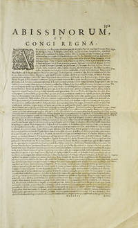
1638263796Amsterdam 1638. Copper engraved map colored in outline letterpress text on verso Abissinourm et Congi Regna Folios 352-353. 1 vols. Folio map 345 x 495 mm. Outline color. Small repairs to Nubia along old fold chiefly infill of blank areas. Very good. Copper engraved map colored in outline letterpress text on verso Abissinourm et Congi Regna Folios 352-353. 1 vols. Folio map 345 x 495 mm. Hand-colored map from the 1638 edition of the Mercator-Hondius Atlas. <br /> <br /> Includes frequent references to Amazons and locates "populi Antropophagi" just north of the Congo and Tritons and Sirens in Lake Victoria. Describes Nubia as "olim Christianam" and locates famous biblical queens of the time of Solomon along the banks of the Nile river. May locate the kingdom of Prester John on top of Amara Mons in the center of the map.<br /> <br /> A beautifully hand-colored map in excellent condition. Koeman I 8720:1A unknown
Carta geografica tratta dal Tabularum Geographicarum contractarum libri septem di Petrus Bertius, edizione latina del 1616. L'opera contiene 219 carte che illustrano questa nuova versione della geografia del Bertius, per la prima volta pubblicata nel 1612 con le carte di Barent Langenes. Le carte derivano dal grande atlante di Mercator/Hondius, delle quali molte rappresentano una semplice riduzione. "After the death of Cornelis Claesz in 1609, Jodocus Hondius II became the new publisher of the work, composed by 7 parts in 1, with engraved title-page and 220 full-page engraved maps in text. All the maps were newly engraved and slightly larger in size, because Hondius was not able to acquire the original plates. With the new plates the work was definitely improved and enjoyed a growing demand of the public, which at that time had the choice between the Atlas Minor by Mercator and Bertius' Tabularum Geographicarum. The 219 plates, with the oval world map appearing twice, were produced to illustrate a new version of the geography of Bertius, published in 1616. According to King, their correct attribution is by Hondius, after Mercator and Hondius, taken from Bertius, who was only responsible for revising his text again" [cfr. G. King, Miniature Antique Maps]. Incisione in rame, perfette condizioni. A superior rival to the pocket Ortelius atlas appeared about 1598, under the imprint of Barent Langenes and Cornelis Claesz. Claesz also published the Tabularum Geographicarum contractarum libri septem, edition with texy by Petrus Bertius, in 1600. After the death of Cornelis Claesz in 1609, Jodocus Hondius II became the new publisher of the work, composed by 7 parts in 1, with engraved title-page and 220 full-page engraved maps in text. All the maps were newly engraved and slightly larger in size, because Hondius was not able to acquire the original plates. With the new plates the work was definitely improved and enjoyed a growing demand of the public, which at that time had the choice between the Atlas Minor by Mercator and Bertius' Tabularum Geographicarum. The 219 plates, with the oval world map appearing twice, were produced to illustrate a new version of the geography of Bertius, published in 1616. According to King, their correct attribution is by Hondius, after Mercator and Hondius, taken from Bertius, who was only responsible for revising his text again. "After the death of Cornelis Claesz in 1609, Jodocus Hondius II became the new publisher of the work, composed by 7 parts in 1, with engraved title-page and 220 full-page engraved maps in text. All the maps were newly engraved and slightly larger in size, because Hondius was not able to acquire the original plates. With the new plates the work was definitely improved and enjoyed a growing demand of the public, which at that time had the choice between the Atlas Minor by Mercator and Bertius' Tabularum Geographicarum. The 219 plates, with the oval world map appearing twice, were produced to illustrate a new version of the geography of Bertius, published in 1616. According to King, their correct attribution is by Hondius, after Mercator and Hondius, taken from Bertius, who was only responsible for revising his text again" [cf. G. King, Miniature Antique Maps]. Copperplate, in very good conditions. Koeman p. 42; King p. 96/99.
La carta viene preparata da Gerard Mercator per l’Atlantis Pars Altera (1595) pubblicato postumo alla morte dell’autore, sotto la supervisione del figlio Rumold Mercator, dallo stampatore di Duisburg Albert Buys. Composto da sei parti – pubblicate separatamente tra il 1589 e il 1594 – comprende 107 mappe, tutte tranne la carta del mondo di Rumold, firmate da Gerard Mercator. Le lastre vennero poi acquistate da Jodocus Hondius, che tra il 1606 e il 1630 le utilizzò per il suo Atlas Sive Cosmographicae Meditationes de Fabrica Mundi, integrandole ed aggiornandole con proprie “nuove” carte. Delle mappe di Mercator sono note anche ristampe curate da Johannes Janssonius. Le edizioni Hondius e Janssonius ebbero un grande successo commerciale e furono stampate in più lingue, con il testo al verso della carta in latino, francese, tedesco e olandese. La carta è incisa con i connotati tipici dell'opera mercatoriana. Le montagne sono allineate in un concetto di area montuosa, non per indicare vere catene o valli, ed hanno una struttura con qualche differenza nella dimensione, ma simile per quanto riguarda la forma, con pendici verticali e cime piatte. Le città sono mostrate attraverso castelli più o meno grandi caratterizzati da tetti slanciati ed aguzzi, simili a cappelli di mago. Esemplare tratto da Atlas Sive Cosmographicae Meditationes de Fabrica Mundi di Jodocus Hondius. Incisione in rame, in buono stato di conservazione. Bibliografia cfr. Koeman II Me 11 e Koeman II Me 13A, 1595); Van der Krogt 1:002; J. Keuning, The History of an Atlas, in “Imago Mundi” IV (1947) pp. 37-43; World Encompassed p. 134. The map is prepared by Gerard Mercator for his Atlantis Pars Altera (1595) published posthumously after the death of Mercator, by the Duisburg printer Albert Buys, under the supervision of his son Rumold Mercator. Composed of six parts - published separately between 1589 and 1594 - it includes 107 maps, all except Rumold's map of the world, made by Gerard Mercator. The plates were then purchased by Jodocus Hondius, who between 1606 and 1630 used them for his Atlas Sive Cosmographicae Meditationes de Fabrica Mundi, integrating and updating them with his own "new" maps. Of Mercator's maps are also known reprints edited by Johannes Janssonius. The Hondius and Janssonius editions had a great commercial success and were printed in several languages, with the text on the back of the map in Latin, French, German and Dutch. The map is engraved with the typical connotations of Mercatorian work. The mountains are aligned in a mountainous area concept, not to indicate true chains or valleys, and have a structure with some differences in size, but similar in shape, with vertical slopes and flat tops. The cities are shown through more or less large castles characterized by slender and pointed roofs, similar to wizard hats. Example from Atlas Sive Cosmographicae Meditationes de Fabrica Mundi by Jodocus Hondius. Copper engraving, in good condition. Bibliografia cfr. Koeman II Me 11 e Koeman II Me 13A, 1595); Van der Krogt 1:002; J. Keuning, The History of an Atlas, in “Imago Mundi” IV (1947) pp. 37-43; World Encompassed p. 134.
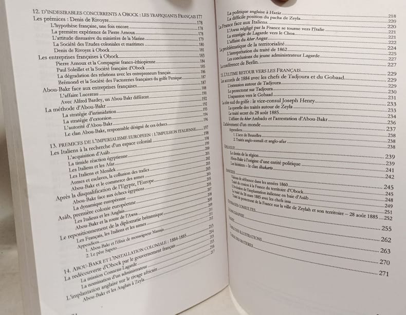
2003100151221Editions L'Harmattan 2003 276 pages 16x1 4x23 8cm. 2003. Broché. 276 pages. Biographie d'Abou-Bakr Ibrahim né en 1810 dans une famille afar impliquée dans le commerce des esclaves. L'ouvrage retrace son ascension comme pacha de Zeyla et marchand d'esclaves tout en analysant les dynamiques diplomatiques et commerciales dans le golfe de Tadjoura entre 1840 et 1885 ainsi que leur impact sur la formation des États contemporains de la Corne de l'Afrique
C10806, New York, Mallard Press, 1989, 156pp. richly ill. in colour, hardcover with dustwrapper, good condition, C10806
Piano nautico tratto dal " Recueil des principaux plans des ports & rades de la Méditerranée" di Josepgh Roux, pubblicato per la prima volta a Marsiglia nel 1764 e successivamente ristampato - ampliato - a Genova da Yves Gravier con il titolo "Recueil de 163 principaux plans des ports et rades de la Mediterranée" (1804).Ulteriore edizione dell'opera, con il titolo "Plans des ports ed des rades de la Mer Méditerranée.." è stampata a Livorno da Carlo Tesi nel 1858. Incisione in rame, finemente acquarellata a mano, in ottimo stato di conservazione. First published in the "Recueil des principaux plans des ports et rades de la Mer Mediterranee", 1764, this nice nautical chart is taken from the rare "Plans des ports ed des rades de la Mer Méditerranée.." published in Leghorn by Carlo Tesi, 1858. Copperplate with fine colouring, in very good condition.
New York, Mallard Press, 1989, 156pp. richly ill. in colour, hardcover with dustwrapper, good condition, C10806