(xt) Yehuda Hadassi, The KaraiteMareMagnum

34 274 résultats
, 1836 Hardback1st edition. 19th Century quarter-leather and boards, 4to (large), [2] 155 leaves, 33 cm. Explaining the commandments written in the Torah as far as the human intellect is capable of comprehending Treatise regarding the tenets of the Karaite faith, arranged according to the Ten Commandments and in alphabetical order, written in poetic Hebrew. Lays out the the fundamentals of the Karaite faith and includes a harsh attack against rabbinic Judaism and its rabbis.Yehudah Hadassi, son of Eliyahu Hadassi, nicknamed "Ha-Avel," lived in Constantinople in the 12th century. This is his primary work. "This work was printed at Eupatoria (1836), with an introduction by Caleb Afendopolo entitled 'Nahal Eshkol.' Alphabets 99-100 and part of 98 were excluded from this edition by the censor, but have been published by Bacher in 'J. Q. R.' (viii. 431 et seq.). Hadassi mentions a previously written work of his entitled 'Sefer Teren bi-Teren,' a collection of homonyms which, he says, was an addition to the eighty pairs of Ben Asher (alphabets 163, 168, 173). There exists also a fragment which Firkovich (Cat. No. 619, St. Petersburg) entitled 'Sefer ha-Yalkut' and attributed to Hadassi, while Pinsker regarded it as an extract from Tobiah's 'Sefer ha-Mizwot.' P. F. Frankl, however, agreed with Firkovich in regarding it as a part of the 'Eshkol ha-Kofer,' which Hadassi had previously written in prose. In the Karaite Siddur there are four piyyutim by Hadassi" (Kaufmann Kolher & M. Seligsohn in EJ). A number of Karaite works were printed in Gozleve and they are all rare. A damaged copy sold at auction in 2015 for $900 with commissions. SUBJECT(S): Karaites. Karaitic literature. Ten commandments. OCLC: 37960603. Library marks on spine and blank endpapers, stamps on reverse of title page, otherwise clean. Generous wide margins. Early 19th Century paper has held up very well, a very nice copy, better than usually found. About Very Good Condition. (RAB-66-22-BFL-'x)
197414S.l. [Paris], s.d. (1802) cartouche (25 et 19 cm de diamètre), en feuille, fixée sur papier fort.
200708944A LONDRES, s.e., 1788 ; in-folio, cartonnage de l'éditeur. Qlq planches sont griboullées au dos de l'impression (sur 2 planches) contient 10 cartes de géographie ttes en bonne état par M. MENTELLE, historiographe de Mgr Cte d'ARTOIS & Cie. gravé par P.F. Tardieu - 93 planches de tactiques militaire et 74 planches de statistiques et divers - pour l'ouvrage de Mr le comte de Mirabeau, coiffes très abimé ainsi que les mors.
594388Budapest, Imprimerie Franklin-Tarsulat et Ed. du Musée National Hongrois, 1877-1878. 2 vol. in-8, rel. de l'ép. demi-chagrin rouge (tome 2 à coins), dos à nerfs, titre doré ; XXXIII-706 et 187-108 pp., 2 cartes et 1 tableau dépliants, très nb. ill., fig., cartes, reprod. photogr. en n/b. in-t. et h.-t. dont 127 pl. in fine du 2eme tome. Il a été relié une note manuscrite ancienne à la pp. 104 du 1er tome, ex- libris manuscrit Baron de Baye au 2eme tome. Rare.
223818Paris, Ladvocat, 1828 2 vol. in-8, 447 pp. et 400 pp., demi-veau vert, dos à nerfs orné de guirlandes dorées et de fleurons à froid (reliure de l'époque). Manques aux coiffes,, dos frottés, épidermures, manque aux pièces de titre, mors et coins usés. Fortes rousseurs. Cachet ex-libris de Cayrol, ex-libris de Bonnault et Jacques Jourquin.
228242Paris, Imprimerie de Goetschy, 1825 petit in-8, 111 pp., demi-veau fauve, dos lisse orné de filets dorés, tranches rouges, couverture citron imprimée conservée (Ateliers Laurenchet).
200553Parme, Imprimerie Royale [Bodoni], 1789 in-folio, [2] ff. n. ch. (titre, dédicace à Charles IV), VIII-29 pp., avec 5 vignettes en-tête ou culs-de-lampe gravées par Raffaelo Morghen d'après Volpato et Tofanelli, manque le frontispice, cartonnage de papier marbré (reliure de l'époque). Manque le dos.
221584Amsterdam, Pierre Mortier, 1750 petit in-8, [12] ff. n. ch. (faux-titre et titre, dédicace au chevalier de Saxe, avant-propos), 136 pp., avec 7 plans en dépliant hors texte, basane fauve marbrée, dos à nerfs cloisonné et fleuronné, pièce de titre cerise, encadrement de simple filet à froid sur les plats, tranches rouges (reliure de l'époque). Restaurations aux coins et aux coiffes.
243361Paris, Sébastien Cramoisy & Sébastien Mabre-Cramoisy, 1665 in-folio, [4] ff. n. ch. (titre avec vignette héraldique, table), 233 pp., avec 2 tableaux généalogiques dépliants hors texte, basane fauve marbrée, dos à nerfs cloisonné et fleuronné, tranches mouchetées de rouge (reliure de l'époque). Reliure très défraîchie, avec importants manques de cuir au dos et sur les plats, coins abîmés, pages roussies.
201860S.l.n.d. in-8 carré, paginé 40 à 81,
188320Turin, Imprimerie Royale, 1854-1857 2 forts vol. in-folio, XX-[2] pp., CXXII-1652 colonnes ; [7] ff. n. ch., LIV-1636 colonnes, avec une planche dépliante gravée au trait, demi-basane mirabelle, dos lisse orné de filets dorés et noirs, pièces de titre et de tomaison noires, tranches mouchetées (reliure de l'époque). Dos insolés, pièces de titre frottées.
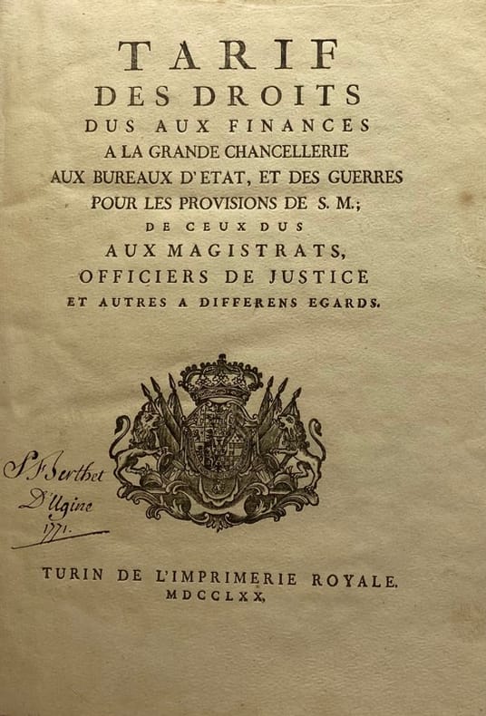
228532Turin, Imprimerie royale, 1770 in-4, [2] ff. n. ch., 419 pp., vélin rigide, dos à nerfs, tranches mouchetées de rouge (reliure de l'époque).
184686339A. Mame & Cie | Tours 1846 | 15.80 x 24.10 cm | relié
200640Paris, Durand, 1861 gr. in-8, XV-608 pp., demi-veau havane, dos à nerfs orné, couv. cons. (rel. moderne). Bon exemplaire.
1900198691900 Sculpture en étain signée d'un double cachet à sa base, (1900), 11 x 34 x 22 cm.
220739Cologne, Pierre Du Marteau, 1668 in-12, titre, 163 pp., veau blond, dos à nerfs orné de pointillés, filets et petits fleurons dorés, pièces de titre bouteille, encadrement de double filet doré sur les plats, simple filet doré sur les coupes, tranches mouchetées, guirlande dorée en encadrement sur les contreplats (Koehler).
160051Paris, Michaud, 1824 2 vol. in-8, XIV-327 pp. et 427 pp., demi-basane rouge, dos lisse orné (rel. postérieure).
222633Paris, Michaud, 1823-1825 3 vol. in-8, (4)-215-191 pp., XI-324 pp. et (4)-VI-320 pp., cartonnage papier bleu à la Bradel (rel. de l'époque). Rousseurs.
Veduta obliqua basso-alto di Piombino, una base spagnola sulla costa della Toscana che era stata catturata dai francesi nel 1646 e poi riconquistata dagli spagnoli, dal 25 maggio all'8 luglio del 1650. Guerra franco-spagnola (1645-1659). In basso a sinistra un cartiglio con la carta dell’Isola d’Elba e la costa antistante con la città di Piombino. Tavola pubblicata nell'opera Les glorieuses conquestes de Louis le Grand roy de France et de Navarre. Sébastien Pontault de Beaulieu (1612-1674) fu un eminente ingegnere francese, che è considerato il primo topografo militare, o piuttosto l'inventore di quest'arte, durante il regno di Luigi XIV. Pontault entrò nell'esercito all'età di quindici anni, e si comportò con così tanto spirito all'assedio di La Rochelle, che il Re gli diede il posto di commissario di artiglieria, anche se era così giovane. In seguito, fu presente alla maggior parte delle battaglie e degli assedi, che ha descritto, e non lasciò la vita militare fino a quando la perdita di un braccio e altre ferite, con l'avvicinarsi della vecchiaia, resero necessario il ritiro. Pontault morì il 10 agosto 1674. Era pratica di Pontault seguire l'esercito e costruire sul posto i piani delle battaglie e degli assedi, con accompagnamento storico e prospettico. La sua opera più importante è intitolata Les glorieuses Conquêtes de Louis-le-Grand: ou Recueil, de Plans et Vues des places assiegeés, et de celles ou se_sont douneés des batailles, avec des Discours. Quest'opera è una delle più magnifiche del genere, copre tutte le operazioni di guerra, dalla battaglia di Rocroi, nel 1643, alla presa di Namur, nel 1692. Pontault morì nel 1674; ma l'opera fu completata fino a questa data a spese di sua nipote, la vedova Des Roches. Questa edizione è solitamente chiamata Grand Beaulieu, per distinguerla da una in scala ridotta, in quarto oblungo, chiamata Petit Beaulieu, di cui esistono due serie, una in tre volumi, con le vedute delle azioni nei Paesi Bassi; l'altra in quattro, che include quelle della Francia. Ogni copia contiene una diversa collezione di tavole; per una descrizione dettagliata delle copie BN e BL si veda M. Pastoreau. Le tavole furono poi utilizzate nella pubblicazione del Cabinet du Roi a partire dal 1727 e sono ora conservate al Louvre. Acquaforte su rame, impressa su carta vergata coeva, in ottime condizioni. Bibliografia Pastoreau, Les atlas français, Beaulieu XV; Shirley, Maps in the Atlases of the British Library T.BEAU-16a A low-high oblique view of Piombino, a Spanish base on the coast of Tuscany which had been captured by the French in 1646 and shown here, retaken by the Spanish, from 25 May to 8 July in 1650. Franco-Spanish War (1645-1659). At lower left a cartouche with a map of the Island of Elba and the coast in front with the city of Piombino. Plate published in the work Les glorieuses conquestes de Louis le Grand roy de France et de Navarre. Sébastien Pontault de Beaulieu (1612–1674) was an eminent French engineer, who is considered to be the first military topographer, or rather the inventor of that art, during the reign of Louis XIV. Pontault went into the army at the age of fifteen, and behaved with so much spirit at the siege of Rochelle, that the king gave him the post of commissary of artillery, even though he was so young. He was afterwards present at most of the battles and siege, which he has described, and did not quit a military life until the loss of an arm and other wounds, with the approach of old age, rendered retirement necessary. Pontault died on 10 August 1674. From the death of this able drafts-man, there were few capable military topographers in France until the latter half of the 18th century. It was Pontault's practice to follow the army, and construct upon the spot plans of the battles and sieges, with historical and perspective accompaniments. His most important work is entitled Les glorieuses Conquêtes de Louis-le-Grand: ou Recueil, de Plans et Vues des places assiegeés, et de celles ou se_sont douneés des batailles, avec des Discours (The glorious victories of Louis the Great, produced from the drawings of the Chevalier de Beaulieu). This work is one of the most magnificent of the kind, covers all the operations of war, from the battle of Rocroi, in 1643, to the taking of Namur, in 1692. Pontault died in 1674; but the work was completed to the above date at the expense of his niece, the widow of the sieur Des Roches. This edition is usually called the Grand Beaulieu, to distinguish it from one on a reduced scale, in oblong quarto, called the Petit Beaulieu, of which there are two series, one in three volumes, with views of the actions in the Netherlands; the other in four, which includes those of France. Each copy contains a different collection of plates; for a detailed description of the BN and BL copies see Pastoreau. The plates were later used in the publication of the Cabinet du Roi from 1727 onwards and are now housed in the Louvre. Etching on copper, printed on contemporary laid paper, in very good condition. Literature Pastoreau, Les atlas français, Beaulieu XV; Shirley, Maps in the Atlases of the British Library T.BEAU-16a.
222227Amsterdam, Louis Elzévir, 1646 in-16, [12] ff. n. ch. (titre-frontispice gravé, titre, dédicace, préface, pièces liminaires), [280] pp. mal chiffrées 270 (il y a saut de chiffrage de 144 à 135), [27] ff. n. ch. de table et d'errata, maroquin cerise à long grain, dos à nerfs fleuronné, encadrement de double filet à froid sur les plats avec fleurons dorés en écoinçon, simple filet doré sur les coupes, tranches dorées, encadrement de guirlande dorée sur les contreplats (rel. du XIXe s.). Légères traces blanches au plat inférieur.
1764LBW-6941764 209 x 167 mm.
1704LBW00282Amsterdam Pierre Mortier 1704 414 x 522 mm.
Carta in due fogli della Danimarca di Johannes Blaeu. La carta viene per la prima volta pubblicata nell’Atlas Major del 1662. Il presente esemplare è tratto dall’edizione con testo latino. Alla morte di Willem J. Blaeu, nell’ottobre del 1638, la tipografia venne rilevata dai figli Johannes o Joan (1596-1673) e Cornelis (circa 1610-1642) che subentrarono negli affari del padre. Nello stesso anno Joan Blaeu assunse anche la posizione di suo padre come cartografo ufficiale del V.O.C. Il titolo poneva la casa editrice Blaeu al centro della creazione di mappe ad Amsterdam, dando loro un potere e un’influenza senza precedenti. Alla morte di Cornelis, nel 1642, la casa editrice rimase esclusivamente nelle mani di Joan Blaeu, che nel 1648 fu il primo a pubblicare una mappa che raffigurava la teoria copernicana della Terra che ruota attorno al Sole, un concetto eretico secondo la Chiesa cattolica. Nel 1662 Blaeu completò il suo opus magnum: l’Atlas maior sive cosmographia Blaviana. Magnifca prova, impressa su carta vergata coeva, finemente colorata d’epoca, in ottimo stato di conservazione. Two-sheet map of Denmark by Johannes Blaeu. The map is first published in the Atlas Major of 1662. The present specimen is taken from the edition with Latin text. At the death of Willem J. Blaeu, in October 1638, the printing house was taken over by his sons Johannes or Joan (1596-1673) and Cornelis (about 1610-1642) who took over the business of their father. In the same year Joan Blaeu also took over his father's position as official cartographer of the V.O.C. The title placed Blaeu's publishing house at the center of map-making in Amsterdam, giving them unprecedented power and influence. Upon Cornelis' death in 1642, the publishing house remained solely in the hands of Joan Blaeu, who in 1648 was the first to publish a map depicting the Copernican theory of the Earth revolving around the Sun, a heretical concept according to the Catholic Church. In 1662 Blaeu completed his magnum opus: the Atlas maior sive cosmographia Blaviana. A fine example, printed on contemporary paper, finely original colouring, in good condition.
198720Florence, Giorgio Marescotti, 1600 petit in-4, [12] ff. n. ch. le dernier portant la vignette de l'imprimeur, armes des Médicis au titre, dérelié.
Modena, a spese del suddetto Domenico Boccolari, 1778. (mm. 157). Mezza pergamena moderna con titolo al dorso. Prima ed unica edizione di questa guida delle migliori locande, dei prezzi dei viaggi e di come si effettuavano. Opera divisa in due parti, una in italiano ed una in francese.