Hatton, Ragnhild and J S Bromley, edsBiblio.com
34 270 résultats
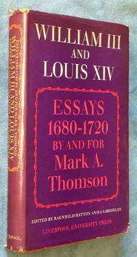
19680001118Liverpool: Liverpool University Press 1968. Hardcover. Very Good /very good. 8vo 6 x 9.5 xii 332 pages. Interior is clean; cover and dust cover is shelf-worn. Liverpool University Press hardcover
Mm 155x240 "Nuova collana di coltura" - Brossura editoriale con sovraccoperta illustrata a colori, viii-283 pagine. Con due saggi di Emilio Cecchi e Elio Vittorini. Segni del tempo e usure ai margini della sovraccoperta, interno ottimo. SPEDIZIONE IN 24 ORE DALLA CONFERMA DELL'ORDINE.
Mm 130x215 Europe: revue littéraire mensuelle, 70 année, n° 753-754, Janvier-Février 1992. Brossura editoriale di 227 pagine. Copia molto buona. Testo in lingua francese - french text. SPEDIZIONE IN 24 ORE DALLA CONFERMA DELL'ORDINE.
1873160339Leipzig & Heidelberg: C. F. Winter'sche Verlagshandlung 1873. XXVIII, 317; VIII, 323 Seiten. 8° (17,5-22,5 cm). Leinenband der Zeit mit Romantikervergoldung auf dem Rücken sowie Blindpräungen auf den Deckeln. [Hardcover / fest gebunden].
1925000327London, Heinmann, 1925. X, 310 S. Orig.-Leinenband. Ein gut erhaltenes Exemplar mit nur leichten Gebrauchsspuren.
63p. Illustrated. Small 8vo. Original cloth backed pictorial paper boards. Worn. Shaken. **PRICE JUST REDUCED! GYPSY 2
trad. di Franca Cavagnoli n. 8 in 24°, bross. edit. con titoli, timbro di appartenenza
Mit 21 Abbildungen nach zeitgenössischen Stichen.
Carta geografica tratta dal Tabularum Geographicarum contractarum libri septem di Petrus Bertius, edizione latina del 1616. L'opera contiene 219 carte che illustrano questa nuova versione della geografia del Bertius, per la prima volta pubblicata nel 1612 con le carte di Barent Langenes. Le carte derivano dal grande atlante di Mercator/Hondius, delle quali molte rappresentano una semplice riduzione. "After the death of Cornelis Claesz in 1609, Jodocus Hondius II became the new publisher of the work, composed by 7 parts in 1, with engraved title-page and 220 full-page engraved maps in text. All the maps were newly engraved and slightly larger in size, because Hondius was not able to acquire the original plates. With the new plates the work was definitely improved and enjoyed a growing demand of the public, which at that time had the choice between the Atlas Minor by Mercator and Bertius' Tabularum Geographicarum. The 219 plates, with the oval world map appearing twice, were produced to illustrate a new version of the geography of Bertius, published in 1616. According to King, their correct attribution is by Hondius, after Mercator and Hondius, taken from Bertius, who was only responsible for revising his text again" [cfr. G. King, Miniature Antique Maps]. Incisione in rame, perfette condizioni. A superior rival to the pocket Ortelius atlas appeared about 1598, under the imprint of Barent Langenes and Cornelis Claesz. Claesz also published the Tabularum Geographicarum contractarum libri septem, edition with texy by Petrus Bertius, in 1600. After the death of Cornelis Claesz in 1609, Jodocus Hondius II became the new publisher of the work, composed by 7 parts in 1, with engraved title-page and 220 full-page engraved maps in text. All the maps were newly engraved and slightly larger in size, because Hondius was not able to acquire the original plates. With the new plates the work was definitely improved and enjoyed a growing demand of the public, which at that time had the choice between the Atlas Minor by Mercator and Bertius' Tabularum Geographicarum. The 219 plates, with the oval world map appearing twice, were produced to illustrate a new version of the geography of Bertius, published in 1616. According to King, their correct attribution is by Hondius, after Mercator and Hondius, taken from Bertius, who was only responsible for revising his text again. "After the death of Cornelis Claesz in 1609, Jodocus Hondius II became the new publisher of the work, composed by 7 parts in 1, with engraved title-page and 220 full-page engraved maps in text. All the maps were newly engraved and slightly larger in size, because Hondius was not able to acquire the original plates. With the new plates the work was definitely improved and enjoyed a growing demand of the public, which at that time had the choice between the Atlas Minor by Mercator and Bertius' Tabularum Geographicarum. The 219 plates, with the oval world map appearing twice, were produced to illustrate a new version of the geography of Bertius, published in 1616. According to King, their correct attribution is by Hondius, after Mercator and Hondius, taken from Bertius, who was only responsible for revising his text again" [cf. G. King, Miniature Antique Maps]. Copperplate, in very good conditions. Koeman p. 42; King p. 96/99.
196543475München: Kindler, 1965. 379 S. : Ill. Gr. 8°. OLwd mit Goldpräg. u. SU.
73489Leipzig und Heidelberg, C. F. Winter’sche Verlagshandlung 1873, 225x150mm, X - VIII - 312 + 323Seiten, Basil-Halbledereinband. Teller marbriertes Papier. Am Rücken vergoldeter Autor und Titel. Boden des geriebenen niedrigereren Tellers andernfalls schönes Exemplar.
Mit Frontisillustration & 9 Tafeln
296820[Hamburg] : Koehler im Maximilian Verlag GmbH & Co. KG, [2016]. 272 Seiten. Mit zahlreichen farbigen Abbildungen. 30 cm Originalpappband.
304 pages. Text in Dutch. Profusely illustrated with reproductions of archival black and white photos. Gift greetings upon first blank leaf. Writing beneath photo on page 74. Average wear. Binding intact. A sound copy. Book
1956742G4482Netherlands: Boerenleenbank 1956. Book. Good. Hardcover. First Edition. 4to - over 9¾" - 12" tall. 304 pages. Text in Dutch. Profusely illustrated with reproductions of archival black and white photos. Gift greetings upon first blank leaf. Writing beneath photo on page 74. Average wear. Binding intact. A sound copy. Boerenleenbank Hardcover
189553555ABWien u.a., F. Tempsky, 1895. Ca. 26 x 19 cm. VIII S., 466 Seiten. Mit zahlreichen Illustrationen im Text und auf Tafeln sowie 5 Kunstdrucktafeln (davon 3 farbige) von Myrbach, Mangold, Jasche, Engelhart und Hey. Halblederband der Zeit mit reicher Rückenvergoldung. [2 Warenabbildungen]
200883983Berlin, Lit-Verlag, 2008. 453 S. Gr.-8° Groß-Oktav, Hardcover/Pappeinband
196534413ABWien, Brüder Rosenbaum, [1965]. Querformat, ca. 22,5 x 23,5 cm. Unpaginiert. Mit zahlreichen meist farbigen Illustrationen von Fritz Busse. Farbig illustr. Orig.-Leinenband mit Schutzumschlag (dieser mit hinterlegtem Einriss).
1985113906Hbg: Nikol 1985. 344 S., 370 Abb. z.T. farb. Lit.verz. Reg. 4° Kart.mS. [Berühmte Architekten dieser Zeit wie Otto Wagner, Adolf Loos, Joseph Maria Olbrich, Josef Hoffmann, Kolomann Moser und Max Fabiani prägten neben vielen anderen das Stadtbild.]
1910810185Leipzig, Klinkhardt & Biermann, (ca. 1910). M. zahlr. Taf. u. Abb. 4 Bl., 134 S. OLwd. (Stätten d. Kultur 8).
1900223240Brüder Kohn , Wien 1, um, 1900.
19398954Schroll, Wien 1939 (Deutsche Lande deutsche Kunst). 168 S. mit zahlr. Abbildungen u. Tafeln. Gr.-8°. Ln. Geringe Gebrsp. Ecken etwas bestoßen. Gutes Exemplar.
19066402Stuttgart, Krabbe 1906. Mit 8 Abb. 136 S. Brosch. 18x12 cm.
1826178584Wien, Härter, 1823-1826. M. 6 gest. Front., 6 gest. Titelbl., 25 (teils gef.) Kpfr.-Taf. u. mehr. Tab. In 5 (4 uniforme) Hldrbdn. u. 1 mod. Ppbd. Einbde. beschabt u. bestoßen. Gebräunt (teils auch stark) u. braunfl. St. a. Tit. 3 Tab. fehlen.
182453656ABWien, Franz Härter'sche Buchhandlung, 1824-1825. Ca. 18,5 12 cm. Mit 9 gestochenen Titelblättern mit je einer Vignette, mit 66 Beigaben (41 Kupferstichtafeln, 12 Lithographien und 13 gedruckten Tabellen und Stammtafeln). Halblederbände der Zeit mit Rückenschildresten. 9 Bände (1. Jahrgang Bände 1-5, 2. Jahrgang Bände 6-9), alles Erschienene. [4 Warenabbildungen]