Oliver and Boyd (Edinburgh, Scotland)Biblio.com
1 584 résultats
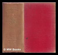
1912331428Edinburgh : Oliver & Boyd 1912. 76th year of publication. Hardcover. Good copy in the original gilt-blocked cloth. Spine bands and panel edges somewhat bumped and rubbed as with age. Remains quite well-preserved overall. Physical description: 1288; 140p 55; 14 cm.Subjects: Almanacs Scottish. Edinburgh Scotland; Calendars.Edinburgh directories. Scotland. Genre: Almanacs - Scotland. Edinburgh : Oliver & Boyd hardcover
1358673853.Ghardcover. Good. Access codes and supplements are not guaranteed with used items. May be an ex-library book. hardcover
1166609634.Gpaperback. Good. Access codes and supplements are not guaranteed with used items. May be an ex-library book. paperback
1356122604.Ghardcover. Good. Access codes and supplements are not guaranteed with used items. May be an ex-library book. hardcover
1120333016.Gpaperback. Good. Access codes and supplements are not guaranteed with used items. May be an ex-library book. paperback
0267545711.Ghardcover. Good. Access codes and supplements are not guaranteed with used items. May be an ex-library book. hardcover
133347413X.Gpaperback. Good. Access codes and supplements are not guaranteed with used items. May be an ex-library book. paperback
1890Map 726Scotland: Ordnance Survey Office 1890. 1st Edition . Hardback. Vg. Folding map. Folding map dissected in 18 sections the rare first series edition laid on linen and cased in the original green cloth boards 6.75 x 4.5 inches with a hand-written paper label. Surveyed 1855-1861 and published in1890. Small grid of adjoining maps for the one inch and six inch series pasted to inside cover. 25x19 inches with hand-coloured roads. A nice copy with no wear or loss. There were 132 sheets for the complete Scottish ordnance maps and a second edition appeared in in 1898-1904 with coloured parishes. The one inch maps were based on larger scale surveys of 1843-1878 and published between 1856 and 1895. <br/> <br/> Ordnance Survey Office hardcover
1890Map 728Scotland: Ordnance Survey Office 1890. 1st Edition . Hardback. Vg. Folding map. Folding map dissected in 18 sections the rare first series edition laid on linen and cased in the original green cloth boards 6.75 x 4.5 inches with a hand-written paper label. Surveyed 1859 -1863 and published in1890. Small grid of adjoining maps for the one inch and six inch series pasted to inside cover. 25x19 inches with hand-coloured roads. A nice copy with no wear or loss. There were 132 sheets for the complete Scottish ordnance maps and a second edition appeared in in 1898-1904 with coloured parishes. The one inch maps were based on larger scale surveys of 1843-1878 and published between 1856 and 1895. <br/> <br/> Ordnance Survey Office hardcover
1867Map 731Scotland: Ordnance Survey Office 1867. 1st Edition . Hardback. Vg. Folding map. Folding map dissected in 18 sections the rare first series edition laid on linen and cased in the original green cloth boards 6.75 x 4.5 inches with a hand-written paper label. Surveyed 1859-1864 and published in1867. Small grid of adjoining maps for the one inch and six inch series pasted to inside cover. 25x19 inches with hand-coloured roads. A nice copy with no wear or loss. There were 132 sheets for the complete Scottish ordnance maps and a second edition appeared in in 1898-1904 with coloured parishes. The one inch maps were based on larger scale surveys of 1843-1878 and published between 1856 and 1895. <br/> <br/> Ordnance Survey Office hardcover
1876Map 729Scotland: Ordnance Survey Office 1876. 1st Edition . Hardback. Vg. Folding map. Folding map dissected in 18 sections the rare first series edition laid on linen and cased in the original green cloth boards 6.75 x 4.5 inches with a hand-written paper label. Surveyed 1860-1871 and published in1876. Small grid of adjoining maps for the one inch and six inch series pasted to inside cover. 25x19 inches with hand-coloured roads. A nice copy with no wear or loss. There were 132 sheets for the complete Scottish ordnance maps and a second edition appeared in in 1898-1904 with coloured parishes. The one inch maps were based on larger scale surveys of 1843-1878 and published between 1856 and 1895. <br/> <br/> Ordnance Survey Office hardcover
1869Map 725Ordnance Survey Office 1869. 1st Edition . Hardback. Vg. Folding map. Folding dissected map in 18 sections the rare first series edition laid on linen and cased in the original green cloth boards 6.75 x 4.5 inches with a hand-written paper label. Surveyed 1860-1871 and published in1869. Small grid of adjoining maps for the one inch and six inch series pasted to inside cover. 25x19 inches with hand-coloured roads. A nice copy a couple of small red ink marks otherwise clean with no wear or loss. There were 132 sheets for the complete Scottish ordnance maps and a second edition appeared in in 1898-1904 with coloured parishes. The one inch maps were based on larger scale surveys of 1843-1878 and published between 1856 and 1895. <br/> <br/> Ordnance Survey Office hardcover
185481635Edinburgh:: W. H. Lizars 1854-1855. First edition. publisher's green cloth with printed paper labels on spines. Light foxing to the first few and last few leaves in each volume; the cloth of one volume quite faded; moderate use to both bindings but both are tight and sound. . Folio. Two large folding maps. Additional postage particularly international applicable. W. H. Lizars, hardcover
B9781018844695Hardback. New. hardcover
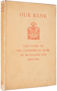
dola760London.: Thomas Nelson And Sons Ltd. 1941. First Edition. 8vo. pp. ix 91 1. 16 plates incl. portraits some double-sided. A very good copy in full red gilt-stamped crushed morocco all edges gilt. Signed by three of the bank's directors London...: Thomas Nelson And Sons Ltd., [1941] unknown
194121141151941. London Thomas Nelson and Sons Ltd. 1941. 8vo. Publisher's red cloth spine lettered in gilt front board lettered and ornamented in gilt; in the original dust wrapper lettered and ornamented in red; outer and lower edges untrimmed; pp. ix 91; with 11 photographic plates one being the frontispiece; a little rubbing to dust-wrapper with a few small unobtrusive marks; light foxing to edges and endpapers else a very good copy.First edition. 'The present brief synopsis of the history of the Bank was suggested by the general manager Mr. J. M. Erskine D. L. 'The record is merely a collection of facts gleaned from many sources but the hope is expressed that it may serve the purpose fro which it is intended' Preface. John Erskine became an apprentice at the bank in 1910 aged 16 and went on to become the bank's general manager in 1932. The bank has since merged with the National Bank of Scotland and the Royal Bank of Scotland. hardcover
51431059like new. unknown
51431059-nnew. unknown
2026__0192870815Oxford University Press 2026. Paperback. New. 2nd revised edition edition. Oxford University Press paperback
2026x-0192870815Oxford University Press 2026. Paperback. New. 2nd edition. 448 pages. 8.66x0.98x10.83 inches. Oxford University Press paperback
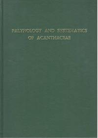
1990S255581990. 178 40 b/w photographic plates. . HB. Buckram. Vg. PhD thesis Department of Botany NHM and University of Reading. hardcover
74479c.1920. . Silver gelatin print. Very good tonal range and in good condition pasted on card.<br /> <br /> [c.1920]. unknown
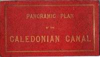
1900037817Fort Augustus Scotland: Williamson 1900. First Edition. Original Boards. Very Good. Strip map in full color image 27" x 7.5". Pictured are landmarks on shore along the Canal. Printed at The Hills Press Sunderland. Tipped into a folder of red leatherette gilt cover lettering. Pasted inside the cover is a leaf of descriptive text. 4.75" x 8.5" WorldCat locates only the National Lib of Scotland holding although U Wisconsin has a similar title with variant imprint. Williamson unknown
16275154London George Humble 1627. Copper engraving 8.7 x 12.3 cms recent hand-colour. Trivial soiling. English text on verso. From the first edition of the so-called minature Speed which used maps by van den Keere to illustrate a pocket edition of Speeds text and which Humble appears to have printed to coincide with editions of the larger atlas. Map unknown
1967237567Edinburgh: The Royal Commission on the ancient and Historical Monuments of Scotland 1967. First Edition. Green Cloth. Near Fine/Very Good. 4to - over 9¾" - 12" Large. N/a. Two volumes. Complete. 1967. First editions. Both volumes in near fine condition in very good jackets. Original publisher's buckram blue cloth boards - gilt embossed to the spines and to the front boards. Numerous photographic reproductions and fold-out plans illustrate the text plus numerous line drawings. Upper edges dyed blue as they should be. A former owner's neat printed bookplate is pasted to each paste-down of the two volumes. 391 pages in all plus 143 plates. Loosely inserted fold-out map in pouch at the rear of volume two. The jackets have not been price-clipped £20 for both volumes or £336 in today's money - they are a bargain! - they have some edge wear and rubbing to the peripheries but are essentially in very good clean tight condition and free from dust soiling. A lovely clean tight near fine set in very good jackets. The Royal Commission on the ancient and Historical Monuments of Scotland hardcover