54 276 résultats
919258-nnew. unknown
919258like new. unknown
Un volume di XL-364 pagine, tela editoriale con sovraccoperta illustrata. Dimensioni: 14,5x21 cm. Tracce d’uso alla sovraccoperta, volume in ottime condizioni.
3 vol., XV-314 + 252+ 324 pages demi veau glacé olive de l'époque, dos à faux nerfs orné de fleurons à froid, de roulettes et de filets dorés, tranches cailloutées [Simier] 1825, 1825, in-8, 3 vol, XV-314 + 252+ 324 pages, demi veau glacé olive de l'époque, dos à faux nerfs orné de fleurons à froid, de roulettes et de filets dorés, tranches cailloutées [Simier], Seconde édition "refondue en entier et considérablement augmentée", de cet ouvrage, paru initialement en 1823, de Théobald Walsh (1792-1881). Annotation manuscrite ancienne (ex-libris ? ) biffée sur une garde blanche, suivie d'une autre annotation à l'encre informant de l'existence d'une autre édition parue en 2 volumes chez Hivert en 1834. La même personne a inséré, en tête du premier tome, 2 feuillets de [2] pages manuscrites sur papier lavande, contenant un poème, "Au Voyageur sans aveu", daté du 27 janvier 1862, s'adressant à l'auteur : "Un lecteur à l'auteur. Cher riverain du fleuve Bac [Théobald Walsh résidait au n° 104 de la rue du Bac à Paris]... Par votre bon ami Chambure..." : probablement Eugène Andoche de Chambure (1813-1897). Agréable exemplaire en reliures d'époque, dont l'une est signée, en pied du dos, "Simier, r[elieur] du Roi [Louis XVIII]". Coiffes légèrement frottées et dos un peu insolés
19343360640Zürich, 1934. 134 S. Mit Karte und Tabellen. OKart.
199734649Peter Lang. 1997. Softcover. Very Good. Minor edgewear to wraps. Scholars' bookplate to inner cover Slater & Dunbabin.; Grazer Altertumskundliche Studien: Band 4; 8.2 X 5.9 X 0.6 inches; 263 pages . 3631312229 . Peter Lang paperback
30x21. 30p. 117 láminas. Enc. Cart. Ed. Sobrecubierta.
201130020London: Frances Lincoln Ltd. As New in As New dust jacket. 2011. 1st Edition. First Printing. Hardcover. 0711231427 . Publisher's full gray cloth silver lettering on spine photographic endpapers. Profusely illustrated with over 300 newly taken color photographs as well as maps architectural plans graphs and archive illustrations showing the early stages of the excavations. "This significant addition to the few available books focusing on Herculaneum is the first major study of the spectacular archaeological findings there since Joseph Jay Deiss' book published in 1966 and last revised in 1993. It is based on the latest excavation work and incorporates much new material that has revolutionized our understanding of the site. Illustrated with 300 recent color photographs it is the definitive overview for the general public of what we know and understand about Herculaneum of what is still unknown and mysterious and of the potential for future discoveries in both archaeological and political contexts." "One could hardly ask for a clearer more comprehensive and better illustrated guide to Herculaneum." - Publishers Weekly. Winner of the Felicia A Holton Book Award 2013 from the Archaeological Institute of America. Both the volume and the unclipped dust jacket are in perfect pristine condition; unread unmarked tight square and clean. A large heavy book six pounds - additional shipping charges may apply. AS NEW/AS NEW. Color Photographs maps and drawings. Folio 13" - 23" tall. 352 pp . Frances Lincoln, Ltd. hardcover
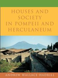
199425261Princeton University Press. 1994. Hardcover. Good in Very Good- dust jacket. Scholar's name to ffep Robert Brown. Underlining in pen to pages. Small stain to top of front panel of DJ. A few scratches to back panel of DJ .; Few sources reveal the life of the ancient Romans as vividly as do the houses preserved by the eruption of Vesuvius. Wealthy Romans lavished resources on shaping their surroundings to impress their crowds of visitors. The fashions they set were taken up and imitated by ordinary citizens. In this illustrated book Andrew Wallace-Hadrill explores the rich potential of the houses of Pompeii and Herculaneum to offer new insights into Roman social life. Exposing misconceptions derived from contemporary culture he shows the close interconnection of spheres we take as discrete: public and private family and outsiders work and leisure. Combining archaeological evidence with Roman texts and comparative material from other cultures Wallace-Hadrill raises a range of new questions. How did the organization of space and the use of decoration help to structure social encounters between owner and visitor man and woman master and slave What sort of "households" did the inhabitants of the Roman house form How did the world of work relate to that of entertainment and leisure How widely did the luxuries of the rich spread among the houses of craftsmen and shopkeepers Through analysis of the remains of over two hundred houses Wallace-Hadrill reveals the remarkably dynamic social environment of early imperial Italy and the vital part that houses came to play in defining what it meant "to live as a Roman."; 244 pages . 0691069875 . Princeton University Press hardcover
198322894London: Duckworth. 1983. Hardcover. Very Good in Very Good dust jacket. Some pencil marginalia mostly checkmarks especially to first 60pp ink smudge in margin of 2 pages. Very light bump to 1 corner.; Ix 216pp.; 216 pages; Suetonius a Roman historian was the author of "The Lives of the Caesars". This biography sets the historian's career and his method of dealing with his subject matter in the context of Roman society in the early Empire and draws a picture of the coherence of Suetonius's life appointments scholarship and literary activities. Seutonius is presented as a man of learning rather than as a failed narrative historian. This portrait takes account of evidence concerning his life and seeks to clarify the character of "The Lives of the Caesars" as a description of emperors and Roman imperial society by a scholarly biographer who himself was in the service of a scholarly Caesar . 0715617478 . Duckworth hardcover
Mm 120x185 Brossura originale, 239 pagine. Buona copia, spedizione in 24 ore dalla conferma dell'ordine.
8vo., Second Edition, with photographs, illustrations and maps in the text; pale blue cloth, backstrip lettered in black, a very good, bright, clean copy in unclipped dustwrapper. First published in in 1977. VERY SCARCE.
Traduzione: Landi Attilio dall'inglese . Pagine: 222+catalogo . Formato: 16° . Rilegatura: Cartonato grigio . Stato: Buono . Caratteristiche: Altra copia . Collana: BMM n°779 .
132p. Illustrated. Original white cloth binding. Folio. Excellent study of the "Feast of the Gods". **PRICE JUST REDUCED! W14
in-12, 255 pp., illustrations en noir et en couleurs, broché, couverture illustree. Etat proche du NEUF. [BL-10]
19088123London: Macmillan and Co. Very Good with no dust jacket. 1908. First Printing. Hard Cover. Publisher's full black cloth gilt lettering on spine gilt Hermes medallion on cover t.e.g. Illustrated with numerous full-page B&W photographs tissue-protected color frontispiece photograph two color maps Campania and Herculaneum and color fold-out plan of the Villa Suburbana. . Covers rubbed light foxing on several pages all illustrations bright and clean unmarked tight and square. VERY GOOD. Color frontispiece Color and B&W Plates and Maps. 4to 11" - 13" tall. xxii i 324 pp . Macmillan and Co. hardcover
Rara ed importante carta della penisola, tratta dalla prima edizione della Geographie Opus Novissima Traductione e Grecorum Archetypis curata dal Waldseemuller ed edita da Johannes Schott nel 1513. L’opera è considerata come il primo atlante moderno, preparato usando la traduzione dal greco di Mathias Ringmann; si tratta di una delle più importanti edizioni del Tolomeo, contenente molte nuove mappe della regioni. Sono 20 le carte aggiunte, basate sulle nuove scoperte e conoscenze, oltre al consueto corpo di 27 carte che compongono la Geografia di Tolomeo, basate sull’atlante edito a Ulm nel 1482. Borri la descrive: “Nell’Italia settentrionale l’orografia risulta assai semplificata; è del tutto inesistente nelle altre parti. I monti non hanno più conformazione a placca lineare ma sono rappresentati da coni accumulati, leggermente arrotondati e con ombra a destra. Le medesime semplificazioni si riscontrano per il sistema idrografico, anch’esso inesistente al centro ed al Sud, con la sola eccezione di un breve tratto del fiume Tevere. La carta deriva da quella del Berlinghieri e perciò in essa è stata introdotta la normale orientazione, con l’eliminazione delle imperfezioni tolemaiche e con l’aggiunta dei nuovi elementi tratti dalle carte nautiche”. Xilografia, scala graduata con lieve coloritura coeva, pieni margini, in straordinario stato di conservazione. Eccellente esemplare di questa rarissima carta della penisola, una delle più importanti rappresentazioni a stampa. Bibliografia: Borri p. 17, 16; Almagià (1927) p. 11b; Perini pp. 22/25. A rare and important map of the peninsula, taken from the first edition of the Geographie Opus Novissima Traductione e Grecorum, 1513. The first modern atlas, prepared by Martin Waldseemuller using the translation of Mathias Ringmann. This is one of the most important editions of ptolemy, containing many new regional maps. Twenty new maps based on contemporary knowledge were included in addition to the traditional body of twenty-seven Ptolemaic maps derived from the 1482 Ulm edition. Schott's edition was commenced by the most famous of all early sixteenth-century cosmographers, Martin Waldseemuller and his associate Mathias Ringmann, partly at the expense of Duke Rene of Lorraine. It was brought to completion by Jacobus Eszler and Georgius Ubelin. The atlas contains the first map in an atlas entirely devoted to america (Tabula terre nove), often called the "Admiral's map" after Columbus. The map of Lotharingia (the first map of the Duchy of Lorrain), printed in black, red and olive, is one the earliest examples of colour-printing. This edition was reprinted in 1520 using the same woodcut blocks. Borri: “In Northern Italy orographic is much more simplified and it doesn’t exist in other parts. The mounts have not the linear plate form, but are depictes like a bunch of cones, lightly round with shadow on the right. Extremely simplified also the representation of the hydrographic system especially in the South. The only exception is the course of the Tiber. This map derives from Berlinghieri’s and thus it shows the common orientation, the cancellation of ptolemaic errors and the addition of new elements from sea charts”. Woodcut, light contemporary colour, full margins, in excellent condition. Extraordinary example of a rare map, one of the most important prints ever realized on the peninsula. Literature Borri p. 17, 16; Almagià p. 11b; Perini pp. 22/25. Borri p. 17, 16; Almagià p. 11b; Perini pp. 22/25.
Rara ed importante carta della penisola, tratta dalla prima edizione della Geographie Opus Novissima Traductione e Grecorum Archetypis curata dal Waldseemuller ed edita da Johannes Schott nel 1513. L’opera è considerata come il primo atlante moderno, preparato usando la traduzione dal greco di Mathias Ringmann; si tratta di una delle più importanti edizioni del Tolomeo, contenente molte nuove mappe della regioni. Sono 20 le carte aggiunte, basate sulle nuove scoperte e conoscenze, oltre al consueto corpo di 27 carte che compongono la Geografia di Tolomeo, basate sull’atlante edito a Ulm nel 1482. La Tabula Moderna presenta la gradazione su tre lati (manca sul lato Nord), due scale grafiche (di Italia e Germania) sul lato Sud.Borri la descrive così: "L'orografia assume un aspetto meno libeare, più articolato e variegato rispetto a quello della tavola antica, con bordi molto meno ombreggiati; il sistema idrografico, pressochè dipendente, appare notevolmente arrichito, con la presenza, in discreta collocazione, di tutti i grandi laghi del Nord (compreso il Pennino e quello di Lugano) e dell'Italia centro-meridionale (compreso quello di Bolsena). Anche il numero delle città risulta più elevato e con una più esatta collocazione. Il contorno della penisola invece è quasi identico a quello della tavola antica, eccezion fatta per alcuni promontori (vedi, ad esempio, quelli di Monaco e del Gargano)".Xilografia, con pieni margini, in perfetto stato di conservazione.Splendido esemplare di un'opera rara ed importante. A rare and important map of the peninsula, taken from the first edition of the Geographie Opus Novissima Traductione e Grecorum, 1513. The first modern atlas, prepared by Martin Waldseemuller using the translation of Mathias Ringmann. This is one of the most important editions of ptolemy, containing many new regional maps. Twenty new maps based on contemporary knowledge were included in addition to the traditional body of twenty - seven Ptolemaic maps derived from the 1482 Ulm edition. Schott's edition was commenced by the most famous of all early sixteenth - century cosmographers, Martin Waldseemuller and his associate Mathias Ringmann, partly at the expense of Duke Rene of Lorraine. It was brought to completion by Jacobus Eszler and Georgius Ubelin. Commentary by Roberto Borri: "L'orografia assume un aspetto meno libeare, più articolato e variegato rispetto a quello della tavola antica, con bordi molto meno ombreggiati; il sistema idrografico, pressochè dipendente, appare notevolmente arrichito, con la presenza, in discreta collocazione, di tutti i grandi laghi del Nord (compreso il Pennino e quello di Lugano) e dell'Italia centro-meridionale (compreso quello di Bolsena). Anche il numero delle città risulta più elevato e con una più esatta collocazione. Il contorno della penisola invece è quasi identico a quello della tavola antica, eccezion fatta per alcuni promontori (vedi, ad esempio, quelli di Monaco e del Gargano)".Woodcut, with full margins, very fine condition. Karrow, 80/40; Borri, 16; Almagià p. 11b; Perini pp. 22 / 25.
1990142375Barr : Edition Izi 1990. 16 Seiten. Leporello zum Ausfalten. Originalbroschur mit mont. Titelbild. (Gebrauchsspuren). 21x15 cm
In-4, mezza tela editoriale, pp. 28, con 45 tavole fuori testo in bianco e nero e a colori. Edizione in inglese. In buono stato (good copy).
Carta geografica dell'Italia, antica ed originale, Autore: Walch Johannes edit.. Luogo: Italia. Anno: 1812. Tecnica: incisione in rame. Dimensioni: 210x250 il foglio. Coloritura coeva
Carta raffigurante il territorio della Repubblica Cisalpina. Interessante notare la mancanza della raffigurazione dell’appennino ligure. Stato non menzionato nella bibliografia di riferimento. Bibliografia: Davoli, Sanfelici, p. 22, n° 4
200331207ABMilano., ediziona Gabriele Mazzotta., 2003. 4°. 126 S. OKarton mit OKLappenumschlag / Soft Cover. 1. Auflage / First edition. Verlagsfrisches, neuwertiges Exemplar / Fine copy as new.
19771092901977 Editions de la Différence, Collection "L'Apparence" - 1977 - In-4, cartonnage marron illustré en couleurs de l'éditeur - 149 p. - Nombreuses reproductions d'oeuvres d'art in, hors-texte et pleine page en ciouleurs et en N&B
1962852581962 Paris, Sélection des Amis du Livre, 1962, fort volume in 8° relié pleine toile verte décorée de l'éditeur, 462 pages ; illustrations hors-texte en noir.