54 317 résultats
1990104800Con un intervento di Stefano Agosti e alcune osservazioni dell'Autore. Mondadori, Milano, 1990. In-8 p., brossura editoriale, pp. 52. Ben conservato.
1988104801Mondadori, Milano, 1988. In-8 p., brossura editoriale, pp. 91,(5). Prima edizione. Ben conservato.
1987104799Mondadori, Milano, 1987. In-8 p., brossura editoriale, pp. 101. Prima edizione. Ben conservato, con dedica autografa dell'A.
1991104804Guanda, Parma, 1991. In-8 p., brossura editoriale, pp. 92. Prima edizione. Ben conservato, con dedica autografa dell'A.
1997104811Con sette incisioni di Attilio Steffanoni. Libri Scheiwiller, Milano, 1997. In-16 p., brossura editoriale con alette, pp. 43, con illustrazioni in bianco e nero nel testo. Prima edizione. Ben conservato.
1994104094Una storia in versi. Book Editore, Castel Maggiore, 1994. In-8 p., brossura editoriale, sovracoperta, pp. 92,(4). Prima edizione. Dedica autografa dell'A. all'occhietto. Ben conservato.
1979104822English translation by Diana Wormuth. Preface by Stefano Agosti. Italica, Stockholm / Roma, 1979. In-8 p., brossura editoriale, sovracoperta, pp. 95,(7). Testo originale a fronte. Ben conservato, con dedica autografa dell'A.
1996104309Mondadori, Milano, 1996. In-8 p., brossura editoriale, pp. 59,(5). Prima edizione. Ben conservato.
1550ABC_49514Italy 1550. 17th-century gold-tooled brown calf sewn on 6 supports with the corresponding raised bands on the spine a red morocco title label on the spine with the title "Novissima urbis Romae descriptio" lettered in gold gold-tooled board edges. Large oblong folio ca. 59 x 42.3 cm. With 76 full-page engravings and 12 full-page etchings. Remarkable album with 77 beautiful examples of 16th-century Italian cartography all in very fine dark impressions. The collection includes plans of important Italian towns such as Rome Venice Genoa Naples Milan Florence Palermo Siena Bologna and Pisa as well as detailed views of individual buildings and monuments in Rome. They are engraved by several cartographers from the school of Antonio Lafreri 1512-1577 primarily Claudio Duchetti d. 1585 Matteo Florimi d. 1613 and Lafreri himself. Florimi's works are among the rarest of the Lafreri school map makers especially his Siena imprints of which several have here been included.In the middle of the 16th century Italy was the centre of map production and distribution in Europe. This industry primarily took place in Venice and Rome. The most notable of the publishers in Rome was Lafreri. His most important and most popular work is the Speculum Romanae magnificentiae a collection of plans an views of Rome's monuments; no two copies of the Speculum are the same. The present collection contains more than thirty plates from the Speculum. When Lafreri died his nephew Claudio Duchetti inherited the company. He continued to produce the Speculum plates but often made small adjustments and signed his own name at the bottom. Most of the Speculum plates in the present album are by Duchetti. After his death the copperplates were sold to other publishers such as Giovanni Orlandi before 1590-after 1640 who reissued them. The majority of the plates in the present album were printed by Orlandi in 1602.The album further contains 32 engraved city plans mostly of Italian towns although a few foreign cities are also included; one of the rarest is the view of Moscow which is also included here. The collection ends with a incomplete series of 11 etchings of landscapes and biblical scenes.A list of contents is available upon request.With the bookplate of Louis Routy de Charodon seigneur de Grésigny and Charodon 1710-1794 on the front pastedown and remnants of another bookplate above. The boards are somewhat scratched and stained the spine shows traces of use the edges of the boards have been professionally restored and the boards have been lengthened to fit the maps. The maps are slightly browned some are slightly foxed the first few maps have been mounted onto 17th-century leaves the longer maps are somewhat soiled on the fore edge three maps are restored at the fore edge and one at the bottom edge some maps have been cut slightly short. Otherwise in good condition.l Cf. Parshall P. "Antonio Lafreri's "Speculum Romanae magnificentiae"" in: Print Quarterly vol. 23 1 2006 pp. 3-28. hardcover
152759Paris, 1835 in-plano (68,5 x 52 cm), [4] ff. n. ch. (titre et table des planches), et 68 grandes planches à double page, gravées par Perdoux, Desaulx, Cardano, Misbach, Schroeder, Lameau, Fortier, etc., d'après les dessins de Bagetti ; le tout monté sur onglets demi-maroquin vert, dos lisse (reliure à l'imitation). Taches et rousseurs à certaines planches, trace de pliure à la page de titre.
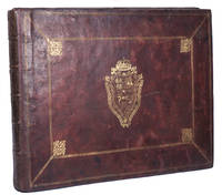
1700ABC_49518Italy 1700. Probably early 18th-century gold-tooled red morocco with the elaborate coat of arms of King Philip V of Spain as a centre piece on both boards within a double frame with floral corner pieces in the inside corners of the inner frame; gold-tooled board edges marbled endpapers. Oblong folio ca. 54 x 39 cm. With 72 drawings on paper in pen ink and ink wash. Remarkable collection of 72 drawings of the scenes on Trajan's Column in Rome. They were made by at least two different Italian artists from slightly different periods but in a cohesive style. The drawings have been mounted into an album bearing the coat of arms of King Philip V of Spain 1683-1746. Trajan's Column proved to be endlessly inspiring in the time period the present drawings were made as similar collections of studies are known from artists such as Amico Aspertini 1474-1552 Giovanni Battista Cipriani 1727-1785 and Nicolas Poussin 1594-1665. The drawings show a selection of scenes from both the first and second Dacian Wars as depicted on the friezes of the Trajan Column. They are made on different types of paper which are easily distinguished by their colour. The later drawings on the light cream coloured paper depict the very first scenes found at the base of the column. They have been mounted in the album in the right order. The earlier drawings on the darker paper depict the later scenes including the battles. They appear to have been mounted at least partly in reverse order as the first few drawings in the album show the victory scenes at the end of the first Dacian War. The cohesive style of the different sets of drawings strongly suggests that the artists used the same model. This was most likely Alfonso Chacón's Historia utriusque belli Dacici a Traiano Caesare gesti 1576 with engravings by Francesco Villamena ca. 1565-1624 or one of the 17th-century editions with engravings by Giovanni Pietro Bellori 1613-1696 and Pietro Santi Bartoli 1635-1700. The drawings especially the later ones fit together perfectly side by side suggesting they were made on a very long strip of paper and cut into smaller pieces at a later date. They may even have formed a scroll or rotulus which was not uncommon for studies of Trajan's Column. The condition of especially the earlier drawings implies that the collection was handled often in the past and possibly served as a reference for either scholars or artists. The binding shows clear signs of wear the boards are scuffed and rubbed the leather around the edges and joints is shaved the work has been re-backed with the original back strip laid down the album contains 19th-century leaves on which the illustrations are mounted. The marbled endpapers are slightly faded and browned along the edges the illustrations are somewhat browned and creased/ folded in the middle the earlier drawings with losses and extensive repairs some laid onto a support heavy toning and surface dirt throughout some slight offsetting on the blank versos of the album leaves probably lacking the illustration which was mounted on leaf 73. Otherwise in good condition.l Cf. Heenes Volker "On sixteenth-century copies of the reliefs from the Column of Trajan - Two new drawings from an unknown rotulus" in: RIHA Journal 0094 July 2014. hardcover
Nel cartiglio in alto a sinistra con in alto lo spazio dello stemma vuoto il titolo ITALIA DI MATTEO GREUTER Revista et augmentata di molti luoghi principali MDCLXXV. Pietro Todeschi fece in Bologna. Gioseffo Longhi forma. Nel lato destro: in una lapide Questo Geografico Disegno è Voltato à traverso per la Comodità del Lettore e del Volume essendo non dimeno osservata la linea Meridionale et altezza Polare, con li suoi gradi et Minuti à Canto, et la longhezza secondo l’Eclittica da, piede, come l’intellige[n]te Lettore Conoscerà. nel piccolo cartiglio sottostante l’imprint in Bologna appresso Gioseffo Longhi 1676. più in basso la scala grafica Scala di Miglia Duodice. In alto a destra la personificazione dell’Italia, una donna seduta, con al lato due personaggi raffiguranti i fiumi Po e Tevere, e dieci donne in costumi locali, da sinistra Genovese, Lombarda, Milanese, Venetiana, Fiorentina, Romana, Nottonese, Matriciana, Napolitana, Siciliana. Nel mare adriatico l’effige di Venezia con il Leone di San Marco, il dio Nettuno, in un riquadro raffigurata l’Europa, gli stemmi dello Stato Pontificio e del Regno di Napoli (Asburgo di Spagna), e in un cartiglio LE XII PROVINCE DEL REGNO. 1. Terra di Lavoro, 2. Principato citra, 3. Principato ultra, 4. Basilicata, 5. Calabria citra, 6. Calabria ultra, 7. Terra d’Otranto, 8. Terra di Bari, 9. Abruzzo citra, 10, Abruzzo ultra, 11. Co[n]tado di Molise, 12. Capitanata. In basso le piante o vedute a volo d’uccello di alcune città Milano, Venezia, Roma, Firenze, Napoli, Messina, vengono poi raffigurate in due ovali la Corsica e la Sardegna, in un riquadro la Sicilia e le piate di Palermo, Siracusa antica e Catania. Orientazione con due rose dei venti, nord-est in alto. Graduazione ai margini, per la latitudine di 1’ in 1’ da 37° 34’ a 42° 20’ lato destro, da 43° 23’ a 48° 7’ lato sinistro, per la longitudine di 5’ in 5’ da 28° 25’ a 39° 34’ lato in basso, da 32° 29’ a 44° 5’ lato in alto. Carta murale dell’Italia, incisa a acquaforte e bulino, stampata su dodici fogli, per una misura complessiva di mm 1150x2100. Esemplare nel primo stato di due. Derivazione della mappa murale della penisola di Matteo Greuter (o anche della copia di Stefano Scolari del 1657) edita da Giuseppe Longhi a Bologna nel 1676. Si tratta di una replica, realizzata mediante l’intaglio di nuove lastre, e non una ristampa della carta dello Scolari come sostenuto da tutte le bibliografie. Di questa nuova carta sono conosciute due edizioni; la prima del 1675 (Firenze, IGM, inventario n. 3161) ed una ristampa del 1713, apparsa di recente sul mercato antiquario ed ora in una collezione privata. La carta è firmata da Pietro Todeschi, probabilmente in qualità di incisore delle lastre, e datata al 1675. Non sono note tirature con la data anteriore, ma solo prove edite da Giuseppe Longhi nel 1676.. La mappa di Matteo Greuter, datata al 1630, è stampata a Roma. Dedicata a Federico Cesi, la carta è conosciuta nelle edizioni del 1640 (la prima nota, un solo esemplare alla BN di Parigi GE DD-5867), 1647 (un solo esemplare conservato alla Mediateca di Santa Teresa di Milano), con data MDCLXXVI (unico esemplare alla Biblioteca Augusta di Perugia) ed infine la più comune ristampa del 1695, curata dall’editore Domenico de Rossi e dedicata a Ottavio Riario (nota in più esemplari). La sua prima replica è l'edizione veneziana dell’incisore ed editore Stefano Mozzi Scolari, stampata nel 1657 e dedicata a Giuseppe Savoldo. Nato a Strasburgo nel 1556, Matteo Greuter lavora a Lione, Avignone e Roma. Si distingue per una tecnica raffinata ed elegante, che trova la sua massima espressione in questa bella carta dell'Italia in 12 fogli, la più grande fino ad allora pubblicata. La mappa ha dimensioni ragguardevoli, 1,15 x2,10 metri, in scala approssimativa di 1:540.000. La toponomastica è in lingua italiana e contiene figure allegoriche delle ... Wall map of Italy, engraved with etching and burin, printed on twelve sheets, with a total size of 1150x2100 mm. In the cartouche at the top left with the space of the coat of arms empty the title ITALIA DI MATTEO GREUTER Revista et augmentata di molti luoghi principali MDCLXXV. Pietro Todeschi fece in Bologna. Gioseffo Longhi forma. Nel lato destro: in una lapide Questo Geografico Disegno è Voltato à traverso per la Comodità del Lettore e del Volume essendo non dimeno osservata la linea Meridionale et altezza Polare, con li suoi gradi et Minuti à Canto, et la longhezza secondo l’Eclittica da, piede, come l’intellige[n]te Lettore Conoscerà. In the small cartouche the imprint in Bologna appresso Gioseffo Longhi 1676. Followed by the Scala di Miglia Duodice. At the top right the personification of Italy, a seated woman, with the side two characters representing the rivers Po and Tiber, and ten women in local costumes, from left Genovese, Lombard, Milanese, Venetian, Florentine, Roman, Nottonese, Matriciana, Napolitana, Sicilian. In the Adriatic Sea the effigy of Venice with the Lion of San Marco, the god Neptune, in a frame depicted Europe, the coats of arms of the Papal States and the Kingdom of Naples (Hapsburgs of Spain), and in a scroll LE XII PROVINCE DEL REGNO. 1. Terra di Lavoro, 2. Principato citra, 3. Principato ultra, 4. Basilicata, 5. Calabria citra, 6. Calabria ultra, 7. Terra d’Otranto, 8. Terra di Bari, 9. Abruzzo citra, 10, Abruzzo ultra, 11. Co[n]tado di Molise, 12. Capitanata. Below the plants or bird's eye view of some cities Milan, Venice, Rome, Florence, Naples, Messina, are then depicted in two ovals Corsica and Sardinia, in a square Sicily and the plans of Palermo, ancient Syracuse and Catania. Orientation with two wind roses, north-east at the top. Graduation in the margins, for latitude of 1' in 1' from 37° 34' to 42° 20' right side, from 43° 23' to 48° 7' left side, for longitude of 5' in 5' from 28° 25' to 39° 34' bottom side, from 32° 29' to 44° 5' top side. Exemple in the first state of two. Derivation of the wall map of the peninsula by Matteo Greuter (or even the copy of Stefano Scolari of 1657) published by Giuseppe Longhi in Bologna in 1676. It is a replica, made by carving new plates, and not a reprint of the map of Scolari as claimed by all bibliographies. Two editions of this new map are known; the first of 1675 (Florence, IGM, inventory n. 3161) and a reprint of 1713, recently appeared on the antiquarian market and now in a private collection. The map is signed by Pietro Todeschi, probably as the engraver of the plates, and dated 1675. There are no known issue with an earlier date, but only proofs published by Giuseppe Longhi in 1676. For an accurate description regarding the historical-critical aspect of the map, see Roberto Borri, L'Italia nelle antiche carte dal Medioevo all'unità nazionale (2010). A fine impression on contemporary laid paper, applied on canvas, reconstructive restorations perfectly executed in some points of the map, contemporary coloring on part of the surface, overall in good condition. Bibliografia cfr. Aliprandi (2005): pp. 95-97; Almagià (1929): p. 64, 7.3; Borri (1999): p. 81; cfr. Borri (2010): pp. 123-129, fig. 145; cfr. Fiorini (1898): pp, 282 e 367; cfr. Lago (2002): pp. 742-743, fig. 701; Valerio (2011): pp. 64-66, n. 22 (4); cfr. Valerio-Spagnolo (2014): pp. 268-269, n. 107.
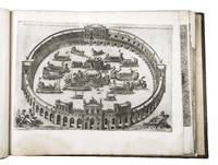
1544379311544 In-folio (309 x 200 mm), vélin souple de lépoque, dos lisse, (5), (1) blanc, LVI [ie. LXV] feuillets, (5) pages de table, (1) feuillet avec la marque dimprimeur de Denis Janot [sign. a6, A-K6, L-M4]. Avec Privilège du Roy. 1544. De l'imprimerie de Denys Janot imprimeur du Roy en langue Francoyse, & libraire juré de l'Université de Paris.
Mm. 24,2 x 318, insolita rilegatura editoriale in cartonato (lievi aloni) con ai piatti due bulloni metallici; il libro è composto di 117 fogli (di cui uno doppio, inclusi quelli non impressi), per un totale di 234 pagine + 2 fogli di risguardo + 4 veline bianche (una porta a stampa: “Mucca in montagna”). Titolo al frontespizio stampato in blu e arancione; alcuni fogli sono in cartone o cartoncino colorato. Il libro è illustrato da numerosissimi disegni e bozzetti al tratto, da alcune bicromie, da riproduzioni fotografiche di cui 2 a colori; tra le foto: un ritratto dell’Autore, uno dell’editore Fedele Azari, una di Azari con Depero; e con composizioni parolibere. Copertina e grafica dell’Autore. Tiratura di 1000 esemplari. Fu realizzata anche un’edizione speciale con copertina metallica, destinata ad importanti personalità tra cui Marinetti e Mussolini. Cfr. Salaris “Storia del Futurismo”, p. 178: “Sponsorizzato dalla Dinamo-Azari di Milano nel 1927, Depero ha pubblicato il notissimo libro imbullonato, sicuramente il più bell’esempio di tipografia futurista, senz’altro uno dei più importanti libri d’avanguardia del mondo. Si tratta di una edizione autopubblicitaria, concepita dall’artista roveretano per divulgare l’attività del suo laboratorio: in queste pagine di diversi colori troviamo riproduzioni di quadri, arazzi, disegni, progetti, brani di onomalingua, maquettes, ecc.; il tutto si avvale d’una insolita rilegatura.. Dice in proposito Depero: Questo libro è: "Meccanico" imbullonato come un motore "Pericoloso" può costituire un’arma proiettile "Inclassificabile" (..) non sta bene in libreria e neppure sugli altri mobili che potrebbe scalfire. Perchè sia veramente al suo posto, deve essere adagiato sopra un coloratissimo e soffice-resistente "Cuscino Depero"”. Esemplare con piccola macchia d’inchiostro blu al frontespizio, altrimenti ben conservato. Con dedica e firma autografa al verso del frontespizio “A Cainelli / la mia simpatia / Fortunato Depero / 5.11.XV°”.
In-4 gr., legature in mz. tela di colori diversi, titolo oro al dorso. Offriamo una collezione completa di 78 annate della Domenica del Corriere, dal 1899 (Anno I, n. 1), al 1976 (Anno LXXVIII, n. 53). Settimanale illustrato del “Corriere della Sera” - celebre per le copertine di Achille Beltrame e di Walter Molino - sulle sue pagine trovarono una vetrina popolare anche le grandi firme del “Corriere”, da Luigi Barzini a Indro Montanelli. Precisiamo che la rivista cambiò titolo nel corso del 1945/1946 e le due annate risultano cosi’ composte: 1945 - dal n. 1 al n. 17 (29 aprile) ”Domenica del Corriere”: il ns. esemplare dispone anche dell’introvabile n. 17 del 29 aprile che non vide mai la luce nelle edicole (e nessuna biblioteca italiana lo possiede); dal 27 maggio (n. 1) al 30 dicembre (n. 32) diventa “Domenica degli Italiani”. 1946 - dal n. 1 al n. 12 (24 marzo) “Domenica degli Italiani”; dal 31 marzo (n. 1) al 29 dicembre (n. 40) ridiventa “Domenica del Corriere”. Il ns. esemplare possiede anche due copie differenti del n. 30 (nuova serie) - sempre datato 20 ottobre - di cui una copertina raffigura Goering condotto alla forca. Questa versione del n. 30 non uscì nelle edicole a seguito del suicidio di Goering per aver ingerito una capsula di cianuro la notte prima dell’impiccagione. Possiamo quindi affermare che questa nostra raccolta costituisce un unicum eccezionale. Tutta la collezione è ben conservata.
147-Io.J. Feder in Braun, braun laviert, über Stift, auf Velin, innerhalb der Darstellung auf der Brunnenmauer unten Mitte bezeichnet, datiert und signiert ?a Torre francolise 1792 Filippo Hackert. F.?. 68,2:47,5 cm.- Mit sorgfältigen Restaurierungen entlang der Ränder. [2 Warenabbildungen]
5 voll. in-4, pp. XXXV, 447; XXVII, 423; XXIV, 384; XV, 339; (6), 455, belliss. leg. m. pelle coeva, piatti in carta dec., angoli, tit. oro ai d. a 5 nervi. Rara opera riccamente illustrata da 1 gr. carta geogr. dell'Italia, 3 ritratti, 42 vedute di città italiana, di cui alcune più volte ripiegate, e 14 tavv. raff. stemmi araldici. L'A. era un nobile letterato nativo di Città della Pieve, a lui si deve anche una riedizione settecentesca dell'Iconologia del Ripa. Ottimo esempl. in elegante e solida leg. originale, a pieni margini. [078]
Amsterdam presso l’autore 1663. Volume in 2°, legatura in tutta pergamena coeva con fregi in oro, tre frontespizi, antiporta incisa raffigurante l’allegoria della Chiesa, 1 dedica, (8), 253 pp. (corrispondenti a 213 carte nn) illustrato da 77 tavole raffiguranti piante e vedute a volo d’uccello delle principali città dell’Italia Centrale. Prima edizione di questo capolavoro della cartografia urbana del ‘600, dedicato alle città dello Stato della Chiesa. Si tratta del primo, monumentale, libro interamente dedicato alla cartografia urbana della sola penisola, preceduto dal “tascabile” Italia Hodierna di Jodocus Hondius del 1627 e realizzato in probabile concorrenza con Johannes Janssonius che, nel 1657, aveva pubblicato il Theatrum praecipuarum urbium, contenente un volume dedicato all’Italia. Johannes Blaeu, durante la sua lunga attività editoriale pubblica tre volumi sulle città italiane. Nel 1663 i primi tre, suddivisi in Stato della Chiesa, Roma e Regno di Napoli e Sicilia. Alla sua morte i suoi eredi danno alla luce altri due volumi datati 1682 incentrati sulle città del Piemonte e della Savoia, poi ristampati da altri editori nel 1693 e 1697. Il francese Pierre Mortier pubblica una ristampa nel 1704/5, intitolata Nouveau Theatre de l’Italie. L’opera è in quattro volumi e comprende le lastre del Blaeu, ritoccate e modificate in piccola parte, integrate dall’aggiunta di numerose nuove mappe di proprio disegno, raffiguranti le città della parte settentrionale della penisola, racchiuse nel primo volume dell’opera. L’atlante del Mortier venne pubblicato con testo latino, francese ed olandese. Il grande successo dell’opera diede origine ad un’ulteriore ristampa, praticamente identica, curata da Alberts ed edita nel 1724/5. Magnifico esemplare. Bibliografia Koeman, Atlas Neerlandici, pp. 332/338; Cremonini pp. 49-52, 39. Amsterdam 1663. Volume in 2°, contemporary vellum's binding with gold friezes, three frontispieces, engraved antiporta depicting the allegory of the Church, one sheet of dedication, (8), 253 pp. Illustrated by 77 plates depicting city plans and bird's eye views, of the main cities of Central Italy. First edition of this masterpiece of this very important town book of the 17th Century, dedicated to the Papal State. This is the first monumental town book entirely covering Italy, preceded by the "pocket-size" Italia Hodierna by Jodocus Hondius jr. (1627) and realized in likely competition with Johannes Janssonius who, in 1657, published the Theatrum praecipuarum urbium, containing a volume dedicated to Italy. Johannes Blaeu, during his long editorial activity published three volumes on Italian cities. In 1663 the first three, divided into the State of the Church, Rome and the Kingdom of Naples and Sicily. At his death his heirs gave birth to two more volumes dated 1682 focused on the cities of Piedmont and Savoy, then reprinted by other publishers in 1693 and 1697. Pierre Mortier publishes a reprint in 1704/5, entitled Nouveau Theatre de l'Italie. The work is in four volumes and includes the plates of Blaeu, retouched and modified in small part, supplemented by the addition of several new maps of his own design, depicting the cities of the northern part of the peninsula, enclosed in the first volume of the work. Mortier's atlas was published with Latin, French and Dutch texts. The great success of the work gave rise to a further reprint, virtually identical, edited by R. Alberts and published in 1724/5. Literature Koeman, Atlas Neerlandici, pp. 332/338; Cremonini pp. 49-52, 39.
In folio (mm. 425 x 288), p. pergamena moderna con legacci, 4 cc.nn. (compreso il bel frontespizio inc. in rame da Oliviero Gatti, e l’Indice), 24 pp.num. (di descrizione generale dell’Italia), con 61 carte geografiche dedicate agli stati italiani, pure inc. in rame e a doppia pag. [salvo 2 a una pag. (Territorio Cremasco - Il Cadorino) e 1 in ‘quarto’ (Elba isola)]. L'opera è dedicata da Fabio Magini a Ferdinando Gonzaga, Duca di Mantova e di Monferrato. Al “verso” della 4a c.nn. si ha la scritta: In Bologna, MDCXXX, presso Clemente Ferroni. La prima edizione si pubblicò nel 1620 a Bologna, per Sebastiano Bonomi; le edizioni successive recarono al frontespizio la data dell'edizione originale portando invece al verso della 4a carta la data reale. "Seconda edizione" di questo celebrato Atlante. Cfr. Almagià “L’Italia di G.A. Magini” (1922), p. V: “La più vasta e importante opera cartografica sull’Italia.. messa insieme dall’astronomo padovano Giovanni Antonio Magini (1555-1617)” e a p. 7: “Ristampa che porta il nome dello stampatore bolognese Clemente Ferroni.. Il Ferroni dovette poi, negli anni successivi, continuare a dar fuori l’opera, perchè se ne hanno molteplici esemplari ma senza più la data 1630 e accresciuti invece di un ritratto del Magini.. Il testo della descrizione dell’Italia è ovunque il medesimo, e quel che più importa, le carte sono sempre identiche e riprodotte sempre dagli stessi rami”. Cat. Piantanida,1350: "Atlante rinomato e pregiato al quale l'A. dedicò gran parte delle sue fatiche nell'ultimo ventennio della sua vita.. egli preparò carte in gran parte originali, delineate cioè in base a rilievi ufficiali fatti eseguire dai vari governi italiani e che egli riuscì a procurarsi per il benevolo interessamento dei Gonzaga. Il lavoro di raccolta, di coordinazione, di revisione e di disegno e incisione non fu molto semplice: l'A. dovette mantenere presso di sè abili incisori specializzati; alcune carte furono stampate e messe in circolazione isolatamente per saggio; nel 1608 fu pubblicata col titolo di "Italia Nuova" una carta generale, insigne lavoro di sintesi; ma la definitiva elaborazione dell'intero atlante tardò ancora e la stampa era appena avviata quando l'A. mori'. Esso pertanto fu pubblicato postumo dal figlio Fabio. Questo atlante esercitò un'immensa influenza: le sue tavole furono ricopiate, contraffatte, imitate moltissime volte in Italia e all'estero; entrarono, senza modificazioni, a far parte di atlanti stranieri notissimi, come quelli del Bleau; in Italia rimasero monumento insuperato per oltre un secolo”. Le seguenti 5 carte presentano: Ducato di Mantova (aloni e fiorit.) - Ducato di Ferrara (qualche alone solo margin.) - Dominio Fiorentino e Stato della Chiesa (restauri per picc. strappi margin.) - Regno di Napoli (con alone) e, sul margine di alc. carte, sbavature di inchiostro tipografico. A parte questi difetti, il ns. esemplare è ben conservato.
27-EFo.J. Bleistift, mit Bleistiftlinie umrandet, auf grau-rosa Bütten mit Wasserzeichen: Initialen PM, rechts oben undeutlich bezeichnet. 31,5:45,2 cm. - Verso: Skizze einer Berglandschaft. Bleistift. - Ränder mit Knickspuren.
148-Io.J. Aquarell, über Bleistiftskizze, auf festem chamoisfarbenem Zeichenkarton, rechts unten signiert ?F. Horner?. 51,4:71,3 cm. - Papier im Bereich des Himmels leicht gebräunt und mit Lichtrand an beiden Seitenrändern. Die Augustusbrücke, die über den Fluß Nera führte, war Teil der Via Flaminia. Literatur: Wird in das in Vorbereitung befindliche Werkverzeichnis von Johannes Fichter, Weisslingen/Schweiz aufgenommen.
Magnifica e celebrata opera, in folio, sulla storia di 150 grandi famiglie italiane, iniziata da Pompeo Litta nel 1819; interrotta con la morte dell'illustre scrittore nel 1852, fu ripresa tre anni dopo e continuata, sempre col suo nome da coloro che erano stati suoi collaboratori, fino al 1883. Questo lungo e poderoso lavoro, uscito a fascicoli, durò esattamente 64 anni, ma le 150 "Famiglie" descritte conservarono sino in ultimo un tutto omogeneo, per cui quest'opera è apprezzatissima dai bibliofili. Il ns. esemplare, con "superba coloritura a mano d'epoca", è cosi' composto: - dalla dispensa n. 1 alla n. 136, fascicoli sciolti conservati nelle brossure originali, - 1 volume, legatura in mz. pelle, contenente 18 (su 19) dispense della famiglia “Savoia”. Manca l’ultima dispensa. Cfr. Ferrante Boschetti "I cataloghi dell'opera di Pompeo Litta "Famiglie celebri italiane"" - Brunet,III,1099: "Un des livres les plus remarquables qui aient paru dans ces derniers temps en Italie". .
In basso al centro, entro un bel cartiglio decorativo, il titolo e una lunga descrizione geografica: L’Italia nobilissima provincia della Europa fu nominata con diversi nomi, cioè Saturnia, Ausonia, Enotria, Esperia, et Italia. Fu anco detta Latio, Gran Grecia, Carmetia, et Rometia: ma se con questi nomi chiamassero l’Italia tutta overo una parte sola io non l’affermo. La sua forma Plinio la simiglia alla foglia di quercia et noi alla gamba dell’huomo. I suoi confini sonno dal Settentrione l’Alpi d’Alemagna, Da Mezo dì il mar Siciliano, et Toscano, Da Levante il Golfo di Vinegia col fiume Arsa in Istria, Da Ponente l’Alpi di Francia col fiume Varo nel Genovesato. È di circuito miglia 4900. La lunghezza 1020. Et è partita per lunghezza da monti Apenini, il Mezo è nell’territorio di Rieti; La larghezza maggiore è fra gli fiumi Arsa, e Varo di miglia 400. la mezana è fra la foce del fiume Pescara, e la foce del Tevere, di miglia 136, la più stretta è nella Calabria di miglia 20. È ripartita in 19 Regioni, cioe Istria, Friuli, Marca Trivisana, Lombardia, Romagna, Marca d’Ancona, Abruzo, Puglia, Terra di Barri, Terra d’Otranto, Calabria, Basilicata, Terra di Lavoro, Campagno di Roma, Ducato di Spoleti, Toscana, et Genovesato. Scrive il Biondo, che sotto di se ha 264 Città di Vescovati. Et Plinio afferma che furono in quella antichamente Città 1566. Higinio dice esserne state 700. Il medesimo Plinio scrive che nonciata la guerra de galli sola senza altri stranieri o quegli oltre il Po sessanta millia cavalli et pedoni settecento millia habbia ella armato. Il medesimo quasi afferma Polibio. Nel cartiglio in basso a sinistra si trova la dedica: All’Ill.mo Sig.re mio p[ad]rone Col.mo il S.re Francesco Morosino Deg.mo Podesta di Trevigi. Ecco la Geografia di tutta l’Italia di Iac.o Gastaldi, di nuovo in questa ult.a impressione revista emendata coreta et ampliata con nomi si delle Regione come di tutte le altre cose che in ella si co[n]tengono. Et un breve compendio della sua gra[n]dezza, confini, sitto, et qualitail tutto tratto fidelmente da piu degni esemplari che si trovano per Gio. Batista Mazza Venetiano. La dedico con ogni humilta a V.S. Ill.ma suplicandola a degnarsi d’aggradirla e insieme l’affetto della perpetua mia devotione verso la nobilissima sua persona cui da Dio N.S.re auguro il colmo d’ogni felicità. In Venetia il dì p.o de Decembre 1599. Di V.S.ia Ill.ma Humilissimo Servitore Donato Rascioti. Sopra al cartiglio è raffigurato Nettuno che tiene in mano la Scala delle miglia (50 miglia = mm 32). Orientazione fornita da una rosa dei venti nel Mar Ionio; il nord è in alto. Graduazione ai margini di grado in grado, da 37° 15’ a 45° 50’ di latitudine e da 27° 37’ a 44° 10’ di longitudine. La carta, incisa da Giovanni Battista Mazza per l’editore Donato Rascicotti, risulta essere una fedele copia dell’opera di Domenico Zenoi del 1567, rispetto alla quale non presenta grandi modifiche se non nei cartigli. Anche questa carta, dunque, si basa sulla mappa di Giacomo Gastaldi alla quale vengono aggiunti numerosi elementi decorativi nel mare. Il formato risulta ridotto, rimangono fedeli all’originale l’idrografia e i centri abitati mentre sono apportate alcune modifiche nella graduazione e viene data una maggiore attenzione all’orografia, rappresentata da isolati “mucchi di talpa” con oronimo, disegno caratteristico delle prime carte rinascimentali. Viene dedicata a Francesco Morosini, podestà di Treviso. La sua peculiarità editoriale è di essere stampata con inchiostro azzurro o grigio e non nero, che produce un insolito effetto cromatico nel mare. Giovanni Battista Mazza fu incisore e stampatore attivo a Venezia negli ultimi anni del ‘500. Dal segno elegante e preciso, incide diverse carte, messe poi in commercio da Donato Rasciotti, ed anche un grande planisfero di Giuseppe Rosaccio, del 1597, nel quale si firma Giovan Battista Mazza venet... In the bottom center, within a beautiful decorative scroll, the title and a long geographical description: L'Italia nobilissima provincia della Europa fu nominata con diversi nomi, cioè Saturnia, Ausonia, Enotria, Esperia, et Italia. In the cartouche in the lower left-hand corner is the dedication: All'Ill.mo Sig.re mio p[ad]rone Col.mo il S.re Francesco Morosino Deg.mo Podesta di Trevigi… . In Venetia il dì p.o de Decembre 1599. Di V.S.ia Ill.ma Humilissimo Servitore Donato Rascioti. Above the cartouche is depicted Neptune holding in his hand the Scale of the miles (50 miles = mm 32). Orientation provided by a wind rose in the Ionian Sea; north is at the top. Graduation at the margins from degree to degree, from 37° 15' to 45° 50' of latitude and from 27° 37' to 44° 10' of longitude. The map, engraved by Giovanni Battista Mazza for the publisher Donato Rascicotti, appears to be a faithful copy of the work of Domenico Zenoi in 1567, compared to which it does not present major changes except in the cartouches. Even this work, therefore, is based on the map of Giacomo Gastaldi to which are added several decorative elements in the sea. The format is reduced, the hydrography and the towns remain faithful to the original, while some changes are made in the graduation and greater attention is given to the orography, represented by isolated "mole piles" with oronym, a characteristic design of the first Renaissance maps. It is dedicated to Francesco Morosini, podestà of Treviso. Its editorial peculiarity is to be printed with blue or gray ink and not black, which produces an unusual chromatic effect in the sea. Giovanni Battista Mazza was an engraver and printer active in Venice in the last years of the 1500s. With his elegant and precise mark, he engraved several charts, later marketed by Donato Rasciotti, and also a large planisphere by Giuseppe Rosaccio, dated 1597, in which he signed Giovan Battista Mazza venetiano Maestro delle stampe della Zecha de Venetia. Donato Rascicotti was a publisher, merchant and printer. Of Brescian origin but active in Venice, and perhaps also in Bologna and Rome. Sometimes is indicated as Rasciotti and Rosigotti. According to some, he should be identified with Donato Resegato "printer of drawings", arrested in Rome in 1577 on the charge of having stolen drawings from the workshop of Lafreri. In Venice his workshop was at Ponte dei Barettieri. Etching and engraving, printed on coeval laid paper, trimmed at the copper and with added margins, minimal restorations perfectly executed - in particular at the lower right corner - for the rest in excellent condition. Applied on antique paper support. Example in the first state of two, before the address of Stefano Mozzi Scolari. The second state of the plate has the date changed to MDCLXIIII and the signature In Venetia Appresso Steffano Scolari forma a S. Zulian. (cf. Bifolco-Ronca, p. 1848). RARE work. There are only 4 copies of the paper preserved in the main public collections: Chicago, Newberry Library; Florence, Biblioteca Comunale; Paris, Bibliothèque Nationale; Rome, Biblioteca Apostolica Vaticana (cf. Bifolco-Ronca, p. 1848). We are aware of two more, in as many private Italian collections. Bibliografia Bifolco-Ronca, Cartografia e topografia italiana del XVI secolo, tav. 927, I/II; Almagià (1948): p. 32; Almagià (1929): p. 27, I; Bifolco-Ronca (2014): n. 18; Borri (1999): p. 63, n. 65; Borri (2010): pp. 79-80, n. 64, fig. 83; Frutaz (1972): vol II, tav. 50; Karrow (1993): n. 30/90.8; Perini (1996): p. 32; Tooley (1983): nn. 335b & 338a.
- Prima carte à figures della penisola -Incisione in rame, acquaforte e bulino, 1606, firmata e datata in lastra in basso a destra. Esemplare nel rarissimo primo stato di quattro, con la firma Guilelmus Iannsonius, edito nel 1606.Magnifica prova, ricca di toni, impressa su carta vergata coeva, rifilata alla linea marginale e con margini aggiunti, nel complesso in ottimo stato di conservazione. Delicata coloritura coeva.I primi esempi delle così denominate “carte con figure”, nascono nell’Olanda Meridionale del tardo ‘500. Una delle prime rappresentazioni di carta geografica decorata è il celebre Viaggio di Abramo di Ortelius, pubblicata nel Parergon del 1586. Per questa carta Ortelius si avvalse della collaborazione del pittore Maarten de Vos, che realizzò le scene per il bordo decorato. Jodocus Hondius, nel 1590, produce 3 piccole mappe di Inghilterra, Francia e Paesi Bassi con dei bordi decorati, seguito da Pieter van den Keere (Kaerius) che nel 1596 realizza una mappa decorata dell’Olanda. Ma lo sviluppo vero e proprio alle mappe con le decorazioni lo diedero la carta murale in 15 fogli dell’Europa di Jodocus Hondius (1595) e la carta del Mondo in 20 fogli di Willem J. Blaeu del 1605. Negli anni seguenti, il Blaeu realizzò diverse carte decorate di formato in-folio, a partire proprio dalla carta dell’Italia del 1606. Dal punto di vista cartografico, la mappa è interamente basata sulla carta di Mercator del 1589, che venne poi inserita anche negli atlanti Mercator & Hondius editi a partire dal 1606, in Amsterdam da Jodocus Hondius. La carta si presenta decorata su tre bordi. Il lato superiore è composto quasi interamente da un lungo panorama di Roma, al quale sono accostati una pianta di Venezia ed una di Genova. Negli angoli inferiori, si trovano le piante di Napoli e Firenze, mentre ai lati alcune scene di costume raffiguranti nobildonne e nobiluomini dei principali siti della penisola. La fonte del panorama di Roma è sicuramente la grande veduta panoramica della città disegnata da Hedrick van Cliven ed edita ad Amsterdam da Hendrick Hondius (1599-1605). Le altre piante delle città sono chiaramente riduzioni delle tavole del Civitates Orbis Terrarum di Braun & Hogenberg. La carta ebbe una seconda stesura, ad opera di Blaeu, nel 1620 circa, e due ristampe a cura di Cornelis e Danker Dankerts (1640 e 1661). Tutte le edizioni di questa carta sono assolutamente rarissime. Schilder elenca solo 10 esemplari conosciuti di questa carta, nessuno presente nelle raccolte italiane. Borri cita il primo stato della mappa, al quale assegna la rarità di 95/100, descrivendola come “pregiata e decorativa carta in rigoroso stile mercatoriano, rarissima, mai ristampata, è la prima del genere delle cartes à figures”, ignorando quindi l’esistenza degli stati successivi. - FIRTS EDITION OF THE FIRST CARTE A FIGURE OF ITALY - Etching and engraving, 1606, signed and dated in the plate lower right. Example of the very rare first state of four, with the imprint Guilelmus Iannsonius, published in 1606. Magnificent proof, rich in shades, printed on contemporary laid paper, trimmed to the marginal line and with added margins, overall in very good condition. Contemporary delicate coloring.The first examples of the so-called "carte à figures", born in Holland in the late '500. One of the first representations of a decorated map is the famous Travel of Abraham by Ortelius, published in the Parergon of 1586. For this map Ortelius had the collaboration of the painter Maarten de Vos, who designed the sets for the decorated border. Jodocus Hondius in 1590, produces 3 small maps of England, France and the Netherlands with decorated edges, followed by Pieter van den Keere (Kaerius), which in 1596 created a map of Holland decorated. But the real development to the maps with the decor gave it a wall map of Europe in 15 sheets of Jodocus Hondius (1595) and the map of the World in 20 sheets of Willem J. Blaeu in 1605. In the following years, Blaeu created several maps decorated, in-folio format, starting from the map of Italy in 1606. From the cartographic point of view, the map is entirely based on the work by Mercator of 1589, which was then inserted also in & Mercator Hondius atlas published in 1606 in Amsterdam by Jodocus Hondius. The map presents decorated on three edges. The upper side is made up almost entirely of a long panorama of Rome, which are combined with a plan of Venice and one of Genoa. In the lower corners, are the plants of Naples and Florence, while the sides costume depicting scenes noblemen and noblewomen of the main sites of the peninsula. The source of the panorama of Rome is definitely the great view of the city designed by Hedrick van Cliven and published in Amsterdam by Hendrick Hondius (1599-1605). Other city maps are clearly reductions of the plates inserted in the Civitates Orbis Terrarum by Braun & Hogenberg.The map had a second state, by Blaeu, around 1620, and two reprints edited by Cornelis and Danker Dankerts (1640 and 1661). All editions of this paper are absolutely rare. Schilder lists only 10 known examples of this map, no one present in the Italian collections. Borri cites the first state of the map, which assigns to the rarity of 95/100, describing it as "fine and decorative map in strict style mercatoriano, rare, never reprinted, is the first of its kind of cartes à figures", thus ignoring the ' existence of successive states. G. Schilder, Monumenta Cartographica Neerlandica, vol. VI, pp. 55/63 e 367/370, 89; Borri, L’Italia nelle antiche carte dal medioevo all’unità nazionale, p. 97, 89.
16941669641694. ITALY. MISSON François-Maximilien. Nouveau Voyage D'Italie Avec un Memoire contenant des avis utiles à ceux qui voudront faire le mesme voyage. Three volumes. 26 248 21; 352 28; 18 413 i.e. 417 21 pp. Illustrated with a total of 65 engraved plates of which 39 are folding plus one folding letterpress plate. Titles printed in red and black with woodcut printer's device a few small woodcut illustrations in-text woodcut tail-pieces. Engraved armorial device at head of dedication to Charles Butler in volume I. Errata leaf at end. Ruled in red throughout. 12mo. 155 x 95 mm. uniformly bound in near-contemporary French dark blue morocco sides with triple fillet border vase and flower tools at corners central gold-blocked arms of Lorenzo Marziani Prince of Furnari in Sicily Guigard II 344 spine in six compartments richly gilt second and third compartments lettered in gold gilt edges. The Hague: Henri van Bulderen 1694-1698. Second Enlarged Edition of the description of a voyage to Italy made by the author in 1687-88 which served for fifty years as an essential European guide book to the Grand Tour. This copy was handsomely bound for a Sicilian noble. Volume III is not called for in the 1694-98 publication; it has been taken from the third edition and uniformly bound with our set. François-Maximilien Misson ca. 1650-1722 a Protestant from Lyon was forced to seek refuge with his family in England upon the revocation of the Edict of Nantes in 1685. His father became a minister within the Huguenot community of London and Misson found employment as tutor to Charles Butler later Earl of Arran. It was with his pupil that Misson undertook the Grand Tour of which he gave an account in this book. The two traveled to Italy via Rotterdam Cologne Munich and Innsbruck crossing the Brenner Pass then to Verona and Venice visiting points of interest in and near Naples making a long visit to Rome and returning via Bologna Milan Genoa Turin Geneva Strasbourg and Brussels. His work in the form of a series of letters describes every locale visited and is "resoundingly modern" in tone containing an orderly account of "first-hand factual observations augmented by the critical perspective of a protestant travelling through a Catholic country" Oxford DNB. First published in 1691 translated into English in 1695 the work was hugely popular and was frequently reprinted with additions and enlargements. The fine engraved plates show detailed and accurate views of the principal sites from the major Italian and other European cities monuments objects animals and plants of local interest and regional costumes. This special copy is enlarged with the third volume of the following edition containing a "Memoire" for prospective tourists with sections on France Flanders and Vesuvius an alphabetical index of cities; a guide to the principal fairs and markets in various European cities; and lists of most important luxury goods found in various Italian cities with a blank folding plate for the reader's own additions. Small tear to lower blank corner of frontispiece tears to three plates in vol. I occasional minor small stains slight wear at joints and extremities of spines. Still a very fine set in a wonderful near-contemporary French morocco binding. PROVENANCE: Lorenzo Marziani supra-libros; Pastoret 19th-century armorial bookplate; Dr. Desnos 20th-century bookplate; Giannalisa Feltrinelli bookplate and blind-stamps sale Part VII Christie's Paris 11 December 2001 lot 2014. Rossetti 7093 describing 38 plates in vol. I but stating that "the number of plates may vary from copy to copy" and 7094. Borroni Bibliografia dell archeologia classica Florence 1962 3125/1. unknown books