Holland, MarionBiblio.com

13 039 résultats
0394800052.Ghardcover. Good. Access codes and supplements are not guaranteed with used items. May be an ex-library book. hardcover
195825406877New York: Beginner Books/Random House 1958. Book. Illus. by Holland Marion. Fair. Hardcover. First Edition. 8vo - over 7¾" - 9¾" tall. 65 pages. Copyright date 1958. A 'Beginner Book.' Each end of spine coming free. Corners opened with lots of wear to extremeties of boards. 1.5" tear to bottom of front flyleaf. Was privately owned. Unmarked. Average wear and soiling to contents. Red boards with white and black illustration on front. Beginner Books/Random House Hardcover
067983947X.Ghardcover. Good. Access codes and supplements are not guaranteed with used items. May be an ex-library book. hardcover
DADAX0375815937Beginner Books Random House 0000-00-00. paperback. New. 0.00x0.00x0.00. Buy with confidence. Excellent Customer Service & Return policy. Beginner Books (Random House) paperback
0001713183.Gpaperback. Good. Access codes and supplements are not guaranteed with used items. May be an ex-library book. paperback
G0001711059I3N00Collins & Harvill Press 1961. Hardcover. Good. Pages can have notes/highlighting. Spine may show signs of wear. ~ ThriftBooks: Read More Spend Less.Dust jacket quality is not guaranteed. Collins & Harvill Press hardcover
1958A44008aUsa: Beginner Books 1958. Hardcover. Very Good. 9x6x0. In Very Good Condition The Boards And Pages Are Clean. Printed In 1966. Name Inscription At The Front End Paper Dated 1966. This Book Is Not Signed. Book Club Edition.- Specializing in academic collectible and historically significant providing the utmost quality and customer service satisfaction. For any questions feel free to email us. Beginner Books hardcover
0001711059.Ghardcover. Good. Access codes and supplements are not guaranteed with used items. May be an ex-library book. hardcover
1993Q-0375815937Beginner Books Random House 1993-01-01. Paperback. New. In shrink wrap. Looks like an interesting title! Beginner Books (Random House) paperback
65 pages. Copyright date 1958. A 'Beginner Book.' Each end of spine coming free. Corners opened with lots of wear to extremeties of boards. 1.5" tear to bottom of front flyleaf. Was privately owned. Unmarked. Average wear and soiling to contents. Red boards with white and black illustration on front. Book
0265818516.Ghardcover. Good. Access codes and supplements are not guaranteed with used items. May be an ex-library book. hardcover
1330621883.Gpaperback. Good. Access codes and supplements are not guaranteed with used items. May be an ex-library book. paperback
45164691-nnew. unknown
45164691like new. unknown
054874422X.Gpaperback. Good. Access codes and supplements are not guaranteed with used items. May be an ex-library book. paperback
1016946104.Ghardcover. Good. Access codes and supplements are not guaranteed with used items. May be an ex-library book. hardcover
2009HVD-58005-A-0Canada: Heinz. Very Good. 2009. Stated First Edition. Paperback. 228 pages; B&W illustrations. Very Good condition. No noteworthy defects. No markings. ; - Your satisfaction is our priority. We offer free returns and respond promptly to all inquiries. Your item will be carefully cushioned in bubble wrap and securely boxed. All orders ship on the same or next business day. Buy with confidence. . Heinz paperback
A9781165278374New. unknown
B9781165278374New. unknown
1357085168.Ghardcover. Good. Access codes and supplements are not guaranteed with used items. May be an ex-library book. hardcover
1165278375.Gpaperback. Good. Access codes and supplements are not guaranteed with used items. May be an ex-library book. paperback
1437448860.Gpaperback. Good. Access codes and supplements are not guaranteed with used items. May be an ex-library book. paperback
199926203LUDION 1999
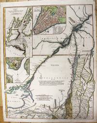
1776M11157London: Robert Sayer and John Bennett 1776. Very Good. Notes: This is the upper section of a two sheet map published in Thomas Jeffery's American Atlas. Size : 686x533 mm 27.01x20.98 Inches Coloring: Hand Colored Reference: Goss #69; McCorkle #768.3 Category: Maps United States East New York; Robert Sayer and John Bennett unknown
177517671London: Published by J.F.W. Des Barres in 'The Atlantic Neptune' 1775. Copper-engraved and etched map with aquatint on two joined sheets. Printed on laid paper with `J Bates' watermark and `JB' countermark in excellent condition. Sheet size: 30 1/4 x 42 5/8 inches. With: The explanatory text leaf titled as above. 1p. folio 25 1/2 x 19 inches. The finest and most celebrated sea chart of Boston Harbor ever produced and a highly important Revolutionary War map depicting details relating to the Siege of Boston: with the very rare explanatory text leaf.<br/> <br/>This is one the most important maps contained in Des Barres' The Atlantic Neptune and one of the most significant large-scale maps of the Revolutionary War. It provides an invaluable record of Boston at the beginning of the war covering the area from the environs of the city out into the open waters of Massachusetts Bay. A particularly striking feature is the use of boldly etched and subtly aquatinted details to capture the diverse topography of the region including the numerous hills islands and river estuaries. It is important to remember that this was issued as a working sea-chart and as such the cartographer has naturally concentrated on features such as depth soundings indicated by detailed lines and based on surveys by Samuel Holland and George Callendar and the navigable channels between the harbor's numerous shoals which are delicately outlined in stipple-engraving. Holland's original manuscript map is today preserved in the British Hydrographic Library at Taunton Somerset. The present map shows the city of Boston with its streets carefully outlined occupying a pear-shaped peninsula a position that would soon prove precarious to its British defenders in the escalating conflict. This is the second state of five of Des Barres' chart and is identical to the Henry Stevens Collection variant 96D in the National Maritime Museum Greenwich. This state shows a number of notable changes when compared with the original and was evidently altered to take particular account of the Siege of Boston April 19 1775 to March 17 1776. Henry Stevens noted that this state depicted the addition of "Numerous Forts Batteries Redoubts &c. which have been inserted in many places notably on the Charles Town peninsula and on the mainland between 'Willis Creek' and 'Mystic River' also on the east and north side of 'Charles River' below 'Cambridge'.also to the south of 'Boston Neck' and 'Dorchester Neck'.This state is almost as rare as the first state. It is found in some copies of the earliest edition of the Neptune." The accuracy scope and artistic virtue of Des Barres's Chart of the Harbour of Boston was apparent to his contemporaries and it became the main source map of the area for decades to come. Joseph Frederick Wallet Des Barres was born in Switzerland where his Huguenot ancestors had fled following the repeal of the Edict of Nantes. He studied under the great mathematician Daniel Bernoulli at the University of Basel before immigrating to Britain where he trained at the Royal Military College Woolwich. Upon the outbreak of hostilities with France in 1756 he joined the British Royal American Regiment as a military engineer. He came to the attention of General James Wolfe who appointed him to join his personal detail. During this period he also worked with the legendary future explorer James Cook on a monumental chart of the St. Lawrence River. Upon the conclusion of the Seven Years War Britain's empire in North America was greatly expanded and this required the creation of a master atlas featuring new and accurate sea charts for use by the Royal Navy. Des Barres was enlisted to survey the coastlines of Nova Scotia Newfoundland and the Gulf of St. Lawrence. With these extremely accurate surveys in hand Des Barres returned to London in 1774 where the Royal Navy charged him with the Herculean task of producing the atlas. He was gradually forwarded the manuscripts of numerous advanced surveys conducted by British cartographers in the American Colonies Jamaica and Cuba of which the present map is based on the work of Samuel Holland conducted in the 1760s. The result was The Atlantic Neptune which became the most celebrated sea atlas of its era containing the first systematic survey of the east coast of North America. Des Barres's synergy of great empirical accuracy with the peerless artistic virtue of his aquatint views created a work that "has been described as the most splendid collection of charts plates and views ever published" National Maritime Museum Catalogue. The Neptune eventually consisted of four volumes and Des Barres's dedication to the project was so strong that often at his own expense he continually updated and added new charts and views to various editions up until 1784 producing over 250 charts and views many appearing in several variations. All of these charts were immensely detailed featuring both hydrographical and topographical information such that in many cases they remained the most authoritative maps of the regions covered for several decades. Following the completion of The Neptune Des Barres returned to Canada where he remained for a further forty years becoming a senior political figure and a wealthy land owner living to the advanced age of 103.<br/> <br/>Cf. GuthornBritish Maps of the American Revolution referring to Holland's original manuscript 59/3; Krieger & Cobb p.107 1781 issue; Lingel Atlantic Neptune N91.2; National Maritime Museum Henry Stevens Collection K0713 HNS 96D; National Maritime Museum Catalogue 78-83; Nebenzahl Bibliography 3; Stevens Bibliography of the Atlantic Neptune unpublished pp.211-216; Sellers & Van Ee 945. Published by J.F.W. Des Barres in 'The Atlantic Neptune' unknown books