Ireland ML M LBiblio.com

6 228 résultats
2002CBS-9780721680293Sp Elsevier 2002. New. Sp Elsevier unknown
2002CBS-9780721680293Sp Elsevier 2002. New. Sp Elsevier unknown
A9780415615112Hardback. New. hardcover
A9780367186524Hardback. New. hardcover
A9781843921219Hardback. New. hardcover
A9781032484679Hardback. New. <p>This book explores how the education sector can transition to being truly sustainable and why necessary innovations for educational change are being subverted and undermined when mapped onto the existing Industrial educational system.</p> hardcover
A9781138146747Hardback. New. hardcover
First Irish edition, xi, [1], 412, [16]pp., cont. calf, worn, raised bands, without title label, the bottom inch of spine is worn through to stitching.
First Dublin Edition, 20pp., modern marbled boards, morocco label. "A Prayer to be used on Occasion of the late Earthquakes,...." pp.17-20, has a title-page with the imprint "Dublin: Printed in the Year, 1750."
New revised edition, 4to (195 x 154 mm), 484, [8]pp., cont. calf, rubbed, hinges cracked, head and foot of spine chipped. An important source on the Quakers which includes, as well, much on the Irish society, local history and genealogy. Provenance: Early ownership ink signature to title page "John Humphreys, City new, Sarum [Salisbury], L/N."
First Edition, 16pp., with half-title, short tear to blank margins of fore-edge, some minor soiling, later plain paper wrappers. Posing as praise, this work is a thinly-veiled attack on the honesty and morals of a high public servant who has supposedly enriched himself at public expense. ESTC tentatively gives Dublin as place on publication; Goldsmiths'-Kress no. 10680.
First edition, 12mo, iv, [5]-56 pp., modern marbled wrappers. Bodleian copy only on Copac.
24pp., recent marbled wrappers, printed paper label on upper cover. No other copy located.
1797TT6232R. Faulder & T. Egerton 1797. Early diced tan calf to boards more recent tan morocco spine a good match. Gilt title to spine. Marbled edges and endpapers. Neat sympathetic cloth strips reinforcing inner gutters. Small bookplate to inside front board. Collated: 30 plates 1 portrait 1 map. Browning to plate margins. Errata slip at rear. ~Robust packaging. Tracking can be added to overseas orders. Used books are exempt from USA tariffs. Very Good. xii 159pp. illus. R. Faulder & T. Egerton Hardcover
35754401like new. unknown
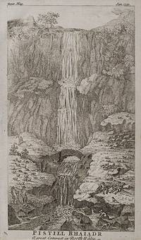
1750200089AG1750. Gentleman's Magazine and others 1750. Original engraving. Plate Size: 13.5 x 9.5 cm - 15 cm x 21.5 cm. Sheet Size: 20 cm x 11.7 cm - 19.5 cm x 24.3 cm. Original engravings. In good- condition. Some browning evident. One sheet has significant tear with section of margin missing. A lovely collection of engraved landscapes of some places of natural beauty in Ireland Wales and Scotland. Text in German and English. The titles of the individual engravings are as follows: 'Ansicht der vordern Seite des Bullers bei Buchan in Schottland'. 'Pistall Rhaiadr -A Great Cataract in North Wales'. 'Die Riesenstrasse in Irland.' 'Die Basalt Insel Staffa mit des Fingals Höhle / Innere Ansicht der Fingals Höhle.' unknown
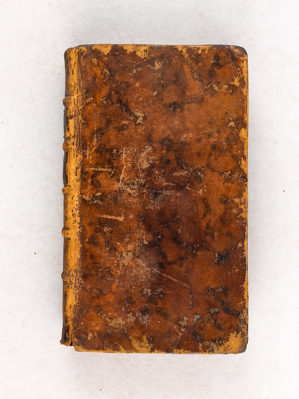
1779523636 vol. in-12 reliure de l'époque pleine basane marron, Chez Jean-Edme Dufour & Phil. Roux, Maestricht, 1779
Carta geografica dell'isola, per la prima volta pubblicata nel volume “L’isole Piu Famose Del Mondo Descritte Da Thomaso Porcacchi Da Castiglione Aretino E Intagliate Da Girolamo Porro Padovan” di Tommaso Porcacchi (ca. 1532-1576), umanista e letterato originario di Castiglion Fiorentino.Gli interessi geografici coltivati sin dal Pomponio Mela del 1557 diedero vita nel 1572 al trattato, pubblicato dalla società tra il libraio Simone Galignani e l’incisore padovano Girolamo Porro, che si servirono della tipografia di Giorgio Angelieri (con privilegio di 10 anni concesso il 16 luglio 1572). Secondo Valerio (cfr. Valerio-Spagnolo, Sicilia 1477-1861, La Collezione Spagnolo-Patermo in quattro secoli di Cartografia, 2014, p. 163) il volume sarebbe stampato nell’officina di Domenico e Giovan Battista Guerra. Il volume, in formato in quarto, con dedica di Galignani a don Giovanni d’Austria, presenta le magnifiche tavole calcografiche di Porro (una seconda edizione, cospicuamente accresciuta di testo e tavole, usci nel 1576, poi ancora, postume, nel 1590, 1604, 1605, 1620 e 1686). Nella lettera dedicatoria Porro narra di essere stato il promotore dell’operazione e di aver incaricato Porcacchi di scrivere un libro sulle isole, riservandosene l’illustrazione. Il modello e quello degli “isolari”, sul quale però Porcacchi innesta lo spirito delle corografie antiche, aggiungendo per ciascuna isola una descrizione fisica, storica e culturale. La concezione e molto ampia (sono comprese penisole, grandi isole come l’Inghilterra o interi continenti: l’America Settentrionale), ma nel “Prohemio” Porcacchi fornisce un glossario di termini geografici che testimonia lo sforzo di impiegare in maniera corretta la terminologia della disciplina (cfr. Franco Pignatti, Porcacchi Tommaso, in "Dizionario Biografico degli Italiani" - Volume 85, 2016). Nel testo vi sono mappe di isole incise su mezza pagina, compreso il planisfero – riduzione della carta murale di Camocio del 1567 e la “carta da navigare con le rotte e i venti, di derivazione gastaldina. Incisione in rame posta nella parte superiore del foglio che contiene anche la parte descrittiva, in ottimo stato di conservazione. Map taken form “L’isole Piu Famose Del Mondo Descritte Da Thomaso Porcacchi Da Castiglione Aretino E Intagliate Da Girolamo Porro Padovan” by Tommaso Porcacchi (ca. 1532-1576), humanist and scholar from Castiglion Fiorentino. The geographical interests cultivated since Pomponio Mela in 1557 gave life to the treatise published in 1572 by the company between the bookseller Simone Galignani and the Paduan engraver Girolamo Porro, who used the typography of Giorgio Angelieri (with the privilege of 10 years July 1572). The volume, with a dedication by Galignani to Don Giovanni d'Austria, presents the magnificent calcographic plates by Porro (a second edition, conspicuously augmented with text and tables, came out in 1576, then again, posthumously, in 1590, 1604, 1605, 1620 and 1686). In the dedicatory letter Porro tells of having been the promoter of the operation and of having entrusted Porcacchi with writing a book on the islands, reserving the illustration. The model is that of the "isolari", on which however Porcacchi inserts the spirit of ancient chorographies, adding a physical, historical and cultural description for each island. The concept is very broad (including peninsulas, large islands such as England or entire continents: North America), but in the "Prohemio" Porcacchi provides a glossary of geographical terms that testifies to the effort to correctly use the terminology of the discipline (see Franco Pignatti, Porcacchi Tommaso, in "Dizionario Biografico degli Italiani" - Volume 85, 2016). In the text there are maps of islands engraved on half a page, including the planisphere - reduction of the wall map of Camocio of 1567 and the "carta marina”.Copperplate placed at the top of the sheet also including a descriptive part, in very good condition.
SKU0219999Wiley 2017-12-19. Loose Leaf. Good. Textbook May Have Highlights Notes and/or Underlining BOOK ONLY-NO ACCESS CODE NO CD Ships with Tracking Wiley unknown
2022__0337600244Stationery Office Books 2022. Hardcover. New. 724 pages. Stationery Office Books hardcover
5985611like new. unknown
35754401-nnew. unknown
2180234-nnew. unknown