Carleton, WilliamBiblio.com
6 228 résultats
1854701729Dublin: James Duffy 1854. A lively and beloved portrait of rural Ireland Carletons "Tales and Sketches" blended sharp humor and affectionate storytelling with wonderful illustrations by Phiz to create a more modern and human portrait of the Irish for the 19th century world. This handsome edition is bound in three-quarter burgundy leather over light reddish-brown linen cloth. Gilt floral decorations on spine. Decorative marbled endpapers. Front and rear hinges heavily worn both appear to have been repaired at some point as both free endpapers very tight to binding. Some general wear to edges chipping to spine. Pages very clean and bright. Eight black and white illustrations by Phiz. 5.5 x 8.75 inches with 393 pages. Hard Cover. Good. Illus. by Phiz. James Duffy Hardcover
1946049237<p>New York: Devin-Adair Company. Very Good in Very Good dust jacket. 1946. 4th Revised Edition. Hardcover. Hardcover with dustjacket this unique copy is signed by the author: "Seumas MacManus of Donegal." Book has two minor flaws" mild tanning on the top outer page-edge a discreet hidden by the jacket flap name-stamp is present on the inside of the front cover the binding is tight and clean and the contents are fine the jacket has moderate tanning on the spine and folds and a few short edge-tears at top of spine the jacket is also clean the front panel illustration is quite attractive the original price 4.00 is present and a professional removable mylar cover is included; Signed by Author .</p> Devin-Adair Company hardcover
0140087141.Gpaperback. Good. Access codes and supplements are not guaranteed with used items. May be an ex-library book. paperback
Sm. 4to., Fifth Edition, LARGE PAPER, on laid paper, title in red and black, some very light and inoffensive spotting; brown cloth, upper board with two Greek Key fillets enclosing title in gilt, gilt back, gilt top, uncut, bevelled boards, black endpapers, expertly rebacked with old backstrip laid down, a near fine copy. LARGE PAPER COPIES ARE UNCOMMON.
8vo., First Edition, with frontispiece (original tissue guard present), 16 plates and very numerous illustrations in the text, half-title lightly spotted, contemporary signature on title; navy cloth, gilt back, black endpapers, uncut, small pull at headband else a near fine copy in publisher's binding. With small personal book-label on front paste-down. The Wildfowl Records leaves at end are blank. SCARCE IN THIS CONDITION.
Grande carta intelata incisa in rame, confini coloriti all'epoca, mm. 780x645, suddivisa in 20 riquadri. Scala in miglia inglesi e irlandesi. Ottima conservaz.
Mm 120x185 RARO. Opere in lingua inglese / Works in English language - Volume in copertina rigida con titolo in oro al dorso, contenente: Dion Boucicault, "The Fireside Story of Ireland" (M.H. Gill and Son, Dublin senza data / undated, 24 pp.); "The Truth about Ireland" by an English Liberal (Kegan Paul, Trench & Co., London, 1884, viii-48 pp.); Grattan, O'Connell, Parnell, "The National Exhibition Song Book, containing the best Irish national songs" (M.H. Gill and Son, Dublin, 1882, 32 pp.); Cath Fíonntráigh or the battle of Ventry Harbour : which took place in the third century and continued without intermission for three hundred and sixty-six days", being a translation from an old Irish manuscript written in heroic verse by An Fir-bolgh-og (Sealy, Bryers and Walker, Dublin, 1884, xi-81 pp.). Legatura lievemente scolorita ai margini, peraltro esemplare in ottimo stato di conservazione. SPEDIZIONE IN 24 ORE DALLA CONFERMA DELL'ORDINE.
Carta geografica tratta dal “Atlas encyclopédique, contenant la géographie ancienne et quelques cartes sur la géographie du Moyen Âge, la géographie moderne, et les cartes relatives à la géographie physique” di Rigobert Bonne e Nicolas Desmarest, edito a Parigi nel 1787-88, "Par M. Bonne, Ingénieur-Hydrographe de la Marine, et par M. Desmarest, de L'Académie Royale des Sciences".Il Bonne è stato uno tra i cartografi francesi più influenti del settecento, tanto da venir scelto quale successore di Jacques Nicolas Bellin al Depot de la Marine come idrografo di Sua Altezza Reale Luigi XVI.L'Atlas Encyclopédique, opera che il Bonne portò a termine con l'ausilio di Nicholas Desmarest, costituisce il suo lavoro di maggior fama.Incisione in rame, in buono stato di conservazione. Map taken from the “Atlas encyclopédique, contenant la géographie ancienne et quelques cartes sur la géographie du Moyen Âge, la géographie moderne, et les cartes relatives à la géographie physique” by R. Bonnè and Nicolas Desmarest, printed in Paris "Par M. Bonne, Ingénieur-Hydrographe de la Marine, et par M. Desmarest, de L'Académie Royale des Sciences", 1787-88.Bonne was one of the most influential French cartographers of the eighteenth century, so much so that he was chosen as the successor of Jacques Nicolas Bellin to the Depot de la Marine as a hydrograph of His Royal Highness Louis XVI.The Atlas Encyclopédique, that Bonne completed with the help of Nicholas Desmarest, constitutes his most famous work.Copperplate, in good conditions.
Carta geografica tratta dal raro "Atlante Geografico" dell'abate Bartolomeo Borghi (1750-1821), cartografo, incisore ed editore che tra l'altro pubblicò l'atlante del Pazzini Carli in Siena. Incisione in rame, coloritura coeva dei contorni, in ottimo stato di conservazione. A rare map from "Atlante Geografico" of priest Bartolomeo Borghi. Copperplate with original outline colour, in very good condition. Bartolomeo Borghi(1750-1821) was an italian cartographer, engraver and publisher (editor of Atlante Geografico by Pazzini Carli, Siena 1788/1800).
Piccola carta geografica dell'Irlanda disegnata dal Bucelino. Questa fa parte di una serie di trenta piccole carte che il King, nel suo volume "Miniature Antique Maps", definisce "...scarce maps." e con ogni probabilità incise da Melchior Kusell. In particolare la carta dell'Irlanda sarà ritoccata per un'edizione successiva datata 1664. Antico restauro nell'angolo in basso a sinistra. Testo al verso
Carta geografica raffigurante Inghilterra ed Irlanda. Leggere macchie nel margine che non compromettono il buono stato di conservazione generale. Incisione originale in coloritura coeva inserita nel III volume, in prima edizione, dell’opera "Nuovo Atlante Geografico Universale delineato sulle ultime osservazioni", edita a Roma nel 1792. Successivamente vennero pubblicati il secondo volume nel 1797 ed in fine il terzo nel 1801. L’opera fu commissionata al Cassini dalla Calcografia Camerale di Roma.
1959029064London 1959 Max Parrish Hardcover Good 1st Edition
Carta geografica raffigurante l'Inghilterra, la Scozia e l'Irlanda. Sulla destra si nota un grande e decorativo cartiglio in cui si trova iscritto non solo il titolo, ma sono indicate le città di Londra, Edimburgo e Dublino di cui sono riportate le rispettive coordinate. Nell'angolo in alto a sinitra, entro semplice riquadro, sono invece raffigurate le isole sotto il dominio della corona inglese che si trovano a nord della Scozia.
19557424BBFreiburg im Breisgau, Verlagsanstalt Klemm-Erich Seemann, 1955. 47 S. Mit 5 Lithographien von Oskar Kokoschka. Orig.-Pappband. + Wichtig: Für unsere Kunden in der EU erfolgt der Versand alle 14 Tage verzollt ab Deutschland / Postbank-Konto in Deutschland vorhanden +, bild
190226447Dublin: HMSO 1902. odd volume rebound in modern cloth paper label on spine text complete with folding maps charts etc 641 pages foxing affecting outer few leaves particularly but occasionally also in text. First Edition. Hard Cover. Good/No Jacket. Folio - over 12" - 15" tall. HMSO Hardcover
1964194541964. New-York E.P. Dutton & Co. Inc. 1964 e. o. américaine (pas de grand papier) - Cartonné bien complet de la jaquette 12 5 cm x 20 5 cm 91 pages - Texte en anglais de Lawrence Durrell envoi daté de 1969 de l'auteur à Alex et Nadia Blokh - Très bon état
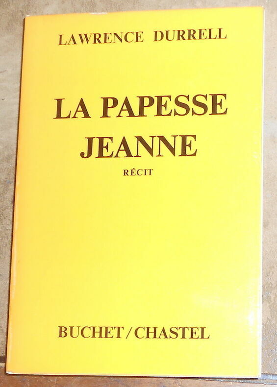
1974194531974. Paris Éditions Buchet-Chastel 1974 e. o. (pas de grand papier) - Broché couv. à rabat 14 cm x 20 5 cm 231 pages - Texte de Lawrence Durrell adapté de l'oeuvre de Emanuel Royidis trad. de Georges Belmont et Hortense Chabrier envoi de l'auteur à Alex et Nadia Blokh - Très bon état
110353London, Arthur L. Humphreys, 1911 fort in-8, XXII-437 pp., front., 53 pl. dont 11 en coul., index, carte dépl. en fin de vol., percaline verte (rel. de l'éditeur).
Dublin, John Browne, 1844. 4to.; II pp., 1 h., 391 pp. Encuadernación de época en piel marbreada con lomera ornada y tejuelo.
Carta geografica raffigurante l'Irlanda. Interessante la raffigurazione delle ferrovie e la suddivisione del territorio nelle sue province. Attraente coloritura coeva all'acquerello. Piccolo foro di tarlo
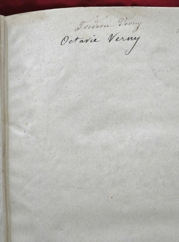
110959Paris, Chez Guillaume et Cie, Libraires-Editeurs, rue Richelieu, et aux Bureaux de la Revue Britannique, rue Drouot, 1850, 2 volumes in-8 de 225x140 mm environ, Tome I. 1f.blanc, un frontispice, viii-499 pages, 1f.blanc, - Tome II. 1f.blanc, faux-titre, titre, 503 pages, 1f.blanc, demi basane corail, titres dorés sur dos lisses, ornés de motifs romantiques dorés, tranches finement mouchetées. Dos insolés, frottements sur le cuir et le cartonnage, des appartenances sur les pages de garde, des notes et mouillures très claires dans les marges. Avec un frontispice dans le tome I.
Carta tratta dalla "Geographia di Claudio Tolomeo", a cura del Ruscelli, pubblicata in Venezia in pù edizioni tra il 1561 ed il 1598. La carta è basata sulla "Geografia" di Giacomo Gastaldi, che probabilmente disegnò personalmente anche queste mappe, che vennero incise dai fratelli Sanuto. La peculiarità di queste mappe è che sono incise due per lastra e successivamente tagliate; questo il motivo per cui il segno del rame appare solo in tre lati della mappa. Il testo del Ruscelli e le sue carte sono considerate come il miglior atlante moderno fino alla prima versione del Thatrum di Ortelius, 1570. Solo la loro enorme diffusione ne impedisce una valutazione sostenuta nel mercato antiquario. L'opera infatti ebbe una prima stesura nel 1561, stampata da Vincenzo Valgrisi che ne curò anche la ristampa del 1562. Tre sono le edizioni firmate da Giordano Ziletti (due nel 1564 e una del 1574), mentre nel 1597 viene edita dai fratelli Calignani. Tutte queste edizioni contengono 64 tavole. Nel 1598 e 1599 vengono alla luce le due edizioni curate da Giuseppe Rosaccio e stampate dagli Eredi di Melchior Sessa. Queste ultime due edizioni comprendono 69 tavole; sono infatti aggiunte la carta del planisfero e dei continenti del Rosaccio. Map, taken from Ruscelli edition of Ptolemy's "Geographia", printed in Venice from 1561 to 1598. Ruscelli's Atlas is an expanded edition of Gastaldi's "Geografia" of 1548, which has been called the most comprehensive atlas produced between Martin Waldseemüller's Geographiae of 1513, and the Abraham Ortelius Theatrum of 1570. Ruscelli and Gastaldi's maps were beautifully engraved on copper, marking a turning point in the history of cartography. From that point forward, the majority of cartographic works used this medium. As it was a harder material than wood it gave the engraver the ability to render more detail. Gastaldi sought the most up-to-date geographical information available, making the modern maps in Ruscelli's Geographia among the best modern maps of the period. The maps are engraved by the Sanuto borthers.Only their enormous diffusion prevents a sustained evaluation in the antique market. The work in fact had a first issue in 1561, printed by Vincenzo Valgrisi who also edited the reprint of 1562. There are three editions signed by Giordano Ziletti (two in 1564 and one in 1574), while in 1597 it was edited by the Calignani brothers. All these editions contain 64 engraved maps. In 1598 and 1599 the two editions edited by Giuseppe Rosaccio and printed by the heirs of Melchior Sessa come to light. These last two editions include 69 plates; in fact the map of the planisphere and of the continents of Rosaccio are added.
Carta geografica tratta dall’Atlante novissimo, illustrato ed accresciuto sulle osservazioni e scoperte fatte dai più celebri e più recenti geografi. Stampato in quattro volumi da Antonio Zatta tra il 1779 ed il 1785. Atlante fra i più belli e completi mai pubblicati in Italia nel XVIII secolo, l'opera più famosa dello Zatta. L’Atlante Novissimo, come si specifica anche nel titolo, è “accresciuto sulle osservazioni scoperte fatte dai più celebri e più recenti geografi”. Tra le novità più significative vi è la comparsa delle nuove isole scoperte nell'Oceano Pacifico da James Cook e la prima carta italiana della Nuova Zelanda. Le illustrazioni furono ideate e disegnate dai suoi collaboratori Giovanni Marco Pitteri, Anton Friedrich Busching, Pietro Antonio Novelli ed incise da Giuliano Zuliani. Il primo tomo dell’atlante è introdotto da un breve saggio di geografia generale dove l’autore definisce in modo sintetico e preciso gli elementi che compongono i reticoli eclittico ed equatoriale usati nelle tavole. Interessante la sezione dove si sofferma a descrivere il fenomeno della precessione degli equinozi e quello della variazione ciclica dell'obliquità dell'eclittica. Acquaforte, stampata su carta vergata coeva, coloritura coeva dei contorni, in buone condizioni. Map from the Atlante novissimo, illustrato ed accresciuto sulle osservazioni e scoperte fatte dai più celebri e più recenti geografi. Printed in four volumes by Antonio Zatta between 1779 and 1785. Atlas among the most beautiful and complete ever published in Italy in the eighteenth century, the most famous work of Zatta. The Atlante Novissimo, as also specified in the title, is “increased on the observations made by the most famous and most recent geographers”. Among the most significant innovations there is the appearance of the new islands discovered in the Pacific Ocean by James Cook and the first Italian map of New Zealand. The illustrations were designed and drawn by his collaborators Giovanni Marco Pitteri, Anton Friedrich Busching, Pietro Antonio Novelli and engraved by Giuliano Zuliani. The first volume of the atlas is introduced by a brief essay of general geography where the author defines in a concise and precise way the elements that make up the ecliptic and equatorial grids used in the tables. Interesting is the section where he pauses to describe the phenomenon of precession of the equinoxes and the cyclical variation of the obliquity of the ecliptic. Etching, printed on contemporary laid paper, contemporary outline coloring, in good condition.
Carta geografica tratta dall’Atlante novissimo, illustrato ed accresciuto sulle osservazioni e scoperte fatte dai più celebri e più recenti geografi. Stampato in quattro volumi da Antonio Zatta tra il 1779 ed il 1785. Atlante fra i più belli e completi mai pubblicati in Italia nel XVIII secolo, l'opera più famosa dello Zatta. L’Atlante Novissimo, come si specifica anche nel titolo, è “accresciuto sulle osservazioni scoperte fatte dai più celebri e più recenti geografi”. Tra le novità più significative vi è la comparsa delle nuove isole scoperte nell'Oceano Pacifico da James Cook e la prima carta italiana della Nuova Zelanda. Le illustrazioni furono ideate e disegnate dai suoi collaboratori Giovanni Marco Pitteri, Anton Friedrich Busching, Pietro Antonio Novelli ed incise da Giuliano Zuliani. Il primo tomo dell’atlante è introdotto da un breve saggio di geografia generale dove l’autore definisce in modo sintetico e preciso gli elementi che compongono i reticoli eclittico ed equatoriale usati nelle tavole. Interessante la sezione dove si sofferma a descrivere il fenomeno della precessione degli equinozi e quello della variazione ciclica dell'obliquità dell'eclittica. Acquaforte, stampata su carta vergata coeva, coloritura coeva dei contorni, in buone condizioni. Map from the Atlante novissimo, illustrato ed accresciuto sulle osservazioni e scoperte fatte dai più celebri e più recenti geografi. Printed in four volumes by Antonio Zatta between 1779 and 1785. Atlas among the most beautiful and complete ever published in Italy in the eighteenth century, the most famous work of Zatta. The Atlante Novissimo, as also specified in the title, is “increased on the observations made by the most famous and most recent geographers”. Among the most significant innovations there is the appearance of the new islands discovered in the Pacific Ocean by James Cook and the first Italian map of New Zealand. The illustrations were designed and drawn by his collaborators Giovanni Marco Pitteri, Anton Friedrich Busching, Pietro Antonio Novelli and engraved by Giuliano Zuliani. The first volume of the atlas is introduced by a brief essay of general geography where the author defines in a concise and precise way the elements that make up the ecliptic and equatorial grids used in the tables. Interesting is the section where he pauses to describe the phenomenon of precession of the equinoxes and the cyclical variation of the obliquity of the ecliptic. Etching, printed on contemporary laid paper, contemporary outline coloring, in good condition.