9 209 résultats
1890C103957Lisboa, Impressa Nacional 1890 xxiii + [14] + 628pp., with bl/w illustrations in text + plates out of text (of which some folding maps and plans), 23cm., publisher's illustrated hardcover (corners bit bumped), some occasional foxing, stamp at verso of tilte page, upper right corner of title page cut out, text in Portuguese, overall in good condition, rare, weight: 1.6kg., C103957
xxiii + [14] + 628pp., with bl/w illustrations in text + plates out of text (of which some folding maps and plans), 23cm., publisher's illustrated hardcover (corners bit bumped), some occasional foxing, stamp at verso of tilte page, upper right corner of title page cut out, text in Portuguese, overall in good condition, rare, weight: 1.6kg., C103957
1849HI004Porto, Typ. do Nacional, 1849-1850. Petit -8o, 2 vol. de ii+308+340+ii p. A' edition portugaise, ex. propre avec une dechirure minime a la page du titre. Reliure demi-veau contemporain avec une piece de titre et une tomaison.
2006PG204<p>XVIIIème Roi de Portugal. Imprimerie Raphaël Giusti. Livourne. 1908.</p>_x000d_<p>De 317x215 cm. Com 335 clxviii págs. Brochado.</p>_x000d_<p>Ilustrado em extratexto sobre papel couché nas 168 páginas finais com a reprodução de grande número de gravuras com retratos e documentos e fotografias de moedas com a efígie do Prior do Crato brasões louça da China pedras e inscrições sepulcrais e vistas de cidades da época.</p>_x000d_<p>A capa de brochura apresenta a data de 1909.</p>_x000d_<p>Exemplar sem lombada da brochura e com foxing nas capas de brochura. Precisa de ser encadernado.</p>_x000d_<p>Obra dividida em duas partes:<br />A primeira até página 100 é composto por uma pequena biografia de D. António e por um pormenorizado levantamento da sua descendência tendo os mais proeminentes membros da família notas biográficas e a transcrição integral dos epitáfios gravadas nas respectivas sepulturas. <br />A segunda contém uma vasta recolha de documentos que fundamentaram o estudo do autor.<br />São ambas obras muito raras publicadas em tiragens muito reduzidas e valiosas pela sua qualidade tipográfica e importância como fonte para o estudo da figura de D. António e dos respectivos descendentes até ao século XX.</p>_x000d_<p>Ref.: Catálogo da Livraria Duarte de Sousa Vol. 2 983.</p> I-100-A-19 unknown
1690LBW-4822[1690-1695]. 166 x 270 mm.
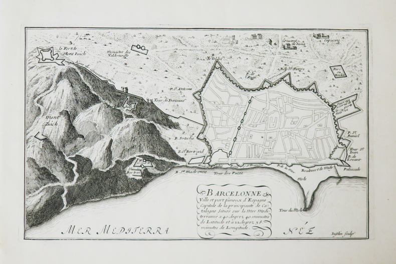
LBW-4031Paris, Sr. de Fer, 1705. 222 x 334 mm.
LBW-4026Paris, Sr. de Fer, [1705]. 242 x 347 mm.
191658124Frankfurt: Verlag Nachrichtendienst, 1914, 1915, 1916. nicht paginiert, einige s/w-Fotografien und Zeichnungen, einige Orig.-Dokumente in Kopie beigebunden, 4°, priv. Halbleinenband,
239948Lisbonne, Imprimerie nationale, 1914 in-8, 116 pp., broché. Dos défraîchi.
170146402323Amsterdam, Louis de Lorme, 1701 ; in-12, veau brun, dos orné. (Reliure de l’époque) 382 pp.Édition d’Amsterdam parue la même année que l’édition originale de Paris.Frémont d’Ablancourt, né à Paris en 1625 mort à La Haye vers 1694 était neveu du célèbre Perrot d’Ablancourt. Turenne l’ayant pris sous son patronage, il fut nommé à sa demande, en 1663, à l’ambassade du Portugal. “Les mémoires qu’il a écrits prouvent qu’il n’était pas au-dessous de cette place” dit Haag V, p.171 qui lui consacre une belle notice dans La France protestante.Exemplaire provenant de la bibliothèque de M. de Fréminville, notaire à Marcigny (ex-libris manuscrit). Célèbre famille installée dans le Bourbonnais au XVIIIe siècle les La Poix de Fréminville ont occupé, de père en fils, de nombreuses charges juridiques. Voir Quirielle p.123. Tache brune à l’angle des derniers feuillets.
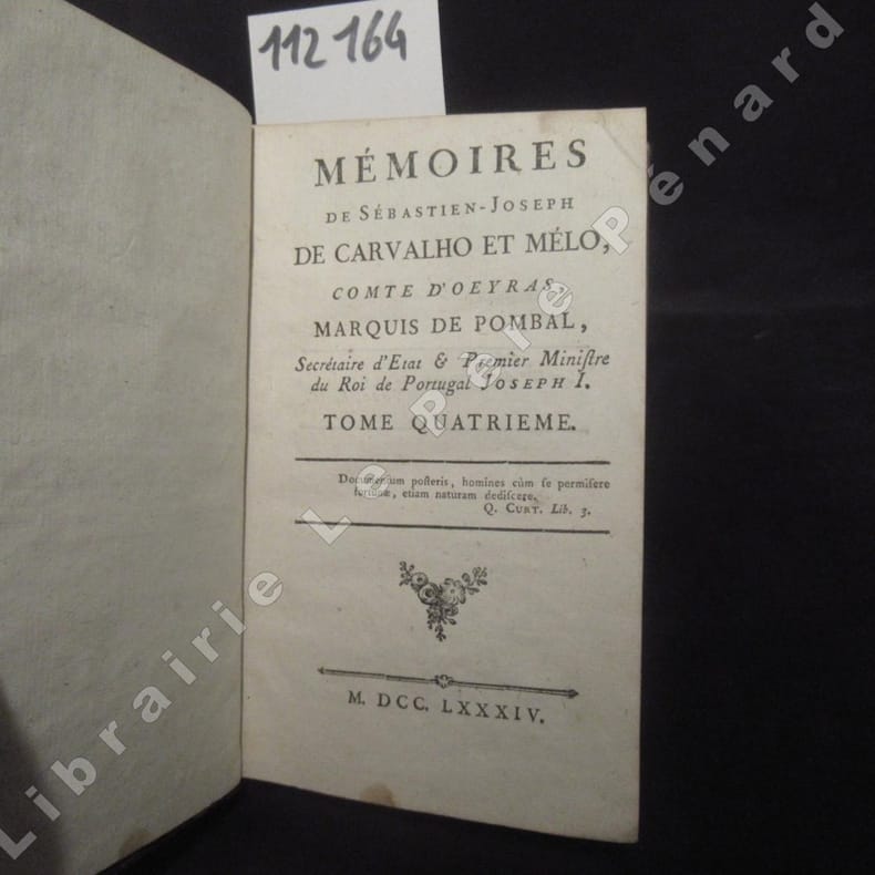
17841121641784 Sans mention d'éditeur ou d'impression - MDCCLXXXIV, 1784 - 4 volumes in-12 (8,5 x 14,5cm environ), reliure demi peau brune, tranches rouges - Caissons ornés et fleurons doré au dos avec pièce de titre et de tomaison au dos - lxiv, 244 + 438 + 356 + 380 pages - Bandeaux et lettrines
1833250641833 Planche 304 de La Caricature N° 145.La Caricature, August 15, 1833 1833. Lithographie originale sur Velin blanc. . Delteil 67. Belle épreuve en noir et pli horizontal,plis;lithographie en noir sur velin blanc,Delteil 67,tirage bien noir malgré l'image jaunie
Barcelona, por Jacinto Andreu, Impressor, a la calle de Santo Domingo, a costa de Jacinto Azcona, Antonio Ferrer y Juan Payssa, Libreros, 1673. 4to.; 2 hs., 360 pp. (numeradas de 403 a 763 pp., 9 hs. Enc. del XIX en media piel y cartoné.
218959Paris, Anselin, 1832 in-8, 261 pp., 2 planches de figures et 1 carte dépliantes, demi-basane brune, dos lisse orné, filets dorés (reliure de l'époque). Dos frotté, coupes et coins usés, fortes mouillures.
192133295Madrid, Rivabeneyra, 1916-1921. 1 Bl., V, 441 S. Mit zahlreichen Abbildungen. Fol. (39,5 x 28 cm). Halbleder der Zeit mit 2 Rückenschildern (der Original-Umschlag eingebunden).
188114948Charpentier Paris 1881 1 vol. Grand in-8 de X 406 pp., cartonnage éditeur de l'époque, dos lisse orné, premier plat à décor doré, tranches dorées (reliure de Souze).
199895Paris, Léautey, 1898 gr. in-8, 478 pp., ill., toile brique, couv. cons. (reliure posterieure).
1727LBW024f31727 173 x 251 mm.
1727LBW024f21727 172 x 251 mm.
Carta nautica tratta dal raro Recueil de Plusiereurs Plans des Ports et Rades de la Mer Mediterranée Dediée A Monseigneur le Grand Prieur de France, General des Galeres Levé et Dessigné sur les Lieux par les Srs. Michelot Hydrographe et Pilote Real des Galeres du Roy et Bremond Hydrographe du Roy et de la Ville, avec Pri.ge Du Roy (1727), atlante nautico di 37 tavole, stampato a Marsiglia. I piani nautici sono incisi da Pieter Starckman, uno dei più attivi intagliatori dell’epoca, collaboratore di molti cartografi ed editori. Secondo Shirley [cfr. Maps in the Atlases of the British Library, p. 1234] la prima edizione dell’opera contiene 21 tavole, mentre la ristampa, senza data, contiene 37 tavole delle quali alcune datate 1730. La terza, e ultima, contiene 38 tavole e reca la data 1732. Henry Michelot, dopo il successo riscosso con la pubblicazione della sua guida nautica Le Portulan de Partie de la Mer Méditerranée, ou Le vray Guide des Pilotes Costiers (1703), si unì a Laurent Bremond. All’inizio del XVIII secolo Henry Michelot e Laurens Bremond pubblicarono due importanti atlanti nautici del Mediterraneo e piani nautici ampiamente utilizzati dai naviganti costieri. Le carte sono interessanti e importanti per l’attendibilità derivata dall’esperienza di Michelot che, a differenza dei successivi “geografi del Dépôt des cartes et plans de la Marine” come Jacques-Nicolas Bellin, ha avuto una lunga esperienza in mare. Il primo atlante prodotto contiene 16 carte, su piccola scala, del Mediterraneo e della costa atlantica in prossimità dello stretto di Gibilterra, integrate da una o più profili costieri. Le date delle carte sono comprese tra il 1715 e il 1726; in questo periodo Michelot si firmava come Hydrographe et Pilote Real des Galères du Roy (idrografo e pilota della cambusa reale per il corpo della galea dei re). Poco si sa del co-creatore dell’opera Laurent Bremond. Nella raccolta nautica il suo nome succede sempre a quello di Michelot, e viene qualificato come Hydrographe du Roy et de la Ville (idrografo del re e della città). Bremond sembrerebbe essere stato l’editore e il venditore della raccolta nautica, la forza commerciale della società; titolare di una sorta di negozio vicino al porto. Tutte le carte sono chiaramente contrassegnate: Ce vendent a Marseille chez Laurens Bremond sur le Port au coin de Reboul (venduto a Marsiglia da Laurens Bremond nel porto all’angolo di Reboul). Incisione in rame, in ottimo stato di conservazione. Bibliografia S. Bifolco, Mare Nostrum (2019), pp. 270-271, tav. 122; Palau, 168325. Tooley, 438,80. Nautical chart taken from the rare Recueil de Plusiereurs Plans des Ports et Rades de la Mer Mediterranée Dediée A Monseigneur le Grand Prieur de France, General des Galeres Levé et Dessigné sur les Lieux par les Srs. Michelot Hydrographe et Pilote Real des Galeres du Roy et Bremond Hydrographe du Roy et de la Ville, avec Pri.ge Du Roy (1727), nautical atlas of 37 plates, printed in Marseilles. The nautical plans are engraved by Pieter Starckman, one of the most active engravers of the time, collaborator of many cartographers and publishers. According to Shirley [see Maps in the Atlases of the British Library, p. 1234] the first edition of the work contains 21 plates, while the reprint, undated, contains 37 plates, some of which are dated 1730. The third and last edition contains 38 plates and is dated 1732. Henry Michelot, after the success achieved with the publication of his nautical guide Le Portulan de Partie de la Mer Méditerranée, ou Le vray Guide des Pilotes Costiers (1703), joined Laurent Bremond. In the early 18th century Henry Michelot and Laurens Bremond published two important nautical atlases of the Mediterranean and nautical plans widely used by coastal mariners. The charts are interesting and important for the reliability derived from the experience of Michelot who, unlike later "geographers of the Dépôt des cartes et plans de la Marine" such as Jacques-Nicolas Bellin, had long experience at sea. The first atlas produced contains 16 maps, on a small scale, of the Mediterranean and the Atlantic coast near the Strait of Gibraltar, supplemented by one or more coastal profiles. The dates of the charts are between 1715 and 1726; at this time Michelot signed himself as Hydrographe et Pilote Real des Galères du Roy (hydrographer and pilot of the royal galley for the kings' galley corps). Little is known about the co-creator of the work Laurent Bremond. In the nautical collection his name always succeeds that of Michelot, and he is qualified as Hydrographe du Roy et de la Ville (hydrographer of the king and the city). Bremond would seem to have been the publisher and seller of the nautical collection, the commercial force of the company; owner of a sort of store near the port. All charts are clearly marked: Ce vendent a Marseille chez Laurens Bremond sur le Port au coin de Reboul (sold in Marseille by Laurens Bremond in the port at the corner of Reboul). Copper engraving, in excellent condition. Literature S. Bifolco, Mare Nostrum (2019), pp. 270-271, tav. 122; Palau, 168325. Tooley, 438.80.