MICHELOT & Laurent BREMOND HenryMareMagnum

9 209 résultats
Carta nautica tratta dal raro Recueil de Plusiereurs Plans des Ports et Rades de la Mer Mediterranée Dediée A Monseigneur le Grand Prieur de France, General des Galeres Levé et Dessigné sur les Lieux par les Srs. Michelot Hydrographe et Pilote Real des Galeres du Roy et Bremond Hydrographe du Roy et de la Ville, avec Pri.ge Du Roy (1727), atlante nautico di 37 tavole, stampato a Marsiglia. I piani nautici sono incisi da Pieter Starckman, uno dei più attivi intagliatori dell’epoca, collaboratore di molti cartografi ed editori. Secondo Shirley [cfr. Maps in the Atlases of the British Library, p. 1234] la prima edizione dell’opera contiene 21 tavole, mentre la ristampa, senza data, contiene 37 tavole delle quali alcune datate 1730. La terza, e ultima, contiene 38 tavole e reca la data 1732. Henry Michelot, dopo il successo riscosso con la pubblicazione della sua guida nautica Le Portulan de Partie de la Mer Méditerranée, ou Le vray Guide des Pilotes Costiers (1703), si unì a Laurent Bremond. All’inizio del XVIII secolo Henry Michelot e Laurens Bremond pubblicarono due importanti atlanti nautici del Mediterraneo e piani nautici ampiamente utilizzati dai naviganti costieri. Le carte sono interessanti e importanti per l’attendibilità derivata dall’esperienza di Michelot che, a differenza dei successivi “geografi del Dépôt des cartes et plans de la Marine” come Jacques-Nicolas Bellin, ha avuto una lunga esperienza in mare. Il primo atlante prodotto contiene 16 carte, su piccola scala, del Mediterraneo e della costa atlantica in prossimità dello stretto di Gibilterra, integrate da una o più profili costieri. Le date delle carte sono comprese tra il 1715 e il 1726; in questo periodo Michelot si firmava come Hydrographe et Pilote Real des Galères du Roy (idrografo e pilota della cambusa reale per il corpo della galea dei re). Poco si sa del co-creatore dell’opera Laurent Bremond. Nella raccolta nautica il suo nome succede sempre a quello di Michelot, e viene qualificato come Hydrographe du Roy et de la Ville (idrografo del re e della città). Bremond sembrerebbe essere stato l’editore e il venditore della raccolta nautica, la forza commerciale della società; titolare di una sorta di negozio vicino al porto. Tutte le carte sono chiaramente contrassegnate: Ce vendent a Marseille chez Laurens Bremond sur le Port au coin de Reboul (venduto a Marsiglia da Laurens Bremond nel porto all’angolo di Reboul). Incisione in rame, in ottimo stato di conservazione. Bibliografia S. Bifolco, Mare Nostrum (2019), pp. 270-271, tav. 122; Palau, 168325. Tooley, 438,80. Nautical chart taken from the rare Recueil de Plusiereurs Plans des Ports et Rades de la Mer Mediterranée Dediée A Monseigneur le Grand Prieur de France, General des Galeres Levé et Dessigné sur les Lieux par les Srs. Michelot Hydrographe et Pilote Real des Galeres du Roy et Bremond Hydrographe du Roy et de la Ville, avec Pri.ge Du Roy (1727), nautical atlas of 37 plates, printed in Marseilles. The nautical plans are engraved by Pieter Starckman, one of the most active engravers of the time, collaborator of many cartographers and publishers. According to Shirley [see Maps in the Atlases of the British Library, p. 1234] the first edition of the work contains 21 plates, while the reprint, undated, contains 37 plates, some of which are dated 1730. The third and last edition contains 38 plates and is dated 1732. Henry Michelot, after the success achieved with the publication of his nautical guide Le Portulan de Partie de la Mer Méditerranée, ou Le vray Guide des Pilotes Costiers (1703), joined Laurent Bremond. In the early 18th century Henry Michelot and Laurens Bremond published two important nautical atlases of the Mediterranean and nautical plans widely used by coastal mariners. The charts are interesting and important for the reliability derived from the experience of Michelot who, unlike later "geographers of the Dépôt des cartes et plans de la Marine" such as Jacques-Nicolas Bellin, had long experience at sea. The first atlas produced contains 16 maps, on a small scale, of the Mediterranean and the Atlantic coast near the Strait of Gibraltar, supplemented by one or more coastal profiles. The dates of the charts are between 1715 and 1726; at this time Michelot signed himself as Hydrographe et Pilote Real des Galères du Roy (hydrographer and pilot of the royal galley for the kings' galley corps). Little is known about the co-creator of the work Laurent Bremond. In the nautical collection his name always succeeds that of Michelot, and he is qualified as Hydrographe du Roy et de la Ville (hydrographer of the king and the city). Bremond would seem to have been the publisher and seller of the nautical collection, the commercial force of the company; owner of a sort of store near the port. All charts are clearly marked: Ce vendent a Marseille chez Laurens Bremond sur le Port au coin de Reboul (sold in Marseille by Laurens Bremond in the port at the corner of Reboul). Copper engraving, in excellent condition. Literature S. Bifolco, Mare Nostrum (2019), pp. 270-271, tav. 122; Palau, 168325. Tooley, 438.80.
18340053881834 Lyon, Périsse frères - Paris, Meyer et Cie, 1834. Petit in-folio (250 X 337 mm) demi-basane brune, dos lisse muet, étiquette de titre papier collée sur le premier plat (Reliure de l'époque) ; (3) ff. de titre, table des cartes et avertissement, 36 cartes à double page (33 X 45 cm). Dos frotté avec important manque de cuir, tache brune en lisière inférieure des trois premiers feuillets de texte et des trois premières cartes (sans atteinte au texte ni aux cartes), rousseurs claires et mouillures marginales.
Carta tratta dalla rara raccolta di carte geografiche denominata Atlante Geografico, prima stesura delle opera dell’abate Bartolomeo Borghi, pubblicata in Siena dal Pazzini Carli. Molte delle carte, datate tra il 1788 ed il 1800, sono incise da Agostino Costa e poi successivamente inserite nell’opera Atlante generale dell'ab. Bartolommeo Borghi, pubblicato a Firenze nel 1819.Bartolomeo Borghi, che Vermiglioli (Biografia degli scrittori perugini, 1829) definisce "uno dei migliori geografi dell'Europa", nacque nel 1750 a Monte del Lago, piccola frazione del comune di Magione, in provincia di Perugia, sulle rive del Trasimeno. Ordinato sacerdote nel 1774, trascorse i primi anni del suo mandato nel paese natale, poi a Magione e quindi a Sorbello (Cortona).Appassionato studioso di geografia, applicò dapprima le sue conoscenze all'analisi delle terre a lui più familiari: nel 1770 scrisse Descrizione geografica, fisica e naturale del Lago Trasimeno (che sarà tuttavia data alle stampe per la prima volta solo nel 1821), e nel 1791 pubblicò negli atti dell'Accademia etrusca di Cortona una Dissertazione sopra l'antica geografia dell'Etruria, Umbria e Piceno, arricchendo entrambe le opere di una carta delle regioni descritte. Intanto la sua fama di cartografo, oltre che di geografo, cresceva, tanto da fargli ottenere le nomine a membro delle Accademie Cortonese e Reale di Firenze, e procurargli l'incarico, da parte di Pietro Leopoldo, di delineare la carta del catasto pubblico di Cortona e del contado di Castiglione.Nello stesso tempo gli orizzonti geografici della sua attività si allargavano sensibilmente, e se nell'Atlante Novissimo, illustrato ed accresciuto sulle osservazioni, e scoperte fatte dai più celebri e più recenti cartografi di Antonio Zatta (Venezia 1779-1785) il suo contributo fu ancora legato all'area toscana, nell'Atlante geografico che si pubblicò a Siena da Pazzini Carli tra il 1798 ed il 1800 il Borghi tracciò la maggior parte delle carte e spaziò dalle province del Sud-Est dell'Inghilterra, al Regno di Danimarca, alla Romania.Una sorta di prova generale, quest'ultima, della sua opera più importante, quell'Atlante generale dell'ab. Bartolommeo Borghi, pubblicato a Firenze nel 1819. L'Atlante, corredato da brevi descrizioni storiche, politiche, civili e naturali che introducono le carte relative ai territori afferenti a ciascun Impero o Regno illustrato, rispecchia il nuovo assetto geo-politico attuato dal Congresso di Vienna. Incisione in rame, in buone condizioni. Map taken form the very rare Atlante Geografico, the first draft of the abbot Bartolomeo Borghi, published in Siena by Pazzini Carli. Many of the mapss, dated between 1788 and 1800, are engraved by Agostino Costa and then later incorporated in the work of AB Atlante Generale di Bartolomeo Borghi, published in Florence in 1819.Bartolomeo Borghi, who Vermiglioli (Biography of writers Perugini, 1829) calls "one of the best geographers of Europe", was born in 1750 in Monte del Lago, a small fraction of the town of Mansfield, in the province of Perugia, on the shores of Lake Trasimeno. Ordained in 1774, spent the first years of his term in his hometown, then to Mansfield and then Sorbello (Cortona).A passionate student of geography, first applied his knowledge to the analysis of land more familiar to him: he wrote in 1770 Description geographical, physical and natural Lake Trasimeno (which will however be given to the press for the first time only in 1821), and 1791 published in the Proceedings of Etruscan Cortona a dissertation on the geography of ancient Etruria, Umbria and Piceno, enriching both the works of a map of the regions described. Meanwhile, his fame as a cartographer, as well as a geographer, was growing, so that he get the nomination as a member of the Royal Academies of Florence and Cortona, and give him the job, by Pietro Leopoldo, to outline the paper's public land Cortona and the county of Castiglione.At the same time the geographical horizons of its activities widened considerably, and if in the Atlas Novissimo, illustrated and amplified the observations and discoveries made by the most recent and most famous cartographer Antonio Zatta (Venice 1779-1785) his contribution was still related area of Tuscany, in the Atlas geographic monthly published in Siena by Pazzini Carli between 1798 and 1800 the villages drew most of the cards and spaced from the provinces of South-East of England, the Kingdom of Denmark, Romania.A sort of dress rehearsal, the latter, his most important work, quell'Atlante General of AB. Bartolomeo Borghi, published in Florence in 1819. The Atlas, accompanied by brief descriptions of historical, political, civil and natural to introduce the papers relating to the territories belonging to each United Empire or illustrated, reflects the new geo-political structure implemented by the Congress of Vienna.
In 8, pp. 93 + (1b). D. rifatto. Macchioline al p. ant. Sporadiche bruniture alle cc. Br. ed. con cornicette tip. ai p. Traduzione francese, dall'orig. italiano uscito lo stesso anno, relativo al soggiorno di tre mesi di Pecchio in Portogallo. Giuseppe Pecchio (Milano, 1785 - Brighton, 1835), economista, giurista e patriota, fece parte del movimento dei romantici milanesi riuniti attorno al foglio Il Conciliatore. Dopo il fallimento dei moti piemontesi del marzo 1821, Pecchio fu costretto ad abbandonare l'Italia e, dopo lungo viaggiare (fu in Svizzera, Spagna, Portogallo, Grecia) si stabili' in Inghilterra. Legato alla tradizione del Caffe' e dei Verri, e' noto anche come autore di una biografia di Ugo Foscolo.
1768LBW-1948vers 1768. 480 x 575 mm.
1683LBW-7051683. 189 x 265 mm.
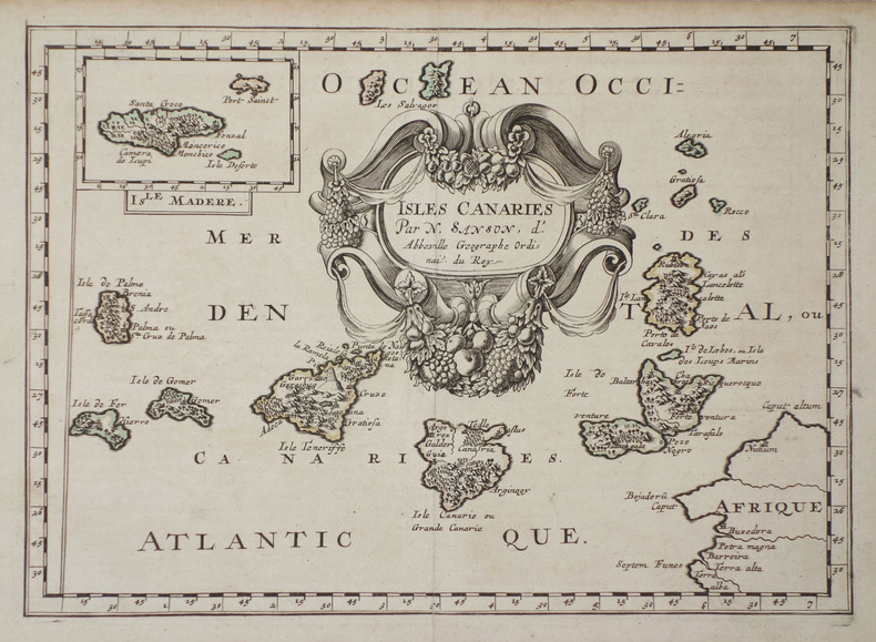
Tratta dall'edizione del "Cartes Gènerales de toutes les parties du Monde" curata da Pierre Mariette, edita nel 1663. Sanson era il più famoso cartografo francese della storia moderna, cosmografo al servizio di Luigi XIV, re di Francia; dotò le sue mappe delle più recenti informazioni geografiche e delle incisioni più belle e acute del periodo. Il "Cartes Generales de Toutes les Parties du Monde" rappresenta il più importante prodotto della cartografia commerciale francese del diciassettesimo secolo.Le mappe furono compilate a partire dal 1630 e l'atlante edito per la prima volta nel 1654, stampato da Pierre Mariette. Map taken from "Cartes Gènerales de toutes les parties du Monde" by Sanson.The maps were compiled by Nicolas Sanson who published his atlas in 1654, with 100 maps, and printed by Pierre Mariette; they were issued progressively from 1630. Sanson was the most noted French cartographer in modern history. Mapmaker to Louis XIV, King of France, Sanson endowed his maps with the most recent geographical information as well as the finest and sharpest engraving of the period. His "Cartes Generales de Toutes les Parties du Monde" was the most important single product of French commercial cartography of the seventeenth century.Copperplate, good condition.
342824 pages in8 - En tête: O Seculo - bon état avec petite restauration à la pliure - Sebastião de Magalhães Lima fut grand maitre du Grand Orient Lusitanien -
172030980Augsburg, Seutter, um 1720. 48,5 x 56 cm Blattgröße 53 x 60,5 cm
2573In 12 plein cuir fauve,pièce de titre chagrin rouge,petits fers dorés,filets à froid en encadrement sur les plats et sur les coupes.Faux-titre,titre,II,203 pages Bouillon-Ganguery 1770
1909RO80066723*PLON-NOURMARESCQ A. & Cie - PLON-NOURRIT.. 1909. In-12. Broché. Etat d'usage, Couv. défraîchie, Dos satisfaisant, Quelques rousseurs. 213 pages. Frontispice en noir et blanc, avec serpente. Quelques planches illustrées en noir et blanc, avec serpentes légendées. Petit manque sur la coiffe en pied.. . . . Classification Dewey : 946-Espagne, Portugal
1869ROD0111742MICHEL LEVY FRERES. 1869. In-12. Relié demi-cuir. Etat d'usage, Coins frottés, Dos à nerfs, Mouillures. 434 pages. Dos à 4 nerfs. Etiquette collée sur la coiffe en pied. Tampons et une annotation sur la page de titre. Epidermures. Coins abimés. Trace de mouillures sans réelle conséquence sur la lecture.. . . . Classification Dewey : 946-Espagne, Portugal
1829R320066780PICHARD. 1829. In-8. Broché. Etat d'usage, Couv. défraîchie, Dos abîmé, Intérieur frais. 408 + 417 pages - Tampon sur la page de titre et 1er plat - 1 etiquette collée en coiffe en pied sur les 2 volumes - Dos fendus et brunis.. . . . Classification Dewey : 946-Espagne, Portugal
1857R240083313DIDIER ET CIE. 1857. In-8. Relié demi-cuir. Etat d'usage, Coins frottés, Dos à nerfs, Quelques rousseurs. XXIV + 511 + 587 pages - ex libris de la bibliothèque de Mr Le Baron Evain sur le 1er contre plat des deux tomes - quelques rousseurs sans réelle conséquence sur la lecture - plats et contre plats jaspés - titre + auteur + filets + tomaison dorés sur le dos - dos à 4 nerfs - info sur l'auteur écrit au crayon à papier sur la page de garde du tome 1 - 2 photos disponibles.. . . . Classification Dewey : 946-Espagne, Portugal
1967RO80171625SKIRA. 1965 - 1967. In-Folio. Relié. Très bon état, Couv. remarquable, Dos impeccable, Intérieur frais. 248 + 242 pages augmentées de nombreuses photos en couleur dans et hors texte (reproductions contre-collées). Les deux volumes sont sous emboitage en carton. Bandeau éditeur conservé pour le volume 2. / 6 PHOTOS DISPONIBLES.. Avec Jaquette. Sous Emboitage. . Classification Dewey : 946-Espagne, Portugal
1884RO20007530Mame. 1884. In-4. Cartonnage d'éditeurs. Bon état, Couv. convenable, Dos satisfaisant, Rousseurs. 398p illustrées de gravures sur papier noir et blanc dans le texte., cartonnage d'éditeurs, plat décoré, toilé rouge, dos décoré de fleurons doré.. . . . Classification Dewey : 946-Espagne, Portugal
1975R100075415Livre club Diderot. 1975. In-4. Relié. Etat d'usage, Tâchée, Dos satisfaisant, Intérieur frais. 412 pages + 383 pages + 405 pages + 389 pages + 389 pages - rodhoïd conservé sur les 4 volumes - nombreuses illustrations, photos en couleurs et en noir et blanc dans et hors texte - couverture des volumes tâchées.. . . . Classification Dewey : 946-Espagne, Portugal
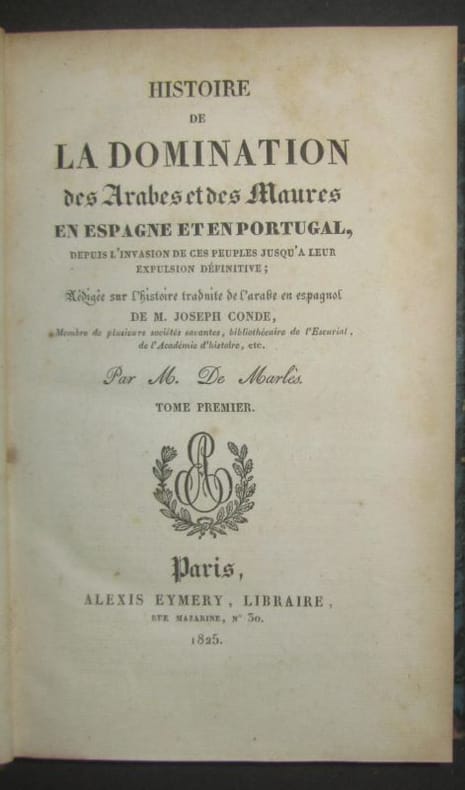
1825624831825 P., Alexis Eymery, 1825, 3 volumes in 8° reliés demiveau vert, dos lisses ornés, VI-504-XXXVIII, 470 et 412 pages ; habiteulles rousseurs ; reliures frottées, dos uniformément éclaircis, coiffes usées (2 coiffes supérieures arrachées).
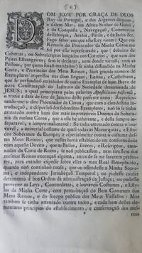
GD107<p>Alvará. Declara nulo e sem efeito o breve 'Apostolicum pascendi'" de 1765 em defesa dos Jesuítas. Documento tratando sobre a perseguição aos jesuítas pelo Marquês de Pombal. 8 de maio de 1765. Completo 7 páginas. Primeira e única edição. Papel marcas d´água de autenticidade do papel que podem ser vistas sob incidência de luzImpressão original com marcas d ´água. Documento foi periciado por aquivo público e foi constatada sua autenticidade e que sua origem não provém de nenhum arquivo público. Coleção Graphos Arte.</p><p>Decree. Declares null and void the brief 'Apostolicum pascendi' of 1765 in defense of the Jesuits. Document dealing with the persecution of the Jesuits by the Marquis of Pombal. May 8 1765. Complete 7 pages. First and only edition. Paper with watermarks of authenticity of the paper that can be seen under the incidence of light. Original print with watermarks. Document was examined by public archive and its authenticity was confirmed and that its origin does not come from any public archive. Graphos Arte Collection.</p>
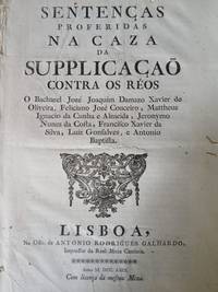
GD95<p>Sentença Proferida na Caza de Suplicação - Condenando réus por fraudes fiscais. Interessante documento. Ano 1769. 16 páginas. Impressão original com marcas d ´água. Documento foi periciado por aquivo público e foi constatada sua autenticidade e que sua origem não provém de nenhum arquivo público. Coleção Graphos Arte.</p><p>Sentence Delivered in the Court of Appeals - Convicting defendants of tax fraud. Interesting document. Year 1769. 16 pages. Original print with watermarks. Document was examined by public archives and its authenticity was confirmed and that its origin does not come from any public archive. Graphos Arte Collection.</p>
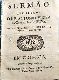
GD83<p>Sermão dos Bons Anos também conhecido por "Sermão da Circuncisão" um dos mais populares e frequentemente reimpressos de todas as obras de Vieira. Há pelo menos três edições ou números com a marca Lisboa: Na Officina de Lourenço de Anveres 1642 pelo menos duas datadas de 1645 impressas na Officina de Domingos Lopes Rosa pelo menos dois com o cunho Coimbra: Na Officina de Thome de Carvalho 1658 e uma de 1671 no mesmo estabelecimento gráfico. Thome de Carvalho era à época o impressor oficial da Universidade de Coimbra. Essa edição é a última edição em vida revista pelo próprio Vieira em 1671. Apresenta marca d´água do editor.</p><p>Sermon of Good Years also known as "Sermon of Circumcision" one of the most popular and frequently reprinted of all Vieira's works. There are at least three editions or issues with the Lisbon stamp: Na Officina de Lourenço de Anveres 1642 at least two dated 1645 printed at Officina de Domingos Lopes Rosa at least two with the Coimbra stamp: Na Officina de Thome de Carvalho 1658 and one from 1671 at the same printing establishment. Thome de Carvalho was at the time the official printer of the University of Coimbra. This edition is the last edition revised by Vieira himself during his lifetime in 1671. It has the publisher's watermark.</p>
194430207Madrid: Imp. Del Servicio Geográfico Del Ejército. Good with no dust jacket. 1944 1945 1952. First Edition. Paperback. Military; 4to 11" - 13" tall; Diccionario Bibliografico de la Guerra de la Independencia Espa¤ola 1808-1814. Referencias y Notas Comentadas de Obras Impresas Documentos y Manuscritos de Autores Nacionales y Extranjeros . Militares Historicos Politicos Religiosos Ec¢nomicos . Relacionados con dicha Guerra y su Epoca. 3 Volumes. Madrid: Ministerio del Ejrcito 1944-1947-1952. First Edition. 4to wraps alphabetical texts with over 5000 entries many with brief to lengthy annotations. Wraps with some wear and soiling noticeable chipping wraps detached from one volume texts clean and sound. Intended to be the most complete bibliography of books documents and manuscripts by Spanish and foreign writers on all aspects of the SPANISH WAR OF INDEPENDENCE 1808-1814. Includes 15 color plates and numerous b/w illustrations. Aprox 900pp. . Imp. Del Servicio Geográfico Del Ejército paperback
1850G23London, A. Fullarton & Co. 1850. Handkolorierte Stahlstichtafel aus: Royal Illustrated Atlas of Modern Geography, Plate 49. Größe: 47 x 31 cm (Folio). Zustand: Schwach gebräunt. Im linken Rand Druckspur von Rahmung. Rechte obere Ecke mit Einriß (kein Darstellungsverlust). Beigabe: 1 altkolor. Stich aus gleicher Zeit: Ländliche Beschäftigung auf Madeira (Stecher: Hössel, 11 x 19 cm).
176932069ABHmbg, Bohn 1769. Sechste rechtmäßige Auflage. 2 Bände. 9 Bll., 796 S.; 1 Bl., (797)-1460 S., 88 Bll. Ldr der Zt mit 2 Rückenschildern. Etwas berieben. Deckelbezug mit Wurmgängen und kl. Fehlstellen. Kapitale und Ecken etwas bestoßen. Teils etwas gebräunt. 6
189936467Berlin, Reimer, 1899. XII, 347 S. Mit 20 teils gefalteten Tafeln und Karten. Gr.-8° (25 x 18,5 cm). Illustrierte Original-Leinwand.