SANCHES FERREIRA, Manuel Reis de.MareMagnum

9 237 résultats
Lisboa, Tipografia da Casa E. da Cunha e Sá., 1912. 4to.; 6 pp. sin numerar. Ejemplar con envío autógrafo de S. Ferreira. Cubiertas originales.
20202-6200375003Editorial Académica Española 2020. Paperback. New. 164 pages. Spanish language. 8.66x5.91x0.37 inches. Editorial Académica Española paperback
199683074BBBerlin:, Wagenbach, 1996. 8°. 137 S., Pappband (sehr gut erhalten) (=Quartbuch)
Lisboa, 1906. 4to.; 14 pp. Cubiertas originales de papel.
Carta geografica tratta dal Provinciale Ordinis Fratrum Minorum S. Francisci Conventualium seu Polychronicon Jordanis.. , atlante raffigurante i conventi francescani in Europa. Incisione in rame, bella coloritura coeva, in ottimo stato di conservazione. Opera molto rara, specialmente in coloritura originale. Unsual map taken from Provinciale Ordinis Fratrum Minorum S. Francisci Conventualium seu Polychronicon Jordanis.. , an atlas depicting the Franciscan friaries of Europe. Copperplate with fine original colouring, excellent condition. A very rare work, not know before with original colouring.
151354087Strasbourg. 1513. Originalt tresnitt. Arkets størrelse : 60 cm X 425 cm. Norsk. <br/><br/><em>“Martin Waldseemüller a highly accomplished scholar of geography merged the science of mapmaking and the art of printing in his 1513 atlas one of the most groundbraking documents in the history of cartography. He intended this atlas as a new edition of Ptolemy’s Geographia but included the addition of 20 modern maps which were not based upon the tradition of Ptolemy. Waldseemüller’s use of a quadratic plane projection was also a noteworthy advance.â€Martin Waldseemüller 1470-1520.Liten rift ved nedre marg. Et lite ormehull i venstre marg. Et par slitasjer i øvre marg. </em> unknown
Carta è tratta dal rarissimo atlante nautico del Barentsz edito postumo dal Janssonius con il titolo "Descriptio Maris Mediterranei per tabulas hidrographicas & geographicas", Amsterdam nel 1654. L'opera contiene dieci carte nautice del Barentsz, per la prima volta incluse nel suo "Caertboeck vande Middelandtsche Zee", 1595; le carte sono stampate con la lastra originale ma sono completamnete rilavorate, con numerose varianti e con meno elementi decorativi nel mare. L'atlante è completato da alcune carte dello stesso Janssonius e da altre del Mercator, sempre modificate dal Jannsonius. Il Koeman cita solo 4 esemplari di questo atlante!!! Incisione in rame, coloritura coeva dei contorni, in ottimo stato di conservazione. Rarissima edizione. Striking map from Barentsz's "Descriptio Maris Mediterranei, per tabula hydographics & geographicas, . . .", published by Janssonius in Amsterdam in 1654. This is a rare variant edition. The atlas includes re-issues of Barentsz's 10 maps (first included in "Caertboeck vande Middelandtsche Zee", 1595) of the Mediterranean, with Jansson having completely changed the title and reworked the decorative embellishments, removing many of the great images originally added by Barentsz. Copperplate, original outline colour, in very good conditions.
Carta tratta dal rarissimo atlante nautico del Barentsz edito postumo dal Janssonius con il titolo "Descriptio Maris Mediterranei per tabulas hidrographicas & geographicas", Amsterdam nel 1654. L'opera contiene dieci carte nautice del Barentsz, per la prima volta incluse nel suo "Caertboeck vande Middelandtsche Zee", 1595; le carte sono stampate con la lastra originale ma sono completamnete rilavorate, con numerose varianti e con meno elementi decorativi nel mare. L'atlante è completato da alcune carte dello stesso Janssonius e da altre del Mercator, sempre modificate dal Jannsonius. Il Koeman cita solo 4 esemplari di questo atlante!!! Incisione in rame, coloritura coeva dei contorni, in ottimo stato di conservazione. Rarissima edizione. Striking map from Barentsz's "Descriptio Maris Mediterranei, per tabula hydographics & geographicas, . . .", published by Janssonius in Amsterdam in 1654. This is a rare variant edition. The atlas includes re-issues of Barentsz's 10 maps (first included in "Caertboeck vande Middelandtsche Zee", 1595) of the Mediterranean, with Jansson having completely changed the title and reworked the decorative embellishments, removing many of the great images originally added by Barentsz. Copperplate, original outline colour, in very good conditions.
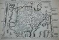
Carta tratta dalla "Geographia di Claudio Tolomeo", a cura del Ruscelli, pubblicata in Venezia in pù edizioni tra il 1561 ed il 1598. La carta è basata sulla "Geografia" di Giacomo Gastaldi, che probabilmente disegnò personalmente anche queste mappe, che vennero incise dai fratelli Sanuto. La peculiarità di queste mappe è che sono incise due per lastra e successivamente tagliate; questo il motivo per cui il segno del rame appare solo in tre lati della mappa. Il testo del Ruscelli e le sue carte sono considerate come il miglior atlante moderno fino alla prima versione del Thatrum di Ortelius, 1570. Solo la loro enorme diffusione ne impedisce una valutazione sostenuta nel mercato antiquario. L'opera infatti ebbe una prima stesura nel 1561, stampata da Vincenzo Valgrisi che ne curò anche la ristampa del 1562. Tre sono le edizioni firmate da Giordano Ziletti (due nel 1564 e una del 1574), mentre nel 1597 viene edita dai fratelli Calignani. Tutte queste edizioni contengono 64 tavole. Nel 1598 e 1599 vengono alla luce le due edizioni curate da Giuseppe Rosaccio e stampate dagli Eredi di Melchior Sessa. Queste ultime due edizioni comprendono 69 tavole; sono infatti aggiunte la carta del planisfero e dei continenti del Rosaccio. ORIGINAL COLOURING!!!!Etching with engraving, about 1561. Magnificent proof, printed on contemporary laid paper, with margins, in perfect condition. Example in wonderful contemporary coloring.Map, taken from Ruscelli edition of Ptolemy's "Geographia", printed in Venice from 1561 to 1598. Ruscelli's Atlas is an expanded edition of Gastaldi's "Geografia" of 1548, which has been called the most comprehensive atlas produced between Martin Waldseemüller's Geographiae of 1513, and the Abraham Ortelius Theatrum of 1570. Ruscelli and Gastaldi's maps were beautifully engraved on copper, marking a turning point in the history of cartography. From that point forward, the majority of cartographic works used this medium. As it was a harder material than wood it gave the engraver the ability to render more detail. Gastaldi sought the most up-to-date geographical information available, making the modern maps in Ruscelli's Geographia among the best modern maps of the period. The maps are engraved by the Sanuto borthers.Only their enormous diffusion prevents a sustained evaluation in the antique market. The work in fact had a first issue in 1561, printed by Vincenzo Valgrisi who also edited the reprint of 1562. There are three editions signed by Giordano Ziletti (two in 1564 and one in 1574), while in 1597 it was edited by the Calignani brothers. All these editions contain 64 engraved maps. In 1598 and 1599 the two editions edited by Giuseppe Rosaccio and printed by the heirs of Melchior Sessa come to light. These last two editions include 69 plates; in fact the map of the planisphere and of the continents of Rosaccio are added.
1827R240166435Chez Pierre Beaume. 1827. In-8. Broché. Etat d'usage, Couv. convenable, Dos satisfaisant, Quelques rousseurs. IV + 227 pages. Tous les cahiers ne sont pas coupés.. . . . Classification Dewey : 946-Espagne, Portugal
1829R320066780PICHARD. 1829. In-8. Broché. Etat d'usage, Couv. défraîchie, Dos abîmé, Intérieur frais. 408 + 417 pages - Tampon sur la page de titre et 1er plat - 1 etiquette collée en coiffe en pied sur les 2 volumes - Dos fendus et brunis.. . . . Classification Dewey : 946-Espagne, Portugal
51976Paris Centre Culturel Calouste Gulbenkian 1998 in 4 (25x18,5) 1 volume broché, couverture illustrée à rabats, 199 pages [1], avec des illustrations hors texte en couleurs. Texte en langue portugaise. Bel exemplaire ( Photographies sur demande / We can send pictures of this book on simple request )
18364402AG1836. Lithographie v. C.v. Schiele, Darst. 13 x 8,6 (incl. Text); Bll. 22,7 x 12,6 Auf Wunsch Digitalaufnahme in jpg-Format erhältlich- photo in jpg-format available. Je nach Versandart können die Portokosten bis zu 2 ? weniger als angegeben betragen.+
18502420AGBI, 1850 (ca.). Stahlstich v. Metzeroth (n. Stanfield) 14,6 x 9,3 (excl. Untertitel); Bll. 25 x 18,2 Auf Wunsch Digitalaufnahme in jpg-Format erhältlich- photo in jpg-format available. Je nach Versandart können die Portokosten bis zu 2 ? weniger als angegeben betragen.+
1833542AGLond. Murray and Sold, 1833. Stahlstich v. Finden n. Stanfield, 13,5 x 9 Auf Wunsch Digitalaufnahme in jpg-Format erhältlich- photo in jpg-format available. Je nach Versandart können die Portokosten bis zu 2 ? weniger als angegeben betragen.+
1840768AGBI., 1840 (ca.). Stahlstich v. Grünewald, 14,5 x 9 Auf Wunsch Digitalaufnahme in jpg-Format erhältlich- photo in jpg-format available. Je nach Versandart können die Portokosten bis zu 2 ? weniger als angegeben betragen.+
1836351AG1836. Lithographie, 13,5 x 8,5 (ohne Rahmen, incl. Untertitel; Nr. r.o.) Auf Wunsch Digitalaufnahme in jpg-Format erhältlich- photo in jpg-format available. Je nach Versandart können die Portokosten bis zu 2 ? weniger als angegeben betragen.+
18352334AGBI., 1835. Stahlstich v. Metzeroth n. Holland, 9,5 x 14,5 (H) Auf Wunsch Digitalaufnahme in jpg-Format erhältlich- photo in jpg-format available. Je nach Versandart können die Portokosten bis zu 2 ? weniger als angegeben betragen.+
3715AGWien. Stahlstiche von Eissner, Darst. (I) 13,7 x 10,3; (II) 13,6 x 10,3 (jeweils excl. Text); Bll. 19 x 29,6 (H) Auf Wunsch Digitalaufnahme in jpg-Format erhältlich- photo in jpg-format available. Je nach Versandart können die Portokosten bis zu 2 ? weniger als angegeben betragen.+
194033667ABMünchen und Berlin, Verlag von R. Oldenbourg, 1940. 249, [5] S. Original-Leinenband mit Farbkopfschnitt. Äusseres teils angestaubt, etwas gebräunt u. braunfleckig. Einband leicht lichtrandig. (Schriften der Corona. XXV)
Reichlich in Farbe illustriert.
197449500ABPorto 1974. Volume I. 4° reich ill. OK, OU. OU. leicht berieb./Randläsuren, innen sauber u. gut erhalten. 1 Widmung d. Besitzers a. Vors.
RO20024934Huecograbo, Barcelona. sans date. In-8. Relié. Bon état, Couv. partiel. décollorée, Dos satisfaisant, Intérieur frais. ~ 60 p., nombreuses photos sépia hors texte. Reliure cordelette. . . . Classification Dewey : 946-Espagne, Portugal
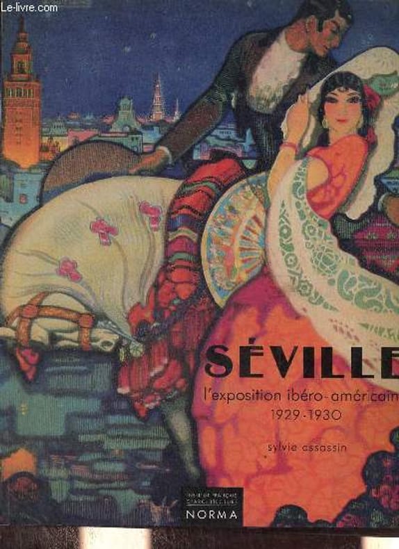
1992R100076793Institut français d'architecture / Norma. 1992. In-4. Broché. Bon état, Couv. convenable, Dos satisfaisant, Intérieur frais. 191 pages - nombreuses photos en couleurs et en noir et blanc dans et hors texte - nombreux plans en noir et blanc dans et hors texte - couverture contrepliée.. . . . Classification Dewey : 946-Espagne, Portugal
1990R200103698Jaguar. 1990. In-4. Relié. Bon état, Couv. convenable, Dos satisfaisant, Intérieur frais. 107 pages augmentées de nombreuses photos en couleurs et noir et blanc, hors texte. Jaquette en bon état.. Avec Jaquette. . . Classification Dewey : 946-Espagne, Portugal