175 résultats
1860WRCAM10894Quebec 1860. 39pp. in French. Original green printed wrappers. Light chipping along spine; minor stains at foot of front wrapper not affecting text. Overall very good. Second edition. General sketch of Canadian resources and institutions. Sabin cites only an 1857 edition published in Toronto. Description of Canada her people resources revenue etc. Scarce. unknown books
1859WRCAM11310Montreal 1859. ii122pp. Dbd. Bit tanned else good. Prints many extracts from documents as well as biographical sketches of French viceroys and officers who served in North America of importance to Canadian history. unknown books
1907218001Leipzig: Karl Baedeker Publisher 1907. Third Revised and Augmented Edition. 13 maps 6 folding and 12 plans. lxiv 331 pp. 1 vols. 12mo. Red flexible boards. Fine in Near Fine dust jacket with small chip at head of spine. Third Revised and Augmented Edition. 13 maps 6 folding and 12 plans. lxiv 331 pp. 1 vols. 12mo. Karl Baedeker, Publisher unknown books
1913234266Toronto: William Briggs 1913. First edition. 1 vols. 8vo. Original green cloth remainder binding with black lettering on front cover and spine. First edition. 1 vols. 8vo. William Briggs unknown books
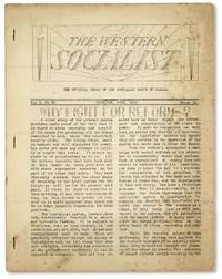
193633473Winnipeg: Socialist Party of Canada 1936-38. First Edition. Eleven original monthly issues. Original mimeographed self-wrappers side-stapled; 12pp per issue. Occasional soil and wear; all issues complete; Good or better. Includes: Vol 3 1936: nos.30 33-35; Vol 4 1937 nos 36-384145; Vol 5 1938: nos 4446. Eleven representative issues of this elusive Canadian periodical founded in 1933 and which despite remaining in monthly publication until 1980 per OCLC appears to be held by only two North American instiutions U. Vic & UBC with no holdings in the United States. Content focuses on radical activities in British Columbia and Manitoba; named contributors include William Child Currey J.A. McDonald F.J. McNey R.C. Walker others; most articles signed only with initials. WEINREICH 5409 apparently unaware of any issues after 1933. Socialist Party of Canada unknown books
1871512371871. Winnipeg: Coldwell and Cunningham 1871 1873-1887. Winnipeg: Coldwell and Cunningham 1871 1873-1887. Manitoba Statutes 1871-1887 Canada. Manitoba. Statutes of Manitoba 1871-1887. Winnipeg: Printed by Coldwell and Cunningham Printers to the Queen's Most Excellent Majesty 1871 1873-1887. 12 books in all. Octavo 8-1/2" x 5-1/2". Later quarter cloth or calf moderate to heavy shelfwear backstrips lacking from two volumes several boards loose internally clean. Ex-library. Location labels to spine small stamps to title pages. $500. One of the ten provinces of Canada Manitoba was established in 1870. It was the first province created from the Northwest Territories. These volumes document the early legal and social history of the province an interesting period that marked its final transition from a collection of territorial settlements to a mature political entity. No sets of these early statutes on OCLC. Sweet & Maxwell A Legal Bibliography of the British Commonwealth 3:75. unknown books
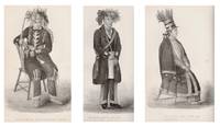
186114866London: A.W. Bennett 1861. First Edition. Hardcover. Very good. 12mo. pp. viii 278 2 ads frontis portrait of the author and 15 plates illustrating aspects of Ojibwe life and culture. Rebound in green cloth gilt title on spine. Edges trimmed mild spine slant; very good. Jones 1802-1856 was a Mississauga Ojibwe chief and Methodist minister from Upper Canada. As a missionary he made significant inroads for Methodism by translating hymns and biblical texts into Ojibwe and Mohawk and because of his ability to communicate with non-English speaking Indians. This work edited and published posthumously by Jones' wife Eliza offers a detailed survey of the history social structure religious beliefs ceremonies language etc. of the Ojibwe in Canada and the United States. A final chapter offers an assessment of the "present state and future prospects of the North American Indians." Sabin 36590; Howes J-238; Field 797. A.W. Bennett hardcover books
1774WRCAM11950London 1774. pp.1899-1904. Folio. Dbd. Very good. with: AN ACT FOR AMENDING AND EXPLAINING AN ACT. London. 1775. pp.1227-29. Folio. Dbd. Very good. These acts proposed to pay for the court system in Quebec and Canada by putting a duty on hard liquor and charging licensing fees. unknown books
1855WRCAM24391Montreal 1855. 106pp. plus two large folding maps. Original cloth stamped in gilt "ESSAI COURONNÉ SUR LE CANADA" on the front cover. Spine ends frayed. Inner hinges cracked spine shaken but holding. Some scattered foxing. Good. A very detailed description of every aspect of Canada accompanied by a "Map of the Province of Canada and the Lower Colonies showing the connection by steam navigation with New York Pennsylvania Ohio Indiana Illinois Michigan Wisconsin & Minnesota." and a map of "Mercators Projection. With the Great Circle Shortest Sailing or Air Lines. Illustrating the directness & capacity of the River St. Lawrence from Lake Erie to the Atlantic." According to a note in TPL the maps were apparently not issued with all copies. This work was published with another essay in Montreal the same year in an English language edition. TPL 3557. GAGNON I:1696. SABIN 32422. hardcover books
182647476Montreal: Imprime´ chex James Lane 1826. 46 pp. with the errata slip. 1 vols. 8vo. Stitched in modern plain wrappers. A fine copy of a scarce and important Canadian pamphlet. 46 pp. with the errata slip. 1 vols. 8vo. Excerpts from a journal and letters written during a trip to the United States in 1819. This serves as a sequel to Viger's "Considerations sur les effets qu'ont produit en Canada la conservations des etablissemens du pays les mœurs l'education etc. de ses habitans." 1809. Sabin 10350; Gagnon I: 111; TPL 1190 Imprime´ chex James Lane unknown books
1881WRCAM30264AMontreal: John Lovell & Son 1881. 219pp. plus large folding color map. Original printed wrappers. Minor wear to wrappers three-inch closed tear in map. Contemporary stamp of the U.S. Geological Survey Library on titlepage. Internally clean. Very good. Issued by the Nelsen Valley Railway Transportation Company this pamphlet and map advertise a new route to the middle of North America. The route marked by a heavy red line takes potential passengers through Hudson's Strait to Churchill Harbor Canada then south by train to the United States border in northern Minnesota. PEEL 448. John Lovell & Son unknown books
1872WRCAM39322Montreal: Dawson Brothers 1872. Colored folding map 33 x 22 1/2 inches. Folded into original pebbled cloth. Front board detached. Bisected and mounted on linen as issued. Old bookplate and withdrawal stamp on front pastedown short closed tear along linen fold of upper outer section not affecting map itself. A handsome detailed folding map showing southeast Canadian territory including Cape Breton the Province of Quebec and provides detailed illustration of the northeast United States spanning from eastern Michigan all the way to New York Harbor. With two small insets of Newfoundland and the environs of Montreal and one larger inset extending to British Columbia and Manitoba. Also illustrates railway routings completed and those under construction and denotes "Free Grant Lands" with color illustration. An interesting late 19th-century map of Canada published only one year after western British Columbia joined the Canadian Confederation to help form the Canadian Pacific Railway. Dawson Brothers hardcover books
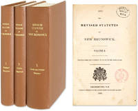
1854511091854. Fredericton: 3 Vols. Complete set. 1845-1855. Fredericton: 3 Vols. Complete set. 1845-1855. First Compilation of New Brunswick Statutes Canada. New Brunswick. The Revised Statutes of New Brunswick. Printed Under the Authority of an Act of the Legislature. Fredericton: J. Simpson Printer to the Queen's Most Excellent Majesty 1854-1855. Three volumes. Complete set. Octavo 9" x 6". Recent cloth gilt titles to spines endpapers renewed. Clean tears to first page of Volume I Preface annotations in early hand to margins of Volume I in some places interiors otherwise clean. Ex-library. Small stamps to title pages. $450. Only edition. Volume II: The Public Statutes of New Brunswick Passed in the Year 1854 Together with Those Unrepealed by the Revised Statutes; Volume III: The Local and Private Statutes of New Brunswick. Settled by the French New Brunswick was taken by the British in 1759 and incorporated into the colony of Nova Scotia. Its population expanded significantly through an influx of Loyalists after the American Revolution. Its enlarged population and distance from Halifax the capital of Nova Scotia led the colonial administrators to establish New Brunswick as a separate colony in 1784. The first collection of New Brunswick acts covering the years 1786-1805 was published in 1805. The Revised Statutes was the first compilation. In 1867 New Brunswick was one of the six colonies that became the Canadian Confederation. Sweet & Maxwell A Legal Bibliography of the British Commonwealth 3:77. unknown books
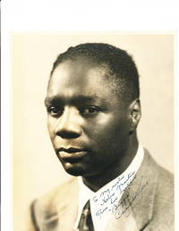
2339Referring to his role as Bigger in Orson Welles' 1941 stage production of Richard Wright's novel "Native Son" Lee has signed and inscribed this fine sepia toned photograph "To my sister Helen Martin From her brother 'Bigger' Canada Lee." Helen Martin 1910-2000 was an African-American actress who appeared in film and television as well as on stage. Her films include "Hollywood Shuffle" "Cotton Comes to Harlem" "Repo Man" and "Bulworth." She also appeared in the television series "Roots" and other shows. The photograph is stamped on verso "A. Steiner Photographer" with some pencil docketing. unknown books
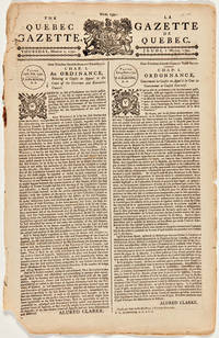
1792WRCAM12534Quebec: Samuel Nielson 1792. 4pp. printed in double-column format in parallel English and French. Folio. Torn at bottom corner affecting a few words else very good. This issue contains two proclamations by Allured Clark the lieutentant-governor acting in the absence of Lord Dorchester. The first is an ordinance for cases appealed to the Executive council while the second relates to the law courts. The remainder of the issue is taken up with news items and advertisements. Copies are noted by Tremaine in an appendix. Samuel Nielson unknown books
1848WRCAM47361London 1848. 171pp. Folio. Modern half morocco and red cloth spine gilt. Cloth bubbling. A bit of light soiling. Near fine. The late 1840s saw a major push for the colonization of Vancouver Island. This series of thirteen letters includes a document issued by the British Crown establishing the right of the Hudson's Bay Company to colonize the island. The report describes Vancouver Island and the prospects for colonization. One of the reports is by James Douglas a fur trader and Hudson's Bay Company official who in 1851 succeeded Richard Blanshard as governor of Vancouver Island. Considered the "father of British Columbia" Douglas became the first governor of the colony of British Columbia in 1858. The Hudson's Bay company controlled the development of Vancouver Island until 1866 when it was annexed to British Columbia. STREETER SALE 3399. GAGNON 3460 TPL 2908. LOWTHER 7. hardcover books
1904262740Canada: Department of Public Works 1904. unbound. Set of 8 Map. Color lithograph. In original cardboard case.<br/><br/> This set of eight maps depicts the government telegraph lines throughout the dominion of Canada. Issued by the Department of Public Works contains the maps of the different sections or systems to accompany the report on the Canadian Government telegraph lines compiled up to 1st August 1904. The maps include an index map and seven other regional maps depicting the British Columbia and Yukon System the Northwest Territories system Pelee Island Ontario system Chicoutimi and North shore of St. Lawrence and Gulf Grosse Isle system Bay of Fundy system Chatham-Escuminac New Brunswick system and the Magdalen Island system. Each map notes important cities and telegraph lines are shown with red and black lines. The maps are printed on onion skin paper and are brittle and fragile. Some maps show rips along folds. Surplus of Library of Congress stamp. All maps slip into an envelope inside hard cover case. Gives a good overview of the telegraph system in the early 20th century.<br/><br/> Department of Public Works unknown books
1849WRCAM22323Montreal: Armour & Ramsay 1849. 21533pp. plus large folding map 36 x 19 1/4 inches. 12mo. Original green cloth stamped in blind and gilt. Map detached from book with tape reinforcements on verso along several folds. Else clean and very good. A rare anonymous Canadian guide book containing Edward Staveley's fine engraved map of Canada: "A Map of Canada Compiled from the latest Authorities. By Edward Staveley. Montreal 1848. Engraved by W. & A.K. Johnson Edinburgh for Armour & Ramsay Montreal." With inset maps of Montreal Quebec Niagara Kingston and Toronto. This map is well-known and first appeared separately in 1844. The text consists of interesting descriptions of tourist destinations historical essays a tariff schedule for all manner of produce and accounts of the primary Canadian cites and towns. This is the fourth issue of the map and the first edition of THE CANADIAN GUIDE BOOK. TPL 2975. GAGNON I:661. PHILLIPS MAPS p.197. DIONNE 565. SABIN 10627. Armour & Ramsay hardcover books
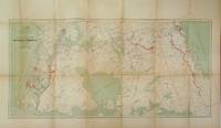
188135023Ottawa: Printed by MacLean Roger & Co. 1881. Original printed salmon wrappers stitched. 2 10 large folding map short closed tear 20 11 3 2 2 pp as issued. Vertical fold light edgewear. Very Good.<br/> offered with Booth C.J. President: THE CANADA ATLANTIC RAILWAY CO'Y. PROSPECTUS. Ottawa: 1889. 4 pp printed on rectos only. Caption title as issued. Pinned at upper blank corner and docketed in ink on final blank "Canada Atlantic RR Prospectus January 1889." Fine.<br/><br/> The map in excellent condition is titled "Canada Atlantic Railway Map December 1881" accomplished by "Geo. Bishop & Co. Lith. Montreal." It measures 18" x 35" with the route of the railway; extensions and other railways also notes; other boundaries in green. All the documents creating the Company set forth in the title of the pamphlet are printed each individually numbered. The Railway as the Prospectus states "extends from Ottawa in a south easterly direction a distance of 142 miles and connects with the Central Vermont Railroad at the village of Alburgh Springs Vt. U.S.A."<br/> "The Canada Atlantic Railway CAR was a small regional railway created in 1880 by lumber baron John Rodolphus Booth. Initially planned as part of the transportation network for his vast lumber holdings the railway quickly grew into a general-purpose railway serving passengers and communities along the route. Booth's first target was to gain access to Vermont in order to connect with the Central Vermont Railway CV and further exploit the US markets" "Canada Atlantic Railway" Ontario Railways accessed at Canada-Rail website May 2018.<br/> As of May 2018 we do not locate either of these documents-- or the map-- on OCLC. Printed by MacLean, Roger & Co. unknown books
1842248173London: Goerge Vertue 1842. First edition. Engraved vignette title-page to each volume portrait frontispiece to first engraved map and 116 engraved plates after drawings by Bartlett. 128; 166 pp. 2 vols. 4to. Full contemporary black calf gilt spine plain endpapers. A little rubbing at extremities labels chipped both vignette titles and title pages quite severely stained and inner margins of most plates in Vol. One. Bartlett W.H. First edition. Engraved vignette title-page to each volume portrait frontispiece to first engraved map and 116 engraved plates after drawings by Bartlett. 128; 166 pp. 2 vols. 4to. Sabin 3786; Lande 2310; Alston 7673; TPL 2424 Goerge Vertue unknown books
1866240437London: Hurst and Blackett Publishers 13 Great Marlborough Streeet 1866. First edition with tipped-in errata slip. 6 chromolithographs and numerous text illustrations. xv 3 334 pp. 1 vols. 8vo 26.5 x 18 cm. Original green cloth with gilt moose on upper cover. Fine. Signed "With J.B. Keith's best wishes. June/66. First edition with tipped-in errata slip. 6 chromolithographs and numerous text illustrations. xv 3 334 pp. 1 vols. 8vo 26.5 x 18 cm. A detailed and useful guide to Canadian sport. Four of the 12 chapters are devoted to fishing: "The Fisheries of Canada" concerning salmon rivers lakes and lesser waters; "The Salmon" its location size etc. includes data on trout and white fish; "The Canadian Shad" habitat etc. including other fish; and "The Tom Cod" annual arrival etc. including discussion of bass sturgeon and others. Rare. Bruns K-49; Gee p. 61; Lande 1886; Sabin 37857; TPL 6220 Hurst and Blackett, Publishers, 13, Great Marlborough Streeet unknown books
19301441Various locations in Ontario Alberta and the Southern U.S. 1930. Very good. 165 photographs on forty-four leaves. Most images approximately 3 x 4 inches or 2 x 3 inches with a few larger. Oblong octavo. Original brown cloth album with black paper pages string-tied. Light wear to album first leaf detached. Internally clean with some minor wear most images captioned. Interesting photo album made by a young man working in the Canadian forestry service in the 1920s. Images here document time spent along Loch Lomond and Lake Superior in Ontario and later on Mount Shunda in the Canadian Rockies. There is also a section of images covering work in the orange groves of Florida and in the Southern United States. The album is captioned throughout -- extensively so in the segment on Alberta -- providing context and humor to the images.<br/><br/>Our author who is pictured but not identified was employed by the Ontario Forestry Branch in 1928 around Loch Lomond and Lake Superior just south of Thunder Bay. Approximately seventy of the images relate to this region. They show the scenery wildlife and the camps and operations of the forestry service. Most are captioned in some way: "The Cook loading a canoe"; "Cliffs at mouth of Carp River"; "O.F.B. camp Loch Lomond survey." Several later images show the Temagami district of northern Ontario including the Mattagami River and its dam as well as an image captioned "Indian cabin flooded by Mattagami River."<br/><br/>The last several leaves of the album are devoted to the author's work with the Dominion Forest Service in Alberta and British Columbia in 1930. These photos are generally larger 4 x 5 inches and more extensively captioned. The opening image is a panoramic shot of the Big Horn Mountains in Alberta seen forty miles distant. The next shows the small town of Brazeau: "Looking north from Brazeau to Mt. Baldy on left and Mt. Shunda on right. Brazeau is a coal mining town 120 miles west of Red Deer Alberta and lies just inside the first range i.e. Brazeau Mts. Elevation of town 4000 ft. Mt. Shunda 6700 ft." This series of sixty photographs depicts the area around Mt. Shunda including sweeping scenery and towns as well as the forestry camps and activities. One image of three men in a tent from out on the trail is captioned "Over night camp from main camp to reach out-of-the way territory. Frank Mac and Obey. Note it rained over night also note holes in tent." There are mentions of the Canadian Pacific Railway and several images of stations and tracks.<br/><br/>Incongruously placed in the middle of the album is a group of images from 1925 documenting time spent working in the American South. These thirty-five images briefly document the trip to Florida: "Crossing the Roanoke River Virginia"; "On a road in Georgia" depicting a Black man in a goat-drawn cart; "Two tramps outside Philadelphia". There are individual images of the orange grove "Young trees about 5 yrs. out Hiawassee Orange Grove Florida along with shots of the cabin wash day loading fertilizer for the grove and the "View from our shack."<br/><br/>Altogether an interesting album of images documenting one young man's time in the Canadian Forestry Service as well as his earlier adventures working with trees in the American South. unknown books
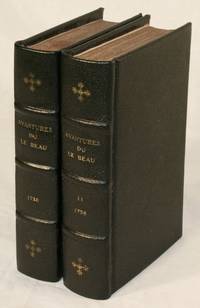
173814194Amsterdam: Herman Uytwerf 1738. First Edition. Hardcover. Good. Two volumes pp. xiv 370 6; 430 6 with six folding plates and a folding map. Modern full-leather with marbled endpapers. Title pages clipped at upper and lower edges; damage with losses to three plates repairs to back of map; all else very good. Le Beau was transported from France to Quebec in 1729 probably on a charge of libertinism. According to his own account he was appointed a clerk in the Beaver Office and then chief clerk in the King's warehouses. Bored and depressed he stole gunpowder from the warehouses and set off for New England. A warrant for his arrest was issued but he escaped encountering many perils natural and human before he reached Boston and eventually sailed for Holland. His ensuing work on his adventures in North America includes much detail on Huron Iroquois and Algonquin customs but its style has been dubbed fanciful. Howes L-167 describes the work as "a basically veracious narrative from competent authorities though somewhat romanticised." The Dictionary of Canadian Biography argues that Le Beau "deserves credit for painting an exact picture of the customs and character of the Canadians" noting that "the best chapters are those that discuss the habits of beaver and the religious ideas of the Indians." Siebert #14; Field 229; Sabin 39582. Herman Uytwerf hardcover books
183534163Quebec: Printed by Thos. Carey & Co 1835. 8vo. xxviii 2 2 192 30pp. Contemporary cloth paper label on spine soiled and worn.<br/> <br/>Regulations regarding the British regiment stationed in Canada.<br/> <br/>The introductory leaf is signed in print by Duncan McDougall the Lt. Col. commanding the regiment.<br/> <br/>TPL 1888. Printed by Thos. Carey & Co unknown books
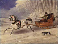
1840WRCAM19322N.p. 1840. Watercolor on stiff paper. 27.2 x 20.8 cm. With a rather unobtrusive 7 cm. tear through the lower left quadrant. Contemporary manuscript title on verso "An American Cutter." Overall a fine image. A handsome unsigned watercolor depicting a single-horse sleigh pulling a clever-looking American trapper with hunting dog barely keeping up. A lively image probably a Canadian scene very displayable. unknown books