Alaska.ABAA
1 282 résultats
1912106335<p>8vo original printed stiff paper wrappers folding map 18 1/2" x 26" 12 2 pp. Some wear to wrappers slight creasing; otherwise near fine. This is a somewhat scarce fairly early map of Alaska that includes a 12-page index of places and geological features0f the area. The map shows all the railroads cities towns post offices and lakes and rivers. The map also contains three inset maps of the Aleutian Islands Seward Peninsula Mining District and the Mt. McKinley District. The OCLC locates three copies. OCLC. </p> Rand McNally & Company, books
6Z-R3DC-0MLSHardcover. Good. INSCRIBED by the photographer ""for Mr. Rockefeller - thank you for supporting ACF"" - presumably David Rockefeller Jr. who was once Vice Chair of the Alaska Conservation Foundation. Jacket has moderate wear and small tears book has light wear. hardcover
1910113798Seattle Washington: Printed by the Pacific Press Inc. nd c1910. Softcover. very good. 1st Edition. 157pp. 2pp. indexpp. Octavo. Illustrations from photos. Original black cloth taped backed blue wrappers minor fading. very good Tourville 156. Illustrated report giving a history of the commission detailed statement of all disbursements summary of receipts and disbursements and description and costs of buildings and major exhibits. 1910 Printed by the Pacific Press, Inc. paperback
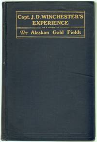
190012740Salem MA: Newcomb and Gauss Printers 1900. First Edition. Hardcover. Very Good. 251 pp with frontispiece and many sketches by the author which are rather amateurish but charming. Mild marginal dampstain to the first few pages boards a bit scuffed rubbed at corners and spine ends. The author joined the Lynn Mining Company and departed from Massachusetts in November 1897 traveling via the Schooner "Abbie M. Deering" to Bahia Brazil and on to San Francisco. From there the party secured passage to Seattle and then St. Michael eventually traveling up the Yukon and Koyukuk Rivers to the Arctic Circle. Includes detailed and colorful description of the outfitting process and the vicissitudes of travel and prospecting. Wickersham 80; Tourville 4919; Graff 4712; Howes W556; Smith 11106 Arctic Bibliography 19606. Newcomb and Gauss, Printers hardcover books
1994437462PN. New. 1994. Soft Cover. Date is original print. This is a reprint edition. . PN paperback
1962715528PN. New. 1962. Soft Cover. Date is original print. This is a reprint edition. . PN paperback
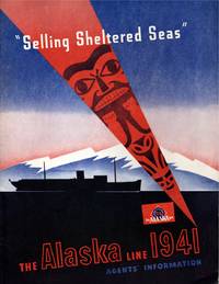
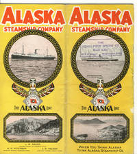
191411421Seattle: Alaska Steamship Company. Near Fine. 1941; 1914. Ephemera. Pacific brochure with 2" split top of spine 1" split bottom; closed 1" tear leading edge front cover; wear at edges with a heavy chip rear top edge causing loss on cover & several pages. Poor condition thus. Alaska Line with slight bump to lower front leading corner else fine. ; Alaska Line: illustrated stapled blue & black wrapper; tab indexed page foredges; includes charts and timetables lodging and transportation informations; information on side trips "what to see"; deck plans including 4 fould out plans in color; large folding map in rear pocket approx. "30 x 20" in color on what appears to be onion skin paper in pristine apparently unused condition. PACIFIC STEAMSHIP brochure: Illustrated stapled wrappers; 15 pp. With map photographs double page deck plan; 4to 11" - 13" tall; 21 pages . Alaska Steamship Company unknown
0331982595.Gpaperback. Good. Access codes and supplements are not guaranteed with used items. May be an ex-library book. paperback
0331982609.Ghardcover. Good. Access codes and supplements are not guaranteed with used items. May be an ex-library book. hardcover
1867319700Washington D.C.: Printed at the Congressional Globe Office 1867. First edition. Text in two columns. 48pp. Without the folding map not issued in all copies. Stitched. First edition. Text in two columns. 48pp. Without the folding map not issued in all copies. Sumner's important speech in support of the ratification oof the treaty with Russia which ceded what would become Alaska to the U.S. Sometimes found with a large folding map by Lindenkpohl though it was not issued with the speech according to Lada-Mocarski. Howes S1134; Lada-Mocarski 159; Tourville 4391; Wickersham 4128 Printed at the Congressional Globe Office unknown books
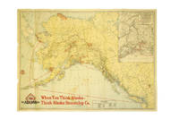
1939286138Seattle: Farwest Lithograph and Printing Co 1939. Map. Color Lithograph. 21" x 28".<br/><br/> This beautifully colored map of Alaska and the Gulf of Alaska shows the Alaskan boat lines from Seattle and was first drawn by Edward Camy for the Alaska Steamship Company in 1934. A great pictographic map includes an inset showing the Alaska Railways route from Seward to Fairbanks and the Richardson Automobile Highway. The bottom of the map shows a series of cartoons of events on the ship. In good condition a great example of Alaska.<br/><br/> Farwest Lithograph and Printing Co unknown books
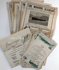
19341007At sea 1934. Very good. Five issues of The Morning Alaskan each 4pp. Also four leaves of manuscript four mimeo news sheets two passenger lists thirteen menus and related material. Light wear and chipping to edges of newsletters and news sheets heavier to news sheets. Light wear overall. A nice archive of ephemera collected during a voyage from Seattle to Alaska aboard the S.S. Alaska. Founded in 1894 the Alaska Steamship Company ran cargo and passenger service to Alaska from Seattle through the mid-1950s at which point it became a freight-only company until its demise in 1971. The materials here likely saved from a voyage in June 1934 provide a glimpse into Alaskan cruise tourism during the height of the Great Depression. There are four daily mimeo "news sheets" titled "Sense and Nonsense" which are filled with one-liner inside jokes about the goings-on about the ship: "Mr Sullivan his own is still holding against all comers and how!!" and "Who was the boyfriend in Ketchikan Rose The flowers at least were beautiful." Additionally thirteen menus for breakfast lunch and dinner meals. The shipboard newspaper The Morning Alaskan features ads and a vignette of the ship on the first page followed by a mixture of news and tidbits from locales across the globe. One issue includes news about the dock strike in San Francisco the reappearance of a missing Japanese Vice Consul in Shanghai and sports news. It was a fairly sophisticated production presumably with the first page pre-printed and then the interior mimeographed aboard ship. The manuscript leaves contain brief notes about the voyage. Upon leaving Seattle on June 13 the author made the following notes providing an insight into the other passengers on the ship: "Six mo. truce made. First boat in 6 mo. why Eng. boats no help to Alaskans. Heavy cargo interesting loading - autos personal Bride soldiers lecturer natives Alaskans going home prospectors old men going back missionaries teachers natives contractors for school projects "nails counted." Orchestra steward. News Daily - ship personals sight seeing paper. Food number of meals & type." He notes stops at Juneau and Hawkes Inlet: "Juneau again. Hawkes Inlet at 9:30 p.m. light. Beautiful. Private homes at most canneries Gov. visiting Hawkes Inlet came on board." Though brief his notes do provide interesting details about the voyage. Notably this archive also highlights possible Chinese migration to Alaska perhaps for the cannery industry based on the passenger lists. The northbound passenger list from Seattle to Skagway on June 14 lists eighty roundtrip passengers as well as 107 passengers with destinations at various ports along the way such as Ketchikan Wrangell Petersburg Juneau and Skagway. It also lists among the passengers sixty "Orientals" and forty-six passengers traveling "Oriental Steerage." At Hawk Inlet thirty-one "Orientals" disembarked -- no white passengers -- twenty-nine of them traveling steerage. An interesting group of ephemera made even more interesting by the addition of the Asian-American component in the passenger lists. unknown books
193730885Seattle: Alaska Steamship Co 1937. Shape book in the form of a circle approx. 6 3/4" in diameter pp. 12; original pictorial color wrappers die-cut in the shape of a globe showing the northwest portions of North America from Seattle to the Bering Strait; illustrated throughout; very good. Contains a detailed account of the Arctic voyage and including a deck plan of the S. S. Victoria and notes on the Inside Passage and hints on what to wear. Not found in in OCLC. <br/><br/> Alaska Steamship Co unknown books
191737386Chicago: Poole Bros. 1917. 1917. ALASKA. First edition. A full-color folded map of Alaska showing both the coastal and seagoing routes that leave from Seattle to Alaska by the Alaska Steamship Company. Points of interest are indicated in red and include the Klondike Region Fairbanks Gold Placers Mt. McKinley National Park Kennecott Copper Mines etc. In the upper right corner is an 11" x 8" inset black & white map of the Copper River & Northwestern RY. and the Alaska Railroad showing Copper River Region in Alaska Prince William Sound the Richardson Automobile Highway Mt. McKinley National Park and Government Telegraph Line and Tributary Territory. Map has a few tears at folds some soiling to the map's surface and general wear from handling and use. Overall a good map of Alaska. Poole Bros., 1917. unknown
1939286138Seattle: Farwest Lithograph and Printing Co 1939. Map. Color Lithograph. 21" x 28".<br/> <br/> This beautifully colored map of Alaska and the Gulf of Alaska shows the Alaskan boat lines from Seattle and was first drawn by Edward Camy for the Alaska Steamship Company in 1934. A great pictographic map includes an inset showing the Alaska Railways route from Seward to Fairbanks and the Richardson Automobile Highway. The bottom of the map shows a series of cartoons of events on the ship. In good condition a great example of Alaska.<br/> <br/> Farwest Lithograph and Printing Co unknown
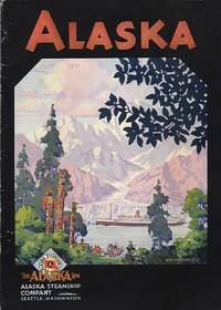
1931109085Seattle: Alaska Steamship Company 1931. Softcover. good to very good. 40pp.pp. Octavo. Black and white illustrations in text from photos and drawings and folding colour map at end in printed pocket entitled "The Alaska Line" with inset "Map of the Copper River & Northwestern Ry and the Alaska Railroad showing Copper River Region in Alaska Prince William Sound the Richardson Automobile Highway Mt. McKinely National Park Government Telegraph Line and Tributary Territory". Original pictorial wrappers stapled as issued; Old dampstain in top margin of text leaves and minor wear and short tear to rear cover. good to very good 1931 Alaska Steamship Company paperback
19353116Seattle WA: Alaska Steamship Company 1935. Paperback. Very Near Fine. Alaska Steamship travel brochure folded size is 4 x 9 inches unfolds to 8 x 9 inches staple bound pp. unpaginated 24 inc. covers illustrated with B&W photo reproductions and a color map at rear. Bright and clean with just a bit of edge wear else unmarked throughout. The Alaska Steamship Company cruise offerings for the 1935 season. Alaska Steamship Company paperback
192839103Chicago: Poole Bros. Inc. 1928. 1928. ALASKA. First edition. 8vo. 9" x 8" color pictorial wrappers folded to 9" x 4" 24 pp. including covers illustrated map deck plans. Map outlines the route of the Alaska Steamship Company and connections from Seattle to various ports in Alaska in red. The remainder of the booklet provides information on various trips from one Alaskan point to another along with the steamship used a deck plan of the steamship accommodations and rates for travel and sailing schedules. Agent stamp on cover panel covers lightly soiled rubbed along spine panel and lower spine split about four inches from the bottom else a good copy. Poole Bros. Inc., 1928]. unknown
0882400002New. paperback. New. Satisfaction Guaranteed or your money back. paperback
Q-0882400002Alaska Northwest Books 1962-06-01. Paperback. New. In shrink wrap. Looks like an interesting title! Alaska Northwest Books paperback
1900124823San Francisco: Edw. H. Mitchell 1900. Undetermined. very good. Complete deck of 52 cards. No Jokers. Single card map with publishers inprint and date. Single advertising card. A nice example missing the box lid but with the box liner. very good The images on the cards are general views from all over Alaska but include Skaguay Canyon City Dawson and other subjects that relate to the Klondike and Yukon as well. The card backs illustrate the Seal of the District of Alaska and are decorated with totem poles. 1900 Edw. H. Mitchell unknown
1566121116.Gpaperback. Good. Access codes and supplements are not guaranteed with used items. May be an ex-library book. paperback
1566120381.Gpaperback. Good. Access codes and supplements are not guaranteed with used items. May be an ex-library book. paperback
1891243722Philadelphia: John Y. Huber Company 1891. First edition. Frontispiece maps and illustrations throughout. 418 pp. 1 vols. 8vo. Original pictorial gray-blue cloth. Bookplate. About fine and rare thus. First edition. Frontispiece maps and illustrations throughout. 418 pp. 1 vols. 8vo. Bruns S80 John Y. Huber Company unknown books
15-10607Vancouver & Prince Rupert BC: Alaska Princess 1950. Folio. 12 pp. Stapled Wraps Very Good with some toning. Illustrated photographs. Onboard magazine for Alaskan cruises. Daily Radio News bulletin dated June 21 1950 for the S.S. Princess Kathleen present. Scarce piece of memorabilia. Vancouver & Prince Rupert, BC: Alaska Princess, 1950. paperback