Alaska Northwest PublishingBiblio.com

1 282 résultats
1995DADAX0882404709Brand: Alaska Northwest Books 1995-11-01. paperback. New. 8.56x0.43x9.02. Buy with confidence. Excellent Customer Service & Return policy. Brand: Alaska Northwest Books paperback
0882401920.Gpaperback. Good. Access codes and supplements are not guaranteed with used items. May be an ex-library book. paperback
0882405209New. paperback. New. Satisfaction Guaranteed or your money back. paperback
0882405098New. paperback. New. Satisfaction Guaranteed or your money back. paperback
0882404466New. paperback. New. Satisfaction Guaranteed or your money back. paperback
0882401955.Gpaperback. Good. Access codes and supplements are not guaranteed with used items. May be an ex-library book. paperback
0882402161.Gpaperback. Good. Access codes and supplements are not guaranteed with used items. May be an ex-library book. paperback
0882401750New. paperback. New. Satisfaction Guaranteed or your money back. paperback
1972Q-0882401750Alaska Northwest Books 1972-01-01. Paperback. New. In shrink wrap. Looks like an interesting title! Alaska Northwest Books paperback
1903WRCAM43317Juneau 1903. 4pp. Folio. Chipped and browned at edges. Two leaves separated at fold. Good. Daily Alaskan newspaper containing news of William Sulzer's speech in support of the territory an idyllic word-portrait of prospecting and numerous advertisements. Sulzer a Democratic Congressman from New York argues that Alaska deserves to be a full-fledged territory rather than just a district owing to its beauty and vast natural resources. Sulzer would later serve as New York's governor and hold the record as the only governor of that state to be impeached; his brother Charles was an Alaskan politician. Alaska would not become a territory until 1912. unknown books
56395London: British Admiralty 1907 1924. . An engraved chart on heavy stock uncolored sheet size 20 x 27.5 inches. Published 22nd April 1907; Small corrections printed to 1924. Unfolded. A nice clean copy. In lower right: "Engraved by Davies & Company". Chart number is 3653. Small typed label on verso giving chart & folio info. Published under the Superintendence of Rear Admiral A. Mostyn Field. <br/><br/> London: British Admiralty, 1907 (1924). unknown
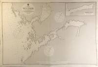
56414London: British Admiralty 1908 1925. . An engraved chart on heavy stock uncolored sheet size 40 x 27.5 inches. Published 29th Sept. 1908; Small corrections printed to 1925. Original vertical fold a nice clean copy a couple of small additions in red pen. In lower right: "Engraved by Weller & Addison". Chart number is 3705. Small typed label on verso giving chart & folio info. Published under the Superintendence of Rear Admiral A. Mostyn Field. Includes an inset map of Washington Bay. Originally published in 1908 this is a printing of 1925. <br/><br/> London: British Admiralty, 1908 (1925). unknown
56412London: British Admiralty 1907 1921. . An engraved chart on heavy stock uncolored sheet size 40 x 27.5 inches. Published 2nd April 1907; Small corrections printed to 1921. Original vertical fold. A nice clean copy some small additions in red pen. In lower right: "Engraved by Davies & Company.". Chart number is 3637. Small typed label on verso giving chart & folio info. Published under the Superintendence of Rear Admiral A. Mostyn Field. Plans of anchorages in Chatham Strait and Frederick Sound: Red Bluff Bay Herring Bay and Chapin Bay Hoggatt Bay Gut Bay and Surprise Harbour and Murder Cove. Murder Cove was so named for the killing of two gold prospectors in retaliation for the killing of two Tlingit tribesmen which precipitated the fighting between the Tlingit and the US Government known as the Kake War. <br/><br/> London: British Admiralty, 1907 (1921). unknown
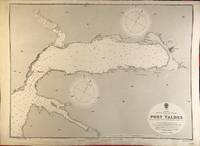
56392London: British Admiralty 1906 1921. . An engraved chart on heavy stock uncolored sheet size 27.5 x 20 inches. Published 6th June 1906; Large Corrections 1907; Small corrections printed to 1921. Unfolded. Some wear and a short tear to lower margin basically clean and very good. In lower right: "Engraved by Weller & Addison". Chart number is 3569. Small typed label on verso giving chart & folio info. Published under the Superintendence of Rear Admiral A. Mostyn Field. Valdez is an important Alaskan port and was a key town on the Gold Rush Trail. <br/><br/> London: British Admiralty, 1906 (1921). unknown
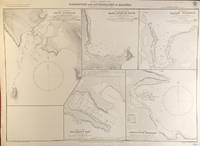
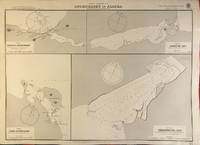
56400London: British Admiralty 1904 1928. . An engraved chart on heavy stock uncolored sheet size 27.5 x 20 inches. Published 11th Nov. 1904; Small corrections printed to 1928. Unfolded a nice clean copy. In lower right: "Engraved 1904" and "Zc 1928". Chart number is 3464. Small typed label on verso giving chart & folio info. Published under the Superintendence of Captain A. Mostyn Field. Maps of five anchorages in the Ikatan Peninsula and Sanak Island: Dora Harbour East Anchor Cove Sanak Acherk Harbour Peterson Bay and North East Harbour. <br/><br/> London: British Admiralty, 1904 (1928). unknown
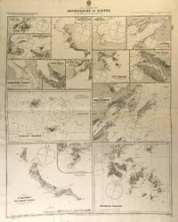
56425London: British Admiralty 1890 1925. . An engraved chart on heavy stock uncolored sheet size 27 x 33.5 inches. Published 11th Aug. 1890; New Edition July 1911; Small corrections printed to 1925 and mss. to 1929. Original horizontal fold a nice clean copy small additions in red pen. In lower right: "Engraved by Edwd. Weller". Chart number is 1454. Small typed label on verso giving chart & folio info. Published under the Superintendence of Captain W.J.L. Wharton. Fifteen anchorages various sizes: Kukak Bay Northwest and Yukon Hrs. Southwest Anche. Chernoffski Harbour Eagle Harbour Kulilyak Bay Pribilof Islands English Bay St. Matthew and Adjacent Islands Akun Cove Port Etches Port Wrangell Port Graham Kodiak Harbour and Shumagin Islands. <br/><br/> London: British Admiralty, 1890 (1925). unknown
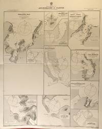
56424London: British Admiralty 1890 1924. . An engraved chart on heavy stock uncolored sheet size 27 x 33.5 inches. Published 2nd Aug. 1890; Large Corrections to Nov. 1908; Small corrections printed to 1924 and mss. to 1929. Original horizontal fold a nice clean copy small additions in red pen. In lower right: "Engraved by Edwd. Weller". Chart number is 1457. Small typed label on verso giving chart & folio info. Published under the Superintendence of Captain W.J.L. Wharton. Eleven anchorages: Unalaska Bay Captains Bay Cape Etolin Simeonof I. & Hr. Samganuda Bay Popof Strait and Humboldt Harbour Port Mulgrave Coal Harbour Doris & Anchorage Bays Nateekin Bay Liituya Bay and Sanborn Hr. <br/><br/> London: British Admiralty, 1890 (1924). unknown
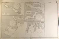
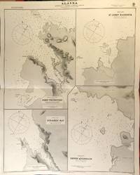
56417London: British Admiralty 1890 1925. . An engraved chart on heavy stock uncolored sheet size 27 x 34 inches. Published 2nd Aug. 1890; Small corrections printed to 1925 and mss. to 1927. Original horizontal fold a nice clean copy small additions in red pen. In lower right: "Engraved by Edwd. Weller". Chart number is 1433. Small typed label on verso giving chart & folio info. Published under the Superintendence of Captain W.J.L. Wharton. Four charts: Port Protection Steamer Bay St. John Harbour and Dewey Anchorage. Currently residents of Port Protection are featured in the National Geographic Channel reality series: Life Below Zero: Port Protection and its spinoff: Lawless Island. <br/><br/> London: British Admiralty, 1890 (1925). unknown
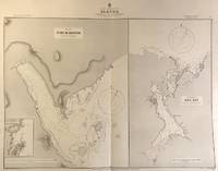
56416London: British Admiralty 1890 1924. . An engraved chart on heavy stock uncolored sheet size 33.5 x 27 inches. Published 11th Aug. 1890; Large Corrections to Aug. 1898; Small corrections printed to 1924 and mss. to 1927. Original vertical fold a nice clean copy small additions in red pen. In lower right: "Engraved by Edwd. Weller". Chart number is 1449. Small typed label on verso giving chart & folio info. Published under the Superintendence of Captain W.J.L. Wharton. Two large charts of anchorages: Port McArthur and Red Bay; the Port McArthur plan includes a small inset map of Port Conclusion. <br/><br/> London: British Admiralty, 1890 (1924). unknown
56393London: British Admiralty 1900 1924. . An engraved chart on heavy stock uncolored sheet size 27.5 x 20 inches. Published 29th May 1900; Large Corrections April 1905. Small corrections printed to 1924. Unfolded a nice clean copy. In lower right: "Engraved by Davies & Company". Chart number is 3136. Small typed label on verso giving chart & folio info. Published under the Superintendence of Rear Admiral Sir W.J.L. Wharton. Maps of four anchorages on Kodiak Island: Karluk Anchorage Larsens Bay Uyak Anchorage Shearwater Bay. <br/><br/> London: British Admiralty, 1900 (1924). unknown
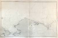
56479London: British Admiralty 1856 1932. An engraved chart on heavy stock uncolored sheet size 40 x 27.5 inches. Published Febr. 20th 1856; New Edition Dec. 1908. Large Corrections to Sept. 1932. Original vertical fold a very good copy some light wrinkling a few additions in red and some route marks in pencil. In lower right: "Engraved 1856". Chart number is 2435. Small typed label on verso giving chart & folio info. A large-scale chart extending from the Chukchi Peninsula in Asia to Liverpool Bay and Cape Bathurst in the Canadian Arctic. The course of the Mackenzie River is shown as well as the Porcupine River and Yukon River. The tip of Wrangell Island is shown at the left edge. <br/><br/> London: British Admiralty, 1856 (1932). unknown
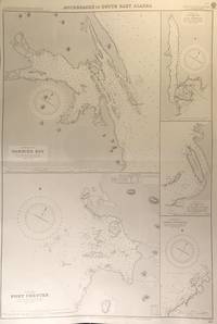
56413London: British Admiralty 1894 1928. . An engraved chart on heavy stock uncolored sheet size 27.5 x 40 inches. Published 6th August 1894; New Edition Aug. 1898; Large Corrections 14th Sept. 1928; Small corrections mss. to 1929. Clean and attractive original horizontal fold some small additions in red pen. In lower right: "Engraved by Edwd. Weller". Chart number is 2110. Small typed label on verso giving chart & folio info. Published under the Superintendence of Captain W.J.L. Wharton. Five anchorages in Frederick Sound and Clarence Strait: large plans of Gambier Bay and Port Chester; smaller plans of Woewodski and Eliza Harbours Fanshaw Bay and Cleveland Passage and Chasina Anchorage. First published 1894 this is a printing of 1928. <br/><br/> London: British Admiralty, 1894 (1928). unknown
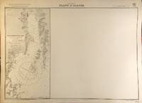
56394London: British Admiralty 1907 1930. . An engraved chart on heavy stock uncolored sheet size 27.5 x 20 inches. Published 22nd April 1907; Small corrections printed to 1930. Unfolded a nice clean copy some small marks in red pen. In lower right: "Engraved 1907" and "Zc 1930". Chart number is 3655. Small typed label on verso giving chart & folio info. Published under the Superintendence of Rear Admiral A. Mostyn Field. Much of this chart is blank; the left edge prints a map of Resurrection Bay showing Seward and the U.S. Naval Reservation. <br/><br/> London: British Admiralty, 1907 (1930). unknown
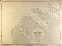
56398London: British Admiralty 1900 1929. . An engraved chart on heavy stock uncolored sheet size 27.5 x 20 inches. Published 13th July 1900; New Edition - Large Corrections 15th November 1929. Clean and attractive never folded. In lower right: "Engraved 1900" and "Zc 1929". Chart number is 3132. Small typed label on verso giving chart & folio info. Published under the Superintendence of Rear Admiral Sir W.J.L. Wharton. Saginaw Bay has recently 2019 been renamed to Skanax Bay following a petition from Tlingit tribal leaders complaining of its association with the 1869 Kake War during which a U.S. warship The Saginaw destroyed three Tlingit communities. <br/><br/> London: British Admiralty, 1900 (1929). unknown
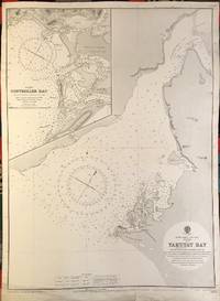
56391London: British Admiralty 1902 1922. . An engraved chart on heavy stock uncolored sheet size 20 x 27.5 inches. Published 13th Dec. 1902; New Edition 8th Jan. 1915. Small corrections printed to 1922 and mss. to 1929. Unfolded. Some wear and a short tears to lower margin basically clean and very good some revisions and additions in red pen. In lower right: "Engraved by Davies & Company". Chart number is 3313. Small typed label on verso giving chart & folio info. Published under the Superintendence of Rear Admiral Sir W.J.L. Wharton. Inset map of Controller Bay. Yakutat Bay has had various names; James Cook called it "Bering Bay" as indicated on this chart. Jean-François de La Pérouse who visited it in 1786 named it "Baie de Monti" for one of his officers; also in 1786 Captain Nathaniel Portlock named it "Admiralty Bay". The Spanish referred to it as "Almirantazgo" and it was also called "Port Mulgrave" when Alessandro Malaspina and José de Bustamante y Guerra sailed into the bay on their Malaspina Expedition 1789-94. <br/><br/> London: British Admiralty, 1902 (1922). unknown