Alaska Nautical ChartBiblio.com
1 282 résultats
56390London: British Admiralty 1907 1930. . An engraved chart on heavy stock uncolored sheet size 20 x 27.5 inches. Published 5th March 1907; New Edition 14th Feb. 1930. Clean and attractive never folded. In lower right: "Engraved 1907" and "Zc1930". Chart number is 3633. Small typed label on verso giving chart & folio info. Published under the Superintendence of Rear Admiral A. Mostyn Field. <br/><br/> London: British Admiralty, 1907 (1930). unknown
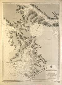
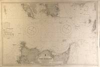
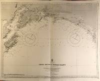
56389London: British Admiralty 1895 1925. An engraved chart on heavy stock uncolored sheet size 20 x 27.5 inches. Published 26th Aug. 1895; Large corrections to Nov. 1900; Small corrections printed to 1925 and mss. to 1930. Clean and attractive never folded some small additions in red pen. In lower right: "Engraved by Edwd. Weller". Chart number is 2337. Small typed label on verso giving chart & folio info. Published under the Superintendence of Rear Admiral W.J.L. Wharton. Sitka Sound was named Ensenada de Susto by Juan de la Bodega on 15 August 1775. It was later named Norfolk Sound by James Cook. In 1801 Fleurieu published a map naming it Baie Tchinkîtâné in an attempt to use Tlingit toponyms. <br/><br/> London: British Admiralty, 1895 (1925). unknown
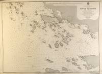
56397London: British Admiralty 1895 1925. . An engraved chart on heavy stock uncolored sheet size 20 x 27.5 inches. Published 30th Sept. 1895; Large Corrections Jan. 1898; Small corrections printed to 1925 and mss. to 1927. Some dust soiling at lower edge in general a nice clean copy a few additions in red pen. In lower right: "Engraved by Edwd. Waller". Chart number is 2348. Small typed label on verso giving chart & folio info. Published under the Superintendence of Rear Admiral W.J.L. Wharton. A detailed chart of the islands and coastal area around Sitka; the Sitka town plan indicates the Wireless Telephone Stn. Astronomical Stn. Indian Village and Mission. <br/><br/> London: British Admiralty, 1895 (1925). unknown
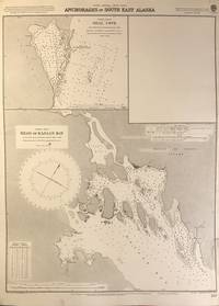
56402London: British Admiralty 1898 1925. An engraved chart on heavy stock uncolored sheet size 20 x 27.5 inches. Published 2nd Aug. 1898; New Edition Nov. 1921; Small corrections printed to 1925 and mss. to 1926. Clean and attractive never folded short tears to margin at lower right some small additions in red pen. In lower right: "Engraved by Davies & Company". Chart number is 837. Small typed label on verso giving chart & folio info. Published under the Superintendence of Rear Admiral Sir W.J.L. Wharton. Two maps: Seal Cove Gravina Island and Head of Kasaan Bay at Prince of Wales Island. <br/><br/> London: British Admiralty, 1898 (1925). unknown
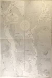
56415London: British Admiralty 1899 1930. . An engraved chart on heavy stock uncolored sheet size 27.5 x 40 inches. Published 20th Feb. 1899; New Edition 17th Jan. 1930. Original horizontal fold a clean and attractive copy some small additions in red pen. In lower right: "Engraved 1899" and "Zc 1930". Chart number is 3022. Small typed label on verso giving chart & folio info. Published under the Superintendence of Rear Admiral Sir W.J.L. Wharton. Divided vertically into two charts this extends from Frederick Sound to Sumner Strait showing the Lindenberg Peninsula Mitkof Island Woewodski Island. Previously known as Wrangell Strait this channel is 22 miles long. <br/><br/> London: British Admiralty, 1899 (1930). unknown
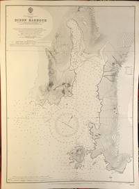
56409London: British Admiralty 1911 1924. An engraved chart on heavy stock uncolored sheet size 40 x 27.5 inches. Published 11th April 1911; New Edition 30th May 1921; Small corrections printed to 1924 and mss. to 1927. Original vertical fold clean and attractive some small additions in red pen. In lower right: "Engraved by Davies & Company". Chart number is 3754. Small typed label on verso giving chart & folio info. Published under the Superintendence of Rear Admiral H.E. Purey-Cust. Good detail of the northern end of Graham Island in the Haida Gwaii formerly Queen Charlotte Islands. The Dixon Entrance remains a contentious area today with ongoing disputes about the precise location of the boundary line between Canada and the USA. This 1924 map shows a dotted line just south of Prince of Wales Island with the text: "Approximate Boundary between British Columbia and Alaska". <br/><br/> London: British Admiralty, 1911 (1924). unknown
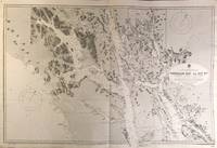
56418London: British Admiralty 1896 1925. . An engraved chart on heavy stock uncolored sheet size 46 x 28 inches. Published 15th Dec. 1896; Large Corrections to July 1907; Small corrections printed to 1925 and mss. to 1929. Original vertical folds a clean and attractive copy some small additions in red pen. In lower right: "Engraved by Davies & Compy.". Chart number is 2458. Small typed label on verso giving chart & folio info. Published under the Superintendence of Rear Admiral W.J.L. Wharton. A large and detailed chart extending from the Dixon Entrance north to Wrangell Island; the chart extends east to the Portland Canal and the edge of British Columbia including Observatory Inlet and Salmon Cove visited by Captain Vancouver in 1793 and so named because he set up his observatory there in order to calibrate the chronometers. Good detail of Prince of Wales Island and Clarence Strait. Originally published in 1896 this is a 1925 printing. <br/><br/> London: British Admiralty, 1896 (1925). unknown
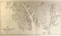
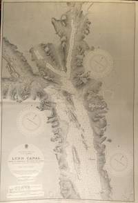
56427London: British Admiralty 1897 1925. . An engraved chart on heavy stock uncolored sheet size 40 x 27.5 inches. Published 6th March 1897; Large Corrections to June 1907; Small corrections printed to 1925 and mss. to 1930. Original vertical fold a clean and attractive copy some small additions in red pen. In lower right: "Engraved by Davies & Company". Chart number is 2462. Small typed label on verso giving chart & folio info. Published under the Superintendence of Rear Admiral W.J.L. Wharton. A highly detailed chart showing the north part of Admiralty Island and Chichagof Island Chatham Strait Glacier Bay; Inset map at the top: Continuation of Lynn Canal. Originally published 1897 this is an edition of 1925. <br/><br/> London: British Admiralty, 1897 (1925). unknown
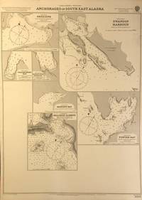
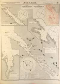
56401London: British Admiralty 1898 1920. An engraved chart on heavy stock uncolored sheet size 20 x 27.5 inches. Published 11th Nov. 1898; Large corrections to April 1904; Small corrections printed to 1920. Clean and attractive never folded some small additions in red pen. In lower right: "Engraved by Edwd. Weller". Chart number is 3008. Small typed label on verso giving chart & folio info. Published under the Superintendence of Rear Admiral Sir W.J.L. Wharton. Maps of seven anchorages at Lynn Canal Glacier Bay and Chatham Strait: Fritz Cove Swanson Harbour William Henry Bay Barlow Cove Anchorage Bartlett Bay Killisnoo Harbour and Funter Bay. <br/><br/> London: British Admiralty, 1898 (1920). unknown
56426London: British Admiralty 1898 1926. . An engraved chart on heavy stock uncolored sheet size 27.5 x 40 inches. Published 23rd July 1898; Large Corrections to 6th August 1926; Small corrections mss. to 1927. Original horizontal fold a clean and attractive copy some small additions in red pen. Some wrinkling of paper at centre but not very noticeable on the printed side. In lower right: "Engraved 1898." and "Zc 1926". Chart number is 2288. Small typed label on verso giving chart & folio info. Published under the Superintendence of Rear Admiral Sir W.J.L. Wharton. A detailed and attractive chart of this major inlet. <br/><br/> London: British Admiralty, 1898 (1926). unknown
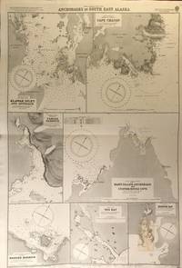
56419London: British Admiralty 1900 1925. An engraved chart on heavy stock uncolored sheet size 27.5 x 40 inches. Published 31st December 1900; New Edition January 1916; Small corrections printed to 1925 and mss. to 1927. Clean and attractive original horizontal fold some small additions in red pen. In lower right: "Engraved by Edwd. Weller". Chart number is 3138. Small typed label on verso giving chart & folio info. Published under the Superintendence of Rear Admiral Sir W.J.L. Wharton. Maps of seven anchorages: Klawak Inlet and Approach Cape Chacon Tamgas Harbour Mary Island Anchorage and Custom House Cove Hassler Harbour Yes Bay and Redfish Bay. Originally published in 1900 this is a 1925 printing. The small plan of Redfish Bay has corrections on a paste-over partly printed in red. Klawak is now known as Klawock and had a variety of names used by the Tlingit Klawerak Tlevak Clevak and Klawak. <br/><br/> London: British Admiralty, 1900 (1925) unknown
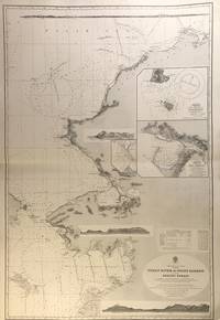
56407London: British Admiralty 1907 1928. An engraved chart on heavy stock uncolored sheet size 27.5 x 40 inches. Published 17th April 1907; New Edition Jan. 1923. Large Corrections 1st June 1928. Original horizontal fold a clean and attractive copy some small additions in red pen. Engraved shorelines in vignette. In lower right: "Malby & Sons". Chart number is 593. Small typed label on verso giving chart & folio info. Published under the Superintendence of Rear Admiral A. Mostyn Field. A large and detailed chart with inset maps of Chamisso and Port Clarence with an additional detailed inset of Port Clarence. From the Yukon River north to the Bering Strait Kotzebue Sound as far as Point Barrow on the coast of Alaska here designated as West Georgia. <br/><br/> London: British Admiralty, 1907 (1928). unknown
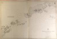
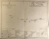
56420London: British Admiralty 1903 1929. . An engraved chart on heavy stock uncolored sheet size 40 x 27.5 inches. Published 23rd April 1903; New Edition 1st March 1929. Clean and attractive original vertical fold some small additions in red pen. In lower right: "Engraved 1903" and "Zc 1929". Chart number is 3336. Small typed label on verso giving chart & folio info. Published under the Superintendence of Rear Admiral Sir W.J.L. Wharton. A detailed chart of the Fox Islands Group in the Eastern Aleutians. <br/><br/> London: British Admiralty, 1903 (1929). unknown
56423London: British Admiralty 1890 1925. . An engraved chart on heavy stock uncolored sheet size 34 x 27 inches. Published 9th July 1890; Large Corrections Jan. 1908; Small corrections printed to 1925 and mss. to 1929. Clean and attractive original vertical fold some additions in red pen. In lower right: "Engraved by Davies & Company". Chart number is 1499. Small typed label on verso giving chart & folio info. Published under the Superintendence of Captain W.J.L. Wharton. The south coast of Alaska centered on Prince William Sound. First published 1890 this is a printing of 1925. <br/><br/> London: British Admiralty, 1890 (1925). unknown
56422London: British Admiralty 1890 1924. . An engraved chart on heavy stock uncolored sheet size 34 x 27 inches. Published 9th July 1890; New Edition 19th Jan. 1917. Small corrections printed to 1924 and mss. to 1929. Clean and attractive original vertical fold some additions in red pen. In lower right: "Engraved by Davies & Company". Chart number is 1500. Small typed label on verso giving chart & folio info. Published under the Superintendence of Captain W.J.L. Wharton. A detailed chart of the Aleutian Islands chain from Alaska to Seguam Island. Several engraved vignettes of shorelines at the bottom. Originally published 1890 this is a 1924 printing. <br/><br/> London: British Admiralty, 1890 (1924). unknown
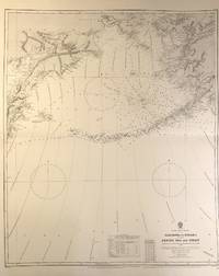
56408London: British Admiralty 1884 1928. . An engraved chart on medium stock uncolored sheet size 27 x 34 inches. Published 28th Oct. 1884; New Edition 15th Jan. 1923. Large Corrections 14th Sept. 1928. Original horizontal fold a clean and attractive copy some small additions in red pen. In lower right: "Engraved by Davies & Company". Chart number is 2460. Small typed label on verso giving chart & folio info. Published under the Superintendence of Captain W.J.L. Wharton. Good details of the Aleutian Islands and Bering Sea Eastern Siberia and the Bering Strait at the top. <br/><br/> London: British Admiralty, 1884 (1928). unknown
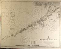
56421London: British Admiralty 1890 1928. . An engraved chart on heavy stock uncolored sheet size 34 x 27 inches. Published 9th July 1890; New Edition 28th Sept. 1928. Clean and attractive original vertical fold. In lower right: "Engraved 1890" and "Zc 1928". Chart number is 1501. Small typed label on verso giving chart & folio info. Published under the Superintendence of Captain W.J.L. Wharton. A detailed chart of the Aleutian islands including the Near Islands Rat Islands and Andreanof Islands groups. Included are nine small inset maps of harbours and anchorages on the various islands: Bay of Islands Korovin Bay Nazan Bay Bay of Waterfalls Suchikof Bay McDonald Bay Constantine Hr. Kiska Hr. and Chichagof Hr. Included in this chart are Attu Island and Kiska Island which were occupied by the Japanese during WW II. Two inset maps provide details of these islands: Chichagof Harbour on Attu Island and Kiska Harbour on Kiska Island. <br/><br/> London: British Admiralty, 1890 (1928). unknown
56396London: British Admiralty 1898 1924. . An engraved chart on heavy stock uncolored sheet size 20 x 27.5 inches. Published 22nd March 1898; Small corrections printed to 1924 and mss. to 1927. Unfolded. A nice clean copy. In lower right: "Engraved by Edwd. Weller". Chart number is 1524. Small typed label on verso giving chart & folio info. Published under the Superintendence of Rear Admiral Sir W.J.L. Wharton. Maps of Juneau Anchorage Wrangell Harbour Ratz Harbour Tongass Narrows and Tolstoi Bay. Upper right map Wrangell Harbour is corrected with a paste-over printed in black & red. <br/><br/> London: British Admiralty, 1898 (1924). unknown
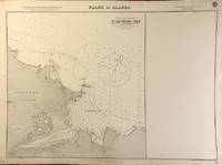
56403London: British Admiralty 1900 1923. . An engraved chart on heavy stock uncolored sheet size 27.5 x 20 inches. Published 10th Aug. 1900; New Edition July 1909; Small corrections printed to 1923. Unfolded. A nice clean copy. In lower right: "Engraved by Davies & Company". Chart number is 3143. Small typed label on verso giving chart & folio info. Published under the Superintendence of Rear Admiral Sir W.J.L. Wharton. One plan only of St. Michael Bay Norton Sound - South Shore St. Michael Island. <br/><br/> London: British Admiralty, 1900 (1923). unknown
193561878Stanford CA: Stanford University Press 1935. Hardcover. Very Good with no dust jacket. An on-the-ground investigation of the educational possibilities and needs of the native peoples of Alaska and an evaluation of the educational system so far 1934 provided for them. 472 pages 5 b/w plates many photos tables and drawings gatefold map edges rubbed and stained. Cover corners bumped spine ends rubbed "Kasigluk Alaska 1952" inked on pastedowns; 8 1/2 x 11 Stanford University Press hardcover
0930931114-7-1Alaska Natural History Association. Acceptable. The item might be beaten up but readable. May contain markings or highlighting as well as stains bent corners or any other major defect but the text is not obscured in any way. Alaska Natural History Association unknown
Z04B-04207Used - Very Good. Very Good condition. A copy that may have a few cosmetic defects. May also contain light spine creasing or a few markings such as an owner’s name short gifter’s inscription or light stamp. unknown
SONG0615196675Alaska Native Tribal Health Consortium 0000-00-00. spiral_bound. Used: Good. 0.00x0.00x0.00. Buy with confidence. Excellent Customer Service & Return policy. Alaska Native Tribal Health Consortium unknown
0615196675.Gspiral_bound. Good. Access codes and supplements are not guaranteed with used items. May be an ex-library book. unknown
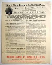
189729536New York 1897. Broadsheet 9 1/2" x 12". With a small oval half-tone portrait. On recto at the bottom printed in red: 'Norton Hall Granville N.Y. Thursday Eve. Dec. 30 1897". Near Fine.<br/><br/> A rare announcement of a public entertainment-- "Not a Lecture. But a Budget of Jewels Sparkling Pathetic Humorous and Original"-- by this popular Western hero who on his first outing as a reporter in 1875 did much to promote the Black Hills Gold Rush. John W. Crawford 1847-1917 was a "poet-scout" who memorialized Custer and Wild Bill Hickok in verse. He "was one of the original discoverers of gold on French Creek in the Black Hills in 1876." After a stint with Buffalo Bill's Wild West Show which he left when he accidentally shot himself in the groin blaming it on Buffalo Bill's drinking he moved to New Mexico to scout for the Army against the Apache. He "did more than any other man in the Territory in bringing before the public the immense mineral wealth of New Mexico."<br/> This broadsheet serves not only to publicize Captain Jack's Entertainment but also to promote "The Capt. Jack Crawford Alaska Prospecting and Mining Co." Testimonials to Crawford are printed here along with an invitation for the recipient to receive a Company prospectus.<br/>OCLC 778631567 2- Yale SMU as of March 2018. unknown books