Northwestern Alaska Chamber of CommerceBiblio.com
469 résultats
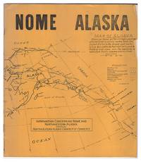
1932623955Northwestern Alaska Chamber of Commerce 1932. First Edition. Paperback. Good. Scarce Depression-era guidebook highlights the opportunities in Alaska centered upon Nome. The ads are of particular interest. A good copy in the original yellow pictorial wraps some creasing to covers and text short closed tears to edges. Illustrated in b/w. 40 pages : illustrations map portraits; 24 cm. Northwestern Alaska Chamber of Commerce paperback
3924Showing 21 international artist photographers with images printed using vegetable inks. Limited to 1000 copies worldwide hand numbered. Large format printing 48 x 28 cms white printed paper wrappers open stitch spine. Alaska Editions Spring-Summer 2008. unknown
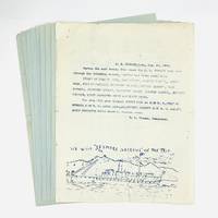
1908770201908. Significant collection of bulletins clarifying the route of the S.S. Spokane in the summer of 1908. Each is naively illustrated with views from the ship - Sitka Seymour Narrows Taku Glacier Patterson Glacier and Devil's Thumb - as well as Alaska Natives and even baseball.<br /> <br /> An elegant passenger liner the S.S. Spokane was constructed by the Pacific Coast Steamship Company. The vessel was launch in San Francisco in 1901 and made her first voyage to Seattle in 1902. A year later she had the distinction of transporting President Theodore Roosevelt and his party to Seattle. The Spokane was able to carry nearly 300 passengers at a time including 171 in first class.<br /> <br /> From these broadsides we learn the S.S. Spokane sailed from the Strait of Juan de Fuca and on to Kasaan Discovery Passage Queen Charlotte Sound and Juneau in August 1908. Three years later the ship was wrecked on an uncharted rock in Seymour Narrows with the loss of two lives. The Spokane was later raised and repaired returning to service in early 1912.<br /> <br /> Nine broadsides 8 1/2" x 11" or 280 x 215 mm printed on the recto only of the blue or white paper. Old folds with evidence of stapling to the upper left corner and some minor edgewear. unknown
0484743201.Ghardcover. Good. Access codes and supplements are not guaranteed with used items. May be an ex-library book. hardcover
1334248419.Gpaperback. Good. Access codes and supplements are not guaranteed with used items. May be an ex-library book. paperback
1892154137.Ghardcover. Good. Access codes and supplements are not guaranteed with used items. May be an ex-library book. hardcover
1330531051.Gpaperback. Good. Access codes and supplements are not guaranteed with used items. May be an ex-library book. paperback
1528568303.Ghardcover. Good. Access codes and supplements are not guaranteed with used items. May be an ex-library book. hardcover
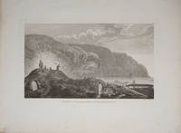
178522404London 1785. Very good condition. Copper engraved view of natives in traditional garb tending their kayaks at the water's edge. Drawn by John Webber and published in James Cook's third voyage around the world. 15 x 9 1/2" on large paper. unknown
1998Q-1570611009Sasquatch Books 1998-04-01. Paperback. New. In shrink wrap. Looks like an interesting title! Sasquatch Books paperback
0882409611.Ghardcover. Good. Access codes and supplements are not guaranteed with used items. May be an ex-library book. hardcover
0882401920.Gpaperback. Good. Access codes and supplements are not guaranteed with used items. May be an ex-library book. paperback
2021DADAX1797203223Chronicle Books 2021-11-09. hardcover. New. 6.35x1.00x8.25. Buy with confidence. Excellent Customer Service & Return policy. Chronicle Books hardcover
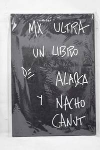
20162712919Madrid.: Caniche. 2016. Hardcover. Good. 30 cm. 80 80 p. il. Encuadernación en tapa dura de editorial ilustrada. Canut Ignacio 1957-. Texto manuscrito Olvido Gara. Recoge las fotografías de Nacho Canut y los comentarios manuscritos de Alaska a las mismas. Textos e imágenes en dos volúmenes independientes unidos por la cubierta posterior. México. Obras ilustradas. Libros ilustrados. Gara Olvido. 1963- . ISBN: 9788494516115 Fotografía. Canut Ignacio 77 Canut Ignacio 77 Descripción geográfico-histórica de un territorio una localidad. 721/727 908721/727 908 Caniche. hardcover
1995Q-0882404709Alaska Northwest Books 1995-11-01. Paperback. New. In shrink wrap. Looks like an interesting title! Alaska Northwest Books paperback
1995DADAX0882404709Brand: Alaska Northwest Books 1995-11-01. paperback. New. 8.56x0.43x9.02. Buy with confidence. Excellent Customer Service & Return policy. Brand: Alaska Northwest Books paperback
1527870219.Gpaperback. Good. Access codes and supplements are not guaranteed with used items. May be an ex-library book. paperback
2004Q-088240587xAlaska Northwest Books 2004-05-01. Paperback. New. In shrink wrap. Looks like an interesting title! Alaska Northwest Books paperback
1566610338.Gpaperback. Good. Access codes and supplements are not guaranteed with used items. May be an ex-library book. paperback
0882402102.Gpaperback. Good. Access codes and supplements are not guaranteed with used items. May be an ex-library book. paperback
0882402129.Gpaperback. Good. Access codes and supplements are not guaranteed with used items. May be an ex-library book. paperback
0882402153.Gpaperback. Good. Access codes and supplements are not guaranteed with used items. May be an ex-library book. paperback
2006Q-1574717235Creative Teaching Press 2006-06-30. Paperback. New. In shrink wrap. Looks like an interesting title! Creative Teaching Press paperback
0882401947.Gpaperback. Good. Access codes and supplements are not guaranteed with used items. May be an ex-library book. paperback
191656549Washington D.C. & Juneau A.T.: Superintendent of Documents U.S. Surveyor General’s Office 1916. Oblong Atlas Folio. 24 x 19 in. 14 colour maps 1 large folding 17.25 x 41.5 in. Printed softcovers stapled and paper reinforcement at gutter margin some minor toning & soiling to fore-edges edgewear to spine minor scuffing and a couple removed label ghosting still VG- bright copy. First edition of this remarkably scarce plat map atlas for the Matanuska coal fields and township sites surveyed by Walker & McDaniel during their surveys following those on the Kenai Peninsula. By 1912 with the act establishing Alaska as a U.S. Territory and in 1914 the authorization to construct an Alaska Railroad there became an increased need and demand for coal. The Matanuska mines located about 45 miles northeast of Anchorage first began production in 1916 and would stay in continuous production through both World War I and World War II and well into the 20th Century re-opening again in the 21st Century. Not only do these maps show available government lease sites for coal mines but also available Township sites for homesteaders as required by the original Homestead Acts of 1866 and the 1916 Act for Alaska requiring surveys and resurveys to accurately determine boundaries of unsold railroad lands and identify their boundaries. Worldcat locates 2 copies Anchorage Museum & Univ. of Calgary; See: Catalogue of the Public Documents of the Sixty-Fourth Congress Index Vol. 13 1922 p. 74; C. Albert White A History of the Rectangular Survey System 1983 p. 189. Superintendent of Documents, U.S. Surveyor General’s Office, paperback