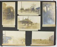
Catholic Woman's Club; Tampa, FloridaBiblio.com

364 résultats
19964829San Antonio Florida: Ralard Printers Inc. 1996. Facsimile reprint of the original cookbook published in 1925. NF. Soft cover book bound in printed wrappers. 26 cm. Unpaginated. Filled with vintage advertisements. In near fine condition. No writing/markings within the interior text. Light edge wear to the covers. Scarce. Ralard Printers, Inc. paperback
1990x-1850007608Falmer Pr 1990. Paperback. New. 2nd edition. 248 pages. 9.50x6.25x0.50 inches. Falmer Pr paperback
1990x-1850007594Falmer Pr 1990. Hardcover. New. 2nd sub edition. 242 pages. 9.75x6.50x0.50 inches. Falmer Pr hardcover
1993176144Ithaca New York.: Southeast Asia Program Publications. 1993. Colour frontispiece illustration and 5 black & white photographic illustrations. Maroon cloth covered boards lettered in gilt. 410pp top fore-edge faintly spotted otherwise a near fine copy. 25.5 x 17.5cm. 'This four-volume series on Javanese literature in Surakarta manuscripts describes the inscribed artifacts stored today in three indigenously consituted Surakarta libraries.' Volume I only. . Southeast Asia Program Publications. hardcover
2000180019Ithaca New York.: Southeast Asia Program Publications. 2000. Volume II only. Black and white photographic illustrations colour frontispiece 576pp bibliography indices upper corner a little creased a very good paperback copy. 25.3 x 18.4cm. Volume 2 of a 4 volume series on Javanese literature in Surakarta manuscripts describes the inscribed artifacts stored today in three indigenously consituted Surakarta libraries.' . Southeast Asia Program Publications. paperback
1993SONG0877276021Southeast Asia Program Publications 1993-01-01. Annotated. hardcover. Used: Good. 7.00x1.19x10.00. Buy with confidence. Excellent Customer Service & Return policy. Southeast Asia Program Publications hardcover
2000DADAX0877276048Southeast Asia Program Publications 2000-01-01. Annotated. paperback. New. 7.00x1.17x10.00. Buy with confidence. Excellent Customer Service & Return policy. Southeast Asia Program Publications paperback
1993DADAX087727603XCornell University Press 1993-01-01. Annotated. paperback. New. 7.00x0.94x10.00. Buy with confidence. Excellent Customer Service & Return policy. Cornell University Press paperback
1993DADAX0877276021Southeast Asia Program Publications 1993-01-01. Annotated. hardcover. New. 7.00x1.19x10.00. Buy with confidence. Excellent Customer Service & Return policy. Southeast Asia Program Publications hardcover
1993x-0877276021Southeast Asia Program Publications 1993. Hardcover. New. 1st edition. 410 pages. 10.20x7.30x0.90 inches. Southeast Asia Program Publications hardcover
1993x-087727603XCornell University Southeast Asia Program Publications 1993. Paperback. New. 1st edition. 410 pages. 9.90x7.20x0.80 inches. Cornell University Southeast Asia Program Publications paperback
2000x-0877276048Cornell University Southeast Asia Program Publications 2000. Paperback. New. 576 pages. 9.70x7.10x1.40 inches. Cornell University Southeast Asia Program Publications paperback
1966730070PN. New. 1966. Soft Cover. Date is original print. This is a reprint edition. . PN paperback
1966730071PN. New. 1966. Soft Cover. Date is original print. This is a reprint edition. . PN paperback
1999182125Tallahassee : Florida State University Museum of Fine Arts 1999. First Edition. Paperback. Fine copy in the original stiff-card wrappers. Particularly and surprisingly well-preserved; tight bright clean and especially sharp-cornered. Signed by the author. ; 8vo 8"" - 9"" tall; 80 pages; Physical desc.: 80 p. : ill. some col. ; 26 cm. Subject: Chicago Judy 1939- --Exhibitions --Feminism in art --Women in art --Women artists --United States --Exhibitions. Tallahassee : Florida State University Museum of Fine Arts paperback
191740733Washington D.C.: Published by the United States Coast and Geodetic Survey 1917. Large folding nautical chart printed on heavy paper stock. Colored. A rare original coastal survey of the south eastern Florida coastline from Boca Raton to Jupiter encompassing Lake Worth West Palm Beach and Delray Beach.<br/> <br/> Established by President Thomas Jefferson in 1807 as the Survey of the Coast the U.S. Coast and Geodetic Survey was the United States' first civilian scientific agency. This agency has followed its mission to survey the U.S. coastline create nautical charts of the coast and help increase maritime safety since its founding and has often played fascinating roles in significant chapters of U.S. history. It served in all theaters of the Civil War in the service of the Union Army and Navy pioneered acoustic exploration in the wake of the sinking of the Titanic and during WWI it worked to detect enemy submarines. In addition this agency worked to survey and produce detailed maps and renderings of the U.S. coast. These nautical survey maps commonly referred to as "T-sheets" provide fascinating insights into the history of the United States coastline which has and will continue to shift. These maps are the most important data source for understanding the physical and ecological characteristics of the U.S. shoreline. The present map is a highly detailed and accurate sea chart of the coast of southeast Florida and an important historical view of the developing state. Published by the United States Coast and Geodetic Survey unknown
192140714Washington D.C.: Published by the United States Coast and Geodetic Survey 1921. Large folding nautical sea chart printed on heavy paper stock. Colored. A rare coastal survey of Florida from Jupiter to Miami bisected into two parts including Jupiter West Palm Beach Boca Raton Pompano Beach Fort Lauderdale Hollywood Miami and Key Biscayne.<br/> <br/> Established by President Thomas Jefferson in 1807 as the Survey of the Coast the U.S. Coast and Geodetic Survey was the United States' first civilian scientific agency. This agency has followed its mission to survey the U.S. coastline create nautical charts of the coast and help increase maritime safety since its founding and has often played fascinating roles in significant chapters of U.S. history. It served in all theaters of the Civil War in the service of the Union Army and Navy pioneered acoustic exploration in the wake of the sinking of the Titanic and during WWI it worked to detect enemy submarines. In addition this agency worked to survey and produce detailed maps and renderings of the U.S. coast. These nautical survey maps commonly referred to as "T-sheets" provide fascinating insights into the history of the United States coastline which has and will continue to shift. These maps are the most important data source for understanding the physical and ecological characteristics of the U.S. shoreline. The present map is a highly detailed and accurate sea chart of the Florida coast from Jupiter to Miami and an important historical view the developing state. Published by the United States Coast and Geodetic Survey unknown
192140707Washington D.C.: Published by the United States Coast and Geodetic Survey 1921. Large folding nautical chart printed on heavy paper stock. Colored. A rare coastal survey of Florida from Jupiter to Miami bisected into two parts including Jupiter West Palm Beach Boca Raton Pompano Beach Fort Lauderdale Hollywood Miami and Key Biscayne.<br/> <br/> Established by President Thomas Jefferson in 1807 as the Survey of the Coast the U.S. Coast and Geodetic Survey was the United States' first civilian scientific agency. This agency has followed its mission to survey the U.S. coastline create nautical charts of the coast and help increase maritime safety since its founding and has often played fascinating roles in significant chapters of U.S. history. It served in all theaters of the Civil War in the service of the Union Army and Navy pioneered acoustic exploration in the wake of the sinking of the Titanic and during WWI it worked to detect enemy submarines. In addition this agency worked to survey and produce detailed maps and renderings of the U.S. coast. These nautical survey maps commonly referred to as "T-sheets" provide fascinating insights into the history of the United States coastline which has and will continue to shift. These maps are the most important data source for understanding the physical and ecological characteristics of the U.S. shoreline. The present map is a highly detailed and accurate sea chart of the Florida coast from Jupiter to Miami and an important historical view the developing state. Published by the United States Coast and Geodetic Survey unknown
1973357791International Exhibition Foundation 1973. First Edition. Hardcover. Good copy in the original title-blocked pictorial cloth. Slightest suggestion only of dust-dulling to the spine bands and panel edges. Remains well-preserved overall; tight bright clean and strong. Physical description; ix 151 p. : ill. some col. port. ; 28 cm. Notes; SIGNED and inscribed. Biog.; Exhibs.; Wks. in Colls. Bibl. Exhibiton circulated by the Interantional Exhibitions Foundation. Subjects; Karl Knaths. Painting. exhibition guides. Genre; Illustrated. International Exhibition Foundation hardcover
192240720Washington D.C.: Published by the United States Coast and Geodetic Survey 1922. Large folding nautical chart printed on heavy paper stock. Colored. A rare original coastal survey of Key West Harbor.<br/> <br/> Established by President Thomas Jefferson in 1807 as the Survey of the Coast the U.S. Coast and Geodetic Survey was the United States' first civilian scientific agency. This agency has followed its mission to survey the U.S. coastline create nautical charts of the coast and help increase maritime safety since its founding and has often played fascinating roles in significant chapters of U.S. history. It served in all theaters of the Civil War in the service of the Union Army and Navy pioneered acoustic exploration in the wake of the sinking of the Titanic and during WWI it worked to detect enemy submarines. In addition this agency worked to survey and produce detailed maps and renderings of the U.S. coast. These nautical survey maps commonly referred to as "T-sheets" provide fascinating insights into the history of the United States coastline which has and will continue to shift. These maps are the most important data source for understanding the physical and ecological characteristics of the U.S. shoreline. The present map of the Florida coastline is notable in displaying the Overseas Railroad as the only main land transportation link between the Keys. At the time this map was published the overseas highway had yet to be built and tourism and travel in the region was limited to boat or train. This map is a highly detailed and accurate sea chart of Key West and an important historical view of a developing Florida. Published by the United States Coast and Geodetic Survey unknown
191940697Washington D.C.: Published by the United States Coast and Geodetic Survey 1919. Large folding nautical chart printed on heavy paper stock. Colored. A rare coastal survey of Key West Harbor including Key West and several anchorage points for potential naval use complete with a U.S. Navy seal.<br/> <br/> Established by President Thomas Jefferson in 1807 as the Survey of the Coast the U.S. Coast and Geodetic Survey was the United States' first civilian scientific agency. This agency has followed its mission to survey the U.S. coastline create nautical charts of the coast and help increase maritime safety since its founding and has often played fascinating roles in significant chapters of U.S. history. It served in all theaters of the Civil War in the service of the Union Army and Navy pioneered acoustic exploration in the wake of the sinking of the Titanic and during WWI it worked to detect enemy submarines. In addition this agency worked to survey and produce detailed maps and renderings of the U.S. coast. These nautical survey maps commonly referred to as "T-sheets" provide fascinating insights into the history of the United States coastline which has and will continue to shift. These maps are the most important data source for understanding the physical and ecological characteristics of the U.S. shoreline. The present map is a highly detailed and accurate sea chart of Key West and an important historical view of a developing Florida. Published by the United States Coast and Geodetic Survey unknown
199239290München [u.a.] : List, 1992. 446 S. 8°. Dt. Ausg. Bibl.- Einbd.
197997797Marathon, Florida, Selbstverlag, 1979. 12 S. mit einigen Zeichnungen. 21 cm. OBroschur.
19095288Various locations mostly in Cuba and Florida: March 5 to April 1 1909. About very good. 21 leaves illustrated with 235 photographs all with typed captions. Oblong folio. Contemporary full dark brown cloth brad bound. Moderate staining and coiling to covers some edge wear. Bottom corners of all leaves chipped not costing content. Occasional minor wear to photos or captions. A well-organized and meticulously-captioned vernacular photograph album with significant content on Florida and Cuba in the first decade of the 20th century. The album is organized chronologically and features a family from Ohio traveling from home by train to Florida and thence to Cuba then returning home in the spring of 1909. The first seven and the last twenty-five photographs emanate from Ohio where the journey started Tennessee and Georgia but otherwise the album features Florida and Cuba in over 200 pictures. The scenes in Florida range from Jacksonville to Key West and other points in-between featuring the state in almost 120 photos both before and after the traveling party went to Cuba. The images capture portraits of the travelers numerous homes hotels businesses and other buildings including an ostrich farm in Jacksonville numerous scenes in Ocala including one image featuring "Mary and her old colored Mammy" various churches and other scenes in Tampa residences in Key West beach scenes at Long Key various hotels and agricultural fields in Miami and various buildings in Palm Beach Ormand and St. Augustine concluding with a front view of the "Old Slave Market" in the latter city.<br /> <br /> Most notably the album includes eighty-six photographs of Cuba the nexus point for the present trip where the party arrived on March 20. The Cuba scenes mostly feature Havana with several views of "Beautiful Residences" and other buildings plus some street views and other scenes in the city. Other interesting Havana scenes picture the railroad station "The Bone Yard -- Old destroyed Catacombs" scenes in the Malecon and more. Some of the street scenes in Havana picture local residents one of "Children on the street corner" and another showing "Children scrambling for pennies" in the middle of the street. The album also contains views of the wreck of the Maine Morro Castle the interior of Fort Cabanas and more. The travelers managed to wander outside Havana for a day when they ventured to the countryside and the town of Guines on March 23. While there the compiler took photographs of countryside outside Guines a railroad car full of sugar cane thatched houses a group photograph of the students at a "Spanish School in Guines" a "Child crying in the street" a group of locals outside a cafe captioned "Strangers in a strange land.Where we tried to get something to eat" other street scenes in the town and the local jail. The last photograph of Cuba here features a "Large Sugar Mill in Providencia." The group then returned through Florida Georgia and Tennessee where they spent a day at Lookout Mountain and Orchard Knob before their final stop in Dayton Ohio. A wonderful early-20th century travel album with significant views in Florida and Cuba. March 5 to April 1 unknown
1956705210PN. New. 1956. Soft Cover. Date is original print. This is a reprint edition. . PN paperback