Antiquariat.de
Merian: Florida.
199026290Hamburg, Hoffmann u. Campe Verlag, 1990. 43. Jahrgang, Heft 10. zahlr. teilw. farb. Abb., 1 Karte, 170 S., 4°, OBr.,

Alpen-Antiquariat · DE - München4,00 €
364 résultats
194190215Northpoint NY: Bacon Percy & Daggett 1941. Presumed First Edition First printing. Hardcover. Good. xx 202 pages. Illustrations. Maps. Chronology. Bibliography. Index. No dust jacket present. Some cover wear noted. Writing inside both covers. Some page soiling noted. This is one of the American Guide series. The cover title is "Guide to Miami and Environs". Foreword by Marjory Stoneman Douglas. The books in the series were to contain accurate and thorough accounts of American history according to a letter to State directors on the project. Each book's primary purpose was to not only outline the history of the individual states but the following as well: Geography Agriculture Tourist attractions Ethnic groups ArchitectureArts and Industry. Three different types of guides were published: state regional and city guides. Each guide had its own distinct features but followed the same uniform structure. The city guides had the most narrow scope out of all three types as the focus was on a single location. Because of this their maps could be in the greatest detail not only giving an overview of a city's layout but individual neighborhoods as well. City Guides highlighted points of special interest in greater detail. In the Philadelphia guide sites such as Carpenters' Hall and Girard College an-all boys boarding school in the city's northern section each had several pages dedicated to them. The maps that were included in each book added value to them as material objects and not just literature. With the increasing mobility afforded by the number of Americans who owned automobiles the guides served as reliable and durable resources for travelers moving throughout the country. The American Guide Series includes books and pamphlets published from 1937 to 1941 under the auspices of the Federal Writers' Project FWP a Depression-era program that was part of the larger Works Progress Administration in the United States. The American Guide Series books were compiled by the FWP but printed by individual states and contained detailed histories of each of the then 48 states of the Union with descriptions of every major city and town. The series not only detailed the histories of the 48 states but provided insight to their cultures as well. In total the project employed over 6000 writers. The format was uniform comprising essays on the state's history and culture descriptions of its major cities automobile tours of important attractions and a portfolio of photographs. Many books in the project have been updated by private companies or republished without updating. Although not then a state a guide for Alaska was published and also for Puerto Rico but not for Hawaii. If there had been room in Rocinante I would have packed the W.P.A. Guides to the States all forty-eight volumes of them.The complete set comprises the most comprehensive account of the United States ever got together and nothing since has approached it." — John Steinbeck Travels with Charley 1962. As part of the Federal Writers' Project established under the Emergency Relief Appropriation Act of 1935 and the Works Progress Administration over 6500 men and women were employed around the country as writers collecting stories interviews and photographs on a variety of subjects. The project attracted many unemployed writers and artists offering a wage of twenty dollars a week. President Franklin D. Roosevelt enlisted Henry Alsberg a journalist and playwright to head the project. As part of this the FWP developed and published a series of books that served as guides to the 48 existing states. Each book's primary purpose was to not only outline the history of the individual state but its culture and geography as well. Their predecessor Baedeker's Handbook for Travelers: United States lacked much of what was needed to give a picture of America during the 1930s. Alsberg insisted that the new series of books paint a picture of American culture as a whole and celebrate the nation's diversity. From 1937 to 1941 thousands of writers set out around the country to capture America's culture conducting fieldwork interviewing citizens and observing and recording folk traditions and local customs. Writers from all over the country sought to capture American culture during the Great Depression a difficult task given the dire circumstances. Alsberg tasked Benjamin A. Botkin a folklorist and scholar with running the folklore division of the project. Botkin was responsible for coordinating and managing the writers a task that was too large for Alsberg to handle as the volume of work coming in was plentiful for the project. In this role Botkin not only influenced the writers' folklore division but also had a great influence on their coverage of culture. The project's beginnings did not come without challenges. During its infancy various writers' organizations pressured the project because of the parameters that were set by the FWP. With the project bringing many established writers back into the workforce the Authors' Guild of America became aggressive in the pursuit of relaxing guidelines for the writers and also developed a disdain for the project's employment of writers with a lack of experience. With the FWP's main focus on creating jobs for the unemployed the Author's Guild and organizations similar to it continued to criticize the amateurism of many writers on the project. The solution to this critique was a simple one: find enough work for all of the writers. The roles of the writers enlisted to work on the project not only included their initial role as writers but also as photographers geographers and cartographers allowing the creation of additional white collar jobs. Bacon, Percy & Daggett hardcover
199026290Hamburg, Hoffmann u. Campe Verlag, 1990. 43. Jahrgang, Heft 10. zahlr. teilw. farb. Abb., 1 Karte, 170 S., 4°, OBr.,
198021880Hamburg, Hoffmann u. Campe Verlag, 1980. 33. Jahrgang, Heft 8. zahlr. teilw. farb. Abb., 1 Karte, 136 S., 4°, OBr.
199831258Hamburg, Hoffmann u. Campe Verlag, 1998. 51. Jahrgang, Heft 12. zahlr. teilw. farb. Abb., 1 Karte, 138 S., 4°, OBr.
199844365Hamurg, Hoffmann und Campe Verlag, 1998. 129 Seiten , 27 cm, kart.,
197840-13041Florida West Coast Symphony Orchestra 1978-01-01. Plastic Comb. Good. Used good. Florida West Coast Symphony Orchestra unknown
19681763373936ADAStuart Vincent & J.M.Watkins Ltd 1968. Hardcover. Good/Good. 1968. No Edition Remarks. 97 pages. Pictorial dust jacket over blue cloth. Pages have light tanning and foxing throughout. Pencil inscription to front free endpaper. Binding remains firm. Boards have light shelf-wear with corner bumping. Spine is in good condition. Unclipped jacket has light edgewear with tears and creasing. Light tanning to spine and edges. Foxing overall. Stuart (Vincent) & J.M.Watkins Ltd hardcover
1974x-0837170508Praeger Pub Text 1974. Hardcover. New. 145 pages. 8.70x5.80x0.60 inches. Praeger Pub Text hardcover
191740711Washington D.C.: Published by the United States Coast and Geodetic Survey 1917. Large folding nautical chart printed on heavy paper stock. Colored. A rare original coastal survey of Charlotte Harbor including Boca Grande and the Charlotte Harbor estuary Florida's second largest estuary and fabled home of mythical pirate Jose Gaspar during Florida's second Spanish period.<br/> <br/> Established by President Thomas Jefferson in 1807 as the Survey of the Coast the U.S. Coast and Geodetic Survey was the United States' first civilian scientific agency. This agency has followed its mission to survey the U.S. coastline create nautical charts of the coast and help increase maritime safety since its founding and has often played fascinating roles in significant chapters of U.S. history. It served in all theaters of the Civil War in the service of the Union Army and Navy pioneered acoustic exploration in the wake of the sinking of the Titanic and during WWI it worked to detect enemy submarines. In addition this agency worked to survey and produce detailed maps and renderings of the U.S. coast. These nautical survey maps commonly referred to as "T-sheets" provide fascinating insights into the history of the United States coastline which has and will continue to shift. These maps are the most important data source for understanding the physical and ecological characteristics of the U.S. shoreline. The present map is a highly detailed and accurate sea chart of Charlotte Harbor and an important historical view of a developing Florida. Published by the United States Coast and Geodetic Survey unknown
1997Star-9783540570783Springer 1997. Hardcover. New. Springer hardcover
1997Star-9783540570783Springer 1997. Hardcover. New. Springer hardcover
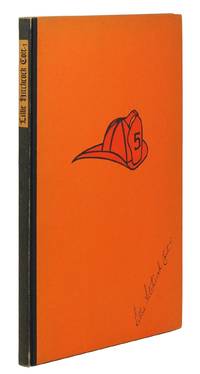
19351268631935. San Francisco: The Grabhorn Press 1935. <br /> <br /> 4to 47 pp. Quarter black fabric orange paper boards illustration of fire helmet to upper board paper label lettered in black to backstrip. Very good copy backstrip slightly rubbed and sunned contents clean.<br /> <br /> § One of 450 copies. Printed in black and orange illustrated with portraits and facsimile letters. An account by a friend of San Francisco's most famous volunteer firewoman the mascot of the Knickerbocker Company No. 5. A true gambling smoking San Francisco eccentric of the early years a bequest she left to the city was used to build Coit Tower on Telegraph Hill. unknown
191740688Washington D.C.: Published by the United States Coast and Geodetic Survey 1917. Nautical chart printed on heavy paper stock. Colored. A rare coastal survey of the coast from Tampa to Venice including Sarasota Bradenton Longboat Key and Siesta Key.<br/> <br/> Established by President Thomas Jefferson in 1807 as the Survey of the Coast the U.S. Coast and Geodetic Survey was the United States' first civilian scientific agency. This agency has followed its mission to survey the U.S. coastline create nautical charts of the coast and help increase maritime safety since its founding and has often played fascinating roles in significant chapters of U.S. history. It served in all theaters of the Civil War in the service of the Union Army and Navy pioneered acoustic exploration in the wake of the sinking of the Titanic and during WWI it worked to detect enemy submarines. In addition this agency worked to survey and produce detailed maps and renderings of the U.S. coast. These nautical survey maps commonly referred to as "T-sheets" provide fascinating insights into the history of the United States coastline which has and will continue to shift. These maps are the most important data source for understanding the physical and ecological characteristics of the U.S. shoreline. The present map is a highly detailed and accurate sea chart of the coast south of Tampa and an important historical view of a developing Florida. Published by the United States Coast and Geodetic Survey unknown
191740726Washington D.C.: Published by the United States Coast and Geodetic Survey 1917. Nautical chart printed on heavy paper stock. Uncolored with minor wear. A rare original coastal survey of the Legare Anchorage in Florida's Biscayne Bay with Elliot Key and Sands Key.<br/> <br/> Established by President Thomas Jefferson in 1807 as the Survey of the Coast the U.S. Coast and Geodetic Survey was the United States' first civilian scientific agency. This agency has followed its mission to survey the U.S. coastline create nautical charts of the coast and help increase maritime safety since its founding and has often played fascinating roles in significant chapters of U.S. history. It served in all theaters of the Civil War in the service of the Union Army and Navy pioneered acoustic exploration in the wake of the sinking of the Titanic and during WWI it worked to detect enemy submarines. In addition this agency worked to survey and produce detailed maps and renderings of the U.S. coast. These nautical survey maps commonly referred to as "T-sheets" provide fascinating insights into the history of the United States coastline which has and will continue to shift. These maps are the most important data source for understanding the physical and ecological characteristics of the U.S. shoreline. The present map is a highly detailed and accurate sea chart of the Biscayne Bay region and an important historical view of a developing Florida. Published by the United States Coast and Geodetic Survey unknown
1956705210PN. New. 1956. Soft Cover. Date is original print. This is a reprint edition. . PN paperback
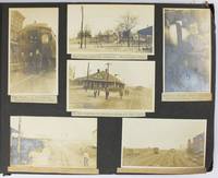
19095288Various locations mostly in Cuba and Florida: March 5 to April 1 1909. About very good. 21 leaves illustrated with 235 photographs all with typed captions. Oblong folio. Contemporary full dark brown cloth brad bound. Moderate staining and coiling to covers some edge wear. Bottom corners of all leaves chipped not costing content. Occasional minor wear to photos or captions. A well-organized and meticulously-captioned vernacular photograph album with significant content on Florida and Cuba in the first decade of the 20th century. The album is organized chronologically and features a family from Ohio traveling from home by train to Florida and thence to Cuba then returning home in the spring of 1909. The first seven and the last twenty-five photographs emanate from Ohio where the journey started Tennessee and Georgia but otherwise the album features Florida and Cuba in over 200 pictures. The scenes in Florida range from Jacksonville to Key West and other points in-between featuring the state in almost 120 photos both before and after the traveling party went to Cuba. The images capture portraits of the travelers numerous homes hotels businesses and other buildings including an ostrich farm in Jacksonville numerous scenes in Ocala including one image featuring "Mary and her old colored Mammy" various churches and other scenes in Tampa residences in Key West beach scenes at Long Key various hotels and agricultural fields in Miami and various buildings in Palm Beach Ormand and St. Augustine concluding with a front view of the "Old Slave Market" in the latter city.<br /> <br /> Most notably the album includes eighty-six photographs of Cuba the nexus point for the present trip where the party arrived on March 20. The Cuba scenes mostly feature Havana with several views of "Beautiful Residences" and other buildings plus some street views and other scenes in the city. Other interesting Havana scenes picture the railroad station "The Bone Yard -- Old destroyed Catacombs" scenes in the Malecon and more. Some of the street scenes in Havana picture local residents one of "Children on the street corner" and another showing "Children scrambling for pennies" in the middle of the street. The album also contains views of the wreck of the Maine Morro Castle the interior of Fort Cabanas and more. The travelers managed to wander outside Havana for a day when they ventured to the countryside and the town of Guines on March 23. While there the compiler took photographs of countryside outside Guines a railroad car full of sugar cane thatched houses a group photograph of the students at a "Spanish School in Guines" a "Child crying in the street" a group of locals outside a cafe captioned "Strangers in a strange land.Where we tried to get something to eat" other street scenes in the town and the local jail. The last photograph of Cuba here features a "Large Sugar Mill in Providencia." The group then returned through Florida Georgia and Tennessee where they spent a day at Lookout Mountain and Orchard Knob before their final stop in Dayton Ohio. A wonderful early-20th century travel album with significant views in Florida and Cuba. March 5 to April 1 unknown
197997797Marathon, Florida, Selbstverlag, 1979. 12 S. mit einigen Zeichnungen. 21 cm. OBroschur.
199239290München [u.a.] : List, 1992. 446 S. 8°. Dt. Ausg. Bibl.- Einbd.
192240720Washington D.C.: Published by the United States Coast and Geodetic Survey 1922. Large folding nautical chart printed on heavy paper stock. Colored. A rare original coastal survey of Key West Harbor.<br/> <br/> Established by President Thomas Jefferson in 1807 as the Survey of the Coast the U.S. Coast and Geodetic Survey was the United States' first civilian scientific agency. This agency has followed its mission to survey the U.S. coastline create nautical charts of the coast and help increase maritime safety since its founding and has often played fascinating roles in significant chapters of U.S. history. It served in all theaters of the Civil War in the service of the Union Army and Navy pioneered acoustic exploration in the wake of the sinking of the Titanic and during WWI it worked to detect enemy submarines. In addition this agency worked to survey and produce detailed maps and renderings of the U.S. coast. These nautical survey maps commonly referred to as "T-sheets" provide fascinating insights into the history of the United States coastline which has and will continue to shift. These maps are the most important data source for understanding the physical and ecological characteristics of the U.S. shoreline. The present map of the Florida coastline is notable in displaying the Overseas Railroad as the only main land transportation link between the Keys. At the time this map was published the overseas highway had yet to be built and tourism and travel in the region was limited to boat or train. This map is a highly detailed and accurate sea chart of Key West and an important historical view of a developing Florida. Published by the United States Coast and Geodetic Survey unknown
191940697Washington D.C.: Published by the United States Coast and Geodetic Survey 1919. Large folding nautical chart printed on heavy paper stock. Colored. A rare coastal survey of Key West Harbor including Key West and several anchorage points for potential naval use complete with a U.S. Navy seal.<br/> <br/> Established by President Thomas Jefferson in 1807 as the Survey of the Coast the U.S. Coast and Geodetic Survey was the United States' first civilian scientific agency. This agency has followed its mission to survey the U.S. coastline create nautical charts of the coast and help increase maritime safety since its founding and has often played fascinating roles in significant chapters of U.S. history. It served in all theaters of the Civil War in the service of the Union Army and Navy pioneered acoustic exploration in the wake of the sinking of the Titanic and during WWI it worked to detect enemy submarines. In addition this agency worked to survey and produce detailed maps and renderings of the U.S. coast. These nautical survey maps commonly referred to as "T-sheets" provide fascinating insights into the history of the United States coastline which has and will continue to shift. These maps are the most important data source for understanding the physical and ecological characteristics of the U.S. shoreline. The present map is a highly detailed and accurate sea chart of Key West and an important historical view of a developing Florida. Published by the United States Coast and Geodetic Survey unknown
1973357791International Exhibition Foundation 1973. First Edition. Hardcover. Good copy in the original title-blocked pictorial cloth. Slightest suggestion only of dust-dulling to the spine bands and panel edges. Remains well-preserved overall; tight bright clean and strong. Physical description; ix 151 p. : ill. some col. port. ; 28 cm. Notes; SIGNED and inscribed. Biog.; Exhibs.; Wks. in Colls. Bibl. Exhibiton circulated by the Interantional Exhibitions Foundation. Subjects; Karl Knaths. Painting. exhibition guides. Genre; Illustrated. International Exhibition Foundation hardcover
191740733Washington D.C.: Published by the United States Coast and Geodetic Survey 1917. Large folding nautical chart printed on heavy paper stock. Colored. A rare original coastal survey of the south eastern Florida coastline from Boca Raton to Jupiter encompassing Lake Worth West Palm Beach and Delray Beach.<br/> <br/> Established by President Thomas Jefferson in 1807 as the Survey of the Coast the U.S. Coast and Geodetic Survey was the United States' first civilian scientific agency. This agency has followed its mission to survey the U.S. coastline create nautical charts of the coast and help increase maritime safety since its founding and has often played fascinating roles in significant chapters of U.S. history. It served in all theaters of the Civil War in the service of the Union Army and Navy pioneered acoustic exploration in the wake of the sinking of the Titanic and during WWI it worked to detect enemy submarines. In addition this agency worked to survey and produce detailed maps and renderings of the U.S. coast. These nautical survey maps commonly referred to as "T-sheets" provide fascinating insights into the history of the United States coastline which has and will continue to shift. These maps are the most important data source for understanding the physical and ecological characteristics of the U.S. shoreline. The present map is a highly detailed and accurate sea chart of the coast of southeast Florida and an important historical view of the developing state. Published by the United States Coast and Geodetic Survey unknown
192140714Washington D.C.: Published by the United States Coast and Geodetic Survey 1921. Large folding nautical sea chart printed on heavy paper stock. Colored. A rare coastal survey of Florida from Jupiter to Miami bisected into two parts including Jupiter West Palm Beach Boca Raton Pompano Beach Fort Lauderdale Hollywood Miami and Key Biscayne.<br/> <br/> Established by President Thomas Jefferson in 1807 as the Survey of the Coast the U.S. Coast and Geodetic Survey was the United States' first civilian scientific agency. This agency has followed its mission to survey the U.S. coastline create nautical charts of the coast and help increase maritime safety since its founding and has often played fascinating roles in significant chapters of U.S. history. It served in all theaters of the Civil War in the service of the Union Army and Navy pioneered acoustic exploration in the wake of the sinking of the Titanic and during WWI it worked to detect enemy submarines. In addition this agency worked to survey and produce detailed maps and renderings of the U.S. coast. These nautical survey maps commonly referred to as "T-sheets" provide fascinating insights into the history of the United States coastline which has and will continue to shift. These maps are the most important data source for understanding the physical and ecological characteristics of the U.S. shoreline. The present map is a highly detailed and accurate sea chart of the Florida coast from Jupiter to Miami and an important historical view the developing state. Published by the United States Coast and Geodetic Survey unknown
192140707Washington D.C.: Published by the United States Coast and Geodetic Survey 1921. Large folding nautical chart printed on heavy paper stock. Colored. A rare coastal survey of Florida from Jupiter to Miami bisected into two parts including Jupiter West Palm Beach Boca Raton Pompano Beach Fort Lauderdale Hollywood Miami and Key Biscayne.<br/> <br/> Established by President Thomas Jefferson in 1807 as the Survey of the Coast the U.S. Coast and Geodetic Survey was the United States' first civilian scientific agency. This agency has followed its mission to survey the U.S. coastline create nautical charts of the coast and help increase maritime safety since its founding and has often played fascinating roles in significant chapters of U.S. history. It served in all theaters of the Civil War in the service of the Union Army and Navy pioneered acoustic exploration in the wake of the sinking of the Titanic and during WWI it worked to detect enemy submarines. In addition this agency worked to survey and produce detailed maps and renderings of the U.S. coast. These nautical survey maps commonly referred to as "T-sheets" provide fascinating insights into the history of the United States coastline which has and will continue to shift. These maps are the most important data source for understanding the physical and ecological characteristics of the U.S. shoreline. The present map is a highly detailed and accurate sea chart of the Florida coast from Jupiter to Miami and an important historical view the developing state. Published by the United States Coast and Geodetic Survey unknown
1999182125Tallahassee : Florida State University Museum of Fine Arts 1999. First Edition. Paperback. Fine copy in the original stiff-card wrappers. Particularly and surprisingly well-preserved; tight bright clean and especially sharp-cornered. Signed by the author. ; 8vo 8"" - 9"" tall; 80 pages; Physical desc.: 80 p. : ill. some col. ; 26 cm. Subject: Chicago Judy 1939- --Exhibitions --Feminism in art --Women in art --Women artists --United States --Exhibitions. Tallahassee : Florida State University Museum of Fine Arts paperback