403 résultats
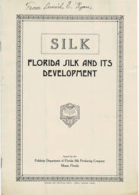
1920100096Miami Florida: Publicity Department of Florida Silk Producing Company circa 1920's. 1920's. Very good. - Octavo 10 inches high by 7 inches wide. Softcover bound in stapled off-white wraps titled & decorated in black. The front cover is lightly soiled & creased. 8 unnumbered pages including the covers with 2 full-page black & white illustrations. "From Daniel E. Ryan" is written in ink at the top of the cover. The brochure is folded twice vertically & horizontally. Very good. <p>A RARE promotional brochure for the Florida Silk Producing Company formed by Dr. Thomas DePamphilis using his special process. We have located no other copies of the brochure.<p>Laid into the brochure is a 2-page broadsheet by the fiscal agents Goodyear-Baker Company titled "The Investment Possibilities of Growing Silk in Florida".<p>The company is mentioned as seeking investment in the September 30 1924 issue of the Springfield News-Sun of Springfield Ohio. Miami, Florida: Publicity Department of Florida Silk Producing Company, circa [1920's]. paperback
1993267559PN. New. 1993. Soft Cover. Date is original print. This is a reprint edition . PN paperback
191640731Washington D.C.: Published by the United States Coast and Geodetic Survey 1916. Large folding nautical chart printed on heavy paper stock. Uncolored with minor wear. A rare original coastal survey of Florida along Everglades National Park and including Marco Island.<br/> <br/> Established by President Thomas Jefferson in 1807 as the Survey of the Coast the U.S. Coast and Geodetic Survey was the United States' first civilian scientific agency. This agency has followed its mission to survey the U.S. coastline create nautical charts of the coast and help increase maritime safety since its founding and has often played fascinating roles in significant chapters of U.S. history. It served in all theaters of the Civil War in the service of the Union Army and Navy pioneered acoustic exploration in the wake of the sinking of the Titanic and during WWI it worked to detect enemy submarines. In addition this agency worked to survey and produce detailed maps and renderings of the U.S. coast. These nautical survey maps commonly referred to as "T-sheets" provide fascinating insights into the history of the United States coastline which has and will continue to shift. These maps are the most important data source for understanding the physical and ecological characteristics of the U.S. shoreline. The present map is a highly detailed and accurate sea chart of the Everglades National Park and an important historical view of a developing Florida. Published by the United States Coast and Geodetic Survey unknown
192961407bdN.l.: Florida Federation of ARts 1929. Single sheet 6.5 x 10.5 inches folded into six panels. Lists 46 artists and 111 of their contributions. Among the artists are Emmaline Buchholz Gainesville; Mark Dixon Dodd St. Petersburg; Rachel Lazarus Coral Gables; Emma Sears Marsh Mount Dora and Hazel W. Ward Tampa. Fine. Florida Federation of ARts, 1929. unknown books
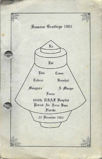
19639099Cocoa Beach Florida 1963. Octavo-sized metal post binding 21.5 x 14 cm 100 leaves printed rectos only. Illustrated. Author title and publication information from cover. A community cookbook with recipes attributed from the airmen and airmen's spouses living at Patrick Air Force. Patrick AFB is a significant location in the history of the American space program and 1963 just two years after the first manned space flight Gagarin and the first human-piloted space flight Shephard. Patrick Air Force base is now Space Launch 45 "the premier launch delta of the United States Space Force." Thor and Atlas Missiles as well as the Titan Booster were the stock in trade of PAFB from the time of this cookbook through the 1980s. The illustration of a space capsule on the front wrapper panel is of a Mercury capsule the capsule that carried John Glenn on the first American orbital flight in 1962. A bit of light soiling otherwise fine in publisher's gray card stock titled and illustrated in black. Unrecorded. OCLC locates no copies; no other references found online or otherwise. unknown
19621500Richmond, Va. Effective April 29, 1962. 12 folded pages. With illustrations and a map. 23x20 cm. Good condition.
1986x-0471826456Wiley-Interscience 1986. Hardcover. New. 1st edition. 594 pages. 10.00x7.00x1.50 inches. Wiley-Interscience hardcover
191840725Washington D.C.: Published by the United States Coast and Geodetic Survey 1918. Large folding nautical chart printed on heavy paper stock. Colored. A rare original coastal survey of the far Lower Keys region including Marquesas Keys and Boca Grande Key.<br/> <br/> Established by President Thomas Jefferson in 1807 as the Survey of the Coast the U.S. Coast and Geodetic Survey was the United States' first civilian scientific agency. This agency has followed its mission to survey the U.S. coastline create nautical charts of the coast and help increase maritime safety since its founding and has often played fascinating roles in significant chapters of U.S. history. It served in all theaters of the Civil War in the service of the Union Army and Navy pioneered acoustic exploration in the wake of the sinking of the Titanic and during WWI it worked to detect enemy submarines. In addition this agency worked to survey and produce detailed maps and renderings of the U.S. coast. These nautical survey maps commonly referred to as "T-sheets" provide fascinating insights into the history of the United States coastline which has and will continue to shift. These maps are the most important data source for understanding the physical and ecological characteristics of the U.S. shoreline. The present map is a highly detailed and accurate sea chart of the Lower Keys region and an important historical view of a developing Florida. Published by the United States Coast and Geodetic Survey unknown
19952202210082xbvkBerlin, NAU-Verlag, 1995. 2 dreiblattgrosse doppelt gefaltete Original-Siebdrucke mit 2 doppelblattgr. Seidenschutzblättern, 11 ganzseitige und 1 gefaltete-doppelblattgr. einseitig bedruckte Farbtafeln von abstrakten Ölgemälden Kuckeis, 1 gefalt. doppelbl.-gr. einseitig bedr. fotografische Bildtafel mit 18 Aufnahmen während der Arbeit und einer Ausstellung in San Francisco; 1 doppelt gefalt. beidseitig bedr. dreiblattgr. Textkarton in chinesischer, englischer und deutscher Sprache 'On Peter Kuckei' by Yan Geling, 1 Bl. Kolophon; alles auf 2 unterschiedlichen (Grafik / Bildtafeln) Künstlerkartons gedruckt. - Zusammen lose in den Grafiken entsprechend illustrierter Karton-Mappe mit Innenklappen und Deckeltitel; Folio (ca. 40 x 28,5 cm; ca. 1 kg.).
191640684Washington D.C.: Published by the United States Coast and Geodetic Survey 1916. Nautical chart printed on heavy paper stock. Colored. A rare coastal survey of Florida from Venice Beach to Fort Myers including Cape Coral Boca Grande and Port Charlotte.<br/> <br/> Established by President Thomas Jefferson in 1807 as the Survey of the Coast the U.S. Coast and Geodetic Survey was the United States' first civilian scientific agency. This agency has followed its mission to survey the U.S. coastline create nautical charts of the coast and help increase maritime safety since its founding and has often played fascinating roles in significant chapters of U.S. history. It served in all theaters of the Civil War in the service of the Union Army and Navy pioneered acoustic exploration in the wake of the sinking of the Titanic and during WWI it worked to detect enemy submarines. In addition this agency worked to survey and produce detailed maps and renderings of the U.S. coast. These nautical survey maps commonly referred to as "T-sheets" provide fascinating insights into the history of the United States coastline which has and will continue to shift. These maps are the most important data source for understanding the physical and ecological characteristics of the U.S. shoreline. The present map is a highly detailed and accurate sea chart of the Fort Myers area and an important historical view of a developing Florida. Published by the United States Coast and Geodetic Survey unknown
191640695Washington D.C.: Published by the United States Coast and Geodetic Survey 1916. Large folding nautical chart printed on heavy paper stock. Uncolored. A rare coastal survey of the Fort Myers area including the San Carlos Bay Caloosahatchee River Cape Coral Sanibel Island and Fort Myers Beach.<br/> <br/> Established by President Thomas Jefferson in 1807 as the Survey of the Coast the U.S. Coast and Geodetic Survey was the United States' first civilian scientific agency. This agency has followed its mission to survey the U.S. coastline create nautical charts of the coast and help increase maritime safety since its founding and has often played fascinating roles in significant chapters of U.S. history. It served in all theaters of the Civil War in the service of the Union Army and Navy pioneered acoustic exploration in the wake of the sinking of the Titanic and during WWI it worked to detect enemy submarines. In addition this agency worked to survey and produce detailed maps and renderings of the U.S. coast. These nautical survey maps commonly referred to as "T-sheets" provide fascinating insights into the history of the United States coastline which has and will continue to shift. These maps are the most important data source for understanding the physical and ecological characteristics of the U.S. shoreline. The present map is a highly detailed and accurate sea chart of Fort Myers area and an important historical view of a developing Florida. Published by the United States Coast and Geodetic Survey unknown
198058230Marceline MO: Military Division Walsworth Publishing Company 1980. Hardcover. Very good. No dust jacket as issued. Three photographs laid in two of formation one of three female trainees. Includes illustrations. Partially paginated approximately 100 pages. Some illustrations in color. Title from cover. Logo on front cover in gold with a crossed sword and rifle. Commissioned on July 1 1968 the Naval Training Center Orlando Florida was established to enhance the manpower training capabilities of the United States Navy. It is not coincidential that it was established during the height of the Vietnam War which saw a significant increase in the membership of the Arms Forces. This training facility occupied the site of the former Orlando Air Force Base. Women began training in Orlando in 1972. This was published in 1980. This version is specific to Traning Unit 3105 which spent June 1980 to August 1980 at the training facility. Military Division, Walsworth Publishing Company hardcover
19802111260492xbvkBerlin, Staatliche Kunsthalle, 1980. 397 Seiten, auf mattem Kunstdruckpapier, durchgehend teils farbig bebildert. - Farbig illustrierter kartonierter Originalumschlag mit Deckel- und Rückentitel; gr.-4to.(ca. 32 x 24 x 2 cm; ca. 1,9 kg.).
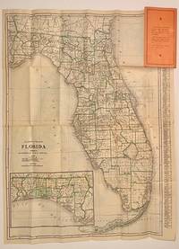
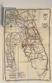
19274918Chicago: Clason Map Company 1927. Fold-out map 71 cm x 53 cm housed in pink printed wrappers 18.5 cm. Map is in nice condition and printed on both sides. Early touring map of Florida. Covers print an advertisement for 'Bank of Mt. Dora - Mt. Dora Florida. Printed on the inside cover is a calendar for 1926 and 1927. Mt. Dora is located on the 'Best Roads' side in red.<br/><br/>One side prints: 'Mileage Map of the Best Roads of Florida.' Index of larger cities at the foot with locating coordinates and population figures for 1925. Inset map of the Florida Panhandle at the lower left. This map locates roads and highways: Atlantic Highway; Bee Line Highway; Dixie Highway; Florida Short Route; Lee-Jackson Highway; National Highway; Old Spanish Trail; Tamiami Trail; Woodpecker Route.<br/><br/>Reverse prints: 'Clason's Guide Map of Florida.' This map locates county boundaries county seats Native American reservations national forests rail lines and main roads. Inset map of the Florida Panhandle at the lower left. Town index at right with locating coordinates. Clason Map Company unknown books
1970049442Bochum., 1970. 225 Seiten und IV Luftbilder. Reihe: Materialien zur Raumordnung herausgegeben vom Geographischen Institut der Ruhr-Universität Bochum - Forschungsabteilung für Raumordnung, Band XIII. Zustand: Aus einer Institutsbibliothek ausgeschieden, unterer Rücken mit Aufkleber (Gewebestreifen), Titelblatt mit Bibliotheksstempel. 4°. S OBroschur mit kl. Leinenstreif
1961648221961. CLEMSON Floride. A Rebel Came Home: The Diary of Floride Clemson Tells of Her Wartime Adventures in Yankeeland 1863-64 Her Trip Home to South Carolina and Life in the South during the Last Few Months of the Civil War and the Year Following. Edited by Charles M. McGee Jr. and Ernest M. Lander Jr. Columbia: University of South Carolina Press 1961. 1st ed. xiv153pp. Portrait frontis. illus. portraits maps. orig. cloth non-priceclipped d/j. A very good or better copy. "An interesting and well-edited diary" Nevins II p. 195. . unknown
19264916Chicago: Rand McNally & Company 1926. Fold-out map 45 cm x 35 cm housed in small blue printed wrappers 13 cm. Map is in nice condition. Early touring map of Florida. Map locates main and secondary routes paved improved graded and unimproved. Main towns are also located. Covers print an advertisement for 'Merchants Bank & Trust Company of Daytona Florida' Reverse prints a descending and progressive list of deposits in five year increments beginning with 1897. Rand McNally & Company unknown books
1988x-1850003815Falmer Pr 1988. Paperback. New. 1st edition. 228 pages. 9.25x6.25x0.50 inches. Falmer Pr paperback
1989x-1850003807Falmer Pr 1989. Hardcover. New. 1st edition. 275 pages. 9.75x6.50x0.75 inches. Falmer Pr hardcover
199506041scsN.1.: Florida State Horticutural Society 1995. Quarto softbound xvi 450 pp iv pp. Photos illus. Articles for: Citrus Garden & Landscape Handling & Processing Ornamentals and Vegetables. Fine. Florida State Horticutural Society, 1995. paperback books
1985773987PN. New. 1985. Soft Cover. Date is original print. This is a reprint edition. . PN paperback
1994437129PN. New. 1994. Soft Cover. Date is original print. This is a reprint edition. . PN paperback
1992253533PN. New. 1992. Soft Cover. Date is original print. This is a reprint edition . PN paperback
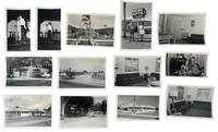
1953233181953. Clearwater Beach tourism photo archive photographed by George Fulmer documenting midcentury Gulf Coast visitor commerce through motel courts apartment lodgings seasonal rate signs furnished rental interiors restaurant frontage retail display and weekend entertainment in 1953 and 1955. Fulmer's assignments record Clearwater during the postwar automobile travel boom when Florida beach towns competed for motorists through inexpensive overnight lodging visible roadside pricing furnished efficiency rooms seafood restaurants and short-stay leisure promotion. The archive preserves the commercial visual language used to attract travelers to Florida's Gulf Coast at the height of early Sunbelt expansion before high-rise redevelopment transformed much of Clearwater Beach. The named studio envelopes and coordinated commercial assignments give the group unusual specificity tying Clearwater's resort economy to identifiable businesses dated jobs and seasonal advertising practices by notable city photographer George Fulmer.<br /> <br /> Photo archive of 40 items including 19 silver gelatin prints with 21 accompanying original and duplicate large format negatives ranging from 3 x 4 to 4 x 5 inches Clearwater Beach and Clearwater Florida 1953-1955. The archive is comprised of some original and some duplicate images between the negatives and photographs. Nine original George Fulmer studio envelopes identify assignments including "Pelican Restaurant" "City Beach Pump House" "Signs Beach Apts." "Wallace Apts. Beach" "Our Bay Restaurant" "Weekend in Clearwater" "Hickey" and "Broadmore Motel" with the Broadmore envelope dated January 14 1955. A low motel court opens onto a central lawn and walkway occupied by seated adults and children; a man and woman stand beside a parked car under a sign reading "WALLACE APTS. / VACANCY / OVERNIGHT"; interiors contain sofas lamps dining sets venetian blinds and compact kitchen areas prepared for seasonal renters. Exterior signs advertise "20 ROOMS $4.00 DOUBLE Apr. 1 to Dec. 1" "15 UNITS $5.00 DOUBLE APRIL 15 NOV. 15" and "SUMMER RATES $5.00 PER COUPLE FROM APRIL 15 TO NOV. 15." Bay Restaurant frontage carries lettering for "SEA FOOD" "PACKAGE GOODS" "STEAKS CHOPS" and "CHICKEN" while performers stand at microphones in the "Weekend in Clearwater" assignment with a pianist visible behind one stage setup. A Hickey-Freeman Customized Clothes storefront adds a downtown retail component to the commercial landscape documented here.<br /> <br /> By the early 1950s Clearwater's economy depended heavily on seasonal tourism tied to automobile travel and winter migration into Florida. Motels apartment lodgings restaurants package stores entertainment venues and retail storefronts competed for travelers arriving along expanding Gulf Coast highway routes often advertising directly through roadside signage visible from passing cars. Fulmer's archive is strongest where it preserves those everyday commercial mechanics in named businesses rather than generalized resort imagery. Light curling corner wear and handling marks to prints and negatives; studio envelopes toned and worn with manuscript annotations. Overall good condition. A tightly focused record of Clearwater Beach tourism at the scale of the motel room roadside vacancy sign restaurant entrance retail storefront and weekend entertainment stage. unknown
1985773988PN. New. 1985. Soft Cover. Date is original print. This is a reprint edition. . PN paperback