Ornithologie - BAILEY (Harold H.)Livre Rare Book
Teachers Go to Rehab
2000mon0000694754R&L Education 10/4/2012 12:00:01 A. hardcover. Like New. 0.7000 in x 9.1000 in x 6.4000 in. R&L Education hardcover

BOOKMONGER LTD · États-Unis89,16 $US≈ 75,44 €
403 résultats
192555075Baltimore, Maryland, The Williams & Wilkins Company 1925 Relié. In-4 31 x 23 cm. Reliure de l’éditeur pleine percaline havane, XXI + 146 pp., 76 planches en couleurs hors-texte, une carte dépliante de l’état de Floride in fine. Coiffes et coins légèrement émoussés. Exemplaire en bon état.. Ouvrage illustré. Bon état d’occasion.
196959289St. Petersburg Florida: Museum of Fine Arts. As New. 1969. Paperback. FREE UPGRADE to Courier/Priority Shipping Upon Request IN STOCK AND IMMEDIATELY AVAILABLE FOR SHIPMENT - AS NEW THE TEXT BLOCK IS PRISTINE CLEAN UNMARKED AND IN EXCELLENT CONDITION - - 48 pp. With 27 ills. 2 col. . 23 x 27 cm. -- with a bonus offer-- . Museum of Fine Arts paperback
2000mon0000694754R&L Education 10/4/2012 12:00:01 A. hardcover. Like New. 0.7000 in x 9.1000 in x 6.4000 in. R&L Education hardcover
191540709Washington D.C.: Published by the United States Coast and Geodetic Survey 1915. Large folding nautical chart printed on heavy paper stock. Colored. Coastal survey map encompassing Tampa Bay up to Cape San Blas including St. Petersburg Tampa Clearwater St. George Island and Cedar Keys.<br/> <br/> Established by President Thomas Jefferson in 1807 as the Survey of the Coast the U.S. Coast and Geodetic Survey was the United States' first civilian scientific agency. This agency has followed its mission to survey the U.S. coastline create nautical charts of the coast and help increase maritime safety since its founding and has often played fascinating roles in significant chapters of U.S. history. It served in all theaters of the Civil War in the service of the Union Army and Navy pioneered acoustic exploration in the wake of the sinking of the Titanic and during WWI it worked to detect enemy submarines. In addition this agency worked to survey and produce detailed maps and renderings of the U.S. coast. These nautical survey maps commonly referred to as "T-sheets" provide fascinating insights into the history of the United States coastline which has and will continue to shift. These maps are the most important data source for understanding the physical and ecological characteristics of the U.S. shoreline. The present map is a highly detailed and accurate sea chart of the coast of Florida from Tampa Bay to Cape San Blas and is an important historical view of the developing state. Published by the United States Coast and Geodetic Survey unknown
191640706Washington D.C.: Published by the United States Coast and Geodetic Survey 1916. Large folding nautical chart printed on heavy paper stock. Colored. A rare coastal survey of Tampa Bay including Tampa St. Petersburg Clearwater Anna Maria Island and Bradenton.<br/> <br/> Established by President Thomas Jefferson in 1807 as the Survey of the Coast the U.S. Coast and Geodetic Survey was the United States' first civilian scientific agency. This agency has followed its mission to survey the U.S. coastline create nautical charts of the coast and help increase maritime safety since its founding and has often played fascinating roles in significant chapters of U.S. history. It served in all theaters of the Civil War in the service of the Union Army and Navy pioneered acoustic exploration in the wake of the sinking of the Titanic and during WWI it worked to detect enemy submarines. In addition this agency worked to survey and produce detailed maps and renderings of the U.S. coast. These nautical survey maps commonly referred to as "T-sheets" provide fascinating insights into the history of the United States coastline which has and will continue to shift. These maps are the most important data source for understanding the physical and ecological characteristics of the U.S. shoreline. The present map is a highly detailed and accurate sea chart of Tampa Bay and an important historical view of a developing Florida. Published by the United States Coast and Geodetic Survey unknown
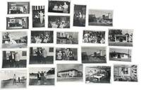
1950233201950. Clearwater Florida photo archive by George Fulmer documenting a Gulf Coast city in the early postwar Sunbelt boom: downtown storefronts automobile traffic tourism businesses beauty shops laundromats pharmacies loan offices civic buildings youth music programs local entertainments and everyday commercial life. George Fulmer identified here through the studio sleeves and the Clearwater job file context worked as a commercial and civic photographer in a period when Pinellas County grew quickly with new residents new retail construction and an increasingly car centered downtown. <br /> <br /> Photo archive of 70 items including 34 silver gelatin photographs with 36 corresponding and unique large format negatives contained in 15 studio sleeves with some annotations ranging from 3" x 5" to 4" x 5" Clearwater Florida circa early 1950s. Storefronts and signs identify Billie Moran Hair Stylist Spotlite Cleaners Launderette Family Loan Co. Loans Lane's Pharmacy Harris Drive In Pharmacy and a downtown block with the Capitol Theatre marquee and McCrory's along a traffic-filled street. Other scenes include audio equipment demonstrations musicians performing before seated audiences children handling rabbits a youth band rehearsal commercial laundry workers golfers near a clubhouse and staged presentation or prize events. Original sleeves strengthen the local identification with handwritten client names addresses dates and job numbers including "Portal Office U.S. Post Office" "P.G.A. Clinic" "Family Loan Office" "Lane Pharm" "Harris Pharmacy" and "Helpy Selfy Laundry." More scenes place people inside the social and commercial interiors of the city: a woman stands beside a microphone while another plays piano; accordion players and guitarists perform before a seated audience in a hall draped with streamers; children and an adult handle rabbits in what appears to be a club or youth program setting; a school band director leans into a room packed with young musicians and music stands; workers stand at wash stations in a commercial laundry; golfers pose and shake hands near a clubhouse; a woman and man stand on a small platform before a seated crowd during what appears to be a staged presentation or prize event.<br /> <br /> These scenes belong to the years when Florida's west coast cities were advertising modern storefronts widening their commercial appeal and absorbing the population growth that followed World War II air conditioning road building and the state's aggressive promotion of itself as a place to live shop vacation and retire. For institutional collections the group supplies named evidence of how a single city looked and conducted business during the first great Sunbelt surge: not only landmark buildings and downtown traffic but service counters display windows local entertainment children's programs and the ordinary businesses that usually vanish first from the record. Light wear minor surface handling and expected age toning to prints and negatives with some sleeves worn from studio use; overall in very good condition. A strong regional archive of Clearwater's commercial and civic life still anchored to the working paperwork that identifies who hired Fulmer and what parts of the city he was asked to record. unknown
1974__0729400174VOLTAIRE FOUND 1974. Paperback. New. 275 pages. 9.00x6.00x0.58 inches. VOLTAIRE FOUND paperback
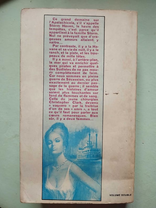
1970500331578Presses Pocket 1970 1970. Vers la fin de la guerre de Sécession le docteur Christopher 'Kit' Clark chirurgien des troupes confédérées est hébergé à Storm Haven une grande plantation appartenant à la famille Storm située aux confins du Texas et de la Floride. Il sauve Valérie Storm l'héritière du domaine d'un accident de cheval et une relation romantique orageuse semble naître entre eux
195360805bdTallahassee Florida: E. O. Painter Printing Company 1953. Octavo burgundy cloth hardcover gilt letters 70 pp. Very Good; library letters printed neatly on upper cover and library’s bookplate to endpaper otherwise clean tight and attractively bound. Part I: Dissolved Phosphorus in Florida Waters by Howard T. Odum; Part II: Petrology of Eocene Limestones in the Citrus-Levy County Area Florida by Alfred George Fischer. E. O. Painter Printing Company, 1953. hardcover books
192140694Washington D.C.: Published by the United States Coast and Geodetic Survey 1921. Nautical chart printed on heavy paper stock. Colored. A rare coastal survey of Florida including Laguna beach Panama City Mexico Beach and Cape San Blas.<br/> <br/> Established by President Thomas Jefferson in 1807 as the Survey of the Coast the U.S. Coast and Geodetic Survey was the United States' first civilian scientific agency. This agency has followed its mission to survey the U.S. coastline create nautical charts of the coast and help increase maritime safety since its founding and has often played fascinating roles in significant chapters of U.S. history. It served in all theaters of the Civil War in the service of the Union Army and Navy pioneered acoustic exploration in the wake of the sinking of the Titanic and during WWI it worked to detect enemy submarines. In addition this agency worked to survey and produce detailed maps and renderings of the U.S. coast. These nautical survey maps commonly referred to as "T-sheets" provide fascinating insights into the history of the United States coastline which has and will continue to shift. These maps are the most important data source for understanding the physical and ecological characteristics of the U.S. shoreline. The present map is a highly detailed and accurate sea chart of BLANK and an important historical view of a developing Florida. Published by the United States Coast and Geodetic Survey unknown
192040728Washington D.C.: Published by the United States Coast and Geodetic Survey 1920. Large folding nautical chart printed on heavy paper stock. Colored with minor wear and small loss to the top margin. A rare original coastal survey of the St Johns River and Lake George in north-central Florida bisected into two parts.<br/> <br/> Established by President Thomas Jefferson in 1807 as the Survey of the Coast the U.S. Coast and Geodetic Survey was the United States' first civilian scientific agency. This agency has followed its mission to survey the U.S. coastline create nautical charts of the coast and help increase maritime safety since its founding and has often played fascinating roles in significant chapters of U.S. history. It served in all theaters of the Civil War in the service of the Union Army and Navy pioneered acoustic exploration in the wake of the sinking of the Titanic and during WWI it worked to detect enemy submarines. In addition this agency worked to survey and produce detailed maps and renderings of the U.S. coast. These nautical survey maps commonly referred to as "T-sheets" provide fascinating insights into the history of the United States coastline which has and will continue to shift. These maps are the most important data source for understanding the physical and ecological characteristics of the U.S. shoreline. The present map is a highly detailed and accurate sea chart of the Lake George region and an important historical view of a developing Florida. Published by the United States Coast and Geodetic Survey unknown
191640686Washington D.C.: Published by the United States Coast and Geodetic Survey 1916. Nautical chart printed on heavy paper stock. Colored. A rare coastal survey of the St. Johns River near Orlando with an inset map of the river continuation in the bottom left corner.<br/> <br/> Established by President Thomas Jefferson in 1807 as the Survey of the Coast the U.S. Coast and Geodetic Survey was the United States' first civilian scientific agency. This agency has followed its mission to survey the U.S. coastline create nautical charts of the coast and help increase maritime safety since its founding and has often played fascinating roles in significant chapters of U.S. history. It served in all theaters of the Civil War in the service of the Union Army and Navy pioneered acoustic exploration in the wake of the sinking of the Titanic and during WWI it worked to detect enemy submarines. In addition this agency worked to survey and produce detailed maps and renderings of the U.S. coast. These nautical survey maps commonly referred to as "T-sheets" provide fascinating insights into the history of the United States coastline which has and will continue to shift. These maps are the most important data source for understanding the physical and ecological characteristics of the U.S. shoreline. The present map is a highly detailed and accurate sea chart of the St Johns River and an important historical view of a developing Florida. Published by the United States Coast and Geodetic Survey unknown
191640716Washington D.C.: Published by the United States Coast and Geodetic Survey 1916. Large folding nautical chart printed on heavy paper stock. Uncolored. A rare original coastal survey of the St. Johns River from Jacksonville to Fleming Island.<br/> <br/> Established by President Thomas Jefferson in 1807 as the Survey of the Coast the U.S. Coast and Geodetic Survey was the United States' first civilian scientific agency. This agency has followed its mission to survey the U.S. coastline create nautical charts of the coast and help increase maritime safety since its founding and has often played fascinating roles in significant chapters of U.S. history. It served in all theaters of the Civil War in the service of the Union Army and Navy pioneered acoustic exploration in the wake of the sinking of the Titanic and during WWI it worked to detect enemy submarines. In addition this agency worked to survey and produce detailed maps and renderings of the U.S. coast. These nautical survey maps commonly referred to as "T-sheets" provide fascinating insights into the history of the United States coastline which has and will continue to shift. These maps are the most important data source for understanding the physical and ecological characteristics of the U.S. shoreline. The present map is a highly detailed and accurate sea chart of St. Johns River around Jacksonville and an important historical view of a developing Florida. Published by the United States Coast and Geodetic Survey unknown
192040702Washington D.C.: Published by the United States Coast and Geodetic Survey 1920. Large folding nautical chart printed on heavy paper stock. Colored with minor wear. A rare coastal survey of Florida around St. Augustine including Vilano Beach St. Augustine Beach Butler Beach Crescent Beach Palm Coast and Ormond Beach.<br/> <br/> Established by President Thomas Jefferson in 1807 as the Survey of the Coast the U.S. Coast and Geodetic Survey was the United States' first civilian scientific agency. This agency has followed its mission to survey the U.S. coastline create nautical charts of the coast and help increase maritime safety since its founding and has often played fascinating roles in significant chapters of U.S. history. It served in all theaters of the Civil War in the service of the Union Army and Navy pioneered acoustic exploration in the wake of the sinking of the Titanic and during WWI it worked to detect enemy submarines. In addition this agency worked to survey and produce detailed maps and renderings of the U.S. coast. These nautical survey maps commonly referred to as "T-sheets" provide fascinating insights into the history of the United States coastline which has and will continue to shift. These maps are the most important data source for understanding the physical and ecological characteristics of the U.S. shoreline. The present map is a highly detailed and accurate sea chart of St. Augustine area and an important historical view of a developing Florida. Published by the United States Coast and Geodetic Survey unknown
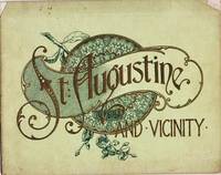
1905037517Philadelphia: J. Murray Jordan 1905. Early edition. Decorated Wrappers. Good. 24pp views from photographs. View include: City Gates; Sea Wall; Oldest House; Treasury Street; St. George Street; Charlotte Street; Hotel Ponce de Leon; The Alcazar; Fort Marion; &c. Bound in gilt-embossed green wrappers; upper corners of cover chipped. 7.75" x 9.75 J. Murray Jordan unknown
1958ABE-165220704065584 PAGES-26,5 CM X 32 CM-EN COUVERTURE: DOMINIQUE COLONNA-PIERRE SCHULL MATADOR FRANCAIS, 4 PAGES-CE QUE SONT DEVENUS LES HEROS DE L'ANNAPURNA, 2 PAGES DONT PHOTO MONTAGE PLEINE PAGE-CHARLES HUMEZ LUI A DIT: "TU N'AURAS JAMAIS A ROUGIR DE TON PAPA!", 2 PAGES, 2 PHOTOS-TERECHKOVITCH LE PLUS SPORTIF DES PEINTRES, 4 PAGES PAR DENIS LALANNE, 2 PHOTOS, REPRODUCTION "TENNIS A ROLAND GARROS" SUR 1 PAGE-LA GRANDE FIEVRE DU CALCIO, 12 PAGES-ELLIOTT COMME LANDY PEUT PERDRE LE TITRE OLYMPIQUE DU 1500 M, 2 PAGES PAR GASTON MEYER-HARY: DEUXIEME 100 M. EN 10'' SI LE STARTER NE L'AVAIT PAS RAPPELE, 2P, 3 PHOTOS-CHEVAL D'AUTEUIL, PAR FERNAND ALBARET, 5 PAGES-ROBERT VIGIER: SON DERNIER ESSAI, 4 PAGES PAR HENRI GARCIA, 6 PHOTOS-PILOTE SUR LA CARAVELLE, PAR MAURICE MAUREL, 3P, 2 PHOTOS-LA CARAVELLE ET MOI JOURNAL TENU PAR ANDRE LESIEUR COMMANDANT DE BORD A AIR FRANCE, 3 PAGES-PARIS CONQUIS PAR LE HORS BORD, 4 PAGES-COMME DES MILLIERS DE VISITEURS DU SALON: ILS ONT AIME LA FLORIDE, 3 PAGES, 7 PHOTOS (JEAN BEHRA, JUST FONTAINE, .)-ILS ONT TUE LE TENNIS AMATEUR, 4 PAGES, 7 PHOTOS (TONY TRABERT, PANCHO GONZALES,.)-PECHE AU THON AU LARGE DE ST JEAN DE LUZ, 4 PAGES-LES AIGLES A TROIS TETES, ETUDE PAR PIERRE CHANY, 4 PAGES, 3 PHOTOS (ANQUETIL, RIVIERE, BOBET)-CENTRE SPORTIF GILLETTE AN II: UNE PROMOTION DE FUTURS CHAMPIONS, 2P, 4 PHOTOS-SPORTS D'HIVER TOUTE L'ANNEE AU MONT BLANC, PAR PHILIPPE GAUSSOT, 4 PAGES-(SPO20)
1935Embry 179568The Grabhorn Press 1935. Number 48 of the author's edition. Some offsetting to front endpapers from previously laid in article slight bowing to front board else fine in very good publisher's plain brown dust jacket with a small chip to head of spine and 3/4 inch chip to front panel in mylar cover. Olive cloth backed orange boards. Inscribed by the author to legendary bookseller John Howell. Includes perspectus. The Grabhorn Press, 1935. Number 48 of the author's edition. hardcover books
19355566San Francisco: Grabhorn Press 1935 Book. Fine. Hardcover. Limited Edition. Limited to 450 copies printed by The Grabhorn Press. Quarto. viii 48pp. Portraits and facsimile letters. Printed in red and black. Handset Lutetia type. Orange boards black cloth spine orange paper spine label printed in black. A very fine copy. Reminiscences by a friend of San Francisco's most famous volunteer firewoman and honorary member of Knickerbocker Engine Company No. 5. Grabhorn: 221. Grabhorn Press hardcover
1989014801USA 1989 United States Department of Agriculture Soft cover
1991014758USA 1991 United States Department of Agriculture Soft cover
1979014798USA 1979 United States Department of Agriculture Soft cover
1989014802USA 1989 United States Department of Agriculture Soft cover
1979014799USA 1979 United States Department of Agriculture Soft cover
19890146801989 United States Department of Agriculture, soil Consevervation Service Soft cover
1992158546Malabar, Florida: Krieger 1992. XII, 291 Seiten. Gr. 8° (22,5-25 cm). Orig.-Kunstlederband. [Hardcover / fest gebunden].