8 987 résultats
188664090Old Cabin Yosemite Valley San Francisco & Oakland CA: Pacific Press Publishing House Britton & Ray 1886. Thick 8vo. 496 pp. Photo-type collotype photo frontisp. numerous collotype photo plates most images by George Fiske Walker & Taber plates half-tone printed photo plates woodcut engravings maps 1 large folding. Publisher’s full speckled sheep gilt & black morocco spine labels marbled endpapers minor splitting to upper front hinge at head of spine rear hinge at foot of spine minor scuffing edgewear still a good bright copy with map in VG condition. First edition of this informative and early travel guide to the Yosemite Valley by the former Forty-Niner who was a key figure in preserving the Yosemite Valley and the Mariposa Big Tree Grove from 1880-1884 where he kept a visitor’s hotel. Also included are details on the Yosemite Indian’s efforts to stall off gold miners and explorers into the valley military campaigns and subsequent removals. See: Currey & Kruska 175. Pacific Press Publishing House, [Britton & Ray], unknown
192662437San Francisco & Oakland CA: Published by H.A. Candrian Edward P. Taylor Importer & Dealer in Books and Stationery ca. 1926. Two parts. 1st - One double-sided atlas folio map. 28 x 22 in. featuring Candrian’s wood plank logo displaying Oakland Alameda and Piedmont w/ inset map of San Leandro neatline borders and map of City of Richmond inset on verso fold creases as issued some thumbing edgewear couple closed tears 1 central closed tear at crease fold still G- copy; 2nd - 12mo. 3.4 x 7.4 in. 96 pp. With 12 pp. of maps and Car-o-Gram glyphs graphically representing streetcar lines in the East Bay with sepia-tinted photo illustrations. Green-tinted and printed softcovers rounded corners minor sunning to lower fore-edges still a VG copy. First editions thus of this very scarce pair including the detailed map of Oakland Alameda Berkeley Piedmont San Leandro and Richmond CA detailing the public buildings parks city streets and more specifically the trolley and streetcar lines across and connecting the East Bay along with Candrian’s innovative Car-o-Gram guidebook. The City of Richmond map includes not only the city boundary line but also connecting railroads such as the Santa Fe Railroad as well as electric streetcar lines. This version does not include the American Bank advertisements which appear in other examples as border to the City of Richmond inset map on verso. Candrian 1862-1928 was a Swiss-American entrepreneur who was the first to introduce Car-oGrams which were little glyphs making streetcar lines much more accessible and although not the best representations the glyphs provided vital visual information for travelers and visitors. Worldcat locates 2 copies w/ map CA Hist. Soc. & Huntington; 2 copies of maps only UCLA Berlin Staatsbibliothek; See: ‘Car-o-Grams:’ Candrian’s Early Transit Mapping Innovation Sunnyside History Project Sunnyside CA May 23 2018. Published by H.A. Candrian, Edward P. Taylor, Importer & Dealer in Books and Stationery, paperback
191262442Oakland CA: San Francisco-Oakland Terminal Railways Co. Maintenance of Way & Buildings Dept. April 1 1912. One oblong elephant folio map sized 36.5 x 12 in. w/ woodcut-engraved border with minor creasing & soiling some rubbing and edgewear a few old closed tears neatly repaired on verso still a VG- copy. First edition of this exceptionally scarce map demarcating the extent of the S.F.O.T. Railways Co. upon its formation in 1912 had after the merger of the Key System East Shore & Suburban Railway and the Oakland Traction Co. by the three main competitors to the Southern Pacific commuter ferry market who also established their own ferry system and substantially expanded their new streetcar line suburbs across the East Bay. The map depicts their growth and reach from Hawayrd to Richmond CA with stops in Albany Berkeley Piedmont Oakland Alameda San Leandro and San Lorenzo in between. Also depicted are the railroad lines of the Southern Pacific Santa Fe Western Pacific Oakland & Antioch Railway and Richmond Belt Line Railway. In 1932 the conversion to motorized buses began on August 1 when the East Richmond/23rd Street line was entirely changed over. They were then steadily converted until No. 1933 when the S.F.O.T. Railways streetcars made their last runs. No copies in Worldcat. See: San Francisco-Oakland Terminal Railways: Bond History and Sinking Fund Requirements 1915; Plan of Reorganization 1922. San Francisco-Oakland Terminal Railways Co., Maintenance of Way & Buildings Dept., unknown
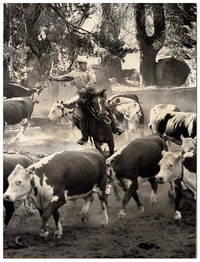
19645328New York: Photo Researchers Inc 1964. Joseph J. "Joe" Munroe 1917-2014 was an Ohio-born photographer and filmmaker who studied with Ansel Adams early on in his career. After serving in the Air Force during World War II he settled in California where he developed an interest in agriculture and rural life. "Munroe's camera caught the last days of farmers driving teams of horses and picking cotton by hand. From the 1940s through the 1970s technology brought dramatic changes to farm life in the United States. There were still families operating small farms with manual labor but fewer of them. From family-operated farms in the Midwest to the vast fields of California's Central Valley the joys challenges and sheer hard work of rural life are seen in Joe's photographs" ref.Ohio Memory Joe Munroe Collection. A rugged powerful image capturing a cowboy on horseback rounding up cattle at the Van Vleck Ranch southeast of Sacramento family-owned since 1856. Original borderless double-weight silver gelatin photograph measuring 25.5cm x 34cm ca.10" x 13 3/8" and mounted on board. Photocopied sheet mounted on verso with photographer's stamp Photo Researchers sticker holograph snipe and the following note: ".at the Stanley Van Vleck Ranch at Sloughhouse Calif. SE of Sacramento.". Light wear to extremities some "spidering" to corners with a short crease toward lower right corner; Very Good. Photo Researchers, Inc unknown
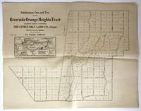
19101275Los Angeles 1910. Good plus. Plat map approximately 14 x inches. Folded a couple of short separations and minor losses along or near folds. A few nicks at edges. Light even tanning. Printed on thin paper. Ephemeral real estate map and advertisement for the Riverside Orange Heights Tract located north of Corona in Southern California and owned by the Citrus Belt Land Company. "The land west of the future Norco Hills consisting of 5500 of the former Little La Sierra Rancho was purchased by a company of Los Angeles men led by James W. Long and by April 1909 that same property was on the market in the form of five- ten- and twenty-acre parcels under the 'Riverside Orange Heights.' In 1910 the Riverside Orange Heights Company was again 'sold' to the Citrus Best Land Company with Long and many of the same stakeholders simply moving from the old corporation to the new. The Citrus Belt Land Company undertook an aggressive sales campaign to sell residential ranch parcels strictly as a suburb of Corona with no effort to build schools commercial businesses or manufacturing centers. Newspaper ads appearing in the local papers the Los Angeles Times and as far away as San Diego touted the plentiful and inexpensive water excellent soil and citrus growing opportunities. It was claimed that the land was impervious to flooding and frost and provided a natural shield from the Santa Ana winds -- statements that many future residents would find to be devastatingly untrue" - Bash. The platted area depicted in this map represents today the southern portion of Norco bisected by Interstate 15. A good cartographic and promotional document of real estate development in the country surrounding Los Angeles during the early 20th century. We locate only one copy at UC San Diego.<br /> Kevin Bash "A Brief History of Norco" Charleston: History Press 2013. unknown
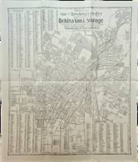
1910List3117Los Angeles California: Bekins Van & Storage 1910. Map measuring 15 ¼ x 13 ¼ inches. Folded with some wrinkling; Near Fine. A map of Los Angeles between Aldama Street South Indiana Street Slauson Ave and Arlington Street published by Bekins Van & Storage. The map is undated but based on the city’s population listed on the map—a mere 125000—it was created some time between 1900 when the population was about 103000 and 1910 when it had ballooned to over 319000. Bekins Van & Storage unknown
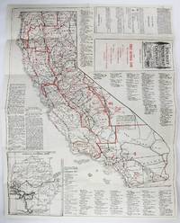
19222318Los Angeles: Pacific Map Co 1922. Very good. Folding map 22 x 17 inches. Old folds minor wear. Handsome tourist road map featuring the state of California in its entirety on one side with an inset of Yosemite and a detail of the area from San Jose to Ventura on the verso. Tourism highlights and amenities are printed in red with a list of garages and gas stations included. With a detailed key and a calendar for 1923 in one panel. Scarce -- we locate one copy at the University of Kansas. Pacific Map Co unknown
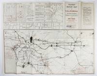
19212317Los Angeles: Giles Publishing and Printing Co 1921. Very good. Folding map 17 x 22 inches. Printed on both sides. Old folds minor wear. Early tourist motor map of California with the whole state on one side and insets of Los Angeles on the other. The side of the map featuring the entirety of the state also has small inset maps of San Francisco and several other cities with basic road details. Tourism highlights are marked in red. The verso shows a large map of Los Angeles with a detail of downtown and a useful key headed "How to Get Out of Los Angeles." There is also an inset with the game laws and seasons. Scarce -- we locate no copies in OCLC. Giles Publishing and Printing Co unknown
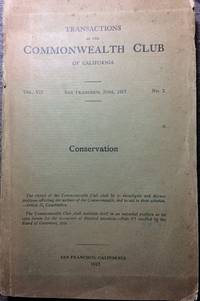
19128776San Francisco: The Commonwealth Club of California. Fair. 1912. Softcover. 314 pp.; 8vo; printed wrappers. Large folding color map approx. 22.5" x 18.5" ot The State of California showing Hydro-Electric Development Forests and Forest Reserves; June 1912 prepared by Committees on Water Power and Forests Section on Conservation Commonwealth Club of California. Photo lithography by Britton & Rey SF. Map in pristine condition. Covers chipped with loss up to 2" x 1"back lower leading corner; 3" cover loss at top to spine; moderate darkening and soil. . The Commonwealth Club of California paperback
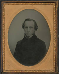
1855List1713California 1855. Quarter plate ambrotype measuring 3 ¼ x 4 ¼ inches with Vance’s embossed identification to mat housed in a black thermoplastic case. Case split at both hinges image fine. Very Good. Robert Vance was one of the first photographers to document California’s gold rush taking over three hundred images of California that were shown in 1851 in New York and since lost. He operated a studio in San Francisco at Sacramento and Montgomery Street. This image of an unidentified subject in formal dress was likely taken in 1855-1856 when Vance began taking ambrotype portraits. unknown
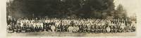
1936List2732Fresno California 1936. Approximately 7 x 30 inches. Some creasing fine contrast; stored in tube with residual shape; overall excellent condition. A photograph of the attendees of a yearly meeting of an affinity group for young Japanese-American Christians in California. The first YPCC retreats were held in 1920 with the help of the Japanese YMCA and YWCA and the group continued its meetings until about 1990. The retreats would include church services speakers discussion groups and recreation with the goal that "The rising generation of the Japanese should be awakened to the light of spiritual life."1 <br /> <br /> 1 Brad Shirakawa “The Domei NCJCCF and the Early Young People’s Christian Conference YPCC†accessed October 2 2024 https://lakesequoiaretreat.wordpress.com/histories/the-domei-ncjccf-and-the-early-young-peoples-christian-conference-ypcc/. unknown
03-0599All-Year Club of Southern California. All-Year Club of Southern California 1947. 39 x 27 inches. All-Year Club of Southern California. unknown
1917914San Francisco 1917. Good plus. Sheet map 28 x 22.75 inches. Folded. Somewhat rumpled; a few small chips at edges not affecting text of map image. Several scattered patches of staining. A scarce real estate map of Berkeley California printed for and distributed by local agents Mason-McDuffie Company in 1917. Blocks are overprinted with lot numbers and letters as well as tract and neighborhood names and a street index is printed at the foot of the map. A large red arrow points to the location of the Mason-McDuffie office just west of the University of California campus and an area shaded in red labeled "Northbrae Properties" at the northern edge of the city limits indicates the principal real estate interests of the agents. We locate four copies at Berkeley Stanford the California State Library and the Oakland Public Library. unknown books
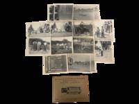
1917232461917. Whittier public development and labor photo archive documenting street paving culvert construction and bridge work by municipal laborers in during the Progressive Era of workers' rights in 1917 Southern California. This group records work on South Painter Lemon Street and North Washington as crews of men grade roadbeds pour or smooth paving surfaces assemble timber forms and pose beside tools and freshly completed improvements. This collection identifies Whittier's early twentieth century transition from Quaker colony and citrus town to incorporated Los Angeles County municipality while also situating these laborers within a moment shaped by expanding workplace regulation compensation law and public debate over hours safety and the treatment of wage workers.<br /> Photo archive of 16 Silver gelatin photographs each 3.75" x 5" Whittier California 1917. The archive includes twelve distinct photos and 4 duplicates. Several versos carry manuscript identifications including "Paving So. Painter between Philadelphia & Gregg Whittier 1917" "100 block So. Painter 1917" "Construction of Lemon St. Whittier 1917" and views of a bridge and culvert work on North Washington. The photographs show crews of male laborers in work shirts overalls brimmed hats and suspenders standing with shovels tools and lumber; one view captures road surfacing in progress with a paving machine or road roller sending up smoke while others show men pulling a long screed across wet pavement excavating and grading a street bed and working beneath a bridge under construction. Two portraits isolate workers and foremen in the roadway and another verso identifies Whittier city engineer at Lemon Street construction as "Paul Todd." The original photo finishing sleeve is present.<br /> By 1917 California's Progressive Era reforms had already brought workers' compensation and state oversight of industrial safety but street crews like those shown here still worked in physically demanding conditions with shovels rollers timber bracing and open roadbeds making municipal improvement an intensely manual system even where machinery had entered the jobsite. Whittier founded in the late nineteenth century by Quaker settlers and long tied to citrus cultivation and regional rail links was expanding its civic fabric in precisely these years. Light corner wear and mild curling to a few prints; manuscript captions clear. Overall very good condition. These photographs tie urban growth to named blocks local labor and the building process of a Southern California city. unknown
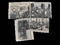
1960234401960. California protest press photo archive documenting antiwar anti nuclear and student civil disobedience demonstrations during the height of Cold War anxiety and the emerging student protest culture of the 1960s. The group captures demonstrators participating in nuclear disarmament activism mass public protest and sit in actions connected to broader fears surrounding atomic weapons and militarization in the years following the Korean War and during escalating East West tensions. These photos record early postwar protest movements before the larger anti Vietnam demonstrations that would dominate the later 1960s.<br /> <br /> Archive of 4 black and white press photographs each approximately 8" x 10" California May and October 1960. One image records demonstrators carrying signs reading "End the Arms Race" and "Ban the Bomb" during a large anti nuclear gathering. Another shows crowds assembled outside a civic building with placards advocating peace and nuclear disarmament. A third photograph captures police physically removing a female sit in demonstrator from a building during a University of California Berkeley protest with the typed caption identifying her as "Gili Studeburg" age 18 dragged from Sproul Hall after refusing to leave during a sit in occupation. The reverse sides retain agency credit stamps typed caption sheets editorial markings and cropping instructions in grease pencil and colored pencil including notations reading "Free Speech Movement" and publication notes.<br /> <br /> The archive falls within the transitional moment between 1950s nuclear anxiety and the explosion of student protest movements that reshaped American political culture during the 1960s. Public demonstrations against atomic weapons accelerated after the hydrogen bomb tests of the 1950s while campus sit ins and direct action tactics became increasingly central to student activism in California. The Sproul Hall arrest scene is especially notable anticipating the Berkeley Free Speech Movement and later antiwar occupations that would make university campuses focal points of political confrontation throughout the decade. Light handling wear editorial markings minor corner wear and scattered toning to versos; captions and stamps remain clear and legible. Overall in good condition. unknown
1952218751952. Archive of identified Japanese American wedding photographs documenting postwar Nikkei community life and the rebuilding of Japanese American social and commercial institutions in Northern California during the early 1950s. The material captures formal wedding celebrations and social relationships within Japanese American communities during the years following World War II incarceration and resettlement. The photographs provide visual evidence of the reestablishment of Japanese American-owned businesses including ethnic-specific photography studios that served as important cultural and social institutions after wartime internment disrupted community life throughout California and the West Coast. Particularly significant are the inscriptions and studio attributions which situate the images within networks of kinship friendship and Japanese American entrepreneurship during the postwar reconstruction era.<br /> Collection consists of three silver gelatin wedding photographs dating circa early 1950s. Photo cards measure between approximately 12 x 11 inches and 9 x 14 inches with mounted photographs measuring approximately 9 x 7 inches. Two photographs depict the same Japanese American couple identified through inscriptions as "Mr. & Mrs. Ben Adachi and Ronnie." One image is a formal studio wedding portrait while another portrays a larger wedding party composed entirely of Japanese American participants and inscribed "Love Mits & Jayme - 12/6/52." Both photographs bear the imprint of Toyo Studio of Sacramento a Japanese American-operated photography business serving Northern California's Nikkei communities during the postwar period. The third photograph depicts another Japanese American couple identified as "George Ets Okasaki" posed alongside their wedding party before a curtain backdrop in a staged studio setting. The matte bears the handwritten inscription "To Ben and Rosie - Love George Ets" and is attributed to Kuroko Studio likely another Japanese American-operated studio in Northern California. Across all three images the couples and attendants are dressed in formal Western wedding attire including satin gowns floral bouquets veils tuxedos dark suits and boutonnières. The repeated dedications to Ben and Rose suggest close social or familial relationships linking the couples represented throughout the archive.<br /> <br /> The photographs document a significant period in Japanese American history marked by postwar community rebuilding after the forced incarceration of Japanese Americans during World War II. During the late 1940s and 1950s Japanese American owned businesses such as photography studios played an important role in restoring civic social and cultural life within resettled Nikkei communities throughout California. These images preserve not only wedding rituals and personal relationships but also evidence of cultural continuity economic recovery and public reaffirmation of Japanese American identity in the years following wartime displacement and exclusion. Particularly notable is the role of Toyo Studio and Kuroko Studio as community-centered institutions producing formal portraits that documented family milestones and social belonging during a period of rebuilding and reintegration. Minor handling wear and light surface wear consistent with age; photographs remain clean and well-preserved overall in very good condition. A cohesive and historically significant group of postwar Japanese American wedding portraits from Northern California's Nikkei community. unknown
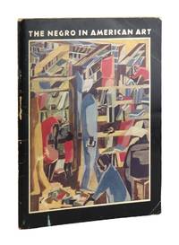
196648138Los Angeles: UCLA Art Galleries/Dickson Art Center 1966. Very Good -. Los Angeles: UCLA Art Galleries/Dickson Art Center 1966. First Edition. Quarto 28cm; pictorial staplebound wrappers; 63pp.; black and white illustrations throughout. Wrappers rubbed with creasing on corners. Some underlining in pencil on the foreword otherwise pages are clean and unmarked. Light foxing to title page. Binding sound. Overall About Very Good. Ownership ex libris of the Black DC artist Lois Mailou Jones inside front cover.<br /> <br /> Signed without inscription by artist Sam Gilliam on p. 23 next to an image of his work titled "Lance Reverse." At the time of this exhibition Gilliam was teaching at McKinley High School in Washington DC and Lois Mailou Jones was teaching at Howard University. UCLA Art Galleries/Dickson Art Center unknown
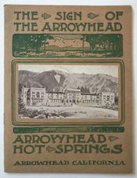
1924677Los Angeles 1924. Near fine. 275pp. Original pictorial wrappers stapled. Minor wear contemporary ink stamp on rear cover. Internally clean. Handsome promotional work for the Arrowhead Hot Springs Resort located near San Bernardino. The pamphlet describes the healing power of the hot springs the hottest in the world according to the chart provided herein and also enumerates the amenities on hand at the deluxe hotel and its facilities. Floor plans of the hotel designed by Arthur B. Benton are included as is a map showing the location and its convenient proximity to rail lines. Illustrated throughout with half-tones of the scenery and grounds. The resort became a Hollywood glamour spot in the late 1930s and is still in operation today. Rare; OCLC locates one copy at UC Berkeley. unknown books
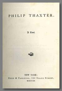
1861WRCLIT71353New York: Rudd & Carleton 1861. 3506pp. Original cloth stamped in blind and gilt. Spine sunned and extremities a bit frayed considerable foxing to endsheets and less so scattered elsewhere a few small marginal discolorations a few signatures starting slightly early ink name on preliminary blank; still a good sound copy. First edition. "A young New Englander comes to California during the gold rush. His life as a gambler and placer miner are set forth in considerable detail. Includes an account of the hanging of a Mexican woman at Downieville an event that caused much distress throughout the state . A rare historical novel" - B&G. WRIGHT II:2658. BAIRD & GREENWOOD 2529. COWAN p.670. Rudd & Carleton hardcover books
1853WRCAM50114Benicia i.e. Boston 1853. xix1071pp. Modern buckram gilt leather labels. Minor dust-soiling light wear to labels library shelf label on spine. Ink library stamps on verso of titlepage. Very good. The first compilation of the laws of the state of California. Compiled by S. Garfielde and F.A. Snyder; additionally Garfielde was the publisher. "Of great historical value and rarity. A limited number of copies were printed by order of the Assembly and this volume is practically the first four Sessions' laws of the State of California" - Norris. "This compilation which includes copious notes and an index brings up to date 1853 the Laws passed by the Legislature since 1850. The imprint 'Benicia' is that of the publisher; the book was actually printed in Massachusetts by the Franklin Printing House" - Howell. Not in Cowan. SABIN 10021. NORRIS 1198. HOWELL 50:598. hardcover books
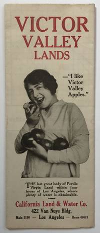
19131284Los Angeles 1913. Very good. Folding map approximately 20.25 x 28 inches. Light wear and a couple of minor separations along folds. Light tanning. An attractive and scarce cartographic promotional for lands under development by the California Land and Water Company in the Victor Valley northeast of Los Angeles. The platted map depicts the lands along the Mojave River between Victorville and Barstow and the areas to the east and west above the San Gabriel Mountains. Above the map is a panorama of the Mojave with a bridge and dam site in the foreground. The verso prints facts about prosperous fruit growing in the region; newspaper testimonials regarding the valley's fertility and recent growth; photographic images of local agriculture including one large image of a Victorville Chamber of Commerce with some state fair prize-winning apples; and even an inspiration economic quotation from "John Stuart Mills." Good evidence of the substantial growth in agriculture in this area during the early-20th century; OCLC locates only one copy at Yale. unknown books
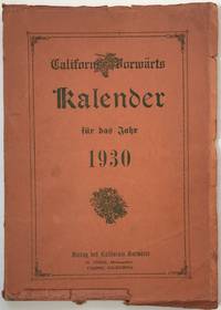
19291049Fresno: H. Tober 1929. About very good. 8151pp. plus plates. Quarto. Original printed wrappers. Light wear some chipping to spine and edges of wrappers. Internally clean. Rare German-Californian periodical featuring an almanac calendars of events around the state travel articles cartoons and numerous local advertisements for the German-speaking population of California. One article is entitled "Der Islam als internationale Religion" "Islam as an International Religion" with the subtitle "Views of Educated Mohammedans." Yet another article is all about divining from variations in one's hand shape. There are photos of American Indians on parade in Vienna the Prince and Princess of Japan and a large zeppelin one can take to travel from Germany. Though presumably an annual all copies located in OCLC are for this year -- we locate three copies at California State University the University of Cincinnati and the National Library of Germany. H. Tober unknown books
197271772San Francisco: Book Club of California 1972. First edition. Folio. 154 pp w/checklist & index of maps. Fine in printed paper-covered boards with gilt-stamped leather spine. Illustrated with twenty-five plates and a bibliographic checklist of maps showing California as an Island 1622-1785. One of 450 copies printed by Robert Grabhorn and Andrew Hoeym. BCC 141. San Francisco: Book Club of California, hardcover books
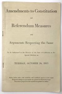
19151753Sacramento 1915. 62pp. Printed self-wrappers stapled. Minor wear at corners. Light tanning and occasional faint foxing. Scarce and extensive informational pamphlet issued by the California Secretary of State regarding state constitutional amendments and referendum measures being put before voters in a special 1915 election. Two laws passed by the state legislature which enacted the use of direct party primary elections to determine state and national candidates and the regularization of ballot appearance were struck down by voters. Six state constitutional amendments which addressed judicial term lengths eminent domain property taxes and several other issues were also put before the people in this special election. The present pamphlet prints the texts of these laws and amendments in full and several examples of proposed ballots relating to the referendum measures are also illustrated. Most interestingly for a state government publication generalized arguments for and against each measure are printed following the text of the laws and amendments themselves. We locate only four copies at UC Irvine UC San Diego Oregon and Harvard. books
19101275Los Angeles 1910. Good plus. Plat map approximately 14 x inches. Folded a couple of short separations and minor losses along or near folds. A few nicks at edges. Light even tanning. Printed on thin paper. Ephemeral real estate map and advertisement for the Riverside Orange Heights Tract located north of Corona in Southern California and owned by the Citrus Belt Land Company. "The land west of the future Norco Hills consisting of 5500 of the former Little La Sierra Rancho was purchased by a company of Los Angeles men led by James W. Long and by April 1909 that same property was on the market in the form of five- ten- and twenty-acre parcels under the 'Riverside Orange Heights.' In 1910 the Riverside Orange Heights Company was again 'sold' to the Citrus Best Land Company with Long and many of the same stakeholders simply moving from the old corporation to the new. The Citrus Belt Land Company undertook an aggressive sales campaign to sell residential ranch parcels strictly as a suburb of Corona with no effort to build schools commercial businesses or manufacturing centers. Newspaper ads appearing in the local papers the Los Angeles Times and as far away as San Diego touted the plentiful and inexpensive water excellent soil and citrus growing opportunities. It was claimed that the land was impervious to flooding and frost and provided a natural shield from the Santa Ana winds -- statements that many future residents would find to be devastatingly untrue" - Bash. The platted area depicted in this map represents today the southern portion of Norco bisected by Interstate 15. A good cartographic and promotional document of real estate development in the country surrounding Los Angeles during the early 20th century. We locate only one copy at UC San Diego.Kevin Bash "A Brief History of Norco" Charleston: History Press 2013. unknown books