5 209 résultats
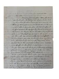
1850235001850. Slavery & Abolition Underground Railroad Fugitive Slave Signed letter mentioning threats of arson against an abolitionist community in Pennsylvania 1850. Lancaster stood on a volatile antislavery route in 1850 with fugitives moving west toward Columbia and the Susquehanna River while pro slavery men targeted communities accused of sheltering escapees. Mary Louisa Harbaugh the young wife of Rev. Henry Harbaugh of the German Reformed Church wrote to her mother that "a party of fellows from Phil. came up here and threatened to burn this place down" and that residents had kept watch after "a great many alarms of fire." Lancaster was the home of Thaddeus Stevens the lawyer and future Radical Republican congressman who defended fugitives and attacked slavery in public life. Columbia eleven miles west had a large free Black population and served as a crossing point for people escaping slavery before and after the Fugitive Slave Act of 1850. <br /> <br /> Harbaugh M. L. Autograph Letter Signed. Lancaster Pennsylvania June 15 1850. Three manuscript pages plus stampless address leaf addressed to her mother Mrs. Margaret A. Linn Lewisburg Pennsylvania. Harbaugh reports household matters children's clothing local health and the arson threat in one domestic letter writing that the city was "very healthy" except for "a few old people" before describing the men from Philadelphia who threatened to burn Lancaster. The address leaf preserves the Lewisburg destination manuscript postal markings and remains of the original red wax seal. The part concerning the arsonists reads as follows:<br /> <br /> "Dear Mother .This place is very healthy now. I know of no disease or sickness at all except among a few old people. We had a great many alarms of fire a few days ago a party of fellows from Phil. came up here and threatened to burn this place down but they were discovered too soon. They have had a watch out since and nothing is heard of them now. The place is not large enough for such persons to do any injury to it."<br /> <br /> Mary Louisa Harbaugh's husband Rev. Henry Harbaugh was a prominent German Reformed minister and writer who avoided public antislavery controversy while her family in Lewisburg was connected to abolitionist politics through her father's break with the Democratic Party for James G. Birney's Free Soil candidacy. Local newspapers such as the June 19 1850 issue of The Lancaster Examiner and Herald reportedly attributed the fire as "no doubt the work of incendiaries as two men were seen running from the Cooper Shop just as the alarm was given" in which they made their escape. It was reported that a young black man by the name of "Gilmore" was arrested and imprisoned on suspicion but was released the next day for insufficient evidence. Other newspapers reportedly minimized the incident without attribution to racial tension all while Columbia suffered a fire that destroyed nine houses and the offices of the Columbia Spy. Folded as mailed with light toning minor edge wear one small seal tear and clean legible manuscript throughout. Overall very good condition. unknown
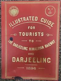
189675179London: McCorquodale & Co. Limited 1896. First edition of this elusive yet important publication. Quarto 7 x 9 7/8 inches. 46 2 ad for the photographer of the book Fred. Ahrle and printer's slug. pp. including 15 full page photographic illustrations by Ahrle and 5 double page plates the first one is a map printed in gold of the railway route used as a frontispiece and one is an gradient diagram and the remainder are plans. Publisher's flexible scarlet cloth with large gilt cover lettering along with the device of the railway. Aside from a couple of ink drops on the corner an exemplary copy. Only a handful of copies located by OCLC. and no copies have appeared at auction according to RBH.The Darjeeling Himalayan Railway is the first and foremost instance of a mountain passenger railway. Opened in 1881 it introduced bold and imaginative engineering approaches to the challenge of rail links on a hilly terrain of excellent beauty this is the first guide book to this fabled railway.The settlement at Darjeeling really began in 1828 with British interest. By 1835 it was separated from Sikkim for establishing a Sanatorium for the invalid servants of the East India Company. It then consisted of a monastery on observatory hill clustered with about 20 huts and a population of about 100 people. Planning began in 1839 to lay out the Darjeeling town and construct a hill road connecting Siliguri Pankhabari Kurseong and Darjeeling. At the same time evolution of hotels began the first being The Darjeeling Family Hotel’s followed by other hotels. By 1840 Darjeeling town had about 30 buildings and a few respectable houses.I n the year 1878 Franklin Prestage Agent of the Eastern Bengal Railway foresaw the utility of a rail link between the hills of Darjeeling and the plains. His scheme was mainly driven by hard economic considerations viz. the huge difference in the cost of essential commodities between Darjeeling and Siliguri the need to carry out tea for export and the inability of the existing road to handle the growing traffic. He submitted a scheme for the construction of a two feet gauge railway line from Siliguri to Darjeeling.In a detailed scheme submitted to the Government of Bengal and approved by the Lt. Governor Sir Ashley Eden he pointed out how a railway could substantially reduce the cost of transport between Darjeeling and the plains. Rice which sold at 98 a ton at Siliguri Cost 238 at Darjeeling! He was also convinced that the cost of construction of the 2 feet gauge rail-line would not be prohibitive and locomotives small but powerful enough to climb steep gradients could be designed Prestage received final sanction for his project on April 8 1879 and formed the Darjeeling Steam Tramway Co. However the idea of operating the line as a steam tramway was soon abandoned and on September 15 1881 the company adopted the designation of Darjeeling Himalayan Railway Co. DHR which remained effective until it was taken over by the Government of free India on October 20 1948. Throughout that period Gillanders Artbuthnot & Co. one of the oldest managing houses in Calcutta handled its financial legal and purchasing interests.abaa-ny-2022 McCorquodale & Co., Limited hardcover
1970151354N.p.: N.p. 1970. Archive of 32 vintage photographs documenting the October 20 1970 collision of two trains along the Chicago Rock Island and Pacific Railroad line in Raytown Missouri. Also included in the archive is a single broadside reward poster offering $5000 for information pertaining to the accident. <br /> <br /> According to a contemporary newspaper article which appeared in nearby Jackson County's Independence Examiner the accident was believed to have been caused by juvenile vandalism to a nearby track switch. The collision and subsequent derailment resulted in the death of one engineer whose partial body is visible in several photographs. <br /> <br /> The photographs in the archive range from close-up shots of the mangled train cars and tracks to distance views of the surrounding woods. Frequently displayed in the images is a small handwritten police chalkboard noting the date location and case numbers. A vivid and interesting look at investigative photography and railway disasters in the late twentieth century. <br /> <br /> Photographs 10 x 8 inches housed in a manila envelope with the logo of Chicago Rock Island and Pacific Railroad Co. on the top left corner. Reward poster 9 x 12 inches. Poster and photographs Near Fine overall envelope Very Good plus. N.p. unknown
190942908Albany NY: State of New York 1909. First edition. Very good clean copy with long tear repaired on th verso and tiny chips at one fold on map inch tear to fore edge of certificate and along bottom margin. Ink on drafting vellum with colored outlines. 15 x 24 inches. Docket sheet mounted to verso. In 1874 the Hudson Tunnel Railroad Company soon named the Hudson River Railway Company was formed to construct tunnels between Jersey City and Greenwich Village the route originally to be about two miles commencing at a point under the Hudson River in the westerly boundaryline of the state of New York opposite the foot of Clarkson street at the termination of the Hudson Tunnel Railroad Company of New Jersey and thence running by a feasible route under the bed of the river and beneath the surface of the city of New York to a point at or near the westerly side of Broadway between Prince and Eighth streets; from whence the line proceeds via Sixth avenue to Thirty-third street New York but stopped construction well before completion. The assets land partially-constructed tunnels trackage etc. were eventually sold to the newly-organized New York & Jersey Railroad incorporated on February 12 1902 under the leadership of William G. McAdoo who was later U.S. Treasury Secretary and which then became the Hudson and Manhattan Railroad 1906. The original of this profile was drafted in 1891 before the railroad collapsed and the present certified copy was prepared by the Secretary of State's office on February 25 1909 almost exactly one year after the official opening of the tunnel the Pennsylvania Railroad's North River Tunnels the second to burrow under the Hudson did not open until late 1910. The reason that a copy of the map was requested is not known but what is known is that the railroad was seeking to extend the Sixth Avenue line later as well as other related projects. Perhaps the map was needed to settle some land issue or in some legal negotiations as the pencilled word "referee" appears after two sets of initials. The tunnels still carry a heavy load of PATH train commuters between Jersey City and Manhattan. Similar maps are difficult to locate. The closest a printed "Map of Hudson & Manhattan Railroad Hudson tunnel system January 1908" is located at the University of Chicago and the Jersey City Historical Society. Provenance: Collection of Gerald J. Levy. State of New York hardcover
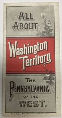
188853587Chicago: Rand McNally & Co. 1888. 1888. 20 3/4" x 13 1/2" sheet folded to 24 panels. Map. One cover panel; one panel showing N.P.R.R. route from Minneapolis to Washington Territory; and 10 panels of information to include information on the area's location and physical features climate agriculture stock raising manufacturing mining public schools cities and towns etc. Opposite 12 panels offer a map of Washington Territory printed in red and black. A rare promotional piece to encourage sales of Northern Pacific Railroad lands in Washington Territory. Light soling a few small splits to creases and with minor wear to the extremities. Very good. Rand, McNally & Co., 1888. unknown
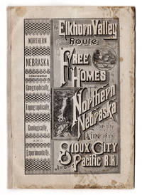
7236Battle Creek Mich.: Review & Herald Steam Printing house 1883. 8vo 8.5" x 5.75" printed wrappers. 46 pp. Folding map 12.75" x 18.25" plus margins. CONDITION: Good dampstaining at covers and the top of the second half of the pamphlet. Light vertical crease at middle throughout. Map good one minor tear at margin. <p>A promotional pamphlet for land along the Sioux City and Pacific Railroad including former Indian reservation lands with an appealing map of the rail line and its spurs.</p> <br /> <p>The text begins with a message to the public advertising the Elkhorn Valley Route on the Sioux City and Pacific Railroad the railroad having recently extended to Fort Niobrara Nebraska and thereby placing within reach of home-seekers millions of acres of free government lands. This is followed by an exhaustive overview of Northern Nebraska and its attractions geographical outlines physical geography topography and neighboring areas including Indian camps and more. A good portion of the text is devoted to Northern Nebraska's geology covering the Old Forest Bed Epoch the origins of "modern Nebraska" "How Came that Grand Old Forest" and so forth. Also included are testimonials from dozens of farmers who settled in Northern Nebraska including "exceptional cases" and highlighted is a large buffalo flat "8 miles long by 3 miles wide". The prospective settler is advised on how to reach these lands how to make a profitable investment in Nebraska lands and Omaha Reserve lands formerly home to the Omaha tribe and how to acquire them. A letter from the U.S. Land Office in Nebraska to the General Passenger Agent of the Sioux City & Pacific R.R. is printed here as well. Ads are included for the Land Agency of I. N. Taylor of Oakdale and Neligh Nebraska and real estate dealers Richards & Keene of Nebraska. The text concludes with a price list of commodities in Northern Nebraska.</p> <br /> <p>The map entitled "Sioux City & Pacific R.R. and connections to the Free Homes for the Million" by Rand McNally & Co. of Chicago spans from Council Bluffs Omaha in the east to the Black Hills in the west and from Pierre South Dakota in the north to a portion of Colorado in the south. The Sioux City and Pacific Railroad and its connections are shown in bold connecting with other railroad routes across the midwest. </p> Battle Creek, Mich.: Review & Herald Steam Printing house, 1883 unknown
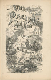
186849559New York: Published by the Union Pacific Railroad Company 1868. 1868. RAILROAD. First edition. 8vo. Original pictorial printed wrappers 32 pp. frontispiece Map of the Union Pacific Rail Road and its Connections introduction. Details the formation of the company and the progress of the work including the topography character of the country and distances along the line. Much information is provided regarding agricultural resources timber minerals etc. Branches and connecting roads along with the needed resources for construction are discussed as is information on actual earnings anticipated earnings and the issuance of the company's first mortgage bonds. A wonderful advertisement on the rear cover panel offers First Mortgage Bonds at par principal and interest Payable In Gold. A faint vertical crease and very lightly toned at the cover edges else a near fine bright copy. Published by the Union Pacific Railroad Company, 1868. unknown
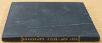
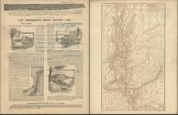
1845619717London: Bradshaw's Railway Information Office 1845. Slender hard cover no jacket intended from the collection of the Worshipful Company of Clothworkers; their coat of arms is stamped to the FEP. In fine condition for its age showing some wear to boards and notable tanning to content however this remains clear and informative. Contains a number of unusual contemporaneous advertisements including Macassar oil; 'For The Hair The Skin & The Teeth' a number of 'Life Assurance Societies' and 'Cabburn's Oil' for the cure of Rheumatism and Gout. Small water mark at spine point of title page. Text block is notably tanned but remains firmly bound. Railways timetables all present including the Second Edition fold out timetable for the journey London to Ely and Norwich and return. A lovely historical piece. Please contact us for further information or additional pictures. CN. Hardcover. Very Good/No Dust Jacket. Bradshaw's Railway Information Office Hardcover
19832110502150908383Atene shobo 1983. Soft Cover. Fine. Number of books: 26 Atene shobo paperback
19312111902160501307Not Available 1931. Soft Cover. Fine. Volume: Imperial Railway Association Not Available paperback
189132829St. Louis: Woodward & Tiernan Printing Co. n.d. 1891. 1891. First edition. Third edition. 12mo. Original orange wrappers printed in black ink 82 2 pp. illustrated map. advertising. Issued by the general passenger department of the Missouri Pacific Railway. A general description of the state and its place in history is provided. Plus soil rainfall churches schools higher educational opportunities newspapers population and wealth corn wheat oats stock farming wild flowers orchards and vineyards salt lead and zinc stone brick and lime coal gas hunting and fishing cities irrigation etc. Views are offered of farms and ranches parade grounds city parks etc. of various cities. Herd 1204 says "Issued by the Missouri Pacific Railway Company this book appeared in many editions though all are now rare." Prior to this copy the earliest edition of a similar booklet was a 13th edition and that was 15 years ago. Fine clean copy with a fine folding map. An exceptional copy of a rare item. Woodward & Tiernan Printing Co., n.d. (1891)]. unknown
1936List3240United States 1936. Forty-two letters with several miscellaneous documents circulars stock offerings etc. Conditions vary with some items worn and quite fragile; most excellent. The Chicago Burlington and Quincy Railroad CB&Q was formed in 1855 by a consolidation of several other western railroad companies. The company and its subsidiaries known for their sleek diesel Zephyr trains operated extensively throughout the midwest west and Texas throughout the nineteenth and twentieth centuries. Today its former passenger operation has been assumed by Amtrak and its freight operation continues as the BNSF Railway. The Burlington Cedar Rapids and Northern Railway BCR&N operated between 1876 and 1903 and was succeeded by the Rock Island Line.<br /> <br /> Offered here is a small collection of letters and documents pertaining to the relatively early days of the CB&Q and BCR&N alongside later correspondence from an Iowan who was writing a history of Iowa railroads.<br /> <br /> Earlier letters include discussions of plans for the extension of the CB&Q lines; for instance railroad official O.W. Palmer writes:<br /> <br /> “The other day at the meeting I gave Mr. McClure some changes to Leavenworth – Since that time I have gone into the question a little more thoroughly and find that to be consistent we would have to reduce a great many points in Western Iowa where there is no competition whatever no need of a reduction – I have therefore concluded not to make any changes except where we have to meet some other fellows rate.†August 7 1894<br /> <br /> On the reverse of this letter and one other is an attractive map of the many CB&Q lines between Chicago and Denver/Cheyenne. <br /> <br /> Also from around this time are several letters from William W. Baldwin discussing railroad business in both an official and unofficial capacity with BCR&N President Charles J. Ives. In 1895 Baldwin tells Ives about a scalping scheme on the BCR&N for which several conductors are fired April 20 and in 1896 about a silver-backing newspaperman:<br /> <br /> “A fellow named Hyskel has persuaded certain silver idiots here to loan him $200 or $300 with which he has started a morning daily called the “Burlington Democratâ€. It is a violent vindictive anarchistic silver sheet and Hyskel himself a thorough crook of the bigoted sort although personally decent and mild enough. Has your company given them transportation They will be after it hot foot. Our folks here have refused him – saying he will have to get it under a regular advertising contract. These are to be made January 1st. If you can put him off until then I think the paper will die before January. They own no press nor any property – are simply trying to bull it through past the election. It is easy enough to put them off there are plenty of good reasons why it ought to be done. There is not a meaner silver organ in the state. It was started as a silver venture purely. I suppose Tracy will get them B.CR. N. transportation if he can. He is the same variety. It is such examples that make the situation so full of menace danger to all business.†October 19<br /> <br /> “Tracy†is Samuel K. Tracy then Solicitor general for the BCR&N the son of Judge Joshua Tracy who was president of the line until his death in 1884.<br /> <br /> Later correspondence is mainly between Baldwin and Albert N. Harbert of Iowa; Harbert was writing a history of Iowa railroads and Baldwin had apparently written a number of pieces on the topic the collection includes a mimeographed bibliography of his works. Harbert had a particular interest in the china dinnerware used on the lines.<br /> <br /> Of interest to historians of western railroads around the turn of the century. unknown
18972111902153000232Hakubunkan 1897. Soft Cover. Fine. Number of pages: 502 pages Size: approx. 20 x width approx. 13 cm Hakubunkan paperback
19382111902160201087Otake Kenji 1938. Soft Cover. Fine. Number of pages: 53 map size: 22cmx15.2cm 53p Number of books: 1 Otake Kenji paperback
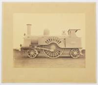
130267Very Good. Two albumen paper photographs each 280 × 372 mm on the original card mounts each approximately 405 × 485 mm. Mounts uniformly tanned and lightly marked; trifling surface loss to silverfish to one plate confined mainly to the blank upper portion where it is inconspicuous; tiny blemishes near the top corners of the second plate; overall in excellent condition. The first image shows 665 'Lord of the Isles' a Problem class or Lady of the Lake class passenger locomotive. Clearly visible on the wheel arch is its build date 'Jany 1863'. The second image shows 2146 a DX Goods class locomotive. Both locomotives are shown in 'photographic grey' livery without tender and it is likely that these are official photographs for London and North Western Railway or the Crewe Works. <p>Both models were designed by John Ramsbottom and entered service in the late 1850s. However these examples are fitted with cabs suggesting that the photographs were taken after the appointment of his successor Francis Webb in 1871. Provenance: 'Mile End Railway Museum South Australia Inc.' inkstamp on the verso of one mount with 'Ex A.E. Cottrell 1/84' in ballpoint pen below the stamp. The contents of the museum were recently dispersed. 2 items. unknown
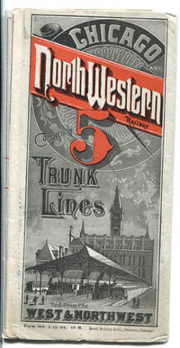
188841991Chicago: Rand McNally & Co. 1888. 1888. TIME TABLES & MAP. 16" x 46 1/2" sheet folded to 50 panels. Printed in red and black. Map. 23 panels of time tables; 1 panel showing tariff of charges for Pullman sleeping accommodations . Between Chicago and San Francisco cost $17.00; Between Chicago ad Madison cost $1.50; 1 cover panel; 1 panel showing an illustration of the North-Western dining car . "Only 75 cents for a splendid meal in these cars." Time tables offered for Council Bluffs and Omaha Line; Sioux city & Southern Dakota Line; Chicago Council Bluffs & California Line; Council Bluffs Omaha & Denver Line; Chicago St. Paul & Minneapolis Line; Minnesota and Central Dakota Line; Huron Pierre & Deadwood Lines; Janesville Watertown and Fond Du Lac Line; Rockford Freeport and Dubuque Line; St. Paul Minneapolis & Manitoba Northern Pacific and St. Paul & Duluth Railways; Milwaukee Green Bay & Marquette Line; Minnesota and Central Dakota Line; Clinton & Anamosa Line; Chicago & North-Western and Milwaukee Lake Shore & Western Railways; Kenosha and Rockford Line; Dayton & Lake city Line; Eagle Grove & Sioux Rapids Line; etc. Opposite panels offers a 24 panel color system map entitled "Geographically Correct Map of the Chicago & North-Western R'y and Its Principal Connections. Correct to September 1st 1881. It Will Be Noticed hat This Is The Leading Railway Of The West And Northwest." A statement at the bottom corner of the map touting that the Chicago & North-Western Railway is one of the largest railway corporations in the world. It controls and operates nearly 3000 miles of road forming the following lines: Chicago Council Bluffs Denver & California Line; Sioux City & Southern Dakota Line; Chicago & Des Moines Line; Chicago Freeport & Dubuque Line; Chicago St. Paul & Minneapolis Line; Chicago La Crosse & Winona Line; Chicago Minnesota & Central Dakota Line; Chicago Pierre & deadwood Line; Chicago Milwaukee & Marquette Line; and Chicago Green Bay & Lake Superior Line. Map shows all states from the west coast to the east coast and to the south showing upper 2/3ds of California and all of Nevada Utah Colorado Kansas Missouri Kentucky and Virginia. 1/2" split to edge at fold along with a couple tiny holes at folds. Very good plus. Rand, McNally & Co., 1888. unknown
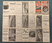
188341860Chicago: The J.M.W. Jones Stationery and Printing Co. 1883. 1883. NORTH DAKOTA. 22 ½" x 25 3/4" sheet folded to 42 panels. Outermost panels printed in red and black. Issued to promote the travel to and settlement of the Red River Valley area and lands west of there. "Every Man a Free Holder. How to Secure a Free Home in North Dakota. Sectional Map and Full Particulars Published by the St. Paul Minneapolis & Manitoba Rail-way." The text panels provide much information regarding agricultural production in the region. Wheat production stock raising soil and climate and other agricultural products are described along with information on Devil's Lake the Mouse River Valley the Turtle Mountain region Stump Lake etc. On verso the small map shows "The St. Paul Minneapolis & Manitoba Railway System and its Important Connections." The large map illustrates in detail the northwestern part of Minnesota from Breakenridge northward and east to include Barnesville Ada Crookston etc. and Dakota north from Wahpeton north and west to Ft. Stevenson on the Missouri River northward and includes southern Manitoba to Winnipeg. Also on this side is an extensive section of text describing "Government Lands and How to Get Them" with emphasis on pre-emptions homesteads and tree claims. Another large section entitled "Facts From a Farmer in North Dakota on the Line of the St. Paul Minneapolis & Manitoba R'y." In this section Mr. James Twamley a Grand Fork area farmer and wholesale grocer describes local agricultural production and recommends specific varieties of wheat oats corn squash beets cabbages carrots beans onions tomatoes asparagus cucumbers berries currants plums grapes potatoes and fodder corn. 1" closed tear to bottom edge of one panel splits at one fold and to top edge have been professionally repaired. An interesting and attractive promotional. A very scarce work. The J.M.W. Jones Stationery and Printing Co., 1883. unknown
188542263Chicago: Chas. N. Trivess Printer 1885. 1885. DAKOTA TERRITORY. RAILROAD. First edition. 7 5/8" x 5 1/8" original stapled printed wrappers 16 pp. map of the Chicago & North-Western Railway system on the back cover. Primarily a series of signed testimonials solicited by the Railway to describe "the Dakota boom." Farmers relate their experiences settling and cultivating the land detail their crop yields and profits from cattle ranching and encourage further settlement as land is still inexpensive and readily available. Several describe the settlers as "a most excellent class of people" who are educated industrious and and morally upright. And if that’s not incentive enough there’s the unsurpassed healthfulness of the air which is "free from malaria and full of inspiring oxygen and invigorating ozone." 3 copies found in OCLC. Top corner of rear cover has been torn away but with minor influence on the railway system map else very good. Chas. N. Trivess, Printer, [1885]. unknown
ria9781032399300_inpMultiple-component retail product. New. New Book; Fast Shipping from UK; Not signed; Not First Edition; Heat Exchanger Design Handbook Third Edition is a three-volume set that provides a comprehensive review on heat exchanger selection design installation commissioning and operation and maintenance and performance in-service. unknown
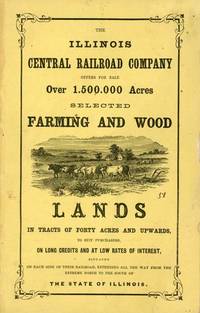
185854460Chicago: Illinois Central Rail Road Office 1858. 1858. ILLINOIS. First edition. 8vo. Yellow pictorial wrappers 5 5 - 80 pp. full page map of Illinois double-page map of the guide to the Illinois Central Railroad Lands wood-engraved frontispiece. six wood-engraved illustrations in the text. The lands are situated on each side of the Railroad between Dunleith and Cairo on the main line and Chicago and Centralia on the Chicago branch. Traversing the entire state from north to south it therefore passes through a great variety of climates and purchasers are enabled to suit their inclinations in their selections. The road passes immediately over some of the lands; others vary in distance from it from one to fifteen miles. A little wear to the bottom corner of all pages and light wear to the fore-edges of the front cover cover and first three leaves else a very good bright copy. Illinois Central Rail Road Office, 1858. unknown
1883034061New York: Railroad Gazette 1883. Book. Very Good. Hardcover. First Edition. 46pp text covering data and descriptions 203pp of steel engravings 40pp of illustrated advertisements in rear. There you'll find ads ranging from full-page notices placed by some of the major builders to smaller ads from suppliers and others. Black cloth binding rebound from original. Gilt titles on spine. Front and rear hinges reinforced with linen tape for a strong binding. Patterned front and rear endpapers. Pages show mild toning but are otherwise clean and unmarked. Volume measures 16" x 11 1/2". Due to its size and weight it's likely this book will require additional shipping charges for international orders and possible Priority Mail shipping within the US. Railroad Gazette Hardcover
185936215Chicago: Illinois Central Railroad Office 1859. 1859. ILLINOIS RAILROAD. First edition. 9" x 6" original pictorial wrappers 4 60 pp. engraved illustrations two frontis. maps one of Illinois showing the lines and stations of the ICR and the other a system map plus a frontispiece of a Prairie Scene in Illinois. Information is provided on the area and extent classification of soils the composition of the soils water crops stock raising etc. Also information on the Illinois Central Railroad and how and why buy their lands inducements to settle in Illinois statistics of towns on the ICR etc. Light wear to the spine ends interior clean overall a very good copy. Illinois Central Railroad Office, 1859. unknown
19612091502135500066Not Available 1961. Soft Cover. Fine. Number of pages: 166 pages 5 pages 6 pages Size: 18 x 26 cm Not Available paperback
19282110502150413974Osaka Mainichi Shimbun Tokyo Nichinichi Shimbun 1928. Soft Cover. Fine. Number of books: 3 Osaka Mainichi Shimbun, Tokyo Nichinichi Shimbun paperback
19192091502135501174South Manzhou Railway 1919. Soft Cover. Fine. Number of pages: 955p thick booklet with multiple folding pages Size: 19x26cm South Manzhou Railway paperback