Sterling Iron and Railway CompanyBiblio.com

5 209 résultats
1166174026.Gpaperback. Good. Access codes and supplements are not guaranteed with used items. May be an ex-library book. paperback
1104867028.Gpaperback. Good. Access codes and supplements are not guaranteed with used items. May be an ex-library book. paperback
1162032588.Ghardcover. Good. Access codes and supplements are not guaranteed with used items. May be an ex-library book. hardcover
20181-1467128228Arcadia Pub 2018. Paperback. New. 168 pages. 9.75x8.88x0.31 inches. Arcadia Pub paperback
0526560231.Ghardcover. Good. Access codes and supplements are not guaranteed with used items. May be an ex-library book. hardcover
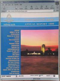
X3481*<p>Annual Report 1999 PRINT Bangkok 1999 Thai & English WL CODE X3481 SIZE 112 pp. illus. in col. 1 map 210 x 290 mm BOOK WEIGHT 0.500 Kg PACKING WEIGHT 0.200 Kg</p> paperback
0266168124.Ghardcover. Good. Access codes and supplements are not guaranteed with used items. May be an ex-library book. hardcover
0656627743.Ghardcover. Good. Access codes and supplements are not guaranteed with used items. May be an ex-library book. hardcover
1332100600.Gpaperback. Good. Access codes and supplements are not guaranteed with used items. May be an ex-library book. paperback
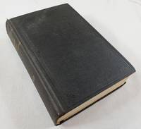
1910043778Hartford CT: Published by the State 1910. 1910 study compiled from the steam railroad and street railway trolley companies for the year ended June 30 1910. Includes color folding maps in front and rear pockets. Dark brown lettered in gilt. Worn condition with fraying to spine head light edgewear hinges good text block sound map pockets brittle and torn maps good with some minor closed tears at intersecting folds with no paperloss pages lightly age-toned but clean legal library label on front free endpaper no other markings. First Edition. Hard Cover. Fair. 8vo - over 7¾" - 9¾" tall. Published by the State Hardcover
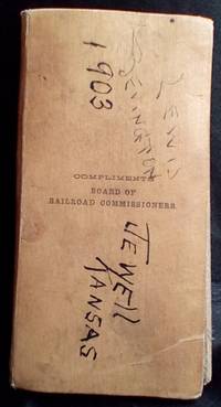
1901ST13907<p>This is a very rare map of Kansas from 1902 shoiwing all the railroad companies operating in the state at that time. The map has a linen backing enclosed in a small carrying case. The case has writing on both sides and there is one note on the linen backing one one panel. See photos for each of these. The map itself has no marks and seems to be in great shape for it's 123 years. Fully folded out the map is roughly 21" by 30.5". Very few maps similar to this are found on the internet and I did not find another from 1902.</p> J. N. Matthews Co.
1987055924Salt Lake City UT: Howe Brothers 1987. 1st . Hardcover. Fine/Near Fine. 4to - over 9¾" - 12" tall. 305pp.incl.index; HB burgundy w/gilt; fine condition w/cleantight pgs. DJ blk.&white photo w/white; slight rub w/spiine&edges sunned. ".the 1889 expeditions' motivation adds an air of fantasy to what actually was a very practical enterprise-proving the feasibility of building a low-grade railroad alongside the Colorado all the way to the ocean." b/w photos. <br/> <br/> Howe Brothers hardcover
1971Q-0890240213Kalmbach Publishing Company 1971-06-01. Perfect Paperback. New. In shrink wrap. Looks like an interesting title! Kalmbach Publishing Company paperback
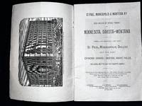
1888004825St. Paul: St. Paul Minneapolis & Manitoba Railway 1888. Soft cover. Very Good. 8vo - over 7¾ - 9¾" tall. 48pp. Printed wraps folding map. Light wear to cover faint ink stamp to cover contents including folding map are in very good condition. Title on cover is "The Great Reservation" which differs from title on title page. The rare folding map shows the railway's routes and connections. There is also a full-page map in the text titled "Free Public Land.in Montana." . <br/> <br/> St. Paul, Minneapolis & Manitoba Railway paperback
1885039474St. Paul Minnesota: Pioneer Press 1885. First Edition. Original Wrappers. Very Good. 48pp; complete with 9 full-page views map on back cover. Bound in salmon wrappers title printed on cover. 8.75" x 5.75" The letters are datelined at various places along the route: Sauk Centre Stearns County Minnesota; Lockhart Farm Norman County MN; Crookston Polk County MN; Devils Lake Ramsey County Dakota Territory; Dunseith Rolette County D.T.; Moose Island Stevens County MN; Jackson Farm Kerkhoven Swift County MN Numbering jumps from Letter VI to Letter VIII as issued. The seven letters are followed by a two-page explanation of where the Railway can take you and by a two-page Catechism for the Free Home Seeker. Statistics of Dakota and Minnesota occupy the final two pages of this booklet. Streeter Americana III:1878. Eberstadt 105:242. Pioneer Press unknown
188515258St. Paul: Pioneer Press n.d. 1885. Only edition 8vo pp.48; 9 full-page wood-engraved illustrations of Minnesota cities and views; very good in original printed wrappers with a map of the St. Paul Minneapolis & Manitoba railroad connections on the back. Mostly on the interior of Minnesota with an excursion into Dakota. "The following letters from a well-known correspondent who visited the Northwest in May and June 1885 are presented to the public in their present form as faithfully setting forth the actual condition and future prospects of the agricultural and other interests of that region. Pioneer Press, n.d. unknown
1867797865St. Paul: Ramaley & Hall 1867. Paperback. Used-Good. Orig. wraps 15 pp. incluidng folding map. Wraps somewhat creased and soiled. Institutional stamp on rear cover. St. Paul: Ramaley & Hall paperback
18679683Saint Paul: Ramaley & Hall 1867. Original printed dark blue wrappers clipped at upper corner of front wrap some wear. 15pp. Folding Map of the St. Paul & Chicago Railway Connecting the Railway System of Minnesota and the Hudson Bay Company's Territory with Chicago and the East. Very Good. <br /> <br /> The Road offers bonds to finance the construction of the "railway from St. Paul to Winona one hundred and one miles where it will connect with the present system of railroads leading to Chicago and Milwaukee." The route will be through a number of towns "sustained by a very rich agricultural back country" and is "almost upon an air line from St. Paul to Winona La Crosse Madison and Chicago." <br /> FIRST EDITION. 135 Eberstadt 532. Not in Modelski Phillips Maps of America. Ramaley & Hall unknown
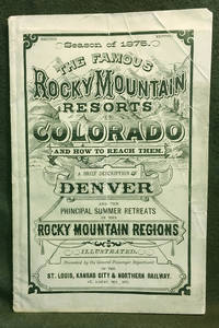
18757<b>A BRIEF DESCRIPTION </b><b>OF THE </b><b>FAMOUS ROCKY MOUNTAIN RESORTS </b><b>IN </b><b>COLORADO </b><b>and </b><b>HOW TO REACH THEM.</b><b><br />Compiled by the General Passenger and Ticket </b><b>Department of the St. Louis Kansas City &</b><b>Northern Railway</b><b><br />Season of 1875 </b><b>Illustrated </b><b><br /></b><b>COLORADO TERRITORY</b><b><br /></b><b>Publication dimensions: 4-3/4 inches by 7-3/8 inches; </b><b>52 pages </b><b><br /></b><b>Second Edition </b><b><br /></b><b>Including "Map of the Principal Resorts of Colorado" </b><b>on Page 22: </b><b>Supplement to "Guide Through Colorado" </b><b>Foldout engraving in front of publication by Arthur Lumley </b><b>"Famous Resorts in the Rocky Mountain Regions </b><b>Colorado" </b><b><br /></b><b>Dimensions: 17-1/2 inches by 11 inches </b><b><br /></b><b>Very good plus to near fine condition: some creasing on front cover; folded once vertically in distant past; interior pages clean bright and sturdy; folded engraving in near fine condition.<br />Historical Colorado railroad guide and map exhibited by: <b><b>COLORADO ARTIFACTUAL </b></b><b><b>& </b></b><b><b>MT. GOTHIC TOMES</b></b></b> General Passenger and Ticket Department of the St. Louis, Kansas City & Northern Railway
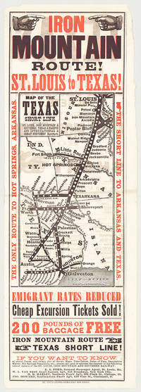
5718St. Louis: St. Louis Globe-Democrat Job Print; Woodward Tiernan & Hale Map Engr's 1878. Broadsheet with map 20.75" x 6.5" plus margins printed in black and red. Map size 11" x 5". Faded purple stamp of agent Henry H. Hannan. CONDITION: Very good upper-half of right margin rough cut. <p>A scarce and attractive promotional broadsheet with map issued by the St. Louis Iron Mountain & Southern Railway advertising special railway offers to emigrants headed to Texas.</p> <p>This broadsheet announces cheap excursion tickets free baggage up to 200 lbs. and reduced emigrant rates for departures from St. Louis on the Short Line Route which runs through Arkansas into Texas. A table of rates on the verso lists first class and emigrant rates. The Texas Short Line extends from St. Louis Missouri to Galveston and Austin and cuts diagonally across the map with various spurs along the way including intersections the Texas & Pacific R'y and the International & Great Northern R'y. Interested parties seeking assistance information on Texas maps time-tables rates of fare etc. are encouraged to call upon or address the nearest of the railroad's Agents located in Missouri Chicago New York City and Ohio whose names are provided on both recto and verso.</p> <p>The St. Louis Iron Mountain & Southern Railway began selling off land holdings in Arkansas in the mid-1870s and continued to do so into the early twentieth century. OCLC records some twenty maps published by the railroad company promoting land it owned in Arkansas issued during this time period. These lands extended from the northernmost point of the state around Little Rock to the line's southern terminus in Texarkana. The company offered various inducements for settlers deep discounts for putting money down as well as reduced freight should homesteaders wish to transport their belongings via the railway. As demonstrated by the present broadsheet the railroad also capitalized on emigration to Texas.</p> <p>OCLC records only three copies at Yale Princeton and University of Texas at Arlington.</p> St. Louis: St. Louis Globe-Democrat Job Print; Woodward, Tiernan & Hale, Map Engr's, 1878 unknown
1898ZB333720Washington: GPO 1898. 1 p issued as 55th Congress 2d Session HR 646; one leaf with light extraction roughness at margin; concerns right of way through Indian Territory. - If you are reading this this item is actually physically in our stock and ready for shipment once ordered. We are not bookjackers. Buyer is responsible for any additional duties taxes or fees required by recipient's country. Washington: GPO, unknown
0265972736.Ghardcover. Good. Access codes and supplements are not guaranteed with used items. May be an ex-library book. hardcover
1528304608.Gpaperback. Good. Access codes and supplements are not guaranteed with used items. May be an ex-library book. paperback
0656727586.Ghardcover. Good. Access codes and supplements are not guaranteed with used items. May be an ex-library book. hardcover
189925554St. Louis: Woodward & Tiernan Printing Co. 1899. 38pp folding map of the railroad and connecting lines. Original printed wrappers light dust and wear small rubberstamp at head of front wrap original staples. Very Good. <br /> <br /> All material on the Road's financial condition with a map depicting its route and connecting lines.<br /> OCLC 251864058 1-AAS 187467966 1-PAU-serial 7984345 11-serial. Woodward & Tiernan Printing Co. unknown