[MAP OF JAPAN FOR EDO TRAVELLERS].Biblio.com
11 476 résultats
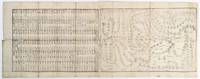
1850177390Late Edo circa1850. Black and white woodblock print map measuring 31 x 80.5cm. Map folds into original yellow paper-covered card cover 16 x 8.5cm with paper title label. This copy lacks the lower cover and the back exposed panel is lightly worn and soiled neat washi tissue repairs along fold some light dampstains and soiling to map although most are scarcely noticeable upper 2.5cm of cover title label is missing. Although showing signs of use this map is still quite charming. This fascinating map of travelling routes in Edo period Japan brings out a totally different perspective on land topography and distance. The map covers the mainland Japan from the Tohoku region to Wakayama including Edo Kyoto and Osaka. The travelling routes such as Tokaido and Nakasendo are also marked. The map does not show north-south and east-west. It shows how the roads are connected and the distances between towns and villages. The map was probably used for pilgrimages to famous temples and shrines such as Zenko-ji and Ise Shrine as they are clearly marked. It also covers the main travelling routes between Edo and Kyoto with the distances and travelling fares including tips. <br> <br>The top end of title label is partially missing and the correct map title and its compiler are not known to us. . unknown
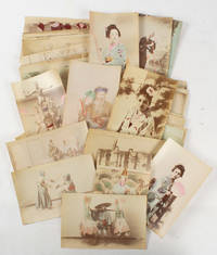
1870175468Japan. circa 1870s-1890s. 94 small handcoloured albumen photographs all approx 8.6 x 13.4 cm most in landscape many with studio captions and numbers in faded but sound condition. A remarkable assemblage; with many studies of geisha portraits scenes of rural and traditional life including a few of wrestlers samurai and musicians and famed studio images. <br> <br>From the estate of well known Hong Kong artist historian and collector Arthur Hacker. . unknown
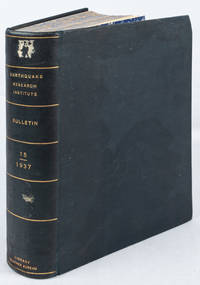
1937173657Tokyo.: Tokyo Imperial University. March- September1937. The four quarterly parts for 1937 numerous tables and maps many folding black and white photographic plates captioned in English and Japanese xii index and contents in English and Japanese 1053pp with the four original title-wrappers in English and Japanese bound in 25.2 x 18cm 63 papers and reports most in English a few in Japanese only one in German and one in French navy blue buckram library binding spine gilt-titled marbled endpapers and fore edges library stamps of: the Library Weather Bureau 1938 withdrawn; Coast and Geodetic Survey Library Archives 1957; and the Library of Congress 1983 duplicate; and their pencil markings to the Volume title page the withdrawn stamp of the Library Weather Bureau on the title wrapper to Part 4 all otherwise unmarked labels of the Library Weather Bureau and the Library of Congress marked surplus to the front pastedown front board darkened with a tidemark and affecting the bottom margin of the last few photographic plates only an adhesion from two small removed shelf labels to the spine but in all a very good handsome volume. A comprehensive grouping of technical reports by members the Tokyo Research Institute listed at the front of the volume relating to seismic and volcanic activity geology and petrology in Japan: two of the included reports in Japanese relate to the seismic event at Niizima in December 1936 and several in English relate to events at the Asama Volcano in Honshu including a remarkable black and white photographic plate of it "exploding" with a dramatic plume of smoke. In addition there is coverage on the effect of seismic events on built structure including on a Pagoda as well as reports on global observations with a folding map showing the distribution of "deep earthquakes". Two of the folding charts are a topographic map showing the crater of Mihara and a very large 44.2 x 30.2 cms impressive coloured geological map of the West of Yokohama. . Tokyo Imperial University. hardcover
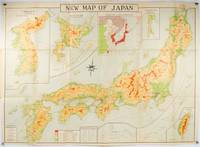
1935214827Tokyo.: Nihon-Kenkyusha. 1935. Large folding colour map of Japan 74.3 x 10⁵ cms; folding into printed card covers 27 x 19.5 cms: 9 insets: Chosen Korea; Hokkaido; Chisima Islands; General Map of Japan and Manchuokuo; Karafuto Saghalien; Okinawa Loochoo; Taiwan Formosa; Micronesia; Ogasawara; Hajijoshima; the covers a litle worn and marked and the sheet slightly toned but the map is in very bright clean condition. Scarce World War II era map of Japan including Korea published in English by Kenkyusha. Founded in 1907 it had a history of publishing for students of English and the English market. An attractively composed map in remarkbable condition; with the insets circled around the islands of Japan heights marked in graduations from green to red and showing provinces railways roads steamer routes Buddhist and Shinto Temples. . Nihon-Kenkyusha. unknown
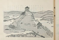
160728京都.Kyoto.: 有文舘.Yūbunkan. 明治四十五 1912. 16 two-tone black and grey woodblock prints with accompanying Japanese text on opposite leaf 31pp unpaginated four stab hole string binding paper title label laid down upper cover. Covers worn and stained extremities worn with loss. Some hold barely affecting the text one leaf and loss of paper upper corner lower paste down. Generally good. 16.6 x 23.9cm. Yamauchi Gusen1866-1927 was a staff illustrator at Osaka Asahi Newspaper. He studied under Takahashi Yuichi and Goseda Horyu. These illustrations originally drawn on Yamauchi Gusn's trip from Shanghai to Europe were first published in the Osaka Asahi Shimbun and where they proved to be very popular. Nihonjinmei daijiten. Japanese name dictionary. <br> <br>The plates in this volume show five images of Shanghai one image of Hong Kong one image of the southern end of the Malay Peninsula four images of Sri Lanka's Port of Colombo Port and four images of the Suez canal. Scarce. . 有文舘.[Yūbunkan]. unknown
2001x-0792370503Kluwer Academic Pub 2001. Hardcover. New. 1st edition. 312 pages. 9.50x6.25x0.50 inches. Kluwer Academic Pub hardcover
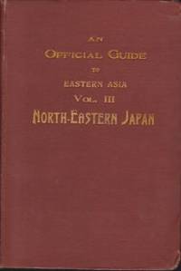
191418288Tokyo: Imperial Japanese Government Railways. 1914. Hardcover. Very Good. Boards with light rubbing to extremities. Slightest bumping to one corner. Maps a bit darkened. Rear hinge a bit gapping but holding strong. ; Top edge gilt. Numerous fold-out maps in color. ; Trans-Continental Connections between Europe and Asia; B&W Photographs; 16mo 6" - 7" tall; x 488 pages . Imperial Japanese Government Railways hardcover
192956448Tokyo: Etsuo Saeki & Kamezo Matsumoto Showa 4 1929. Oblong folio. 14.5 x 10.5 x 1.75 in. 148 leaves including 75 collotype plates all printed on double-page bifolium paper of varying paper weight stocks. Embossed olive-coloured silk punch-sewn at gutter margin w/ purple-coloured silk braid decorated endpapers some scuffing wear to corners minor rubbing and slight fraying still VG copy. Second edition of this lavishly illustrated work on the Japanese Imperial castles and palaces with collotype photos throughout depicting elaborate furnishings interior designs tea houses gates gardens and others of the Heian Imperial Palace Katsura Imperial Villa Shugakin Imperial Villa Nagoya Castle and the Sento Imperial Palace gardens. First issued in 1924 this volume offers an essential reference to Japanese royal architecture between the Wars. Etsuo Saeki & Kamezo Matsumoto, unknown
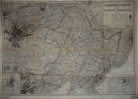
193524456Tokyo: Land Survey Department 1935. Map. Very good overall. A photostat of a Japanese military map known as a gaihozu or "maps of outer lands" likely captured by American forces and stamped at the lower right "Geographic Branch Military Intelligence Division Received Aug 6 -1935". <br /> <br /> The map shows Manchukuo Manchuria a puppet state of Japan's in northeast China 1932 - 1945. In the Mukden Incident the Japanese deliberately bombed their own railway in China the South Manchuria Railway blaming it on the Chinese and using it as a pretext to take over Manchuria and rename it Manchukuo.<br /> <br /> At the upper right can be seen an area designated "Jewish auto. province"; this is an area which exists today known as the Jewish Autonomous Oblast. It is a federal subject of Russia to the far east bordering China. Stalin sent Jews to this remote area starting in the late 1920s in a plan to develop an autonomous nation for Russian Jews. <br /> <br /> Around 1870 the Japanese military began making maps of neighboring countries or gaihozu. At first they copied maps obtained from those countries or from the West. The place names on this map are printed in English. The map shows railways air routes steamer routes rivers wadis deserts marshes "the Great Walls" roads mines telegraph stations harbours aerodromes principal cities & towns Japanese embassies & consulates and "foreign public offices". Four insets include a General Map of Eastern Asia Fengtien Harbin and Hsinking. <br /> <br /> Stamp at lower left "General Staff Map Collection File Copy Do not mark or mutilate". On the verso in manuscript "Official Japanese War Mapof Manchoutikuo" A Photostat Scale 1:2500000". Manuscript note in pen at top margin "For Dr. Acton AP. 40 1/2 x 28 1/4". Slits at original fold intersections; minor chipping at right edge in margin only. OCLC: 495079301. Land Survey Department unknown
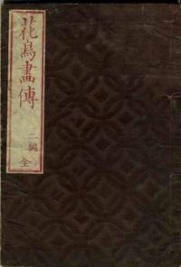
1849151961849. Paperback. Very good. 60 Japanese woodcuts in dark and pale gray with a delicate pink wash by the artist Taito Katsushika a pupil of Hokusai. Birds illustrated include cranes peacocks and pine tree nightingale and plum tree wild geese inko birds and purple magnolia and others. With a very early rough translation of title and author on a handwritten label & a blue paper label inside back cover. 8vo dark brown wrappers with pattern of interlocking circles title label printed in red. Stitched binding unraveling o/w all together complete woodblocks fresh and clean some with penciled titles in English o/w very good. HKD2710. paperback
8482718. Photo album - Japan<br /> <br /> 30 Albumen Scenes around Nikko<br /> <br /> Photo album - Japan. 30 Albumen Scenes around Nikko. Small late 19th early 20th century oblong 11.5 x 17.8 cm album of albumen photos of the city of NikkÅ each about 9.5 x 14 cm. Simple lacquer covers. NikkŠ日光 is a city and tourist destination located in Tochigi Prefecture that is known for its mountains waterfalls and national park. It is also famous for its Shinto shrine NikkÅ TÅshÅgÅ« 日光æ±ç…§å®® the resting place of Tokugawa Ieyasu å¾³å·å®¶åº· depicted here in a number of the photos.<br /> <br /> The images are bw with a bit of fading as usual. The condition overall is very good. unknown
19662110502151101010Not Available 1966. Soft Cover. Fine. Volume: 11 Not Available paperback
19732110502151101925University of Tokyo Press 1973. Soft Cover. Fine. Number of books: 2 University of Tokyo Press paperback
1980057914Kodansha International. A beautiful crisp clean hardcover in fine condition. DJ in fine condition. 1980 Revised edition. Includes clamshell box in good plus condition with rubbing to cloth at corners sunning to cloth. Photos available upon request. . Fine. Hardcover. 1980. Kodansha International hardcover
1922028314W. A. Chalfant / Hammond Press / Conkey 1922. 1st Edition 1st Printing. Red Cloth. Very Good/No Dust Jacket. Folding Map At Front. Xviii 358 Pp. Five Item Errata Slip Pasted Onto Rear Pastedown. Light Wear Spine Gilt Still Brilliant Cloth Just Beginning To Fray At Corners Front Hinge Loose But Not Cracked Entirely Intact. Signed By Chalfant Beneath His Name On The Dedication Page. Bookplate Of Aurelia Mclean Founder Of The Mt Whitney Easter Sunrise Service Long Time Resident Of Lone Pine Inyo County Whose Husband W E Mclean Ran The Town Drug Store; Also Inscribed To Her From Genevieve Naffziger1897 - 1965 Author Of Prose And Poetry About Inyo County And With A Small Note With Names And Some Cryptic Notes About Those Persons Including Naffziger Probably Because Mentioned In The Book And Known To Mclean. <br/> <br/> W. A. Chalfant / Hammond Press / Conkey hardcover
1851200120AG1851. London Edinburgh & Dublin J.& F. Tallis 1851. Original steel engraving / Vintage map. Drawn and engraved by John Rapkin. Partly hand-coloured. Illustrations by H. Warren and Enrgaved by J.H. Kernot. Plate Size: 33 cm x 25.5 cm. Sheet Size: 37.4 cm x 27.3 cm. Vintage 19th century map in very good condition. Published in the Illustrated Atlas And Modern History Of The World Geographical Political Commercial & Statistical Edited By R. Montgomery Martin. Beautifully bordered and fascinating map of Japan and Korea. The names of the major islands of Japan - Kiosiou Sitkokfi Shikoku and Niphon Honshu and the southern tip of 'Matsmai or Yersqi' Hokkaido are included on the map. Below the elbow of Honshu can be seen the tiny island of Fatsisio - the 'place of exile for the Grandees of Japan.' The map's nomenclature is interesting: Tokyo not yet the capital is named as Yedo while the then-capital Kyoto appears as 'Meaco'. Across the Korean Strait modern Seoul appears as 'Han y'. As these maps were being published both of these ancient and distinctive states Korea - the 'Hermit Kingdom' - and Japan - isolated under the centuries' long under the sakoku policy - were having to acclimate to increased Western influence in their region. The 1853-54 U.S. diplomatic and military naval expedition under Commodore Perry would force the establishment of diplomatic relations between Japan and the western "Great Powers" and eventually to the collapse of the ruling Tokugawa shogunate and the Meiji Restoration. Japan would partially embrace the West and western influences and emerge as a burgeoning regional power eventually establishing control over Korea by the early 20th century - at the beginning a calamitous half-century for the region. John Tallis 7 November 1817 3 June 1876 was an English cartographic publisher. His company John Tallis and Company published views maps and atlases in London from roughly 1838 to 1851. Tallis set up as a publisher with Frederick Tallis in Cripplegate in 1842; the business moved to Smithfield in 1846 and was dissolved in 1849. From 1851 to 1854 Tallis operated as John Tallis and Company. He started The illustrated news of the world and national portrait gallery of eminent personages in 1858 selling it for £1370 in 1861; it folded in 1863. Wikipedia The most important project John Tallis undertook was the 'Illustrated Atlas' from 1851. The original map we offer here was part of this exceptional Atlas and all the maps it contained are still today considered as the last reminder of an era of lavish map production. Tallis worked the project together with John Rapkin 1815-1876 and it was Rapkin's style and talent that we have to thank for when we marvel at these maps today. What makes these maps so special is the detail of engraved vignettes that surround the map and often show indigenous scenes people in their environment and even more so historical buildings or historical views of towns and cities architecture and landscape. The project of 'The Illustrated Atlas' was designed to be finished just in time for the anxiously awaited "Great Exhibition of the Works of Industry of All Nations" or The Great Exhibition sometimes referred to as the Crystal Palace Exhibition in reference to the temporary structure in which it was held was an international exhibition that took place in Hyde Park London from 1 May to 11 October 1851. It was the first in a series of World's Fairs exhibitions of culture and industry that became popular in the 19th century and it was a much-anticipated event. The Great Exhibition was organized by Henry Cole and Prince Albert husband of the reigning monarch Queen Victoria. It was attended by numerous notable figures of the time including Charles Darwin Samuel Colt members of the Orléanist Royal Family and the writers Charlotte Brontë Charles Dickens Lewis Carroll George Eliot and Alfred Tennyson. Music for the opening was under the direction of Sir George Thomas Smart and the continuous music from the exhibited organs for the Queen's procession was "under the superintendence of William Sterndale Bennett". Wikipedia unknown
19562080502106912729Not Available 1956. Soft Cover. Fine. The book is in fine condition. Not Available paperback
19722111902160603141Maruzen 1972. Soft Cover. Fine. Number of books: 4 Maruzen paperback
19712080502106912291Not Available 1971. Soft Cover. Fine. The book is in fine condition. Not Available paperback
19822110502150502171University of Tokyo Press 1982. Soft Cover. Fine. Number of books: 2 University of Tokyo Press paperback
19722090202120100089Japan Classic Literature Publishing Society 1972. Soft Cover. Fine. Number of books: 3 Japan Classic Literature Publishing Society paperback
19722090202120300089Japan Classic Literature Publishing Society 1972. Soft Cover. Fine. Number of books: 3 Japan Classic Literature Publishing Society paperback
19392090202120100840Not Available 1939. Soft Cover. Fine. Volume: 1 Not Available paperback
19392090202120300839Not Available 1939. Soft Cover. Fine. Volume: 1 Not Available paperback
19952092902137700069Sankosha 1995. Soft Cover. Fine. The book is in fine condition. Sankosha paperback