236 résultats
18584741baY2Toronto Ontario: John Lovell 1858. Book. Very good condition. Hardcover. First Edition. Octavo 8vo. Canada; Manitoba; Red River expedition 1857; Assiniboine and Saskatchewan expedition 1858; 258pages; 25.5cm; full black leather binding re-backed; inserted folded map: 35 x 77cm; part of Red River Valley north of 49th parallel to accompany report of H. Y. Hind's Canadian Red River expedition; small tear bottom left corner small breaks at 2 folds; detached folded map: 76.5 x 142cm; plan 'shewing' proposed route from Lake Superior to Red River settlement compiled from Dawson & Napier's maps T. Devine surveyor branch west Crown Lands Department Toronto 29th May 1858 Andrew Russell assistant commissioner; across map bottom: Profile of canoe route by Professor Hind horizontal scale 10 miles to 1 inch vertical scale 600 feet to 1 inch; center top of map: Plan of country between Red River settlement and Lake of the Woods scale 8 miles to inch; signed S. J. Dawson note-this is reduced copy of map from actual survey accompanying Dawson's report of 15th March 1858; Red River expedition under direction of George Gladman 1800-63 and Simon James Dawson 1820-1902; report by Henry Youle Hind 1823-1909; Canada Legislative Assembly Victoria 21 appendice No 3. A. 1858. First edition. John Lovell Hardcover books
188422023London: Royal Geographical Society 1884. First edition. Paperback. Very good condition. Proceedings of the Royal Geographical Society the complete monthly issue for November 1884. 8vo 2 pp 615-686 3 large folding maps 2 of Africa one of the Greely Arctic Expedition by Lieut J. B. Lockwood. Original blue printed wrappers slt. spine chip at tips otherwise fine. Royal Geographical Society paperback
1866M2-Et2Paris, Arthus Bertrand, sd. In-4 (290x220mm), relié demi-veau, dos frotté, 200pp. Illustré de 4 cartes dépliantes.
1894013931St. Louis: N.D. Thompson Publishing Co 1894. 1st Edition. Hardcover. Near Fine/No Jacket. Folio - over 12 - 15" tall. Half morocco burgundy cloth over board. Marbled endpapers and edges. 2 pp. 80 ff. half-tone portraits. Recently professionally rebacked new leather spine and spine label. Light wear to original leather corners. Spots of scuffing and staining to cloth. Gold paint to ffep. Damp stain to lower corner of text block. Several short marginal tears mostly at tail edges. Else a nice copy of a fascinating collection of portraits from various ethnic backgrounds including American and Mexican cowboys Egyptian cowherds German military leaders several Javaneese people and French peasant women. N.D. Thompson Publishing Co hardcover
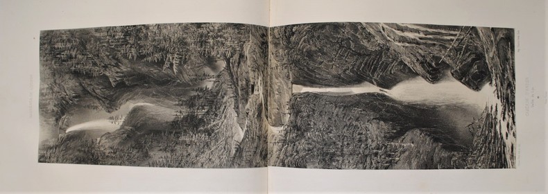
1876895260551<p>Excellent condition but missing the original map that was originally included. 11 fine chromolithographic and 11 lithographic plates. Publication of this report was originally intended for 1861 but the Civil War intervened and prevented publication for another fifteen years. The expedition under Macomb went west from Santa Fe across northern New Mexico and Arizona to the Colorado. The whole drainage of the San Juan had been traced and the relationship of that river with the Colorado clearly established. More important they had also established that the Green River united with the Grand to form the Colorado. The entire maze of intricate canyon country had been threaded and its geography revealed for the first time. In addition Newberry was able to establish numerous stratigraphic columns and to trace the Triassic Jurassic and Carboniferous strata far out across the Colorado River. Newberry.introduced a new level of sophistication into the study of western geology.</p> Government printing office hardcover
1898HM064141898-1931 9 volumes (in all: 2008 p., 189 figs, 117 pls, 45 maps)Part 6-14: Rotes Meer (Red Sea) und weiterführend östliches Mittelmeer (ends with part 14). Parts 1-5 treated the eastern part of the Mediterranean, and are not included in this set! Parts 6-12: orginal hcloth. Parts 13-14: original paperbound. Part 6 with waterstained back cover, otherwise a very good set of these rare expedition reports of the Pola-Expedition to the Red Sea.Part 6: 4to. 628 p., 7 figs, 30 pls, 23 maps. A: Forschungen im Roten Meere (nördliche Hälfte) 1895-1896. Einleitung. I. Koss, K.: Zeit- und Ortsbestimmungen. II. Triulzi, A.Edler v.: Relative Schwerebestimmungen. III. Roeßler, K.: Magnetische Beobachtungen. IV. Arbesser v. Rastburg, C.: Meteorologische Beobachtungen. Angestellt an Bord S.M. Schiffes "Pola" auf The Brothers, in Koseir und in Jidda. V. Arbesser v. Rastburg, C.: Geodätische Arbeiten. VI. Luksch, J.: Physikalische Untersuchungen. VII. Steuer, A.: Sapphirinen des Roten Meeres. VIII. Grobben, K.: Beiträge zur Morphologie und Anatomie der Tridacniden. IX. Natterer, K.: Chemische Untersuchungen. B. Forschungen im östlichen Mittelmeere 1889-1894 XXI: Oberwimmer, A.: Zoolog. Ergebnisse. X. Mollusken. II. Heteropoden und Pteropoden, Sinusigera. XXII: Adensamer, Th.: Zoolog. Ergebnisse. XI. Decapoden. Part 7: 4to. 504 p., 8 maps, 34 pls, 19 figs. A: Forschungen im Roten Meere (südliche Hälfte) 1897-1898 X. Koss, K.: Kimmtiefen-Beobachtungen. XI. Koss, K.: Zeit- und Ortsbestimmungen. XII. Triulzi, A. Edler v.: Relative Schwerebestimmungen. XIII: Roeßler, K.: Magnetische Beobachtungen. XIV: Sturany, R.: Lamellibranchiaten des Roten Meeres. XV. Natterer, K.: Chemische Untersuchungen von Wasser- und Grundproben. XVI. Schulze, F.E.: Hexactinelliden des Roten Meeres. XVII. Steindachner, Fr.: Bericht über die herpetologischen Aufsammlungen. XVIII. Luksch, J.: Physikalische Untersuchungen. XIX. Luksch, J.: Untersuchungen über die Transparenz und Farbe des Seewassers. XX. Grobben, K.: Zur Kenntnis der Morphologie und Anatomie von Meleagrina sowie der Aviculiden im allgemeinen. B. Forschungen im östlichen Mittelmeere 1889-1894 XXIII: Schulze, Fr.E.: Zoolog. Ergebnisse. XII. Mittelmeer-Hexactinelliden. Part 8: 4to. 323 p., 12 pls, 5 figs. 8 maps. A: Forschungen im Roten Meere (südliche Hälfte) 1897-1898. XXI. Arbesser von Rastburg, C.: Metereologische Beobachtungen, angestellt an Bord S.M. Schifes "Pola" in Koseir, Sawakin, Jidda, Massawa, Asab und Perim. XXII. Arbesser von Rastburg, C.: Geodätische Arbeiten. XXIII. Sturany, R.: Gastropoden des Roten Meeres. B. Forschungen im östlichen Mittelmeere 1889-1894. XXIV: Windt, Jan de & Berwerth, Fr.: Untersuchungen von Grundproben auf der 1.,3. und 4. Reise. XXV: Marenzeller, E.v.: Zoolog. Ergebnisse. XIII. Polychäten des Grundes, gesammelt 1893-1894. Part 9: 4to. 97 p., 31 pls, 7 figs. Forschungen im Roten Meere (nördliche und südliche Hälfte) 1895-1898 XXIV. Marenzeller, E.v.: Über den Septennachwuchs der Eupsamminen E.H. XXV. Marenzeller, E.v.: Tiefseekorallen des Roten Meeres. XXVI. Marenzeller, E.v.: Riffkorallen. Part 10: 4to. 54 p., 2 pls & 9 figs. A. Forschungen im östlichen Mittelmeere. XXVI: Ritter-Zahony, R.v.: Zoolog. Ergebn. XIV. Chätognathen. XXVII: Pesta, O.: Zoolog. Ergebn. XV. Copepoden. XXVIII: Ritter-Zahony, R.v.: Zoolog. Ergebn. XVI. Zur Anatomie des Chätognathenkopfes. B. Forschungen im Roten Meere (nördliche und südliche Hälfte) 1895-1898. XXVII: Ritter-Zahony, R.v.: Chätognathen. Part 11: 4to. 104 p., 5 (2 col.) pls, 69 figs. A. Forschungen im Roten Meere (nördliche und südliche Hälfte) 1895-1898. XXVIII. Balss, H.: Zoologische Ergebnisse. XXVIII. Über Stomatopoden des Roten Meeres. XXIX. Kükenthal, W. Zoolog. Ergebn. XXIX. Alcyonaria des Roten Meeres. XXX. Balss, H.: Zoolog. Ergebn. XXX. Die Decapoden des Roten Meeres. B. Forschungen im östlichen Mittelmeere. XXIX: Pesta, O.: Zoolog. Ergebn. XVII. Die Isopodengattung Microniscus. XXX. Pesta, O.: Zoolog. Ergebn. XVIII. Copepoden des östlichen Mittelmeers. Part 12: 4to. 141 p., 1 plate, 29 figs, 1 map. Forschungen im Roten Meere (nördliche und südliche Hälfte) 1895-1878. XXXI. Balss, H.: Zoolog. Ergebn. XXXI. Die Decapoden des Roten Meeres. II. Anomuren, Dromiaceen und Oxystomen. XXXII. Michaelsen, W.: Zoolog. Ergebn. XXXII. Ascidea Plychobranchia und Diclyobranchia des Roten Meeres. Part 13: 4to. 111 p., 1 plate, 25 figs,. & 5 maps. Forschungen im Roten Meere (nördliche und südliche Hälfte) 1895-1897 XXXIII. Michaelsen, W.: Zoolog. Ergebn. XXXIII. Ascidiae Krikobranchiae des Roten Meeres: Clavelinidae und Synoicidae. XXXIV. Balss, H.: Zoolog. Ergebn. XXXIV. Decapoden des Roten Meeres. III. Die Parthenopiden, Cyclometopen und Catometopen. XXXV. Spandl, H.: Zoolog. Ergebn. XXXV. Die Amphipoden des Roten Meeres. Part 14: 4to. 46 p., 1 plate, 19 figs. Forschungen im Roten Meere (nördliche und südliche Hälfte) 1895-1898. XXXVI. Balss, H.: Zoolog. Ergebn. Decapoden des Roten Meeres. IV. Oxyrhyncha und Schlußbetrachtungen. XXXVII. Graf, H.: Zoolog. Ergebn. Die Cypridinidae des Roten Meeres.
185832039ABGotha, J. Perthes, 1858-1906. 4°, jeder Band zwischen ca. 300 und 500 S. mit zahlr. (oftmals farbigen) Ausklapp-Tafeln und Falt-Karten, die ersten 4 Bände (1858-1863) als schwarze original Leineneinbände mit goldener Deckel- und Rückenbeschriftung sowie reicher Deckelbildprägung, der Band 1868 als schlicher schwarzer Pappband der Zeit, dann (1870-1906) Halbleinen-Einbände der Zeit mit Rückenschildern bzw. goldener Rückenbeschriftung und Musterpapierbezügen, alle Bände in Originalausgabe alle Bände unten mit Rückensignaturschildchen, die Rückenkanten der ganz frühen Bände stellenw. angeplatzt, wenige Bände oben am Rücken etwas angerändert, beim schlichten Pappband von 1868 der Rücken beschädigt und mit Fehlstellen (innen aber bindungsstab
185546629Gotha Julius Perthes 1855-1874. 4to. Bound in 18 contemp. hcalf some wear to the first 10 vols. some a bit rubbed. Some scattered brownspots to the first volumes. Gilt spines. Wear to top of spines. With a huge amount of original maps plates profiles etc. lithographed and engraved large and folded and mainly in colour. This set does not include the "Ergänzungsbände". <br/><br/><em>The first 19 lacking vol. 14 volumes of this importent periodical from its "Golden Period". "Petermann's Mittheilungen" became the leading geographic publication of the world and remained so until World War I. All the new geographical discoveries all the reports from the latest exploratory expeditions were published and flowed into Petermann's Geographische Anstalt and he took care to see that it was translated into cartographic form as quickly as possible. The maps soon came to have a reputation for containing the latest and the most accurate information available. Not only German but international readers as well came to see the 'Mitteilungen' as an indispensable organ for the world of geographical research. </em> unknown
1850P1-22-1Bagnères de Luchon, Dulon, Lafont, Bassy, Boicin, s.d.(1850). In-folio oblong, titre et 30 lithographies sur Chine appliquée sur papier fort légendé, cartonnage éditeur percaline, titre orné doré sur le plat supérieur (quelques rousseurs). Bel album de 26 vues, dont 3 doubles et 1 triple. Bagnères de Luchon et ses environs, par Victor Petit. Paris, 1850, oblong folio (390x270mm), original green cloth with gilting enclosing by ornate, gilt covers, attractive collection of lithographs of medicine baths in the Pyrenees. 29 unnumbered plates of which 3 double and 1 triple.
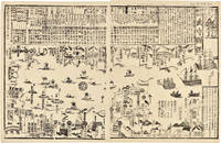
1855WRCAM46844Tokyo 1855. 24 1/2 x 16 inches. Matted. Old fold lines some minor wear and soiling. Near fine. Large wood block print comprised of two sheets showing the disposition of the Japanese soldiers and ships in preparation for the arrival of Commodore Perry's American fleet seen sailing into Tokyo harbor at the right side of the image. The top third of the print is comprised of text in Japanese characters. Three large American ships dominate the right side of the print while several smaller boats dot the rest of the harbor. The whole is dotted with Japanese characters denoting various people and places around the harbor. <br> <br> Perry first arrived in Japan on July 8 1853 with a fleet of four ships flying his pennant on the steam frigate Susquehanna. This first visit lasted ten days and culminated on July 14 with Perry's presentation of a letter from the President of the United States to the Japanese commissioners. Perry then absented himself for seven months returning on February 11 1854 for a stay of over four months. He negotiated a treaty opening Japan to trade with the western world providing for a U.S. consul in Japan and protecting visiting ships and crews. Perry's visit to Japan remains one of the most important events in the diplomatic history between western and eastern nations. <br> <br> A handsome print showing the Japanese side of this important historic event. unknown books
1853347471853. 31; 31; 61pp. plus a loose sheet. Original paper wrappers stitched. Contemporary manuscript annotations in red ink in one volume Scattered worming heavy in places. Some dampstaining and dust soiling. About very good.<br/> <br/>Separate Accounts of the Arrival of Commodore Perry<br/> <br/>Three fascinating Japanese manuscript accounts of the arrival of Commodore Perry to Japan in 1853. Then first Uraga Kurotone Ni Kansaru or "The Black Ship Arriving in Uraga" comprises the official government report of events when Perry steamed into Uraga Bay. This volume contains contemporary edits to the text in red ink. The second account of Perry's arrival Edo Urgga Bikoku Fune Torai Ikken or "Arrival of the Ships at Uraga" contains a double-page manuscript sketch of the coastline of Uraga Bay together with the disposition of Perry's ships. The final volume consists of a third manuscript entitled GASSHUKKO SHOKAN WAGE UTSUSHI a copy of the report on the Perry arrival prepared by Abe Masahiro Chief Senior Councillor in the Toguwara Shogunate which includes translations of the letters from Fillmore and Perry delivered by Perry on July 8 1853. Also with a single manuscript sheet that provides a description of Perry's ship. Vital contemporary manuscript accounts of this monumental transformation in Japanese foreign relations from significant Japanese participants in events. unknown books
1856E05603 volumes: xvii1537 pages with 90 lithographs plates including the usual expunged bathing plate many in color including 3 "facsimiles" of Japanese woodblock prints 2 folding; 6 maps and charts 2 folding; 79 woodcuts in the text; 2414414-1xi pages with 4 color lithographs of Chinese scenes; 2 uncolored natural history engraved plates; 6 hand-colored lithographs of birds; 10 hand-colored steel-engravings of fish; 5 lithographs of shells 2 hand-colored; 16 diagram plates of winds and currents; 14-page facsimile of Japanese language version of the U.S.-Japan treaty; 17 folding charts on 16 sheets; numerous woodcuts in the text; xliii17051 pages woodcut star charts throughout. Volume III titled "United States Japan Expedition. Observations on the zodiacal light from April 2 1853 to April 22 1855 . by Rev. George Jones A.M. chaplain United States Navy". Quarto 11½ x8 ¾" bound in the original blind stamped cloth. Volume 1 rebacked with the original cloth spine laid down. Hill 1332; Sabin 30968 First edition of the House Issue.<br /><br />Detailed and profusely illustrated account of Perry's expedition to open Japan to the West; Upon his return to the U.S. his chief duty for the following year was to compile his reports of the expedition aided by Francis Hawks. The first volume has the account of the voyage and lithographs of the travel; the second volume has the natural history reports by D.S. Green and others and includes hand-colored plates of Japanese fishes and shells. In addition to the artist W. Heine from whose drawings a great number of the lithographs were made the daguerreotypist E. Brown Jr. went on the expedition taking what were undoubtedly the earliest photographic images of Japan many of them reproduced lithographically in this work. This copy with the nude bathing plate which was not included on the list of plates and not issued in all copies. <br /><br />In advance of his voyage to the Far East Commodore Perry read widely amongst available books about Tokugawa Japan. His research even included consultation with the increasingly well-known Japanologist Philipp Franz von Siebold who had lived on the Dutch island of Dejima for eight years before retiring to Leiden in the Netherlands. In 1852 Perry embarked from Norfolk Virginia for Japan in command of a squadron in search of a Japanese trade treaty. Aboard a black-hulled steam frigate he ported Mississippi Plymouth Saratoga and Susquehanna at Uraga Harbor near Edo modern Tokyo on July 8 1853. His actions at this crucial juncture were informed by a careful study of Japan's previous contacts with Western ships and what could be known about the Japanese hierarchical culture. He was met by representatives of the Tokugawa Shogunate who told him to proceed to Nagasaki where there was limited trade with the Netherlands and which was the only Japanese port open to foreigners at that time. Perry refused to leave and demanded permission to present a letter from President Millard Fillmore threatening force if he was denied. Perry ordered his ships to attack several buildings around the harbor to demonstrate US naval power. The Commodore was fully prepared for more hostilities if his negotiations with the Japanese failed and threatened to use unrestrained fire if the Japanese refused to negotiate. He sent two white flags to them telling them to hoist the flags when they wished a bombardment from his fleet to cease and to surrender. Perry's ships were equipped with new Paixhans shell guns capable of wreaking great destruction with every shell. The Japanese military forces could not resist Perry's modern weaponry; the term "Black Ships" in Japan would later come to symbolize a threat imposed by Western technology. Perry returned in February 1854 with twice as many ships finding that the delegates had prepared a treaty embodying virtually all the demands in Fillmore's letter. Perry signed the Convention of Kanagawa on March 31 1854 and departed mistakenly believing the agreement had been made with imperial representatives. The agreement was made with the Shogun the de facto ruler of Japan. On his way to Japan Perry anchored off Keelung in Formosa modern day Taiwan for ten days. Perry and crew members landed on Formosa and investigated the potential of mining the coal deposits in that area. He emphasized in his reports that Formosa provided a convenient mid-way trade location. Formosa was also very defensible. It could serve as a base for exploration as Cuba had done for the Spanish in the Americas. Occupying Formosa could help the US to counter European monopolization of the major trade routes. President Franklin Pierce declined the suggestion remarking such a remote possession would be an unnecessary drain of resources and that he would be unlikely to receive the consent of Congress. When Perry returned to the United States in 1855 Congress voted to grant him a reward of $20000 in appreciation of his work in Japan. Perry used part of this money to prepare and publish a report on the expedition in three volumes titled Narrative of the Expedition of an American Squadron to the China Seas and Japan. He was also advanced to the grade of rear-admiral on the retired list when his health began to fail as a reward for his services in the Far East.<br /><br />Condition:<br /><br />Wear and fading to cloth first volume rebacked; large map detached several others with stub tears and splitting to folds; light foxing else good to very good. A O P Nicholson hardcover books
1869149309geParis, Librairie de L. Hachette et Cie, 1869. Kaliko, mit Rahmen und goldfarbiger Deckelprägung, kl. DinA 5, kleineres Format, 351 Seiten, KEINE Abbildungen, Einband mit stärkeren Gebrauchsspuren, STARK fleckig, beschabt, berieben und bestoßen, Fleck auf der Einbandinnenseite, Schnitt und Seiten papierbedingt stark gebräunt und SEHR STARK stockfleckig, Falz zwischen Vorsatzblatt und Titelblatt fast durchgehend eingerissen, Buchblock beginnt sich vom Einband zu lösen, trotz der deutlichen Gebrauchs- und/oder Altersspuren ausreichender Zustand / used [4 Warenabbildungen]
1824113477Jena: in der Bran 'schen Buchhandlung, 1824. 18,5 cm ; Pp.
1896151586Boston: Little Brown and Company. 1896. Leatherbound. Good. The front plate is detached but is still present; Leatherbound with marble plates; 381 pages . Little, Brown, and Company hardcover
186153686Wien Kaiserlich-königl. Hof-und Staatsdruckerei 1861-62. Small 4to. Bound in 3 orig. full pictorial cloth. Vol. 1 rebacked preserving orig. spine. Vol.2 with a tear in backhinge. Vol. 3 a bit loose first inner hinge weak. Small stamp on title-pages. Lithographed tinted frontispiece. X368;VI434;IX436 pp. Each vol. with Beilagen 42207 music etc. 34 lithographed folded maps in colour 42 plates mostly tinted woodcuts profusely textillustrated with woodcuts. Internally clean and fine. <br/><br/><em>First edition. - Sabin 77625. </em> hardcover
186153686Wien, Kaiserlich-königl. Hof-und Staatsdruckerei, 1861-62. Small 4to. Bound in 3 orig. full pictorial cloth. Vol. 1 rebacked preserving orig. spine. Vol.2 with a tear in backhinge. Vol. 3 a bit loose (first inner hinge weak). Small stamp on title-pages. Lithographed tinted frontispiece. X,368VI,434IX,436 pp. Each vol. with Beilagen (42,20,7, music etc.), 34 lithographed folded maps in colour, 42 plates (mostly tinted woodcuts), profusely textillustrated with woodcuts. Internally clean and fine.
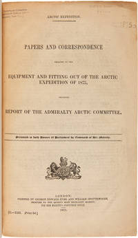
1875WRCAM50678London 1875. 402pp. plus folding map. Folio. 20th-century three-quarter calf and marbled paper boards spine gilt. Stefansson Library stamp on titlepage deaccessioned. Toned minor chipping at edges of some leaves. Final leaf repaired with archival paper with no loss to text; small tears in margin of map. Very good. This scarce document describes the plans for the 1875 Nares Expedition includes specifications for the H.M.S. Discovery data on supplies needed estimations of costs and a hydrographer's report as well as a color chart of the North Polar Sea. The chart is a Polar projection map showing the seas navigated by British expeditions as well as coasts discovered by British American German Swedish and Austrian explorers through 1874. <br> <br> The Nares expedition which sailed from 1875 to 1876 strove to be the first to reach the North Pole and to explore its coasts and region. Though unsuccessful in this venture the expedition was the first to sail ships through the channel between Greenland and Ellesmere Island and as far north as the Lincoln Sea recording valuable information about the mysterious region. A sledging party under Captain Albert Hastings Markham also set a new record on land reaching as far north as 83° 20'. The British Parliament printed occasional reports of the various expeditions and related Arctic subjects which became known as the Arctic "blue books" named after the distinctive blue wrappers in which they were originally issued. This copy has the stamp of the Stefansson collection at the Dartmouth library but was deaccessioned as a duplicate to his widow. ARCTIC BIBLIOGRAPHY 45251. hardcover books
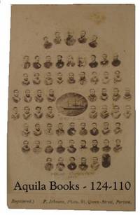
1875124110Portsea: F.Johnson 1875. Photograph. very good. Origninal vintage albumen photograph 6.5 X 10.3 CM on original printed mount. Minor soiling and small tape stain on rear. Small old crease just effecting the image but not very visible. A very nice example. very good This wonderful CDV comprises an image of each crew member and the mascot. The central image is of the ship. Souvenir photographs of both the Alert and the Discovery were taken by rival photographers before the departure of the expedition. Both produced CDV copes as well as much larger examples. Although quite small each potrait is very clear and the name of the individual is usually readable with a magnifing glass. Very Scarce. 1875 F.Johnson unknown
189817878CBHamburg, Verlagsanstalt u. Druckerei Actien-Gesellschaft, 1898. gr.8°, 455 S. mit 159 s/w-Abbildungen und 4 Faltkarten, original Leineneinband (Hardcover), illustratierter Vorderdeckel mit schwarzem Zierrahmen, goldener Deckel- und Rückenbeschriftung, Rückdeckel mit blindgeprägtem Verlagsemblem und blindgeprägtem Zierrahmen, Buchrücken mit Zierbünden im Stil der Zeit, Marmorschnitt und Musterpapiervorsätze, 2. Ausgabe Einbandkanten zum Teil minimal berieben, Musterpapiervorsätze am inneren Gelenk zwischen Vorderdeckelinnenseite und Vorsatzseite stellenweise minimal angeplatzt, Musterpapiervorsätze an oberer Kante der hinteren Vorsatzseite und der Rückdeckelinnenseite
189119866Berlin, Globus, o.J.[1891]. Illustrierter Leinenband, 8°,VIII, 304 S., 2 Bl; -Einband etwas berieben und gebräunt, gutes Exemplar.
189713650Leipzig, Brockhaus, 1897-98. Gr. 8°, X, 527 Seiten; VIII, 507 Seiten mit zusammen 207 Abbildungen, 8 Chromotafeln und 4 Karten; VIII, 519 Seiten mit 86 Abbildungen und 4 Chromotafeln. Orig.Leinenbände mit montierter Abbildung.
1897REIS0414Leipzig, Brockhaus 1897/98. gr.-8°, X, 527; VIII, 539; mit 211 Abb., 8 Chromotaf., 4 Karten; VIII, 519 S.; mit 86 Abb. u. 4 Chromotaf.; OLn. m. aufkasch. Deckelbildchen; berieb., bestoß., leicht angeschmutzt, Rückennähte tlw. etw. rissig. Ergänzungsband: Nordahl, Bernhard. Wir Framleute. Johansen, Hjalmar. Nansen und ich auf 86°14'.
189722615Leipzig, Brockhaus, 1897. Mit einem Beitrag von Kapitän Sverdrup, 207 Abbildungen, 8 Chromotafeln und 4 Karten. Frontispiz, X, 527 SS; Frontispiz, VIII, 507 SS. Alle 4 Karten vorhanden. Gr.-8°, illustr. orig.-Verlagseinband. Die Bände angegraut und leicht gebrauchsspurig.
189711396Leipzig, F.A.Brockhaus, 1897. Geprägte Leineneinbände, montierte Titelfotografie, gr-8°, X, 527/ VIII, 507 S., 207 Abbildungen, 8 Chromotafeln, 4 Karten; -Einbände berieben und etwas fleckig, Papier gebräunt, Gelenke etwas lose.