Fred BlanchodLivre Rare Book
1 955 résultats
1950100093543Payot 1950 in8. 1950. Broché. iconographie en noir et blanc
1980100097322Jml 1980 in8. 1980. Broché. iconographie en noir et blanc
66939New York, D. Appleton & Company 1846, 230x145mm, IV - 186pages, paperback. Lower cover missing. Spine used. Name of the owner on the superior cover.
1831E0132<p>2 volumes. xxi472 pages with three maps two folding and one double page figures and 13 plates; iv452 pages with 10 plates some folding tables and appendices. Octavo 9 1/2" x 5 1/2" Bound in contemporary half leather with marbled boards and gilt lettering to spine. Ferguson 1418; Hill I p. 19; Howes B309; Lada-Mocarski 95; Sabin 4347. Second edition published after quarto edition of the same year.<br /><br />Frederick William Beechey 17 February 1796 – 29 November 1856 was an English naval officer and geographer. He was the son of Sir William Beechey RA and was born in London. 1806 he entered the Royal Navy and saw active service during the wars with France and America. In 1818 he served under Lieutenant afterwards Sir John Franklin in David Buchan's Arctic expedition of which at a later period he published a narrative. In the following year he accompanied Lieutenant W. E. Parry in HMS Hecla. In 1821 he took part in the survey of the Mediterranean coast of Africa under the direction of Captain afterwards Admiral William Henry Smyth. He and his brother Henry William Beechey made an overland survey of this coast and published a full account of their work in 1828 under the title of Proceedings of the Expedition to Explore the Northern Coast of Africa from Tripoly Eastward in 1821-1822. In 1825 Beechey was appointed to command the HMS Blossom. His task was to explore the Bering Strait in concert with Franklin and Parry operating from the east. In the summer of 1826 he passed the strait and a barge from his ship reached 71°23'31" N. and 156°21'30" W. near Point Barrow which he named a point only 146 miles west of that reached by Franklin's expedition from the Mackenzie river. The whole voyage lasted more than three years and in the course of it Beechey discovered several islands in the Pacific and an excellent harbor near Cape Prince of Wales. In July 1826 he named the three islands in the Bering Strait. Two were the Diomede Islands that Vitus Bering had named in 1728: "Ratmanoff Island" Big Diomede and "Krusenstern Island" Little Diomede. Beechey called the uninhabited third islet "Fairway Rock" which is still its contemporary name. One of his crew Petty Officer John Bechervaise gave a detailed account of the voyage in his Thirty Six Years if a Seafaring Life by an Old Quartermaster published privately in 1839. In 1831 there appeared his Narrative of a Voyage to the Pacific and Beering's Strait to Co-operate with the Polar Expeditions 1825-1828. In 1835 and the following year Captain Beechey was employed on the coast survey of South America and from 1837 to 1847 carried on the same work along the Irish coasts. He was appointed in 1850 to preside over the Marine Department of the Board of Trade. In 1854 he was made rear-admiral and in the following year was elected president of the Royal Geographical Society. Beechey Island where Sir John Franklin wintered is named after him.<br /><br /><strong>Condition:</strong><br /><br />Name neatly excised from head corner of titles small inconspicuous stamp to last pages. Inner hinges beginning marble to boards rubbed some stains to map. some toning to some plates some plates not bound in order to the printer but are all accounted for corners gently bumped else about a very good set.</p> Henry Colburn and Richard Bentley hardcover
1717E01353559index pages 36 of 37 maps and copper cuts of the coasts harbor cities plants and other curiosities comprising: 14 plates 3 folding 22 maps charts or plans 14 folding. title page printed in red and black. Printed from the author's original plates inserted in the Paris edition. Lacks the frontispiece map. Royal octavo 9 3/4" x 7 3/4" bound in leather with raised spine bands and red label with gilt lettering. Postscript by Dr Edmund Halley and an account of the settlement commerce and riches of the Jesuits in Paraguay. Palau 94965 Sabin 25926 Nissen ZBI 1433 Hill p117 First English edition.<br /><br />Frézier was educated in Paris and served as lieutenant of infantry from 1702 til 1707 when he entered the engineer corps. In 1712 the government sent him to examine the condition of the Spanish colonies in America. After visiting the principal points in Peru Chili and Brazil he returned to Marseilles. He pointed out several mistakes in the "Relation" of Father Feuille and this led to a bitter controversy between the two travelers. Frézier introduced the large Chili strawberry into France. First published in France in 1714. The first edition into English is preferable to the French original "because it contains Halley's. postscript which corrects certain geographical errors made by Frézier" Hill. "The first part of this book gives an interesting account of the voyage from France around Cape Horn. The second part relates to the voyage along the coasts of Chile and Peru describing the chief towns and cities. Frézier a man of observation brought back information of considerable geographical and scientific value. Much data is included about the native inhabitants.<br /><br />Condition:<br /><br /> Rebacked with original spine label laid down; lacking frontispiece map and binder's leaf free endpapers renewed intermittent foxing else a very nice copy. Jonah Bowyer hardcover books
1717E01353559index pages 36 of 37 maps and copper cuts of the coasts harbor cities plants and other curiosities comprising: 14 plates 3 folding 22 maps charts or plans 14 folding. title page printed in red and black. Printed from the author's original plates inserted in the Paris edition. Lacks the frontispiece map. Royal octavo 9 3/4" x 7 3/4" bound in leather with raised spine bands and red label with gilt lettering. Postscript by Dr Edmund Halley and an account of the settlement commerce and riches of the Jesuits in Paraguay. Palau 94965 Sabin 25926 Nissen ZBI 1433 Hill p117 First English edition.<br /><br />Frézier was educated in Paris and served as lieutenant of infantry from 1702 til 1707 when he entered the engineer corps. In 1712 the government sent him to examine the condition of the Spanish colonies in America. After visiting the principal points in Peru Chili and Brazil he returned to Marseilles. He pointed out several mistakes in the "Relation" of Father Feuille and this led to a bitter controversy between the two travelers. Frézier introduced the large Chili strawberry into France. First published in France in 1714. The first edition into English is preferable to the French original "because it contains Halley's. postscript which corrects certain geographical errors made by Frézier" Hill. "The first part of this book gives an interesting account of the voyage from France around Cape Horn. The second part relates to the voyage along the coasts of Chile and Peru describing the chief towns and cities. Frézier a man of observation brought back information of considerable geographical and scientific value. Much data is included about the native inhabitants.<br /><br />Condition:<br /><br /> Rebacked with original spine label laid down; lacking frontispiece map and binder's leaf free endpapers renewed intermittent foxing else a very nice copy. Jonah Bowyer hardcover
1716BB0841Paris: chez Jean-Geoffroy Nyon quay de Conti au coin de la rue Guenegaud au Nom de Jesus Etienne Ganeau rue Saint Jacques aux Armes de Dombes vis-à-vis la Fontaine de S. Severin Jacque Quillau imprimeur-juré-libraire rue Galande aux Armes de l'Université 1716. First Edition. A defective first edition missing one map and one plate of this classic in the literature of Pacific voyages of exploration. 4to: xiv2982pp with 35 of 37 maps plans and plates 18 of which are folding; ornamental engraved vignettes and woodcut musical notation in the text never bound in were the map of Détroit de le Maire no. v and the plate of Indiens en habits simples no. ix; plate xvi was bound in twice. Contemporary calf spine richly gilt in six compartments brown leather lettering piece gilt "Caissotti" in gilt script on upper board all edges stained red marbled end papers red silk page marker. An exceptional wide-margined copy text maps and plates fresh and clean marred only by a stain in the gutter of first three leaves. Provenance: copper-engraved bookplate "Il Cittadino / Carlo Giac. Caissotti." Sabin 25924. Borba de Moraes 328. Hill p. 115. Leclerc 1736. Palau 94964. Gibson's Library p. 128. Item #BB0841. Frézier set sail in 1712 with a French commission to assess the strength of Spanish settlements on the Pacific coast and to revise existing charts. According to Hill he "brought back information of considerable geographical and scientific value" to later navigators and his account is today appreciated for its keen observations of the customs commerce and natural history—including the cotton and strawberry plants—of Chile Peru and Tierra del Fuego. It's interesting to note that Frezier's surname was itself derived from fraise the French for strawberry. The chapters on Indian and Creole life include descriptions of costume and architecture as well as musical instruments. The folding plans of cities visited are often enhanced by panoramic views as in the case of Callao Concepción Valparaíso La Serena Salvador de Bahía and Angra Azores. Amongst the most important plates are the general map of the expedition the Strait of Lemaire Valdivia Bahía de an Vicente Santiago de Chile Lima and Bahía de Todos los Santos. An immediate success the work was soon translated into English and German and republished several times in the eighteenth century. N. B. With few exceptions always identified we only stock books in exceptional condition with dust jackets carefully preserved in archival removable mylar sleeves. All orders are packaged with care and posted promptly. Satisfaction guaranteed. Fine Editions Ltd is a member of the Independent Online Booksellers Association and we subscribe to its codes of ethics. chez Jean-Geoffroy Nyon, quay de Conti, au coin de la rue Guenegaud, au Nom de Jesus, Etienne Ganeau, rue Saint Jacques, aux Arm unknown
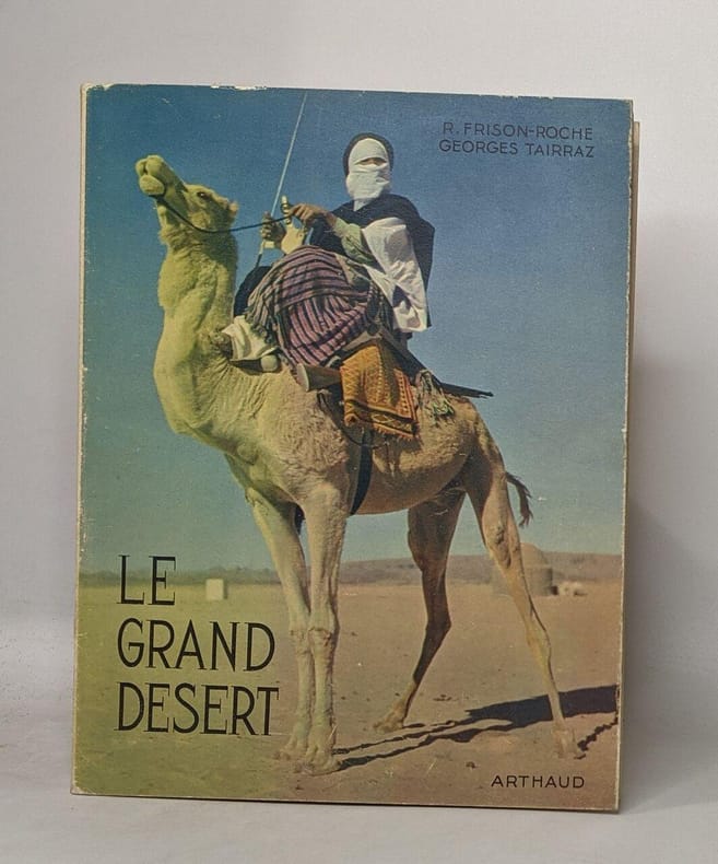
1950100082667Arthaud 1950 in8. 1950. broché.
1950100116455Arthaud 1950 in4. 1950. Broché jaquette.
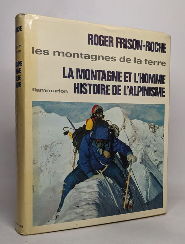
1964100111854Flammarion 1964 in4. 1964. Relié jaquette.
1983100141539ARTHAUD 1983 in8. 1983. Broché.
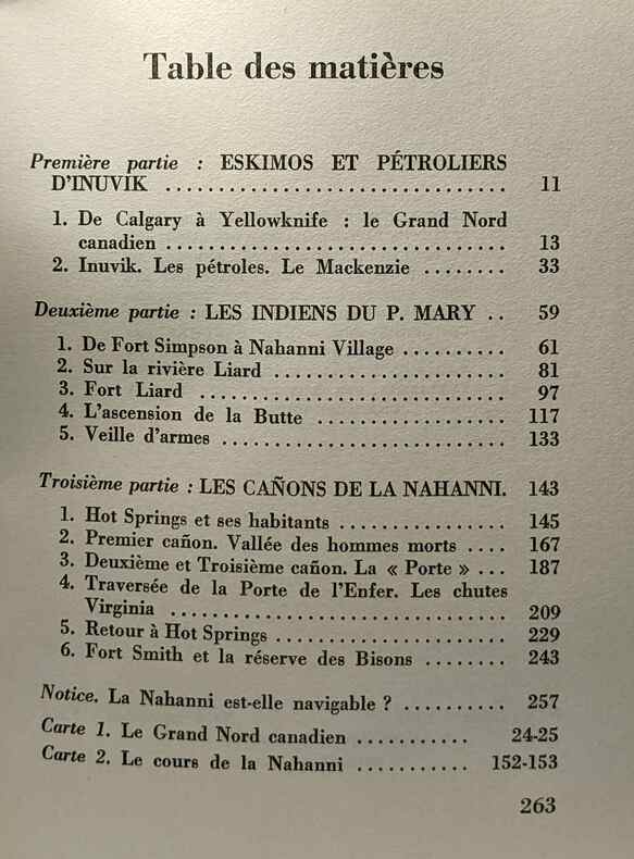
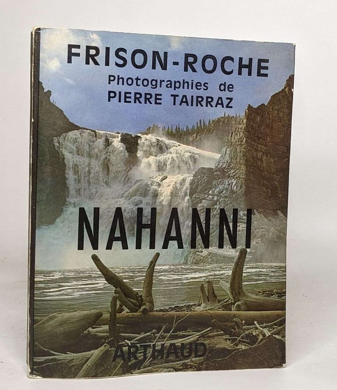
35138Paris Arthaud 1969 in 8 (20x15) 1 volume broché, couverture illustrée à rabats, 263 pages, avec 46 photographies de Pierre Tairraz, 2 cartes. Collection ''Romans et récits de Roger Frison-Roche''. Bel exemplaire ( Photographies sur demande / We can send pictures of this book on simple request )
1970100084315Arthaud 1970 in8. 1970. Broché. illustrations en noir et blanc
1969100117259Arthaud 1969 in8. 1969. Broché.
191215497Vita Deutsches Verlagshaus, Berlin, 1912-1913. XXVI,402,(2); XXIV,508,(4); IX,(5),391,(1) Seiten, ca 27,5x22cm, goldgeprägter OLeinenband. Erster Band: Auf den Trümmern des klassischen Atlantis. Mit ca. 250 Illustrationen, 26 Tafelbildern, 2 mehrfarbigen Tafeln. 3 Kupferdrucken, 4 Heliogravüren und 4 Plänen. Zweiter Band: An der Schwelle des verehrungswürdigen Byzanz. Mit 51 Illustrationen und Tafelbildern, einer mehrfarbigen Tafel, 2 Kupferdrucken und 4 Plänen. Dritter Band: Unter den unsträflichen Aethiopen. Mit 56 Illustrationen und Tafelbildern, einer mehrfarbigen Tafel, einem farbigen Kupferdrucke und 2 Karten. Einbandkanten etwas bestossen. Gute Exemplare. Good copies. Der geplante vierte Band konnte wegen des Kriegsausbruches nicht erscheinen.
191115496Vita Deutsches Verlagshaus, Berlin, 1911. XV, 410 Seiten, ca 26x19cm, illustrierter, goldgeprägter OLeinenband. 48 Tafeln, 27 Illustrationen (z.T. montiert), einem bunten Bild und 2 (eine davon ausfaltbar) Karten. Zweiter Reisebericht der `Deutschen Inner-Afrikanischen Forschungs-Expedition`. Einbandkanten etwas bestossen. Gutes Exemplar. Good copy.
190115514Verlag von Gebrüder Jänecke, Hannover, 1901. XI,414(+ Karten) Seiten, ca 21,5x14,4cm, rundum Farbschnitt Wenige Anstreichungen am Rand und im Text. Das Papier zeitbedingt vorwiegend an den Rändern nachgedunkelt. Eine Ecke gestaucht. Insgesamt gutes Exemplar. Good copy. Selten. Rare.
192315500O.C. Recht Verlag, München, 1923. XI, 85 Seiten und Tafeln, ca 32x24,5cm, OHalb-Leineneinband. S/w-Abbildungen im Text. Gutes Exemplar. Good copy. Der Rücken ausgeblichen und an der Leinenfalz mit kleineren Einrissen, Buchblock am Vorsatz gebrochen. Der Buchblock sitzt fest in der Bindung. Veröffentlichung des Forschungsinstitutes für Kulturmorphologie. Good copy.
192315498C.H. Becksche Verlagsbuchhandlung, München, 1923. XII,184,(2) Seiten, ca 28,5x22cm, OHalbLeder m. reicher Rückenvergoldung. Mit 194 Tafeln, zahlreichen Abbildungen im Text und 54 Karten. Aus dem Inhalt: I. Afrika als Einheit. II. Sahara. III. Zega. IV. Hyläa. Veröffentlichung des Forschungsinstituts für Kulturmorphologie. NaT. Buchgestaltung: F.H. Ehmcke. Gutes Exemplar, der Rücken etwas berieben.
193115525Hugo Bermühler Verlag, Berlin-Lichterfelde, 1931. Seiten 81-120, ca 26x18cm, OBroschur. Zweispaltendruck. Mit Abbildungen im Text und auf Tafeln. Inhalt von Heft 3: Die Kunst Afrikas (mit Abbildungen) von Leo Frobenius - Ein Märchen und eine Mythe - Mitteilungen. Sehr gutes Exemplar. Good copy. Selten. Rare.
189715513Deutsche Akademie d. Naturforscher in Commission b. W.Engelmann, Halle a.S.-Leipzig, 1897. 95 Seiten, ca 31x24cm, schmuckloser, späterer(?) Leinenband Einige Seiten mit Randbeschädigungen, die letzten 8 Seiten am unteren Rand ca 1cm kürzer. Insgesamt ein ordentliches Exemplar. Good copy. Selten. Rare.
193115526Hugo Bermühler Verlag, Berlin-Lichterfelde, 1931. 32 Seiten, ca 26x18cm, OBroschur. Zweispaltendruck. Mit einer Abbildung im Text. Der Einband lichtrandig, ansonsten ein sehr gutes Exemplar. Good copy. Selten. Rare.
190216157Verlag von Gebrüder Jänecke, Hannover, 1902. VIII,450(+ Tafeln) Seiten, ca 21,5x14,4cm, rundum Farbschnitt. Das Papier zeitbedingt vorwiegend an den Rändern nachgedunkelt. Der Einband leicht berieben. Insgesamt gutes Exemplar. Good copy. Selten. Rare.
193715501Otto Harrassowitz Verlag, Leipzig, 1937. XXIX, 74 Seiten und Tafeln, ca 36x28cm, OHalb-Ledereinband. Mit 89 Lichtdrucktafeln und 2 vierfarbigen Buchdrucktafeln nach 69 Vorlagen von Ruth Assisa Cuno, 4 Vorlagen von Käte Marr und 20 Vorlagen von Agnes S. Schulz. Gedruckte Danksagung an Benito Mussolini. Veröffentlichung des Forschungsinstitutes für Kulturmorphologie. Good copy.
193115515Atlantis Verlag, Berlin-Zürich, 1931. 368,VIII Seiten, ca 23,5x16,5cm, OLeinen (der Schutzumschlag nur noch fragmentarisch vorhanden). Die ausfaltbare Tafel unsauber wieder zusammengelegt, dadurch Läsuren an der Karte. Bleistiftanmerkungen auf dem Vorsatzblatt. Gutes Exemplar. Good copy. Veröffentlichung des Forschungsinstituts für Kulturmorphologie e.V. Frankfurt.