Collectif Dimpre Henri (illustrations)Livre Rare Book
57 aventures voyages et combats sur mer
1966201536Grund 1966 544 pages in8. 1966. Relié jaquette. 544 pages.

Un Autre Monde · Val Couoesnon, France13,00 €
1 956 résultats
H4141874. Albumin Prints ca. 145 x 129 cm 15 x 106 cm und 145 x 113 cm auf Kartontafeln montiert. Mit Beschriftung in deutscher Sprache. Eine Aufnahme ist etwas gebleicht die anderen sind in gutem Zustand und von guter Qualit‰t. Die Photos wurden w‰hrend des Aufenthalts der Korvette Gazelle 1874 in Monrovia gemacht. Sie zeigen Mitglieder der Expedition. Kommandant von Schleinitz f¸hrte die Korvette Gazelle 1874 bis 1876 auf einer Weltreise mit wissenschaftlichem Auftrag. Auf den Kerguelen-Inseln verbrachte die Expedition l‰ngere Zeit um den Venustransit zu beobachten. Mitte 1875 ging es weiter nach Neu Guinea. Viele Wissenschaftler forschten in den Bereichen Zoologie Botanik Geologie Meteorologie und Meeresforschung w‰hrend Schleinitz selbst ethnologisches Material sammelte. Er benannte die Halbinsel nach seinem Schiff der Gazelle. Melanesien wurde erfirscht w‰hrend auf der R¸ckfahrt Fiji Tonga und Samoa besucht wurden. Die Ergebnisse der Expedition wurden in einem f¸nfb‰ndigen Werk publiziert. unknown
1966201536Grund 1966 544 pages in8. 1966. Relié jaquette. 544 pages.
1948100109308Editions de paris 1948 in8. 1948. Broché.
Hansen, Johannes; HutchinIn Pristine Condition. unknown
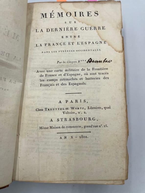
238169Paris et Milan, 1800 - 1801 7 pièces en deux vol. in-8, demi-veau fauve, dos lisses ornés de dent-de-rat et filets dorés, pièces de titre crème, coins en vélin (reliure un peu postérieure). Des mouillures claires au premier volume.
197031246Nicosia Cyprus: Republic of Cyprus 1970. 8vo pp. 16. Paper wraps. Illustrated with drawings plans and photographs. VG. Republic of Cyprus unknown books
98133aafLondon, John Murray, 1913, gr. in-8vo, XXI + 347 p. with 18 illustrations and a map, publisher’s pictorial clothbound
1967013782LondonAmsterdamNew York : Frank Cass/N. Israel/Da Capo Press 1967. Facsimile of 1803 Edition.Bibliotheca Australiana # 3 4 5 6 & 7.Original mottled fawn buckram with blue title labels to upper boards and spines. .This book will be POSTED AT OUR STANDARD RATES FULLY INSURED UK ONLY . Please email for further details NOT "Signed by the Author". Not Signed or Inscribed. Mottled Fawn Buckram . FINE AS BRAND NEW/Plastic Jacket AS NEW. Illus. by numerous Illustrations Maps Views & Charts Including Several Folding . 8vo - over 7¾" - 9¾". HARDBACK. Frank Cass/N. Israel/Da Capo Press hardcover
1967013821LondonAmsterdamNew York : Frank Cass/N. Israel/Da Capo Press 1967. Facsimile of 1803 Edition.Bibliotheca Australiana # 3 4 5 6 & 7.Original mottled fawn buckram with blue title labels to upper boards and spines. .This book will be POSTED AT OUR STANDARD RATES FULLY INSURED UK ONLY . Please email for further details NOT "Signed by the Author". Not Signed or Inscribed. Mottled Fawn Buckram . NEAR FINE NEAR BRAND NEW/Plastic Jacket AS NEW. Illus. by numerous Illustrations Maps Views & Charts Including Several Folding . 8vo - over 7¾" - 9¾". HARDBACK. Frank Cass/N. Israel/Da Capo Press hardcover
1790E00534 of 6 volumes. Volume 1: i-ix-372 pages with 23 plates including frontispiece plate of Cook and 4 folding maps; Volume II lacking; Volume III: 793-1184 pages with 11 plates including frontispiece of Possession Bay and 5 fold out maps; Volume IV: 1185-1546 pages with 26 plates including frontispiece of Woman Child and Man of Van Diemen's Land and 6 folding maps; Volume V: 1547-1938 pages with 30 plates including frontispiece of A View of Huaheine and 8 folding maps; Volume VI lacking. Octavo 8 1/2" x 5 1/2" bound in original full leather with red labels to spine with gilt lettering. Abridged by George William Anderson. An earlier Large folio edition by Anderson was published earlier. This edition originally issued in 80 weekly parts and also called the Large octavo edition. M K Beddie: 39 First edition of the bound edition.<br /><br />Captain James Cook RN was a British explorer navigator and cartographer ultimately rising to the rank of Captain in the Royal Navy. Cook made detailed maps of Newfoundland prior to making three voyages to the Pacific Ocean during which he achieved the first European contact with the eastern coastline of Australia and the Hawaiian Islands as well as the first recorded circumnavigation of New Zealand. Cook joined the British merchant navy as a teenager and joined the Royal Navy in 1755. He saw action in the Seven Years' War and subsequently surveyed and mapped much of the entrance to the Saint Lawrence River during the siege of Quebec. This helped bring Cook to the attention of the Admiralty and Royal Society. This notice came at a crucial moment both in his personal career and in the direction of British overseas exploration and led to his commission in 1766 as commander of HM Bark Endeavour for the first of three Pacific voyages. Cook charted many areas and recorded several islands and coastlines on European maps for the first time. His achievements can be attributed to a combination of seamanship superior surveying and cartographic skills courage in exploring dangerous locations to confirm the facts for example dipping into the Antarctic Circle repeatedly and exploring around the Great Barrier Reef an ability to lead men in adverse conditions and boldness both with regard to the extent of his explorations and his willingness to exceed the instructions given to him by the Admiralty. Cook was killed in Hawaii in a fight with Hawaiians during his third exploratory voyage in the Pacific in 1779.<br /><br />Condition:<br /><br />Lacks volume II and VI. First signature of volume one loose inner hinges cracked some interior soiling spine ends and corners of leather rubbed some scuffing to leather else a good set. Printed for A Millar, W Law, and R Cater hardcover
18363145New York: Wiley & Long 1836. First Edition . Cloth. Good. 16mo - over 5¾" - 6¾" tall. Green boards. 3vi-xviii268p12 fold out platesillus Some browning on plates. Backstrip needs to be reglued. 3" split on baxkstrip. Early owners name ink on fep 1854. Gilt title on spine From the estate of Levi Lincoln- Lieut George Lincoln MSA Oct 4 1834 <br/> <br/> Wiley & Long hardcover
19678240Israel / Da Capo 1967. Facsimile Edition. Hardcover Original Cloth. Very Good Condition/No Dust Jacket. Size: A4 300 x 210mm approx. Text body is clean and free from previous owner annotation underlining and highlighting. Binding is tight covers and spine fully intact. Slight foxing front/rear pages but body of book mostly clean and unfoxed. Original Glassene Wrapper. All edges clean neat and free of foxing. Quantity Available: 1. Shipped Weight: 2-3 kilos. Category: Exploration; Antiquarian & Rare. All our pictures shown here are of the actual item not stock photos. Inventory No: 8240. . This book is extra heavy and may involve extra shipping charges to some countries. Israel / Da Capo hardcover
1911M147391911 P, P Lafitte , 1911 , in4° reliure bleue éditeur , 341 pp , 1 carte dépliante. Une pièce de titre amateur sur le dos. Langue: Français
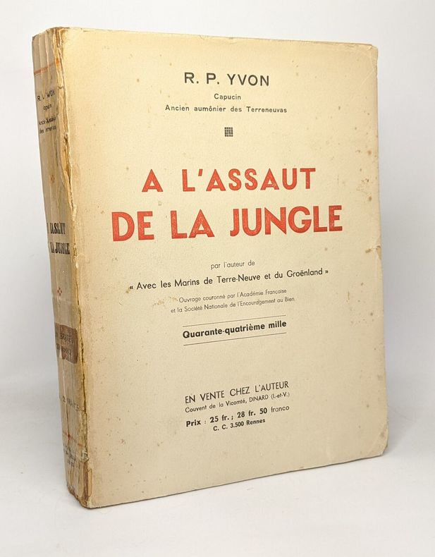
1940100060737En vente chez l'auteur 1940 in8. 1940. Broché.
1911hp292Pierre Lafitte et Cie Cartonné 1911 In-4 (20,5 x 25,8 cm), cartonné toilé, 341 pages, photographies en noir et blanc ; dos insolé, épidermures en tête et traces blanche en queue du quatrième plat, quelques traces et bord insolé au premier plat, par ailleurs intérieur bien conservé, assez bon état général. Livraison a domicile (La Poste) ou en Mondial Relay sur simple demande.
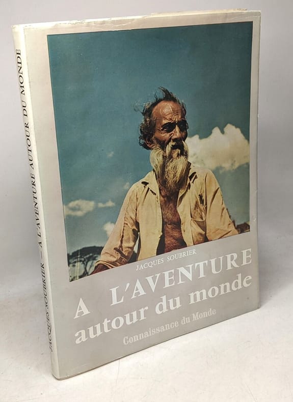
1959100132171connaissance du monde 1959 in8. 1959. Broché.
115577Pôles d'Images Récits Introuvables Pôles d'Images Editions, Coll. Récits Introuvables,2005, 312 p., broché, un timbre à sec sur la page de titre, bon état.
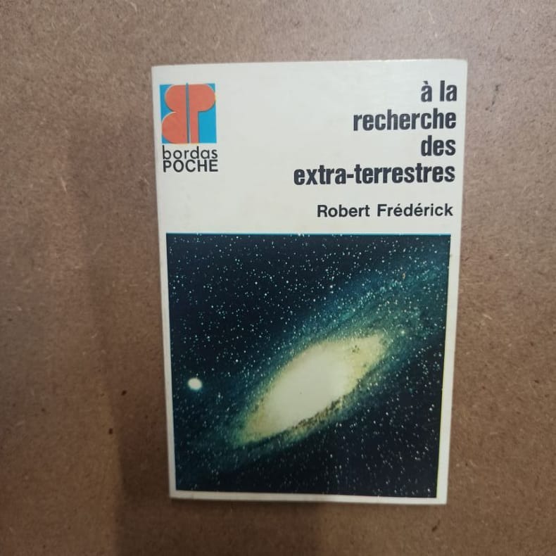
19735611973 - broché - Editions Bordas - Collection "Bordas Poche" N° 3 - 1973 - In-12 (16,5 x 11 cm) broché - 126 pages - Illustrations et photographies principalement en noir et blanc
1948190837Payot 1948 in8. 1948. Broché.
198222210Rotterdam: A. A. Balkema. Near Fine in Near Fine dust jacket. 1982. First Edition. Hardcover. 906191096X . With maps and charts throughout a near fine copy in near fine dustjacket. ; 235 x 160mm; x 246 pages . A. A. Balkema hardcover
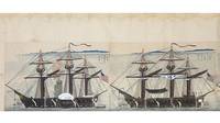
11288Japan: ca. 1854-55.<br /> <br> <br> An impressively assembled scroll that portrays the second American expedition to Japan February-March 1854 led by Commodore Perry; much of it is focused on the American vessels that anchored menacingly off the coast. Seven of the nine ships in the American fleet are carefully portrayed with notes on the estimated numbers of cannons and crewmembers. Steam-powered ships with black smoke gushing from the stacks and rows of powerful cannons shocked the Japanese most of whom had never seen such a demonstration of advanced military technology. The observations in this scroll must have been crucial to inform the decision-making of Japanese officials.<br /> <br> <br> "Black Ship Scrolls" conveying eyewitness reports were disseminated among the Japanese elite and kept top secret. Our scroll was presumably created for a high-ranking Japanese official since any information on the American interlopers was carefully controlled by the local authorities to maintain public order in the face of an anticipated foreign invasion. Compared to other depictions of the foreigners which frequently showed them as caricatures hairy oversized red-faced and blue-eyed the more dignified portraits in our scroll demonstrate the increasing familiarity between the Japanese and American contingents.<br /> <br> <br> In the years following Japan's opening to the West Japanese artisans produced countless scrolls commemorating the American expeditions catering to the tourist trade and as gifts to visiting dignitaries. Mass-produced with foreigners' preferences in mind these scrolls took liberties with the events that transpired straying far from the earliest accounts and sketches. They pale in comparison with the elaborate and scrupulous illustrations found in this early scroll. Though the later mass-produced scrolls are easily found on the market examples like ours presumably created for a Japanese official or nobleman remain greatly treasured for their revealing depictions.<br /> <br> <br> We have ordered the scroll into 15 individual scenes most of which have a contemporary manuscript caption translated below:<br /> <br> <br> I. Three sailors in the American marching band two of whom are uniformed drummer boys. The band led the American march to Yokohama where negotiations between the two nations were held in a newly constructed reception hall. The Japanese manuscript caption reads: "Illustration of musicians."<br /> <br> <br> II. Two sailors with swords sheathed are holding their muskets with bayonets fixed. A fine indigo ink has been employed to depict the uniform on the left. Caption: "Rank: Sergeant/Soldier."<br /> <br> <br> III. Commodore Perry on the right faces a sailor who may be the conductor of the American expedition's marching band. Perry is depicted rather sympathetically compared to exaggerated and even outlandish portraits that depict him as quite large hairy and red-faced. The artist has once more used a deep indigo to capture the color of the uniforms. Caption: "Ambassador Perry/Conductor Commandant."<br /> <br> <br> IV. A larger portrait of a lone sailor probably an officer clutching his sheathed sword and clenching his fist. Caption: "Foreigner Captain landed near Kanagawa."<br /> <br> <br> V. An elaborate and realistic portrait of Perry capturing even the individual hairs on his head and the wrinkles on his face. Caption: "American Envoy Perry."<br /> <br> <br> VI. A portrait of Perry's chief-of-staff Henry A. Adams done by the same artist as Perry's portrait. Caption: "American Vice Envoy Adams."<br /> <br> <br> VII. upper portion A very long horizontal painting of the American column marching to the Yokohama reception hall for negotiations regarding the opening of Japan to American trade. There are more than 100 armed Americans soldiers following the marching band. The top of this sheet has been slightly cropped cutting off part of the American flag in the middle. Caption: "Illustration of American landing column."<br /> <br> <br> VIII. lower right A sizable rendering of the USS Vandalia a sloop-of-war that joined the Perry Expedition in late 1853. Caption: "Name of ship: Vandalia 20 cannons 200 crewmembers." Minuscule mended wormholes to the image.<br /> <br> <br> IX. lower left The USS Saratoga another sloop-of-war. Caption: "Name of ship: Saratoga 20 cannons 200 crewmembers." Expertly mended wormholes touching the image hardly visible.<br /> <br> <br> X. upper portion A panoramic view with a fleet of 23 American rowboats headed to shore. Mending to the top of the scroll.<br /> <br> <br> XI. right lower portion The USS Mississippi a steam frigate that was part of the first expedition. Caption: "Name of ship: Mississippi 8 cannons 240 crewmembers."<br /> <br> <br> XII. left lower portion The USS Southampton a storeship. Caption: "Name of ship: Southampton 6 cannons 50 crewmembers." Expert mending of wormholes affecting the image.<br /> <br> <br> XIII. USS Supply a supply ship. Caption: "Name of ship: Supply 6 cannons 40 crewmembers." Wormholes repaired and with some foxing.<br /> <br> <br> XIV. USS Lexington a supply ship. Caption: "Name of ship: Lexington 26 cannons 50 crewmembers." Repaired wormholes and small sections of the white wash used for the sails have come off.<br /> <br> <br> XV. USS Susquehanna a steam frigate. Caption: "Name of ship: Susquehanna 6 cannons 240 crewmembers." Careful mending of wormholes to head and tail of scroll.<br /> <br> <br> In very good condition; there are a number of wormholes all expertly restored to the point that most are invisible to the naked eye and some browning and speckles to blank segments of the scroll. Two unidentified ownership seals next to the illustration of the USS Vandalia no. VIII. Housed in a custom-made 20th-century wooden box.<br /> <br> <br> ⧠Renata V. Shaw "Japanese Picture Scrolls of the First Americans in Japan" in The Quarterly Journal of the Library of Congress Vol. 25 No. 2 April 1968 pp. 134-53. <br /> <br> <br> For helpful recapitulations of accounts from the Japanese and Americans William McOmie The Opening of Japan 1853-1855: A Comparative Study of the American British Dutch and Russian Naval Expeditions to Compel the Tokugawa Shogunate to Conclude Treaties and Open Ports to Their Ships 2006. unknown
38391. First and only edition 8vo 4 43 1pp. with half-title upper corner from E2 torn away just touching page numeral disbound. Relating to the British raid on Rochefort in 1757. unknown
First and only edition, 8vo, [4], 43, [1]pp., with half-title, upper corner from E2 torn away just touching page numeral, disbound. Relating to the British raid on Rochefort in 1757.
180272327London: A. Arrowsmith 1802. A fine and high quality facsimile of this seminal map commissioned in 2001 by renown Lewis & Clark collector Roger Wendlick. Backed on canvas and measuring 150 x 58 inches in color Wendlick commissioned the firm of Ford Graphics of Portland to make this map. Only 21 copies were made and this is the last one with a letter from Wendlick attesting to this fact. Fine. "The 1802 revision of the map of North America on display delineates the complete length of the Missouri River as well as Mackenzie's journey to the Pacific in 1793. The depiction of the Missouri headwaters which Arrowsmith studied from Peter Fidler's drawing of a map by the Blackfoot Indian Ac Ko Mo Ki shows several streams joining into two branches of the Missouri which flow almost due east. The southern branch of the Missouri appears to be the main branch of the river and connects to the Knife River; the northern branch is a good representation of the actual course of the Missouri.Although the revised map still shows a single ridge of mountains in the west a note near the southern sources of the Missouri states: "Hereabout the Mountains divide into several low Ridges." This note which was based on the reports of Fidler Mackenzie and Thompson was more encouraging to Jefferson and Lewis than the note about the Stony Mountains on the 1795 map which unfortunately turned out to be more accurate. Arrowsmith's map situates the Great Lake River on the western slopes of the mountain range and connects this river to the Columbia River with a dotted line. Since another note claims that this river can be descended to the sea in eight days the Arrowsmith map supported the erroneous belief in a convenient route to the Pacific Ocean.Both the 1795 and 1802 versions of Arrowsmith's map served as resources that Nicholas King consulted as he prepared his map for the Lewis and Clark Expedition. Lewis and Clark in fact carried the 1802 Arrowsmith map along on the expedition. Thomas Jefferson owned the 1802 map as well as an 1802 edition of Arrowsmith's map of the United States. Arrowsmith's 1802 map of North America was the most comprehensive map of the West available to Jefferson and Lewis and it was probably the most important map used in the planning of the expedition." University of VirginiaAaron Arrowsmith's 1802 map was the most current and accurate cartographic representation of the American West available to Lewis on the eve of the journey. Lewis studied this edition closely during the summer of 1803 and even carried a copy on the first leg of the expedition. Among Arrowsmith's sources were Indian maps reports and manuscript maps from the British fur trade and British Navy exploration reports and charts of the Pacific Coast. But various elements in the map reinforced Jefferson's misconceptions of western geography among these were depictions of the Rocky Mountains as a single long chain and the headwaters of the upper Missouri River at the eastern edge of the Rockies suggesting those mountains were readily portaged. A. Arrowsmith unknown
1799biblio153<p>a1-42 binders direction8 subscribers4c-4204 additional subscribers pages with 7 maps 5 folding and 6 plates. Quarto 11 3/4" x 9 1/2" with new spine in six compartment with red label in gilt over original decorative blind stamped calf boards. Ferguson 329; Sabin 104.633 First edition first printing.<br /><br />Captain James Wilson brought the first British missionaries to Tahiti on ship <em>Duff </em>in 1797. Wilson was a deeply religious man. The missionaries he brought were from the London Missionary Society. There were thirty men six women and three children. Wilson on the <em>Duff </em>also explored and visited many islands in the Pacific some of which had never had any recorded visit by a European. Among these the most important are Mangareva in the Gambier Islands and Pukarua in the Tuamotus. <em>Duff</em> paid a visit as a missionary ship to Tahiti during 1796 as a result Missionary Society has first been established in Tahiti. Three years after the establishment the directors of the Society appointed a committee to consider a suitable memorial for presentation to Wilson for his services in helping to establish the first mission in the South Seas.<br /><br />Wilson fought with the British army during the American War of independence and then served nine years with the East India company. While in India he was captured by Hyder Ali and after a daring bid for escape was imprisoned in the black hole of Seringapatam. After his release he continued service as a captain and despite illness and further dangerous missions accumulated sufficient sources to retire. throughout it all Wilson remained fast in his irreligious opinions. While living in England with his niece however he was converted to an evangelical faith. he felt called to volunteer for missionary service after reading the <em>Evangelical Magazine</em>. Haweis did not know Wilson before receiving a letter volunteering his services in the Pacific. his skills and newfound devotion seemed perfectly suited to the situation and Haweis saw him as "God's man." the <em>Duff </em>arrived at Tahiti on march 5 1797. the settlement at Tahiti of twenty of the missionaries five of them with wives and two children gives further examples of the role of the missionary captain. A pattern of intercourse had already been established by other voyagers according to which the captain of a vessel would take the leading role in meetings. It is therefore not surprising that the focus of the chapter describing the arrival is on meetings between significant island figures and Captain Wilson. For example Manemane a "high priest" Frommo'orea sought Wilson as a tayo or friend not Jefferson the president of the missionaries.<br /><br />The official account of the first mission appeared in 1799 under the lengthy title <em>A missionary voyage to the southern Pacific Ocean performed in the years 1796 1797 1798 in the ship Duff commanded by Captain James Wilson compiled from the journals of the officers and the missionaries; and illustrated with maps charts and views drawn by Mr William Wilson.</em>.it was placed firmly within the tradition of the voyages of discovery by an introduction compiled by Samuel Great heed that described previous European contacts with the islands and an appendix "including details never before published of the natural and civil state of Otaheite." the main narrative was taken from Wilson's journal with additions from his son and a journal kept by the missionaries during the period when the <em>Duff </em>was away from Tahiti at Tonga. Wilson dominated the events recorded in the narrative.<br /><br /><strong>Condition:</strong><br /><br />Some offset toning from maps occasional foxing water mark to upper margin on some leaves two leaves miss-bound at back re-backed with contemporary blind stamped calf boards.</p> S Gosnell for T Chapman hardcover