1 956 résultats
1799biblio153a1-42 binders direction8 subscribers4c-4204 additional subscribers pages with 7 maps 5 folding and 6 plates. Quarto 11 3/4" x 9 1/2" with new spine in six compartment with red label in gilt over original decorative blind stamped calf boards. Ferguson 329; Sabin 104.633 First edition first printing.<br /><br />Captain James Wilson 1760–1814 brought the first British missionaries to Tahiti on ship Duff in 1797. Wilson was a deeply religious man. The missionaries he brought were from the London Missionary Society. There were thirty men six women and three children. Wilson on the Duff also explored and visited many islands in the Pacific some of which had never had any recorded visit by a European. Among these the most important are Mangareva in the Gambier Islands and Pukarua in the Tuamotus. Duff Paid a visit as a missionary ship to Tahiti during 1796 as a result Missionary Society has first been established in Tahiti. Three years after the establishment the directors of the Society appointed a committee to consider a suitable memorial for presentation to Wilson for his services in helping to establish the first mission in the South Seas.<br /><br />Wilson fought with the British army during the American War of independence and then served nine years with the East India company. While in India he was captured by Hyder Ali and after a daring bid for escape was imprisoned in the black hole of Seringapatam. After his release he continued service as a captain and despite illness and further dangerous missions accumulated sufficientr esources to retire. throughout it all Wilson remained fast in his irreligious opinions. While living in England with his niece however he was converted to an evangelical faith. he felt called to volunteer for missionary service after reading the Evangelical Magazine. Haweis did not know Wilson before receiving a letter volunteering his services in the Pacific. his skills and newfound devotion seemed perfectly suited to the situation and Haweis saw him as "God's man." the Duff arrived at Tahiti on march 5 1797. the settlement at Tahiti of twenty of the missionaries five of them with wives and two children gives further examples of the role of the missionary captain. A pattern of intercourse had already been established by other voyagers according to which the captain of a vessel would take the leading role in meetings. It is therefore not surprising that the focus of the chapter describing the arrival is on meetings between significant island figures and Captain Wilson. For example Manemane a "high priest" Frommo'orea sought Wilson as a tayo or friend not Jefferson the president of the missionaries.<br /><br />The official account of the first mission appeared in 1799 under the lengthy title A missionary voyage to the southern Pacific Ocean performed in the years 1796 1797 1798 in the ship Duff commanded by Captain James Wilson compiled from thejournals of the officers and the missionaries; and illustrated with maps charts and views drawn by Mr William Wilson.it was placed firmly within the tradition of the voyages ofdiscovery by an introduction compiledby samuel Greatheed that described previous european contacts with the islands and anappendix "including details never before published of the natural and civil state of otaheite." the main narrative was taken from Wilson's journal with additions from his son and a journal kept by the missionaries during the period when the Duff was away from Tahiti at Tonga. Wilson dominated the events recorded in the narrative.<br /><br />Condition:<br /><br />Some offset toning from maps occasional foxing water mark to upper margin on some leaves two leaves miss-bound at back re-backed with contemporary blind stamped calf boards. S Gosnell for T Chapman hardcover books
1911100088070Witherby & Co 1911 in8. 1911. Cartonné.
1828073384London: Longman Rees Orme Brown and Green 1828. "Being Extracts from The Journal of a Detenu Who Continued a Prisoner on Parole in the French Capital From the Year 1803 to 1814. Also Anecdotes of Buonaparte's Journey to Elba." Written by artist Thomas Richard Underwood 1772-1836 and published confidentially at his behest by editor friend John Britton. Full green cloth binding. Title page is loose but present. Patterned endpapers. Small prior bookstore label on front pastedown; prior owner's address stamp on verso of front flyleaf. A small bit of foxing inside some age toning. xix 208pp. plus 4 pages adverts. First Edition. Hardcover. Good/No Dust Jacket. 8vo - 8" - 9" Tall. Longman, Rees, Orme, Brown, and Green Hardcover
8vo [22.5 x 14 cm]; xiii, [ii], 384 pp, 16 plates including frontis from photos, map, 150 illustrations from the author's drawings, appendix on new species of spiders. original cloth, gilt spine title lettering, spine faded but lettering clear, name of Arthur J. Spoor on endpaper, minor foxing on a few margins, front panel of dust jacket glued to front endpaper, tipped in description on endpaper, near fine, clean. A pic An important book on scientific exploration in these South American jungles by the distinguished naturalist and leader of the Oxford University Expedition to British Guiana. Based on long hours of watching in observation posts slung in the tree tops, enabled the author to observe a teeming and fantastic natural world. With much on insects, spiders and spider webs. Nicely illustrated including many sketches of spider webs by the author.
1794BB0447London: printed for T. N. Longman Pater-Noster-Row from 1771 1794. Early Reprint. Stiff Wraps. Fine. 8vo: xxxvi380 numbered columns381-394pp with double-page copper-engraved map as frontispiece; 4216pp. ESTC Citation No. T93564 and T93553. Finely bound to style by Fitterer in stiff beige wraps printed paper spine label. Binding and text block clean bright and unmarked save for offsetting from engraved map. A superlative copy. Fordham Road-Books pp. 27 and 29. Roscoe John Newbery A399/6. Not in Hodson. The tenth edition: with the addition of near ninety pages including considerable improvements in the direct roads many new cross roads and a great number of noblemen’s and gentlemen’s seats. Tenth Edition of the first work 1794; originally published 1771 "With the Addition of near Ninety Pages including considerable Improvements in the direct Roads many new Cross Roads and a great Number of Noblemen’s and Gentlemen’s Seats"; Sixth Edition 1792 improved and corrected of the second work with separate title page. Although Paterson contributed no significant innovations to the compilation of road books relying on the advances of Norden Ogilby and others he "made improvements in style and presentation and added factual detail—so much so that his name was for many years an indicator of reliability in road books and was attached to them long after he had stopped compiling them." ODNB N. B. With few exceptions always identified we only stock books in exceptional condition. All orders are packaged with care and posted promptly. Satisfaction guaranteed. printed for T. N. Longman, Pater-Noster-Row [from 1771] unknown
1790E00534 of 6 volumes. Volume 1: i-ix-372 pages with 23 plates including frontispiece plate of Cook and 4 folding maps; Volume II lacking; Volume 3: 793-1184 pages with 11 plates including frontispiece of Possession Bay and 5 fold out maps; Volume IV: 1185-1546 pages with 26 plates including frontispiece of Woman Child and Man of Van Diemen's Land and 6 folding maps; Volume V: 1547-1938 pages with 30 plates including frontispiece of A View of Huaheine and 8 folding maps; Volume VI lacking. Octavo 8 1/2" x 5 1/2" bound in original full leather with red labels to spine with gilt lettering. Abridged by George William Anderson. An earlier Large folio edition by Anderson was published earlier. This edition originally issued in 80 weekly parts and also called the Large octavo edition. M K Beddie: 39 First edition of the bound edition.<br /><br />Captain James Cook RN was a British explorer navigator and cartographer ultimately rising to the rank of Captain in the Royal Navy. Cook made detailed maps of Newfoundland prior to making three voyages to the Pacific Ocean during which he achieved the first European contact with the eastern coastline of Australia and the Hawaiian Islands as well as the first recorded circumnavigation of New Zealand. Cook joined the British merchant navy as a teenager and joined the Royal Navy in 1755. He saw action in the Seven Years' War and subsequently surveyed and mapped much of the entrance to the Saint Lawrence River during the siege of Quebec. This helped bring Cook to the attention of the Admiralty and Royal Society. This notice came at a crucial moment both in his personal career and in the direction of British overseas exploration and led to his commission in 1766 as commander of HM Bark Endeavour for the first of three Pacific voyages. Cook charted many areas and recorded several islands and coastlines on European maps for the first time. His achievements can be attributed to a combination of seamanship superior surveying and cartographic skills courage in exploring dangerous locations to confirm the facts for example dipping into the Antarctic Circle repeatedly and exploring around the Great Barrier Reef an ability to lead men in adverse conditions and boldness both with regard to the extent of his explorations and his willingness to exceed the instructions given to him by the Admiralty. Cook was killed in Hawaii in a fight with Hawaiians during his third exploratory voyage in the Pacific in 1779.<br /><br />Condition:<br /><br />Lacks volume II and VI. First signature of volume one loose inner hinges cracked some interior soiling spine ends and corners of leather rubbed some scuffing to leather else a good set. Printed for A Millar, W Law, and R Cater hardcover books
177432872NY: James Rivington. Good with no dust jacket. 1774. Hardcover. 18th Century; Maritime; 12mo 7" - 7½" tall; 2 17 1 4 2 260p pages; A New Voyage Round The World In The Years 1768 1769 1770 And 1771; Undertaken by Order of his present Majesty performed by Captain James Cooke In the Ship Endeavour Drawn up from his own Journal and form the Papers of Joseph Banks Vol I of 2. Contemp leather. Covers scuffed edgeworn lacking eps and both plates though small part of folding map is present. Foxed some stains. Upper blank margin of 2nd leaf roughly removed list of subscribers losses to printed area of pp67-68 amounting to a dozen words the normal tears to printed area of a few dozen leaves pencil sketches to rear flyleaf and inside of rear cover. Various old ink markings to title page. JCB Annuel Report for 1931 pp. 12-15; Sabin 30936; Evans 13324 Mitchell Library Cook 656; Holmes 9. 2 . Withal a rare and important American edition of Cook's first voyage. Rivington pirated this American edition to undercut the price of the London First Edition in the American market. . James Rivington hardcover
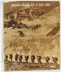
1974102285Peking: Science Press 1974. Hardcover. good to very good. 1st Edition. unpaginated. Quarto in original gilt letterd beige cloth endpaper maps and dust jacket with colour and b&w illustrations from photos. Boards slightly bowed. good to very good Neate C43. Account of the Tibet Scientific Expedition of the Chinese Academy of Sciences. 1974 Science Press hardcover
1019582618.Ghardcover. Good. Access codes and supplements are not guaranteed with used items. May be an ex-library book. hardcover
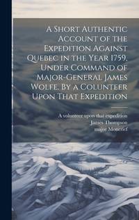
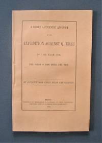
1872R3304Québec: The « Gazette » 1872 "By a volunteer upon that Expedition". Transcribed and edited from the "volunteer's" manuscript notes but never before published. Light foxing on last pages. Soft cover. Fine. The « Gazette » paperback
191018538Paris Fayard 1910 in-8 pleine percale un volume, reliure pleine percale bleu-marine grand in-octavo Editeur (19 x 28 cm) à plaques spéciales Editeur à froid pour le dos et les plats, titre frappé or, décorations à froid pour le dos et les plats (dos insolé), plaque spéciale or aux armes de la ville de paris : "Prix Municipal", toutes tranches lisses, Illustré d'après les dessins de Gaston BURGGRAFF. Photographies, cartes et croquis de l'auteur in et hjors-texte en noir, 206 pages, sans date (1910) Arthème Fayard et Cie Editeur,
98703New York, Frederik A. Stokes 1911, 210x145mm, XV - 317pages, Editor’s cloth binding. Despite top spine with very small tears, book in good condition.
8060carnet d’un touriste,grand in 8 pleine toile rouge d’éditeur à décor gaufré(marguerites)passe partout.Faux-titre,titre illustré, frontispice,270 pages,tranches dorées,librairie Gedalge sans date.Illustrations hors-texte.
1968100118482Berger-levrault 1968 in8. 1968. Broché.
13967P., Hachette, 1893 ; in-4. 2 ff.-IV-395 pp.-(1)-1 carte dépliante en couleurs. Demi-maroquin brun à coins, dos à nerfs, titre et fleurons dorés, filets dorés sur les mors et les coins, tête dorés. Bel exemplaire.
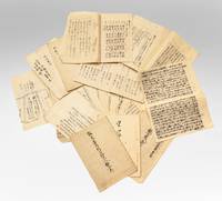
7712Several dozen manuscripts in various formats incl. long folded sheets stitched pamphlets sewn volumes and letters. Japan: ca. 1853-63.<br/> <br/> A substantial group of documents revealing internal high-level debates and discussions in response to Commodore Perry’s landings and later controversies that arose as Western powers established a foothold in Japan. This is an exceptional collection filled with top-secret information on government intrigues as the Japanese state responded to aggressive foreign expansion and dissenting groups within the government urging top-to-bottom reforms.<br/> <br/> The manuscripts touch upon pivotal events in Japan’s history:<br/> <br/> –Commodore Perry’s two expeditions July 1853 & February-March 1854 and the resulting ratification of the Treaty of Shimoda.<br/> <br/> –Japanese translations of the treaties signed with the United States Russia France and the United Kingdom from 1854 to 1858.<br/> <br/> –The assassination of Ii Naosuke in March 1860 also known as the Sakuradamon Incident which precipitated a violent backlash against foreigners under the banner of Sonno joi “Honor the Emperor expel the barbariansâ€.<br/> <br/> –General dissatisfaction with the bakufu and efforts to reform it.<br/> <br/> –The attempted assassination of Ando Nobumasa a chief councillor during this period.<br/> <br/> –The Namamugi Incident in September 1862 when the British merchant Charles L. Richardson was killed by Satsuma domain warriors.<br/> <br/> –The bombardment of Kagoshima August 1863.<br/> <br/> Among all these materials we must highlight several examples of manuscript kengen proposals and commentaries written by aristocrats with policy advice on the difficult situations faced by the Japanese state. These offer compelling perspectives on the most pressing dilemmas of the day. While they were not composed by the decision-makers these documents are filled with the minutiae and data employed in the policy-making process.<br/> <br/> All of the items are in a fine state of preservation.<br/> <br/> ⧠John McMaster “Alcock and Harris. Foreign Diplomacy in Bakumatsu Japan†Monumenta Nipponica Vol. 22 No. 3/4 1967 pp. 305-367. unknown
1747BOOKS005853<p>24548 pages with three folding engraved maps present southern part of South America; part of the Pacific Ocean and the track of the Centurion round the world. Octavo 8 1/4" x 5 1/2" bound in full leather with five raised spine bands with red label to spine in gilt lettering with decorative blind-stamped ruled edges. Compiled from papers and other materials of the Right Honourable George Lord Anson and published under his direction by Richard Walter M.A. Chaplain of his Majesty's Ship the Centurion in that expedition. Hill I pp 317-138. Third edition.<br /><br />"This is the official account of Anson's voyage. England at war with Spain in 1739 equipped eight ships under the command of George Anson to harass the Spaniards on the western coast of South America for the purpose of cutting off Spanish supplies of wealth from the Pacific area. Lord Anson who was a friend and patron of Benjamin Robins after returning from the voyage around the world in the Centurion appears to have entrusted to Robins for revision the account of the voyage which had been compiled from the journals by his chaplain Richard Walter. It is probable that Robins revised and edited the work wrote an introduction and added dissertations." Hill. Perhaps the most popular account of maritime adventure of the eighteenth century. Anson's account of harrying the Spanish of South America and the taking of the Manilla galleon with treasure with a contemporary value of $800000 and his circumnavigation has long enjoyed a distinguished place as a masterpiece in descriptive travel.<br /><br /><strong>Condition:</strong><br /><br />Some small closed tears at the edges of the maps. Rebound in tooled leather with raised bands. Over all a very good to fine copy.</p> John and Paul Knapton and Office of the Lord High Admiral hardcover
1748BOOKS00585324548 pages with three folding engraved maps present southern part of South America; part of the Pacific Ocean and the track of the Centurion round the world. Octavo 8 1/4" x 5 1/2" bound in full leather with five raised spine bands with red label to spine in gilt lettering with decorative blind-stamped ruled edges. Compiled from papers and other materials of the Right Honourable George Lord Anson and published under his direction by Richard Walter M.A. Chaplain of his Majesty's Ship the Centurion in that expedition. Hill I pp 317-138. Third edition.<br /><br />"This is the official account of Anson's voyage. England at war with Spain in 1739 equipped eight ships under the command of George Anson to harass the Spaniards on the western coast of South America for the purpose of cutting off Spanish supplies of wealth from the Pacific area. Lord Anson who was a friend and patron of Benjamin Robins after returning from the voyage around the world in the Centurion appears to have entrusted to Robins for revision the account of the voyage which had been compiled from the journals by his chaplain Richard Walter. It is probable that Robins revised and edited the work wrote an introduction and added dissertations." Hill. Perhaps the most popular account of maritime adventure of the eighteenth century. Anson's account of harrying the Spanish of South America and the taking of the Manilla galleon with treasure with a contemporary value of $800000 and his circumnavigation has long enjoyed a distinguished place as a masterpiece in descriptive travel.<br /><br /><b>Condition:</b><br /><br />Some small closed tears at the edges of the maps. Rebound in tooled leather with raised bands. Over all a very good to fine copy. John and Paul Knapton hardcover books
1717E01353559index pages 36 of 37 maps and copper cuts of the coasts harbor cities plants and other curiosities comprising: 14 plates 3 folding 22 maps charts or plans 14 folding. title page printed in red and black. Printed from the author's original plates inserted in the Paris edition. Lacks the frontispiece map. Royal octavo 9 3/4" x 7 3/4" bound in leather with raised spine bands and red label with gilt lettering. Postscript by Dr Edmund Halley and an account of the settlement commerce and riches of the Jesuits in Paraguay. Palau 94965 Sabin 25926 Nissen ZBI 1433 Hill p117 First English edition.<br /><br />Frézier was educated in Paris and served as lieutenant of infantry from 1702 til 1707 when he entered the engineer corps. In 1712 the government sent him to examine the condition of the Spanish colonies in America. After visiting the principal points in Peru Chili and Brazil he returned to Marseilles. He pointed out several mistakes in the "Relation" of Father Feuille and this led to a bitter controversy between the two travelers. Frézier introduced the large Chili strawberry into France. First published in France in 1714. The first edition into English is preferable to the French original "because it contains Halley's. postscript which corrects certain geographical errors made by Frézier" Hill. "The first part of this book gives an interesting account of the voyage from France around Cape Horn. The second part relates to the voyage along the coasts of Chile and Peru describing the chief towns and cities. Frézier a man of observation brought back information of considerable geographical and scientific value. Much data is included about the native inhabitants.<br /><br />Condition:<br /><br /> Rebacked with original spine label laid down; lacking frontispiece map and binder's leaf free endpapers renewed intermittent foxing else a very nice copy. Jonah Bowyer hardcover
2 vols. (479, 419p.) front. (fold. map) 6 fold. pl. (incl. plans) 22 cm. Hardcover Very good condition, in worn 3/4 leather
1717E01353559index pages 36 of 37 maps and copper cuts of the coasts harbor cities plants and other curiosities comprising: 14 plates 3 folding 22 maps charts or plans 14 folding. title page printed in red and black. Printed from the author's original plates inserted in the Paris edition. Lacks the frontispiece map. Royal octavo 9 3/4" x 7 3/4" bound in leather with raised spine bands and red label with gilt lettering. Postscript by Dr Edmund Halley and an account of the settlement commerce and riches of the Jesuits in Paraguay. Palau 94965 Sabin 25926 Nissen ZBI 1433 Hill p117 First English edition.<br /><br />Frézier was educated in Paris and served as lieutenant of infantry from 1702 til 1707 when he entered the engineer corps. In 1712 the government sent him to examine the condition of the Spanish colonies in America. After visiting the principal points in Peru Chili and Brazil he returned to Marseilles. He pointed out several mistakes in the "Relation" of Father Feuille and this led to a bitter controversy between the two travelers. Frézier introduced the large Chili strawberry into France. First published in France in 1714. The first edition into English is preferable to the French original "because it contains Halley's. postscript which corrects certain geographical errors made by Frézier" Hill. "The first part of this book gives an interesting account of the voyage from France around Cape Horn. The second part relates to the voyage along the coasts of Chile and Peru describing the chief towns and cities. Frézier a man of observation brought back information of considerable geographical and scientific value. Much data is included about the native inhabitants.<br /><br />Condition:<br /><br /> Rebacked with original spine label laid down; lacking frontispiece map and binder's leaf free endpapers renewed intermittent foxing else a very nice copy. Jonah Bowyer hardcover books
8vo., First Edition, with portrait frontispiece, coloured and monochrome plates, and illustrations and maps in the text; original Society binding of navy cloth, upper board blocked with sailing vessel in gilt, gilt back, a near fine copy in unclipped dustwrapper. Hakluyt Society, Third Series, Vol. 32.
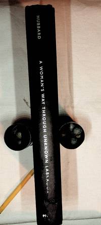
2004002379Montreal: McGill Queens U press. Very Good book no DJ. AS NEW text block. 1st thus. 9.5"x6". 271. 2004. 1st ed thus. Hardcover. VG book no DJ. Publisher info on spine heel worn away. Account of a MAJOR Canadian wilderness canoe expedition. . Spine heel erasure has partially extended into the last word of the title. See scan. Odd flaw it left the "M" of "McGill" in place. Fold out "Map of EASTERN LABRADOR" at book's end with Mina's route and that of her husband's earlier ill fated trip. The fascinating story of this expedition and the two others is a Canadian classic. It has been explored in numerous books and articals. Even Margarat Atwood wrote a short booklet "The Labrador Fiasco" about her father's opinion. Page 233 refers to the Atwood booklet. . McGill Queens U press. hardcover
193980655Franckh'sche Verlagshandlung, 1939.
198722780Stuttgart : Pietsch, 1987. 160 S. zahlr. Ill. (z.T. farb.), Kt. Gr. 8°. 1. Aufl. Bibl.- Einbd.